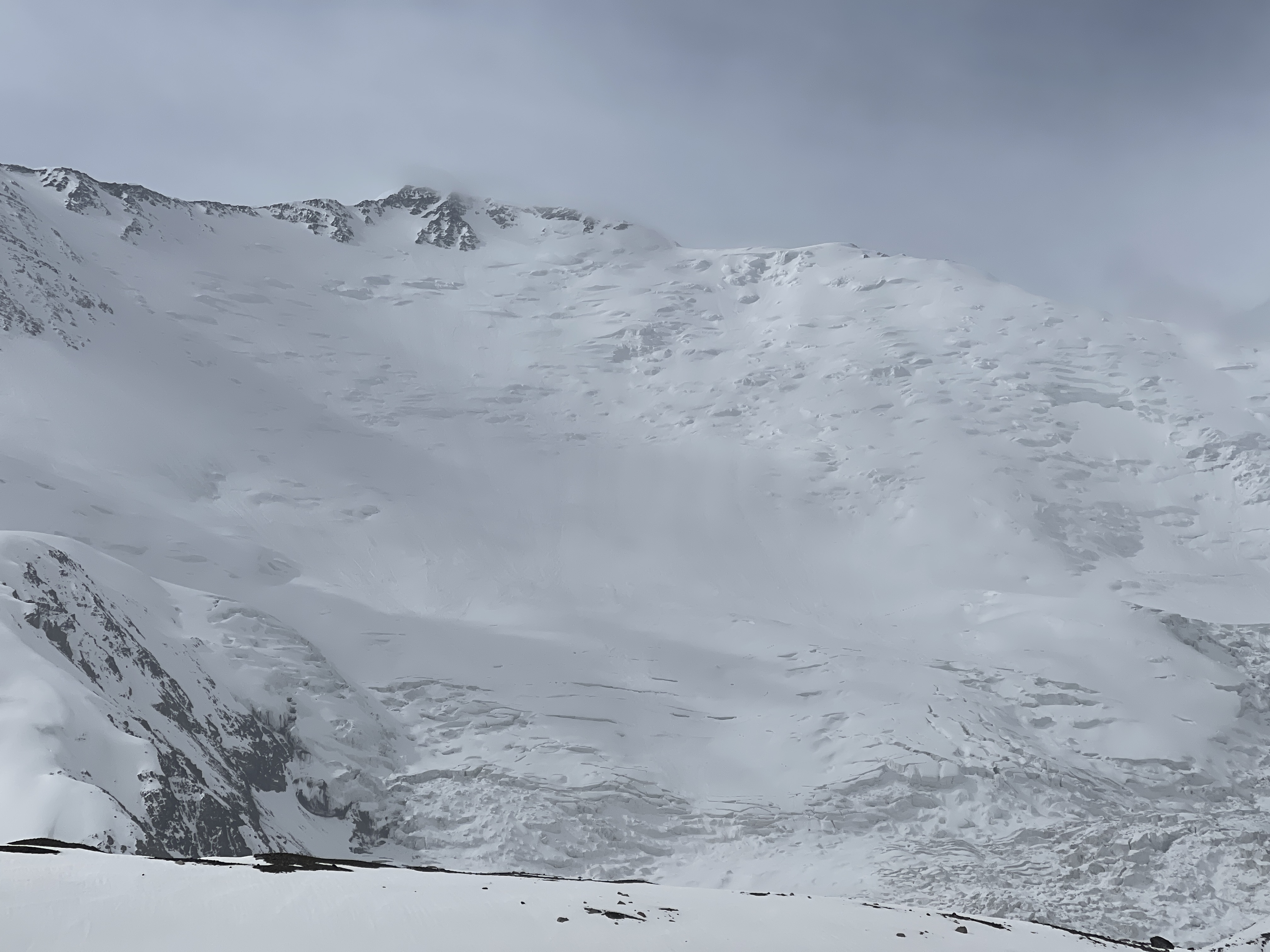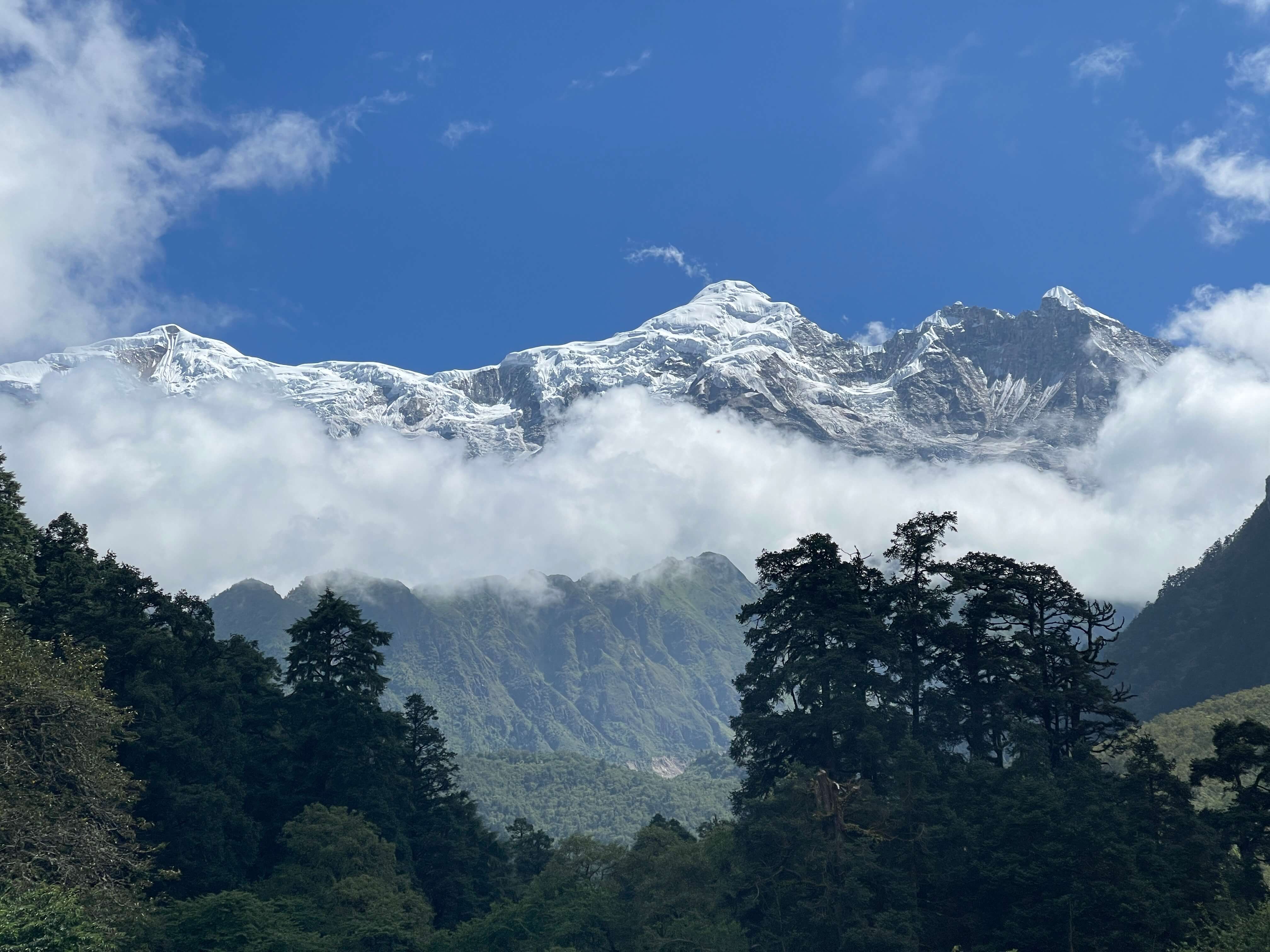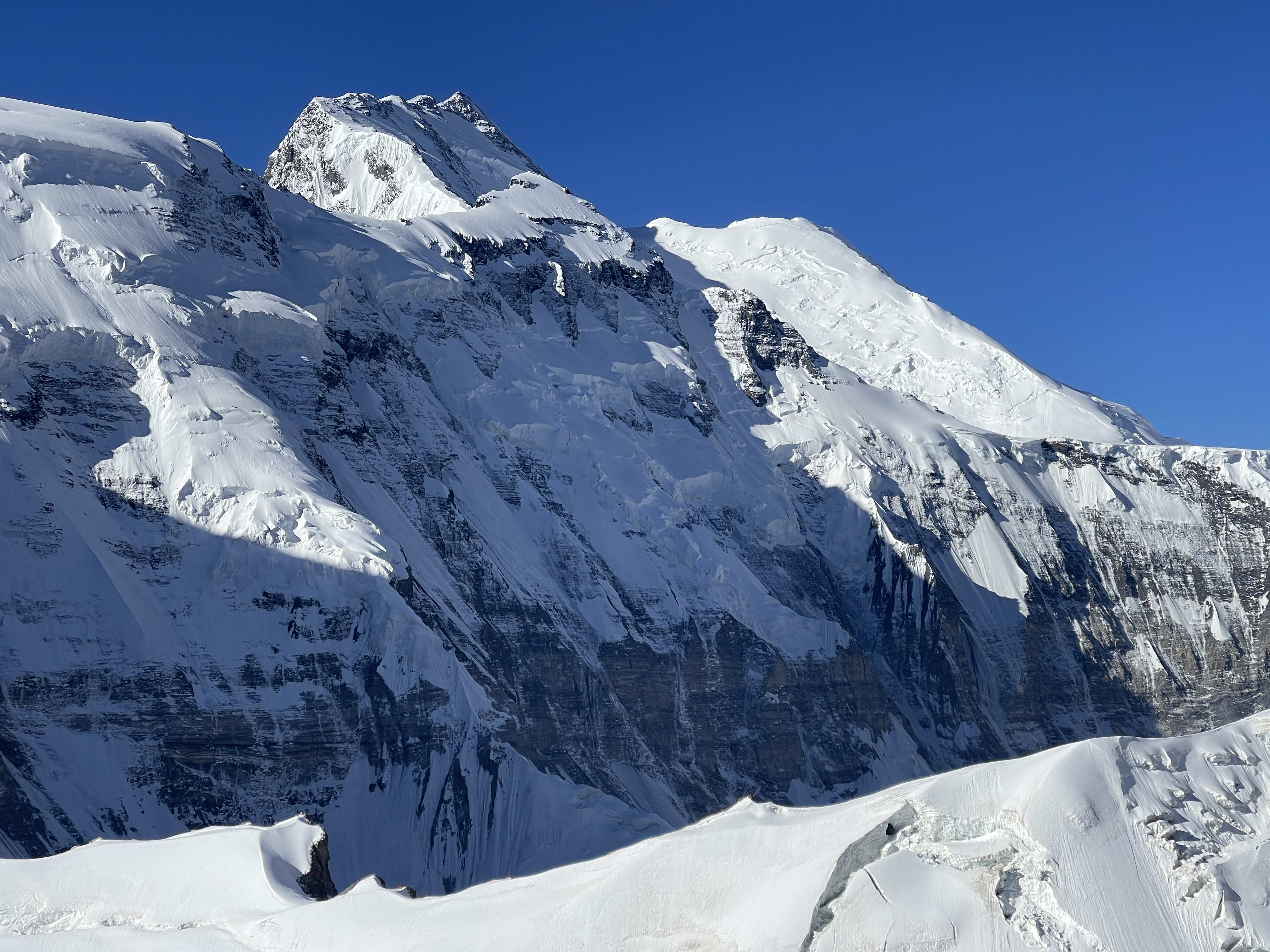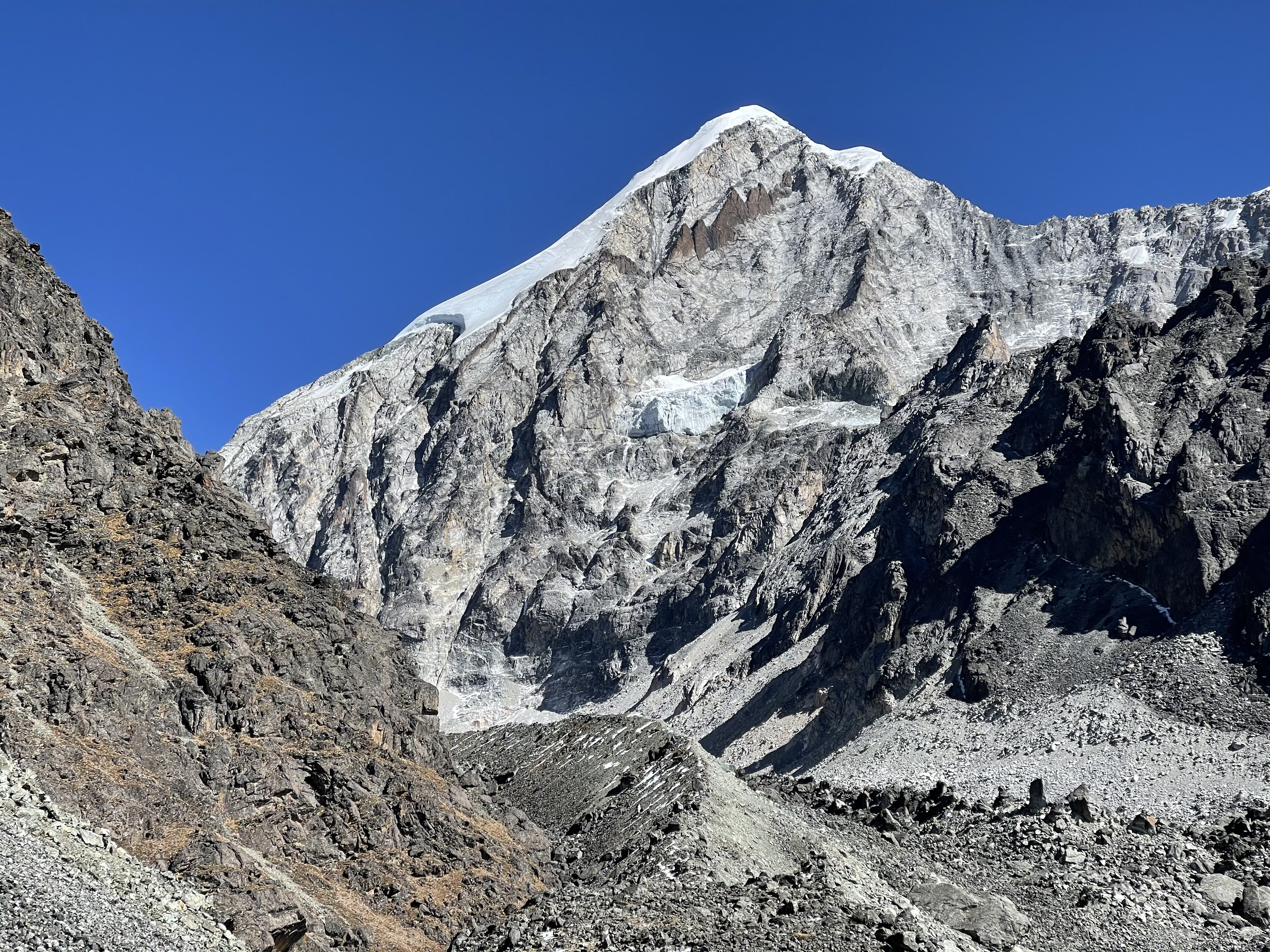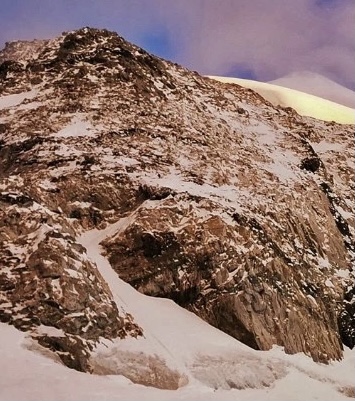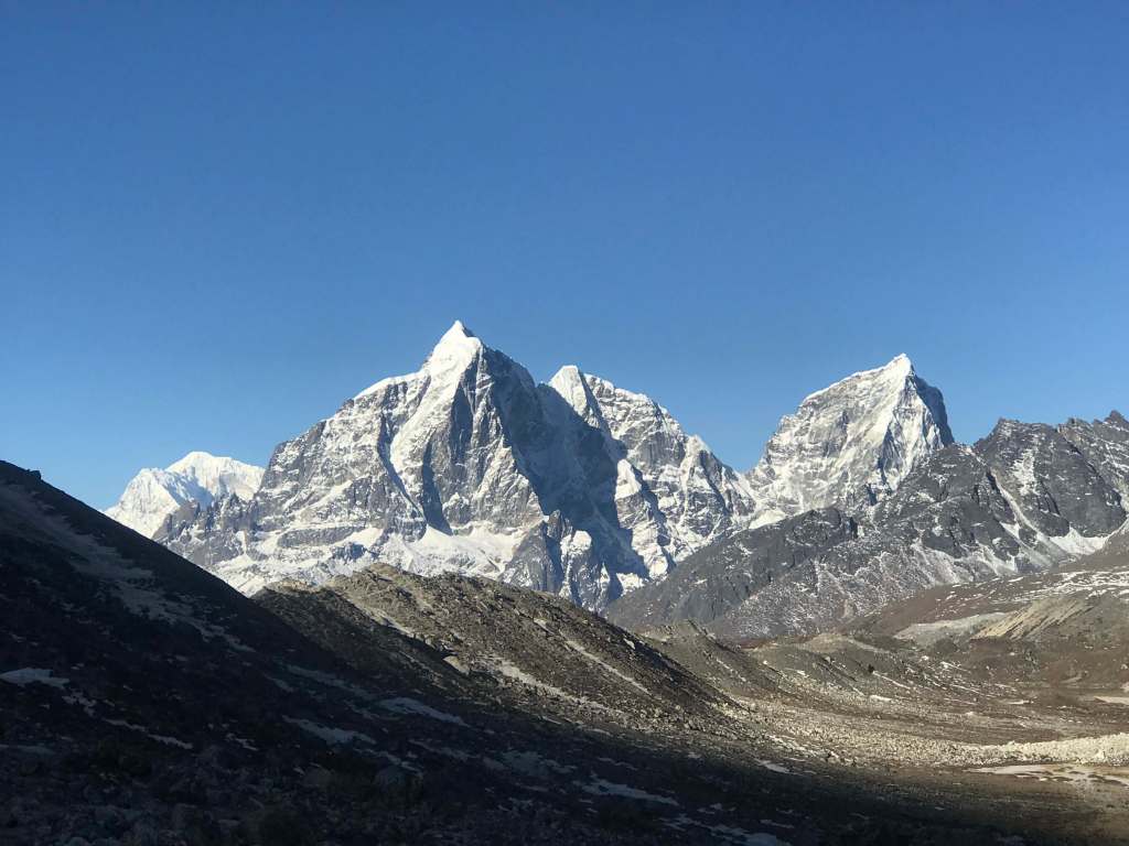
Noshaq, from basecamp at 4650m.
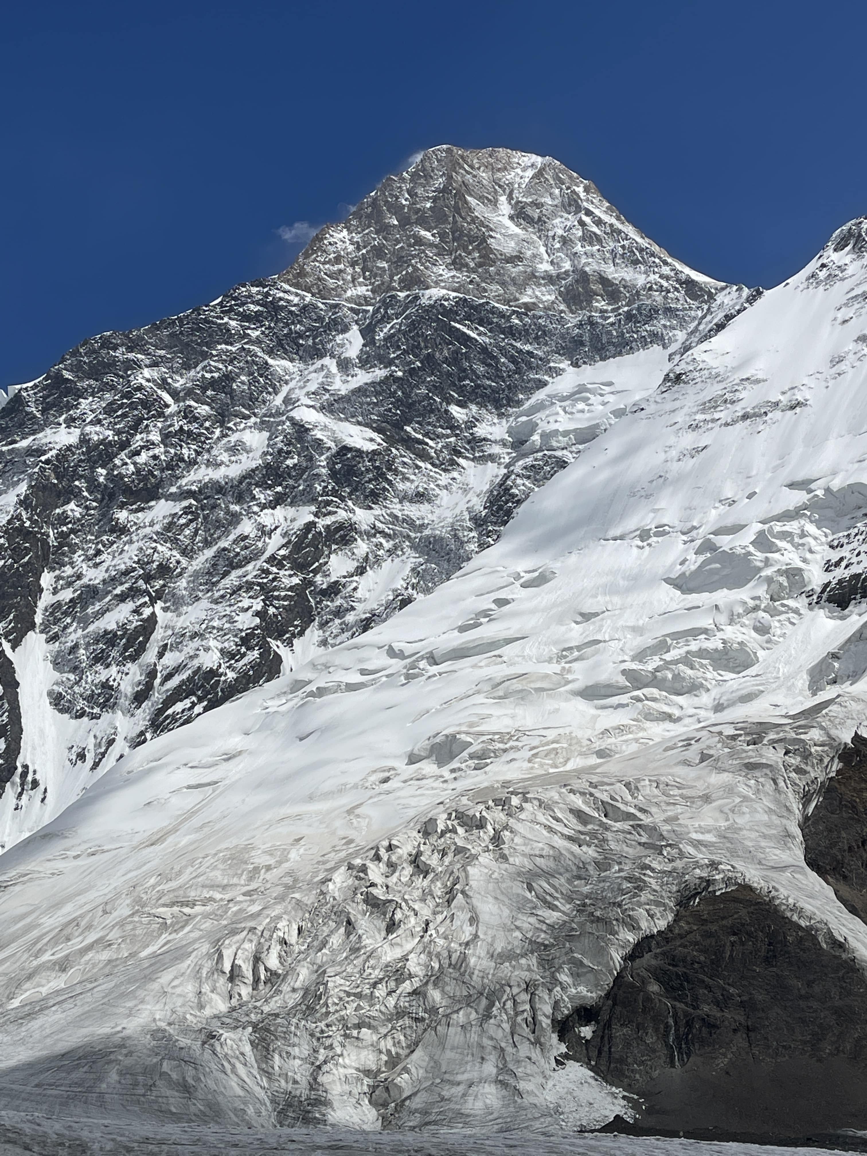
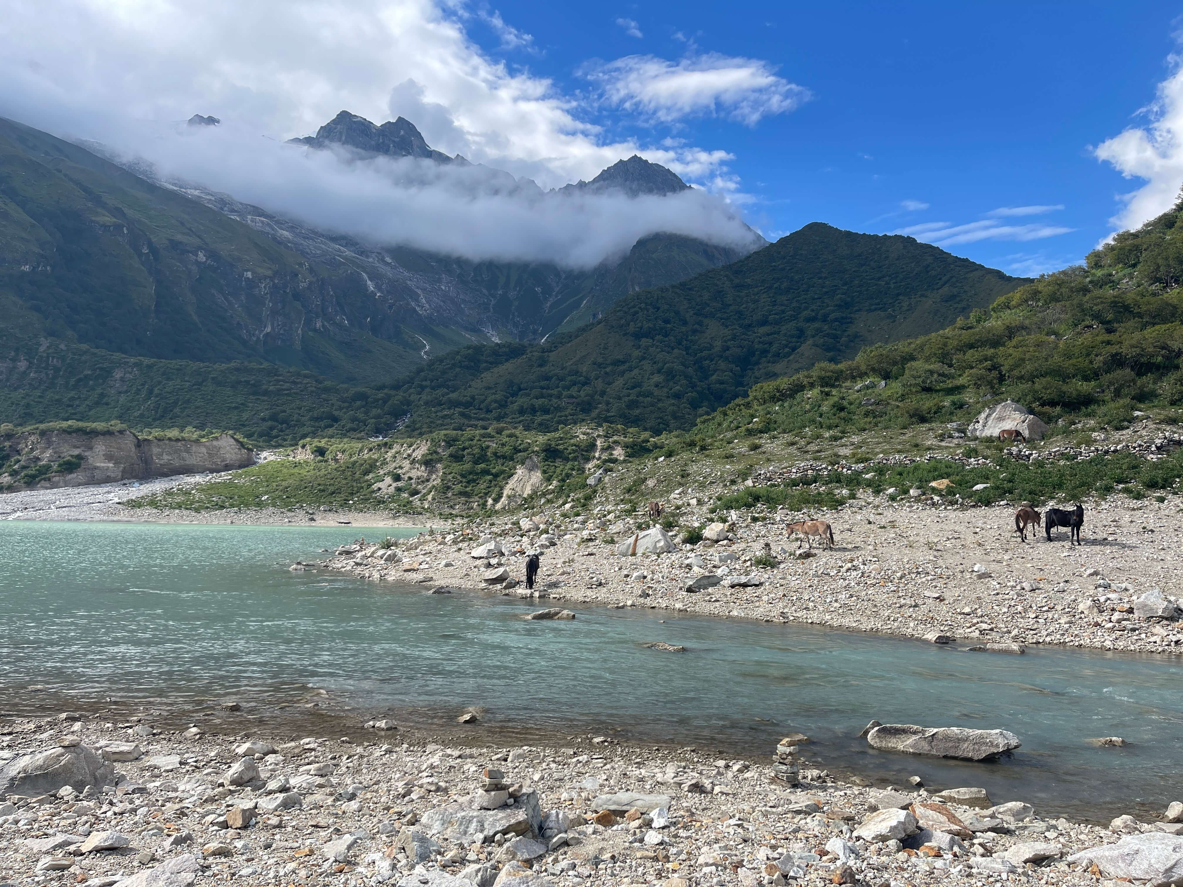
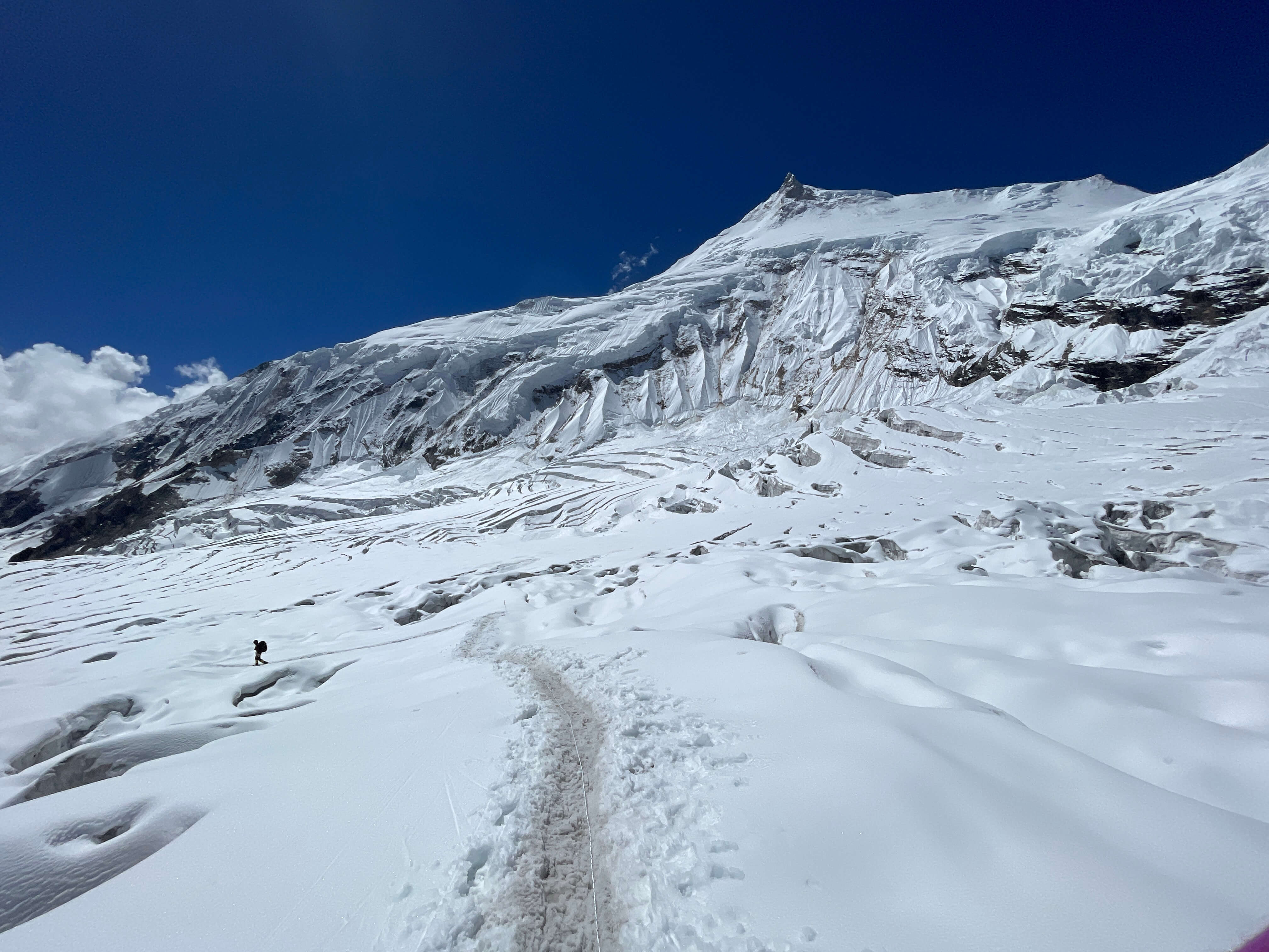
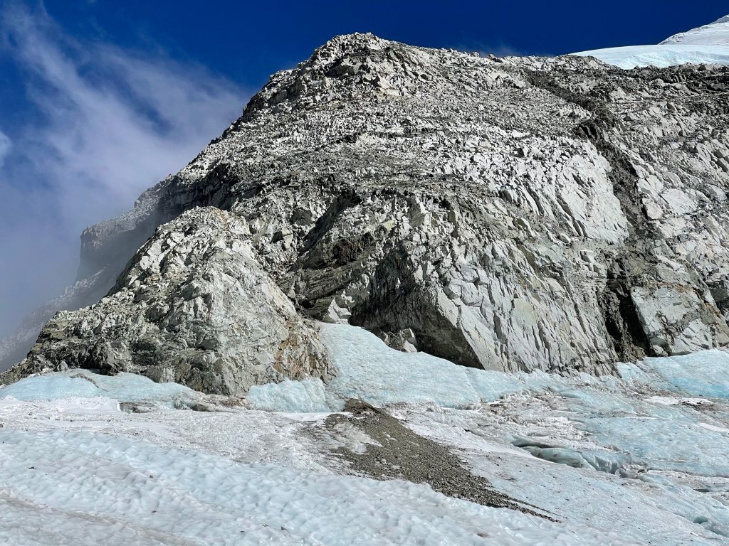
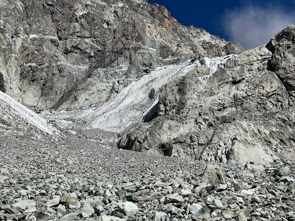
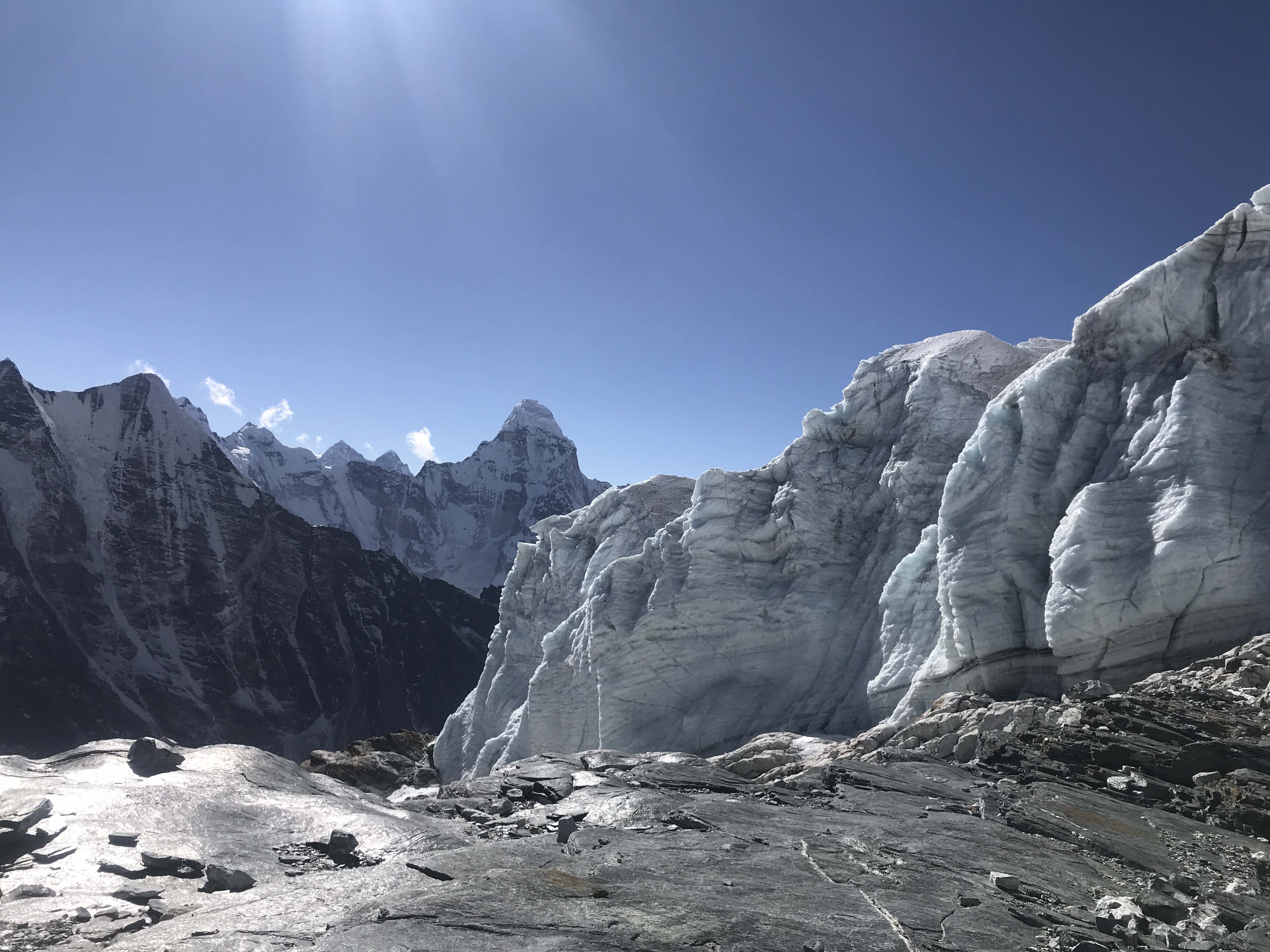
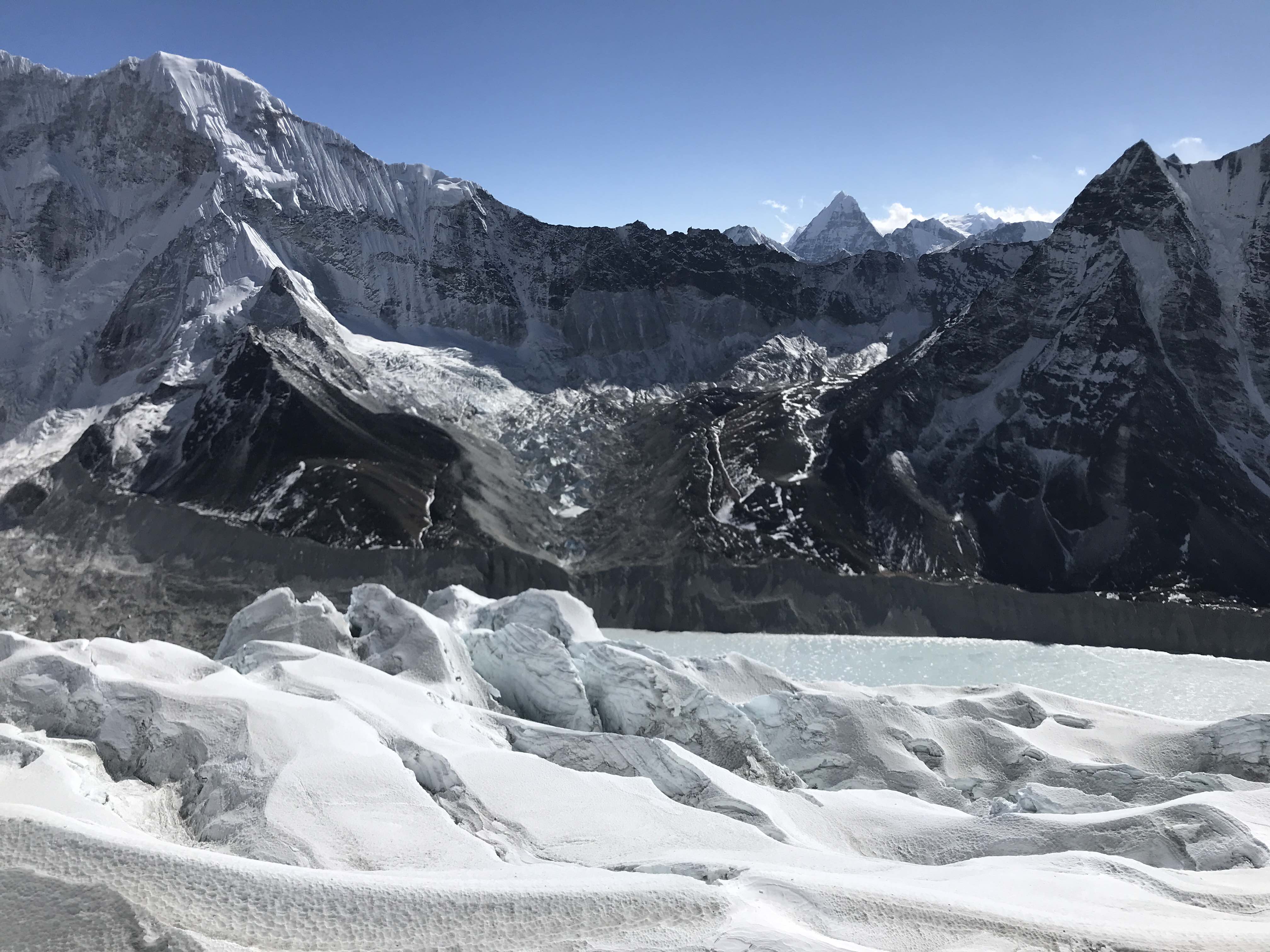
Noshaq, from the near the edge of the glacial moraine at the mountain’s base.
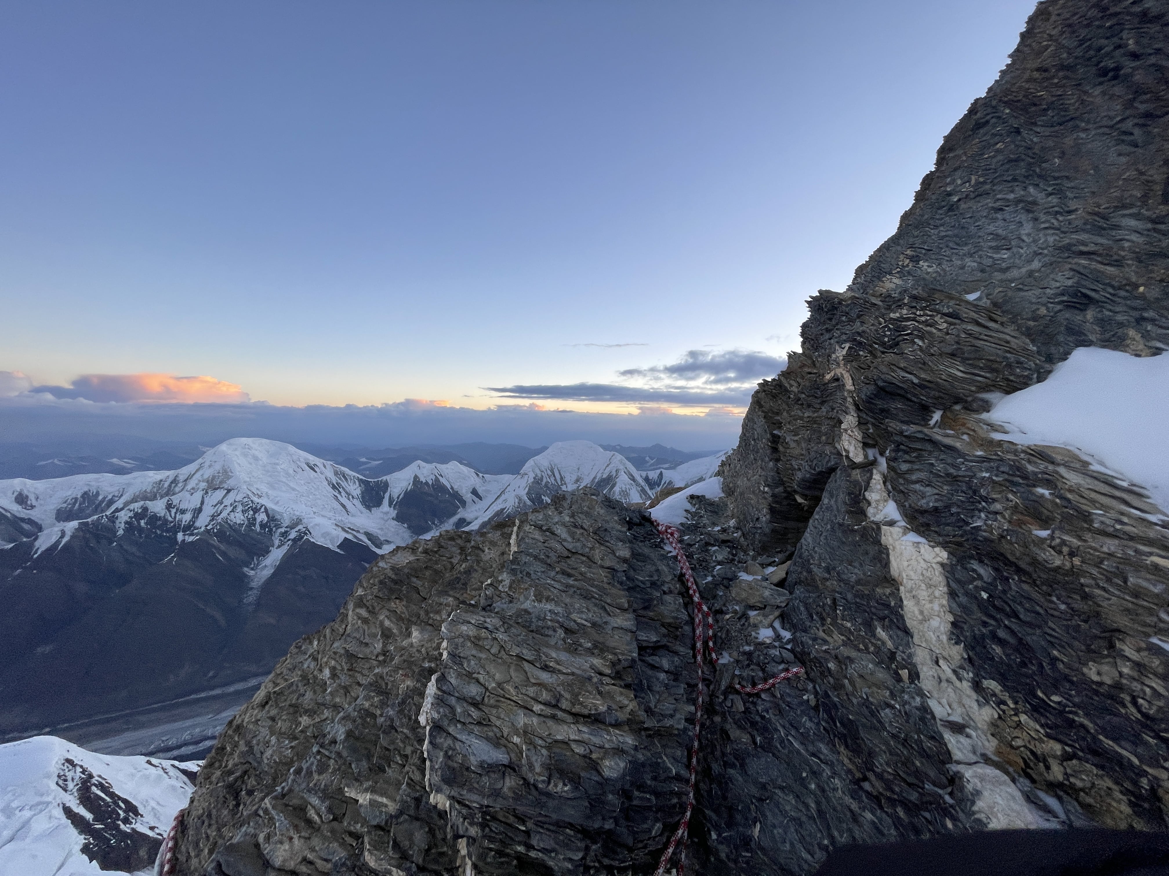
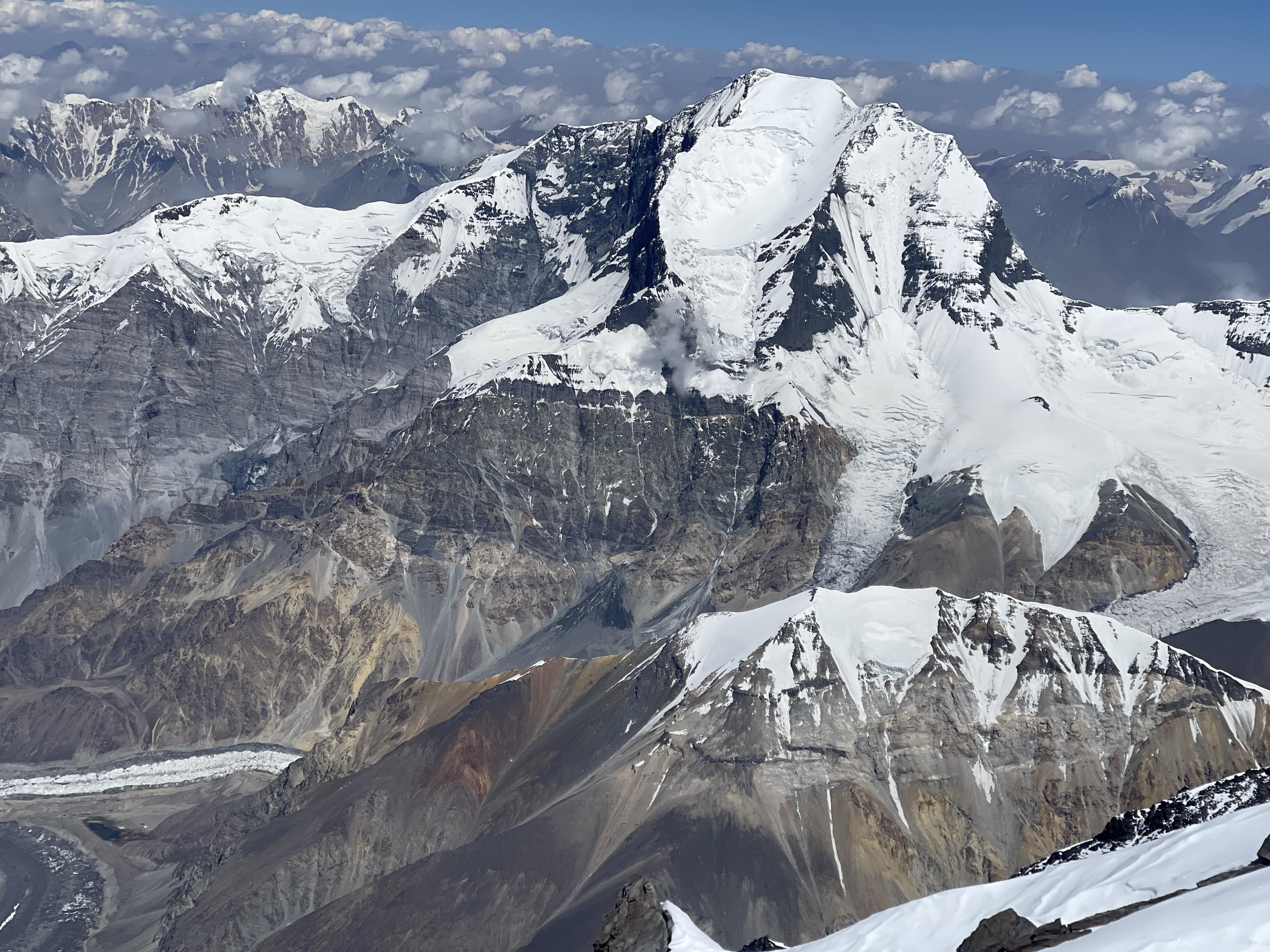
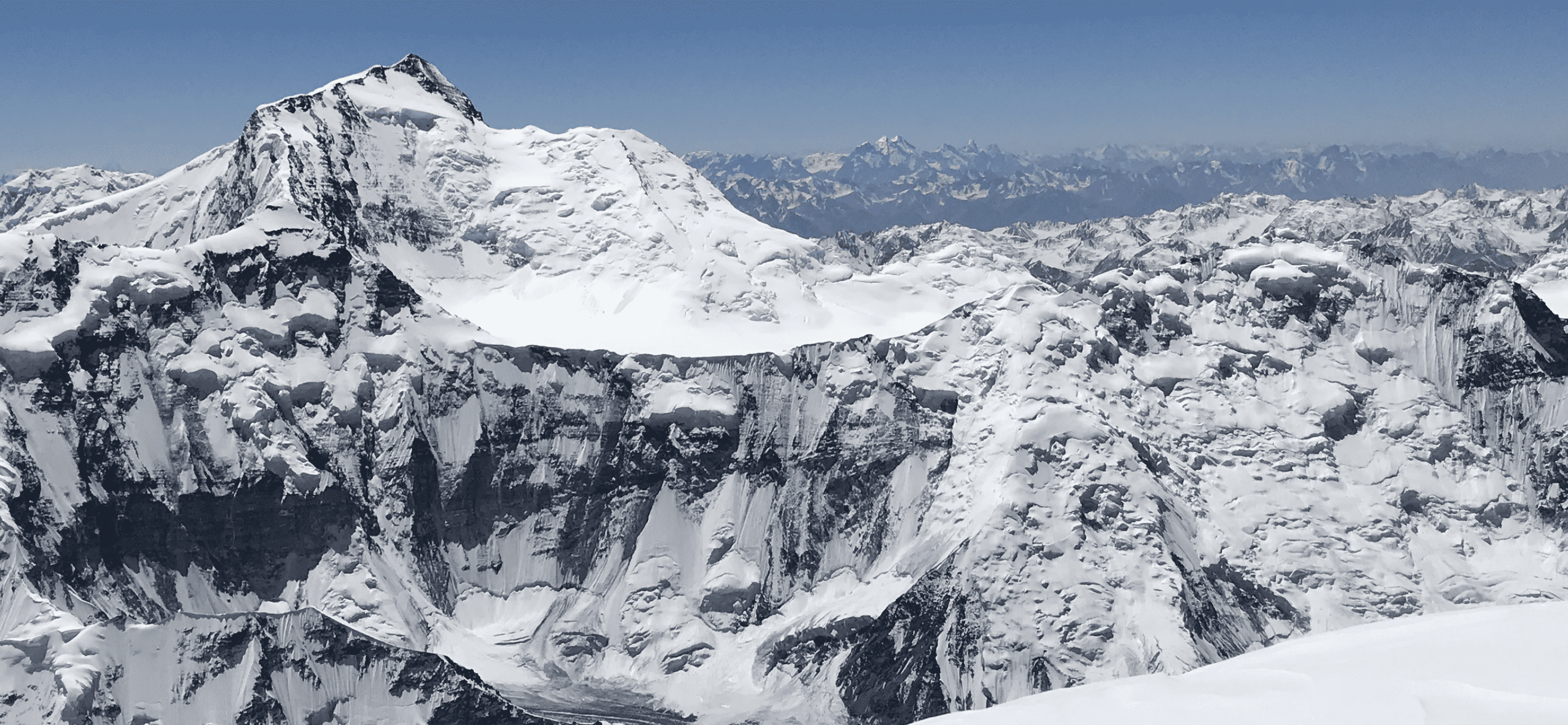
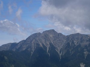
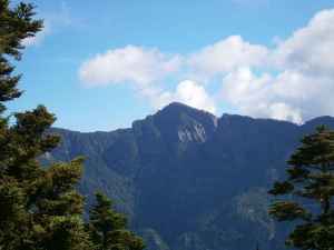
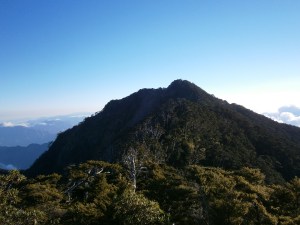
Noshaq
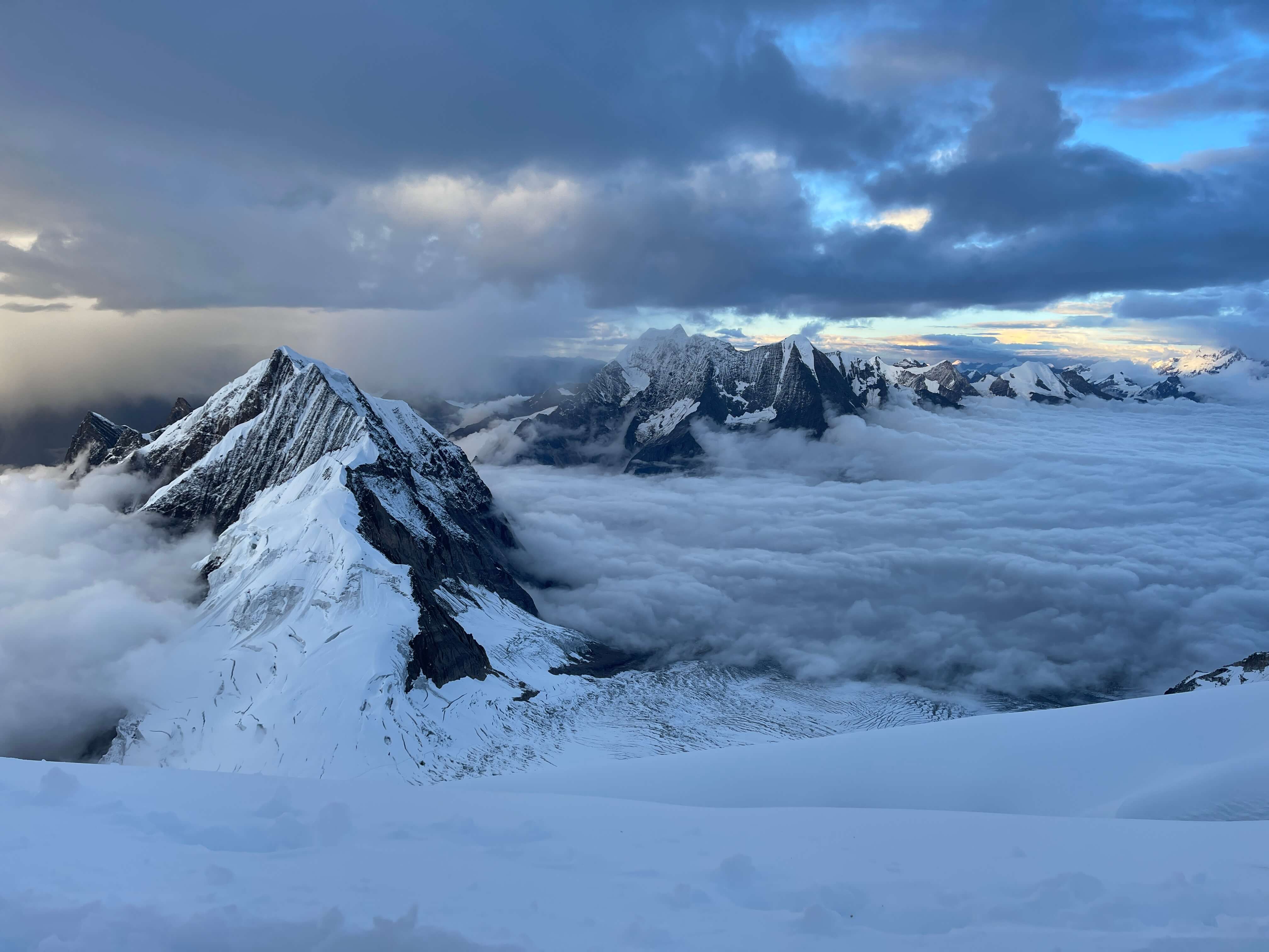
Despite being the 52nd highest mountain in the world, standing at 7492m, Noshaq is not well known outside of niche circles. By most measures Noshaq cannot fairly be described as beautiful or aesthetically pleasing, and is about as far as is possible from being a ‘popular’ mountain to climb, located as it is within the Wakhan Corridor of northeast Afghanistan. The mountain is nonetheless notable as Afghanistan’s highpoint, the second highest summit of the Hindu Kush range, and the westernmost 7000m mountain in the world. Notwithstanding its obscurity within the modern climbing world, Noshaq has a storied early history. Noshaq was first ascended by a Japanese team in 1960, and in 1972 saw a summit by the legendary Reinhold Messner. A year later Noshaq became the first 7000m peak to see a winter ascent when a Polish team reached the top in February of 1973, a feat which as of yet remains unrepeated.

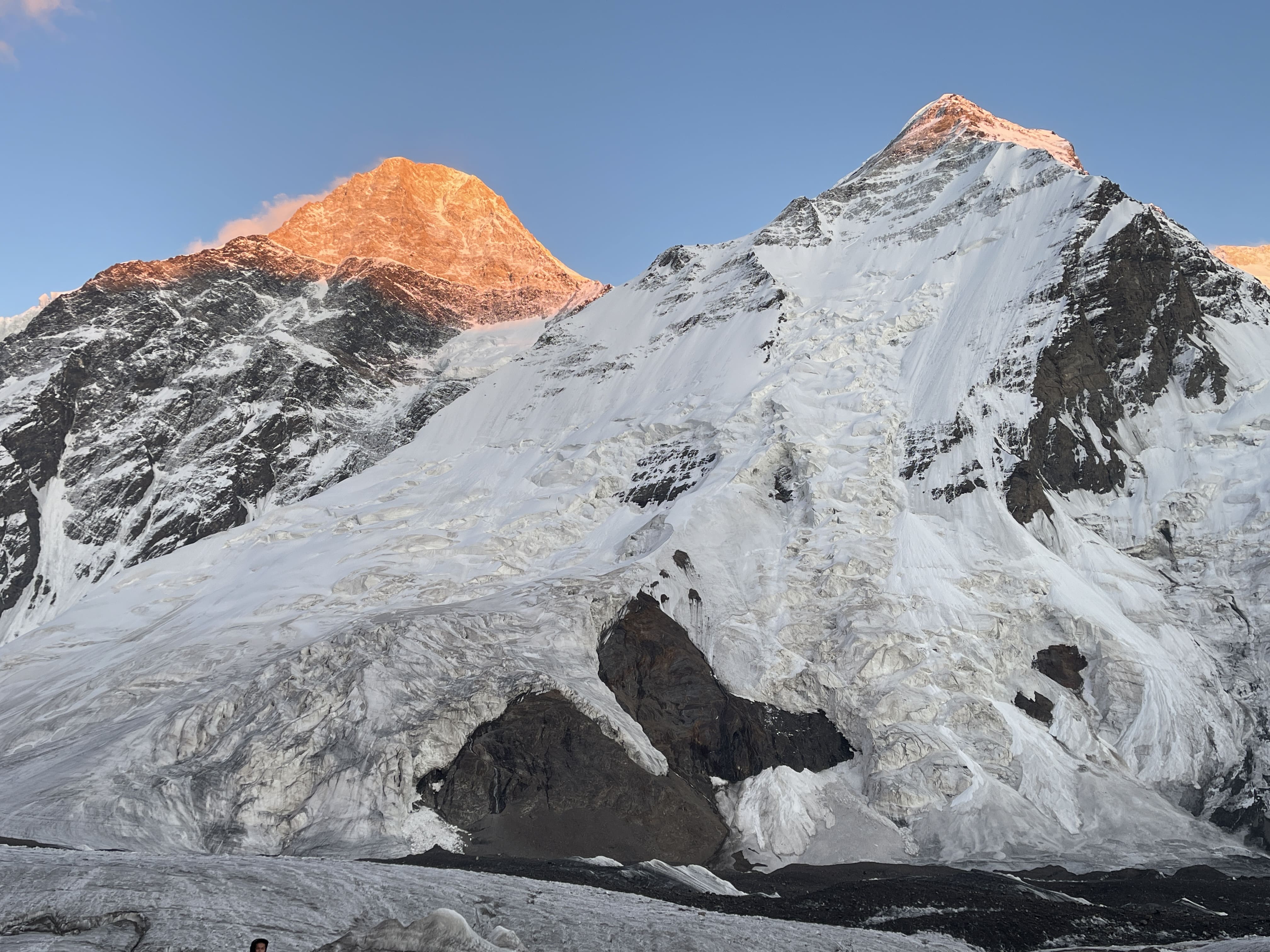
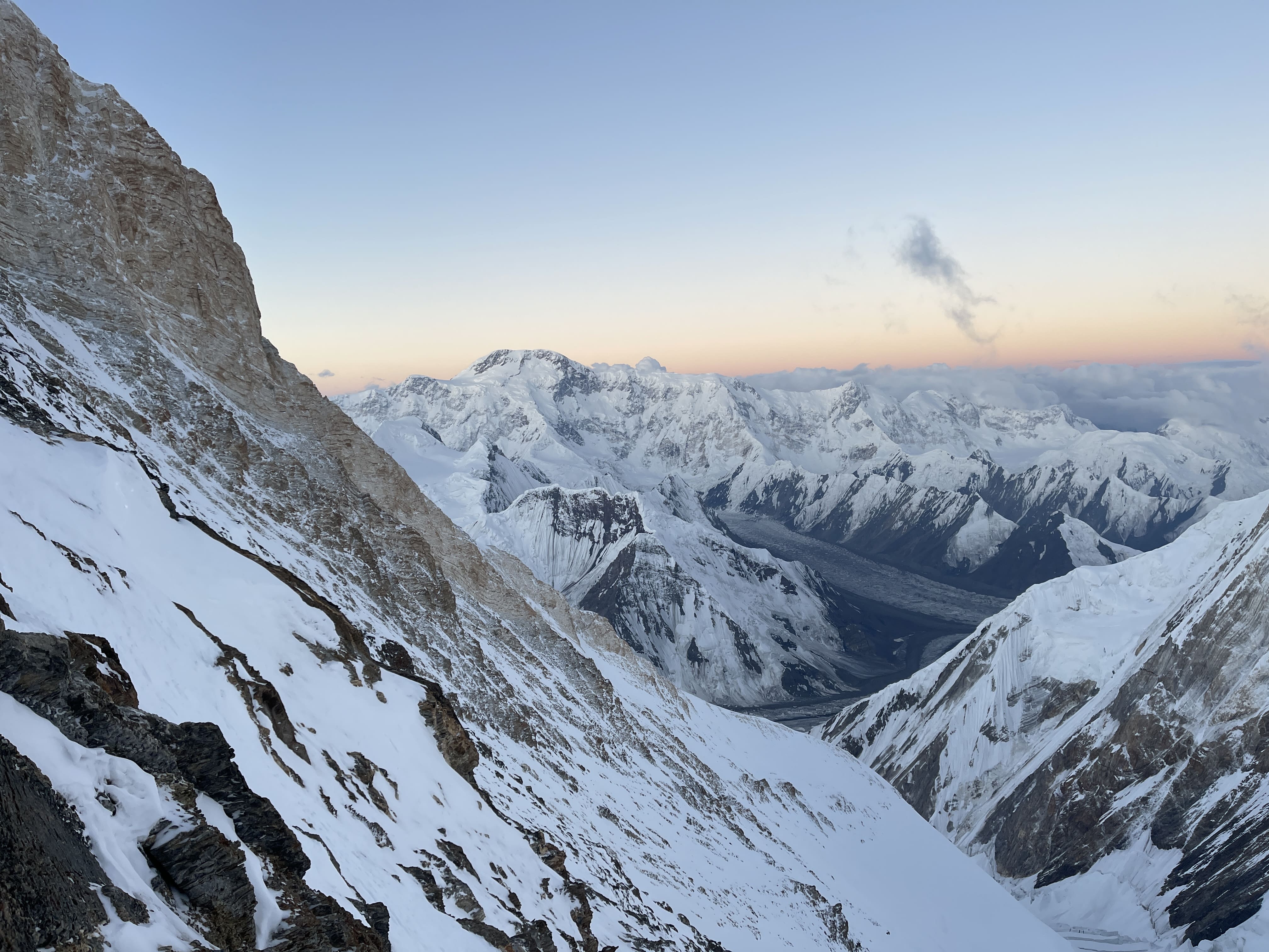
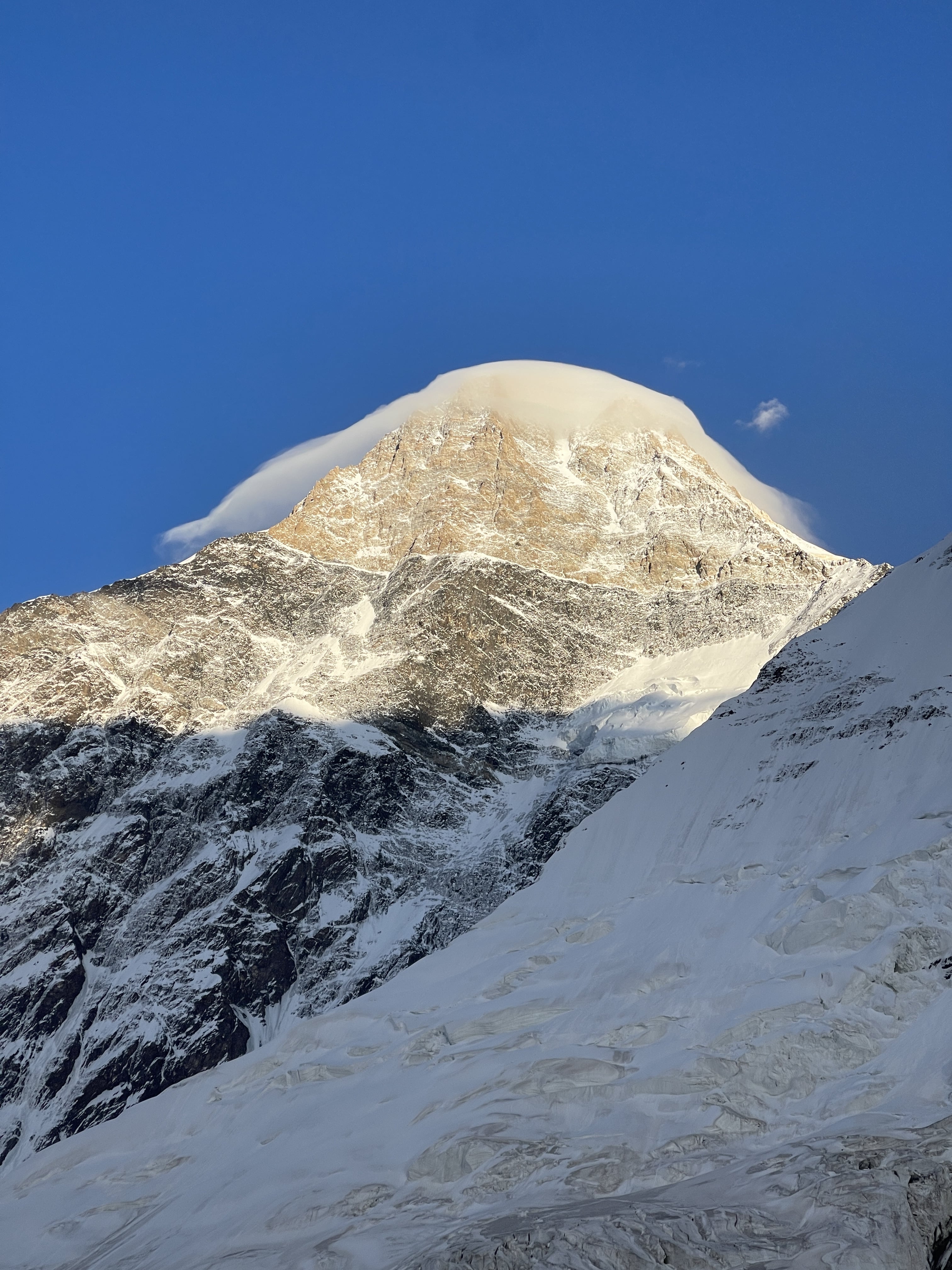
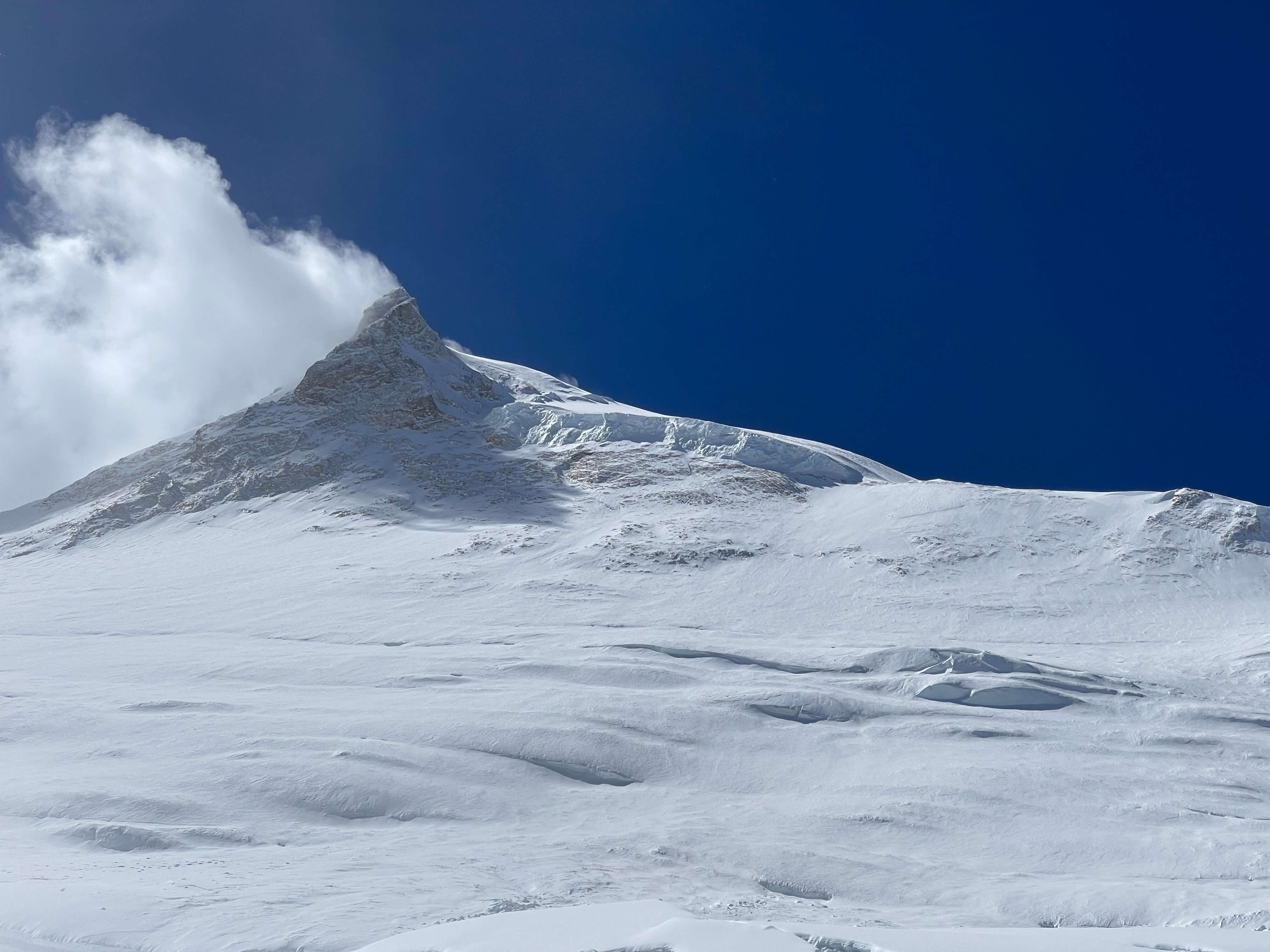
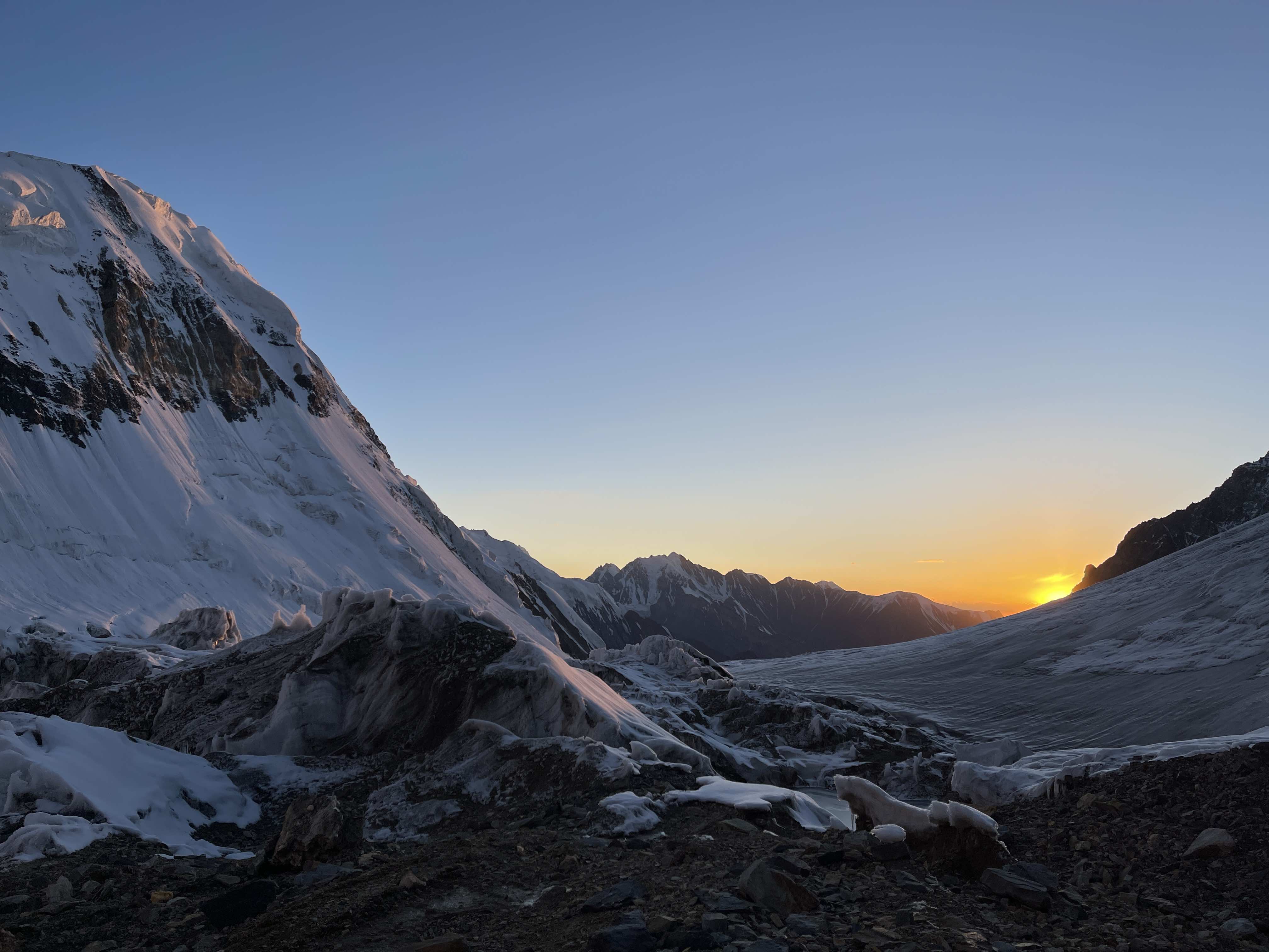
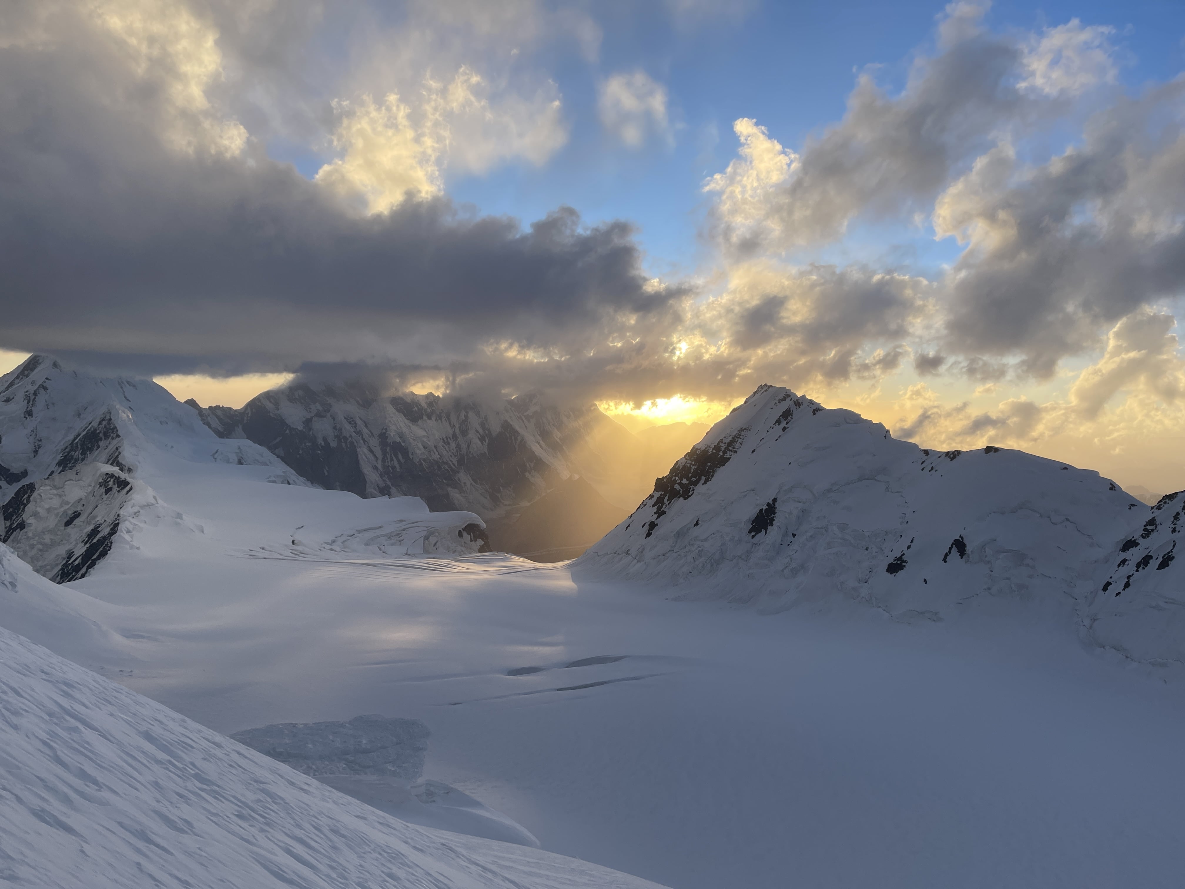
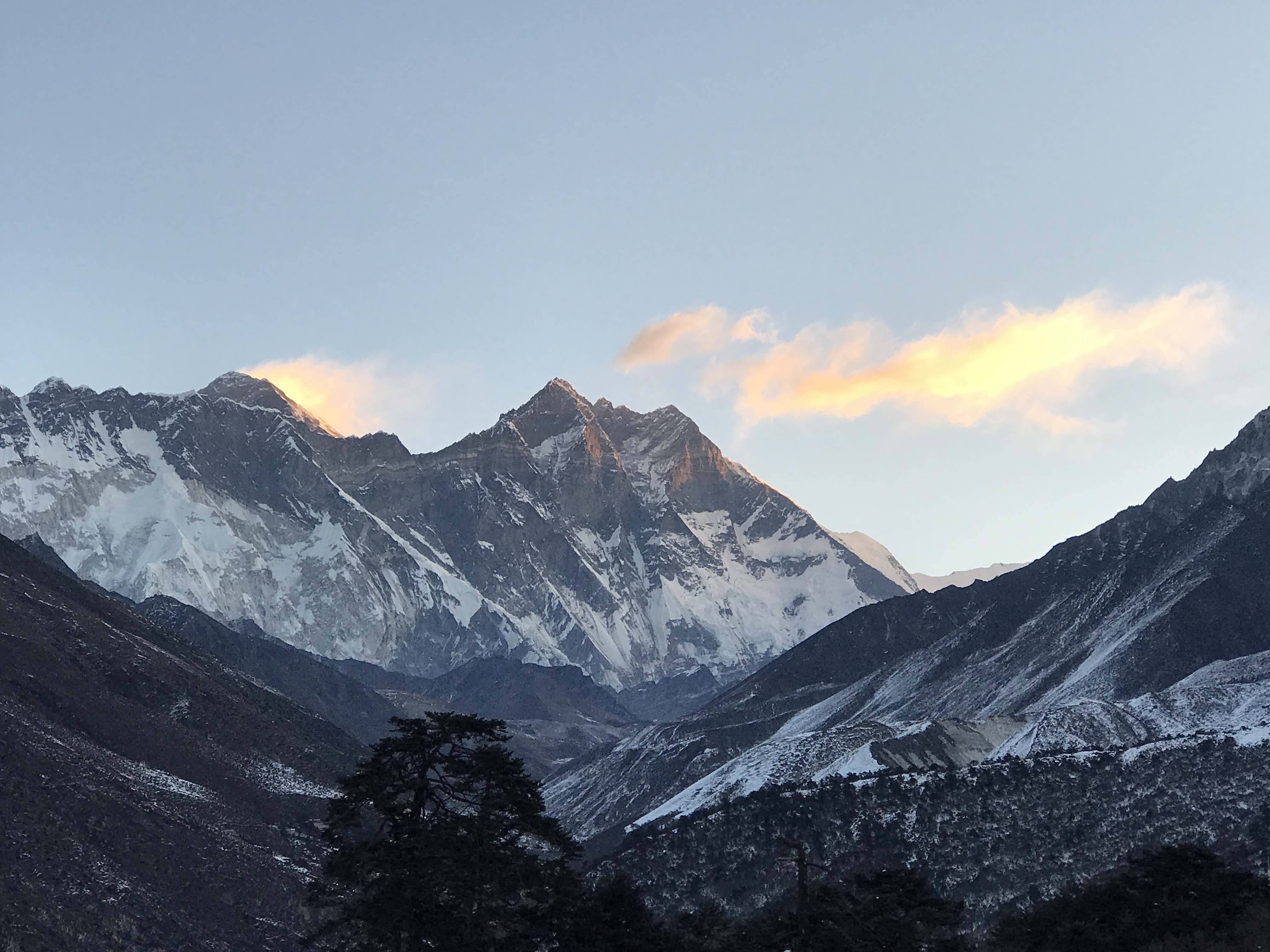
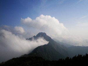
Noshaq at Sunrise.
From 1979 well into the early 2000s Noshaq fell off the radar of the mountaineering community due to Afghanistan’s ongoing political instability, sectarian violence, and outright war. The first Afghan ascents of the mountain took place in 2009 when Wakhan locals Malang and Amruddin, two of a team of four Afghan climbers supported by French guides, reached the top. Both men are still active in the Wakhan, and offer services as fixers and tour operators. Their accomplishment attracting considerable international attention to Noshaq for the first time in decades. The valley which leads to Noshaq Basecamp has since been de-mined, relative stability has returned to Afghanistan’s Wakhan Corridor, and each summer season for the past several years has seen a few teams making attempts on the mountain. In 2018 the first Afghan female gained the summit of Noshaq, climbing with an American NGO team.
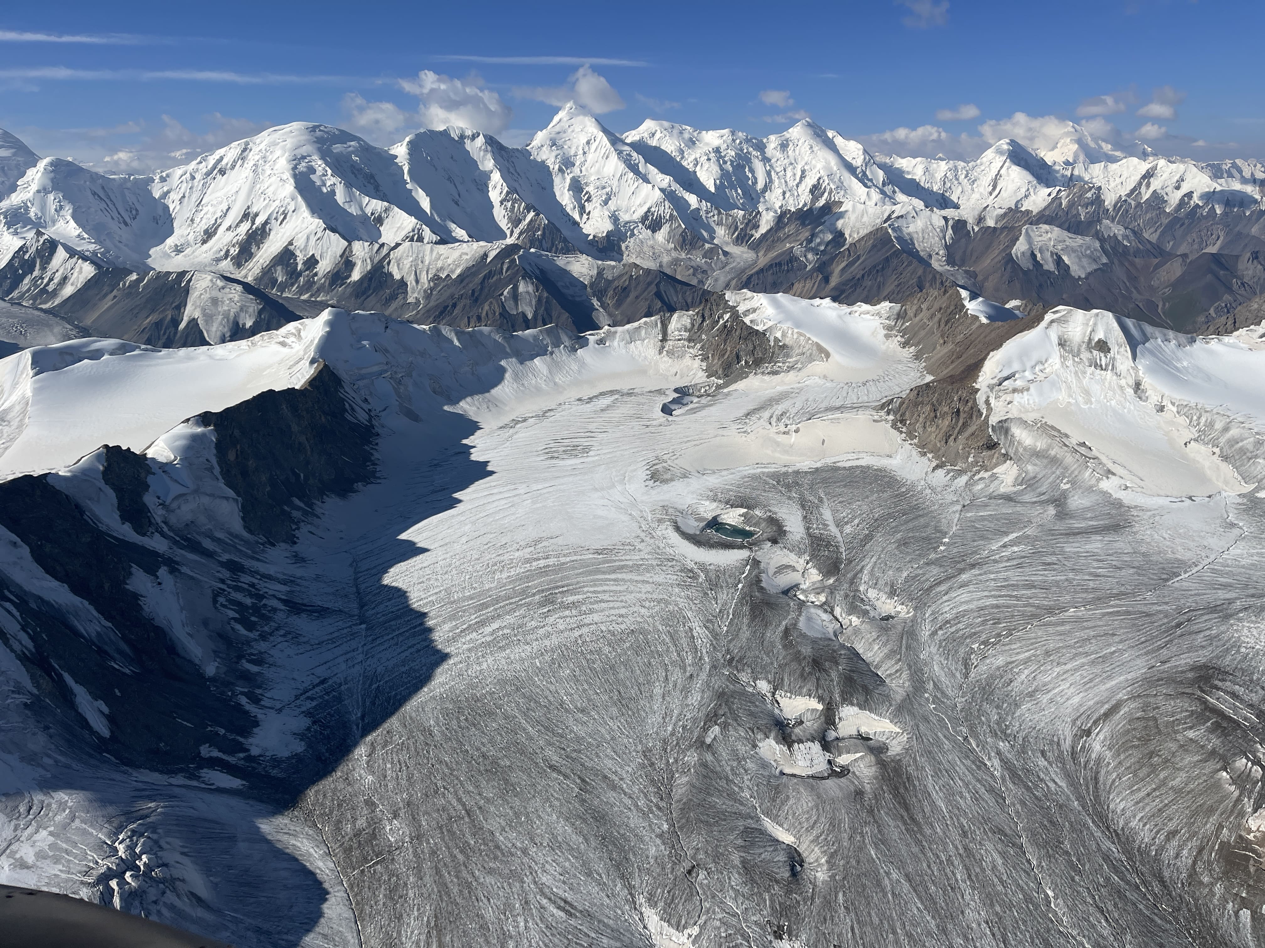
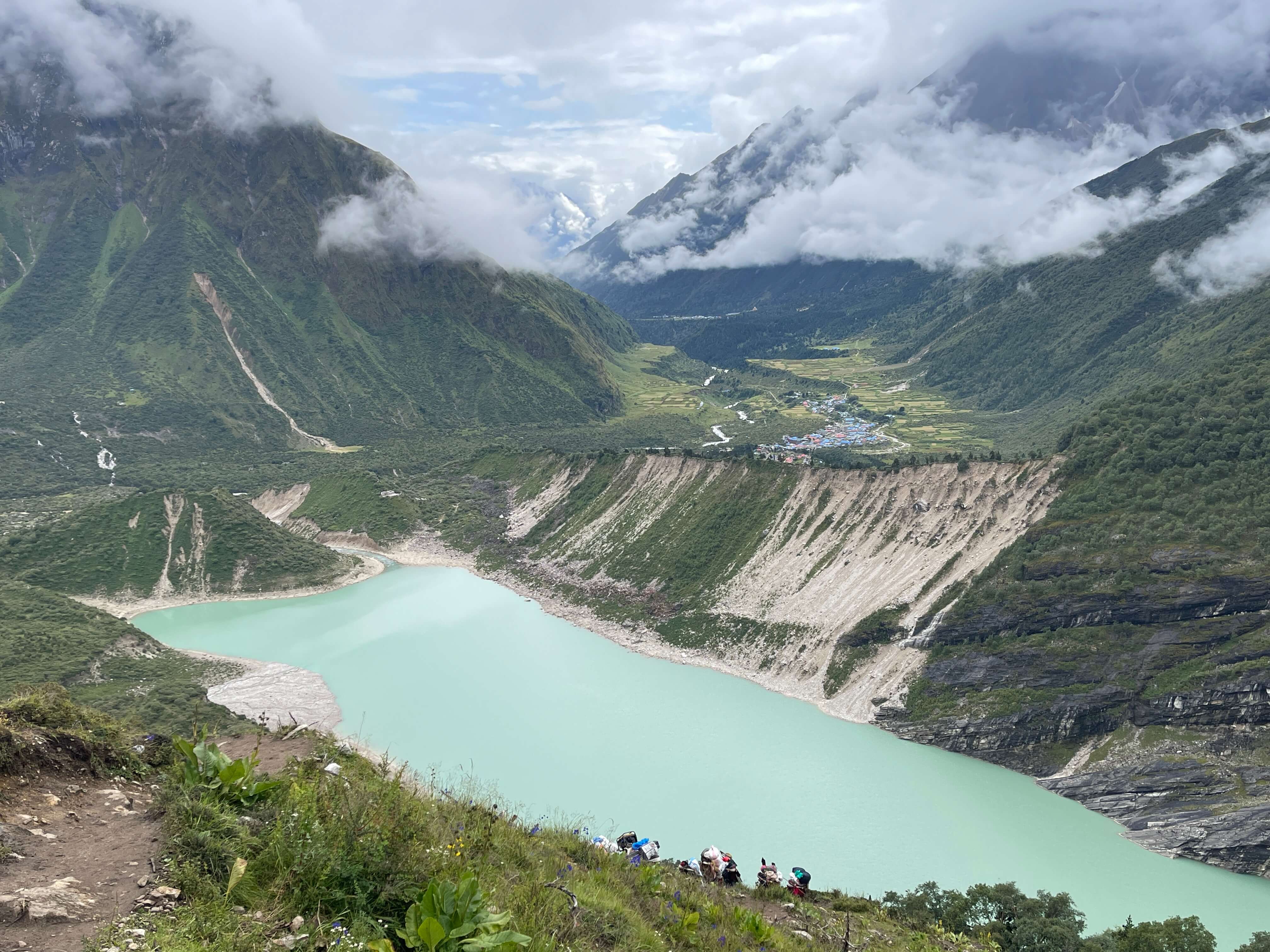
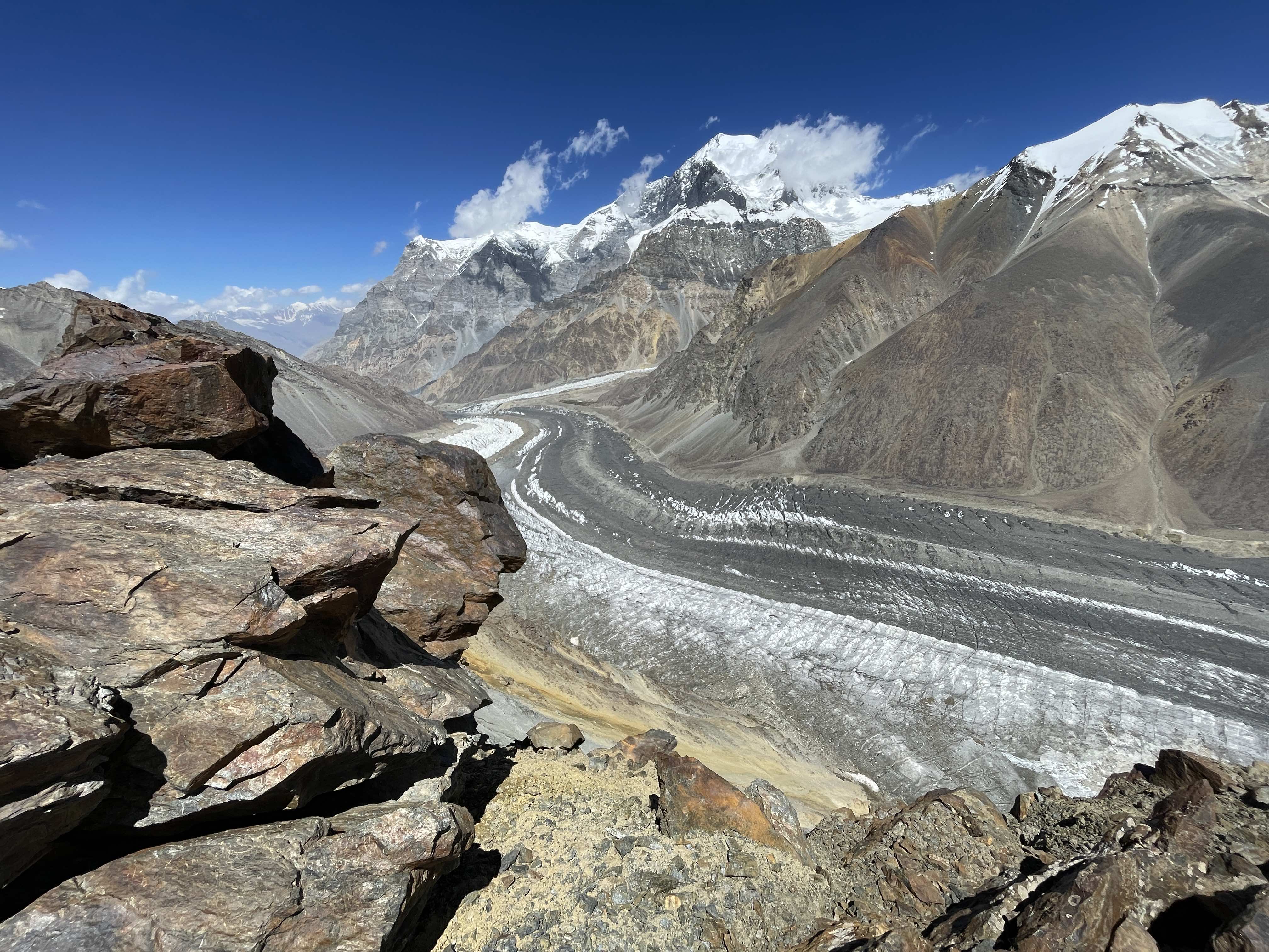
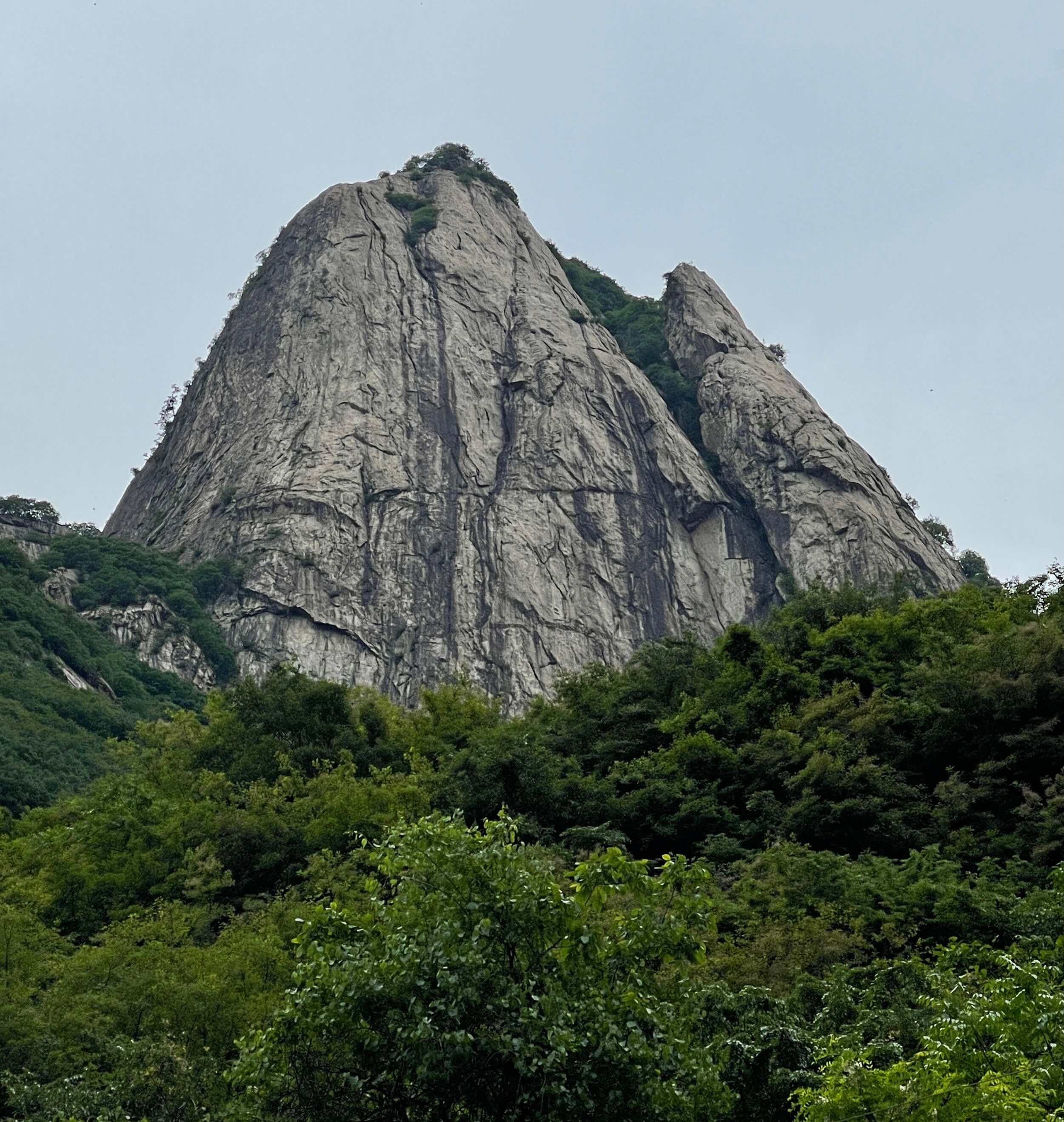
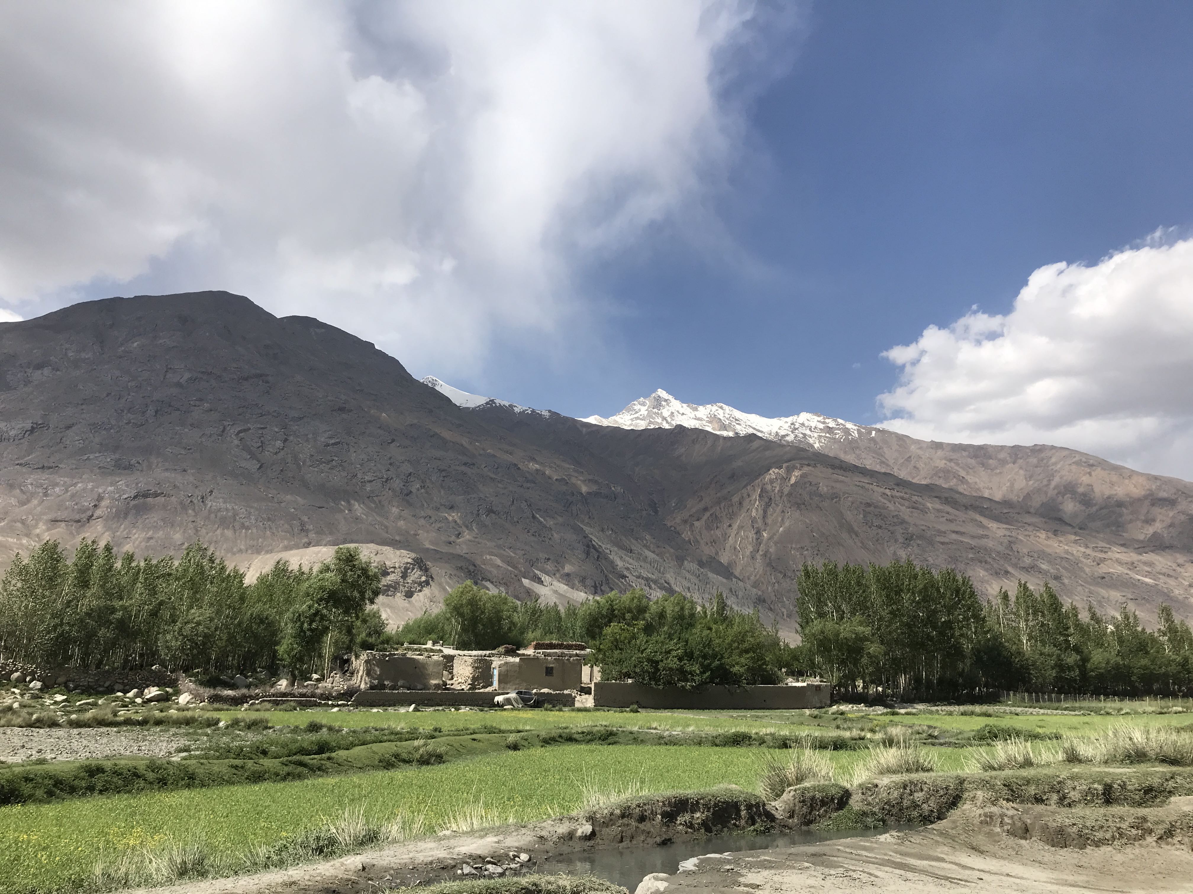
The Wakhan corridor is a natural barrier between the Pamir, Karakoram, and Hindu Kush mountain ranges, a narrow fertile valley wedged between high mountain peaks. The area is remote, difficult to access, and is both culturally and ethnically distinct from the rest of Afghanistan, predominantly populated as it is by the Wakhi people. The Wakhan has been relatively safe for the past ten years or so, and has never seen an established Taliban presence.
Our 2019 expedition to Noshaq was initiated by my American friend Pat, who began to pull together a variety of interested climbers he’d partnered with in the past, or whom had good vouching. Over the course of several months the group resolved into a team of seven, representing the USA, Estonia, Denmark, Canada, Spain, and Hong Kong. Our expedition was successful, and four of our seven summited Noshaq. I did not summit, on account of a severe lung infection which hit me hard after an initial rope-fixing foray and summit attempt. I was unable to shake off symptoms of pneumonia or bronchitis, including a debilitatingly productive cough. With significantly compromised respiration I ultimately ended up struggling just to get off of the mountain.
Getting There
The Wakhan is difficult to access. Land travel from Kabul, Afghanistan, is extremely unsafe and is absolutely not a viable option. The border with China is closed, and will likely remain so for the indefinite future. There are no established airports, and the tiny airstrip in Afghan Ishkashim is limited to special, non-commercial use.
The beautiful Wakhan Corridor.
Support exists in the Afghan Wakhan as one of the first Afghan Noshaq summiteers, Malang, now operates a small tour company there. His right-hand man Azim Ziahee is an absolutely incredible fixer and problem solver whose support was invaluable to our expedition.

Azim’s business card.

Azim’s business card.
Further good news is that it is possible to access the Afghan Wakhan via Tajikistan, crossing the Tajik/Afghan border at Ishkashim. While this sounds daunting at first glance, as a process it is relatively straightforward. For the sake of accuracy, brevity, and clarity, I have written out a detailed step by step process:
1. Obtain an e-visa for Tajikistan. This can be done at http://www.evisa.tj/index.evisa.html#/ . The process is straightforward enough, but pay attention when submitting payment. If a mistake is made in entering credit card information, the system can lock the application. Ensure that you pay the additional fee for a GBAO, Gorno-Badakhsan Autonomous Region, permit.
2. Fly into Dushanbe, or otherwise enter Tajikistan. Dushanbe is a relatively developed city, and has a rather nice supermarket in the main mall. This is absolutely the best place for obtaining supplies anywhere nearby.
3. Buy a SIM card at the ‘Megaphone’ (Tajik’s largest wireless carrier) in the central mall. Tajikistan has a solid 4G network, and prepaid SIM cards are very affordable. The Tajik Megaphone network is accessible from the settled parts of the Afghan Wakhan corridor, or at least from locations with good line of sight. Getting a Tajik SIM is highly advised, as doing so will make the entire trip significantly smoother. A Tajik SIM card is the only reliable means of accessing the internet from the Afghan Wakhan.
4. On entry to Tajikistan, immediately apply for a second e-Visa. Set the entry date to some ~10 days in the future; e-visa validity is good for entry on or after the listed date. This second e-visa will be used to re-enter Tajikistan at the end of the expedition. It is not possible to obtain a Tajik visa at the Afghan land border. It is not possible to cross the Afghan land border into Tajikistan without a visa. It is difficult and slow to apply for a Tajik e-Visa from Afghanistan, due to the absence of stable internet infrastructure. This second e-Visa will likely be approved at some point during the approach hike to Noshaq Basecamp. As such, it is wise to have it emailed to a trusted friend or family member, who can confirm its receipt via satphone, and then forward it to your Afghan fixer/operator. It is easy to print documents in Afghan Ishkashim.
5. Drive to Khorugh, in Tajikistan. The drive takes roughly 14-16 hours from Dushanbe, on bad roads. The drive from Dushanbe to Khorugh is significantly more expensive than the drive back, because there isn’t much demand for travel in that direction! Azim and Malang should be able to assist in arranging transportation. If a Russian speaker is in the party, it will be possible to arrange transportation once on the ground in Dushanbe. LAL hostel in Khorugh is a decent place to spend the night. Bring plenty of food and water for the car ride, as there aren’t many places to stop along the way. Expect at least one flat tire.
6. Visit the Afghan Consulate in Khorugh to apply for an Afghan tourist visa. I can provide GPS coordinates of the Consulate if desired. The application requires 5 visa photos, the small size which is also used by China. Inexpensive photos can be taken in Khorugh, but it is much faster if you already have your own. The visa application is relatively straightforward, but does require a handwritten letter of intent. The cost in 2019 was $220 USD for Americans, $150 for all other nationalities, and must be paid in cash. We were told that Japanese, South Korean, and Russian passport holders are presently unable to apply for a visa. The application took roughly two hours to process, after which time we retrieved our passports with visa stickers inserted.

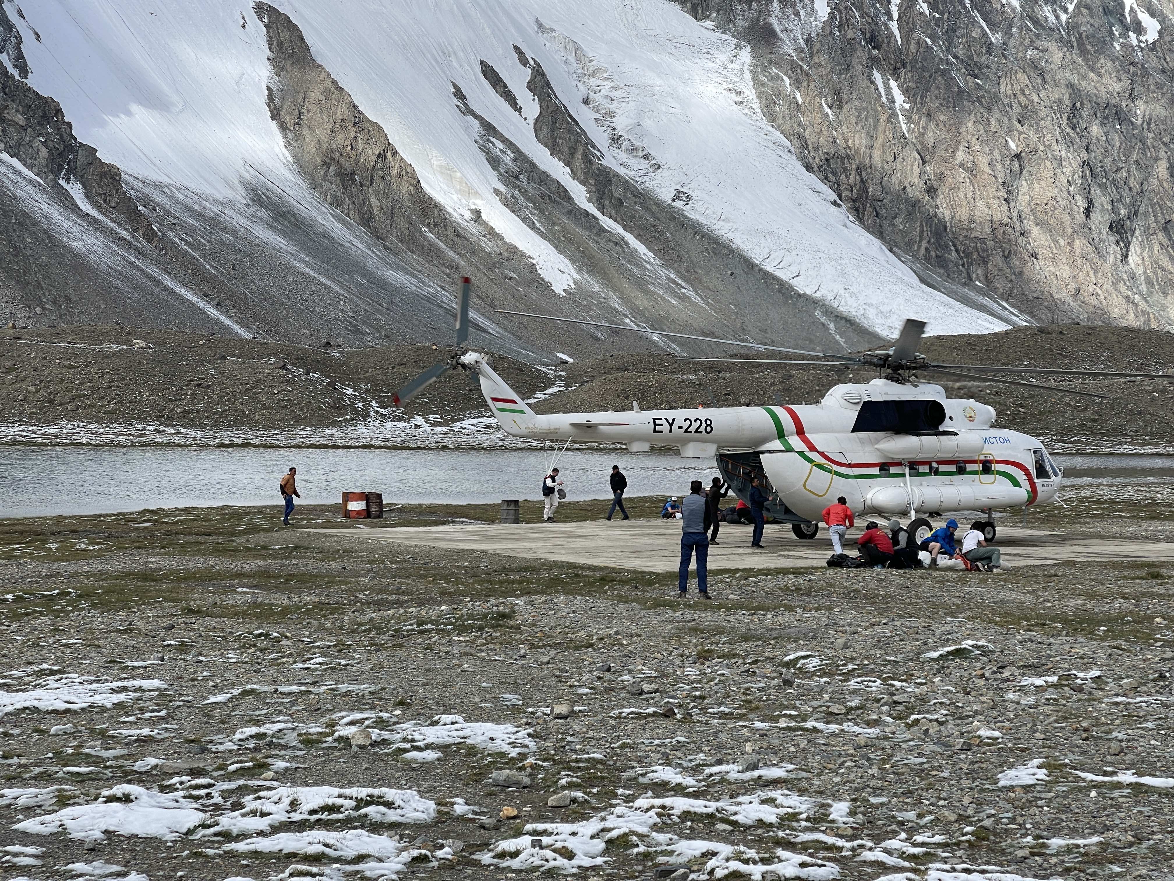
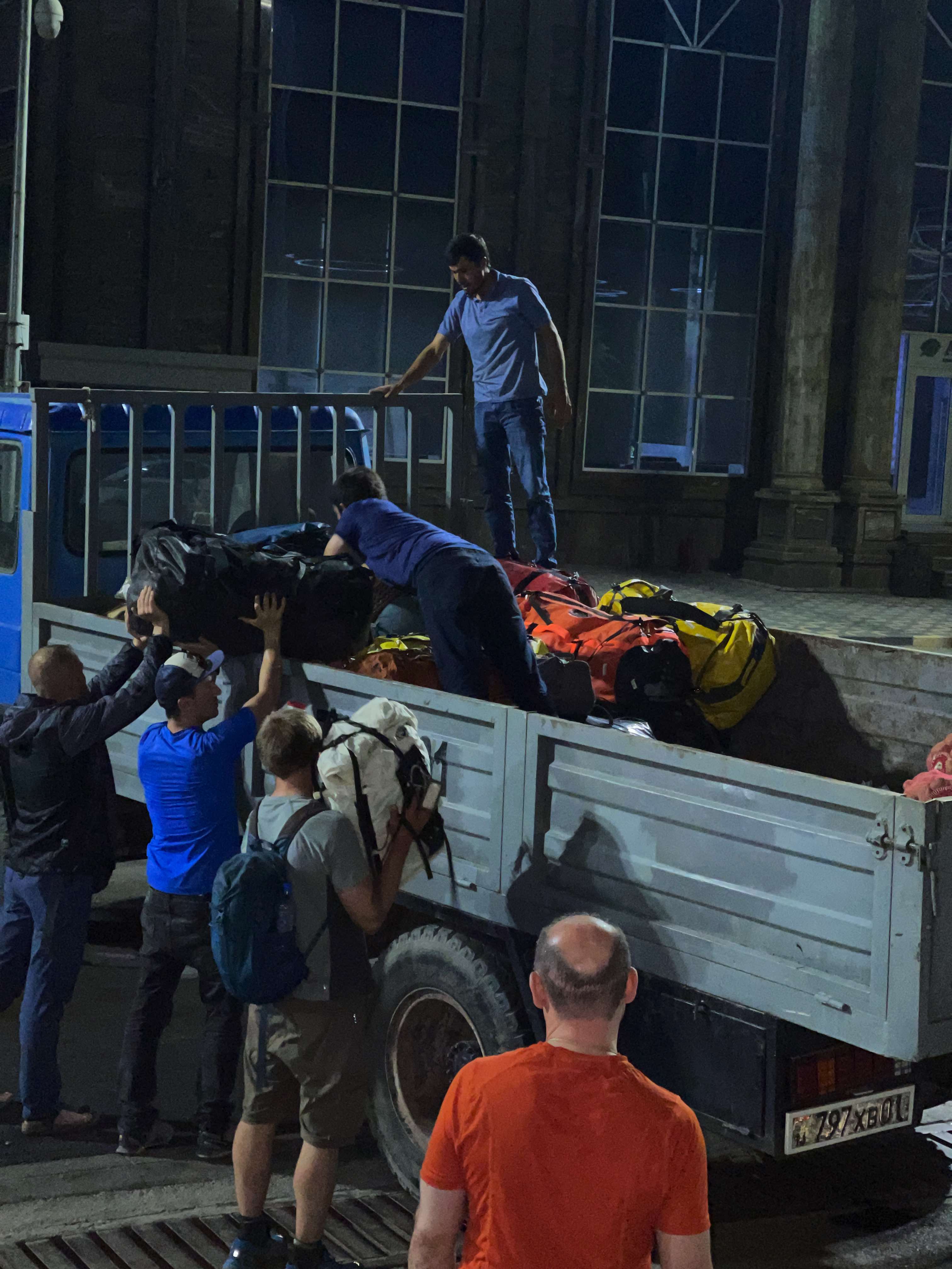
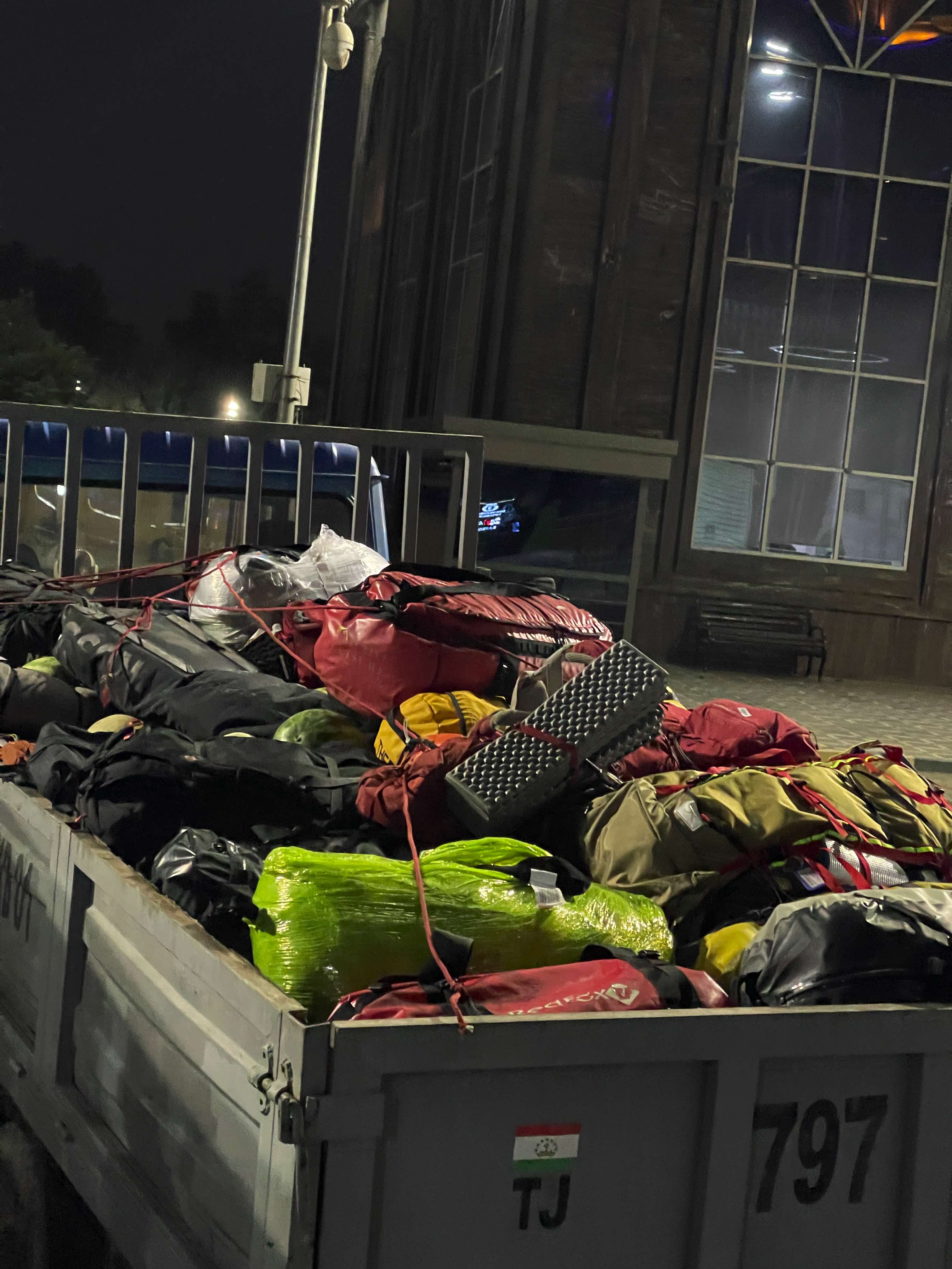
Our group’s gear, at the Afghan/Tajik border.

Filling out application forms, for our Afghan tourist visas.

The Consulate in Korugh.
7. Drive to the border crossing in Tajik Ishkashim. The drive takes about 2-3 hours from Khorugh. The border crossing is on a bridge, in the middle of the large river which separates the Tajik and Afghan Wakhan. The border crossing is slow, as passports must be processed on both sides. We experienced no issues crossing the border. Azim met us with cars on the Afghan side.
8. Drive to Afghan Ishkashim, just a half hour from the border, where one can overnight. We paid $30 USD for bed and board, and while expensive, this appeared to be the standard rate throughout the Afghan Wakhan.
9. Register with the police in Ishkashim and obtain permits for entering the mountains. We needed an additional five photos for this, but took them in Ishkashim at a cost of about $1. The paperwork was easy to sort out with Azim’s assistance. Qazi-Deh, the village from which the Noshaq approach begins, is roughly one hour’s drive from Ishkashim.
Route Description
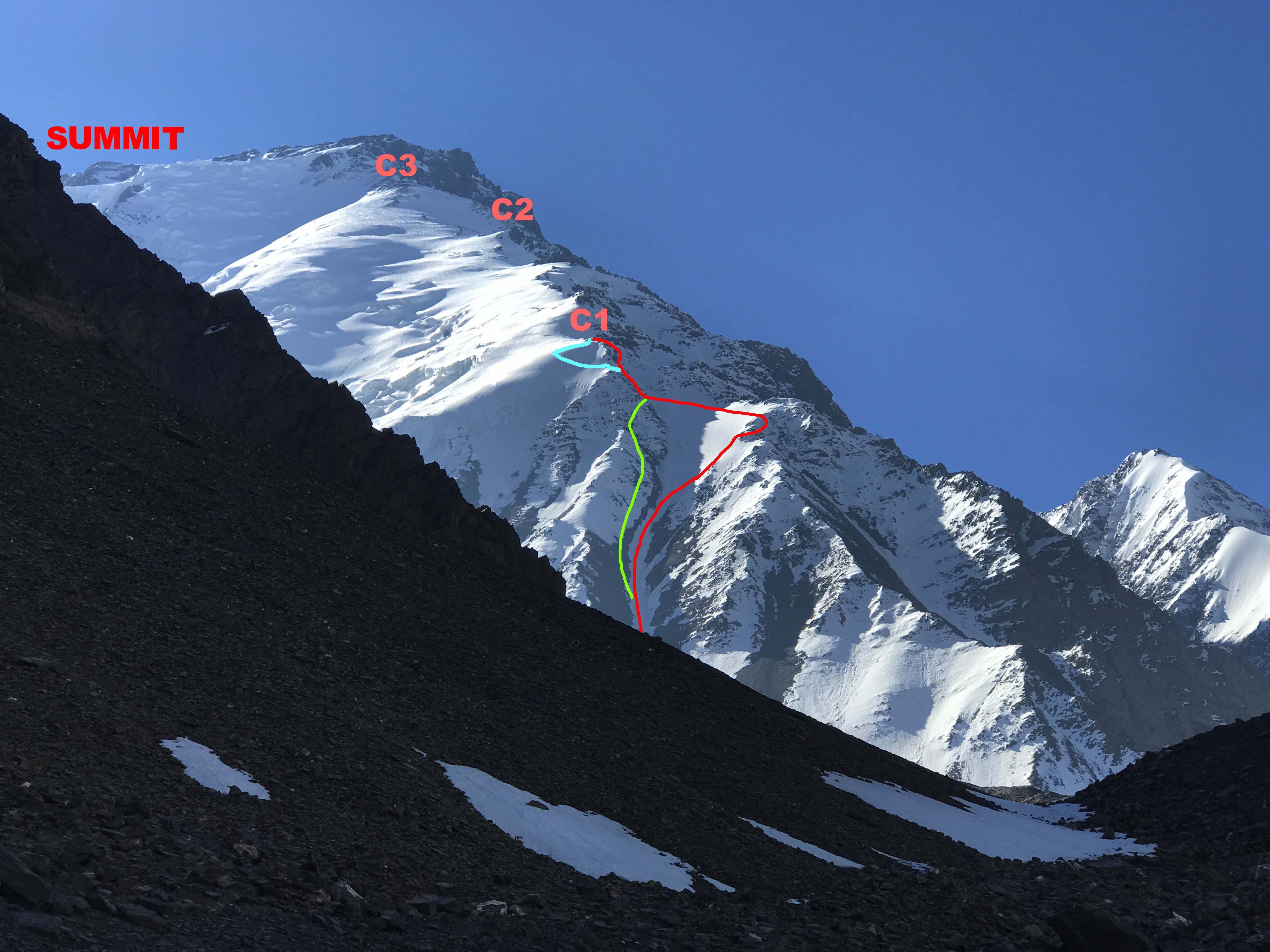
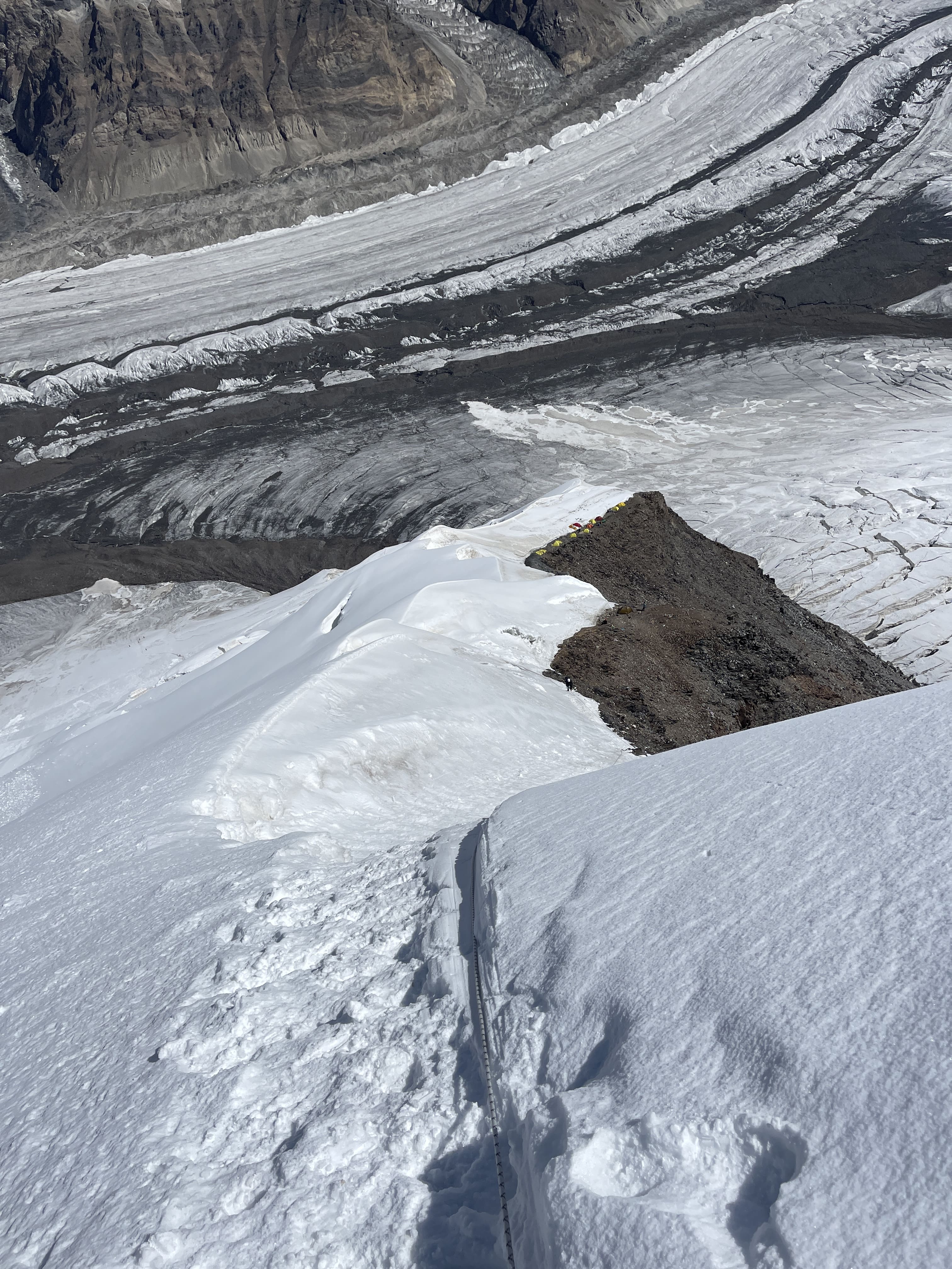
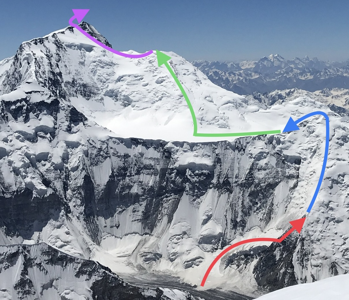
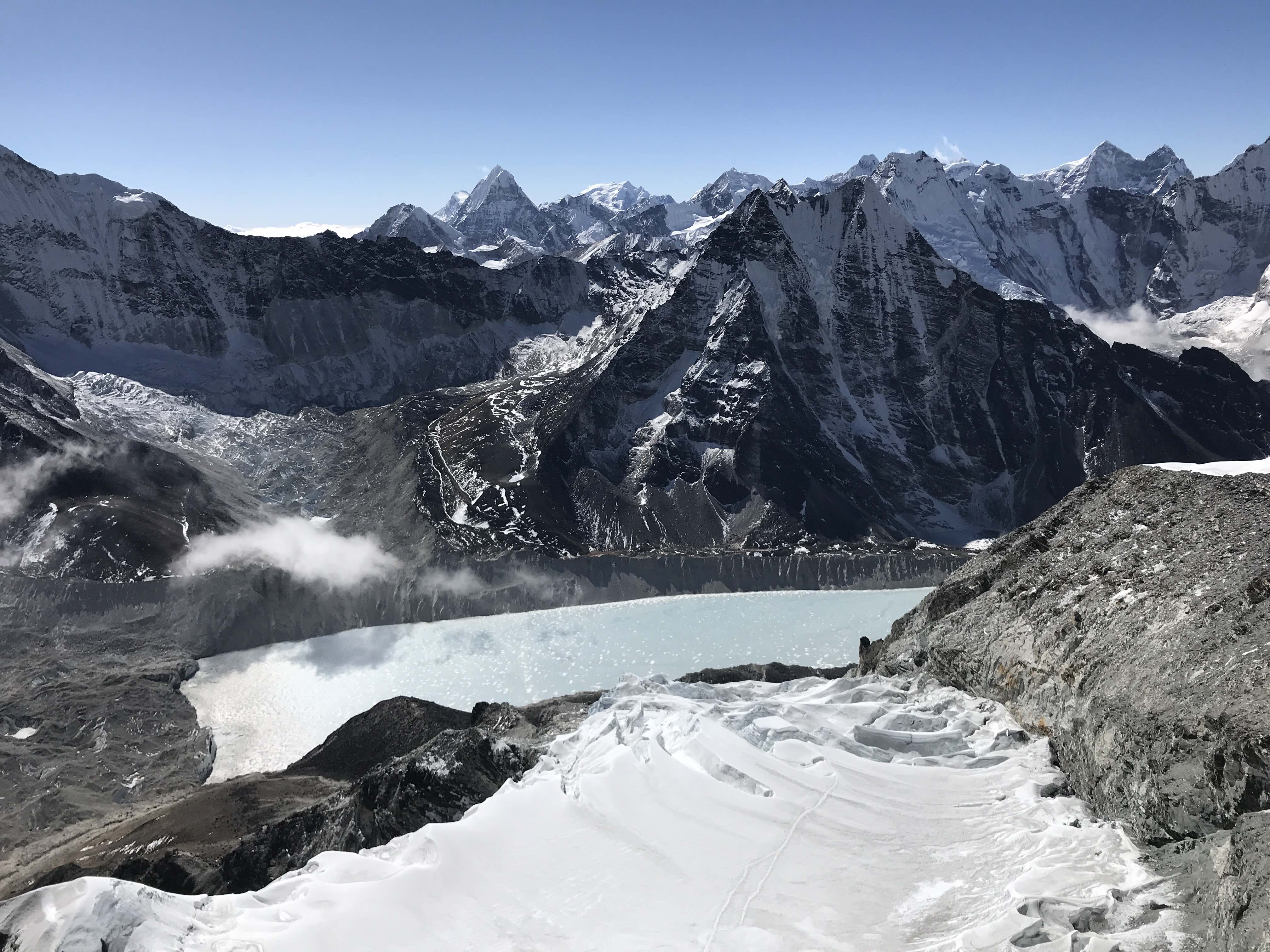
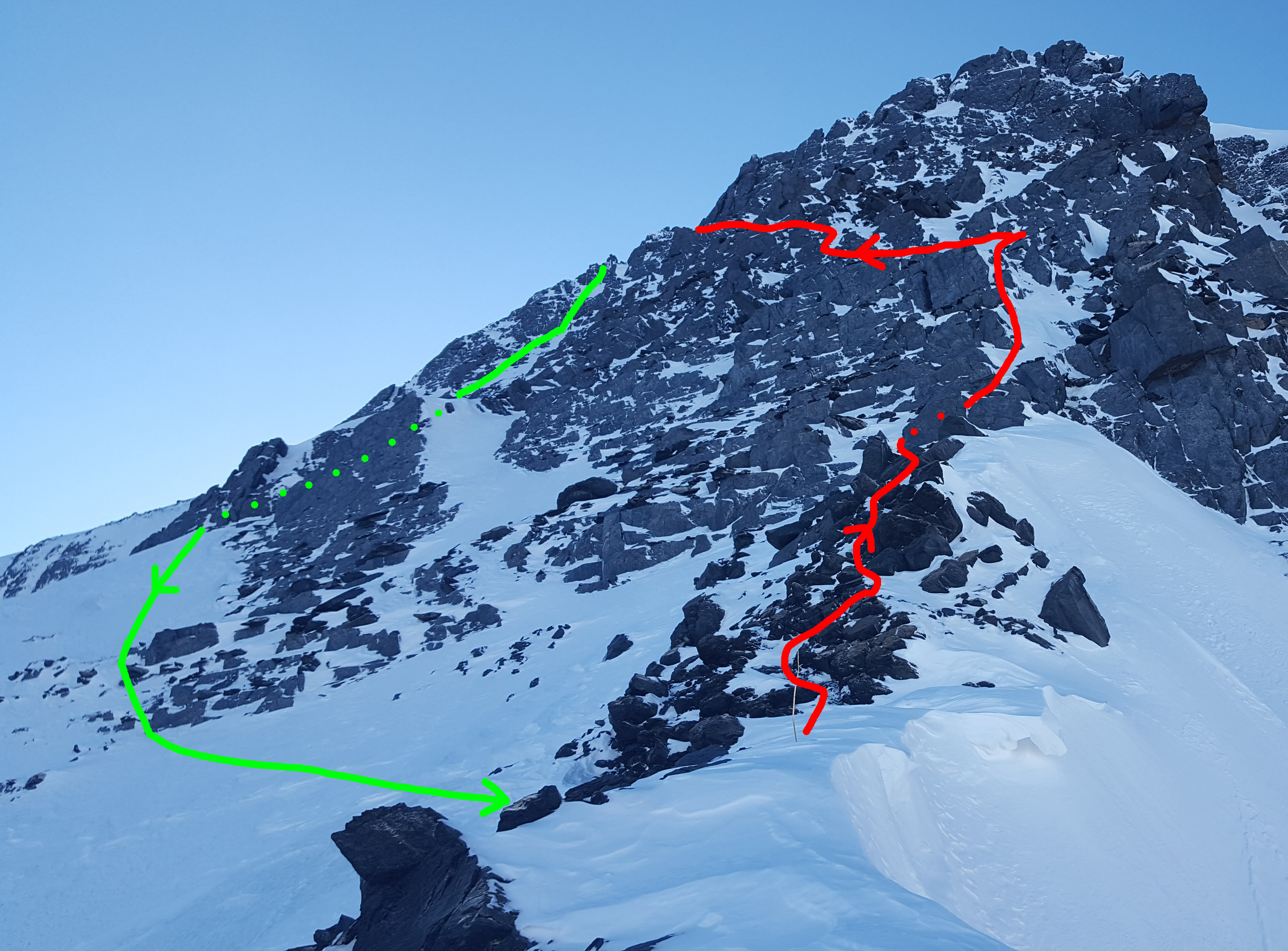
An outline of camp locations and of our climbing routes to 5500m Camp 1. The summit is located at the far left of the ridge, behind where it is marked in this image.
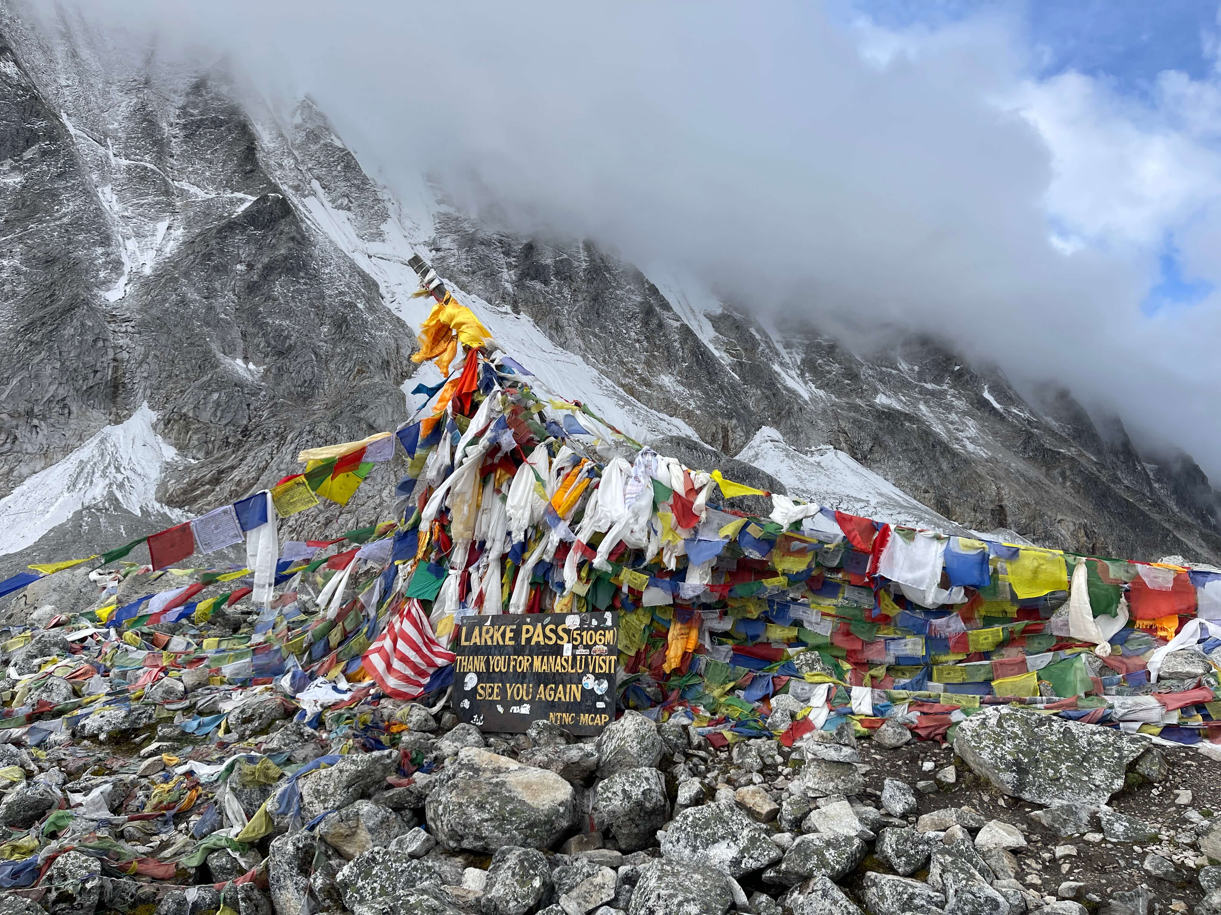
I have accurate GPS waypoints for campsites, major landmarks, and for the summit. Please contact me if you want a copy.
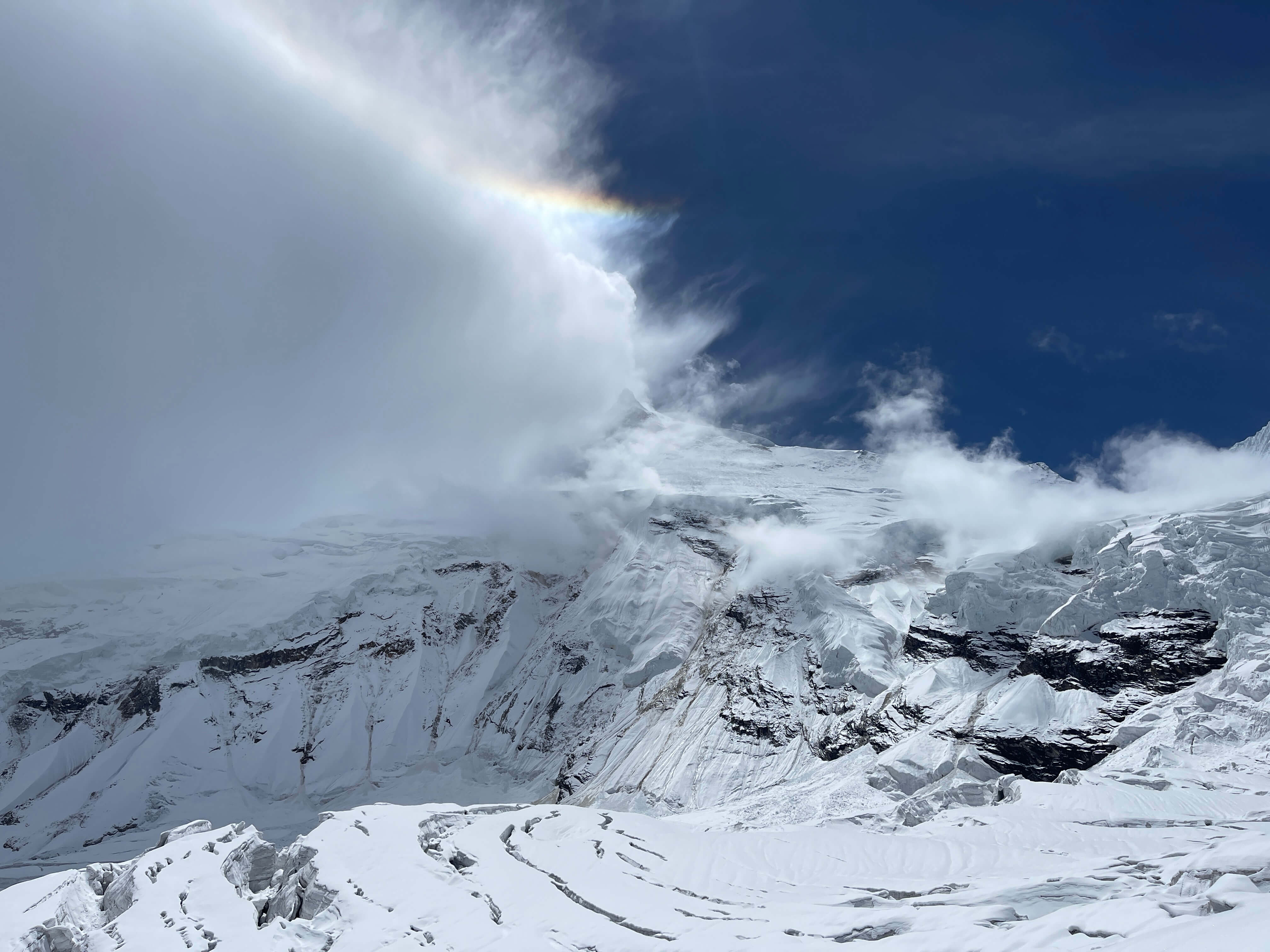
It is worth noting the consistent weather patterns which we experienced on Noshaq. Every morning was clear, with low winds. Every day on the mountain, bar two days in the middle of the expedition, we experienced whiteout, snowfall, and significantly increased winds starting between 11 a.m. and 3 p.m., and lasting until after sunset.
Qazi-Deh to Basecamp
Qazi-Deh, a small village at around 2600m, is the starting point for the approach to Noshaq Basecamp. Qazi-Deh is Malang’s home village, and everyone there knows him; there are comfortable enough guesthouses available. We paid $30 per night for room and board in 2019. The full approach from Qazi-Deh to Noshaq Basecamp is typically completed over a 3-4 day timeframe.

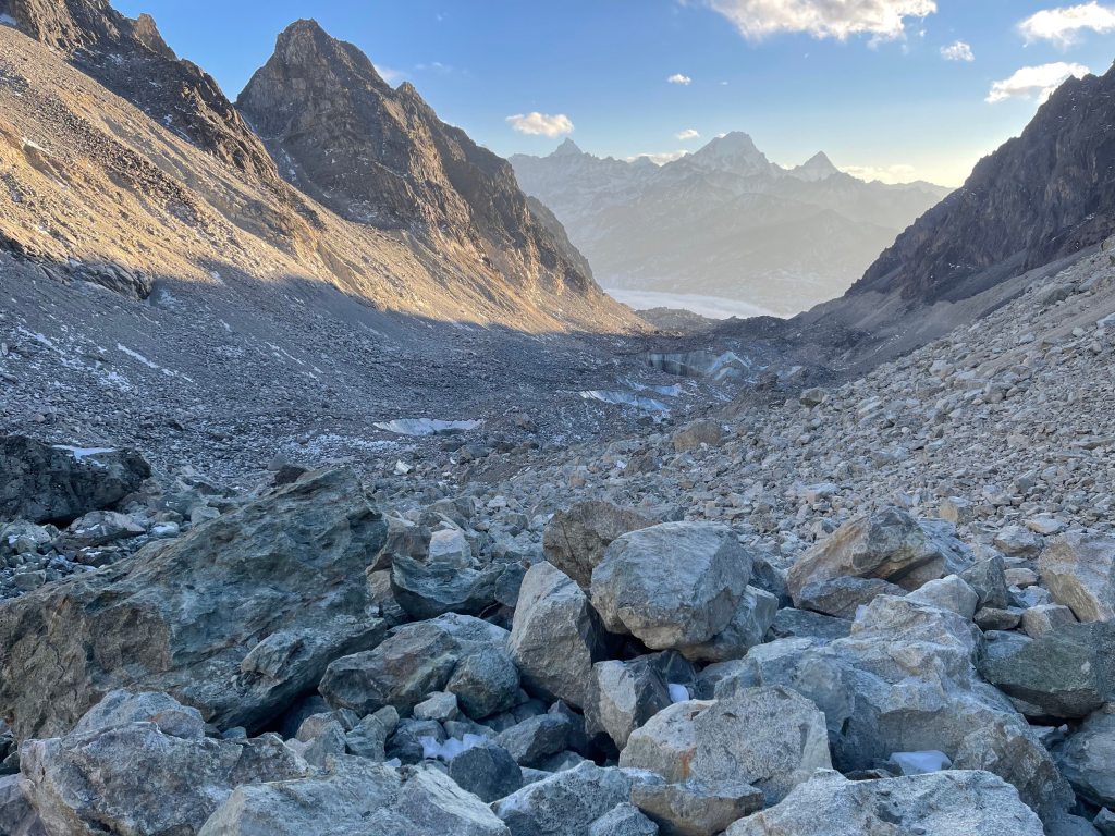
The valley which leads to Noshaq Basecamp.

Razok, Malang’s son and a leader of the porters.

First night’s campsite.

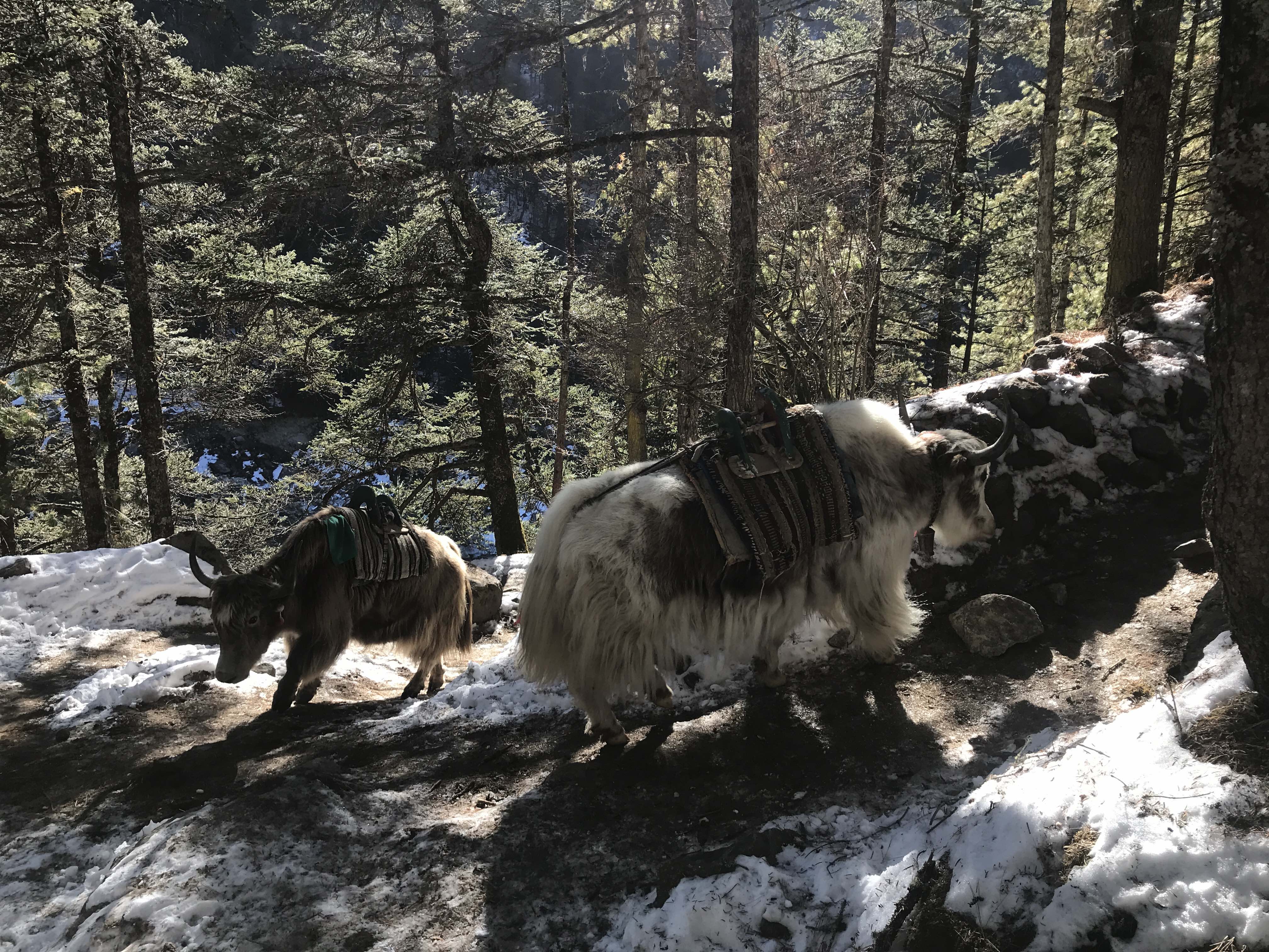
Our porters managing the donkeys, which carried our gear.

With Malang, before beginning the approach hike.

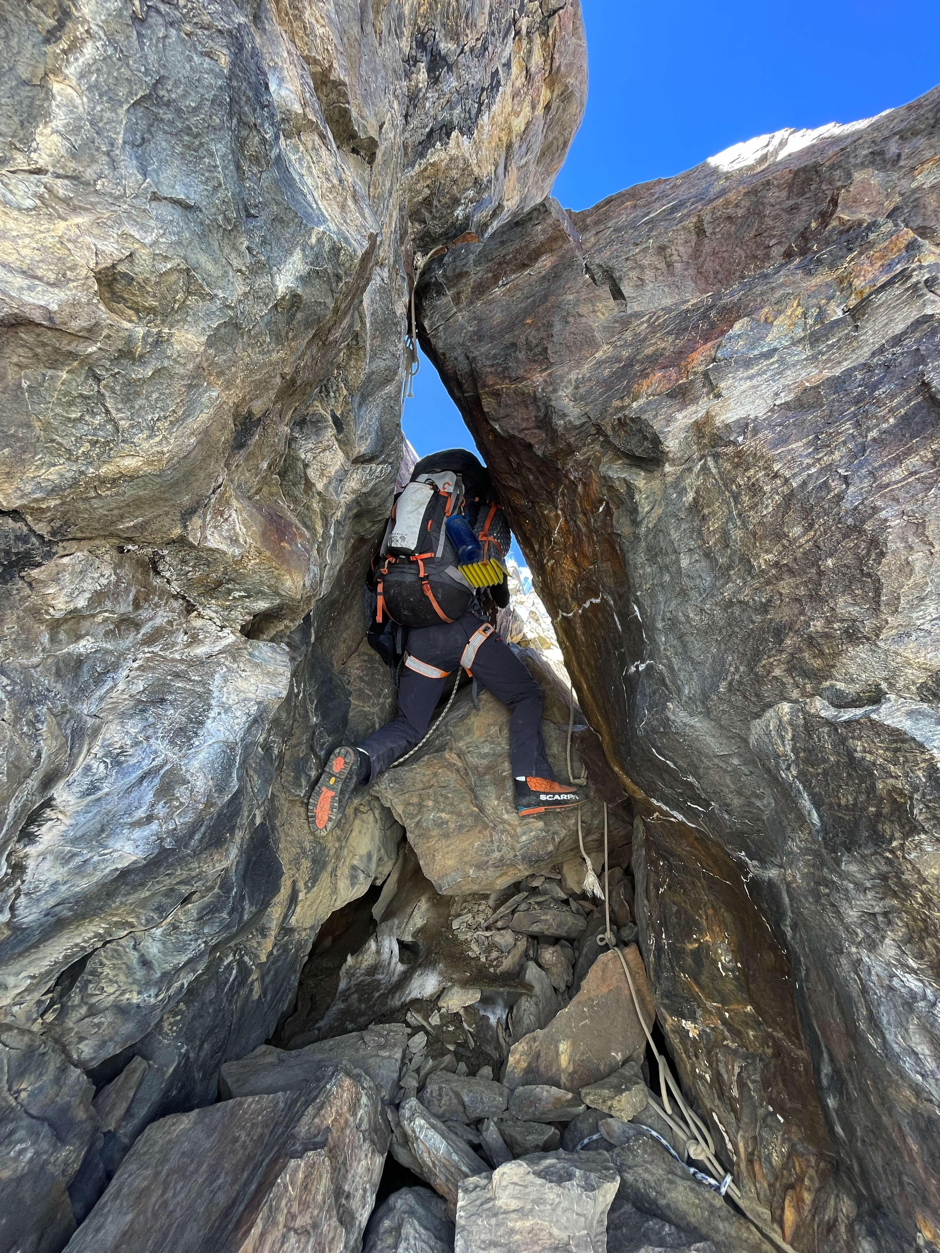
The enormous scree traverse.

The enormous scree traverse.

Looking down the valley.

The enormous scree traverse.

Getting close to Noshaq Basecamp.
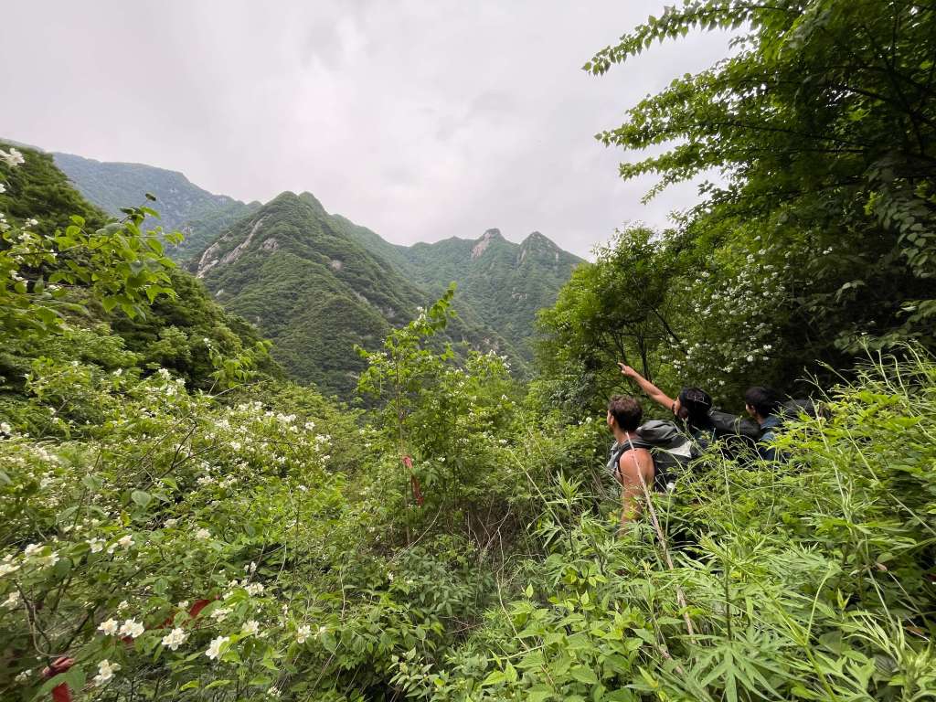
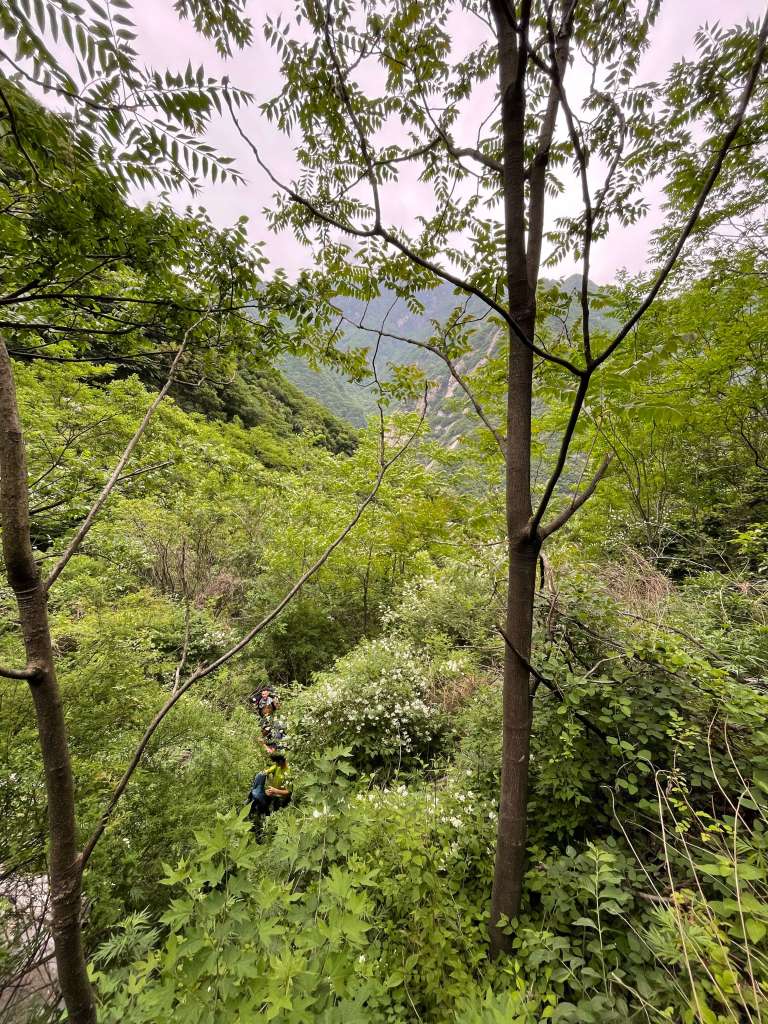
The mouth of the valley leading to Noshaq can be found 2km east of Qazi-Deh, and a well-marked path leads due south, away from the houses and fields. The first few kilometers of the approach cover easy terrain, a rocky path following the valley river. Abandoned farms line the lower valley, and the area is mostly quite barren. Further along are small areas of surprisingly dense greenery, rich with trees and moss cultivated by the glacial meltwaters of the river. This easy, pleasant terrain continues all the way to the standard campsite for the first night, a pastoral grove of trees and grass beside the river at about 3200m. This location is known to porters, and they will plan to stop here to overnight and graze the donkeys. Porters warned our party of landmines around this area, and cautioned us not to leave the path or wander towards the nearby hills. This first night’s campsite is roughly 14.5km from Qazi-Deh, or 12.5km from the mouth of the valley.
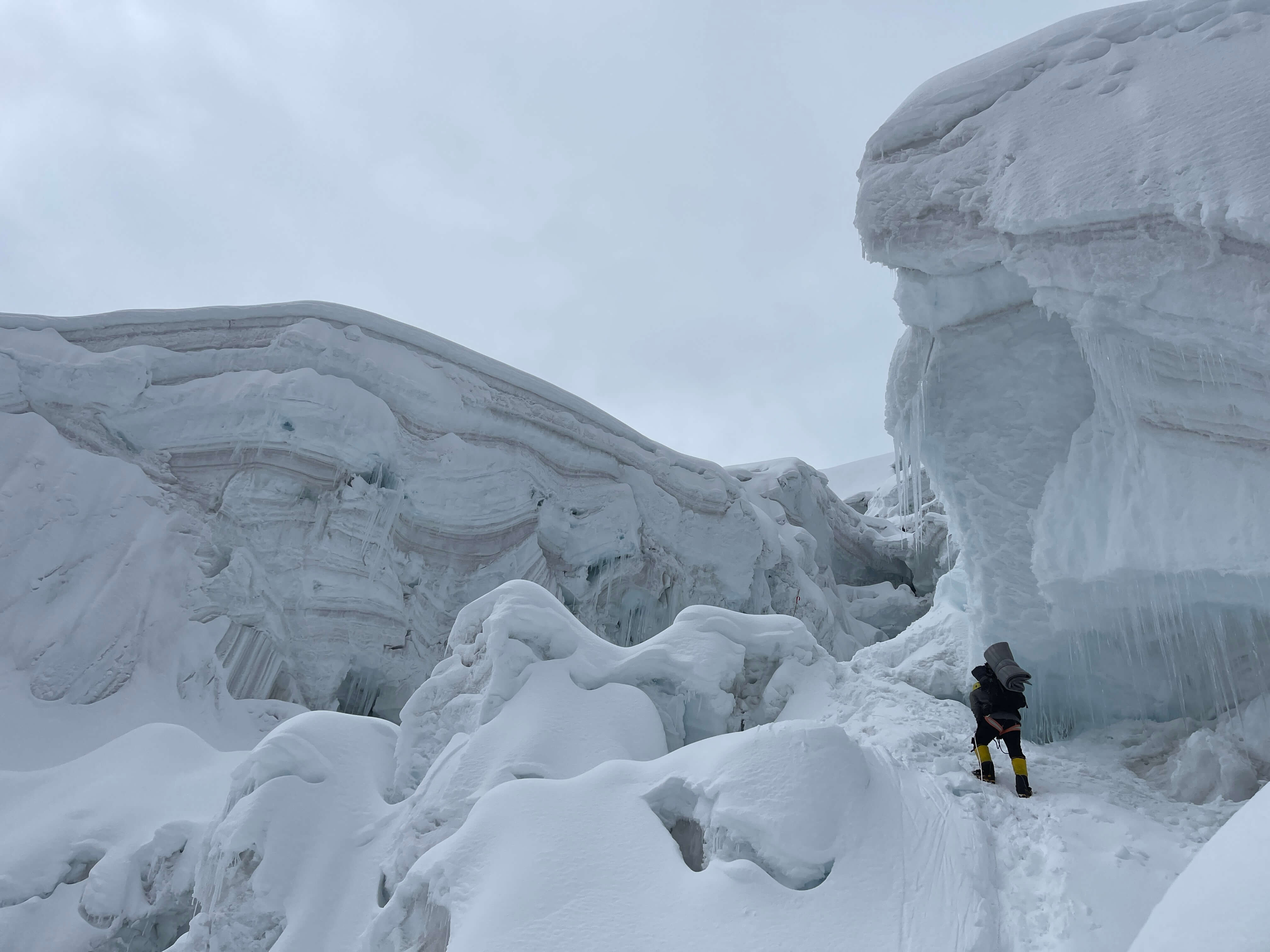
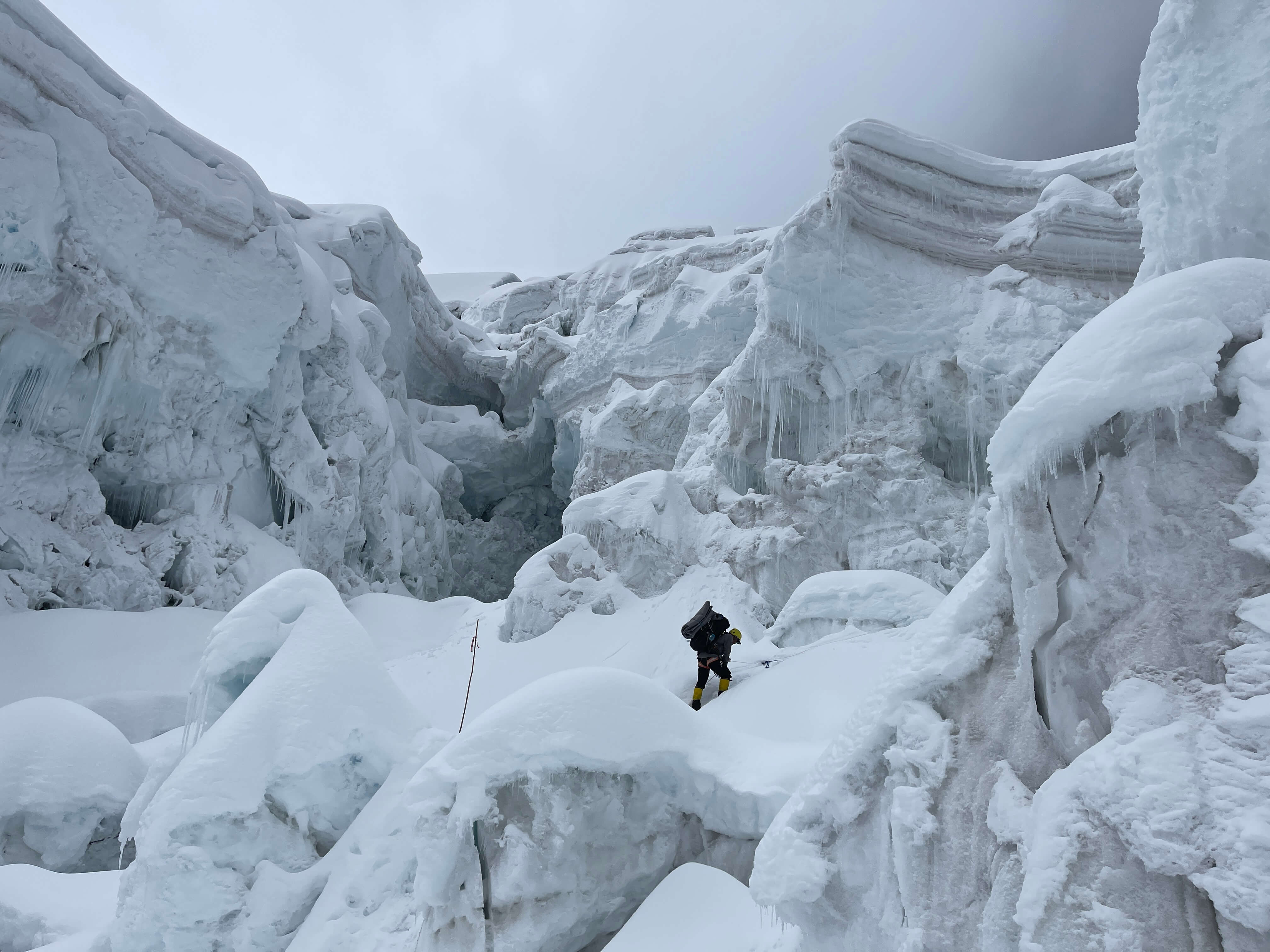
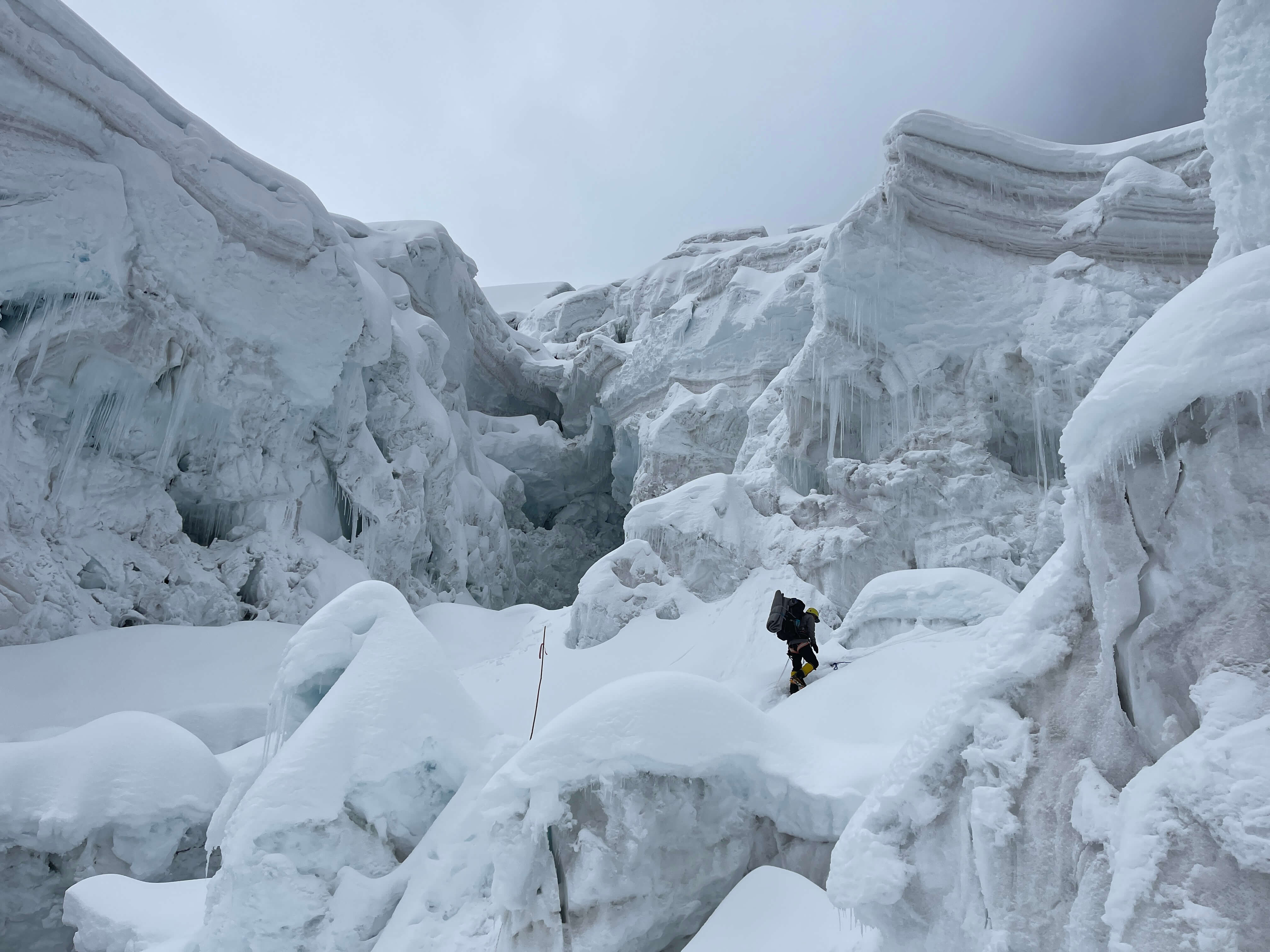
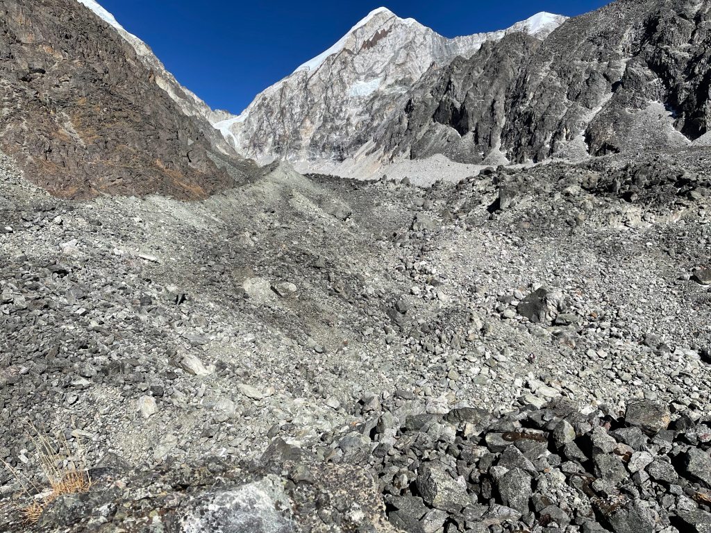
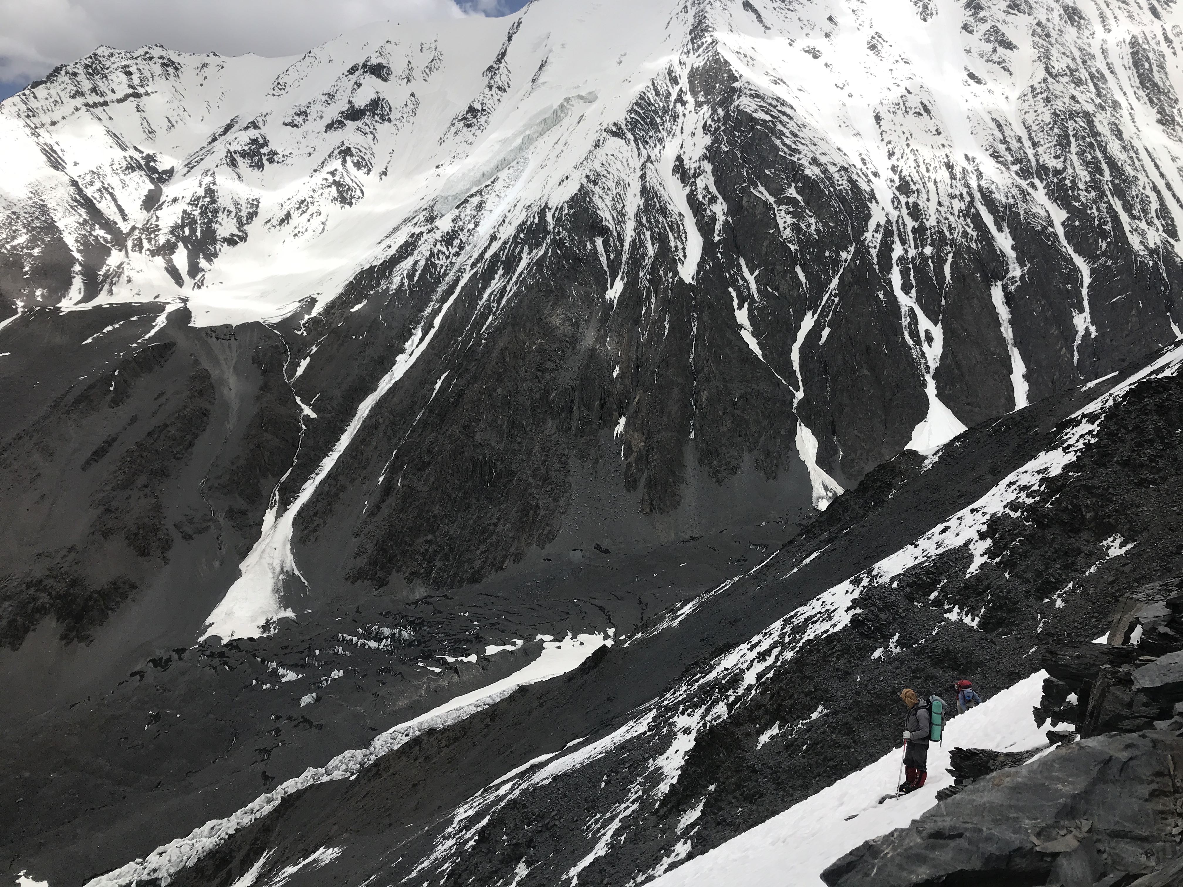
As the route ascends the terrain gradually becomes more severe, crossing scree fields and traversing landslide-prone slopes of rock high above the river valley. One section is notably unstable and lengthy; an enormous scree traverse of considerable difficulty for the donkeys. Porters know the way well, and will keep the donkeys under close watch here. Unfortunately this is also where the path becomes steeper and gains a considerable amount of altitude. Past the traverse is a long swath of glacial moraine and scree fields, churned leftovers of the receding glaciers which flow off of surrounding mountains.

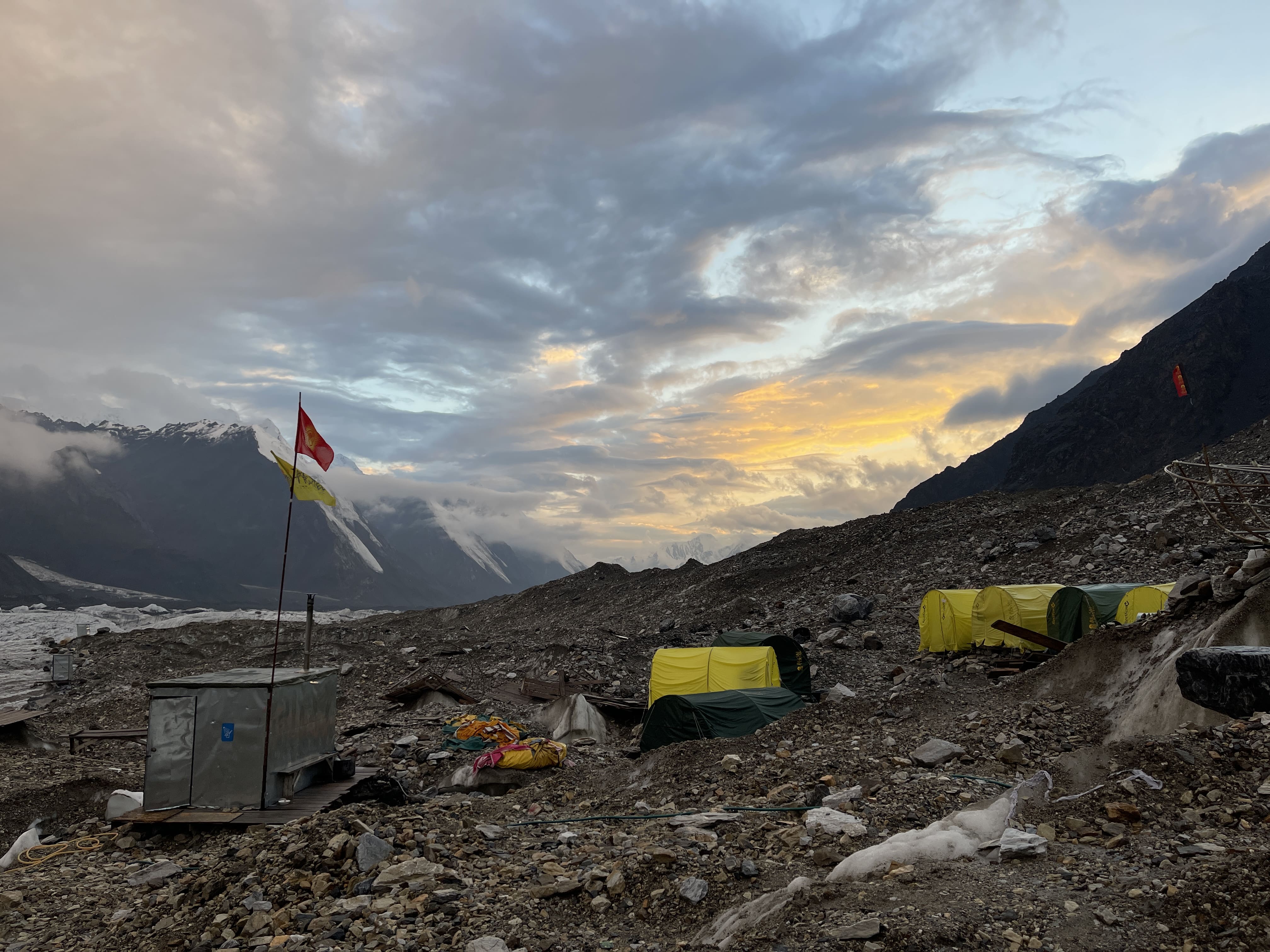
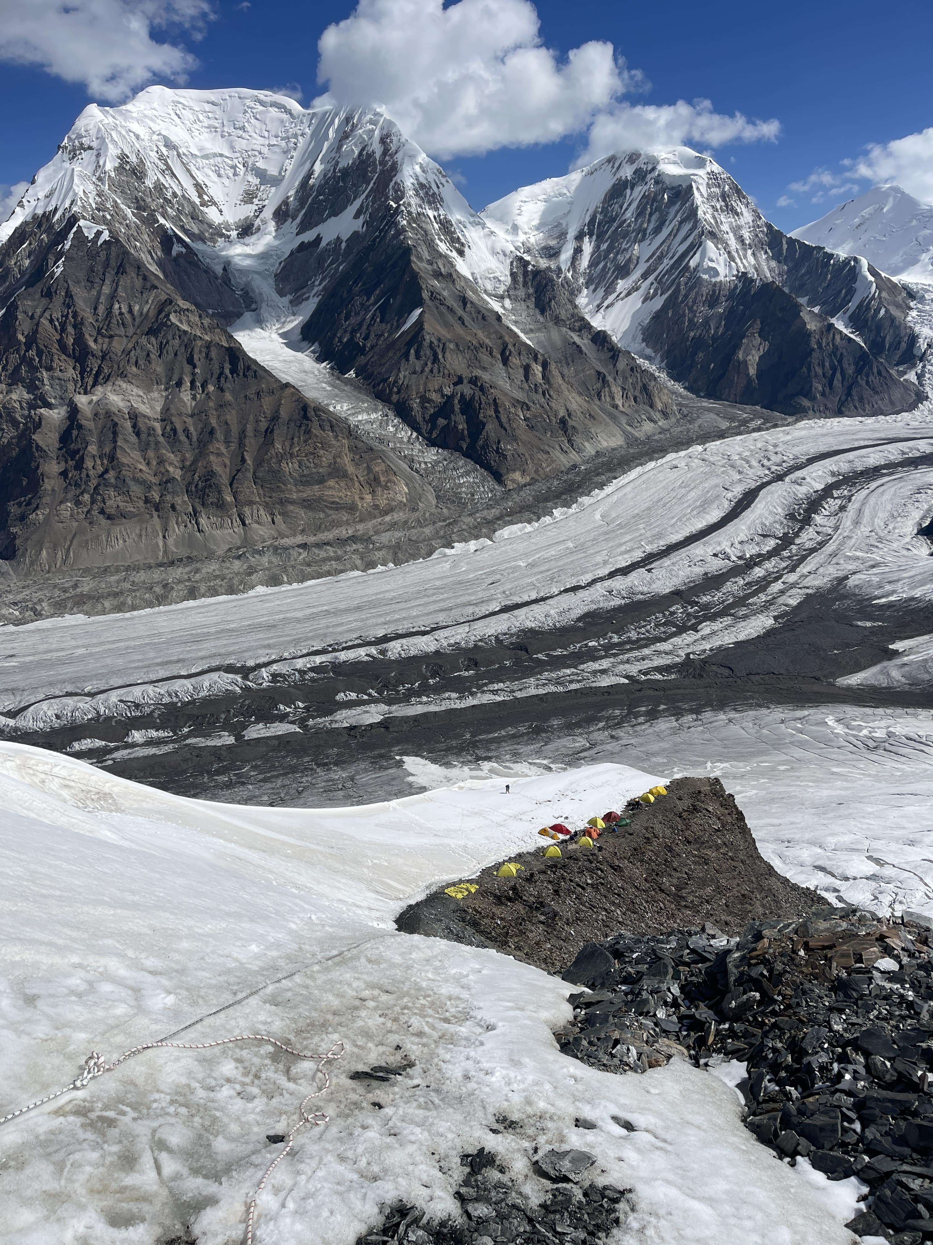
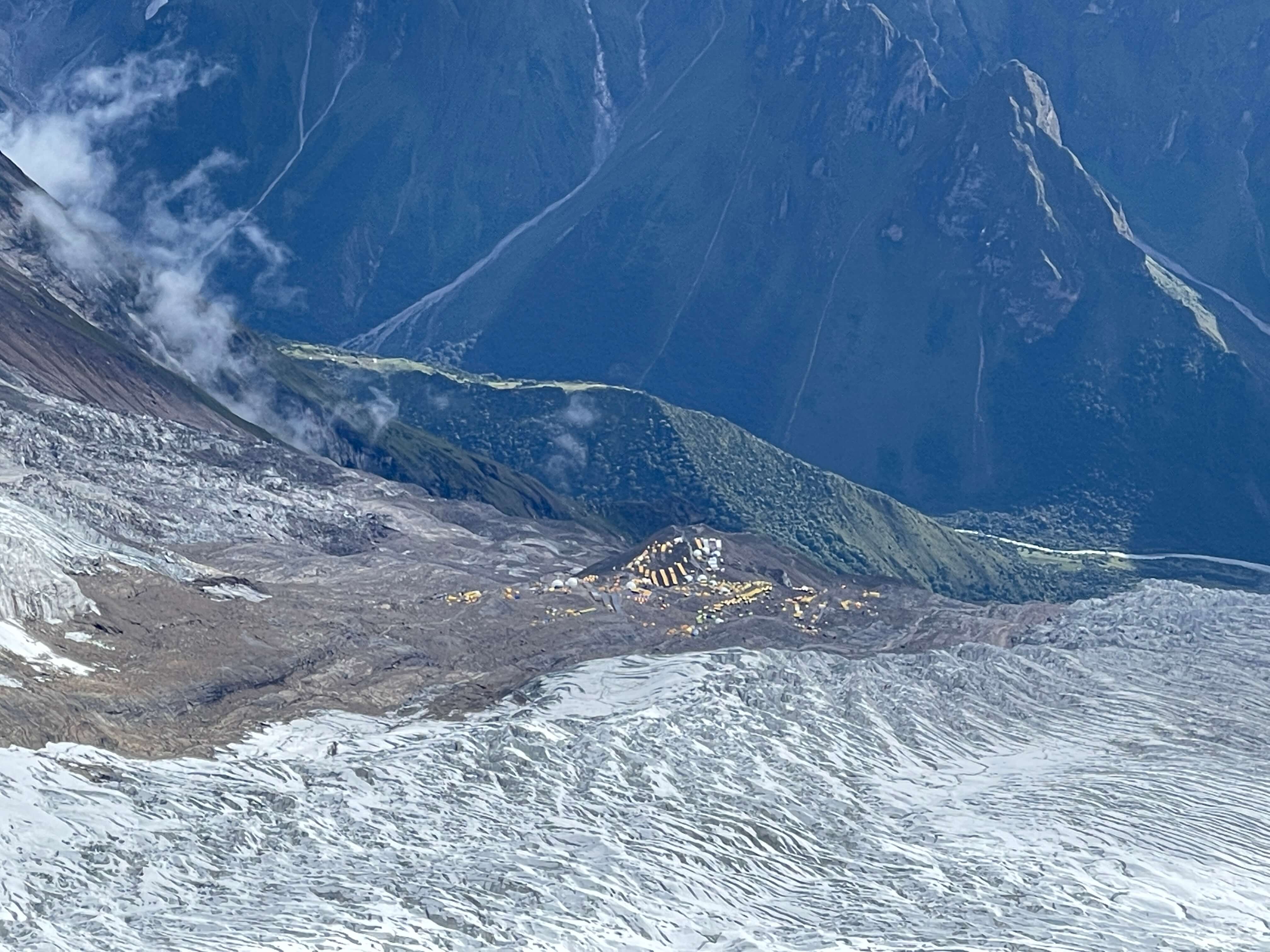
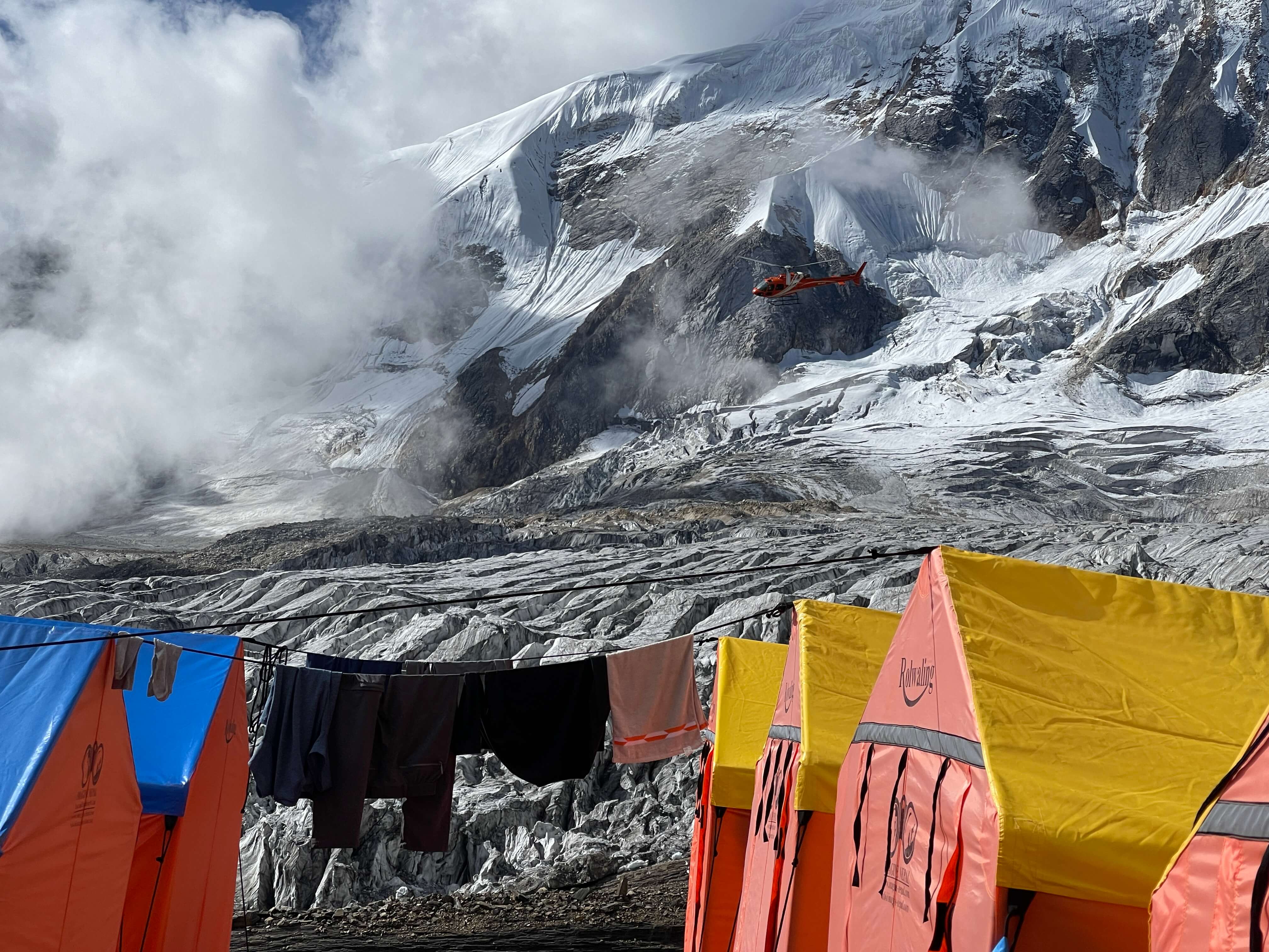
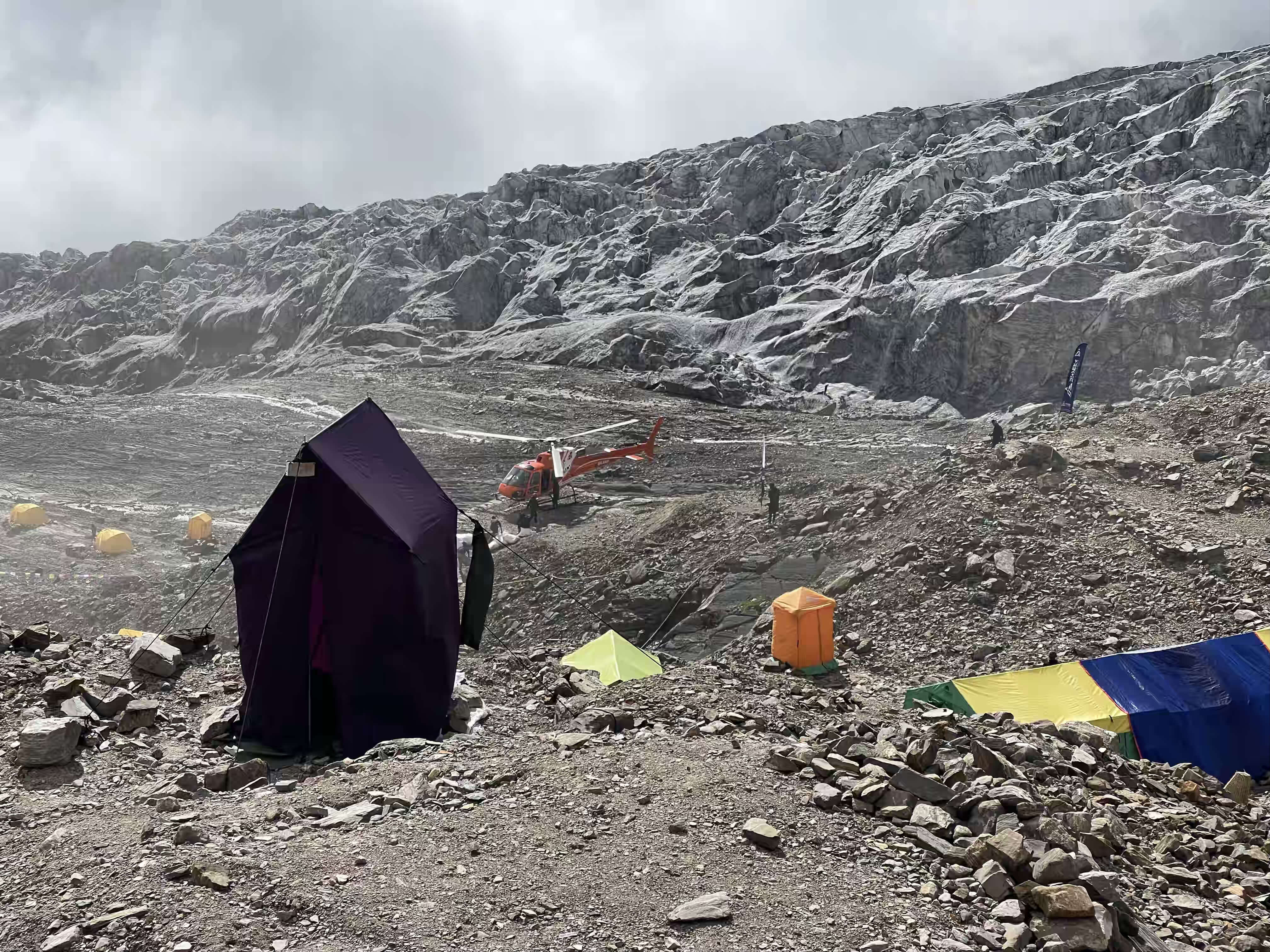
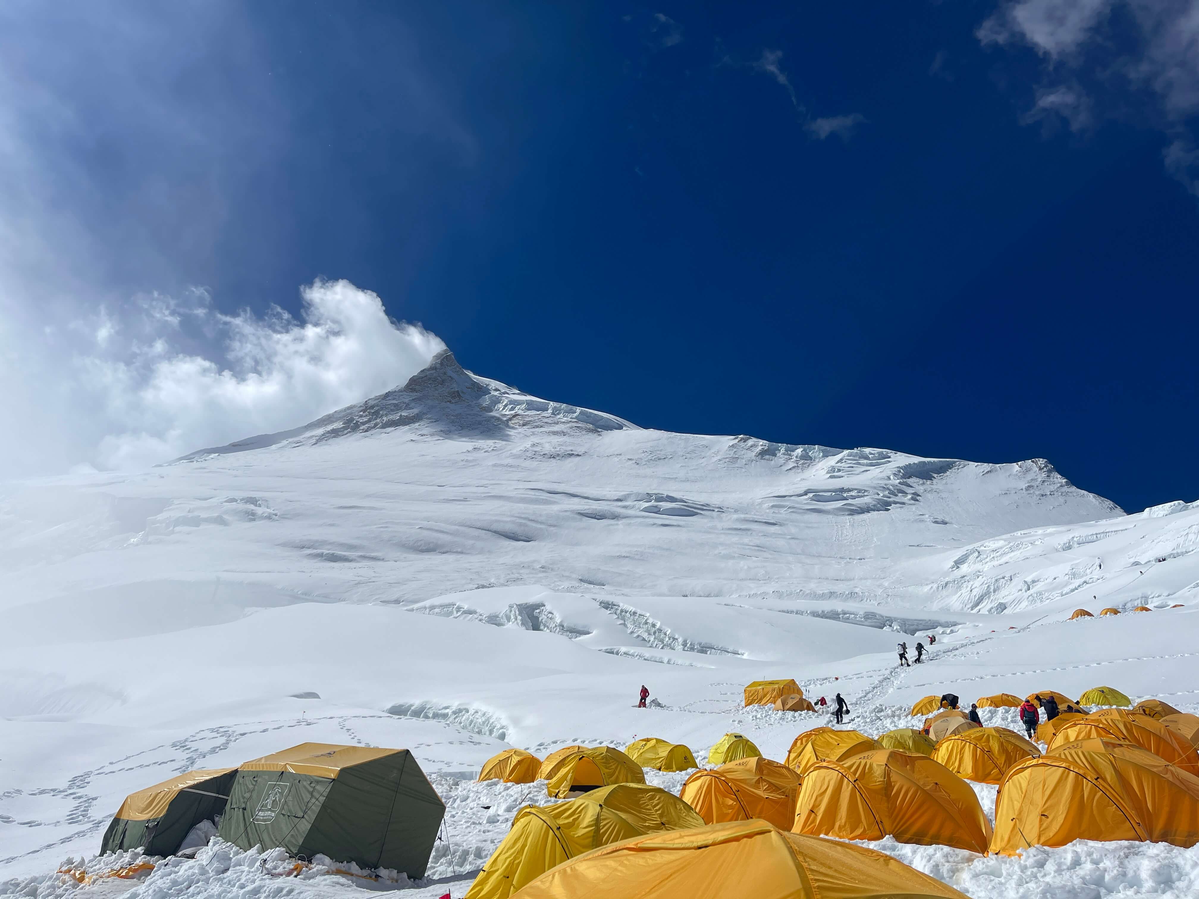
Noshaq Basecamp.

Noshaq Basecamp.

Noshaq Basecamp.

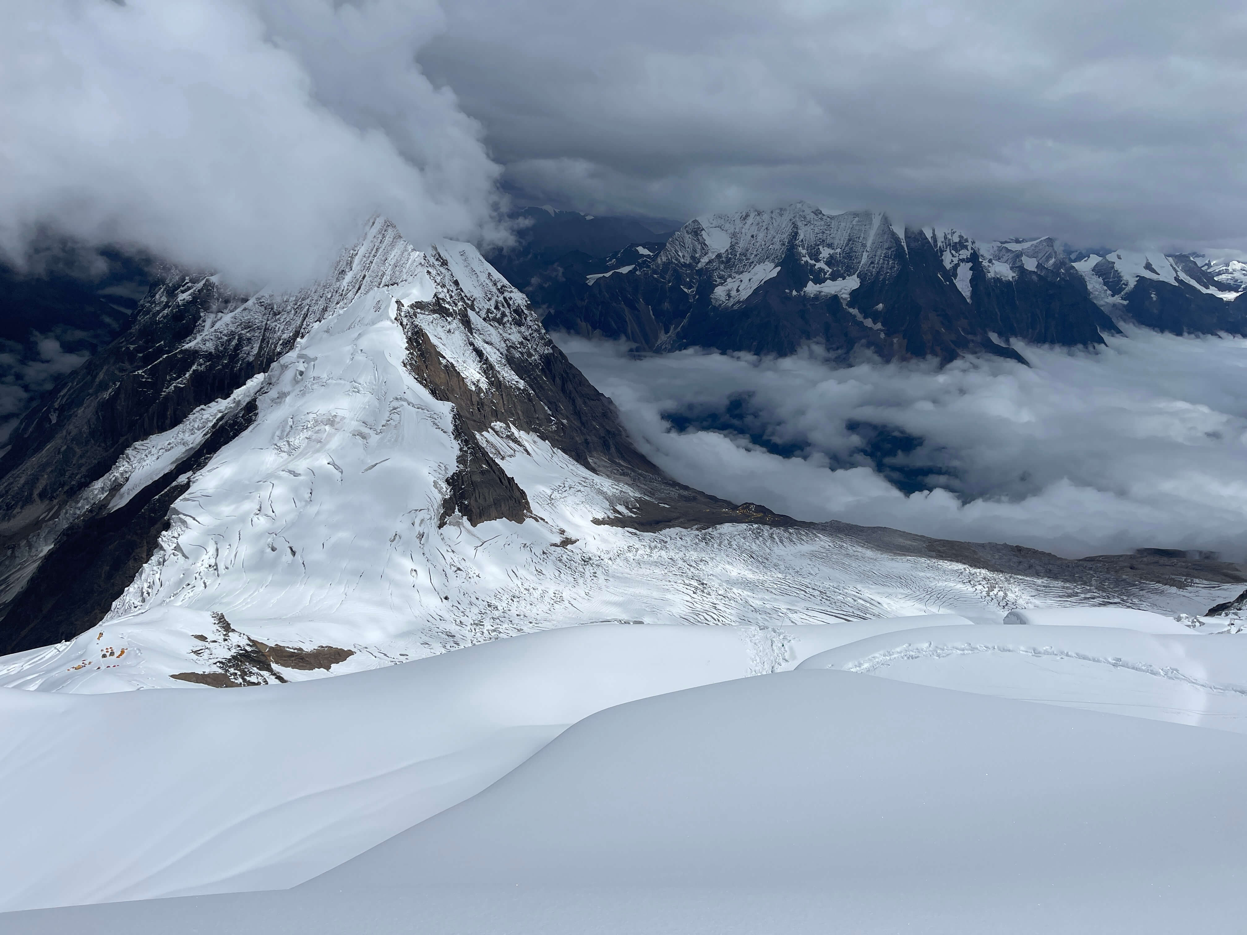
Noshaq seen from basecamp.
Most parties stop at around 4200m to overnight, breaking the second leg of the approach into two days so as to avoid an overly rapid ascent. A direct hike from the riverside campsite at 3200m to basecamp at 4650m covers 16.75km. Basecamp itself is large, with numerous good tent platforms. There is a water source in the form of a small stream which emerges from the ground – it stops flowing overnight, but swells considerably each afternoon.
Basecamp to 5500m Camp 1
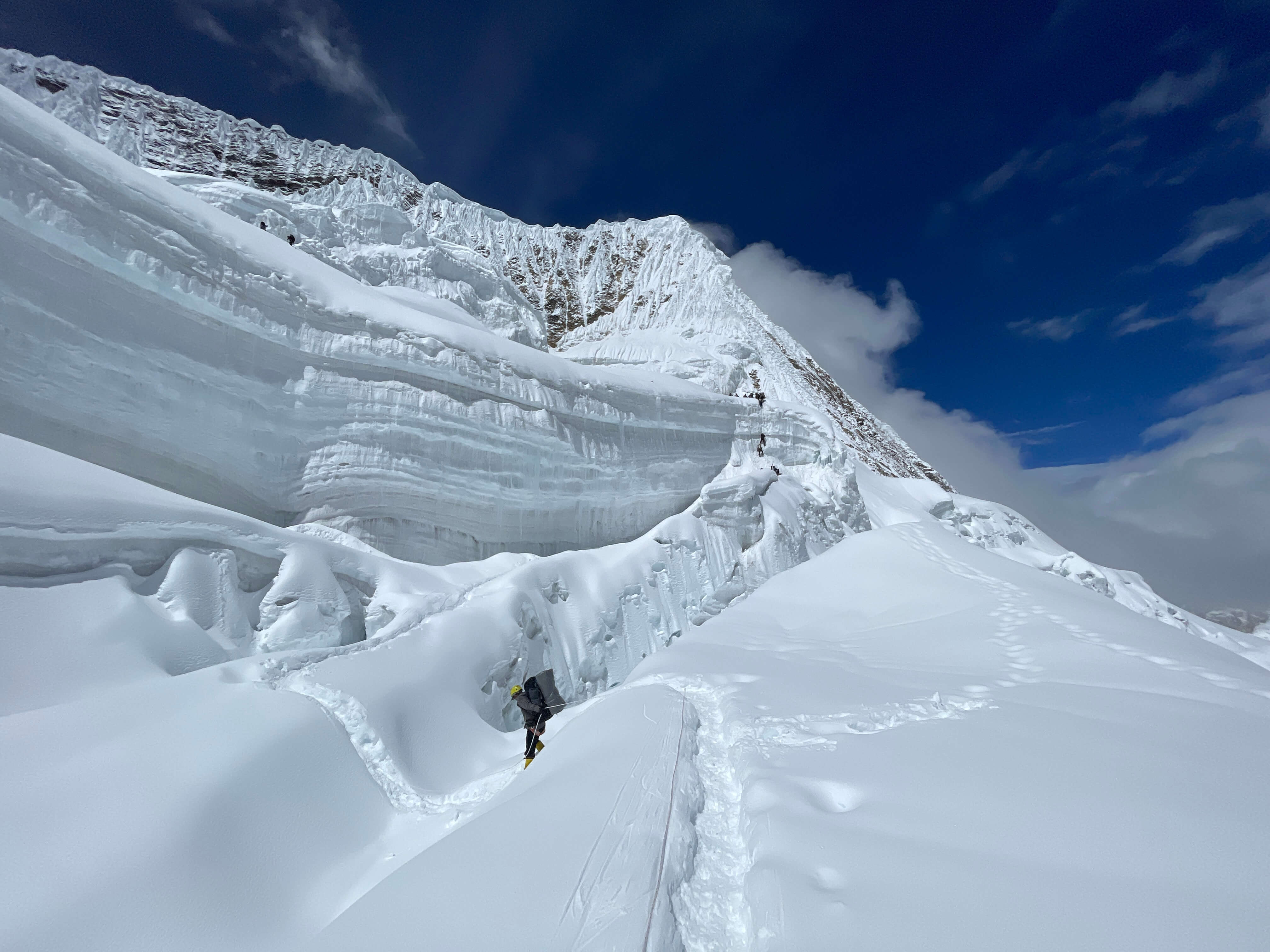
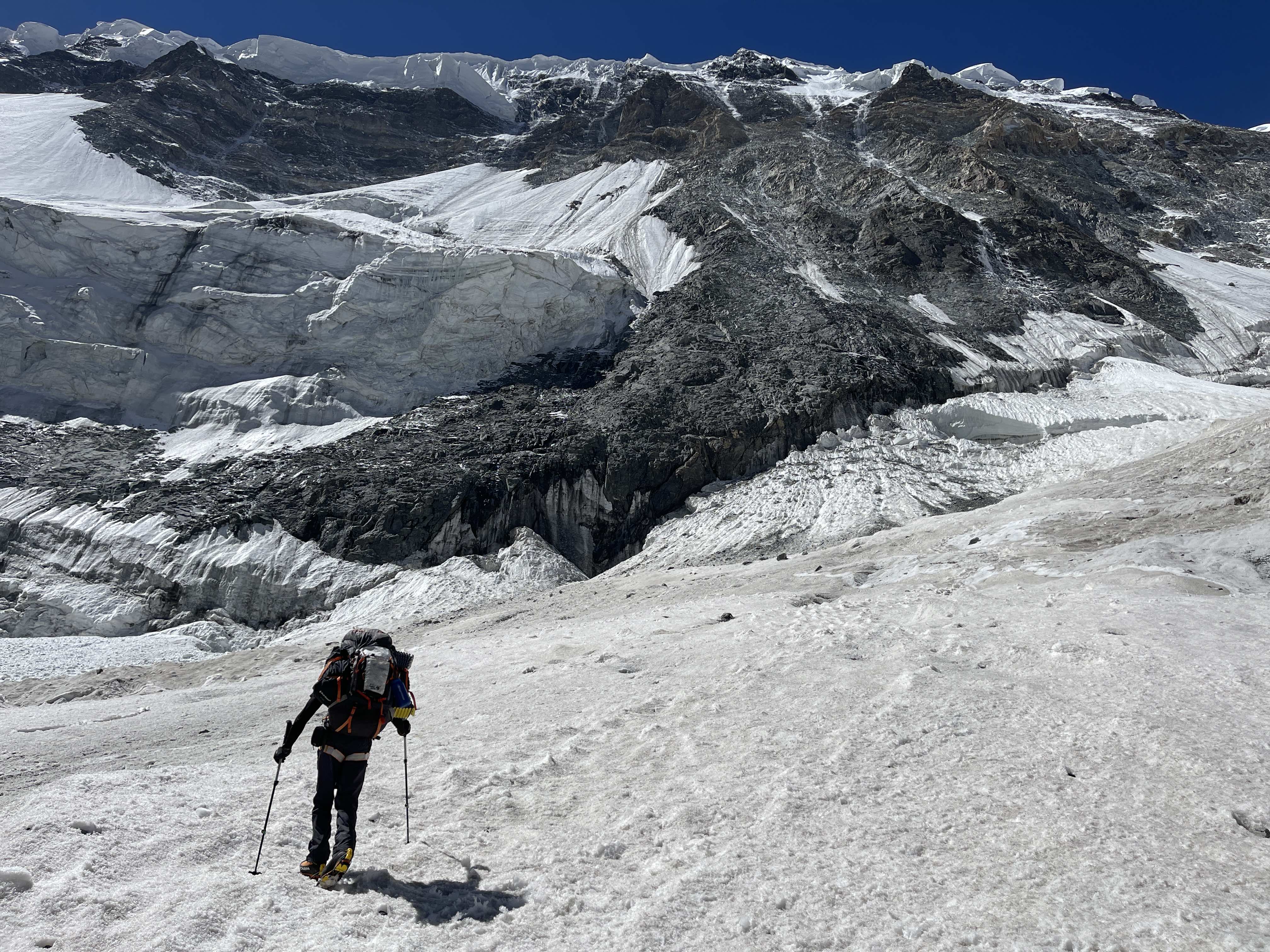
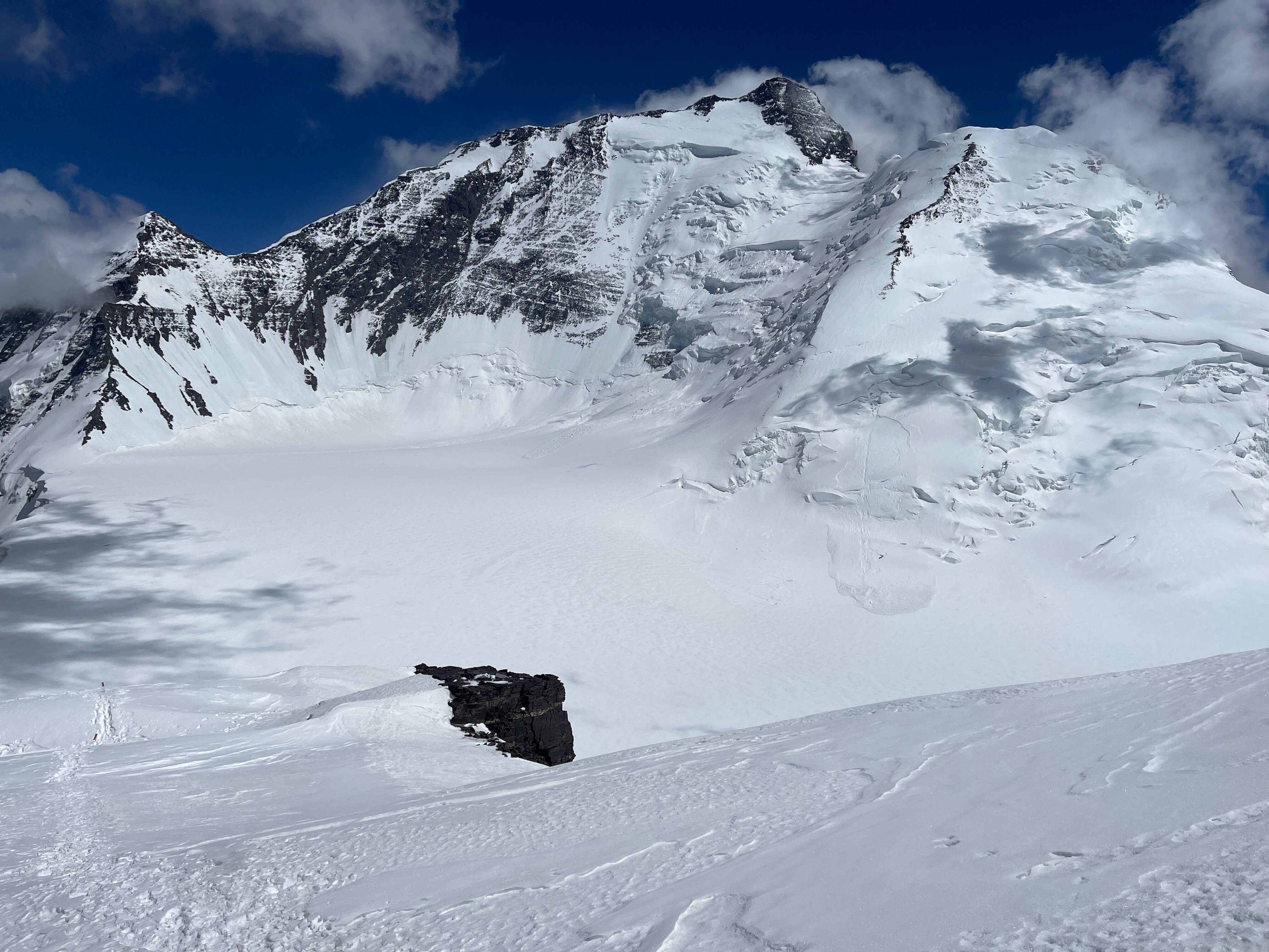
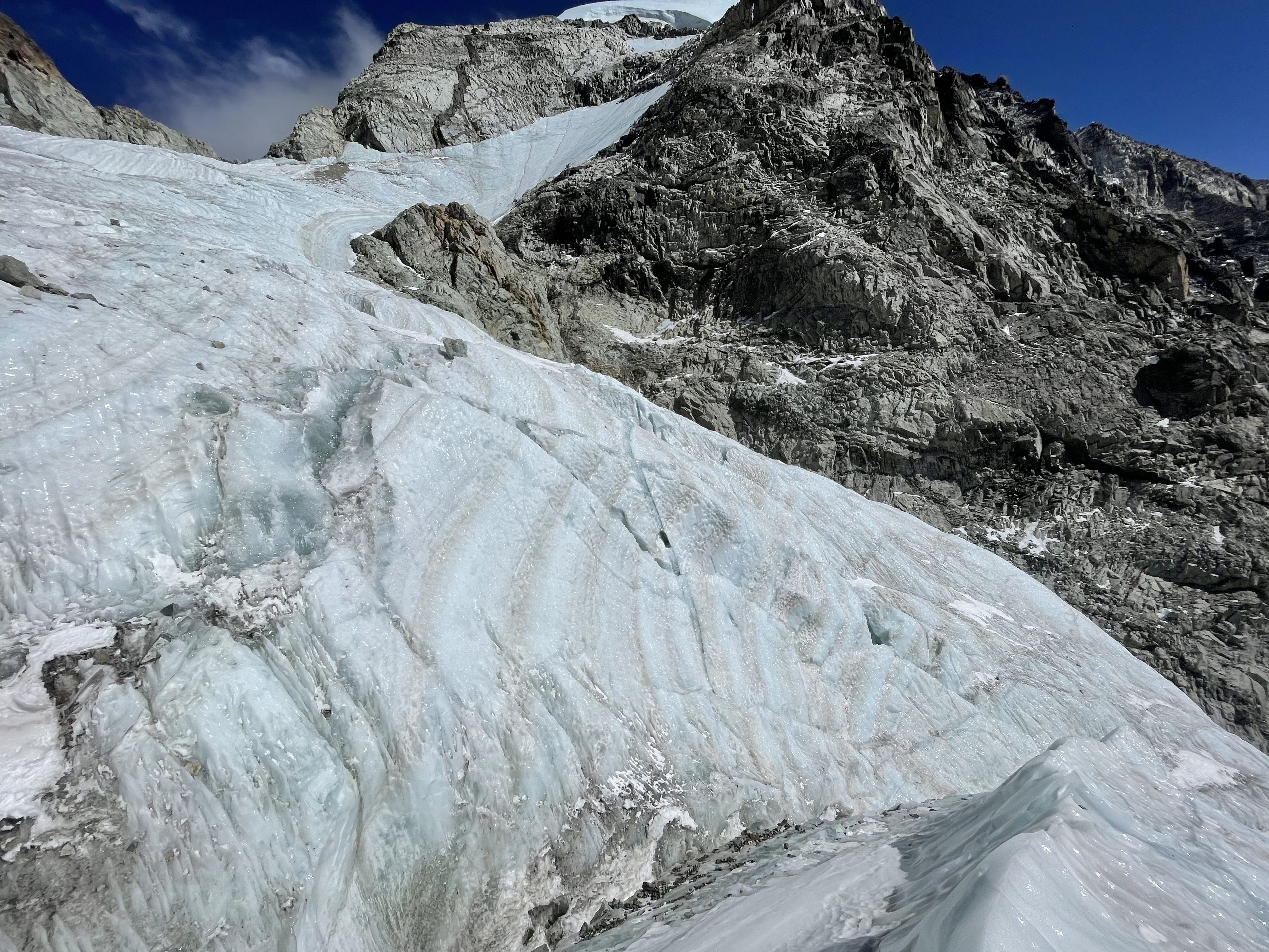
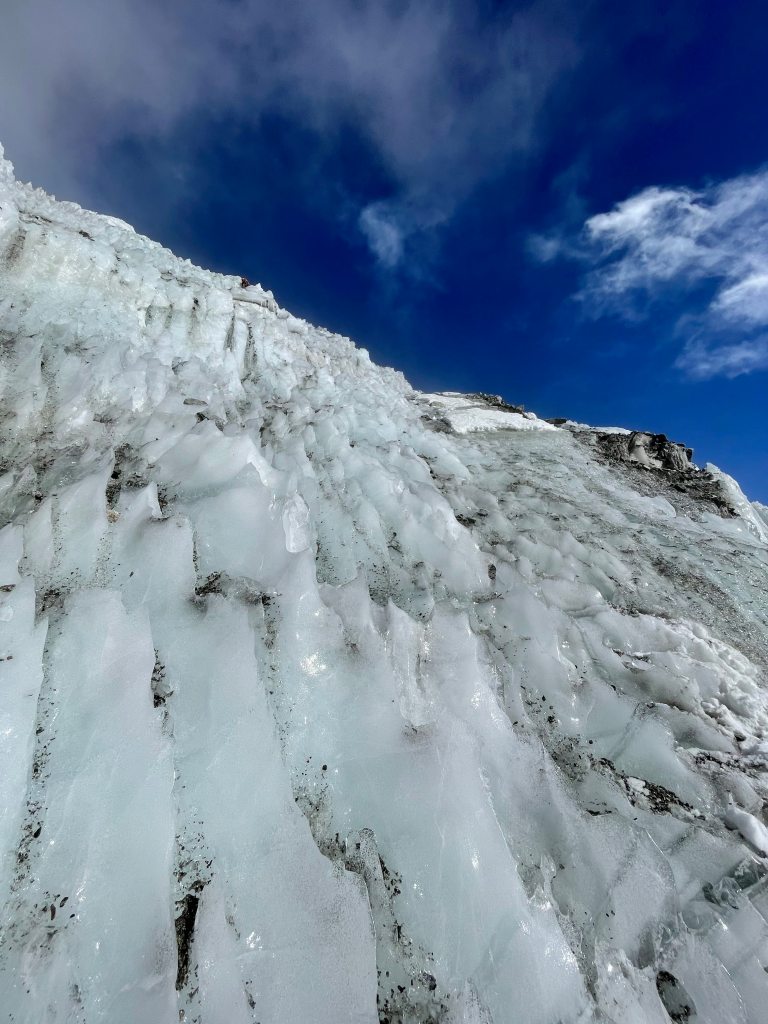
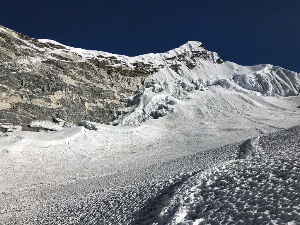
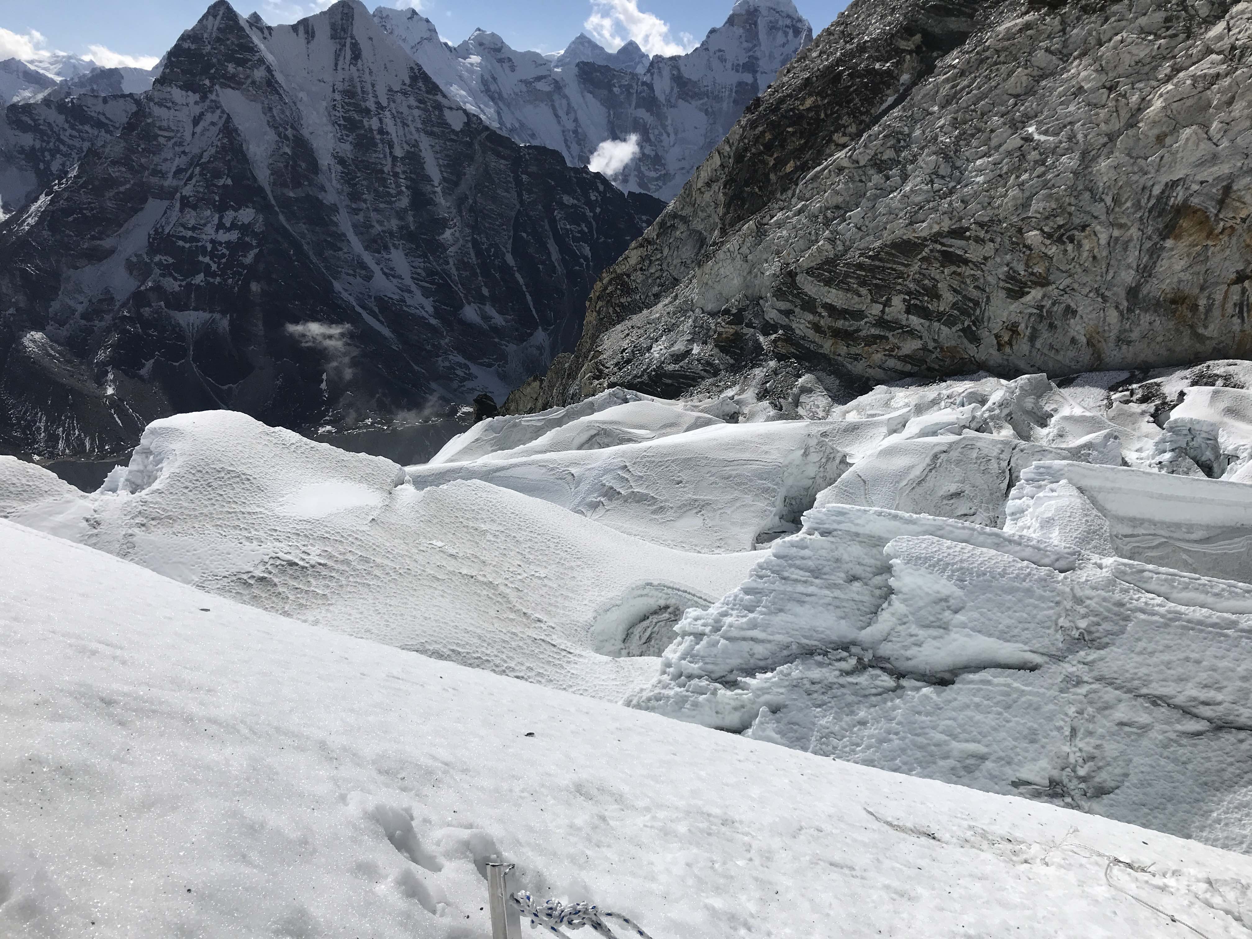
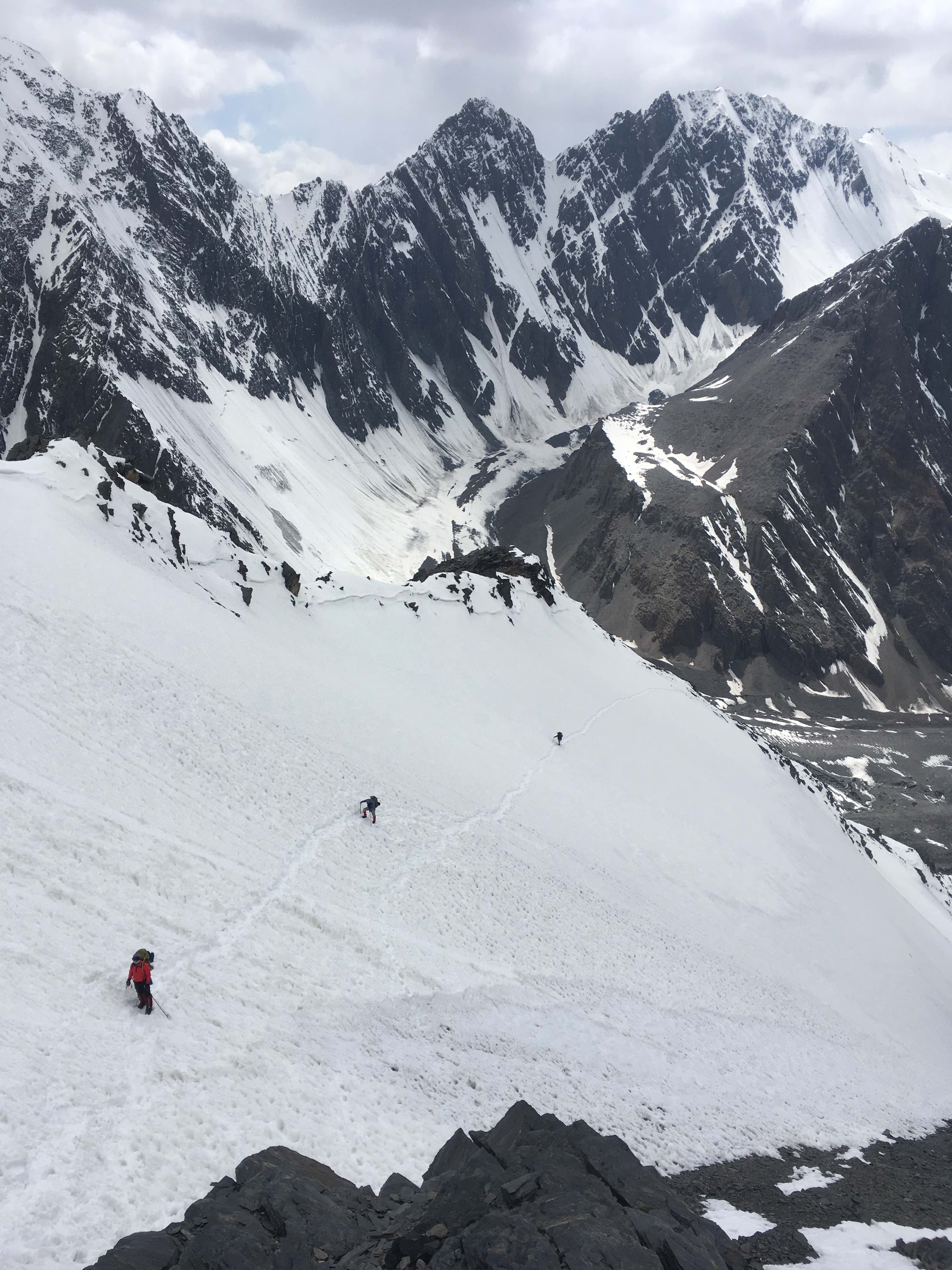
From basecamp a well-cairned boot track follows a ridge of moraine all the way to the snout of a melted out glacier. This lower glacier should be dry and open, crevasses thin and easily spotted, and can safely be crossed in hiking boots. There are many ways across, of varying complexity, and we cairned a few different paths.

Approaching the ascent gully.

Climbing the gully.

5500m Camp 1.

Looking down, across the dry glacier.
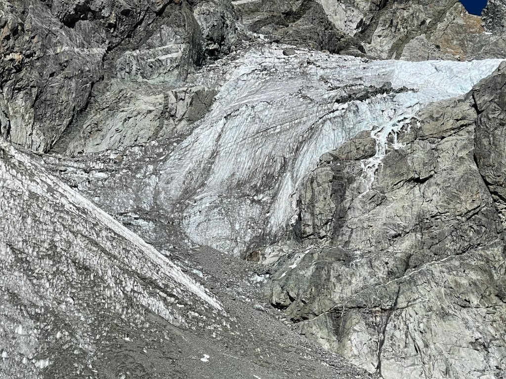
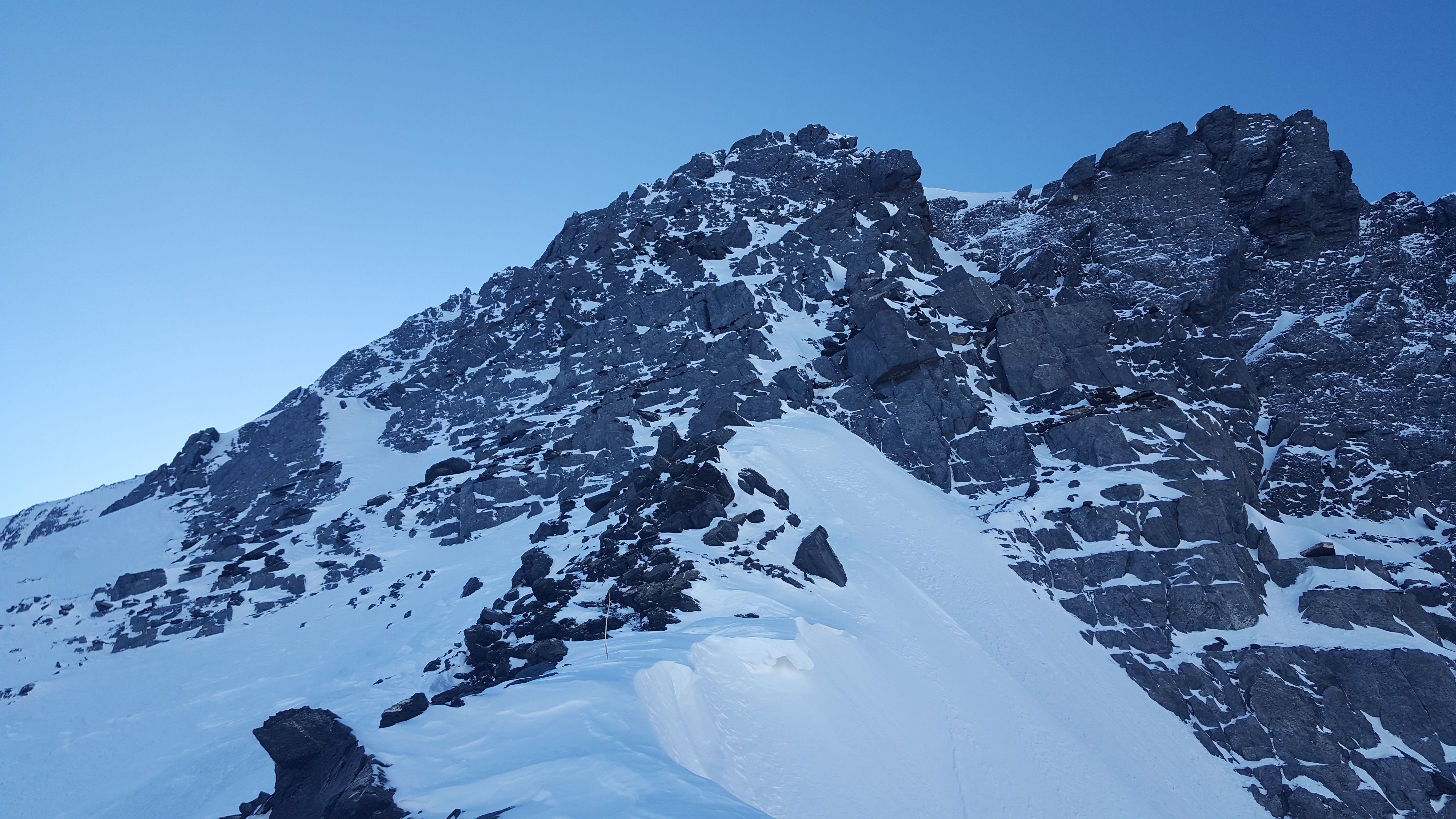
From the base of the mountain there are two easy to spot and relatively straightforward routes to Camp 1. The first option, which we had read about prior to our expedition, is ‘the glacier route’, an ascent up Noshaq’s prominent central glacier. The path of least resistance begins at the base of an obvious ramp, far to climber’s left when facing the mountain from basecamp. Upon seeing the mountain’s condition in person we decided not to explore this option, and did not scout access to the base of the ramp. We rationalized that the hassle of roping for each transition up and down, the objective hazard of significant exposure underneath the large seracs which guard the sides of the ramp, and the general risks inherent to heavily crevassed terrain made the glacier a poor choice.
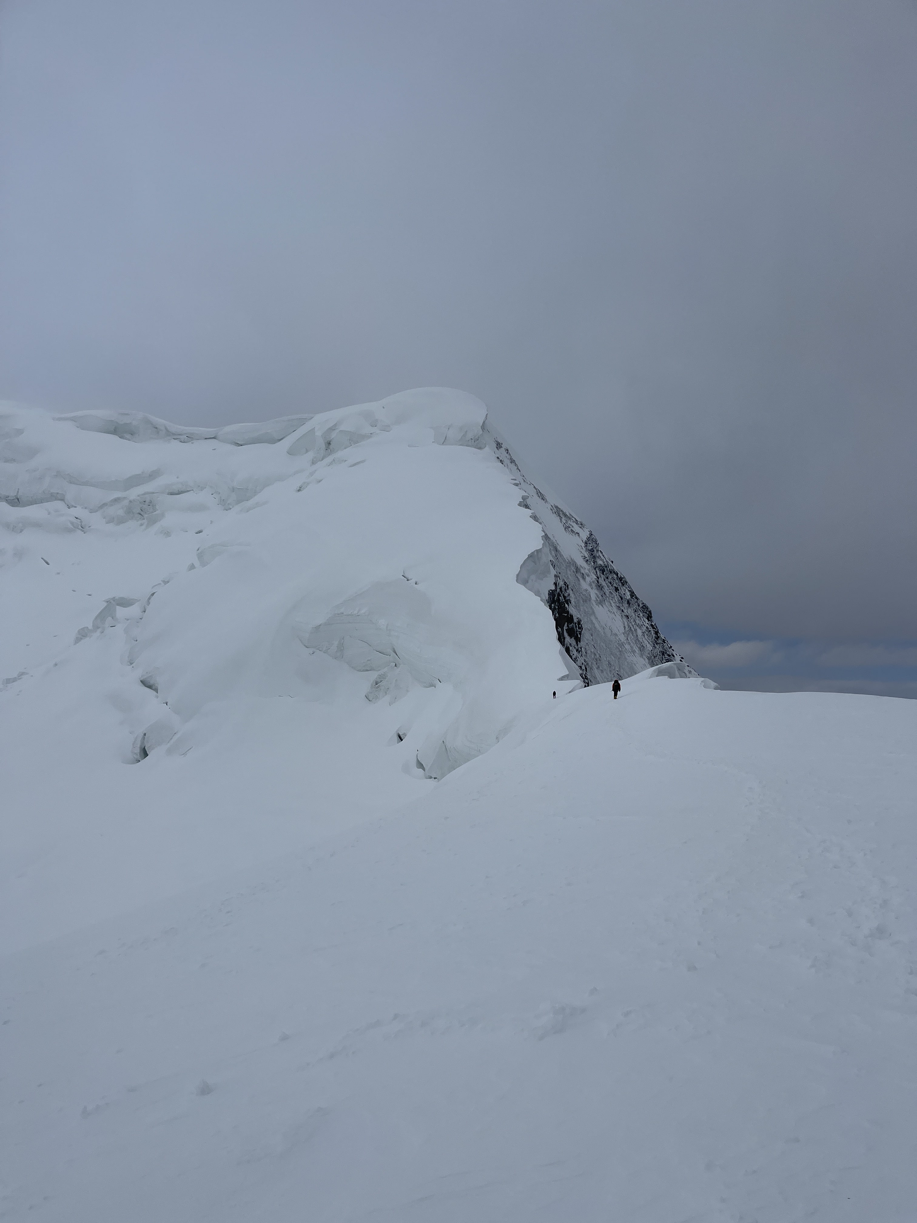
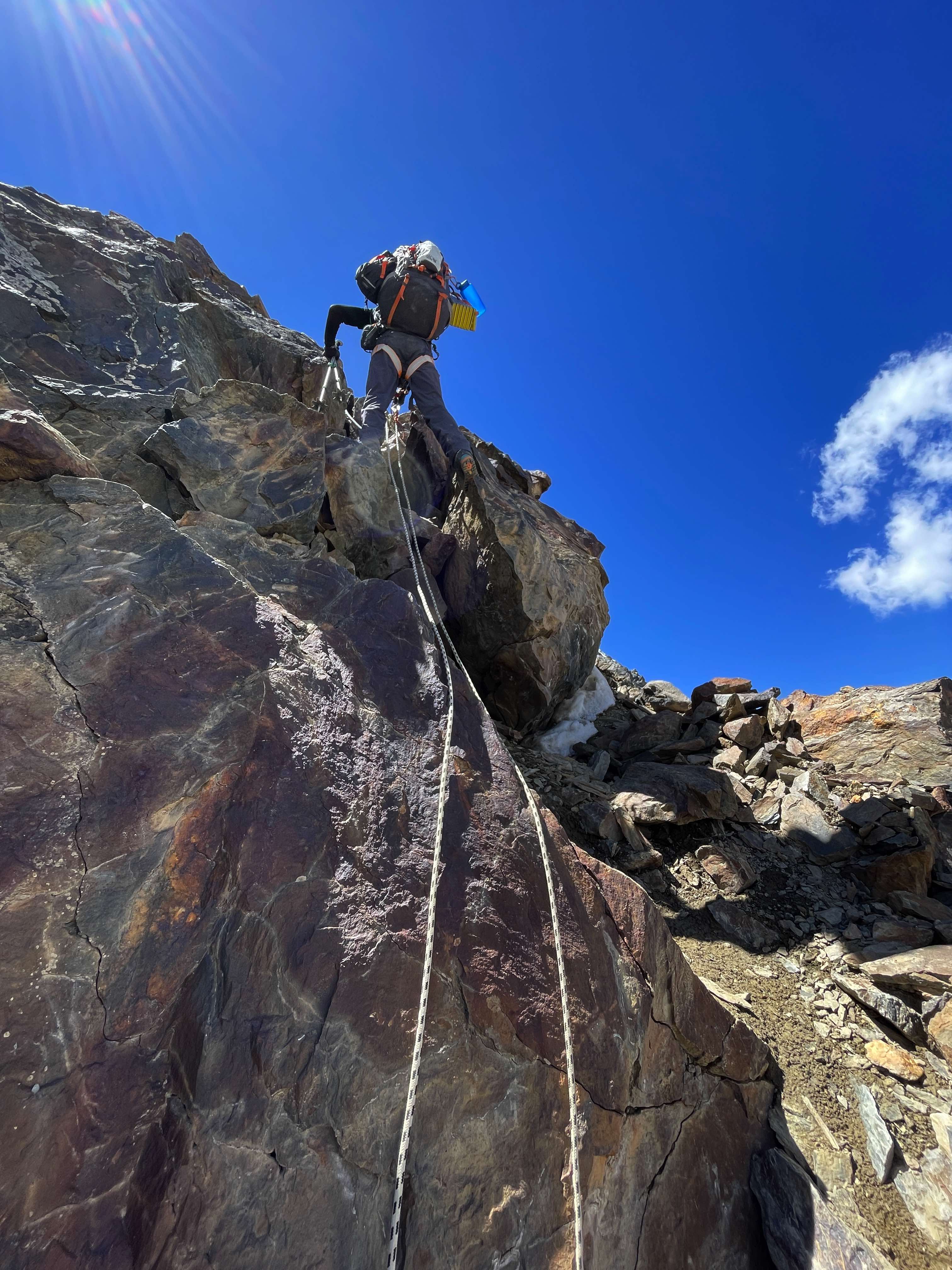
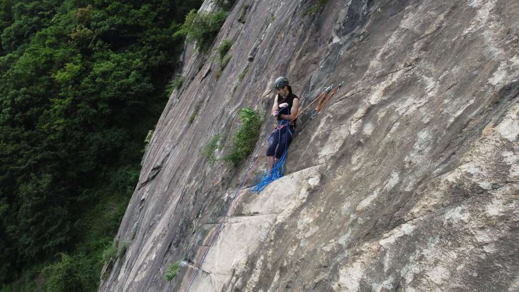
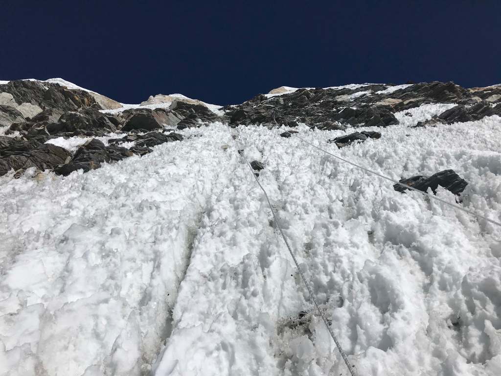
We opted to take the second clear option, and ascend a gully more or less directly in front of a climber observing the mountain from basecamp. About 100m of loose scree leads into this gully from the edge of the melted out lower glacier, and a large boulder at the bottom served as a convenient cache spot and easily identifiable landmark. I have marked this gully in the above image of Noshaq, and have an accurate GPS waypoint for the base of the gully. The weather was warm throughout our climb, and snow conditions on the mountain rapidly deteriorated throughout the expedition. The route to Camp 1 had fully declined into a slippery, melted-out nightmare of ice, rockfall, and steep scree by the time we made our final descent. As such, we ended up climbing this section via three different variations, which I have colored red, blue, and green in the above image.
Red indicates our initial line of ascent, made while there was still a snowpack available. We began by climbing directly up the gully on soft but decent snow, comfortably switchbacking as much as possible. The upper gully is characterized by a steep ‘snow triangle’ which, as evidenced by debris, had avalanched some time before our arrival. As the terrain grew steeper we traversed right, ascended a short section of scrambling to the far right side of the snow triangle, and then made an easy traverse back across. When covered in snow this traverse was straightforward enough for each of us to comfortably solo, and felt quite secure. Unfortunately, as the mountain melted out a hideous layer of hard ice was revealed, making for unacceptable exposure to an ugly runout. In such slippery conditions I wouldn’t want to cross without at minimum a running belay on screws, as self arrest would be impossible and a slip would result in a catastrophic fall down the icy upper gully. From the left-hand side of the snow triangle we ascended alongside a rocky ridge to the area where the red route shown above splits into a blue line. From here the red line indicates the safest means of ascent, scrambling up and over the rocks directly below Camp 1. The blue line shows a variation which many of us opted to take when snow conditions were good; a brief traverse onto well consolidated glacier, and back across along the ridge/ramp which finishes the top of the ‘glacier route’. While a nice ascent option if provided good snow, with poor conditions this variation was not viable.
The green line in the above image indicates an alternative line of ascent and descent. The rocky ridge to the left of the gully and snow triangle, while composed of steep, loose, hideous scree, is far preferable when the gully and snow triangle traverse are melting out. Rockfall was a constant hazard on this ridge; wear a helmet and establish a clear communication routine with partners. Despite the rockfall, this ridge felt much safer and more secure than the icy and exposed snow triangle traverse.
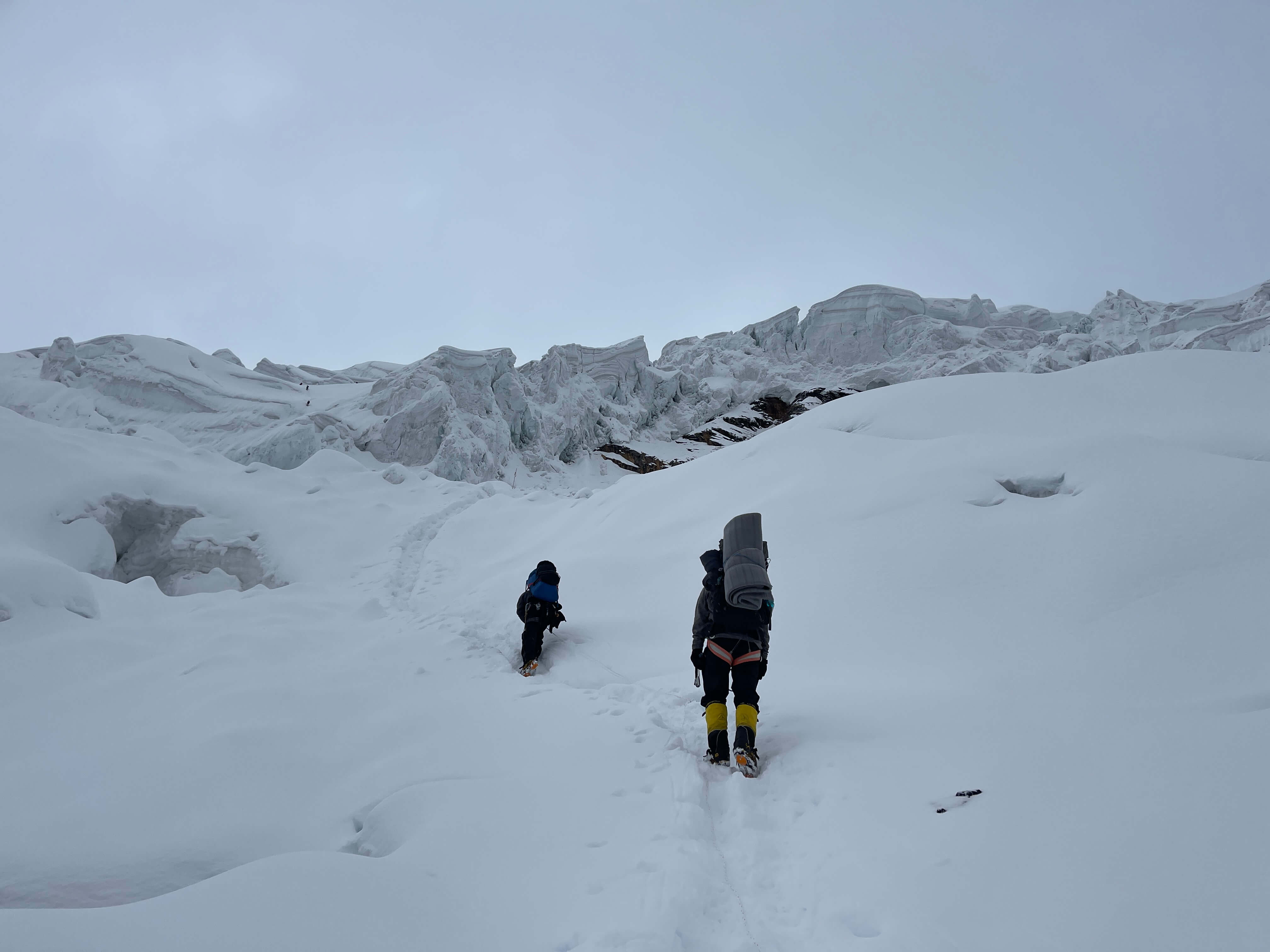
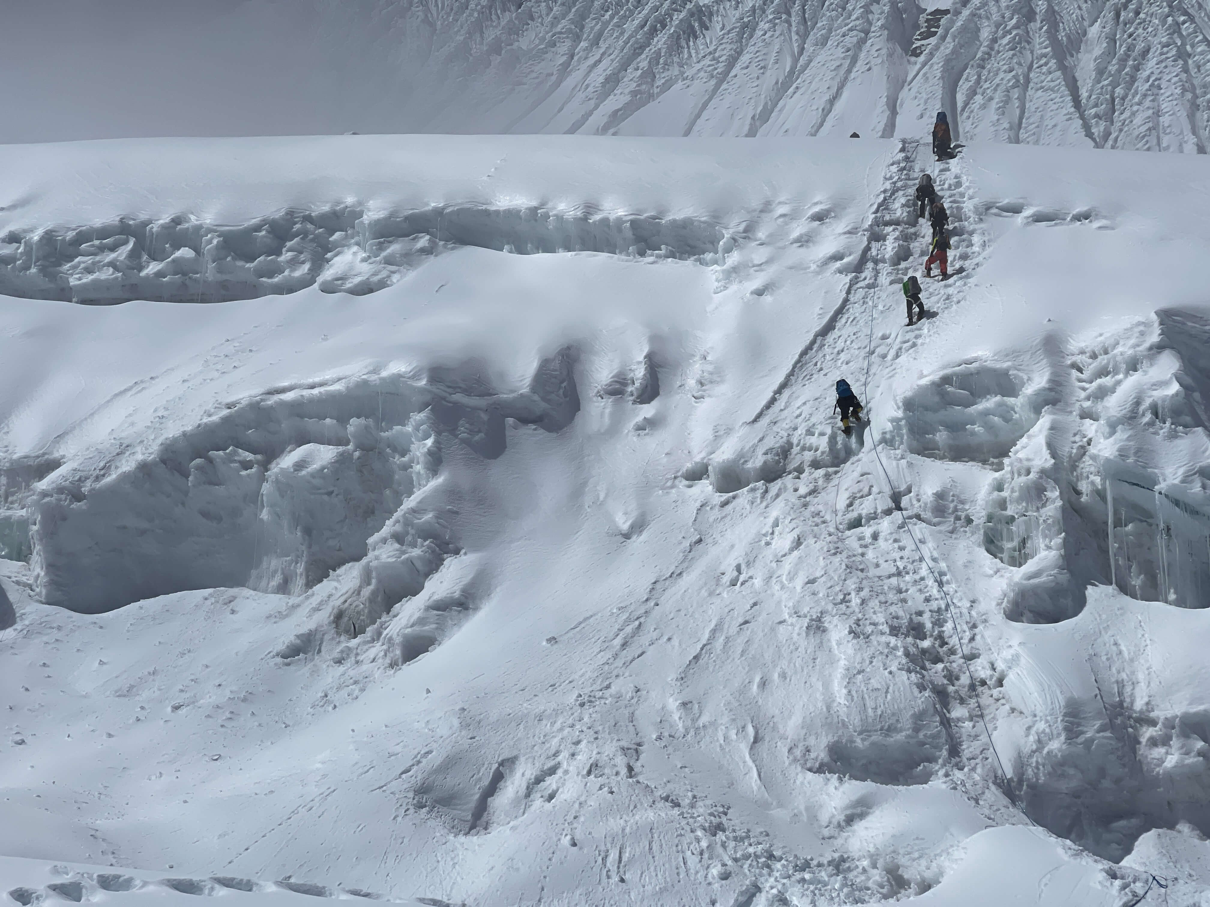
Climbing to 5500m Camp 1.
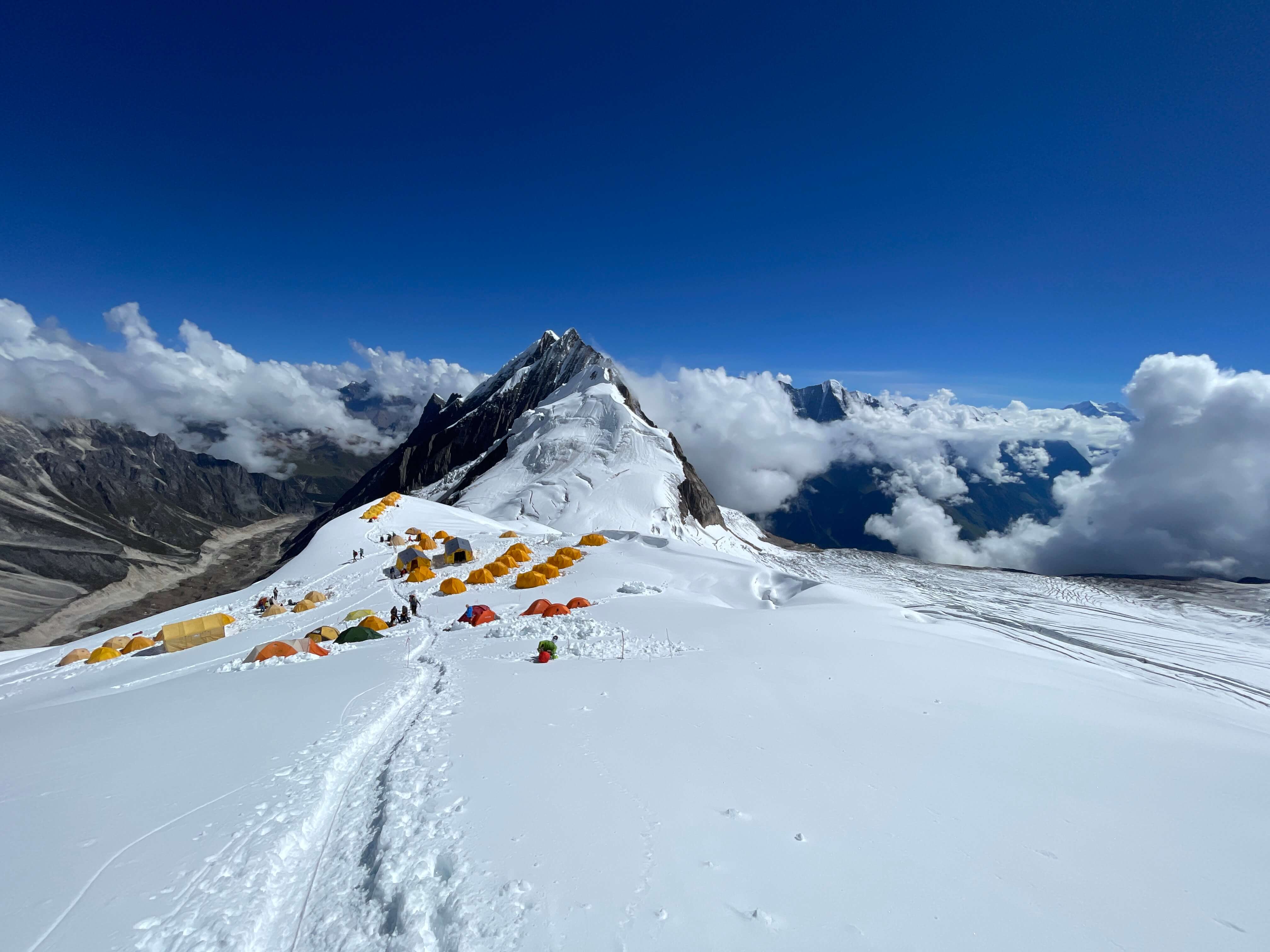
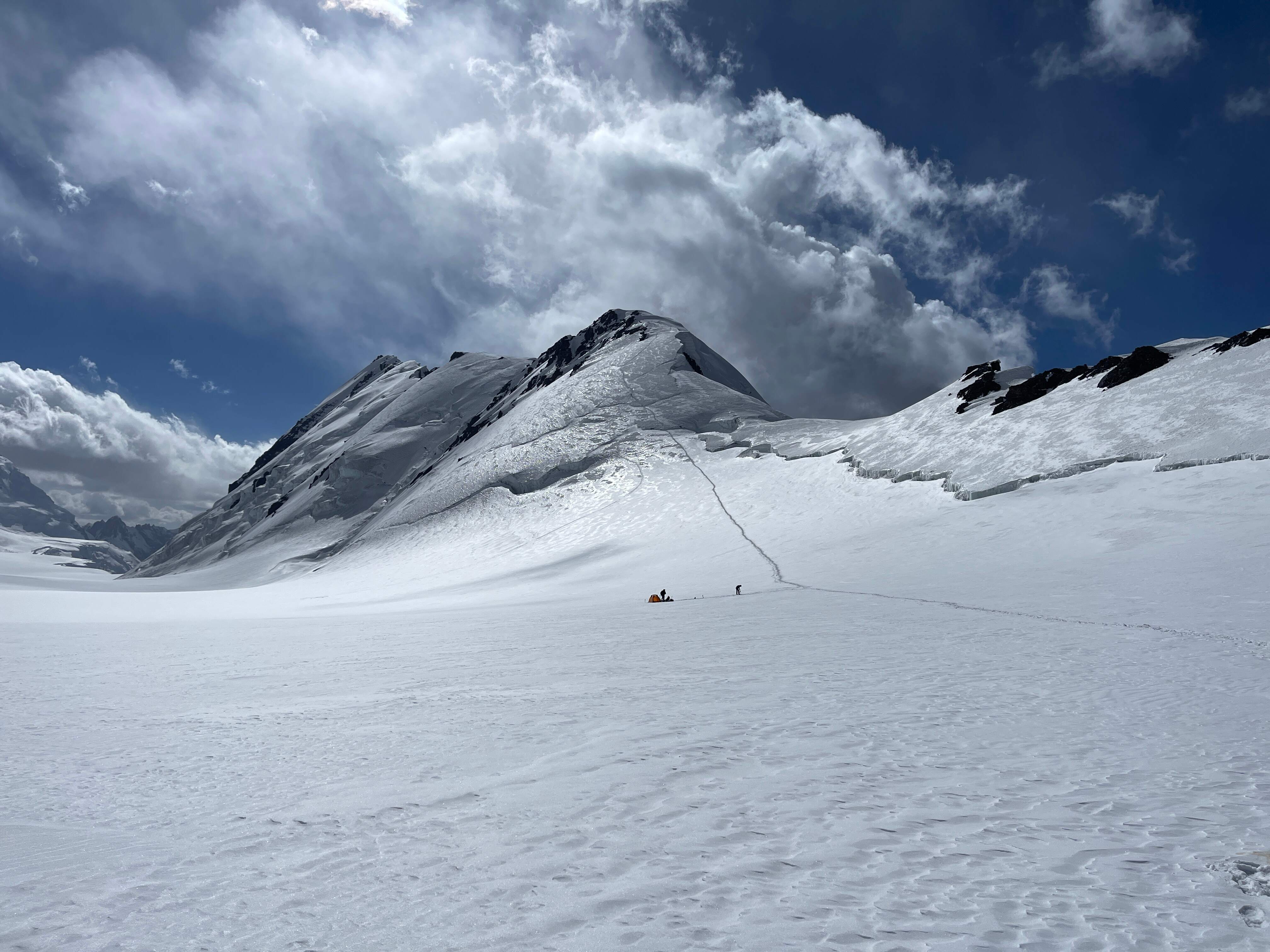
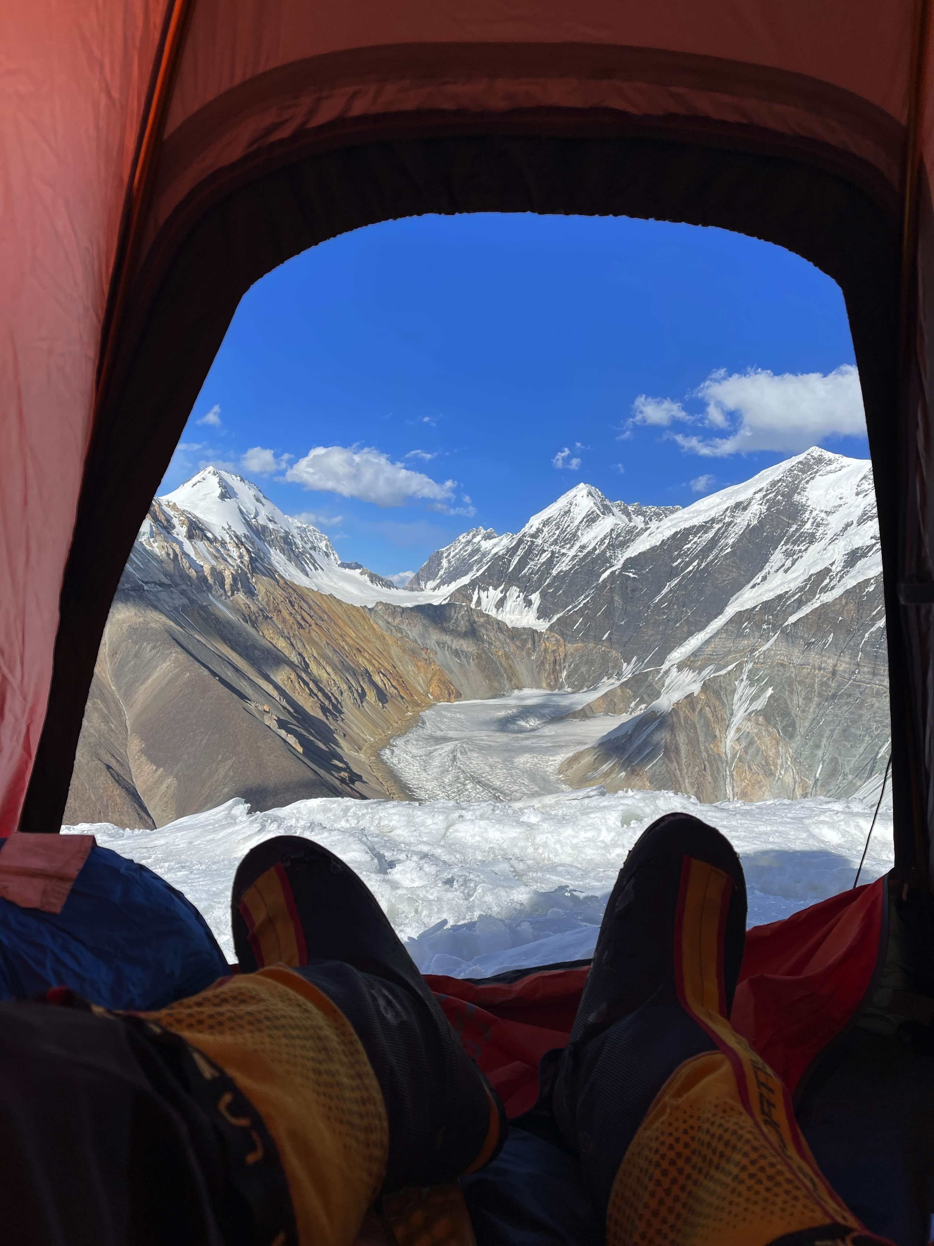
Camp 1 itself is a sizeable, flat area atop a rocky ridge. There is abundant tent space, and plenty of accessible snow for cooking. Amongst the rocks there were a fair number of propane/butane gas cartridges both unopened and partially used.
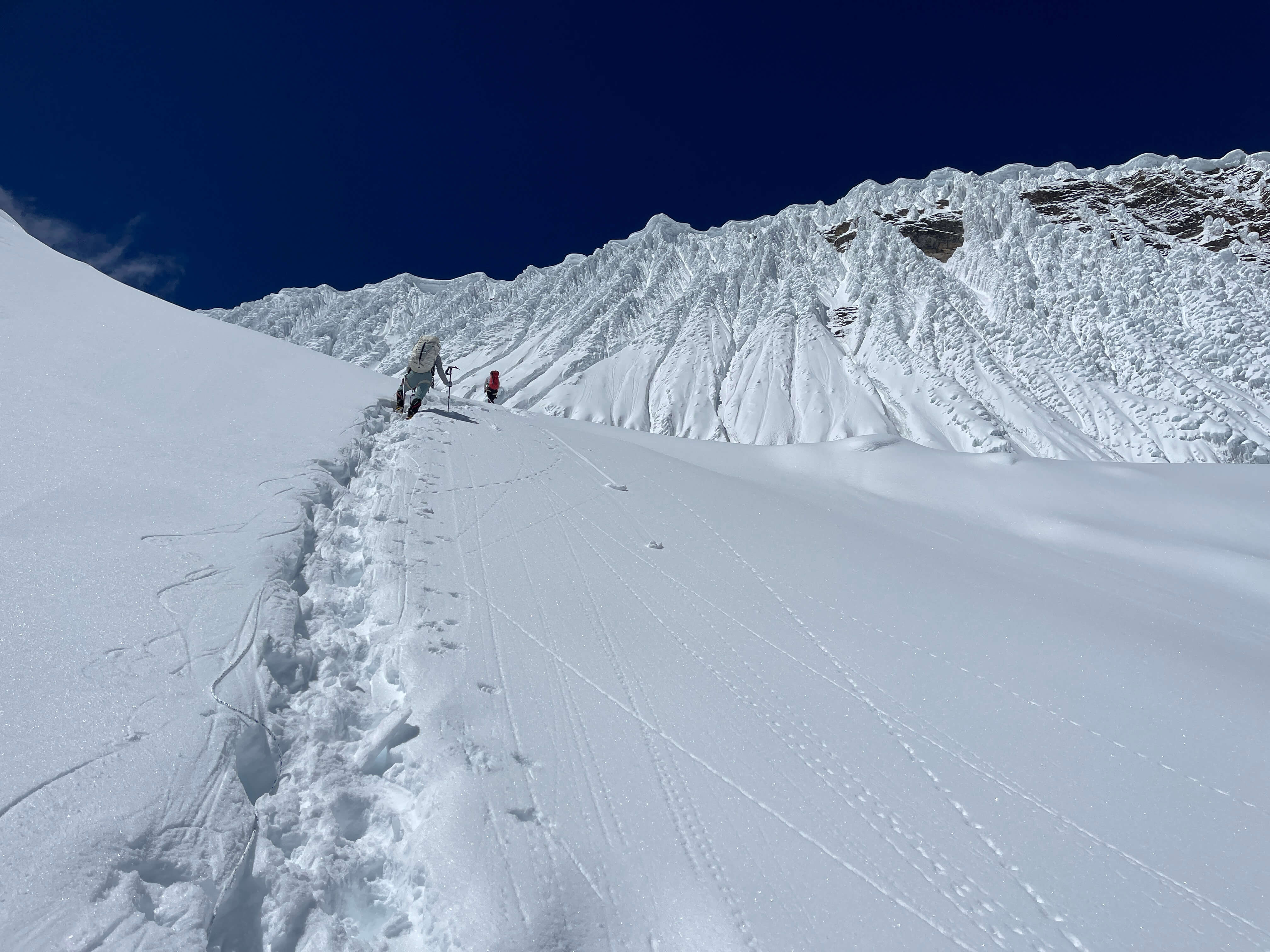
5500m Camp 1 to 6200m Camp 2
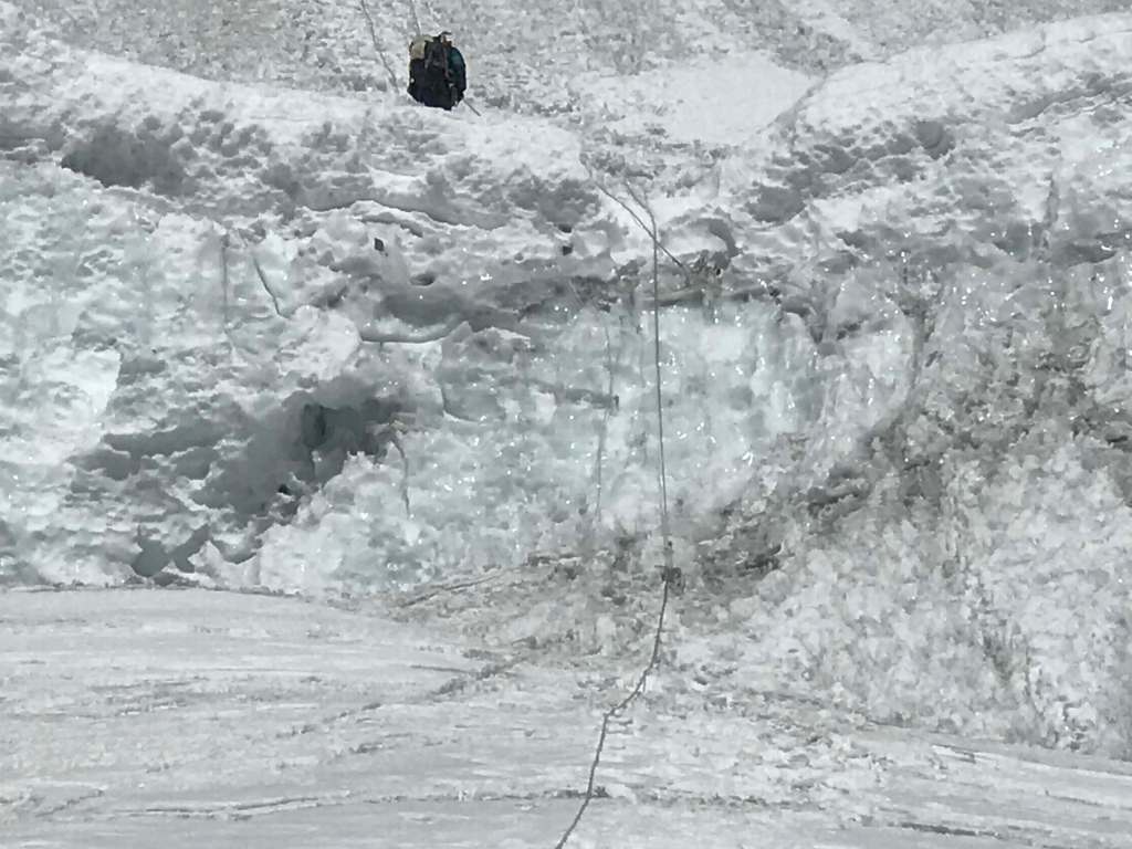
The route to 6200m Camp 2 is straightforward, and follows the ridge quite directly. There are some interesting little features below Camp 2; a short but easy ridge traverse and several protruding rock steps which collectively require about a dozen metres of scrambling. One prominent step just a few hundred metres above Camp 1 can be climbed to the left, over class 4 terrain, or to the right, over easy snow and simple rock scrambling. We discovered a fixed rope on the left side of this particular rock step, and while it turned out to be of good integrity, other old fixed lines discovered higher up were core shot. Never weight a fixed line of unknown origin if you haven’t inspected both it and its anchor. There are several small plateaus along the ridge which would be suitable for camping, but the standard spot for Camp 2 at 6200m is by far the largest and best of them. While the ridge is not glaciated, and thus is not crevassed, it is imperative that climbers attentively stay on route; the glacier is only some 5-10 metres to climber’s left, and a significant bergschrund/moat separates it from the rock of the ridgeline. I sustained an unroped, armpit-deep fall into this moat/bergschrund just above Camp 1, with only my enormous backpack and quick ice ax reflex saving me. Unbeknownst to us, our boot track had been passing dangerously close to this crack throughout the expedition.
Climbing to 6200m Camp 2. Photo by Pat.

Terrain below 6200m Camp 2.

Climbing to 6200m Camp 2.

6200m Camp 2.
I have not marked this section of ascent on the photo, as it is relatively direct and quite straightforward to navigate.
6200m Camp 2 to 6500-6700m Camp 3

Terrain above 6200m Camp 2.

Terrain above 6200m Camp 2.
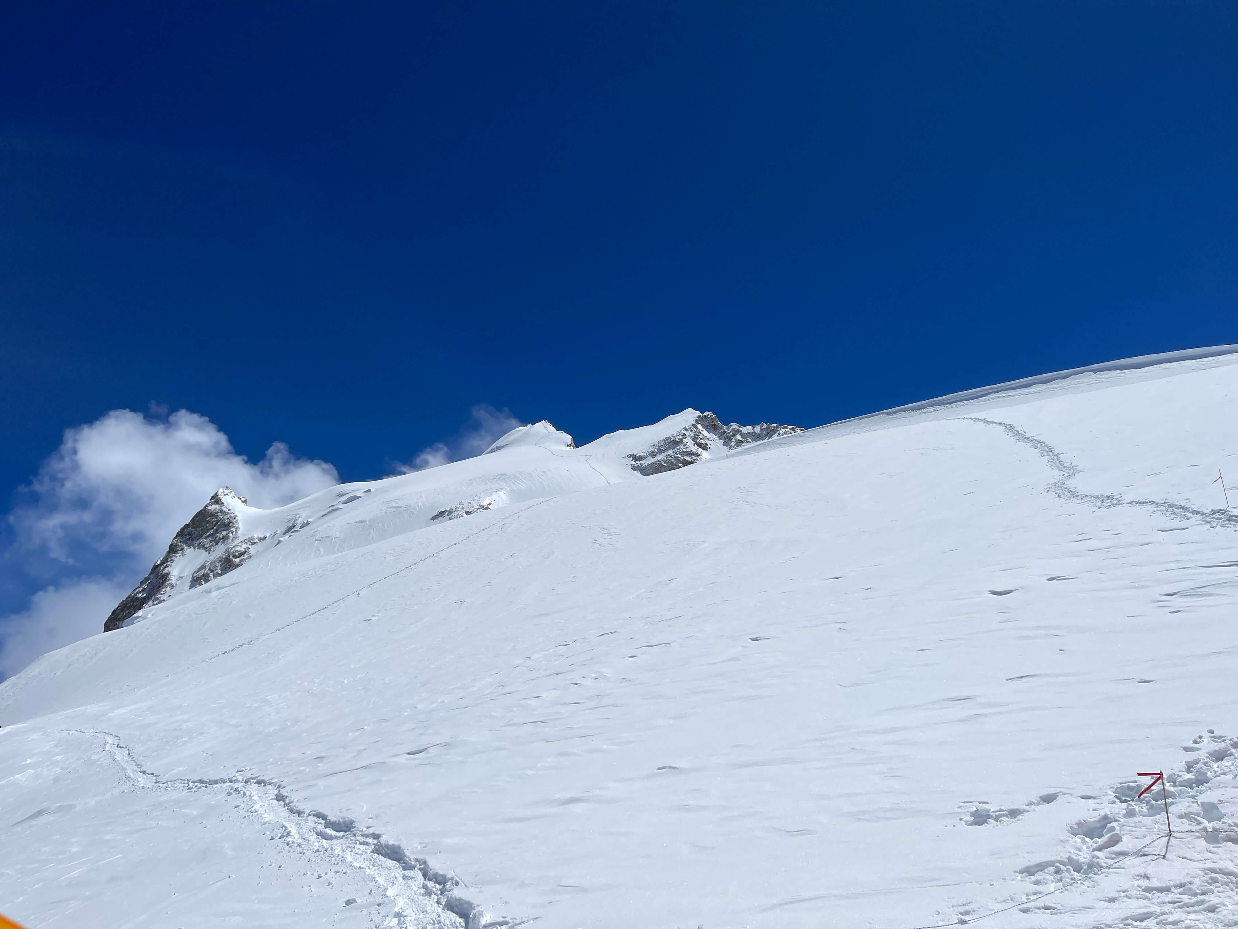
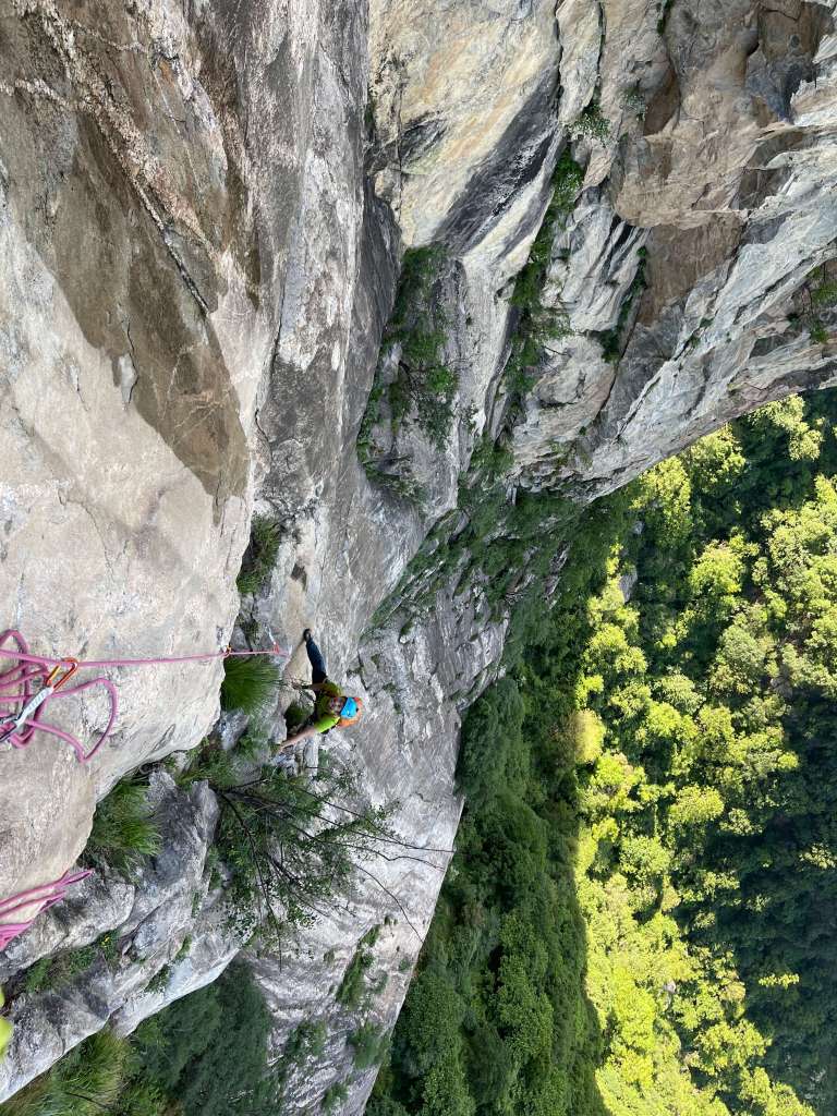
From Camp 2 the route continues directly up the ridge, towards the imposing rock wall which waits above. The ridge broadens above Camp 2, and in a whiteout it can be difficult to ascertain one’s location relative to camp – we did well by paying careful attention to the size and location of prominent rocky sections, and using them to navigate on descent . Higher up, the ridge steadily becomes rockier and slightly steeper. Crossing over the patches of exposed rock is easier than breaking trail through snow, and besides one or two metres of scrambling is mostly just scree slogging. There are several options for a Camp 3 location, with good tent platforms on rocky plateaus at 6500m and 6700m.
Camp 3 to Summit
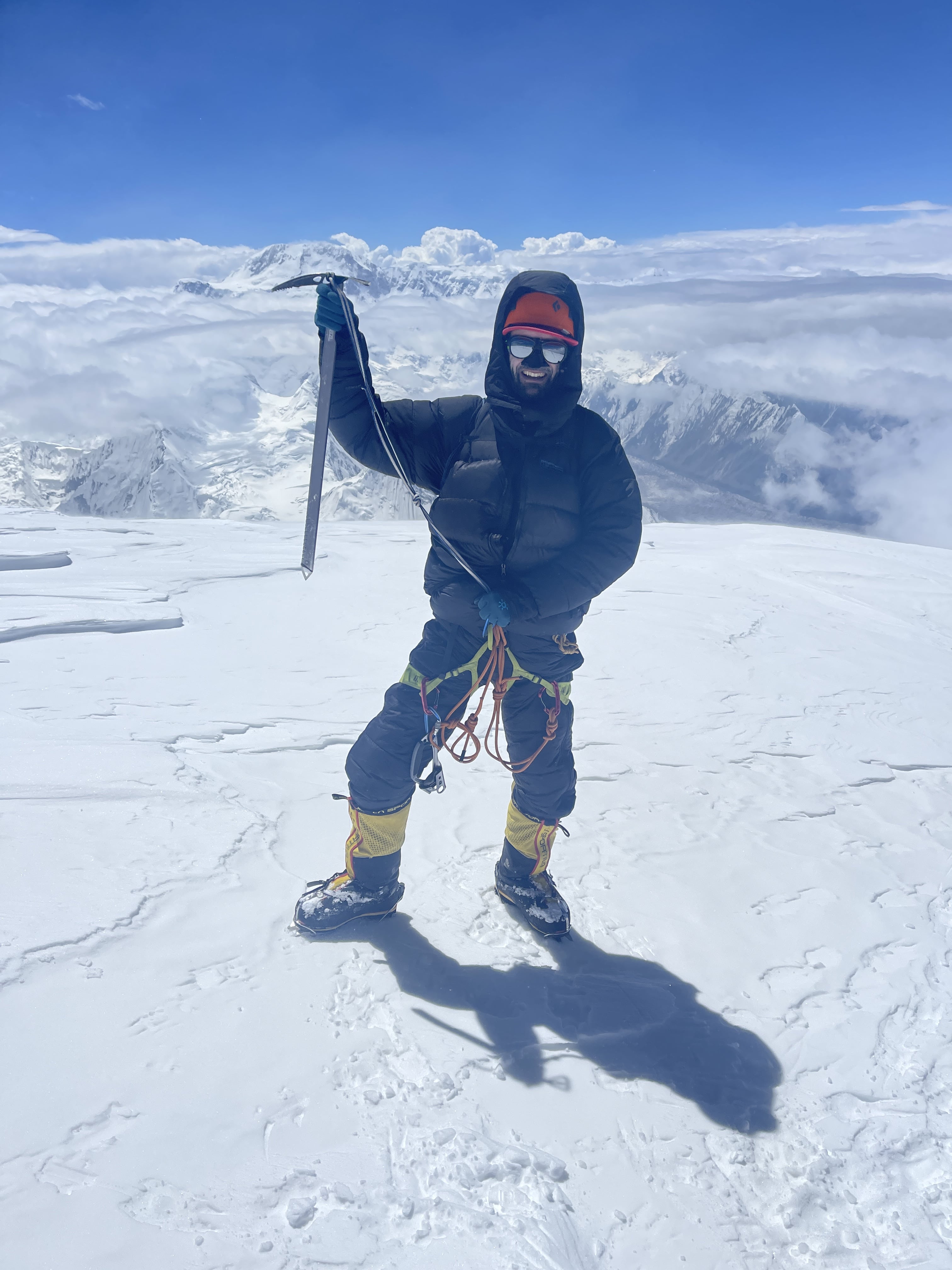
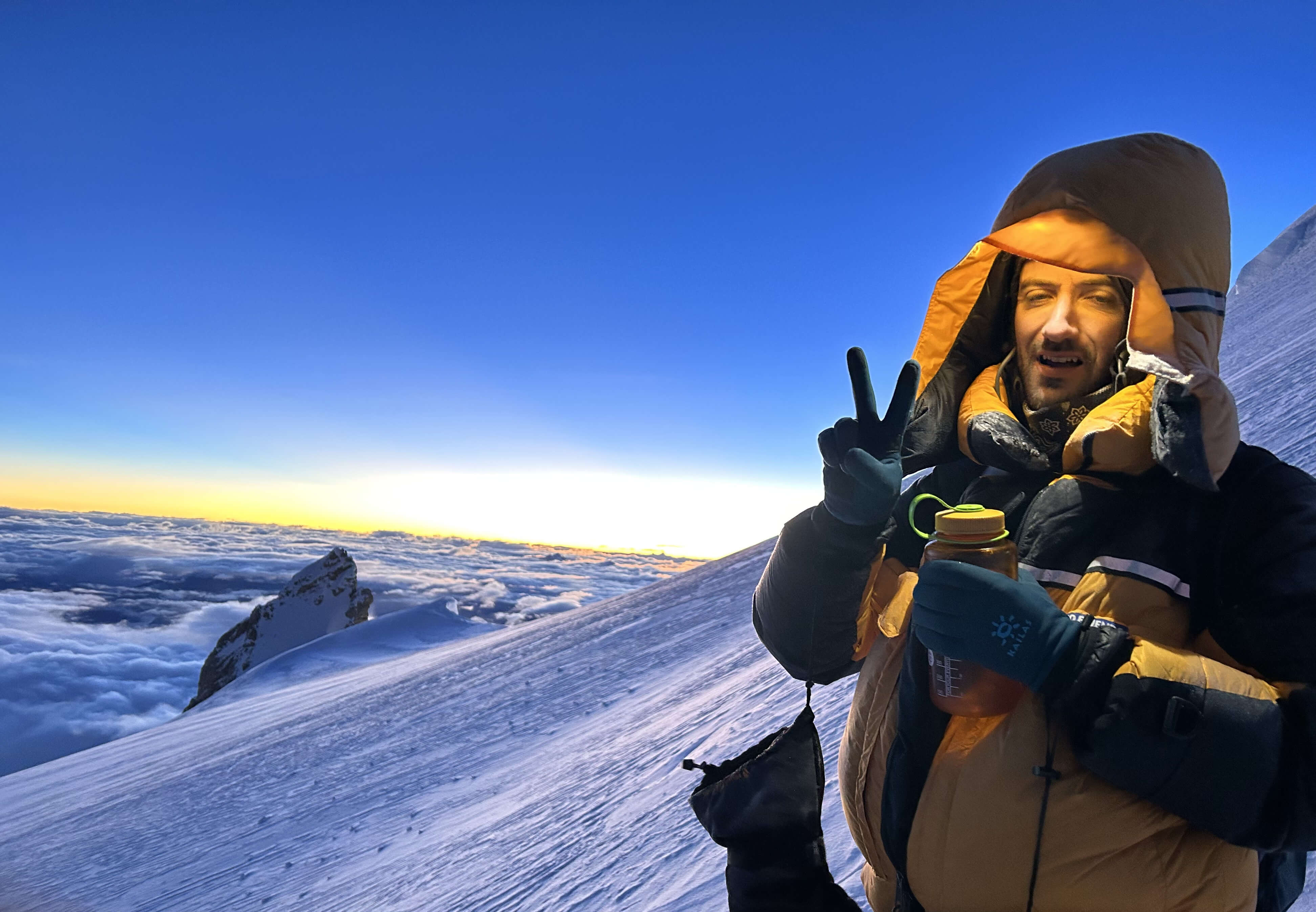
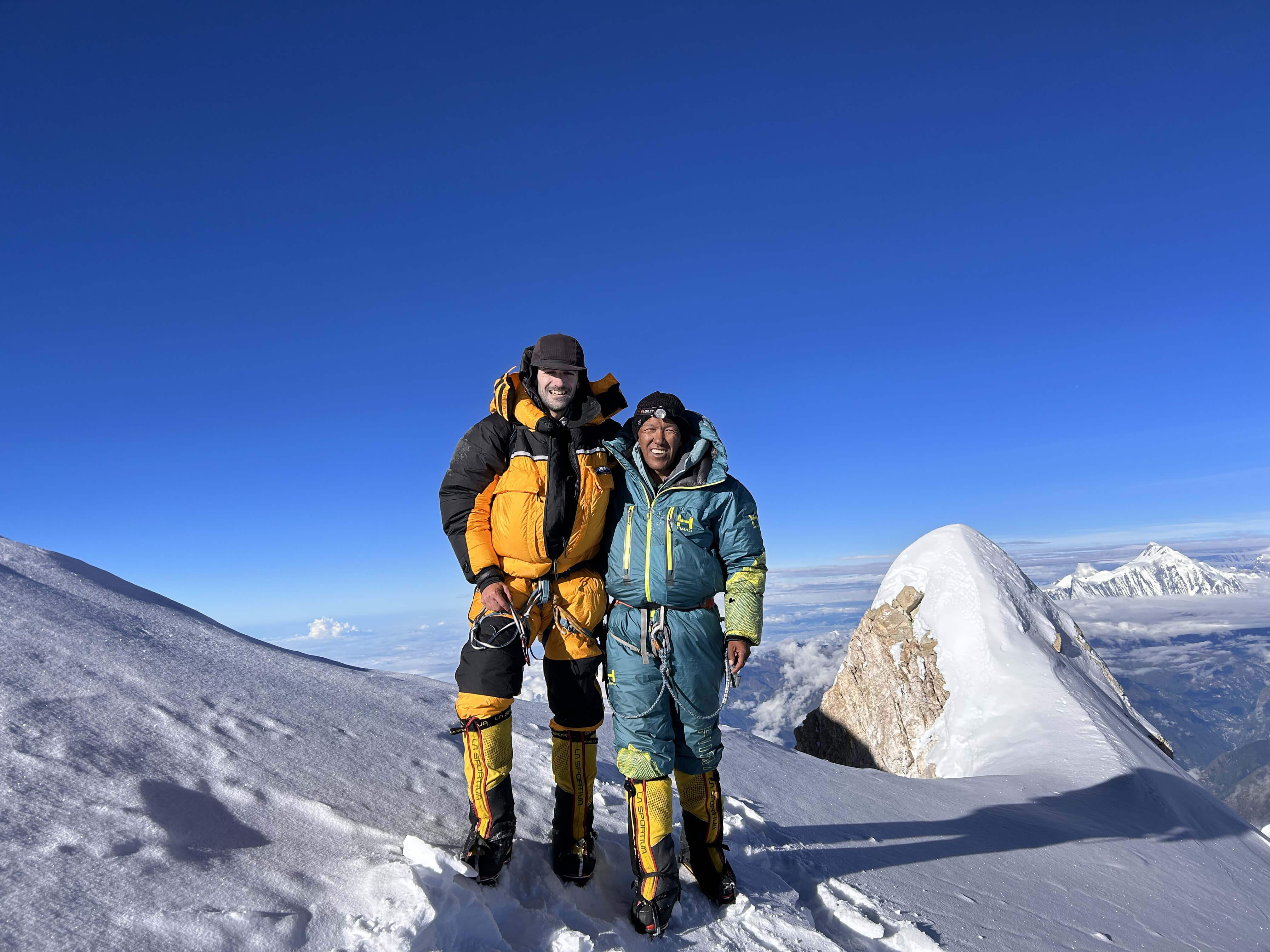
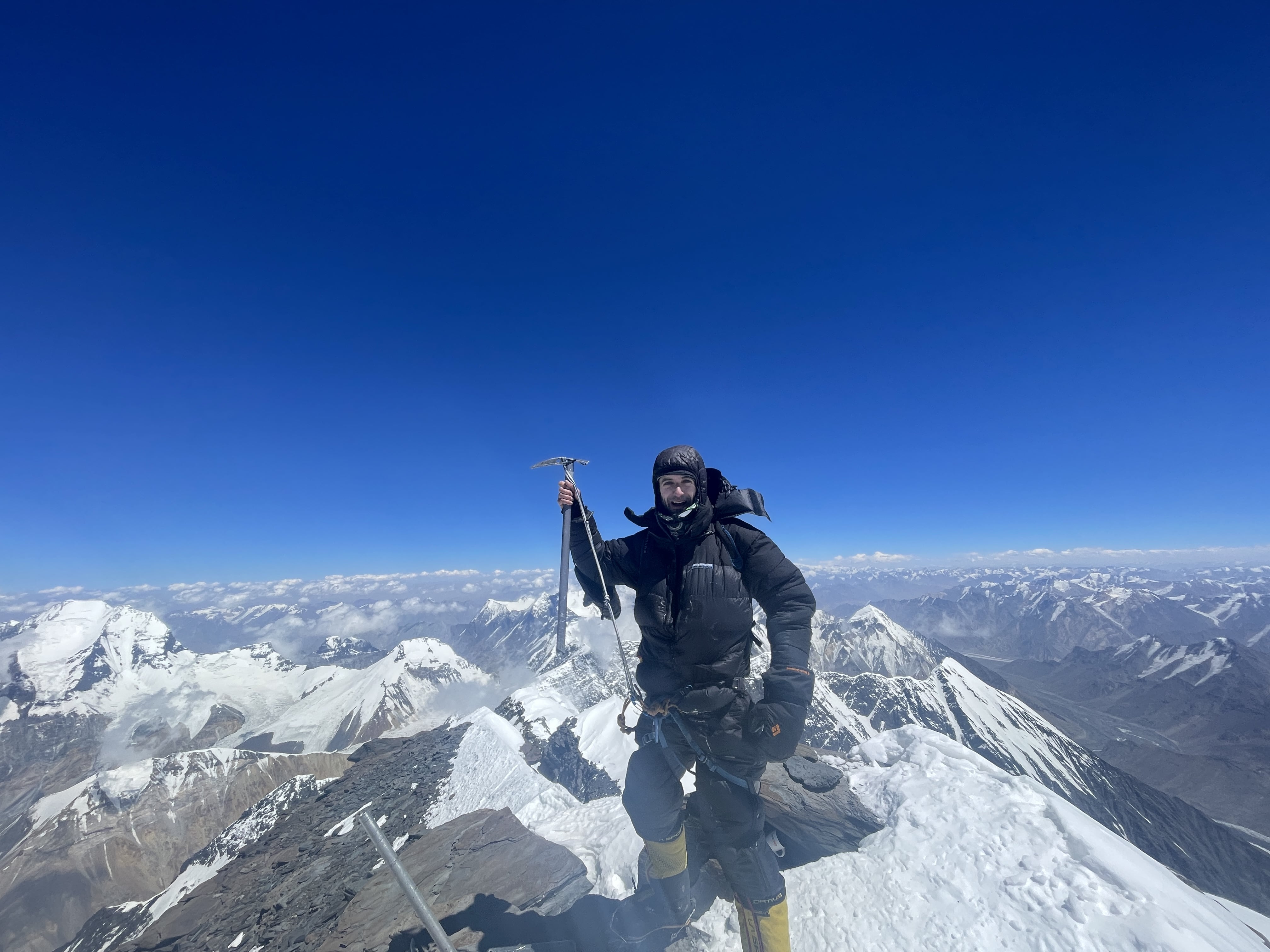
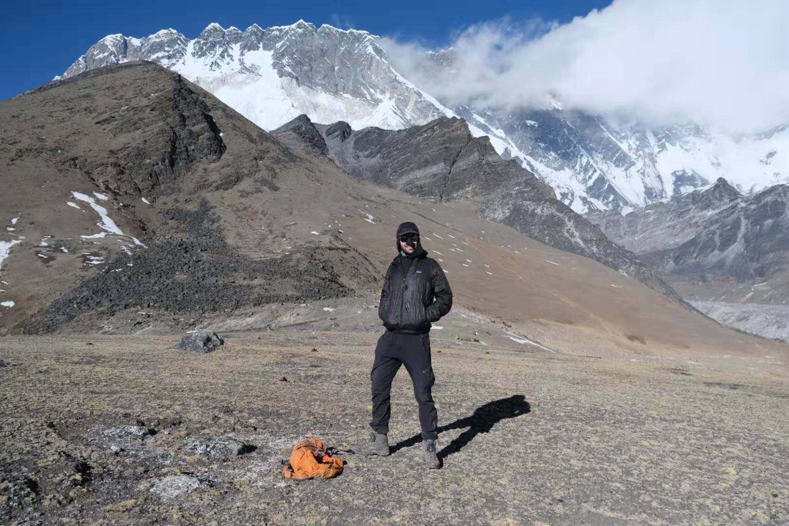
I did not achieve Noshaq’s summit, but did make it to 7100m on the summit plateau, to the base of the summit ridge.

On the summit plateau. Photo by Eric.

The summit plateau.

Looking down the first pitch.

Traversing the second pitch. Photo by Eric.
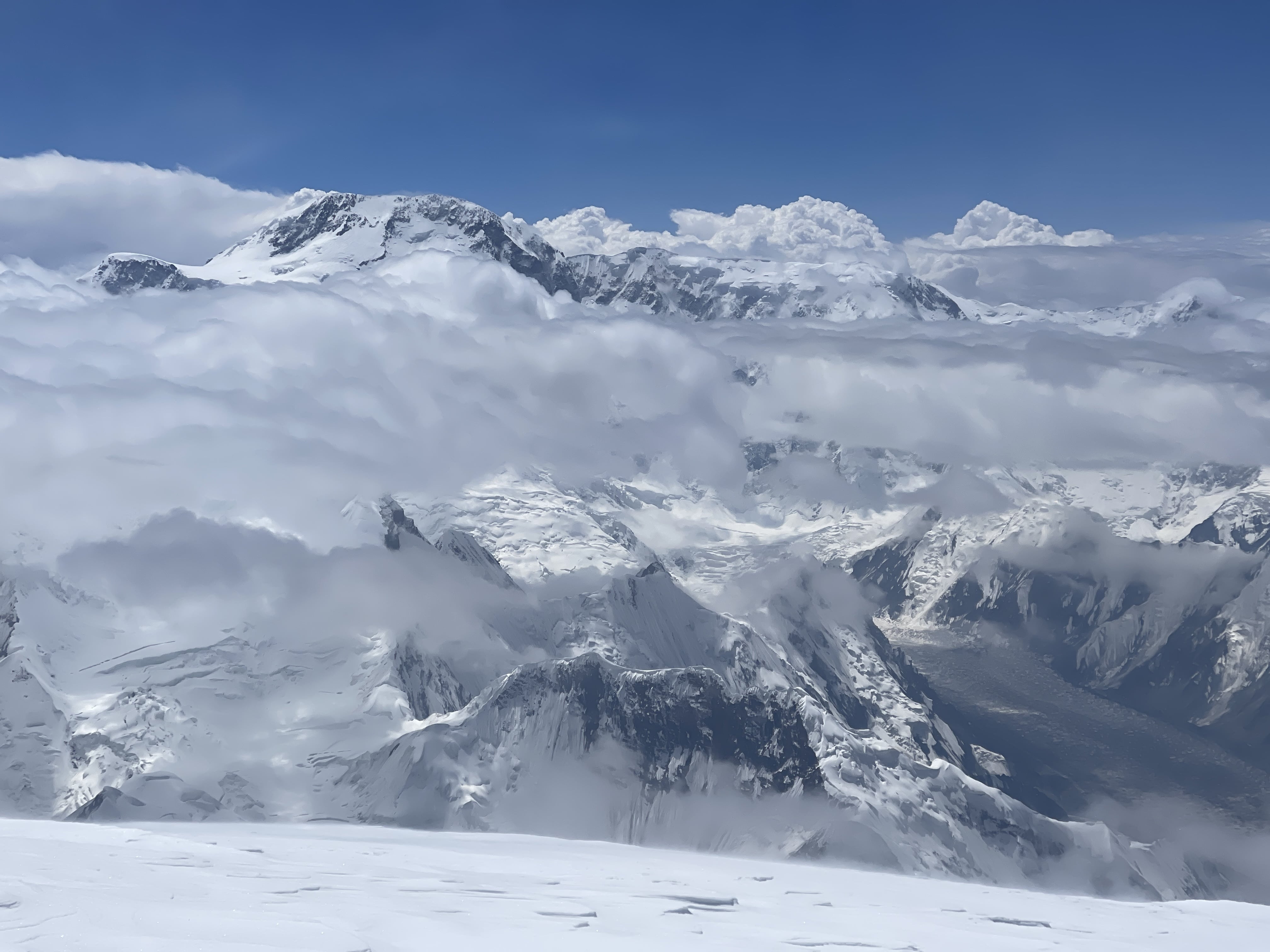
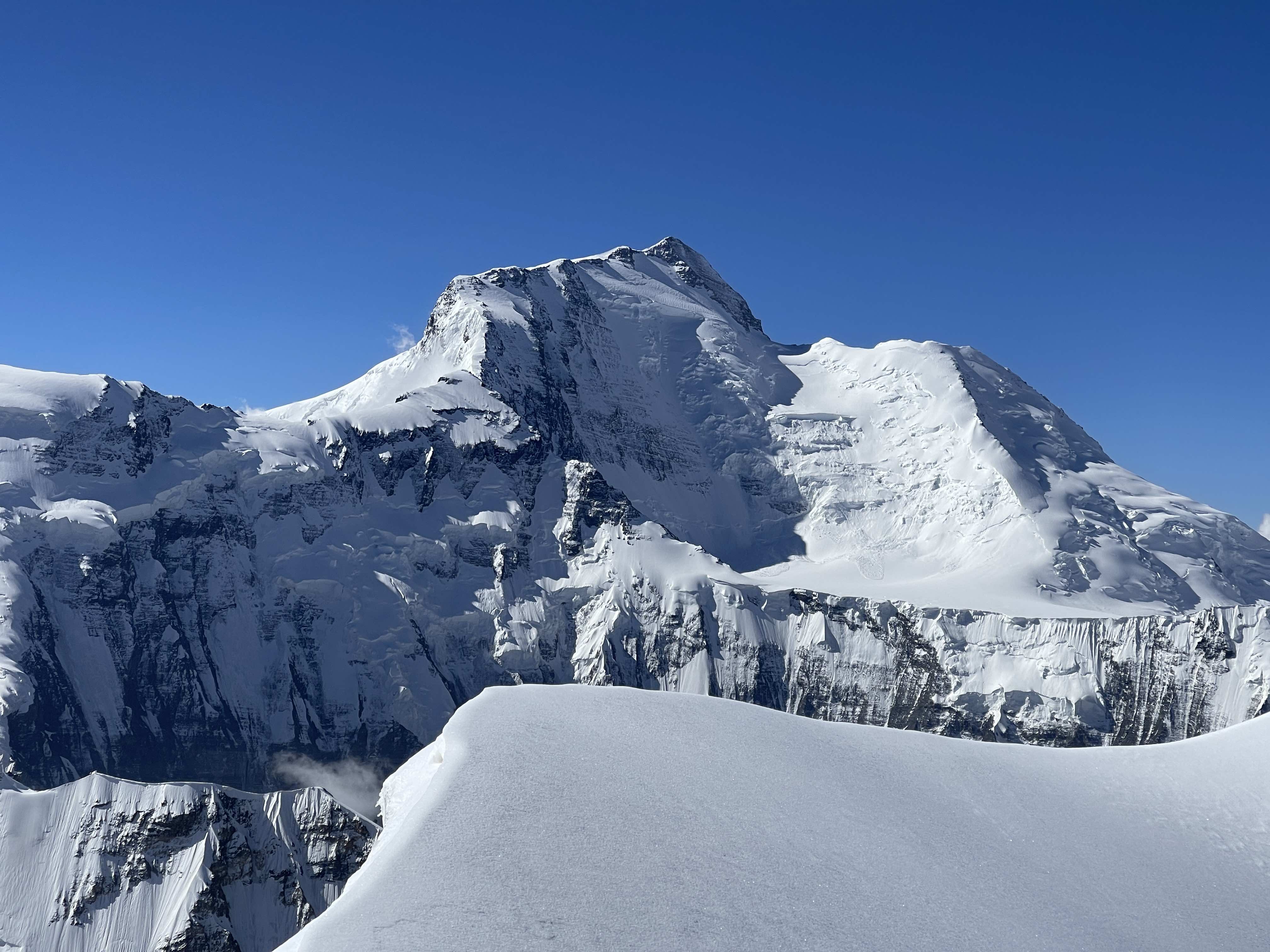
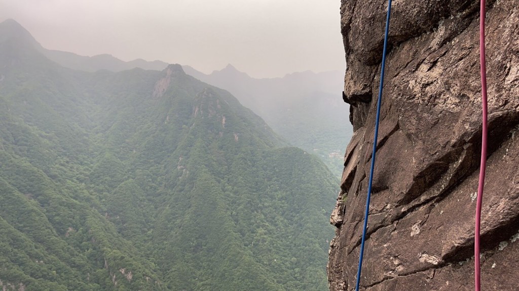
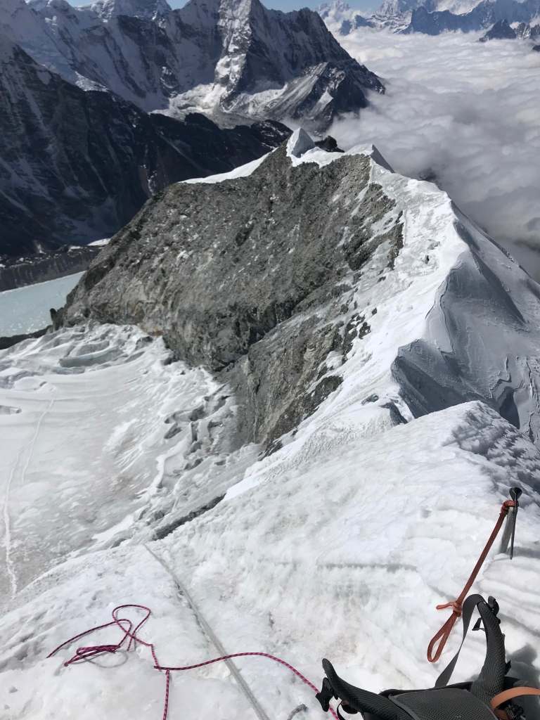
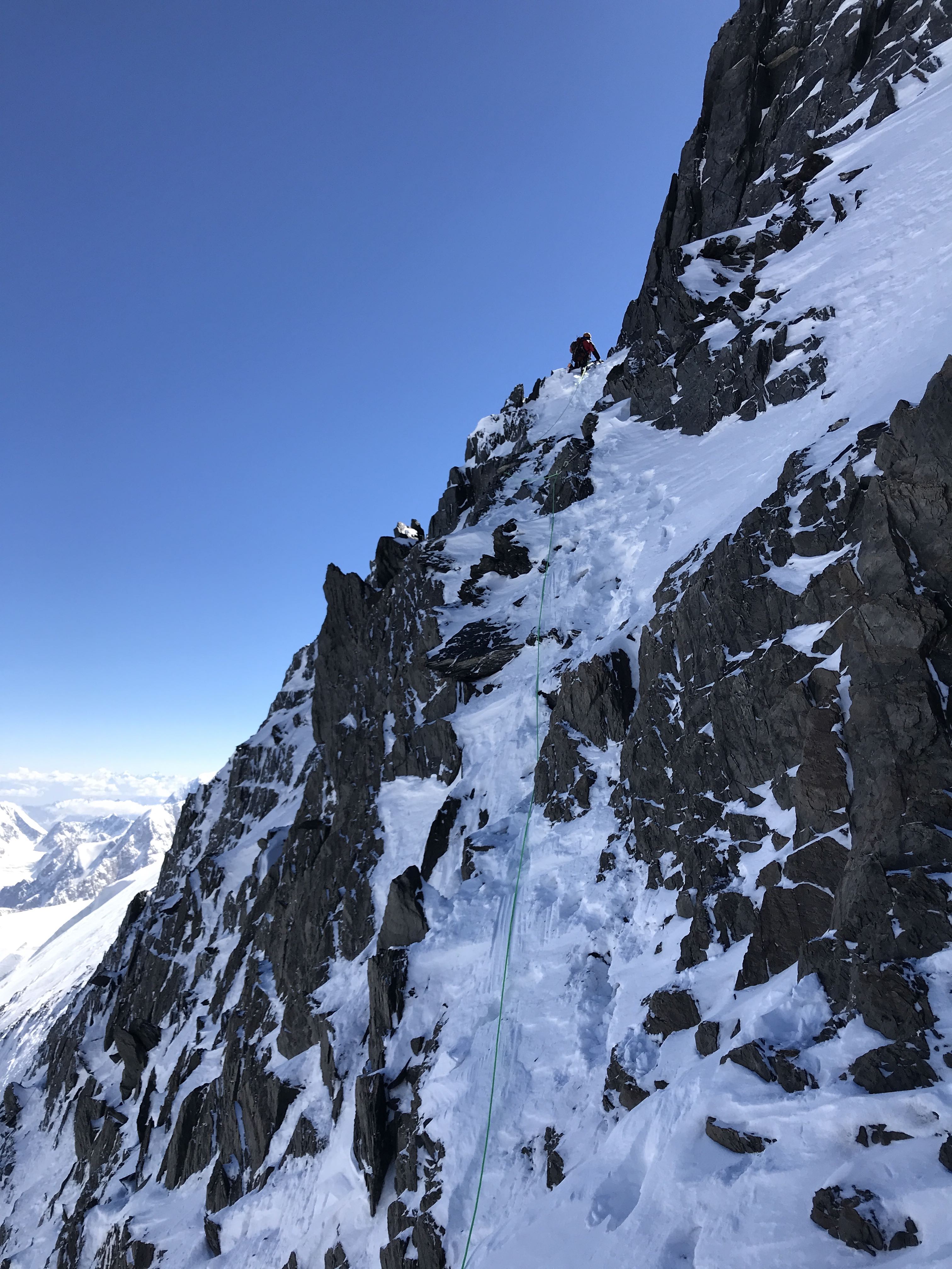
From high camp between 6500-6900m the rock quality improves, but also becomes much steeper. I would classify several sections in this area as Class 4. At around 6900m the route terminates in an obvious ridge, slightly corniced. From this ridge, about 100m of rock stands directly in front of the climber. To climber’s right the wall is steeper, and drops sharply off into Pakistan. Far to climber’s left lies steep and crevassed glacier.
The rock band at 6900m. We ascended to the left. Photo: Eric
On our first summit attempt we ascended the middle-left of the rock wall, up a fairly obvious weakness in the terrain. Altogether we climbed three pitches of about 40m each. Eric, one of two Americans on our team, confidently led all three and was able to place good cams for protection – he used one of each BD small red through BD big red. In different conditions screws could also be useful here. With Eric’s help I have marked the route of ascent in red, and the rappel route in green. The first and second pitches were easy, perhaps 5.6, and fairly secure. Due to its being a traverse, and on account of deep, loose snow, the third pitch was a somewhat sketchy 5.7 and poorly protected. We found good pitons at the top of the third pitch.
Eric leading the third pitch.

Following the second pitch.
While ascending, we noticed a fixed line further to our left. This fixed line ascended significantly easier terrain, perhaps Class 4 or ~5.4. From the top of our three pitch route, we were able to easily access this old fixed rope, to discover that it was thoroughly core-shot. We re-fixed this rope, and used this easier route for descent. Later, it was used for jumared ascent during the successful summit bid. While this route of ascent is considerably easier, accessing it involves a significant traverse along the base of the rock wall. The snow in this area was deep and unconsolidated in 2019, making it an unintuitive option. If I return to Noshaq, I will likely endeavor to ascend the rock wall via this variation, budgeting an entire day from high camp to break trail to its base, ascend it, and fix it prior to any serious summit attempt.
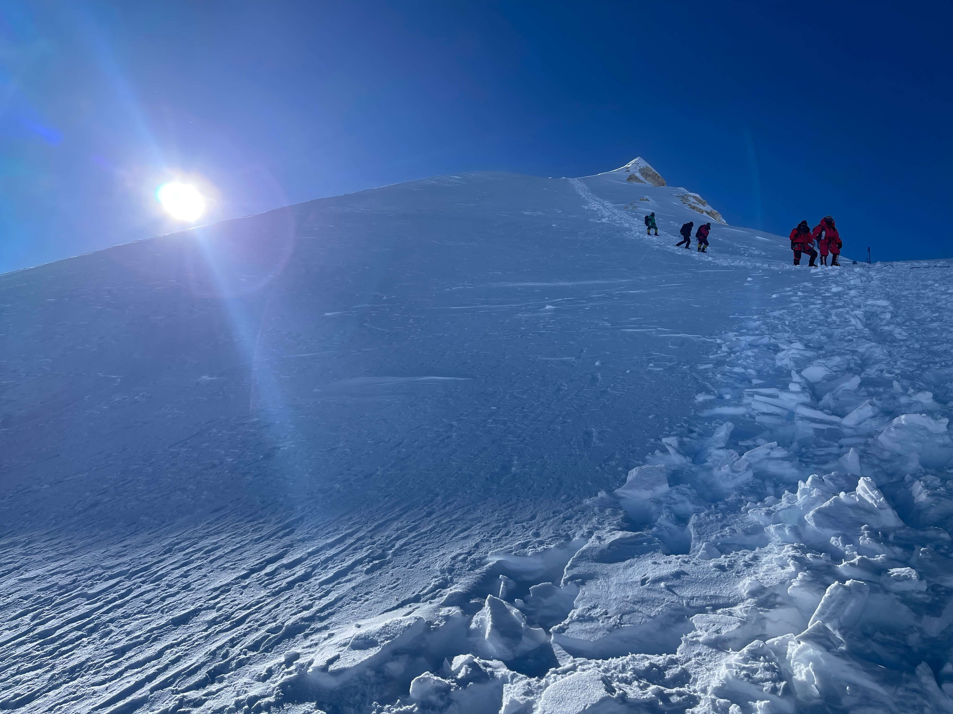
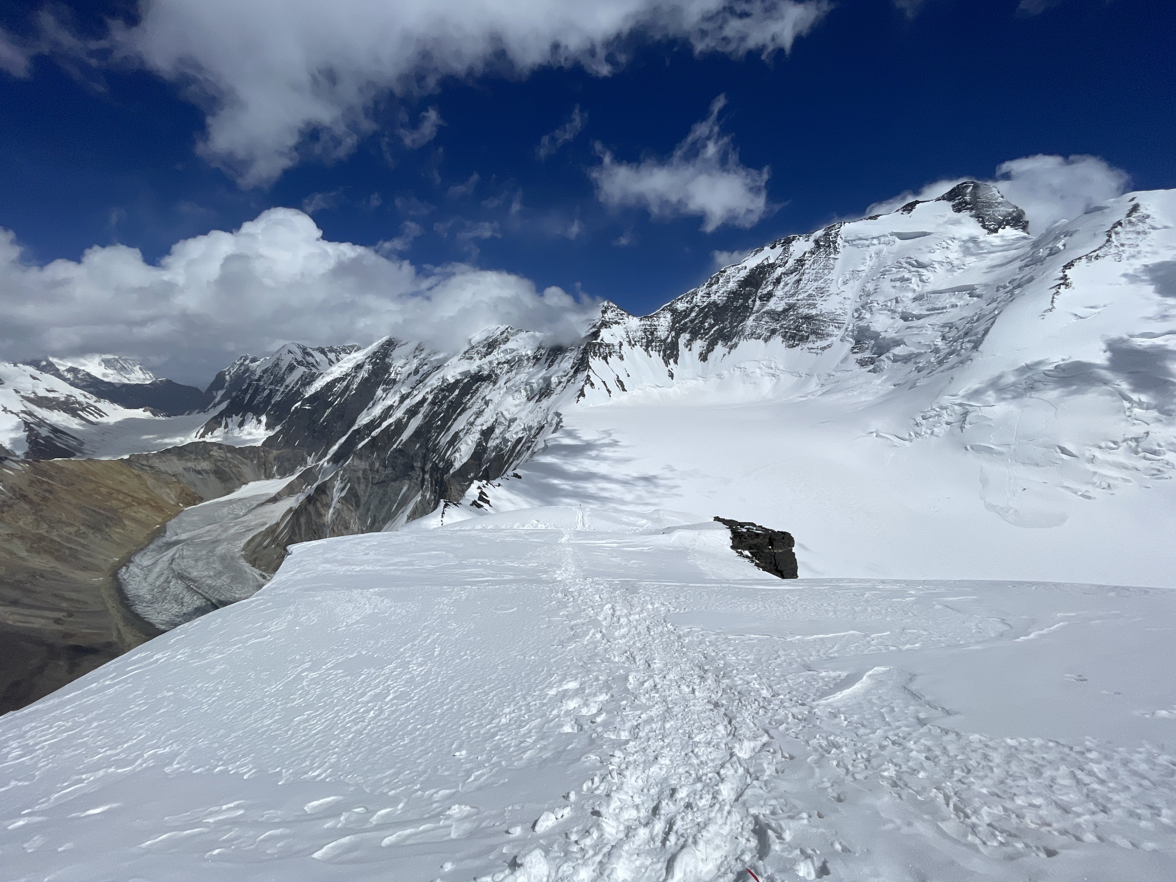
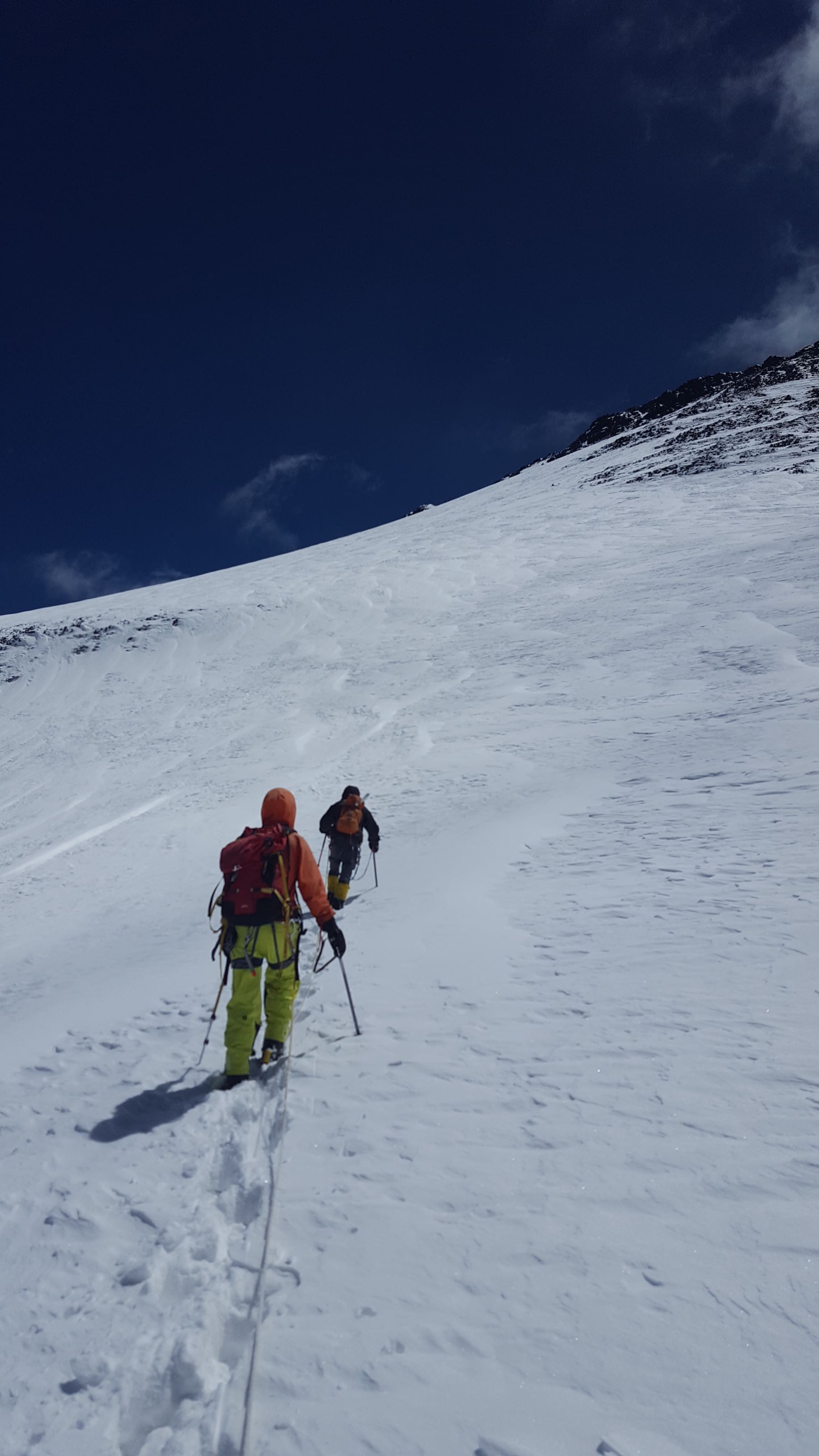
Above the rock difficulties is Noshaq’s enormous summit plateau. The terrain is gently sloped, but most definitely glaciated; climbers should rope up. In the past, many teams have fixed a high camp on the plateau, as there is abundant space very suitable for tents. The summit itself lies at the far eastern termination of the significant ridge standing atop the plateau. Crossing the plateau, ascending the ridge, and crossing the ridge to the summit covers roughly 1.6km of distance. My teammates informed me that they climbed a few meters of Class 3 scrambling in order to gain the ridge itself.
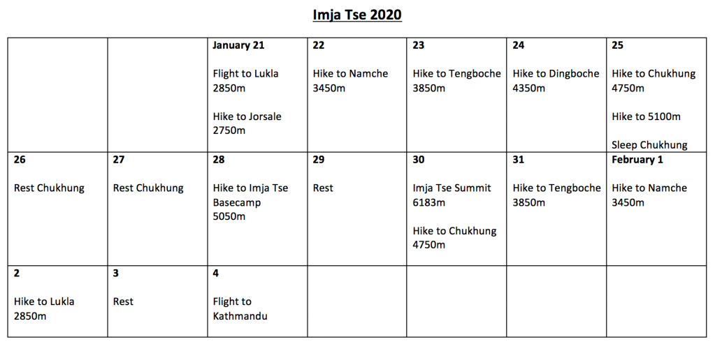
Schedule and Trip Report


July 8th
Dushanbe to Khorugh
Arrived in Dushanbe at 3:45 a.m., on the same airplane as Maria and Pat. There were significant delays at customs, as Pat had to sort out a landing visa. Met Eric and Ludwig at the airport at around 6:30 a.m. We had many errands to complete – grocery, gas, SIM cards, picking Andreas up from his hostel. There was limited time for food or rest, and we were all exhausted. We departed Dushanbe at around 10 a.m. and arrived in Khorugh at 2 a.m. the next day, taking about 14 hours total for the drive. The drive was hot and unpleasant, on bad roads most of the way. We were utterly exhausted by the time we reached Khorugh!
After meeting Ray in Khorugh our team was fully assembled. In total we numbered seven; myself, Pat (USA), Eric (USA), Marie (Estonia), Ludwig (Spain), Andreas (Denmark), and Ray (Hong Kong). While experience within the team varied, everyone seemed keen.
July 9th
Khorugh to Afghan Ishkashim
We met Ray at LAL hostel, where we slept for a few hours. Good WiFi, showers, and acceptable food were to be had. We went to the Consulate General of Afghanistan at 9 a.m., and applied for our tourist visas. A few hours later we drove to the border, where we crossed into Afghanistan. Azim, our highly capable fixer, met us with cars and drove us for about 30 minutes to Afghan Ishkashim, where we were finally able to slow down and rest properly. We had a good meal here, and met Malang, one of the first two Afghan nationals to summit Noshaq. Malang is an interesting and exceptional man.
We have transited from Dushanbe to Afghan Ishkashim in around 40 hours, a breakneck pace. Everything has felt rushed, albeit relatively smooth. If ever repeating this journey I would likely try to pace things in a more relaxed manner, perhaps taking one additional day in Dushanbe and departing for Khorugh at around 6 a.m.
July 10th
Afghan Ishkashim to 3225m Approach Camp
We registered with police in Ishkashim. With Azim’s help the paperwork involved in this was smooth and easy. We then drove for about one hour to Qazi-Deh, the village at 2600m where the approach hike to Noshaq basecamp begins. Here we sorted out porters and donkeys. In the past, expeditions have had porters carry all gear to basecamp manually. Happily, for our approach the porters were able to take donkeys all the way to basecamp, which significantly improved their work situation. Malang told us that this is only the second time donkeys have been able to make the entire approach.
We began the approach hike in the heat of the day at 2:30 p.m. We covered 14.5km in just over four hours, arriving at our first night’s campsite at 6:45 p.m. The campsite is at 3225m, and we were already beginning to feel the impact of altitude. The campsite is very pastoral, in a grassy scattering of trees alongside a branching stream of the main river. There was easy access to water and good camping spots. Porters warned us not to venture towards the nearby mountains, on the premise that there may still be landmines in the area. The first day’s approach was very dry and dusty, and once in camp all of us were complaining of itchy throats and nostrils.
July 11th
3225m Approach Camp to 4650m Noshaq Basecamp
9 a.m. start, 7 p.m. arrival. We hiked 3225m to 4650m in roughly ten hours. All of us are very tired, and this was perhaps too much altitude for one day, with over 1400m of gain. The porters were all doing well, as the donkeys carried everything all the way to basecamp, and were very happy to be paid, ecstatic when we gave each of them a $10 tip. The basecamp was nice, with a good water source and several rock wind walls for tents. Eric, Ludwig and I made it to basecamp about an hour ahead of the remainder of the team, and handled checking luggage and paying the porters. I was experiencing mild AMS on arrival in basecamp, and tried to sleep early. The dust and grit from the second half of the approach had irritated my throat, and a persistent dry cough made breathing uncomfortable while lying down.
July 12th
Carry to 5000m
I carried a light load to 5000m, at the edge of the dry glacier, and then descended to basecamp to rest. Still experiencing mild AMS, I didn’t want to push myself too hard. Tagging 5000m so quickly is not normal for me, and thus far the acclimation schedule has felt extremely rushed. The remainder of the team went higher for a few hours while I turned back to basecamp.
July 13th
Carry to 5000m
The six others on the team decided to make a carry all the way to 5500m Camp 1 today. I decided not to go, as I absolutely did not feel ready to clear 5000m. The team departed at 9 a.m., while I rested all morning. I departed basecamp at 12:35 p.m., and moved my cache at 5000m to the boulder at the base of the gully, also at around 5000m. I met with Eric and Andreas as they descended, but hiked back to basecamp by myself.
Thus far the rushed pace and accelerated acclimation schedule has been pushed forward mostly by Ludwig’s tight timeframe – he has a strict departure flight – and by Eric’s intention to try and climb the Uzbekistan highpoint after Noshaq. If I return to Noshaq, I will likely slow down the initial acclimation schedule by spreading the approach hike over three days, and spending an extra rest day in basecamp.
July 14th
Rest day at 4650m Noshaq Basecamp
July 15th
4650m Noshaq Basecamp to 5500m Camp 1
We agreed that we would move to Camp 1 today – fast, but somewhat reasonable given that I felt well and had twice tagged 5000m. As I had already moved most of my equipment up to the cache boulder at 5000m, lightening the load from basecamp, I felt good about making the move in a single carry. I departed basecamp at 9:05 a.m., collected my cache at 10:15 a.m., and reached 5500m Camp 1 at 3:30 p.m. My single carry bag was very heavy, and I felt slow ascending the gully. Indeed, I took up the rear of the team the entire way, the others all moving faster quite far ahead of me.
There were a few class 3 moves across rotten rock on the way up, and a little bit of exposure on steep terrain. It was an enormous relief to reach 5500m Camp 1 and take my bag off. I quickly pitched my tent on the rocks. The cough which I had been nursing since basecamp persisted, still from the throat rather than the lungs. My throat felt dry and irritated, and I figured that if the dusty two day approach had caused the cough, then the dry air at altitude was developing it.
July 16th
Hike to 6000m
We departed camp at 11:30 a.m. with the intention of making an acclimation hike, and reached 6000m at 3:15 p.m. The route along this section of ridge above 5500m Camp 1 passes several rock steps, one of which had an old fixed rope placed on it – I didn’t climb the rope, and opted for a more secure scrambling option. On descent I inspected the rope’s anchor, rapped it carefully, and hacked it out of the ice – it turned out that the scramble circumnavigating the rope was faster for the remainder of the expedition, but finding and recovering this fixed line still felt promising. Eric led the way up the ridge, breaking trail and finding the most efficient lines past the rock steps. I once again took up the rear for most of the hike, trying to pace myself, and thus climbing slowly. At 6000m we realized that Camp 2 was higher up, but decided to turn around due to deteriorating weather.
July 17th
Rest day at 5500m Camp 1
July 18th
5500m Camp 1 to 6200m Camp 2
We decided to move higher today. We departed at 9:20 a.m., and arrived at 6200m Camp 2 at 3:10 p.m. I once again made a single carry and ascended with an atrociously heavy bag. I felt lightheaded on arrival, and had abnormal difficulty trying to focus on setting up my tent; mild AMS. Eric, Andreas, and I arrived at camp first, followed by Marie. Eric once again broke trail most of the way from 5500m Camp 1. Pat, Ray, and Ludwig opted to stop lower down and complete the move up on the following day. In hindsight, this was a wise decision for acclimation.
July 19th
Hike to 6700m
Feeling much better after a full night’s sleep, Eric, Andreas and I decided to make an acclimation hike and try to scout the rock feature below the summit plateau. We departed camp at 11:15 a.m., and reached 6700m at 2:15 p.m. I broke trail for about half an hour right out of basecamp, Andreas for over an hour, and Eric broke trail for the remainder of the way. This had become a recurrent theme; throughout the trip Eric was the best acclimated of us all, was likely the strongest, and always moved the fastest. At points he outpaced Andreas and I while trail breaking deep snow.

Eric, Andreas, and I before heading to 6700m.

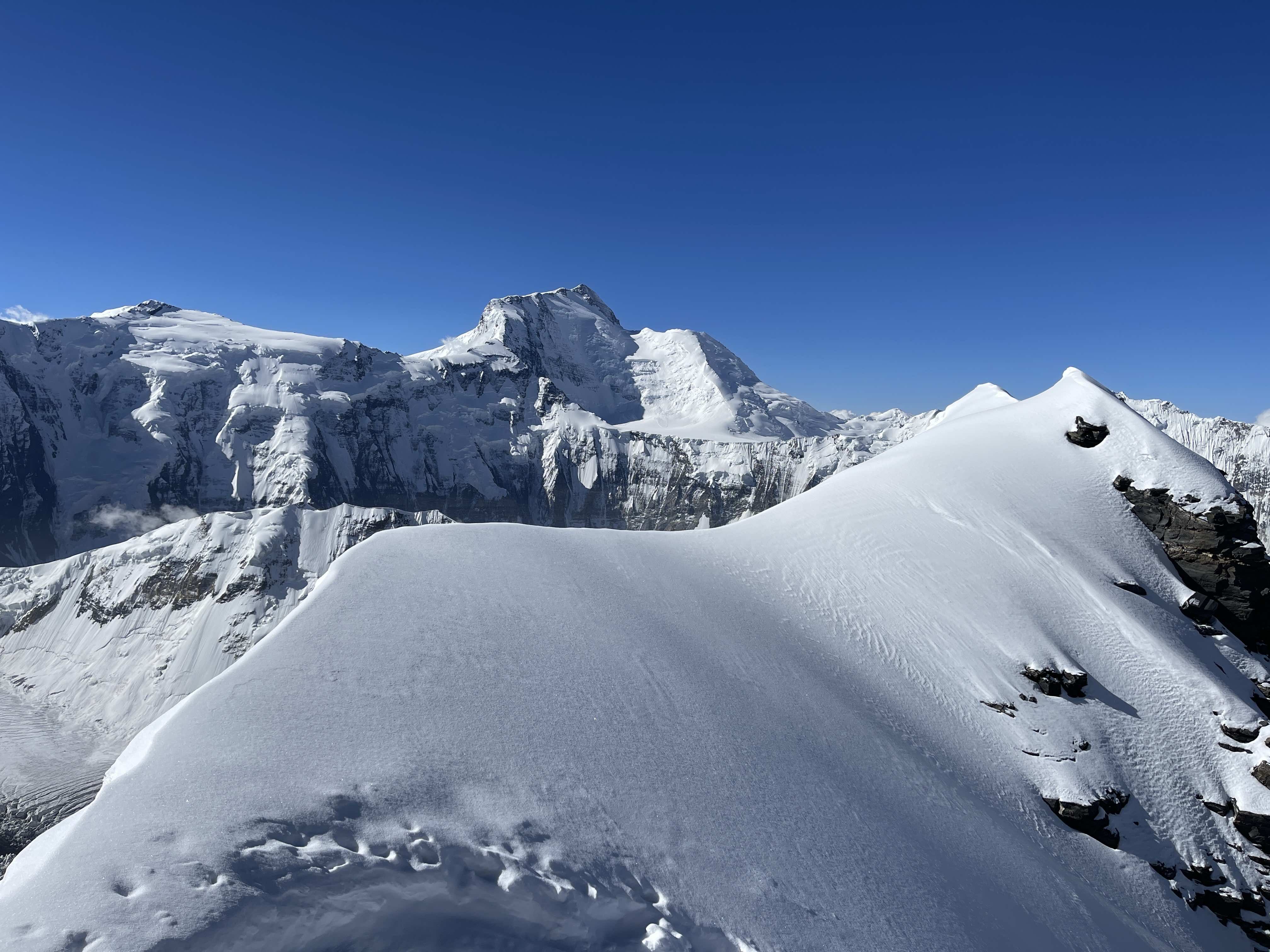
Terrain above 6200m Camp 2.
As we ascended the weather began to deteriorate. At around 6600m we were moving through intermittent whiteout, and climbing increasingly steep terrain. A hundred metres later at 6700m, feeling the altitude, I decided to head back to camp rather than continue pushing higher in terrible visibility. Andreas and Eric continued into the whiteout as I descended alone. Snow had already filled our boot track, and my descent involved plenty of postholing. Despite poor conditions, I was back at camp in just 30 minutes, arriving at 2:45 p.m.
July 20th
Rest day at 6200m Camp 2
The remainder of the team all arrived at Camp 2.
July 21st
Summit attempt to 7100m
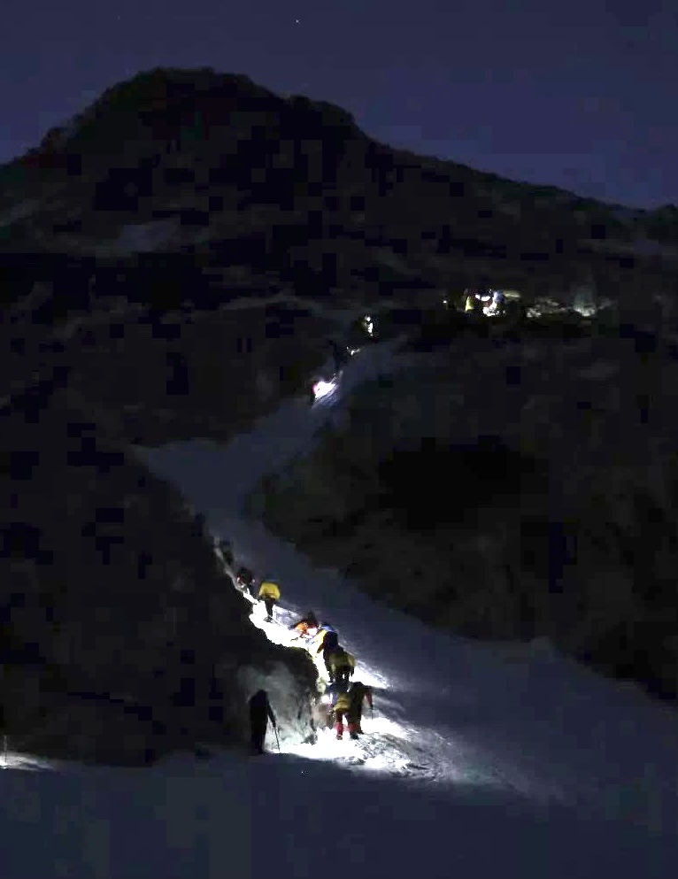
Eric, Andreas, and I decided to make a summit attempt on this day. At the last minute Ray opted to join us, and Ludwig decided he would try to get as high as he could despite his poor acclimation. Pat and Maria chose to wait.
We departed 6200m Camp 2 under a bright moon at 2:10 a.m. The hike to 6700m was mostly uneventful, although Ray lagged far behind Eric, Andreas and I. We were unaware that Ray had lost his mitts in the wind until much later, when he caught up to us at about 6900m. From 6700m to 6900m the terrain became much steeper, slowing us down as we broke trail through deep snow. Eric led most of the way, with Andreas and I taking over only for short sections.

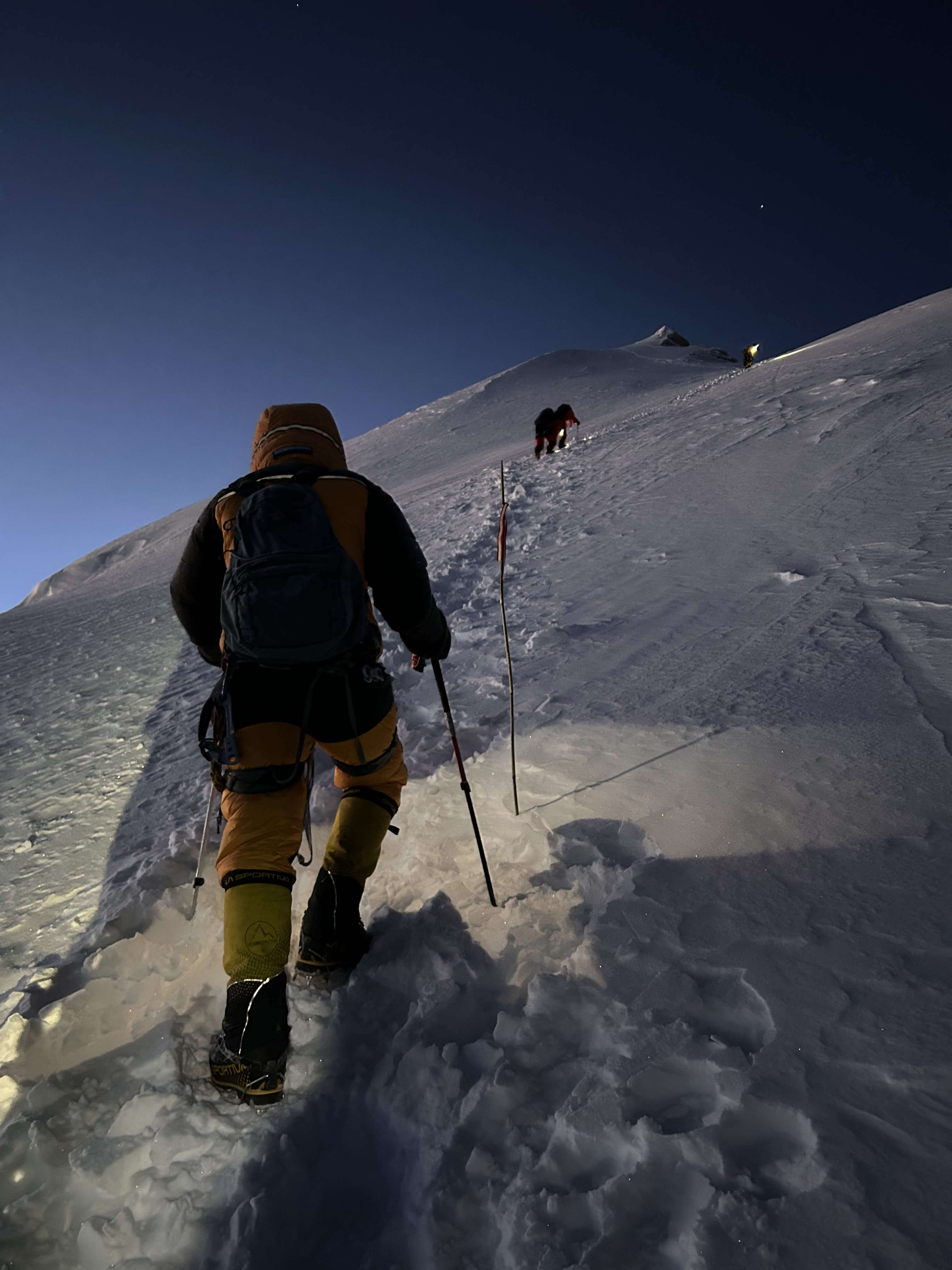
Climbing at dawn.

Andreas at sunrise.

Eric, preparing to lead the first rock pitch.

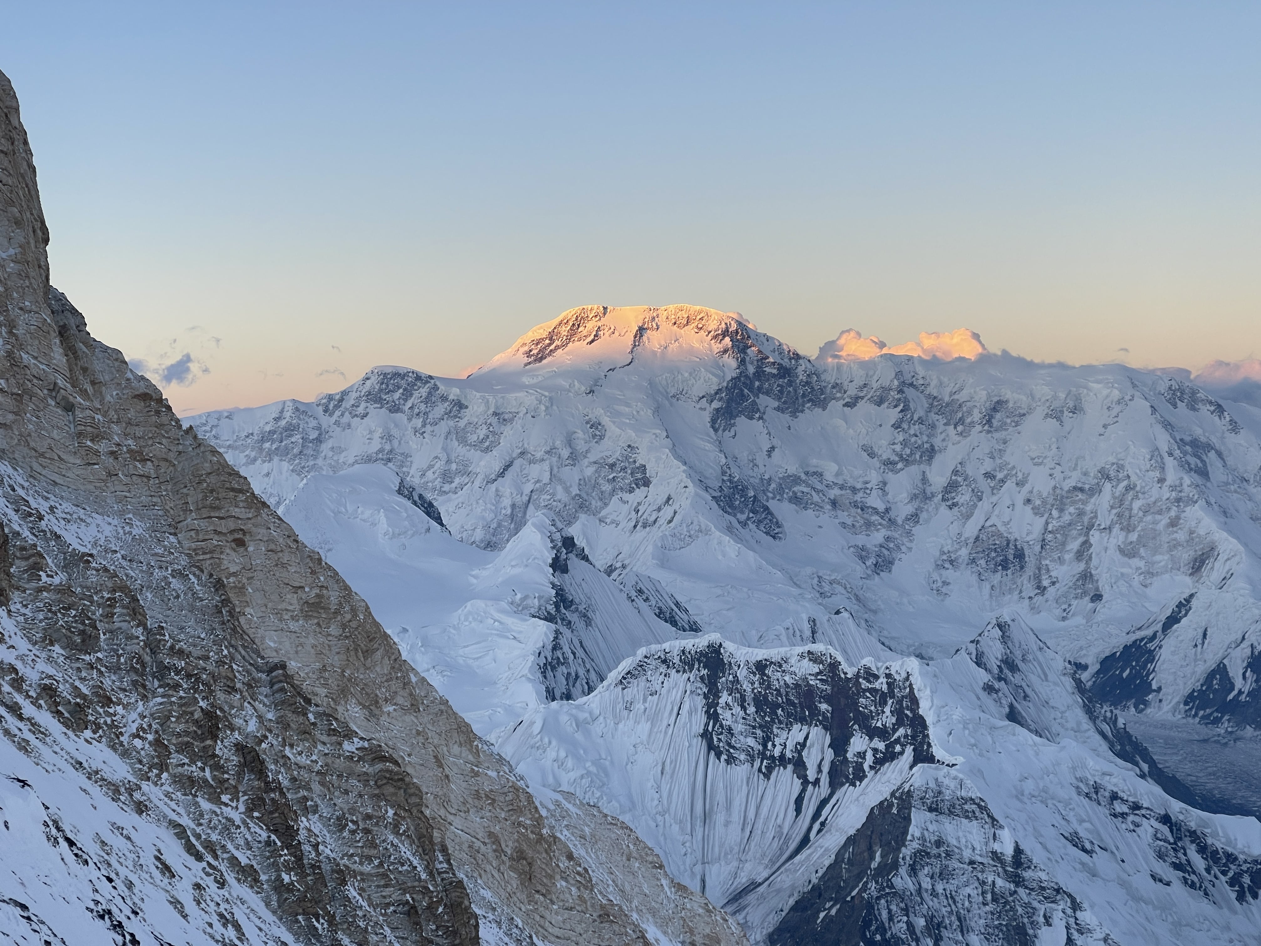
Sunrise from 7000m.

Sunrise from 7000m.

Sunrise from 7000m.
Terrain above 6200m Camp 2.
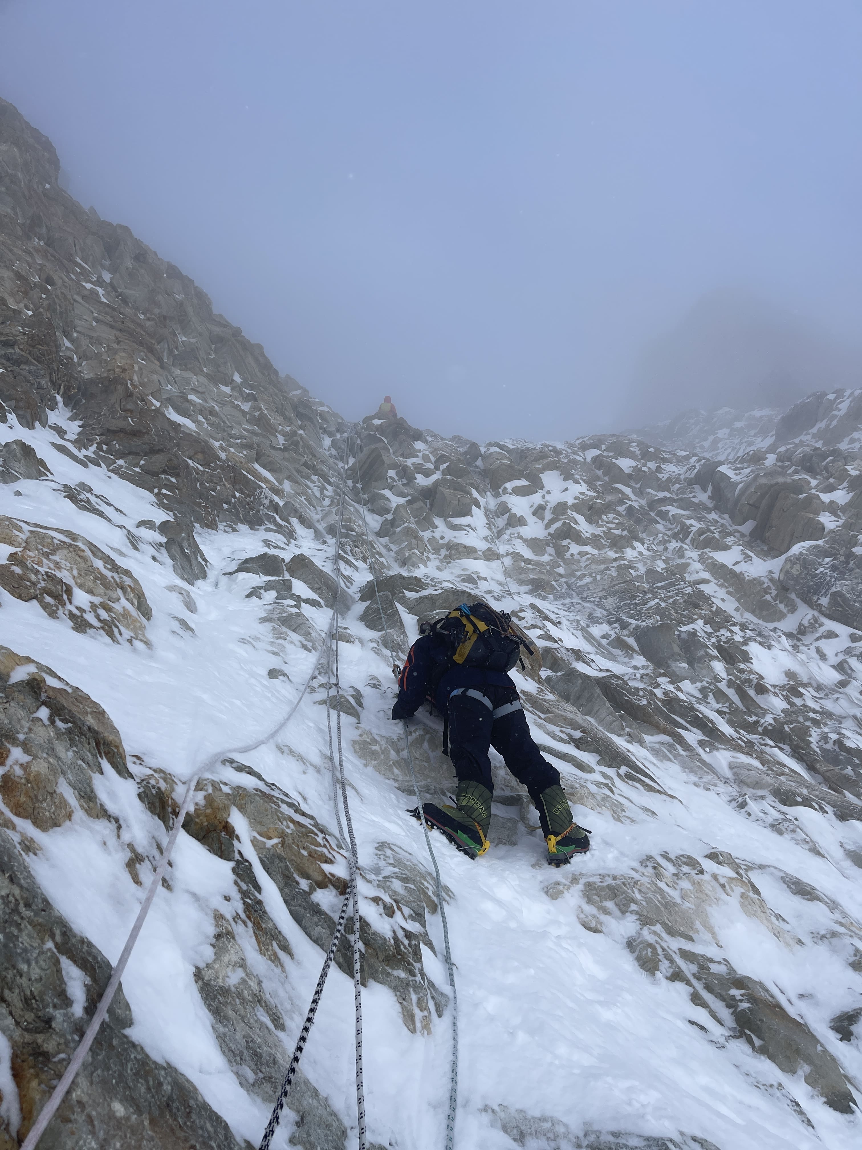
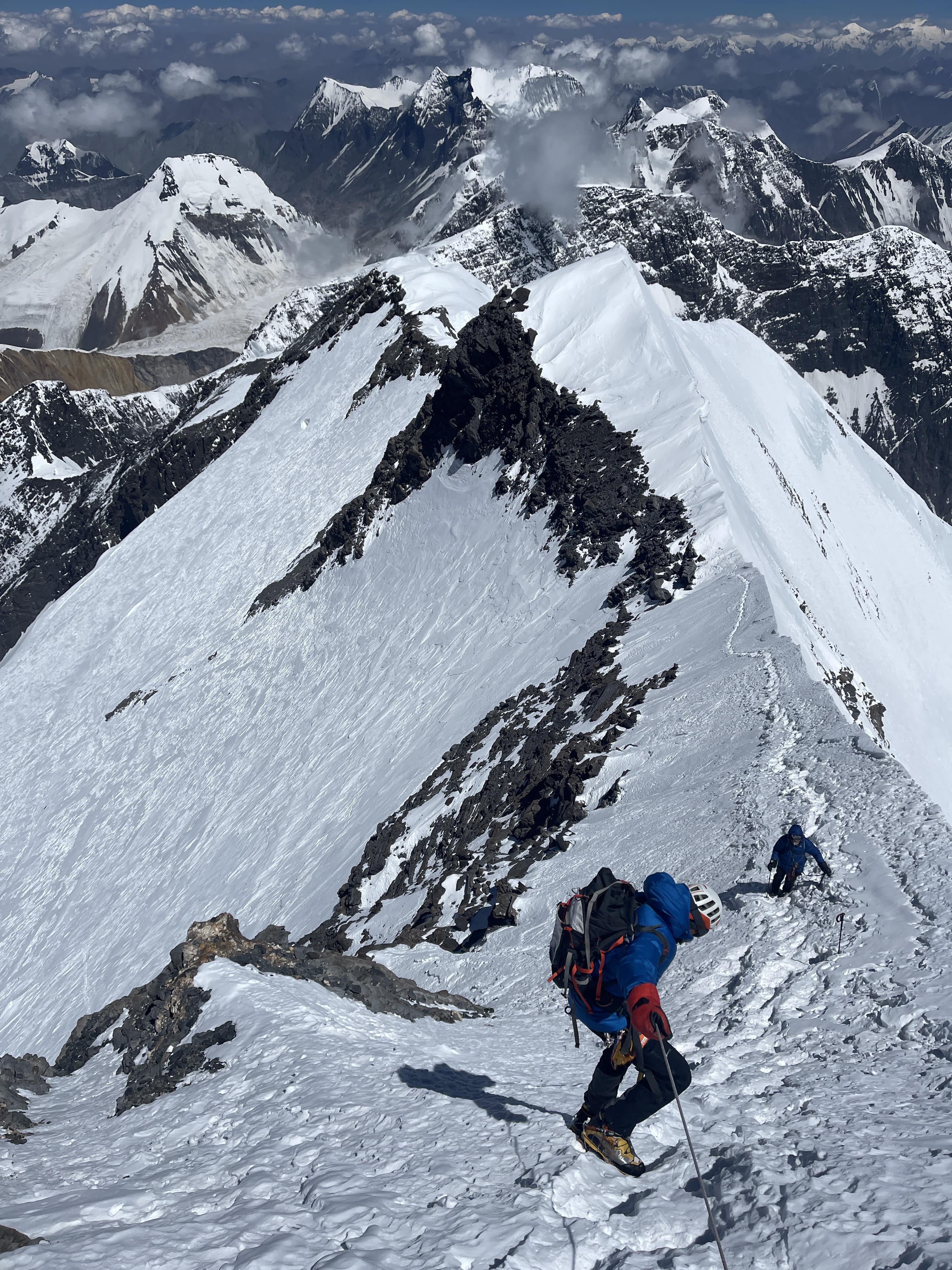
At 6900m we reached the base of the rock section. It was here that Ray caught up with us. As he was without his mitts, we persuaded him that he needed to descend. Eric led three pitches through the rock band as Andreas and I belayed and cleaned. Protection was pretty O.K. for most of it, and Eric was able to place good cams. Only the third pitch was difficult or sketchy, due to a traversing section on loose, deep snow with marginal protection. We found good pitons at the top of the third pitch, and a piton or two along the way, indicating to us that the route we took had been climbed in the past. Our three pitch route roughly ascended to climber’s left, and finished in a prominent notch in the rock. Although I cannot visually identify our route in any of our photographs of the rock band (see the route description, above), the notch is visible to the left, along the ridgeline.
The top of pitch 3 found us at the base of the summit plateau, albeit on a 40 degree slope. From here I could spot the top of the fixed line we had seen on ascent; I made a GPS waypoint, so that we could easily return to it for our descent. The decision to descend via a different route was made due to perceived difficulty in setting fixed ropes on the traversing pitches we had just ascended. Rather than messing about with rapping the route we had climbed, we figured that it would be faster and safer to re-anchor and secure the more direct fixed rope that we had spotted. In hindsight, this was probably a very good decision.
From our last anchor I led a short ~10m section of steep snow to a flatter area, where I belayed Eric and Andreas up on a picket and my ax. We roped up to continue a bit higher, away from the edge, and cached our rock gear.
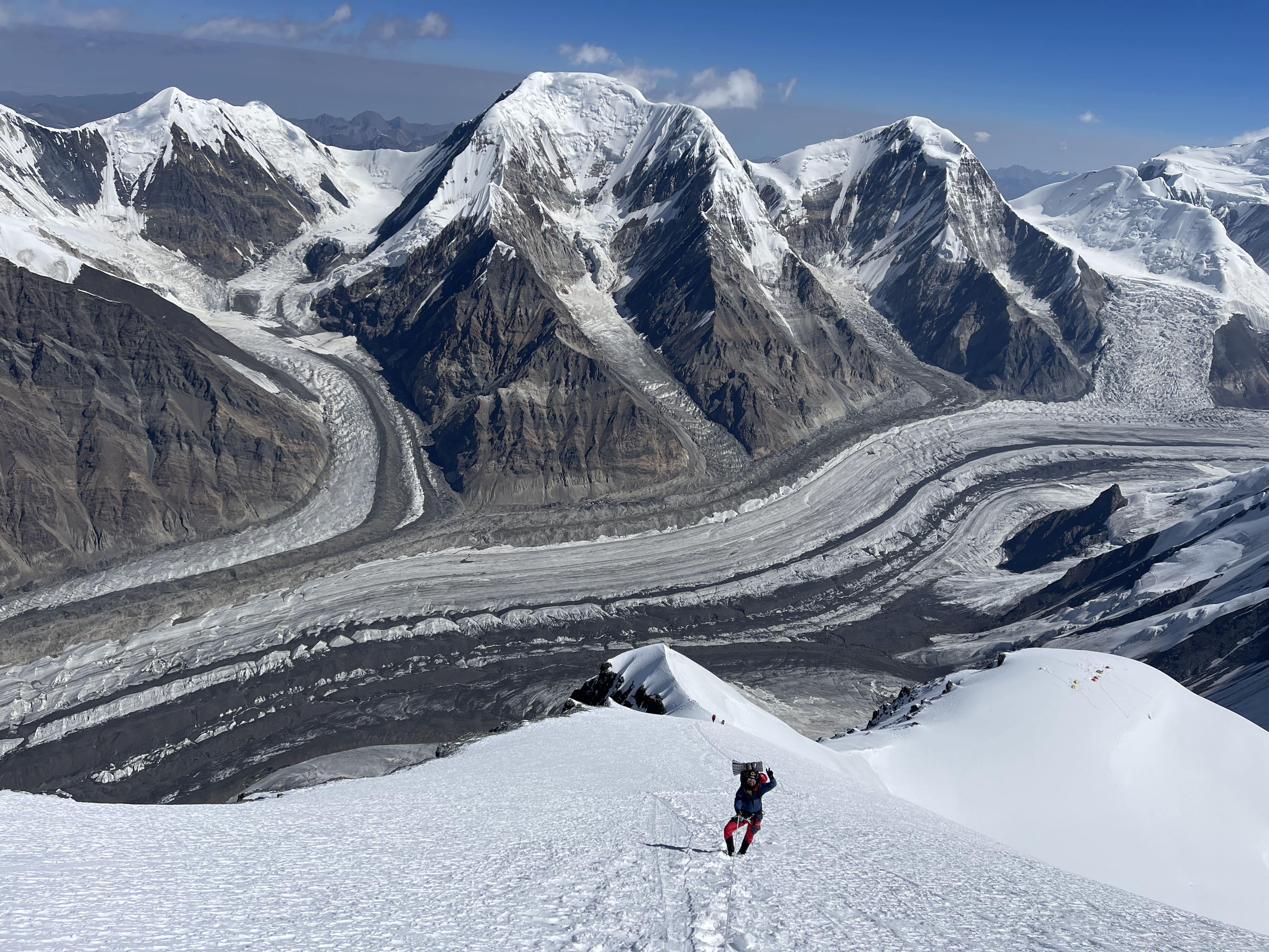
Crossing the summit plateau. Photo by Eric.
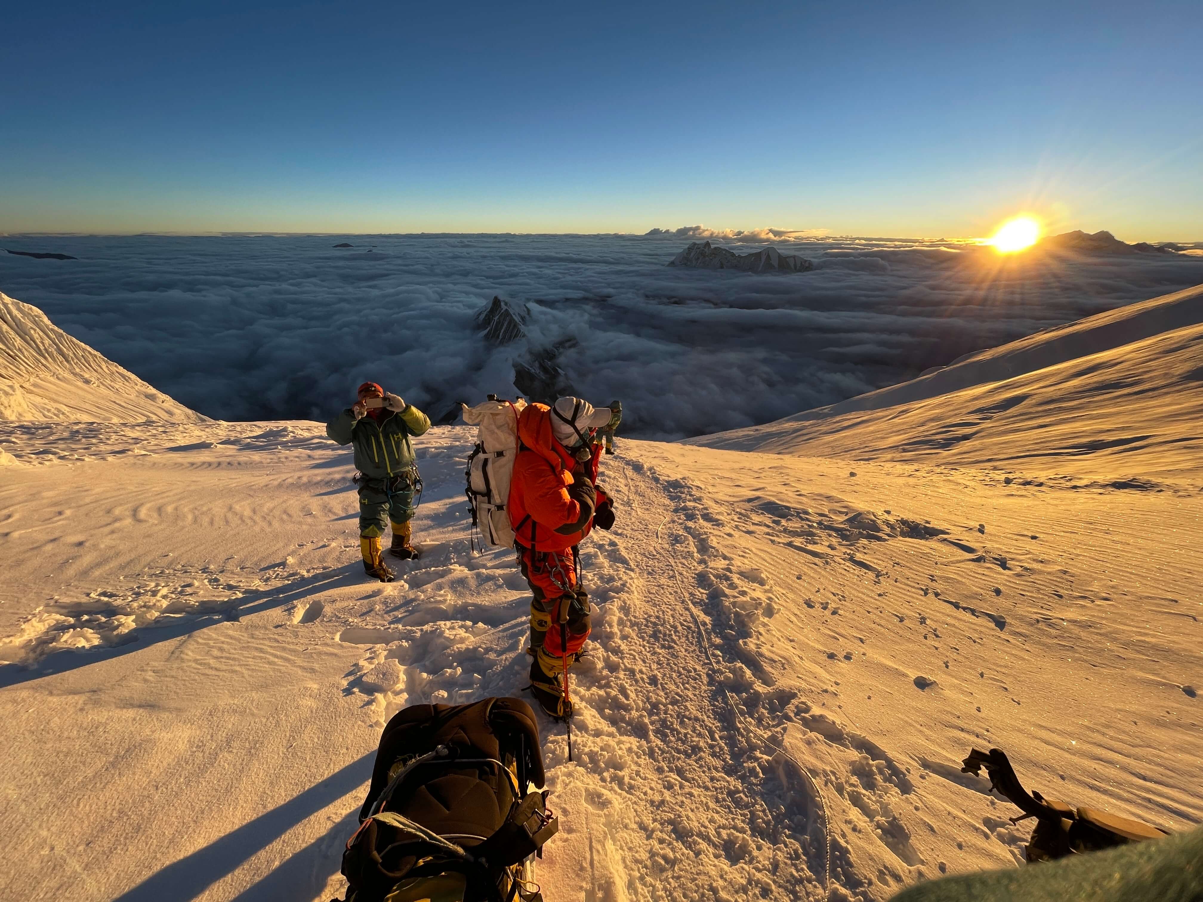
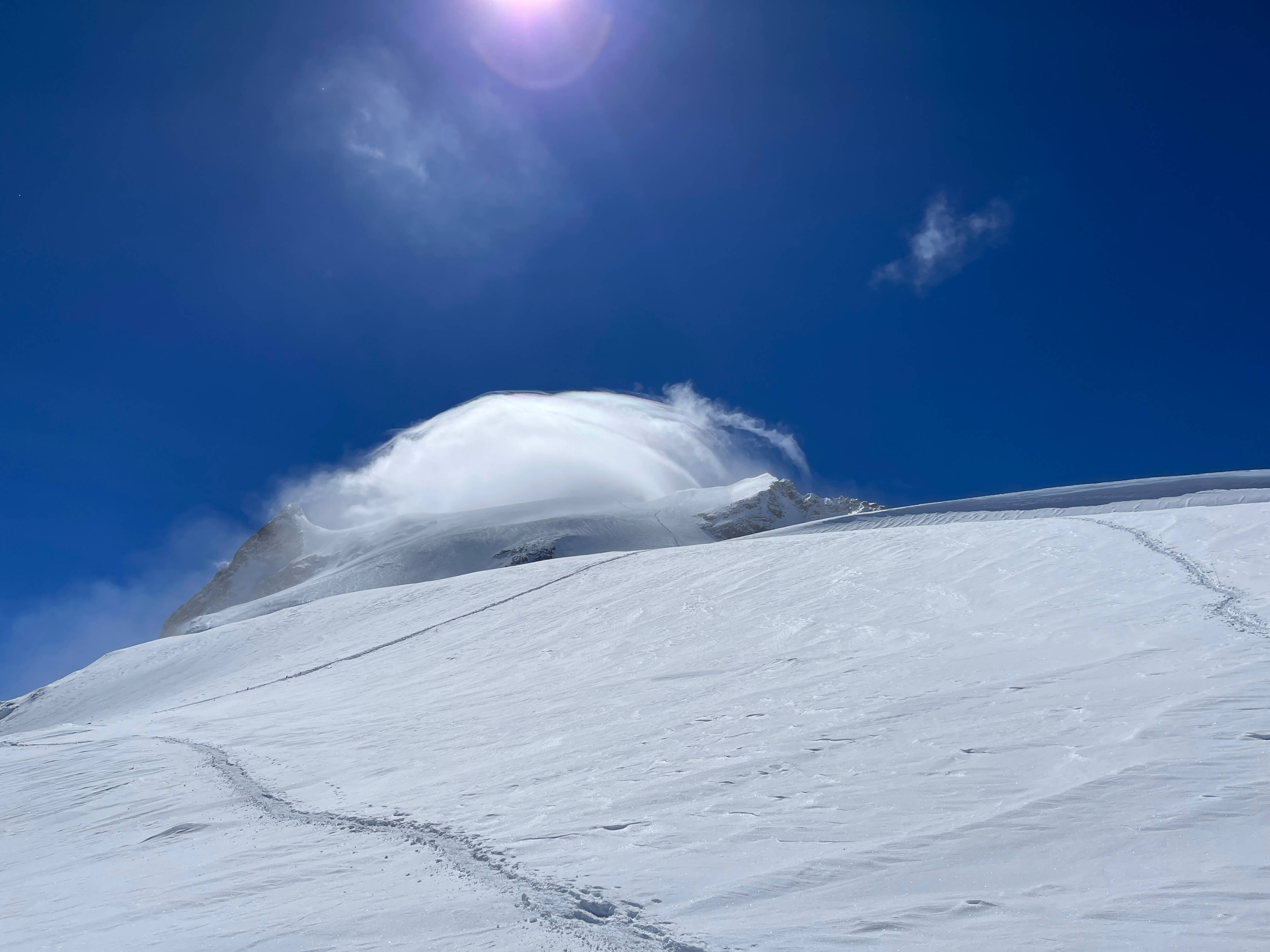
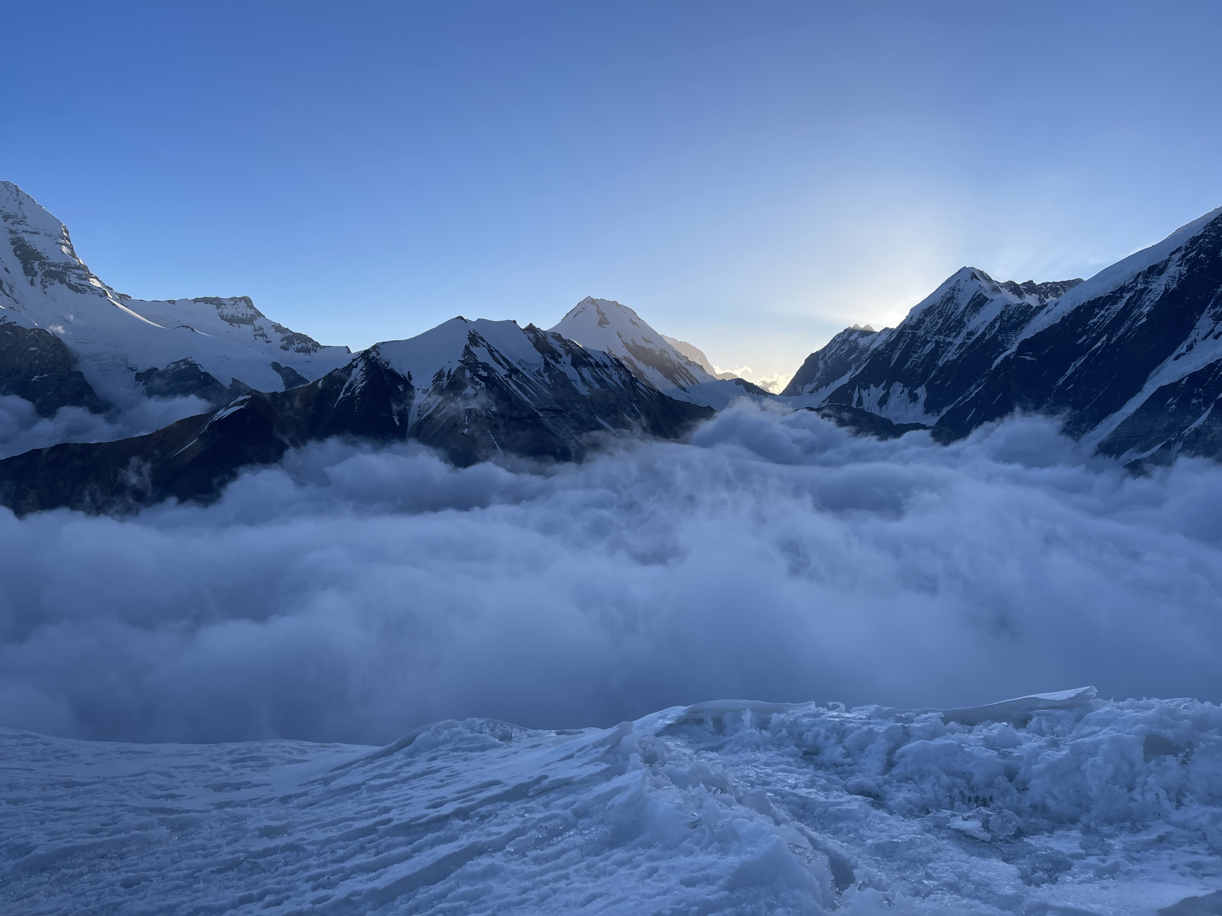
We stayed roped up for the entire summit plateau crossing, quite certain that it was glaciated. Eric and I took the ends of the rope team, placing Andreas in the middle, and I volunteered to break the first trail. The snow was ankle to knee deep, but the terrain was gently sloped. We had begun to really feel the altitude, and moved at a painfully slow pace despite our good condition. It was here that the weather abruptly began to worsen – intermittent whiteout and increasingly heavy snowfall. As the weather got progressively worse, and given our snail’s pace, I suggested that we bail. Andreas seemed undecided, but Eric was adamant that we continue pushing. We all still felt great, albeit tired, so I agreed that we continue. I broke trail for about an hour to the base of the summit ridge, where Eric took over.
From here we climbed for another hour, or so, into worsening whiteout conditions. Wind was picking up, and it was getting colder. Visibility was down to 20-30m. I once again broached the topic of descent, and this time Andreas agreed. We rationalized that we were pacing such that we might summit by 5-6 p.m., but would then be left descending in the dark, or bivvying on the summit plateau. We still had to fix ropes, or at the very least rappel our route of ascent. We had a stove and gas with us, had extra water and extra layers, and bivvying was on the table as an option until we decided that to do so would be to invite frostbite. As a team we agreed to turn back. It was 12:30 p.m., and our elevation was a bit over 7100m.
Back at the edge of the summit plateau I took charge of rope-fixing. I tried to work quickly, but by this point was tired and hypoxic. Easy knots took a few tries to dress correctly, and I was constantly having to double, triple check everything I did. Skills which I practice every weekend on rock had become clumsy and molasses-slow due to cold and fatigue. I was able to salvage most of the anchor gear left with the old fixed line, and back it up nicely with fresh runners. The old rope was core shot, so I cut the bad section out and replaced it with some of the static line that we had carried up with us. I made sure to keep the old rope attached and accessible, as I wanted to follow its line of descent. Anchors and rope all sorted, I rapped while hacking the old rope out of the snow and ice. I was thus was able to follow it down and find a solid cordelette anchor, which had been left on a big boulder.
I backed the cord up with a piton and a sewn runner. From here the ridge that we had ascended from was visible, below and to skier’s left. Eric and Andreas arrived at the boulder, and we agreed that it would be easiest if I tried to fix a second line to the ridge. I took the first rap again, traversing and breaking through knee to waist deep snow along the base of the rock wall, placing a single intermediate anchor part way. It took almost 80m of rope to reach to ridge, costing us Andreas’ 60m climbing rope and most of the remaining static line which we had carried up. I securely tied the system off onto a large boulder.
Andreas rapping the second fixed line. I am visible on the ridge. Photo by Eric.
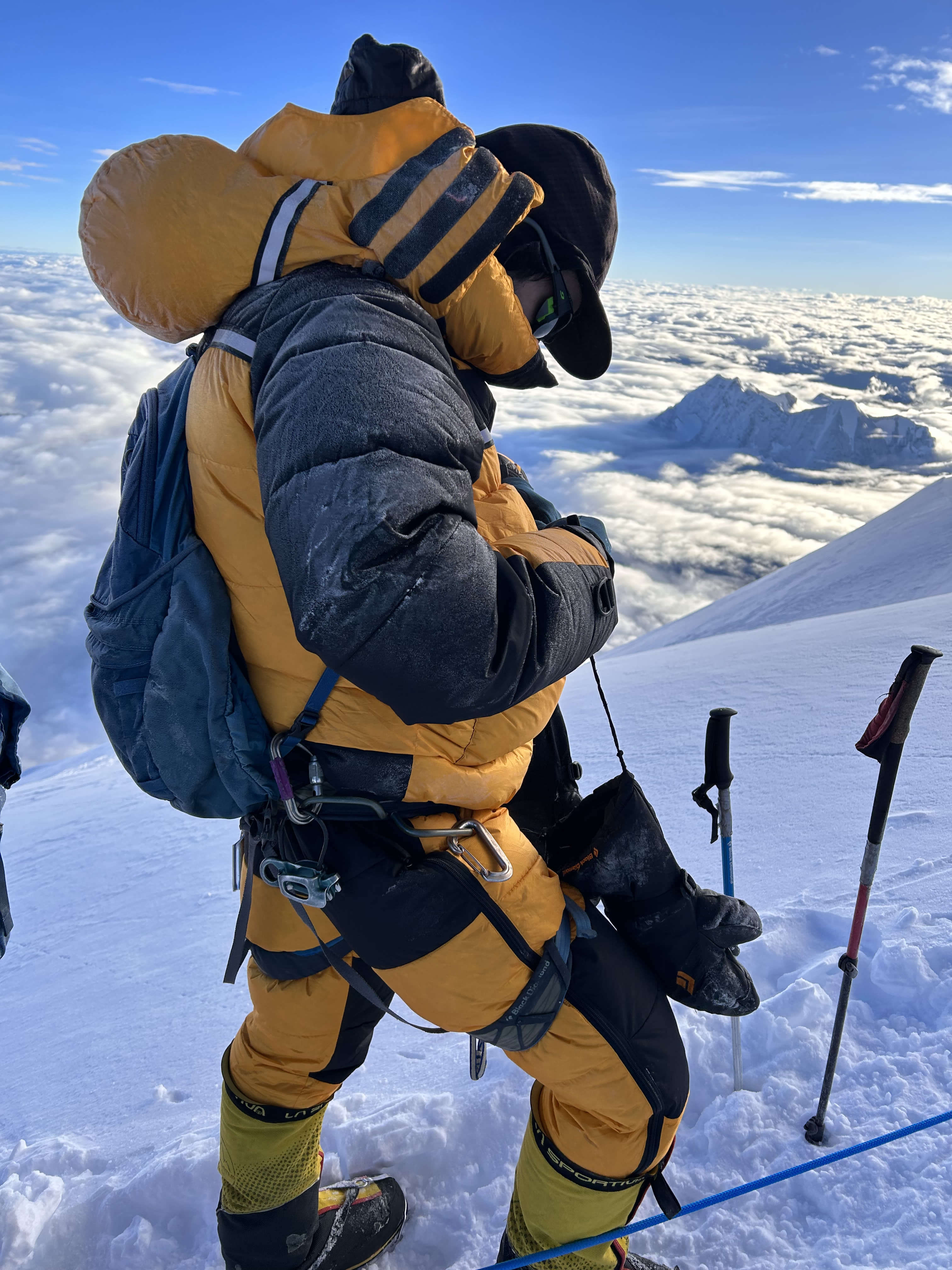
The fixed lines completed, I found myself shivering uncontrollably in the wind and deep snow. The weather was truly heinous by now, with moderate winds, total whiteout, and steady snowfall. As Andreas and Eric rapped across to me, I put on my down pants and storm mitts. My throat was bothering me, and I was wracked with fits of coughing.

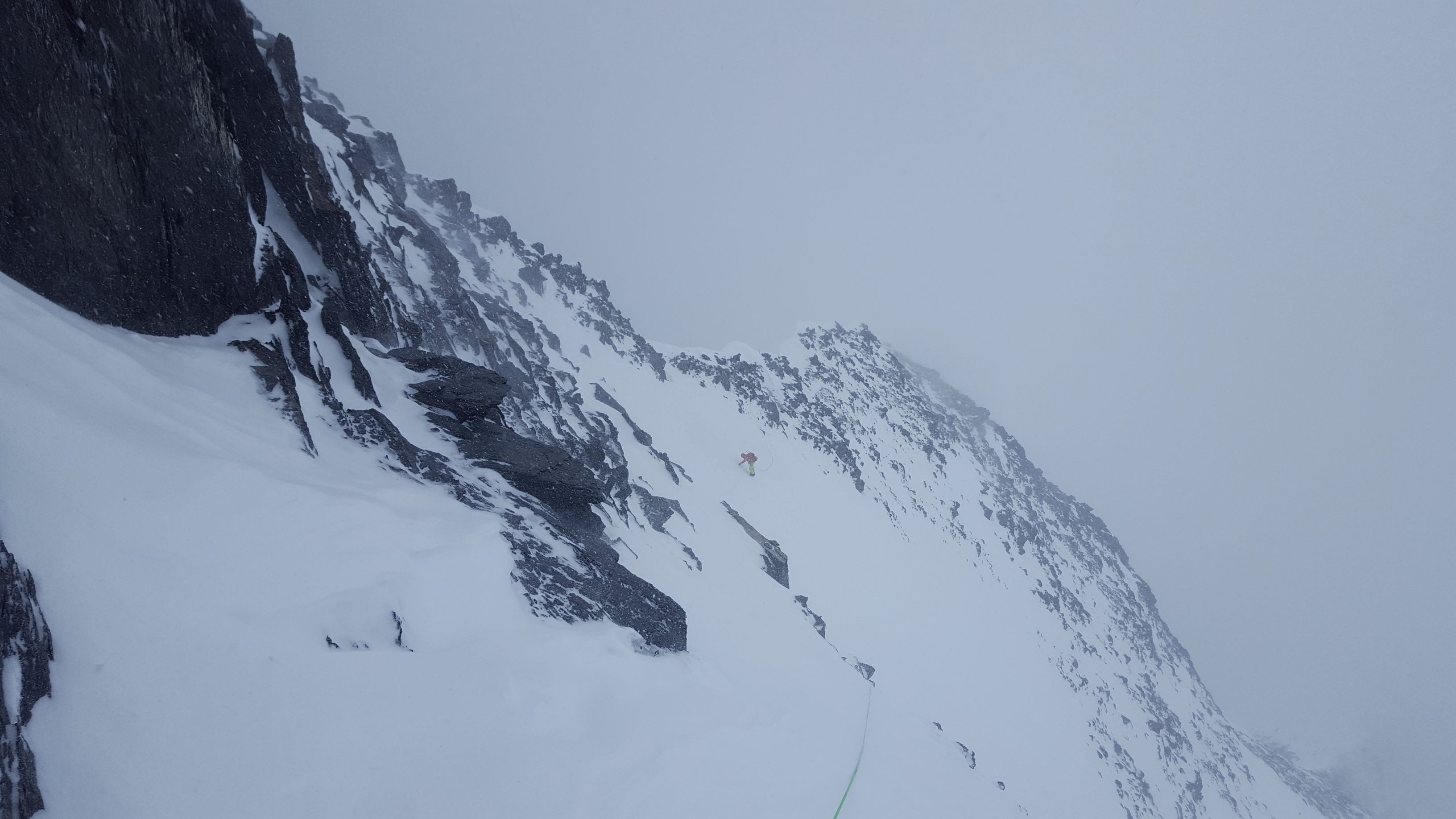
Whiteout conditions on descent.

Whiteout conditions on descent.
Descending back to 6200m Camp 2 was a nightmarish slog through deep snow, the whiteout limiting visibility to some 20m. I was exhausted by this point, coughing and staggering, and found myself moving far slower than I had just two days earlier on the same terrain. Several times I postholed waist deep and had to sit, breathing for a minute, before pulling myself out. We returned to camp at 7:10 p.m., a 17 hour day.
July 22nd
6200m Camp 2 to 4650m Noshaq Basecamp
I woke up feeling terrible. I was coughing uncontrollably, and the cough had developed into a wet, productive one. I had no symptoms of AMS and felt strong aside from the cough; I quickly ruled out HAPE. In regards to climbing, there was much disagreement and discussion as to the best course of action to take next. Andreas also had a cough, although only from his throat, and like myself felt that he needed to descend and rest before another attempt. Ludwig had made it to 6800m on the 21st, and then descended all the way to basecamp; he had to leave to catch his airplane. Eric wanted to move up immediately in preparation for a second summit bid. Pat and Marie were undecided, but tempted to move up and take a shot at the summit. The deciding factor ended up being food. I only had two days supply remaining, Andreas had nothing, and Eric was running low.
Eventually Eric, Andreas, and I decided to return to basecamp to rest and recover. Pat, Marie, and Ray would descend to Camp 1, where they had a food cache. On descent we met three Polish climbers who had arrived while we were on the upper mountain – they were the only other team to attempt Noshaq this season. Much of the route was melted out on descent, and turned to either scree or ice. We departed 6200m Camp 2 at 12:00 noon, reached 5500m Camp 1 at 12:45 p.m., and reached Basecamp at 2:20 p.m. We cooked pasta with sausage when we arrived, and while it looked like dog’s breakfast, it tasted delicious. Some three hours after Eric, Andreas and I arrived in basecamp, we saw Marie approaching across the moraine. We feared bad news, and were relieved to learn that she, Pat, and Ray had descended only because their food cache had been raided and eaten by the ravens which inhabit the valley.
It so happened that 7.22 and 7.23 were the only two days of the entire expedition when weather remained clear of afternoon whiteout and snowfall. Unfortunately this wasn’t of much benefit to us, given we used these as rest days.
July 23rd
Rest day at 4650m Noshaq Basecamp
I slept poorly, waking up several times throughout the night due to uncontrollable coughing, able to sleep only once my lungs were cleared. I was continually coughing up thick chunks of yellowish phlegm, in startling quantity. I was unable to breathe deeply without my lungs bubbling, which triggered coughing fits. Shallow breathing felt fine, and I otherwise felt strong and healthy, with a good appetite. Marie let me use her asthma puffer, which helped suppress the cough for an hour or so after use, but didn’t alleviate my difficulty breathing.
July 24th
4650m Noshaq Basecamp to 6200m Camp 2
The team wanted to move back up to make a summit bid. My cough was only marginally better after a full day’s rest, but accompanying the others was my only chance – in my condition I knew that holding back in basecamp and making a solo attempt later wouldn’t be possible.
We departed basecamp at 9:40 a.m., reached 5500m Camp 1 at 2:40 p.m., and 6200m Camp 2 at 6:40 p.m. – 9 hours in total, covering more than 1500m of elevation gain at a very slow pace. I moved slowly due to terrible conditions in the gully and relentless productive coughing. Much of the route had melted out into dangerously icy conditions, and the traverse across the ‘snow triangle’ (see route description above) was insecure and dangerous – we probably should have taken the time to place a running belay, or even pitch it out. Ray took a ~5m fall on ice, but luckily was completely unhurt and able to continue. Ray later stopped at 5500m Camp 1, too tired to continue to 6200m Camp 2. The route to 6200m Camp 2 felt endless, rest stepping forever in the punishing sun, and later in whiteout and snow.
I was physically very tired when arriving at 6200m Camp 2, and trying to manage my cough. I focused on getting food and water prepared, along with hot water bottles to sleep with.
July 25th
6200m Camp 2 to 6500m Camp 3
I slept poorly, unable to rest properly due to my cough and difficulty breathing. The plan was to ascend to 6700m today, in order to place a high camp in anticipation of making a summit bid on the 26th. Eric and Andreas left on time, while the rest of us took our time getting ready.
We departed camp at 11:00 a.m., and reached 6500m at 2:00 p.m., 300m in a slow two hours. I was still tired from the big ascent the day prior, and significantly impacted by my cough and breathing troubles. Given the nice tent platforms at 6500m, I decided that I should stop for the night. Pat and Marie, seeing that I was in poor shape, decided to camp with me rather than continue to 6700m, where Andreas and Eric waited. We agreed to depart for a summit bid at 2 a.m. the next day.
July 26th
6500m Camp 3 to 4650m Noshaq Basecamp
Ready to leave at 2 a.m., I waited another hour for Pat and Marie to get ready before starting upwards at 3 a.m. Eric and Andreas’ headlights were visible above us; they had started at midnight. By 4 a.m. I realized that I was moving too slowly, couldn’t breathe properly, and was coughing too much to continue. I turned around at around 6650-6700m, and was back in my tent by 4:30 a.m., where I immediately went back to sleep. I slept until 9 a.m., and realized that Ray had also descended. His headlight had broken, and ill equipped for managing the fixed lines he had turned back.
Ray and I packed up our equipment and started down together at 10:15 a.m. We reached 6200m Camp 2 at 10:45 a.m., 5500m Camp 1 at 12:45 p.m., and basecamp at 4:45 p.m.
The descent was quite difficult for me, and validated my decision to abort the summit bid. I struggled to breathe properly due to the amount of fluid in my lungs, and had to stop every 40-60 minutes in order to aggressively cough and clear them. I was coughing up roughly 3 popcorn kernel sized chunks of phlegm each time, yet more kept accumulating. Despite this, I still exhibited no symptoms of AMS – this was a lung infection, not HAPE.
About 100m above 5500m Camp 1, just a few meters to the side of our old boot track, I punched through into a crevasse, a hidden moat where the glacier meets the rock of the ridge. I fell armpit-deep into the crack. My enormous descent backpack lodged against the crevasse edge, and I was also able to plant my ax pick in time to help stop the fall. Looking down I could see that the ice slot went some fifteen to twenty meters deep, and my legs dangled over a dark void. I reacted quickly, and spread my weight onto my arms and ax, back in the direction I had been coming from. I shouted at Ray in Chinese – that I was in a crack and for him to stay where he was. Using my trekking pole and ax, fueled by adrenaline, I was able to physically haul myself out and back onto the snow slope. My heart rate through the roof, breathing heavily from the burst of heavy exertion, I collapsed in a fit of uncontrollable coughing. This was by far the worst unroped crevasse encounter I had ever had, and a full fall could have been catastrophic. We had moved unroped over this area throughout the expedition, feeling secure in the knowledge that we were on a ridge. In hindsight, it is possible that the entirety of the saddle area above 5500m Camp 1 is in fact glaciated; if returning to Noshaq, I would make a point of roping up on this section.
From 5500m Camp 1 the descent became significantly worse. The route was severely melted out, and crossing the snow triangle was no longer a safe option; it was a bulletproof sheet of ice. We opted to descend the rocky ridge to climber’s left of our ascent gully. This option was significantly safer than the ice of the gully, but did expose us to unpleasantly unstable scree prone to rockfall. We gingerly made our way down, taking almost three hours to get to the cache boulder at the base of the gully.
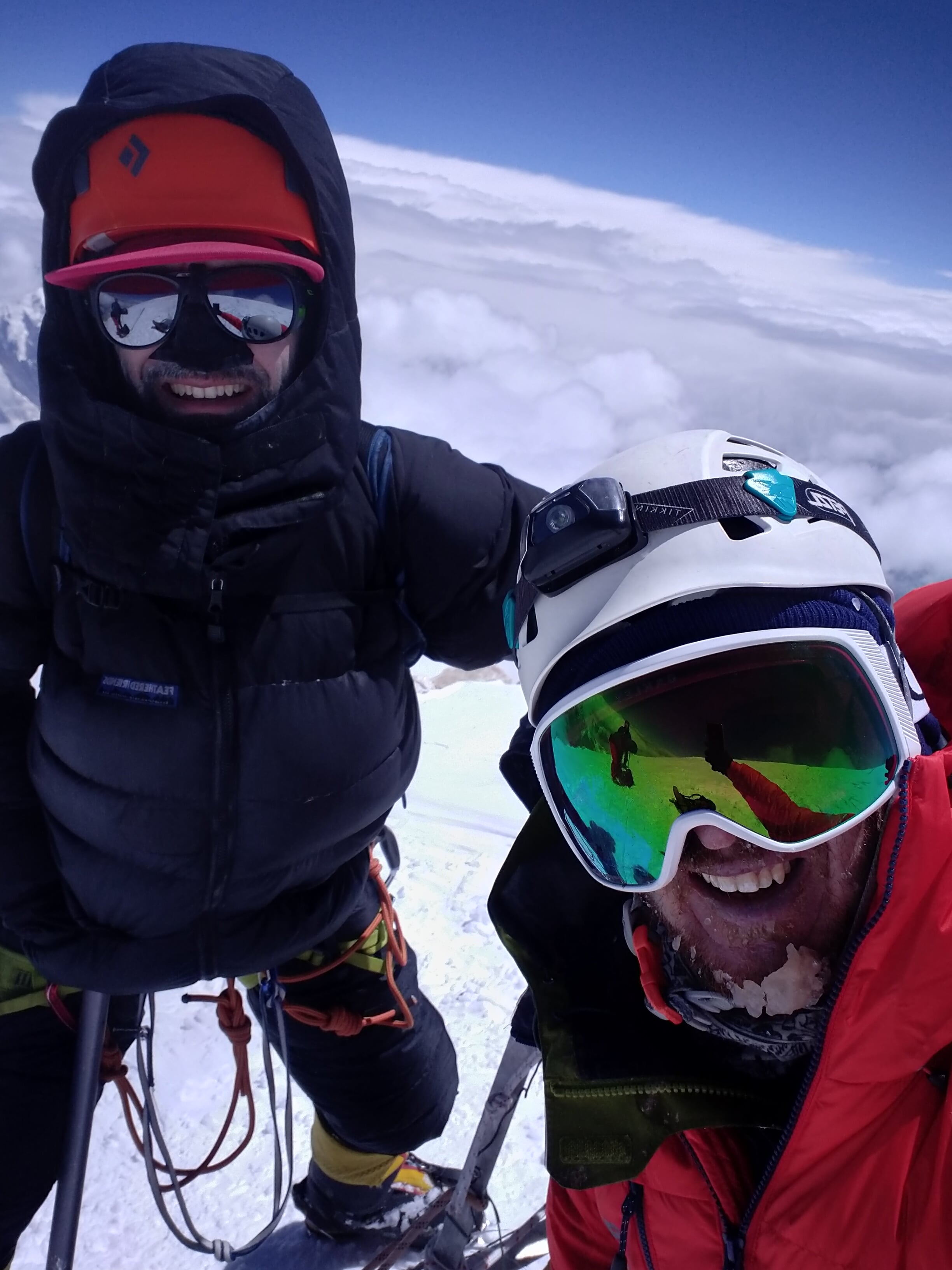
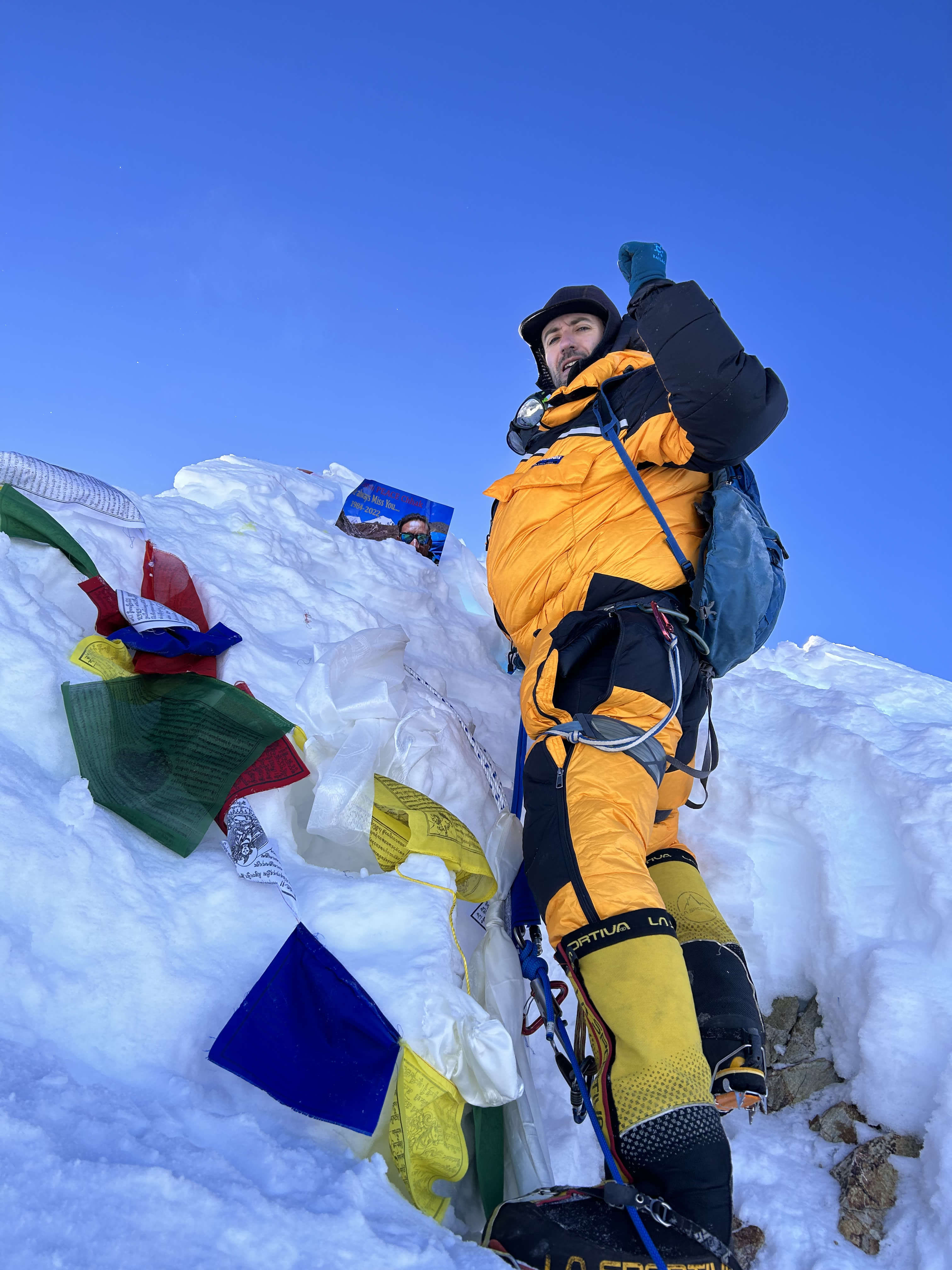
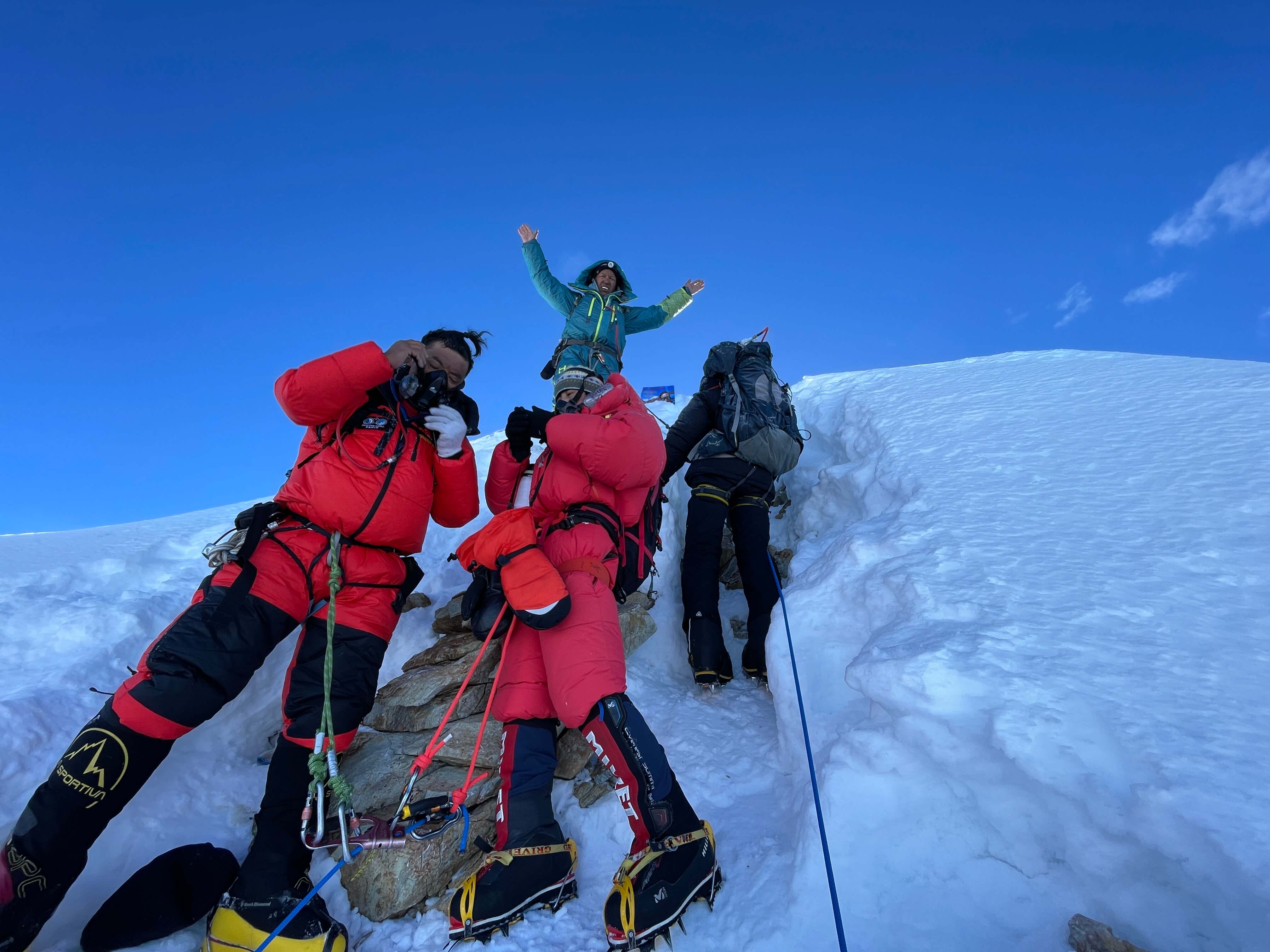
From the cache boulder it took another hour to reach basecamp, where I collapsed into my tent, utterly annihilated and struggling to breathe well. Andreas and Eric arrived several hours later, before sunset, having successfully summited before noon. They were in good spirits, despite Andreas visibly suffering from his throat issue. Pat and Marie got in contact with us via satphone; they had summited and were safely back in their tents at 6500m.
July 27th
Rest day at 4650m Noshaq Basecamp
Pat and Marie made it back to basecamp in the afternoon. A small earthquake hit in the morning, dislodging enormous boulders onto the path between basecamp and the dry glacier.
July 28th
4650m Noshaq Basecamp to Qazi-Deh
The porters arrived in basecamp with donkeys, in the middle of a snowstorm. Throughout the expedition weather had followed the pattern of afternoon whiteout on the upper mountain, some days earlier and some days later. This, however, was the first and only day we experienced snow in basecamp itself, and it came down hard and heavy. One of the Polish team assisted us in weighing everything, and helped negotiate a firm rate with the porters.

Donkeys waiting in basecamp.
We loaded up the donkeys with bags, with one porter carrying an additional bag that didn’t fit, and began to head down. Within fifteen minutes of departing basecamp we broke through the cloud ceiling, and were greeted with a view of blue sky and open valleys. Between the earthquake and the storm in basecamp, it was if the mountain had been angered by the summits, and wanted us gone.

Descending below the clouds, and into open valley.
We made the entire descent hike in a single day, taking some eleven hours to cover the 2000m of descent and 31km of distance. It felt like a death march for me, my clogged lungs and productive cough still adversely impacting my breathing and endurance.
Back in Qazi-Deh we sorted out payment for the porters, tipped each of them $20 for making the descent in a single day, and feasted on chicken and naan bread.
July 29th
Qazi-Deh to Khorugh
We departed Qazi-Deh for the Tajik border, and crossed back into Tajikistan. Pat and Andreas had visa problems, in that neither of them had successfully acquired their second e-visa, and were denied entry. Process the e-visa payment with care, to avoid having the application soft-locked. They made it across the next day, but only after making some phone calls to the American embassy. A car arranged by Azim met us on the Tajik side of the river, and those of us who had crossed over headed to LAL in Khorugh, where we would spend the night. Eric and Ray departed for Dushanbe the next day, while Marie and I waited for Pat and Andreas – the four of us would later make an interesting land journey all the way across Tajikistan, to Bishkek in Kyrgyzstan.
Thoughts on Noshaq
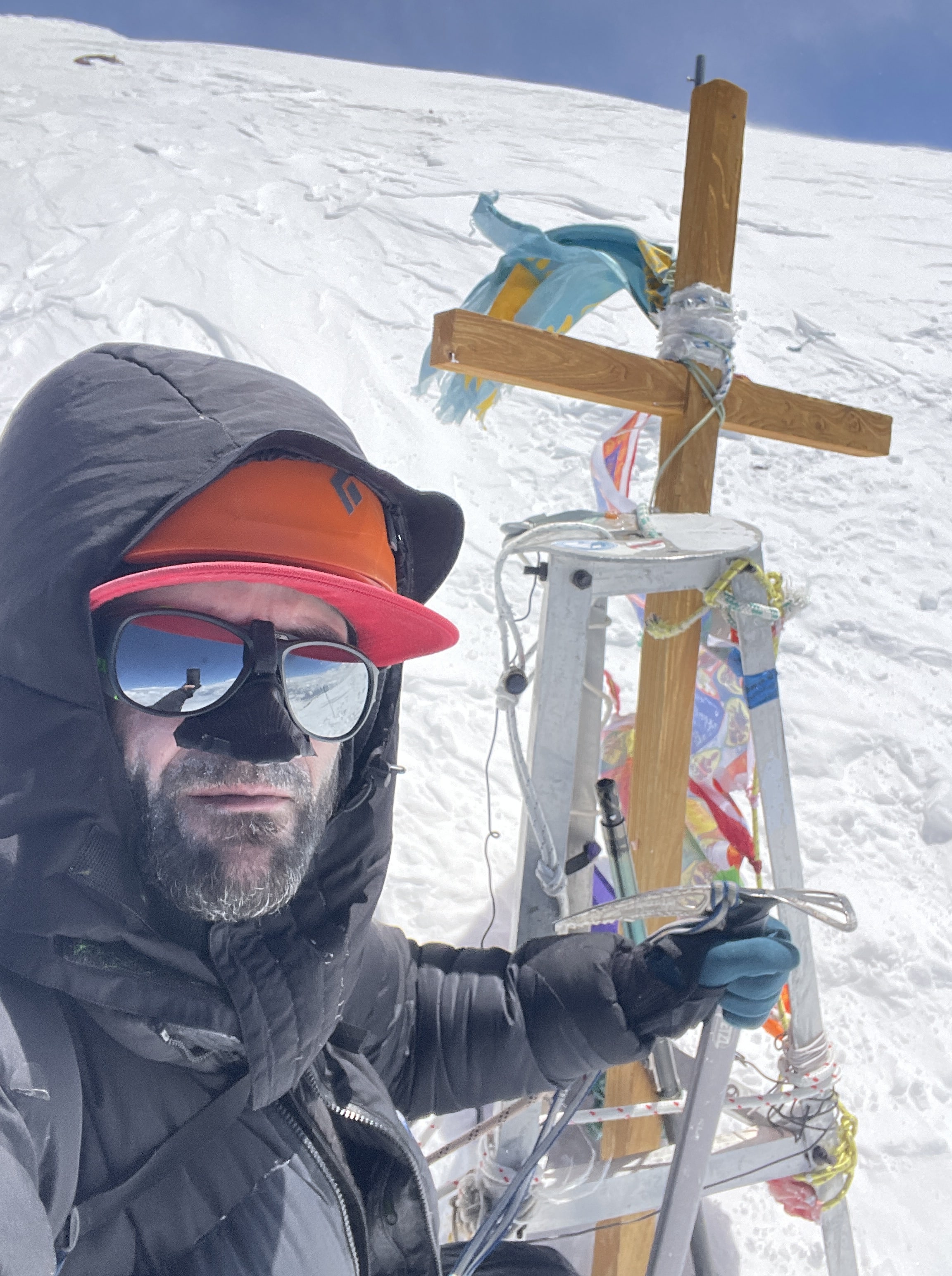
Four of our seven summited the mountain, making the expedition a success. I contributed meaningfully to the trip, especially by taking responsibility for the work required to fix all of the ropes and help open the route up for the others. I performed well throughout the expedition, at least until I was hit hard by the respiratory infection, after the first unsuccessful summit attempt. Our four were the only summits of the year, as the three Polish climbers who arrived after us were hit by a streak of relentless bad weather which forced them to turn around from a highpoint of around 7300m.

Flowers at basecamp.

Flowers at basecamp.

Flowers at basecamp.
I was disappointed that I didn’t summit, especially given that I’d climbed strong up until I became sick. Well after the expedition’s conclusion, in hindsight my non-summit continues to bother me. I feel that I should have made it. Looking at my journal from the climb, I can rationally see that there was no chance of success once I became ill. There was no way I could have ‘pushed harder’ or ‘been tougher’ and somehow made the summit – certainly not responsibly, without putting myself, and by extension the others in the team, in danger. Alluding that my coughing fits and difficulty breathing were dramatization of a mild chest infection is disingenuous – the photos I took showing how much phlegm my lungs were producing, the sheer quantity of what I was coughing up, and my journal writing from the moment should serve to dispel my irrational ‘what if’ hindsight thinking. I have never before been so sick in the mountains, as on this trip. In spite of this, I still think about it. What if I had waited a day longer before the first attempt? What if we had moved camp that day instead? What if we had pushed on that day, and bivvied somewhere secure after summiting? What could I have done differently, to avoid getting so debilitatingly sick?
Our coordination and teamwork could have been stronger on Noshaq. In our group I had only previously climbed with two people, Pat and Marie. Of the six others on the team I only had prior technical climbing involving ropework, communication on terrain, and gear placement with Pat. Our coordination as a group on the mountain wasn’t always predicated on good communication, clearly defined expectations, or scheduling. This was in part due to a lack of familiarity across each person’s habits, style, and routines. We had no radios on the mountain, and relying on satphones for communication made for significant message delays and numerous small miscommunications throughout the trip, some involving minor variations in route finding, others resulting in misallocated equipment.
Throughout the expedition Eric had ended up with a disproportionate amount of the more physically demanding work, in that he thanklessly undertook the majority of trail breaking, with Andreas and to a lesser extent myself filling in the gaps. Eric also handled all of the significant lead climbing. This issue likely could have been resolved with clearer communication of expectations at the beginning of the expedition, and a fairer arrangement for breaking the route – on carry days our pacing was entirely irrelevant to intended outcomes, and it wouldn’t have mattered if someone slower had lead.
Likewise, the expedition felt rushed as a result of what were arguably unrealistic time expectations; Ludwig was climbing on a very slim time budget, and Eric was motivated to finish as soon as possible so as to attempt a second mountain. Our acclimation schedule was the fastest that I have ever followed. While I exercised my better judgement at the beginning of the climb – in hindsight the choice to delay my first trip to 5500m Camp 1 was a great decision – I eventually felt compelled to ‘keep up’. The severity of the respiratory infection that I experienced was definitely exacerbated by rushed acclimation, and arguably would not have hit me at all had I not pushed myself as hard and as fast as I did.
These issues could likely have been eased had we worked together on a warm up climb or practice route of lower intensity and significance, before starting on Noshaq. Radios would have made a huge difference towards smooth and responsive communication, and would have alleviated most, if not all, of the minor miscommunications which occurred. Nightly planning meetings, even for just a few minutes at a time, routinely and formally arranged, would have helped keep expectations in check and given everyone an opportunity to voice opinions on pacing and strategy. Our group was large enough that hiring a private meteorologist to provide weather forecasting would have been economical, and could have made a significant impact on our terrible luck with weather – whiteout and snowfall every single day that we were moving above 5500m, the only two bluebird days spent resting in basecamp!
Noshaq is remote, big, short on looks, and chiefly composed of loathsome choss. When I try to tell people what I was climbing on all summer, they first ask me where on earth it’s even located, then raise an eyebrow and ask me why I’d ever consider going there. That said, for better or for worse, I know that I need to return to Noshaq.