
Mid-way through 2021 – I had been limited to travel, and thus climbing, within the borders of China for well over a year. Further, unfortunately, most high altitude mountaineering opportunities inside of China had been rendered inaccessible to foreigners during the COVID pandemic; rock climbing had become the only realistic realm of mountain-related goal setting and training for me.
The idea of tackling a big wall came about in late 2020 while hunkering through a severe winter windstorm at 4500m in central YunNan province. The prospect of a big, challenging climb in warmer weather was deeply appealing, and we had six months’ time to train and prepare. My friend and I even had a route in mind; Blue Glacier 蓝冰川 China’s longest sport rock route. As 2021’s rock climbing season got well underway we soon found ourselves planning the climb for a team of four, representing China, Canada, Indonesia, and France.
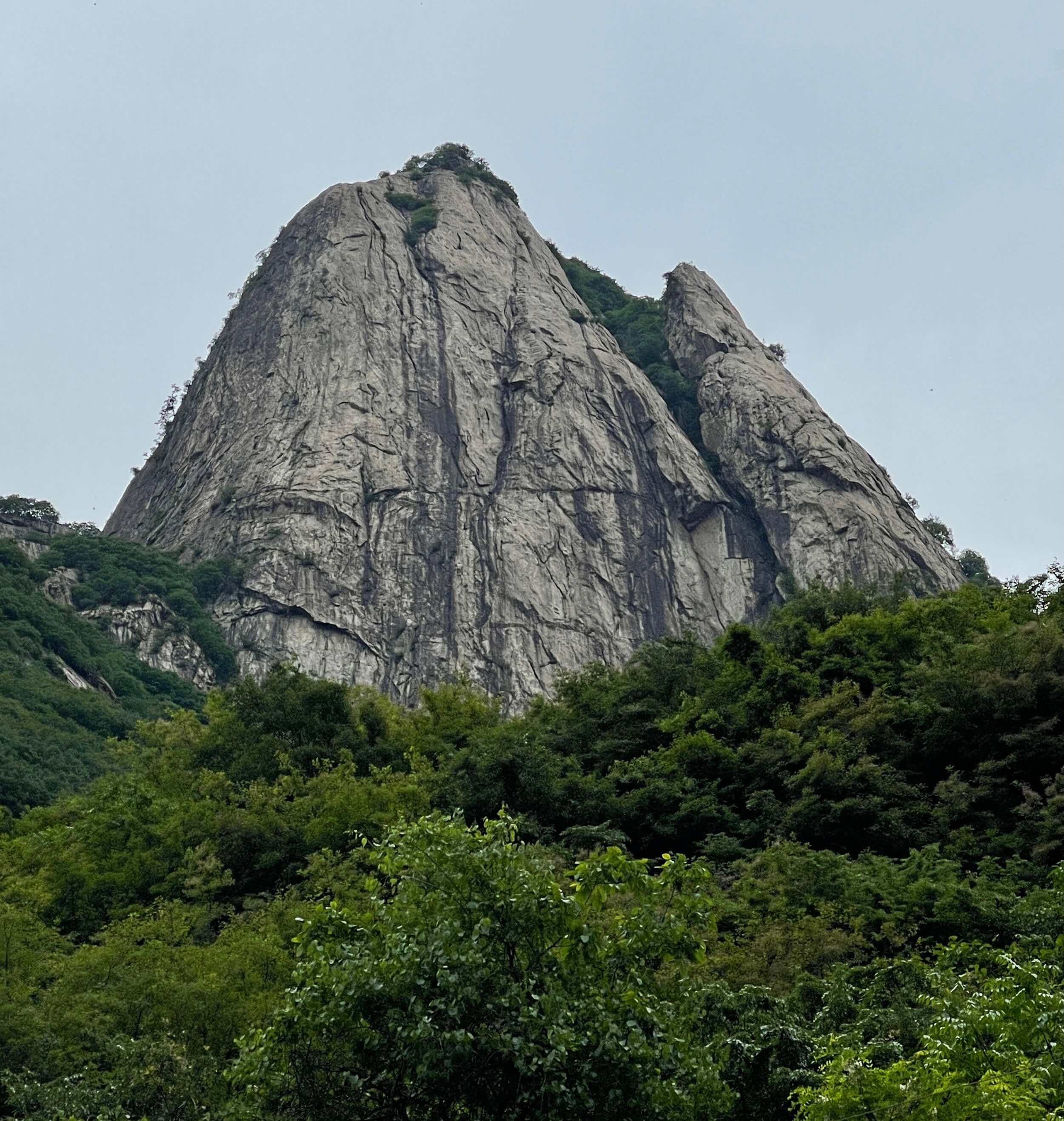
Blue Glacier, a peculiar name for a rock route covering hundreds of metres of golden granite slab, is one of two routes on ~2200m Eggplant Mountain, the other being Elf Fingers 精灵手指, a seldom-climbed trad line. The routes were opened in 2016, and are perfect representatives of the wonderful growth in mountain sports and related development which has taken off in China. Blue Glacier covers 520m over 19 pitches, and goes at 5.12a/A0.

Our climb began with a delayed flight from Shanghai to Xi’An, the provincial capital of Shaanxi. Shaanxi is known for the Terracotta army excavation, for the ancient city walls of Xi’An, and for Hua Shan. Hua Shan, one of China’s five holy mountains, is a touristic granite peak accessible by cable car and frequently painted in watercolor as a symbolic representation of China’s cultural landscape. Nearby Xi’An are rural valleys walled by impressive mountains of sheer granite with an elegant aesthetic to rival that of more famous Hua Shan, but undeveloped for tourism. Eggplant Mountain stands deep within one such valley, past a large hydro dam. Because of the dam infrastructure, the road in is only accessible by road after 6:30 p.m.; we were able to access the road early by contacting a local villager in advance for permission. The beginning of the roadside approach hike to Eggplant mountain can be found at coordinates 33.95422, 109.11861.
Day 1: We drove for around 90 minutes from the airport, stopping for food and water along the way. We parked our rental car nearby a guesthouse by the base of the approach hike, sorted out our equipment, and began the bushwack up to the wall. The approach hike was extremely well marked with red trail tags, and took us roughly 45 minutes to ascend. While quite overgrown, the trail tags made the way clear enough to easily follow.
Once at the wall, we split into two teams, and climbed the first four pitches to a forested bivvy ledge. While we hauled our supplies up using a pulley system, in hindsight we had light enough equipment and food needs that climbing with packs on would have been a preferable strategy. Hauling cost more time than climbing for the first four easy pitches, and was exacerbated in difficulty by the low-angled slabby rock generating friction on our bags.
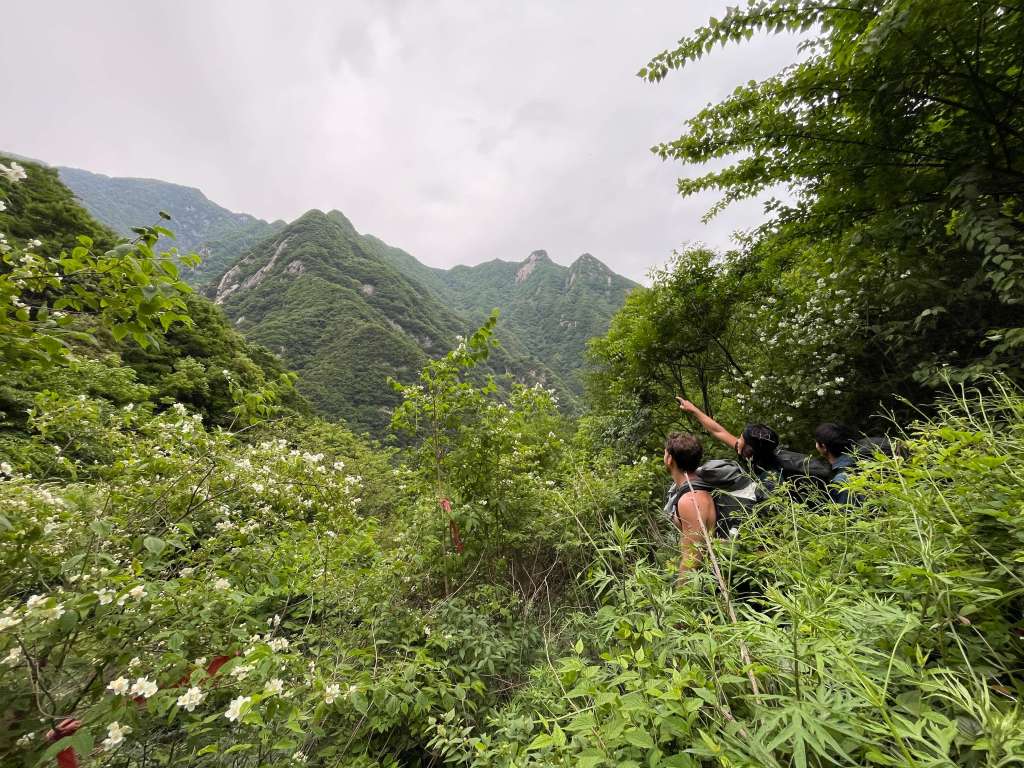
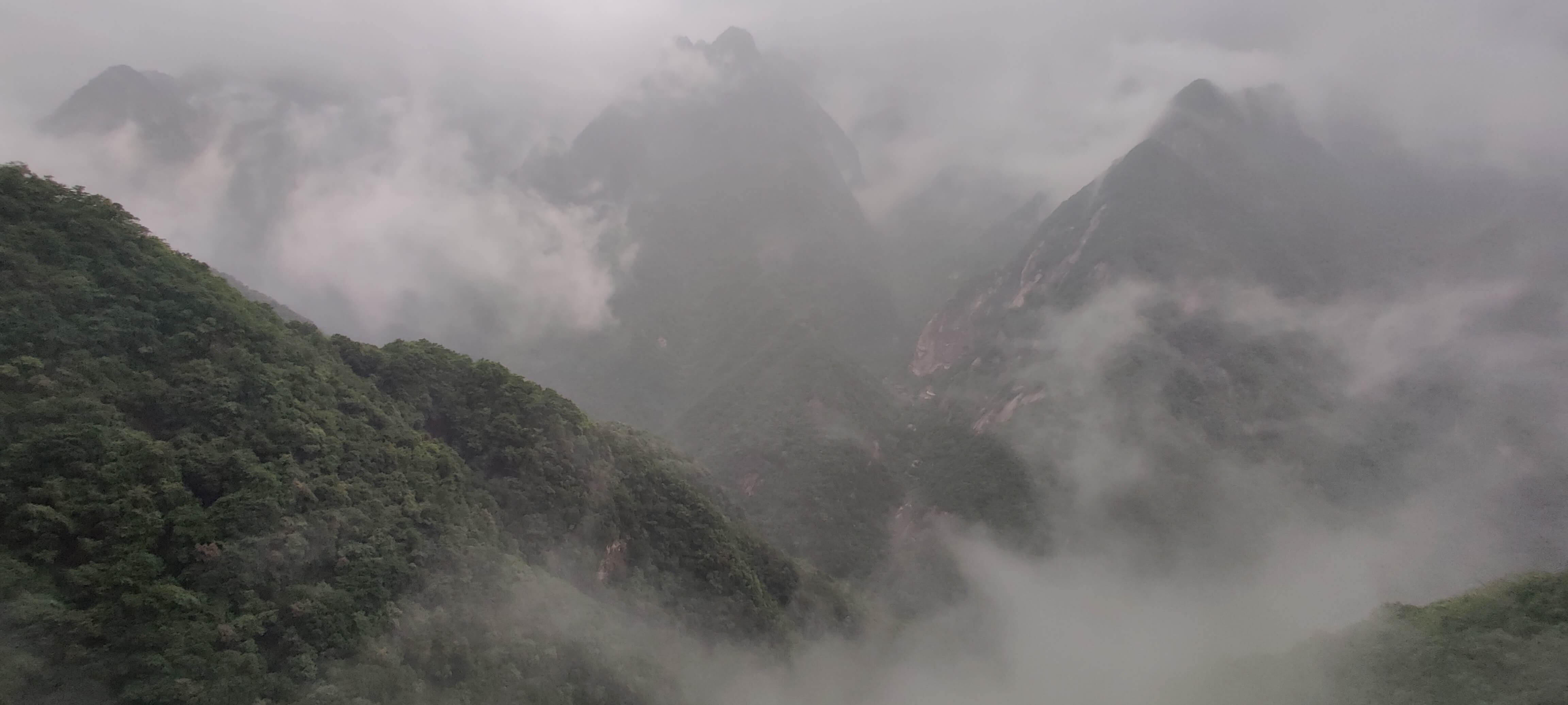
Surrounded by mountains. 
Bushwack approach. 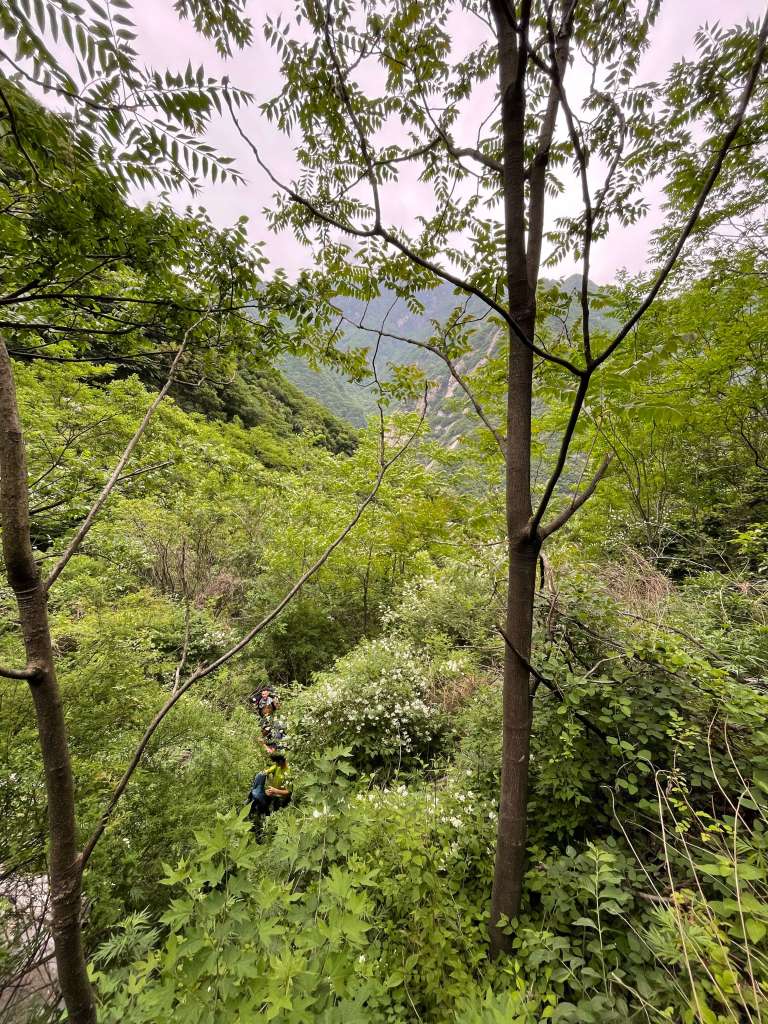
Bushwack approach.

We arrived at the bivvy ledge by nightfall, and got busy eating as much of our food as we could. We slept under the stars with harnesses on, anchored to a tree. The bivvy ledge has a shallow ceiling above it, and while the ledge is small, it would remain dry in rain.
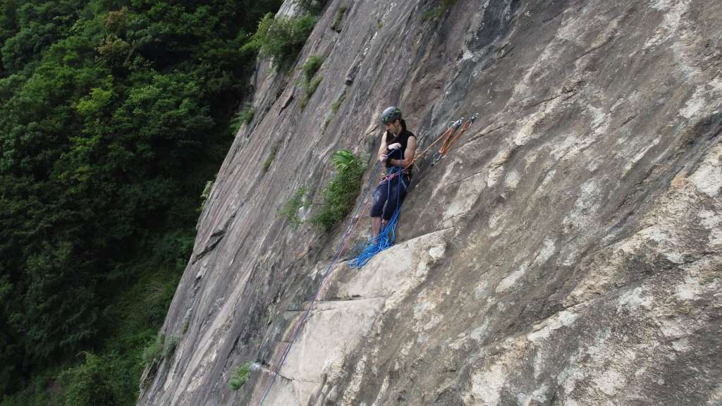
Ascending the lower ‘big slab’ on day one. 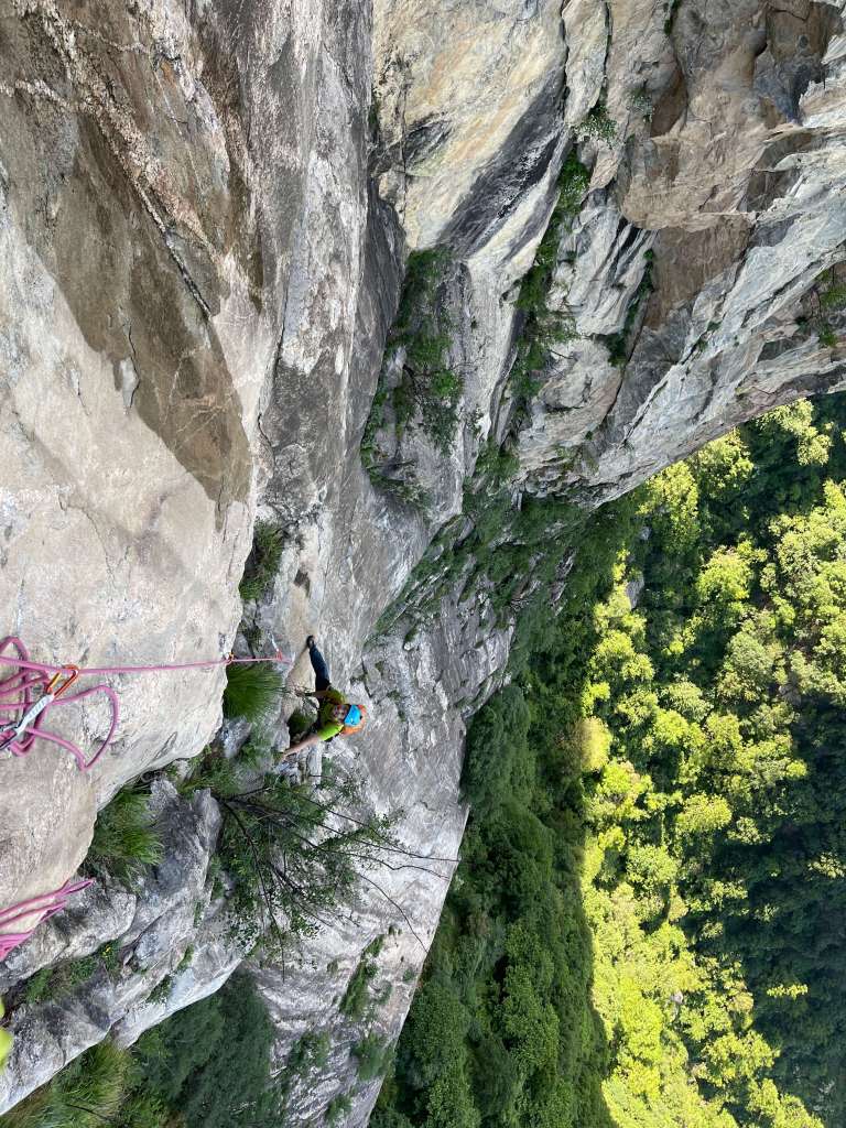
Ascending the upper wall on day two.
Day 2: Our itinerary for the main climbing day was as follows;
4:45 a.m. Wake up
5:15 a.m. Start preparing
7:40 a.m. Begin pitch 5
2:20 p.m. Arrive at the large ledge below pitch 19, spend almost an hour finding pitch 19
3:20 p.m. Arrive at the top of pitch 19, summit
We didn’t make a focused effort towards sending each pitch, and aided where we failed to onsight in order to keep moving. The 12a crux pitch wasn’t too bad, involving only one tricky, reachy move to a high bolt placement. Pitch 19 wasn’t easy to find, and involved walking through the exposed forest behind the ledge at the top of pitch 18 for some five to ten minutes. We were able to access the base of pitch 19 by walking to climber’s right. Overall the quality of the rock on the route was extremely good, albeit dominated by slab climbing with thin hands and feet.
We raced against rainclouds the entire day, with a little bit of light drizzle hitting us here and there on the way up. The sky properly opened up as we began our descent, and we completed the rappels in torrential downpour and driving wind. We got down in 8 simul-rappels, using two 70m ropes; one for pitch 19, five for the main wall to the bivvy ledge, and two for the big lower slab.
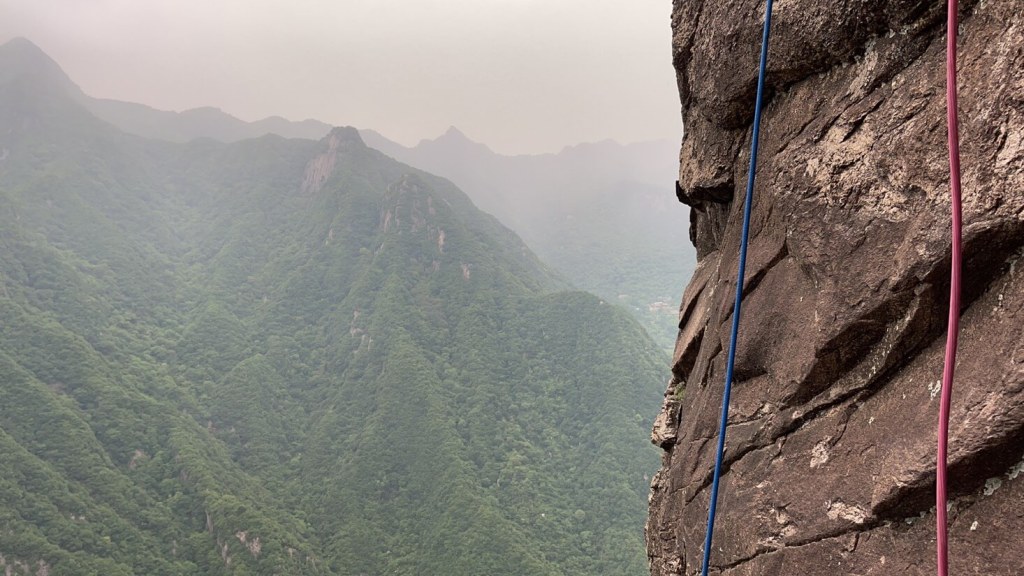
8 simul-rappels to the ground. 
Rapping down in steady rain.
The hike back to our car was a miserable affair, slippery and much more difficult in the dark. By the time we began hiking all four of us were completely soaked, drenched to the skin. Our boots were filled with water, our ropes were waterlogged and twice as heavy, and we were freezing cold – but we were ecstatic to have made it up and down safely! The descent hike took us almost two hours, and wouldn’t have been possible without the red trail tags.
Back in the car, our adventure wasn’t over yet. The wind and rainstorm had knocked a large tree down, blocking the only road out of the valley. Drenched, all of our jackets completely waterlogged, we couldn’t leave the warmth of our car heater for more than a few minutes without beginning to shiver uncontrollably with cold. I made an initial foray out into the wind to take stock of the tree and vainly push at it with a few farmers who had arrived. Back in the car minutes later, my teeth chattering, it seemed like the situation was hopeless. As another car full of locals arrived, however, we realized that we could make an impact if we all joined in – the four of us ran out of the car, yelling, got behind the tree with the others, and levered it off of the road in a minute flat!
We foolishly decided to stay in the city rather than at the airport, and discovered too late that very few of the hotels in Xi’An would take foreigners. It took us hours to find a place to stay where we could also park our car, leaving us with only a few thin hours of sleep before flights back to Shanghai the next morning.
Here is the official topographic map and guide to Eggplant Mountain (in Mandarin):
