
Imja Tse
Imja Tse is a 6183m mountain located in the Khumbu region of the Himalayas. Despite being a significantly prominent mountain by the standards of any other country, Imja Tse is completely dwarfed by the imposing south face of Lhotse, the 8516m fourth highest mountain in the world which stands just a few kilometers to the north. As Imja Tse is further surrounded by higher 6000m and 7000m peaks, when viewed from afar it is easy to understand the mountain’s colloquial name of ‘Island Peak’; it does indeed resemble an island within an icy, mountainous ocean. Imja Tse is designated as a ‘Trekking Peak’ by the Nepal Mountaineering Association, which has practical implications for accessible and affordable permitting. While the ‘Trekking Peak’ label does not implicate the difficulty of an ascent (some technically challenging climbs such as Cholatse are also designated as ‘Trekking Peaks’), Imja Tse by its normal route is not a difficult climb. With fixed ropes and the infrastructure associated with the normal climbing seasons in place, it probably goes at around a PD+ grade.


Going into my decision to climb Imja Tse in January and February, the middle of Nepal’s winter, involved several variables. I had been interested in a winter Himalayan 6000m climb for some time, and in 2018 had made an attempt in northern India. Extreme cold, incorrect route beta, and fatigue had all contributed to a non-summit. Despite being unsuccessful, the trip had been good experience and a successful test of my winter equipment. I intended to return to India in the winter of 2019 for a solo attempt, but thwarted by passport issues and a bad chest cold I never made it out of China. In 2020 mountaineering permits for India looked uncertain; in part due to instability in the Kashmir region, in part due to environmental conservation efforts involving the closure of certain valleys. Further, a solo attempt for 2020 was off the table for me – a close climbing partner and friend had disappeared in the mountains in late 2019 while climbing solo on a moderate route, and his death had deeply impacted my perspective.
As a result of this confluence of considerations the possibility of winter climbing in Nepal arose. While I could only find limited information pertaining to winter ascents of the lower mountains in the Khumbu, I knew that it was possible. After all, all of the area’s 8000m mountains had seen winter ascents! Nepal’s permitting system, while expensive (compared to alternatives in Central Asia or South America) during the normal pre-monsoon and post-monsoon seasons, is significantly cheaper for winter mountaineering permits, and tourist support in general becomes less expensive during the off-season. While soloing in Nepal is possible, the nature of the bureaucratic red tape and well established tourist industry make it very smooth and affordable to arrange an experienced 1:1 local partner; without any friend available on the same time frames as I, this had become an essential consideration for me. The prospect of a winter ascent without any crowds, without any fresh fixed ropes, and with the challenging weather conditions of winter began to look very appealing.
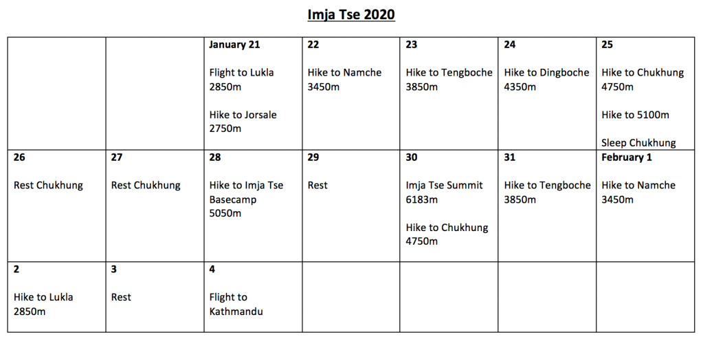
Schedule and Trip Report

The trip began with arrival in Kathmandu and a flight to Lukla two days later. Kathmandu was an enjoyable introduction to Nepal; colorful, flavorful, full of life. The atmosphere, pedestrian traffic, and general feel of the city were similar to my experiences in Indian Kashmir, but past the surface Kathmandu is very much its own unique place – for one there are images and services related to the Himalaya and to Mount Everest visible literally everywhere one looks in the tourist district. I had no issue getting some simple preparatory shopping completed, and had time to meet a Nepalese friend whom I’d known for many years when we had both lived in Northwest China.
I’d arranged the climbing, trekking, and camping permits in advance through a tourist agency, and they were all in order the day after I arrived – an enormous time-saver for marginal additional costs. I met my climbing partner, Ashok Tamang, and we spent a few hours talking shop and discussing our plans after going over each other’s equipment. At first impression Ashok was quite competent, and definitely knew what he was doing when it came to climbing – in the days to come we would spend hours upon hours sharing rock climbing and mountaineering stories. We quickly agreed upon the crevasse safety and basic technical gear that we’d both carry on the mountain.
Day 1: The flight to Lukla departed quite early in the morning, and after a harrowing landing on the sloping, minimalist airstrip of “the most dangerous airport in the world”, we found ourselves in Lukla at 8 o’clock in the morning. 11km of straightforward hiking and 5 hours later, we arrived in Josalle at 2750m where we would spend the night.
Day 2: The morning of the second day it registered with me that climbing in the Khumbu Himlaya would be unlike anywhere I’d ever been before. The teahouse in Jorsalle had served us a hot dinner the night before, and after sleeping overnight on a bed with a mattress we were greeted with a hot breakfast in the morning. Bar two nights spent waiting out winds at high camp, we would lodge in teahouses throughout the entire approach hike – a level of comfort, service, and nutritional consistency the likes of which I had never experienced before. The abundance of tea-houses in the Everest region makes approach hikes extraordinarily comfortable and, dare I say, quite easy. Sleeping in a warm bed every night, enjoying three hot meals per day, having steady access to bottled drinks, and having the option of very affordable porter support makes acclimation significantly more comfortable than anywhere else I have ever climbed.
Given the winter season there were only very few other people around; mostly Chinese nationals going trekking for their Chinese New Year vacation. Despite the lack of crowds, I could tell that the infrastructure was in place to support many thousands of tourists. Indeed, when entering the national park on this second day I was allowed to see the park’s data – tens of thousands swarm the area during the peak climbing and trekking seasons. I can only imagine the crowding, noise, and chaos which this must entail. Paradoxically, despite remaining an economically undeveloped rural area, the Khumbu is highly developed with tourist infrastructure in the form of guesthouses, restaurants, shops, and bridges – the seasonal tourist industry is the backbone of the region’s economy. I felt happy to have come in the middle of winter for my first visit.
On the second day we hiked 4.5km to Namche Bazaar at 3450m. Namche is the central settlement of the Sherpa people, and despite the lack of road access is like a small touristic city. Almost all of the facilities were closed for winter, but several comfortable guesthouses remained open – the food here was the best, by far, of the guesthouses I would stay at in the Khumbu.
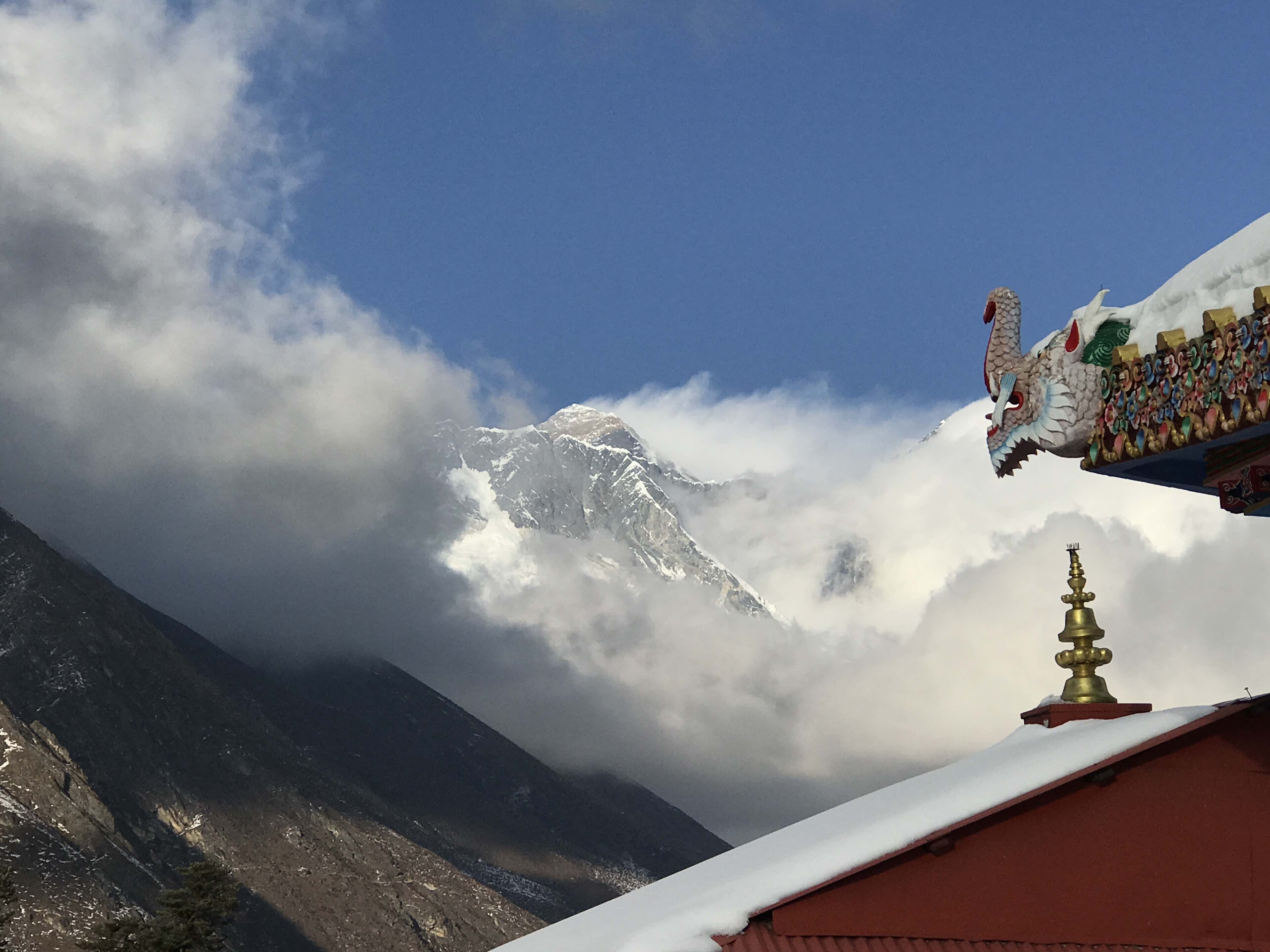
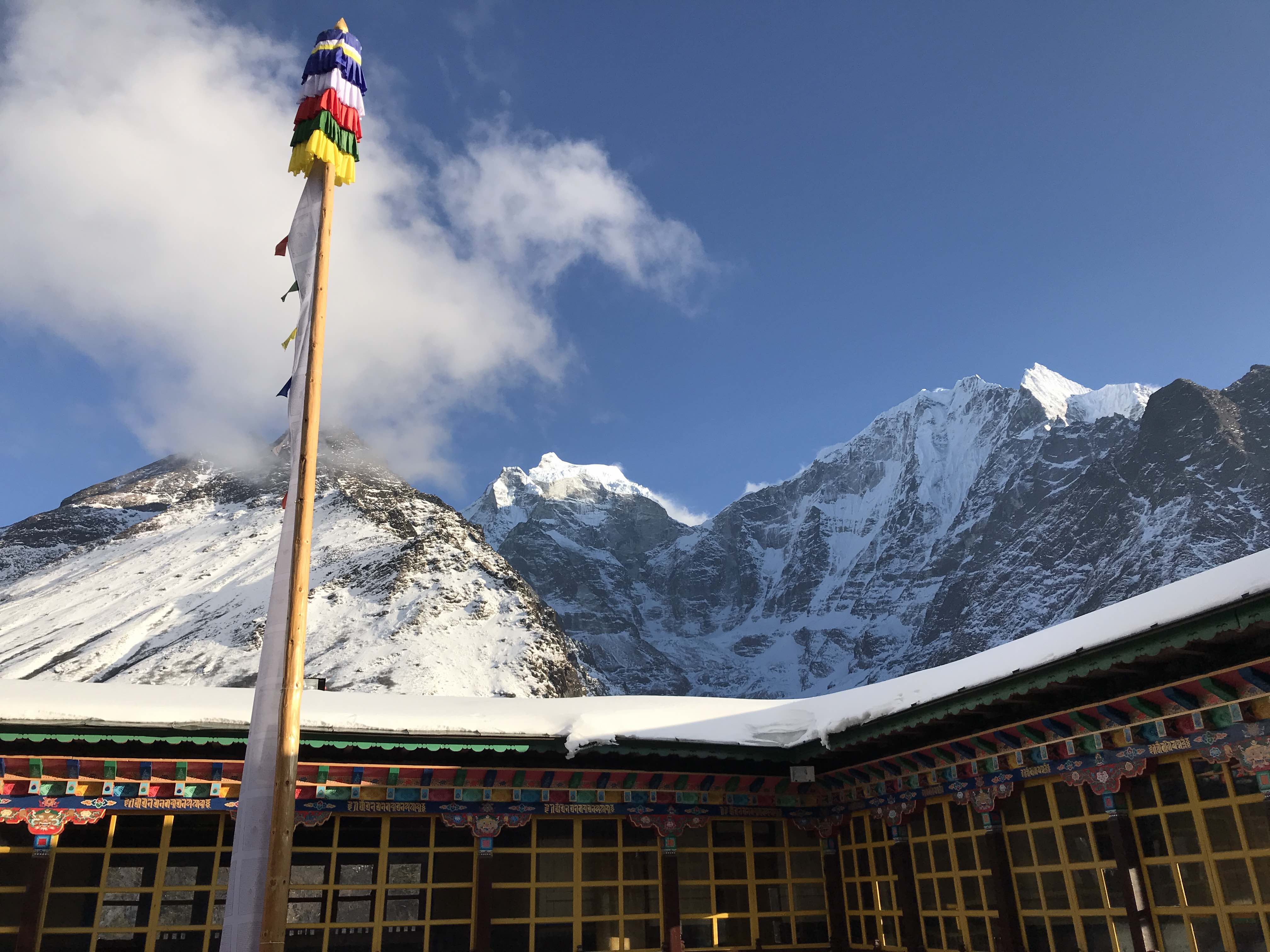
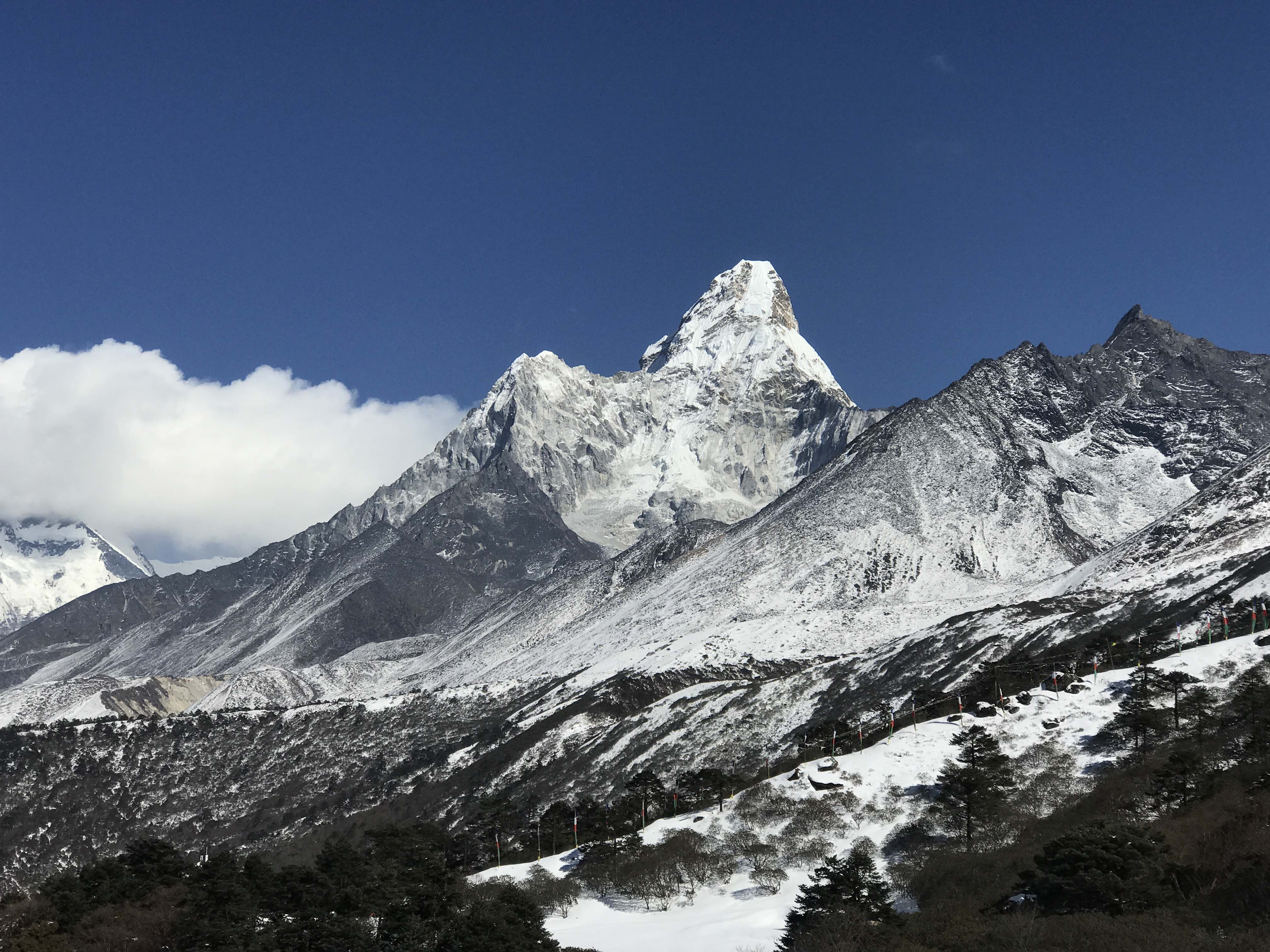
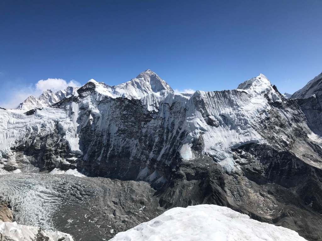
Day 3: A five hour hike through gorgeous evergreen forest took us to Tengboche monastary at 3850m. Good weather allowed for nice views of Mount Everest, Lhotse, Ama Dablam, Thamserku, and Khangtega. Ama Dablam appears tantalizingly close from Tengboche, and was absolutely stunning to observe in the clear winter air. A Spanish team was on the mountain this winter, and would put several members on the summit just a few days after I left the monastery. The monastery itself was empty, the monks having all descended for the winter, but I was able to spend some time taking in its architecture and Buddhist artwork.


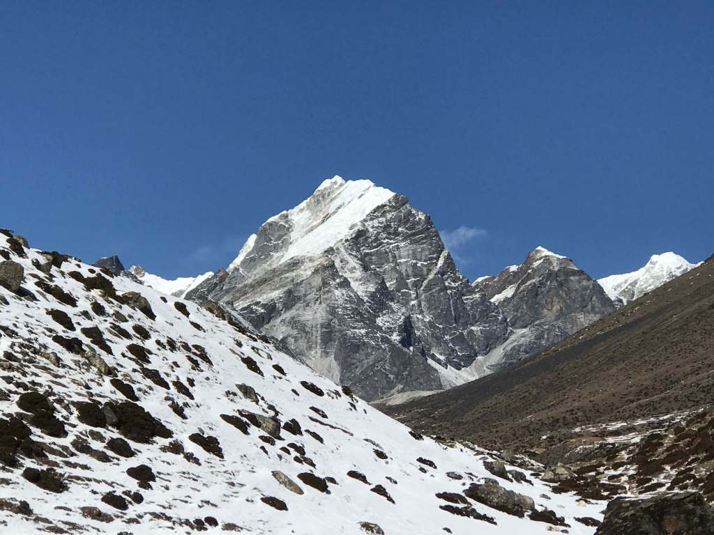
Day 4: A three and a half hour hike to 4350m Dingboche, where we stayed in a lovely guesthouse with a large sunroom on the roof. Acclimation was going well, but this was the first night where I began to feel the effects of altitude. This day’s trek offered spectacular views of Cholatse, Taboche, and distant Lobuche East.
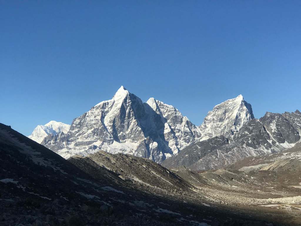
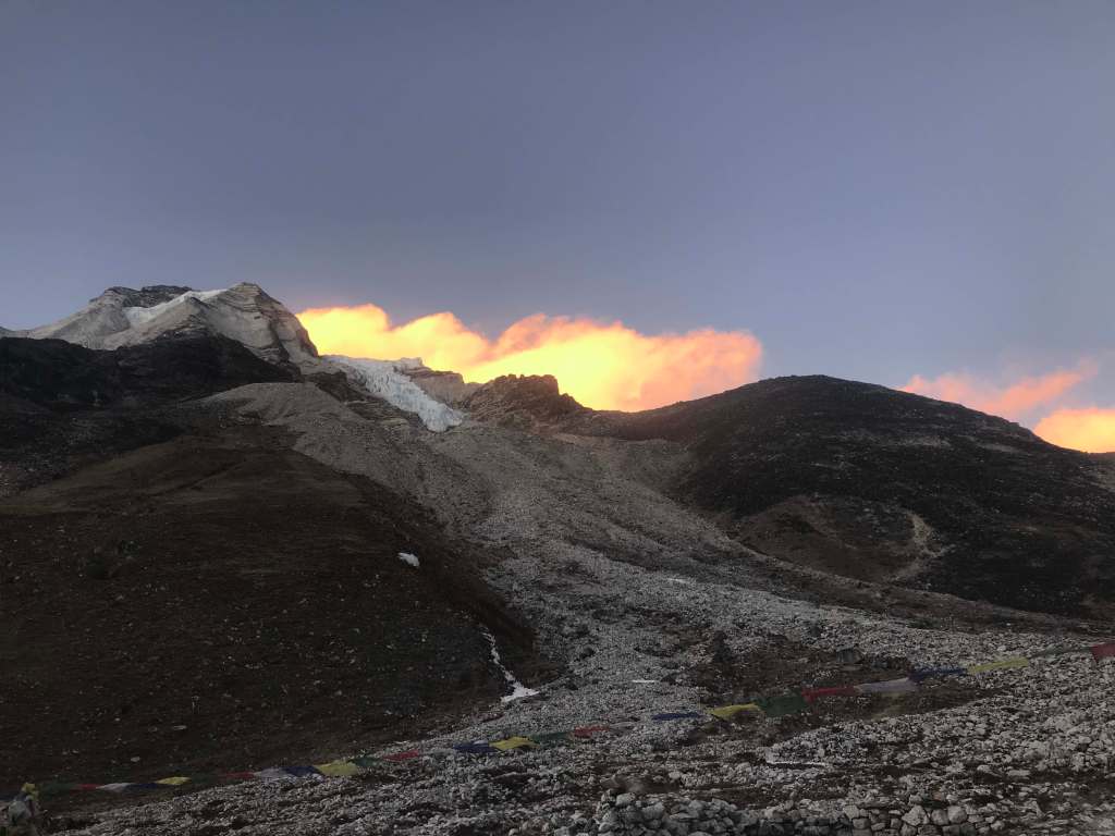
Day 5: A one hour and fifty minute hike took us to 4750m Chukkhung, the highest settlement below Imja Tse. The hike from Dingboche follows relatively close to the Lhotse South face, and passes the Jerzy Kukuczka memorial. After arriving in Chukkung I made a quick acclimation hike to 5100m on the Chukkhung Ri hill behind the settlement, taking about two hours round-trip. Despite this hike being quite easy, the winter wind and cold began to make themselves felt. Chukkhung would later prove to be bitterly cold at night. That said, having a bed and a teahouse to stay in at Chukkhung made the approach hike an absolute luxury to this point.
Day 6: Resting in Chukking for acclimation. I met two other Canadian climbers headed for Imja Tse. They were a few days ahead of my schedule, and intended to move up the next day.
Day 7: Resting in Chukking for acclimation. There were high winds this day, and an uninspiring weather forecast calling for 100km winds for the following days. The two Canadians and one Chinese moved up today, in preparation for a summit bid.
Day 8: A two hour hike to Imja Tse basecamp at 5080m. The two Canadians and one Chinese climber had summited in the morning, but had battled horrific wind conditions which nearly shut them down. The Canadians told me that the beginning of their climb in the dark had been colder than their experience on Denali, due to the wind. Basecamp was windy when we arrived, and the forecast didn’t look promising. We pitched our tent and hunkered down for an afternoon of rest. That evening winds were howling on the upper mountain, and despite the sheltered location of basecamp our tent shook profusely with each gust. After a brief discussion Ashok and I agreed to wait for another day – not an impact given our extra food supplies and spare time.
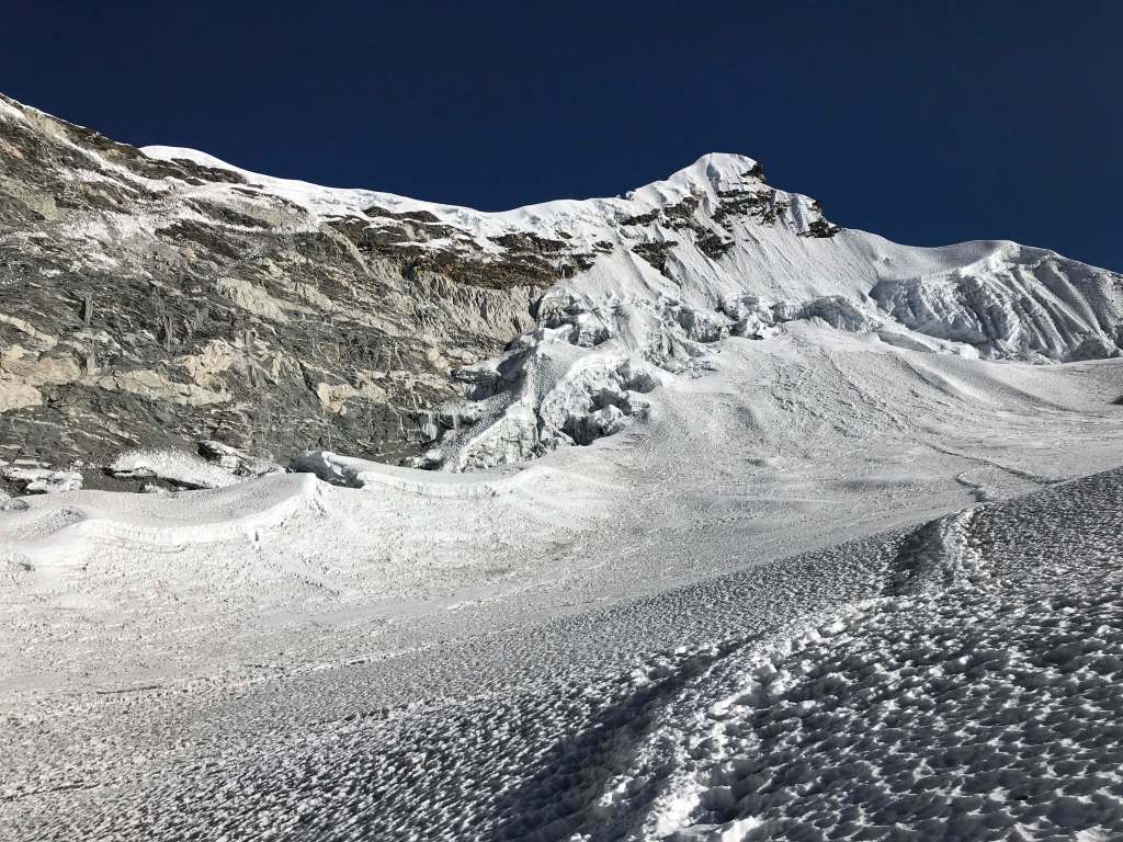
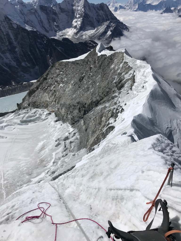
Day 9: We departed our tent at 3:15 a.m. under a clear sky and low winds. The route first crosses a large moraine, circling around the mountain to the east before heading up a gully of good quality rock. There was some class 3 scrambling, but generally this section was fun and easy. After topping out of the gully, we finally had a clear view of Imja Tse’s glacier and icefall. We crossed a narrow and exposed ridge of good rock to the toe of the glacier, where we stopped to hydrate and put on our crampons.
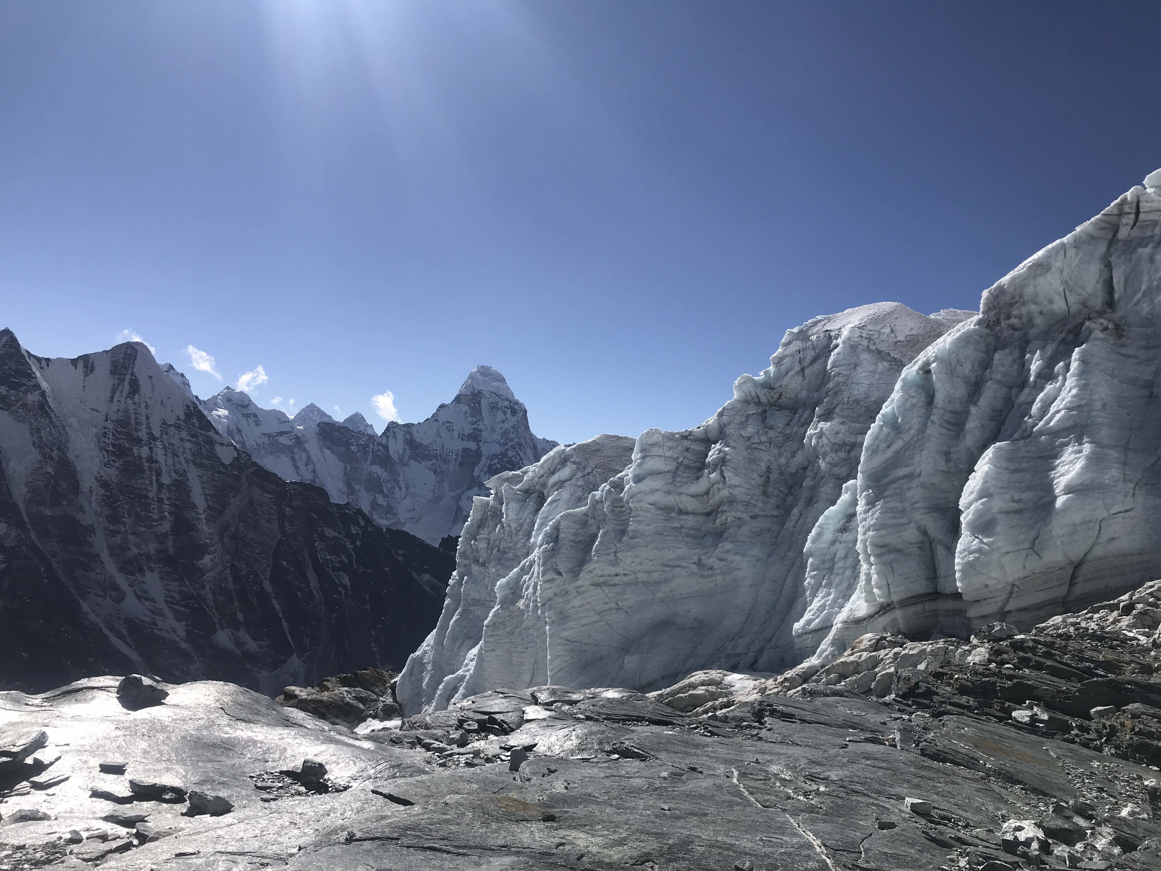
Crossing through the Icefall was interesting, in part because I was surprised at how dry the conditions were. High winter winds and low precipitation meant that the glacier was particularly ‘naked’, leaving all of the crevasses highly visible and open. It looked as if the mountain hadn’t seen snow in weeks. An old boot track was visible; it had melted out from the high traffic of the autumn high season and then frozen into place. The icefall wasn’t difficult, and reminded me of the lower glacier traverse right out of basecamp on Pik Korzhenevskaya in Tajikistan. It was bitterly cold, and I needed to don my down pants and storm parka.

Past the icefall we gained a large plateau below Imja Tse’s summit ridge. The glacier was bone-dry and opened up, bergshrund crevasses gaping. The ridge itself was so barren and exposed that an ascent wouldn’t be viable – the clear route to take went straight up the face of the summit pyramid. The frozen boot track marking the way like a road chopped into the ice was something I had never seen before. In hindsight, this was perhaps the driest glacier I have ever been on.
Crossing the plateau was trivial, and we soon found ourselves at the base of the face. A small ~5m ice step blocked the way, and the old fixed ropes on it looked unsafe. Ashok hadn’t been on the mountain since autumn and wasn’t sure of the ropes, so we agreed to avoid jugging the lines. From here I led on Ashok’s belay, avoiding the fixed ropes in favor of the 30m/8mm rope I’d brought, placing a single screw for protection. The step wasn’t difficult, but balance was a bit tricky given that I only had my 75cm ice ax. Above the step I anchored off onto two of the old fixed lines plus a second screw, and belayed Ashok up.
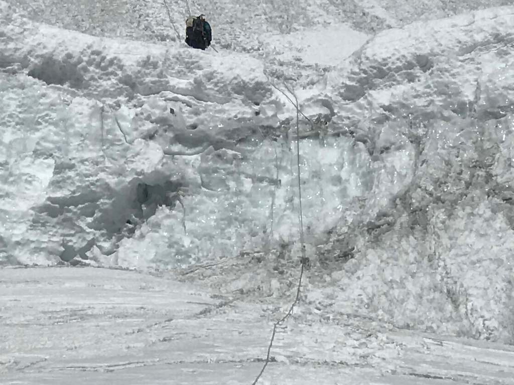
Directly above the little ice step we discovered a significant ~1m crevasse splitting the middle of the face. We agreed to belay the jump across on my anchor while clipping into the two dodgy fixed lines as a secondary backup. I went first, then belayed Ashok up after me.

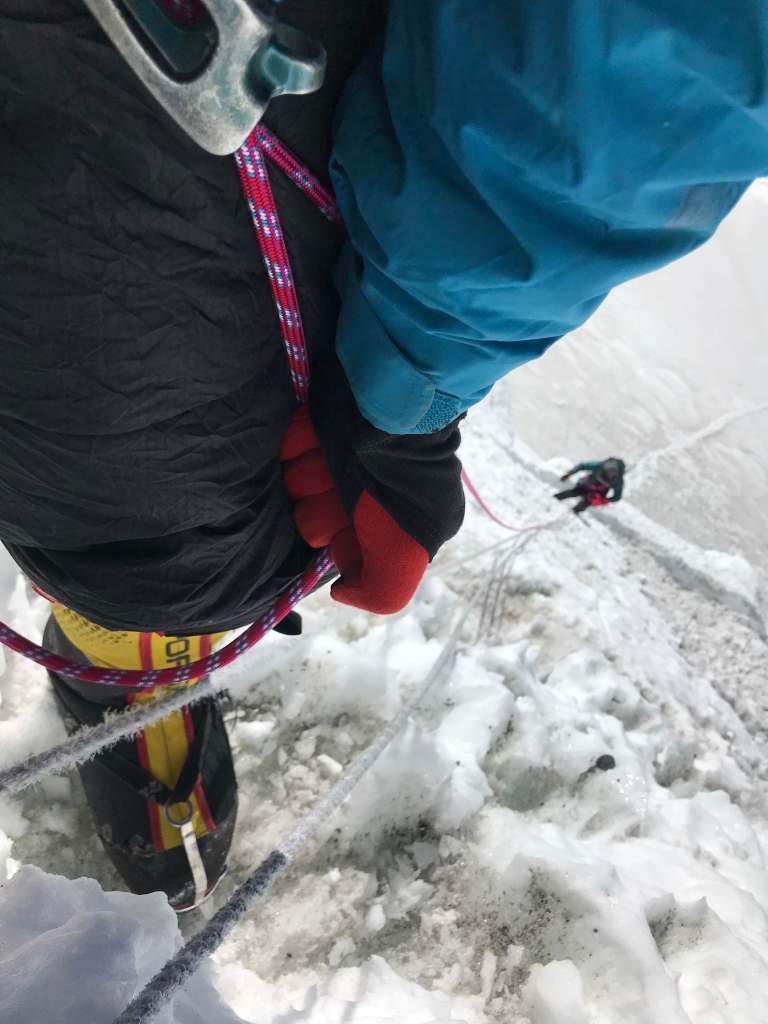
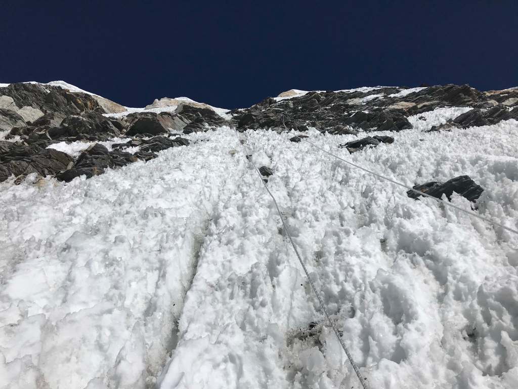
Above the crevasse the going was smooth, with a few straightforward sections of exposed low-angle rock. The conditions were very dry and icy, but the moderate slope wasn’t too difficult. I clipped into the old fixed lines as backup, but led the rest of the way up without an ascender; the fixed ropes were bleached white from sun exposure, and we were unsure of the state of anchors higher up. Never fully commit to an old fixed rope on the way up, without having had the chance to properly inspect anchors and integrity.
Before we knew it, there was nowhere higher to go. It was 11:15 a.m. and we had made it! The summit was decorated with some old prayer flags. A hefty boulder with an assortment of crooked pickets served as the anchor for the old fixed lines which we had been so dubious of. It was cold and windy at the top, and we stayed only long enough to take some photographs. With clear skies the views of surrounding mountains were exceptional.


After checking the anchor at the top, we opted to rap down on the two old fixed lines. They were somewhat frozen and fraying, making them a massive hassle to run through prussik and gear, but using two felt safe enough given that they were separately anchored the entire way down. The rest of the descent was quick, and soon we were back at our tent. We packed up and hiked back to Chukkhung, arriving at 7:15 p.m. The hike back was notable for the snowstorm which hit halfway in, making the path somewhat difficult to find.
Day 10: Exit hike from Chukkhung to Tengboche.
Day 11: Exit hike Tengboche to Namche.
Day 12: Exit hike Namche to Lukla – the final uphill stretch coming into Lukla was a nice workout.
Day 13: Rest in Lukla, waiting for our flight scheduled the next day.
Day 14: After many hours of delay, our airplane finally arrived in Lukla and took us back to Kathmandu, where we celebrated with a pair of tandoori chickens and some Everest beer. On return to Kathmandu the news that I had been reading about the COVID19 outbreak in China began to take on greater clarity; my return flights to Shanghai were abruptly cancelled by the airlines. I departed Kathmandu two days later on a flight to Canada, where I would spend an unplanned month before eventually making my way back to China. Two weeks after I departed Kathmandu the Nepalese government announced the shut down of the spring climbing season; there would be no April/May climbing in the Khumbu.
Other Images
Imja Tse icefall 
Imja Tse basecamp 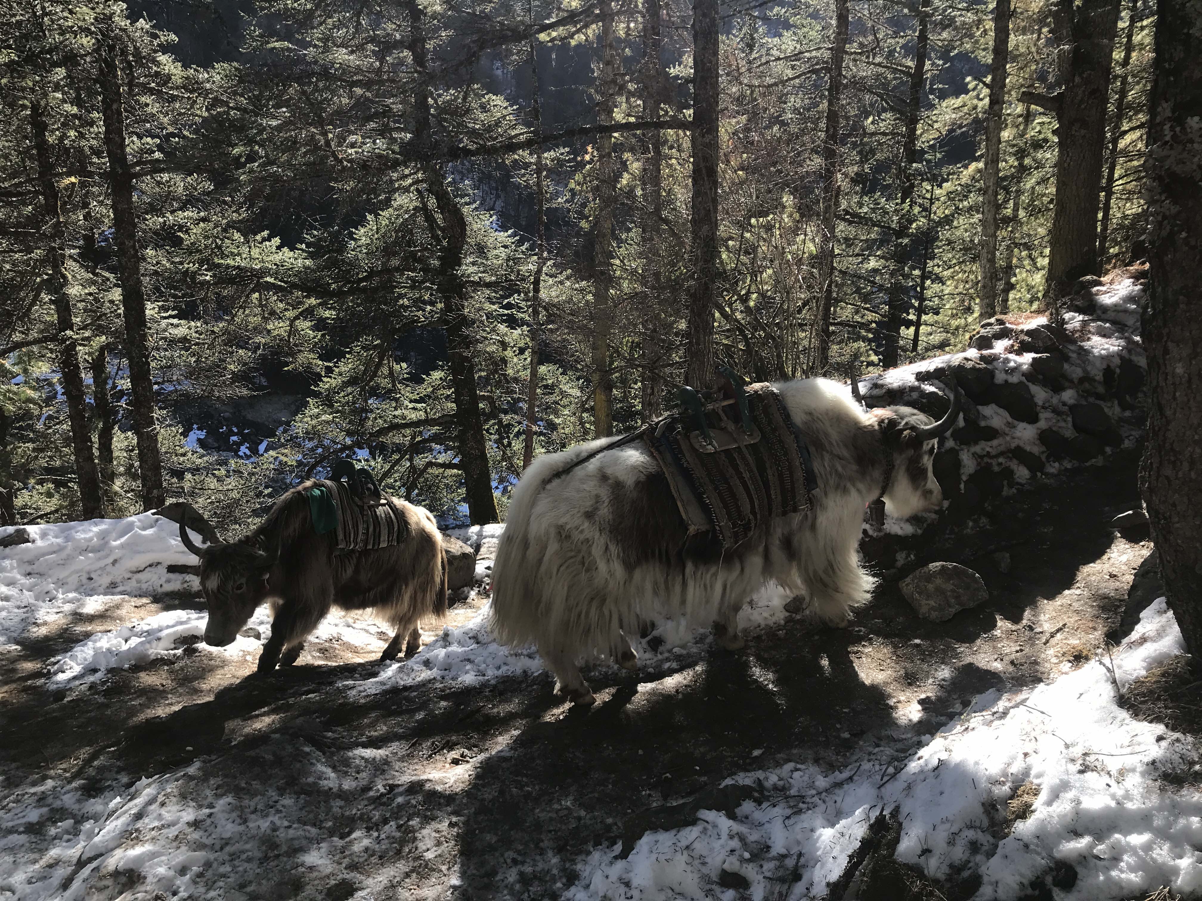
Yak train 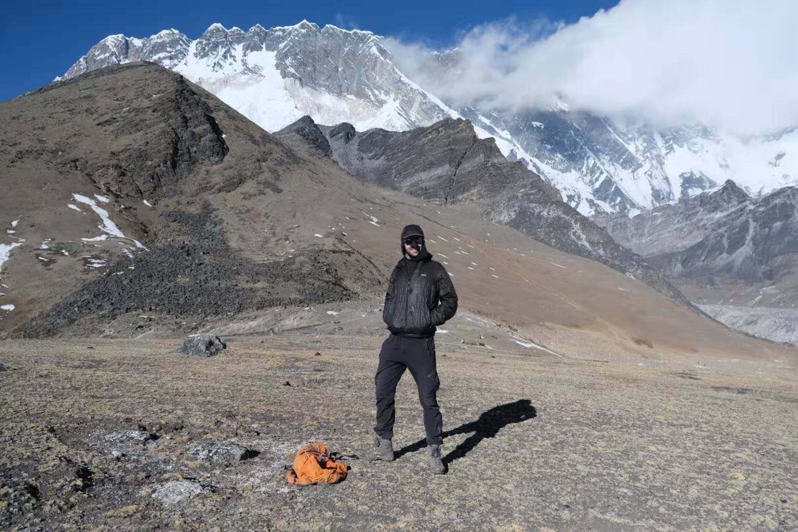
Acclimation hike 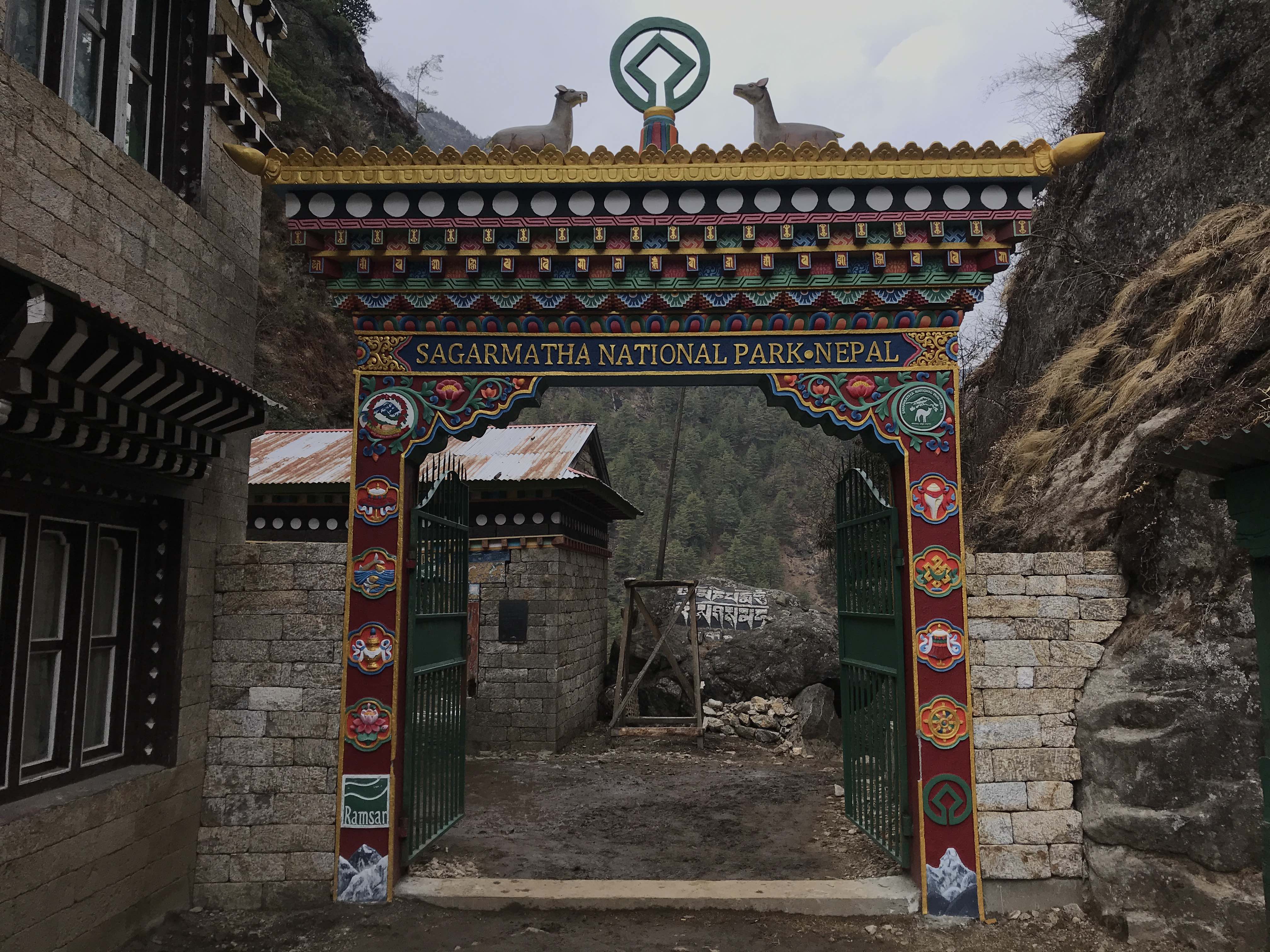
Park gate 
Kukuczka Memorial 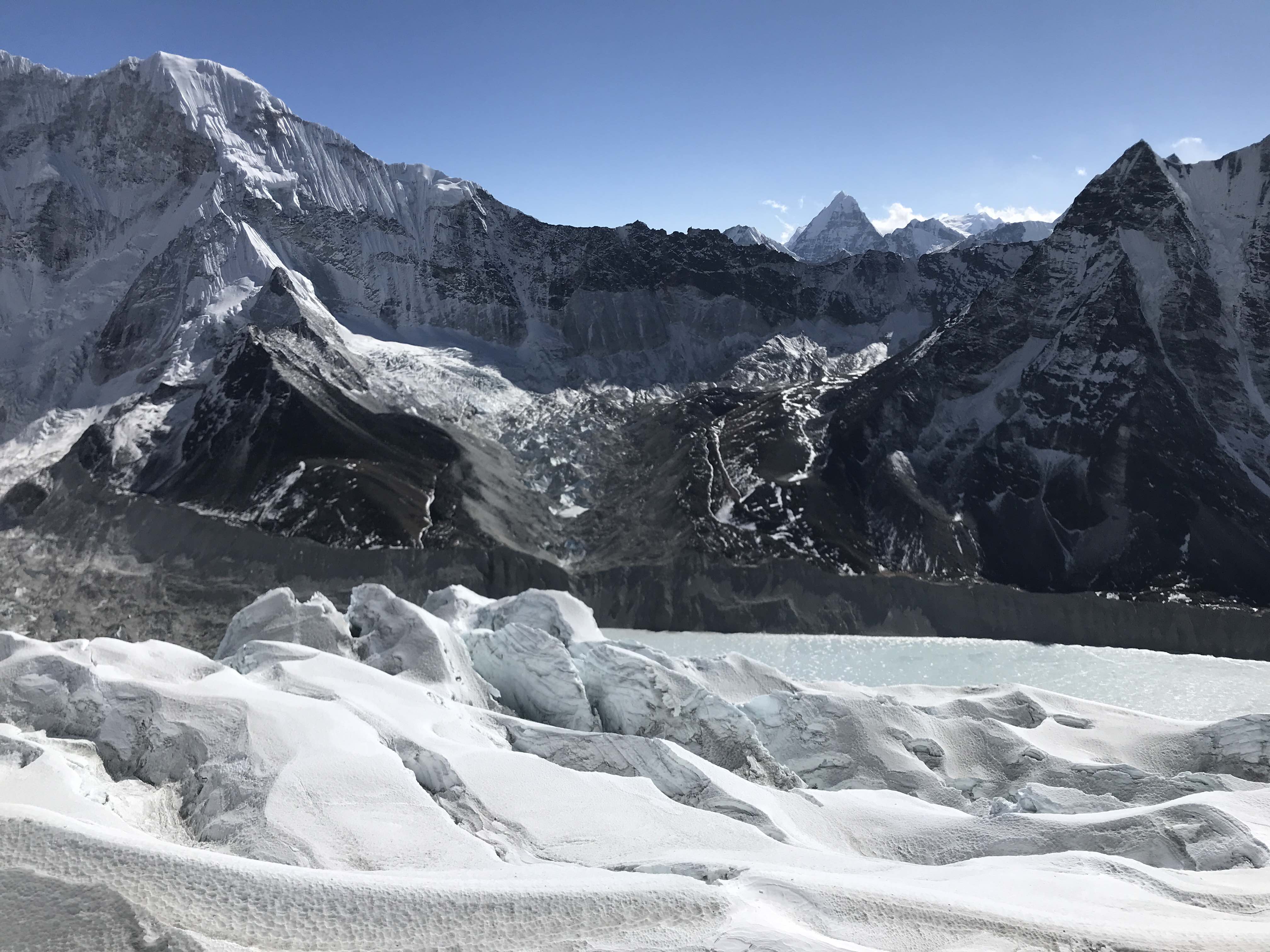
Imja Tse icefall 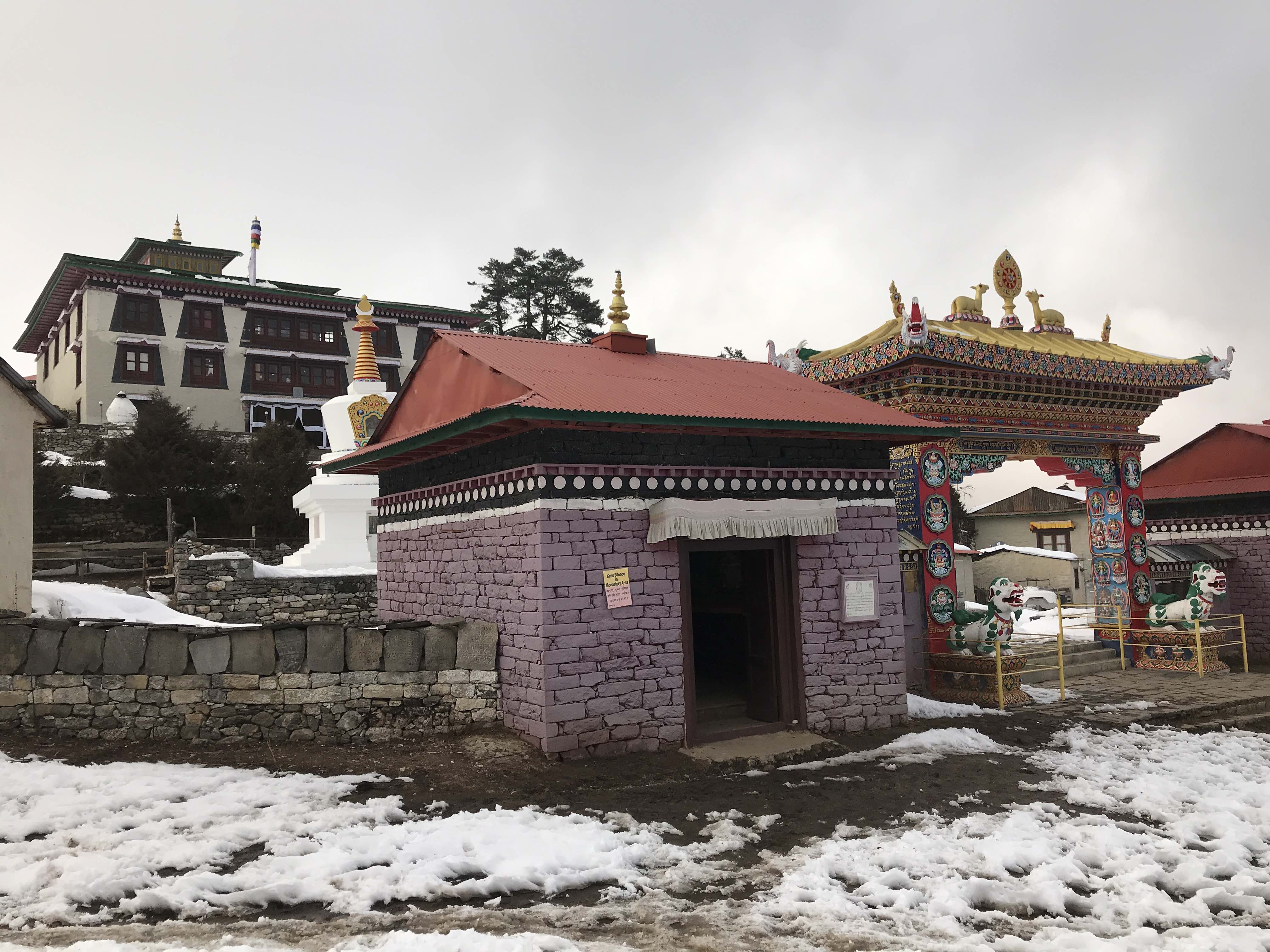
Tengboche Monastery 
Mule train 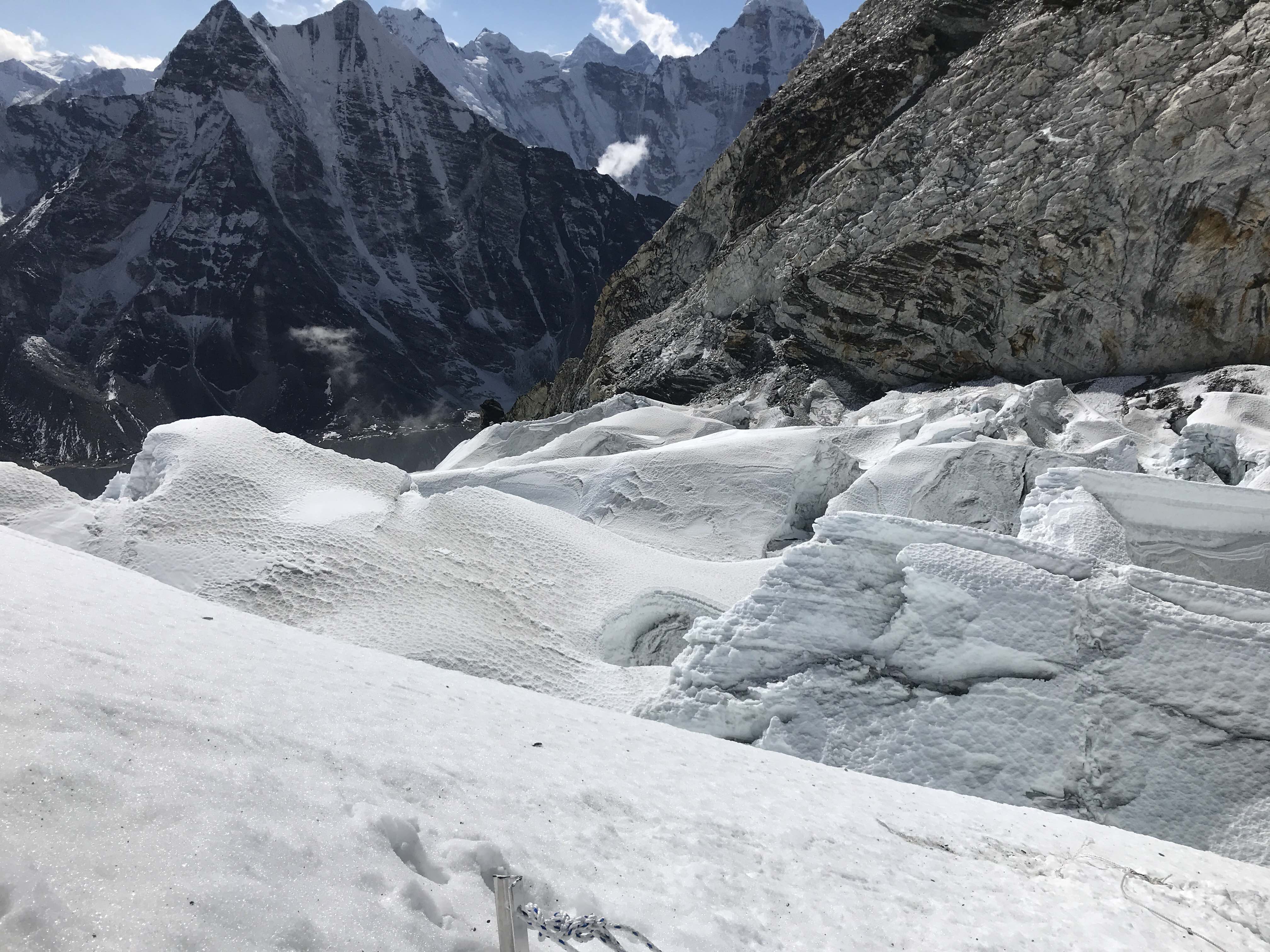
Imja Tse icefall 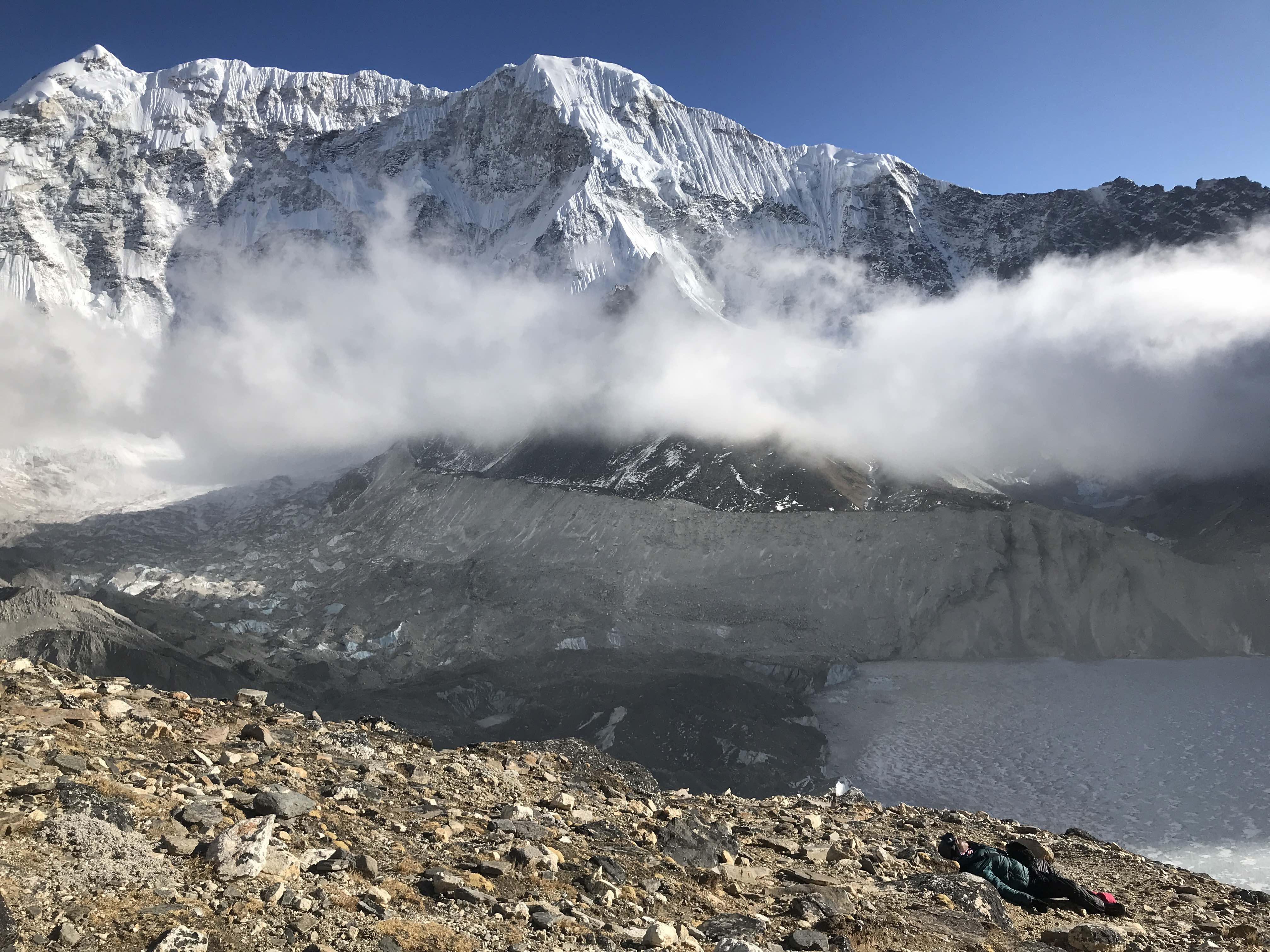
Imja Lake 
Stupa, Ama Dablam 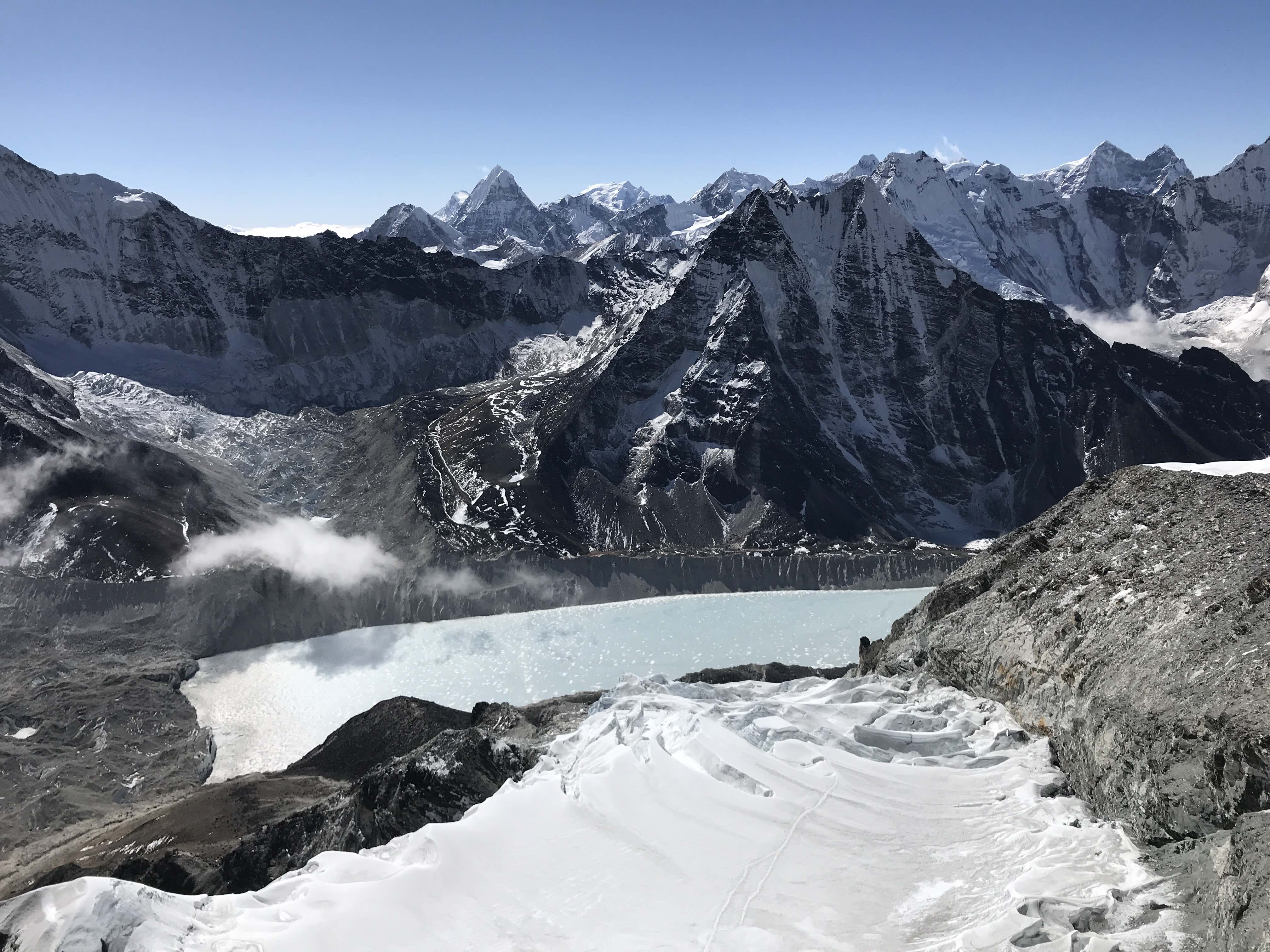
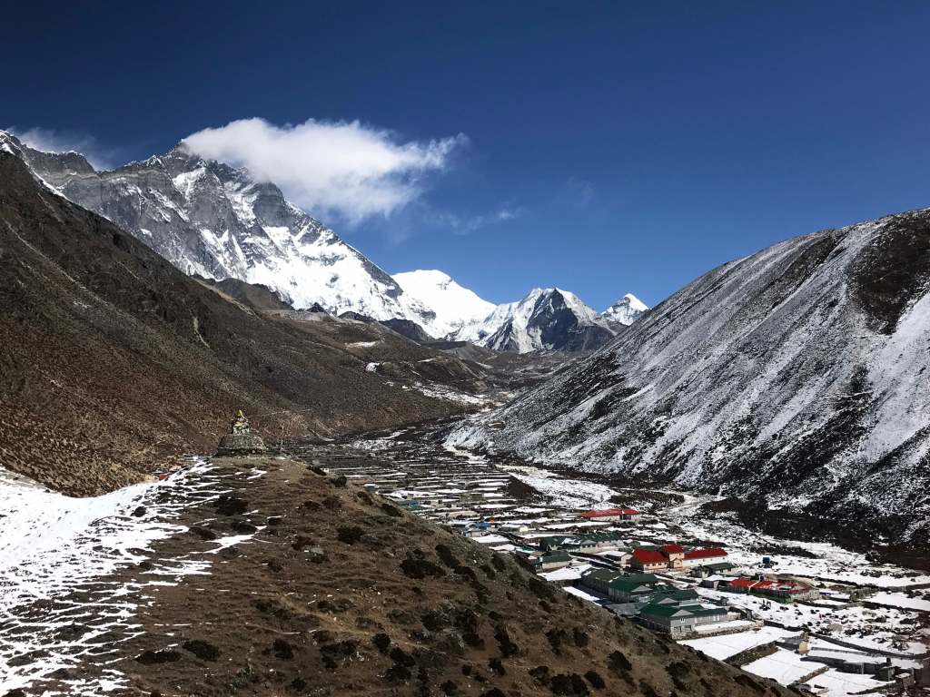
Imja Lake Imja Tse, Chukkhung 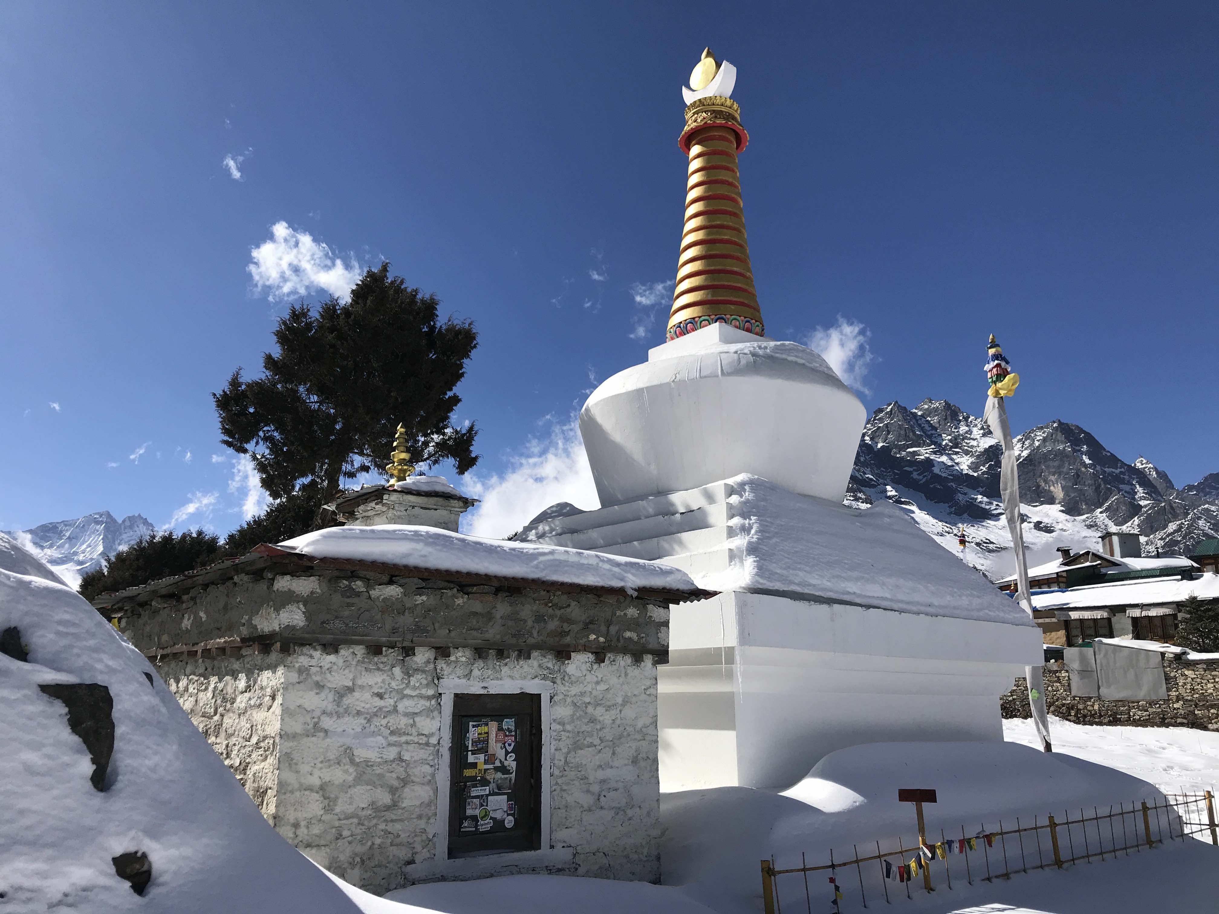
Stupa 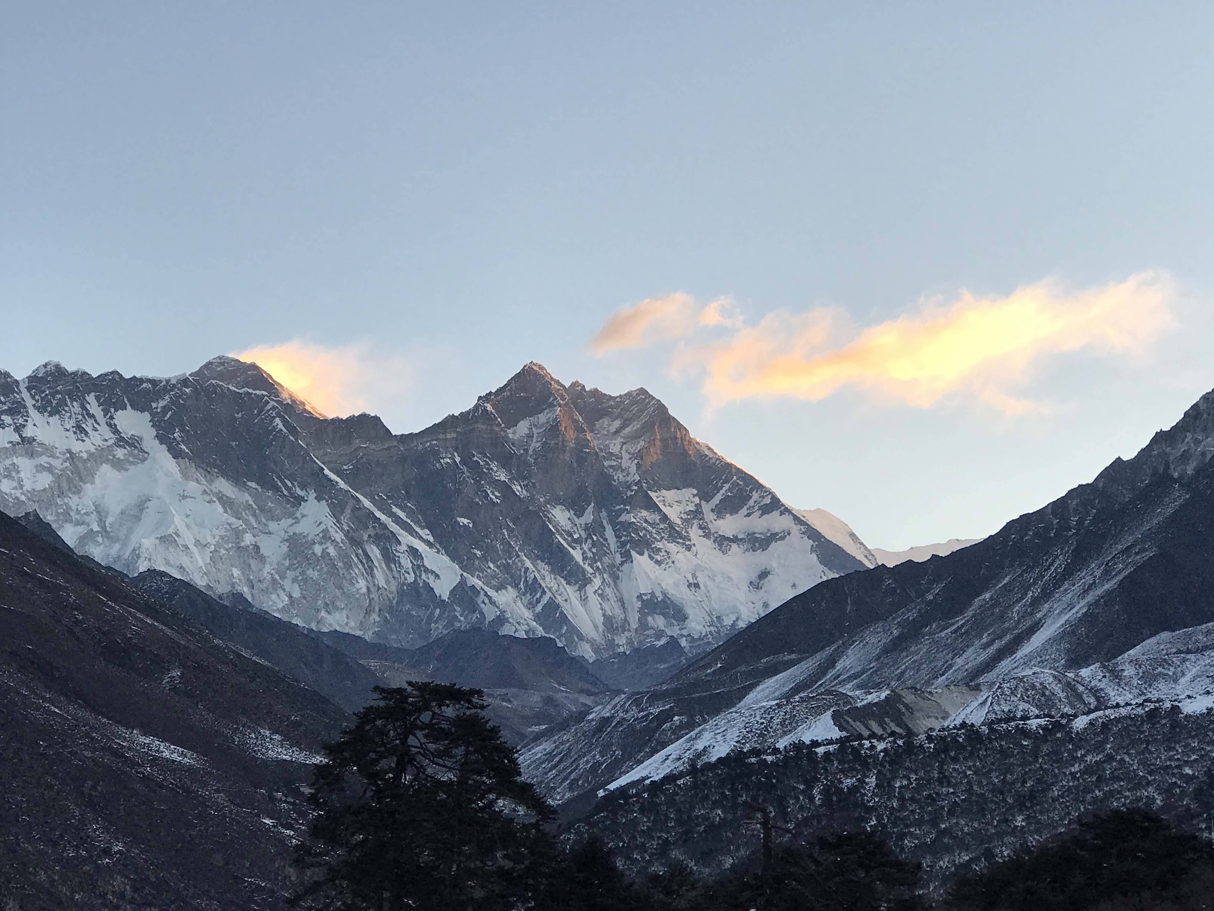
Everest and Lhotse 
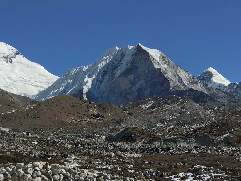
Imja Tse summit pyramid 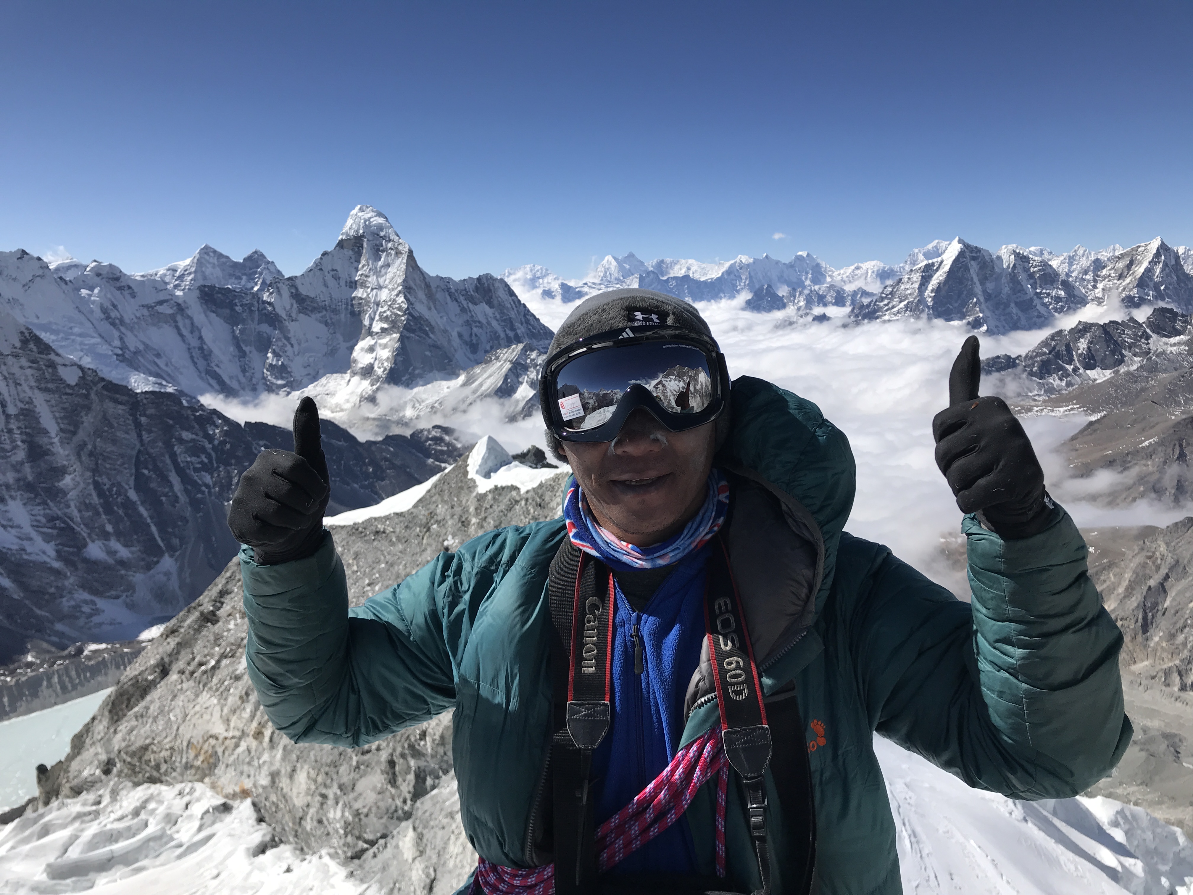
Ashok on the summit
Thoughts on Imja Tse
Winter Imja Tse was a good experience for my first trip to Nepal. Partnered with an experienced local guide who knew the route well the climb wasn’t too challenging, but leading everything on the mountain was still rewarding for me. While not the most difficult, Imja Tse is still of relatively high altitude and does involve a significant icefall and glacier – in hindsight I am satisfied that I didn’t go alone. It was very nice to be the only two people on the mountain, and to generally enjoy the Khumbu area with very few crowds. The trip wasn’t too expensive, largely due to the winter season, but I was still surprised by the level of support and tourist infrastructure in place. I do not think that I would enjoy the area anywhere near as much during the normal spring and autumn high seasons.
Winter in Nepal has a lot of potential. With cheaper permits and cheaper access, and no crowds, there’s a bit more sense of adventure to be had if one is willing to brave the frigid winds. Inspired by the fact that this season saw winter Ama Dablam summits, I am already putting together plans for more ambitious winter goals in the Khumbu area, and am hopeful to return in 2021. Finishing my objective of a 6000m Himalayan summit in winter felt good, but was also somewhat easier than expected. My experience in Nepal involved none of the absolutely grueling load carries and -40C winter camping which I had been through in the northern Indian Himalaya. A return to northern India for more winter climbing attempts likely also remains in the books for me, if I am provided the opportunity, as that particular sort of rugged winter mountaineering still represents the sort of challenge which I am interested in working towards.
