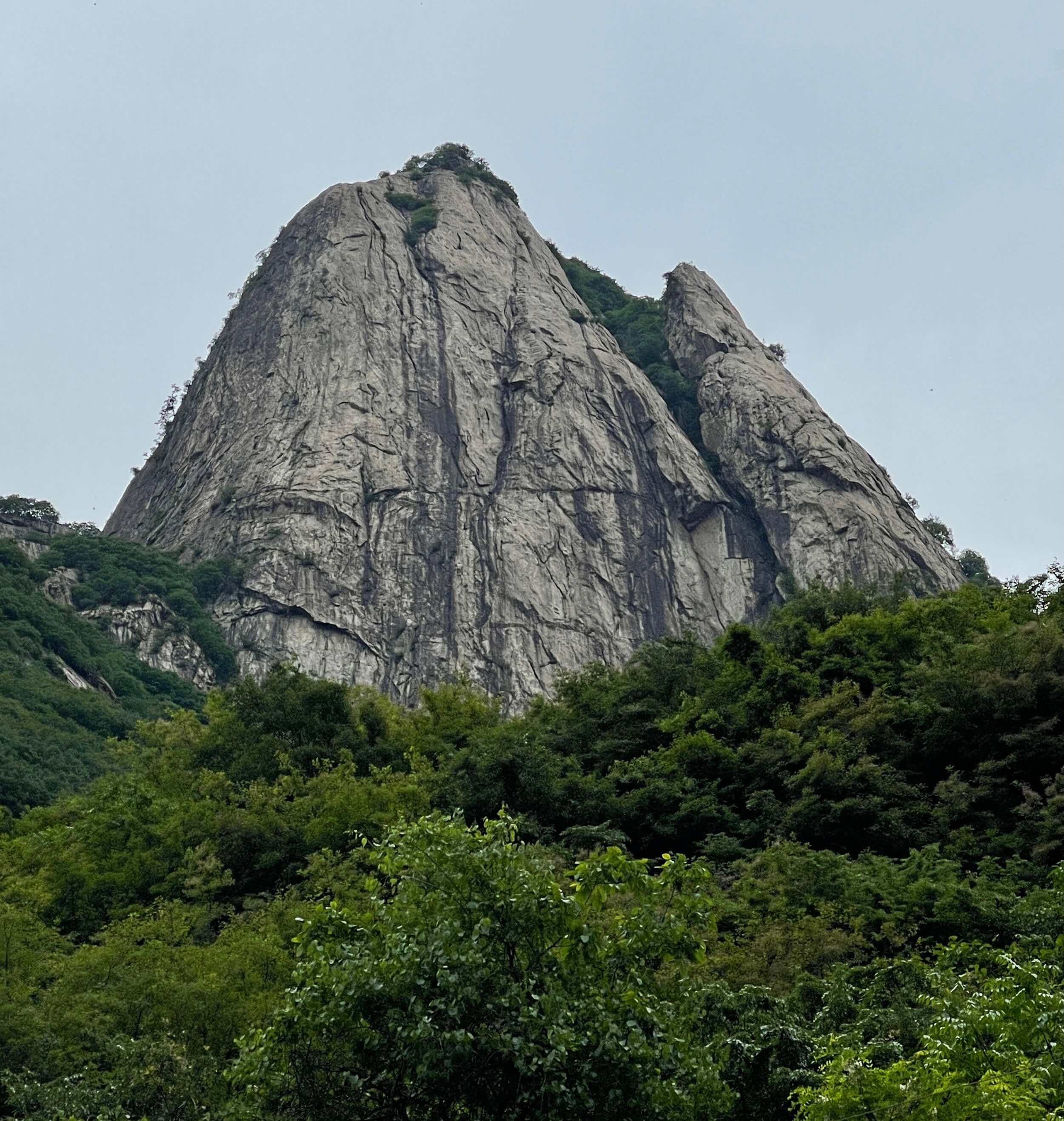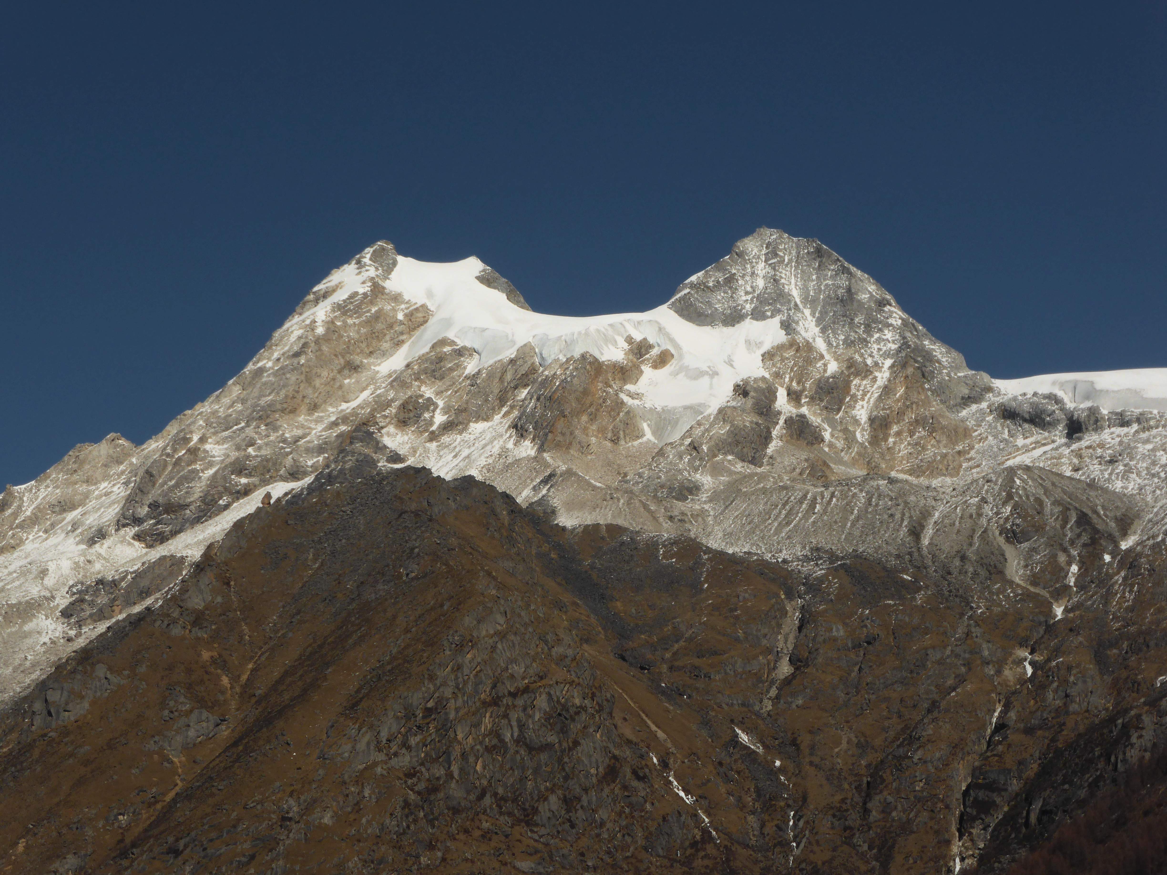
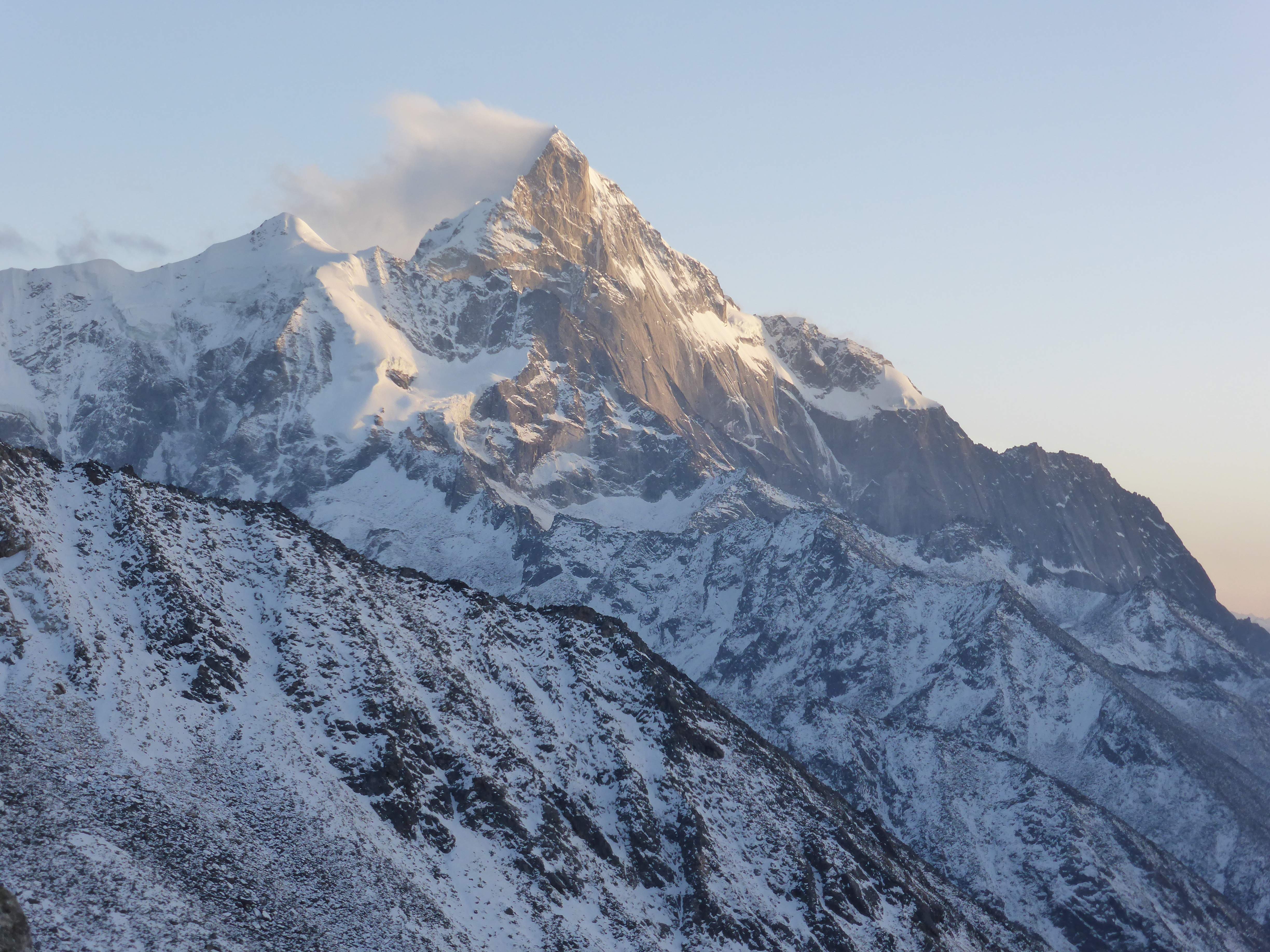
Camel Peak, the west summit to the left.
Camel Peak and Area
5484m Camel Peak, or Luotuo Feng (骆驼峰), stands nearby China’s famous four sisters mountains, the Siguniang Shan (四姑娘山). Camel Peak is named for its resemblance to a camel’s back, with twin summits and a high saddle supporting a beautiful glacier. The Siguniang Shan, which means ‘four sisters mountains / four girls mountains’ are likewise named due to their appearance, as the four peaks stand together in a line, highest to lowest. According to locals the four distinct peaks of the Siguniang Shan are family: four sisters of which the youngest and most beautiful, the Yaomei Feng (幺妹峰), is also the tallest. The remaining three sisters are named San Feng (三峰), Er Feng (二峰), and Da Feng (大峰), with San Feng being the second highest and Da Feng the lowest. Part of the Qionglai Shan (邛崃山) range in northern Sichuan, Camel Peak, the Siguniang Shan, and surrounding mountains lie within Siguniang Shan National Park, one of the province’s giant panda sanctuaries and a World Heritage Site. Camel Peak is a part of the ridgeline at the northern end of the Changping Valley (长坪沟), one of three major valleys within the park.
This area of Sichuan belongs to the Ngawa Tibetan and Qiang Autonomous Prefecture, locally known as Aba (阿坝). The people of Aba are predominantly Tibetan, are friendly and accommodating, and many still live a traditional lifestyle. The common language in this area is Mandarin Chinese – everyone can speak Chinese to some level – and spoken English is very uncommon. Tourism represents a significant segment of the local economy, and while winter was definitely not high season, there were always plenty of good restaurants available. The town closest to the Siguniang Shan and Camel Peak is Rilong (日隆镇), which I based out of for my climb. I stayed in a local hotel located right at the upper entrance to Changping Valley, just outside of central Rilong.

Camel Peak (center), Yangmantai (right), and Changping Valley.
Permit, Preparations, Uncertainty
My plan to climb Camel Peak started in October, when I met with a friend in Guangzhou to discuss potential mountaineering objectives within China for the Chinese New Year winter vacation. My friend, who had been hiking in Changping Valley before and knew the area, suggested Camel Peak but was unable to fit in the same vacation dates as I. As Camel Peak’s west summit appeared to be a moderate glacier climb I began the process of planning, training, and preparing for a solo attempt.
Good information on China’s mountains is difficult to come by or non existent in English, and Chinese trip reports are often lacking in thorough details and photographs. Both a local hotel owner and a contact within the Sichuan Mountaineering Association proved invaluable in assisting with my research, and between them and a handful of Chinese trip reports found online I was confident with the beta and itinerary which I was able to put together. My girlfriend assisted me with Chinese reading beyond my own ability, and helped me to carefully complete the permit application requirements.
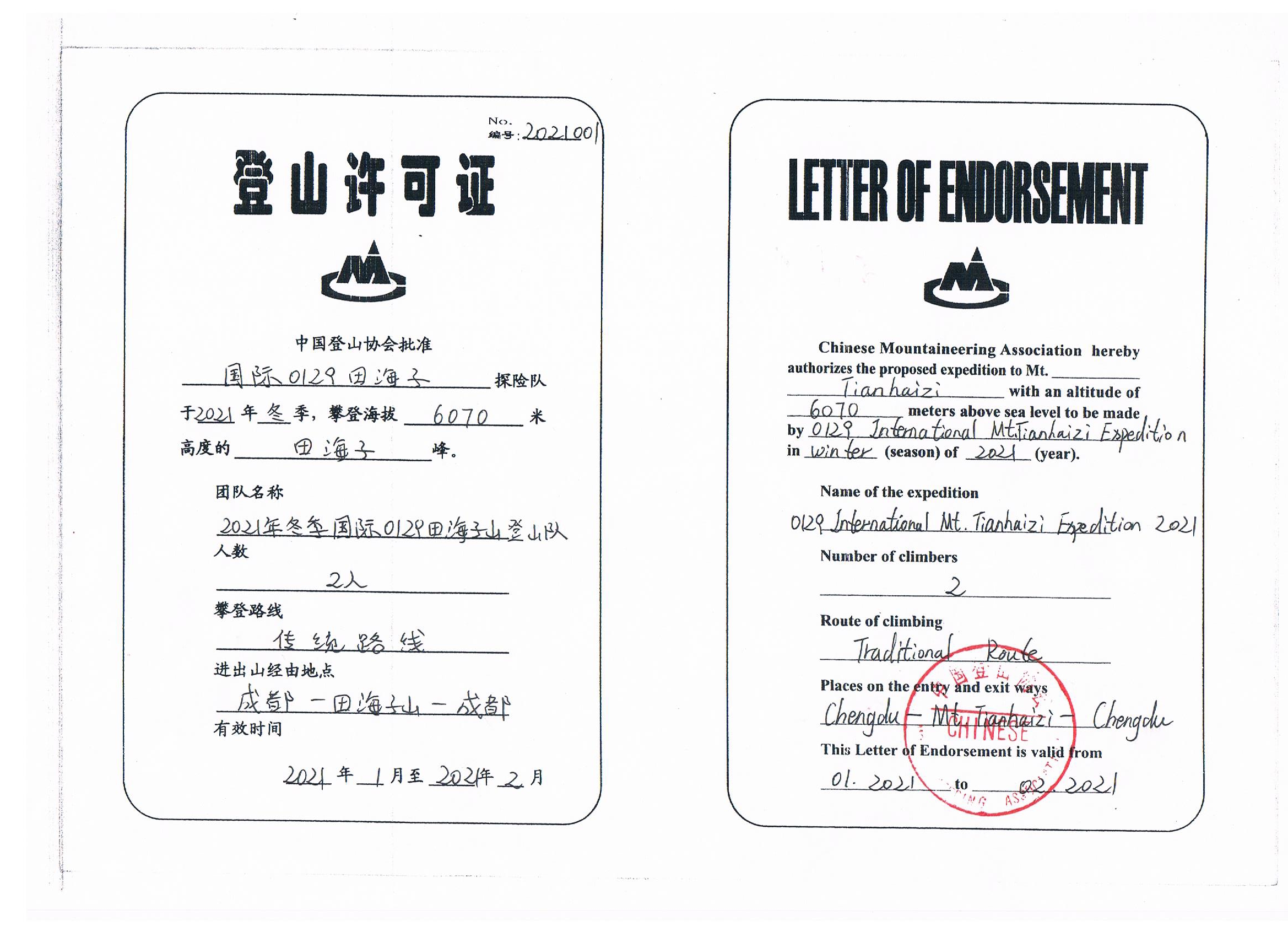
Regardless, uncertainty loomed. I would be climbing solo in the winter, and doubt remained as to whether the Chinese Mountaineering Association would grant me a climbing permit. Focusing on my objective and purpose was difficult for me as I trained for the climb, not knowing whether I would even be allowed to set foot upon the mountain. Training for an uncertain objective contributed to building up the climb psychologically. One week before the winter vacation I received good news; my solo permit had been approved and I had official endorsement.

My climbing permit.
Pre-Climb Acclimatization
Getting to Rilong involves a fair amount of travel. First an evening flight to Chengdu, the next day a 6 hour drive into the mountains and across a 4400m high pass. The drive costs 150 RMB per person if sharing a private car with others, a service which the hotel owner helped me arrange. There are also busses to Rilong, leaving from Chengdu’s Cha Dian (茶店子) bus station.
Rilong sits at ~3200m, an excellent altitude for pre-acclimation prior to heading higher. I spent two days acclimating before beginning my climb; the first day driving over the high pass and then resting, the second day exploring Shuangqiao Valley (双桥沟). Shuangqiao Valley is one of three major valleys, along with Changping Valley and Haizi Valley, within the national park. Unlike Changping Valley which is only accessible by foot, Shuangqiao is developed, inhabited, and has a good paved road running its length. Driving up the length of the valley and stopping intermittently to stroll and take pictures was relaxing, a good introduction to the area’s terrain, and great acclimation with the valley’s end-point reaching a high of ~3800m.
The Qionglai mountains are steep, sharp, and savage. Almost all present technical mixed climbs, sheer and unforgiving, and many of them remain unclimbed. Even the peaks beside the road within Shuangqiao were intimidating and impressive to behold.
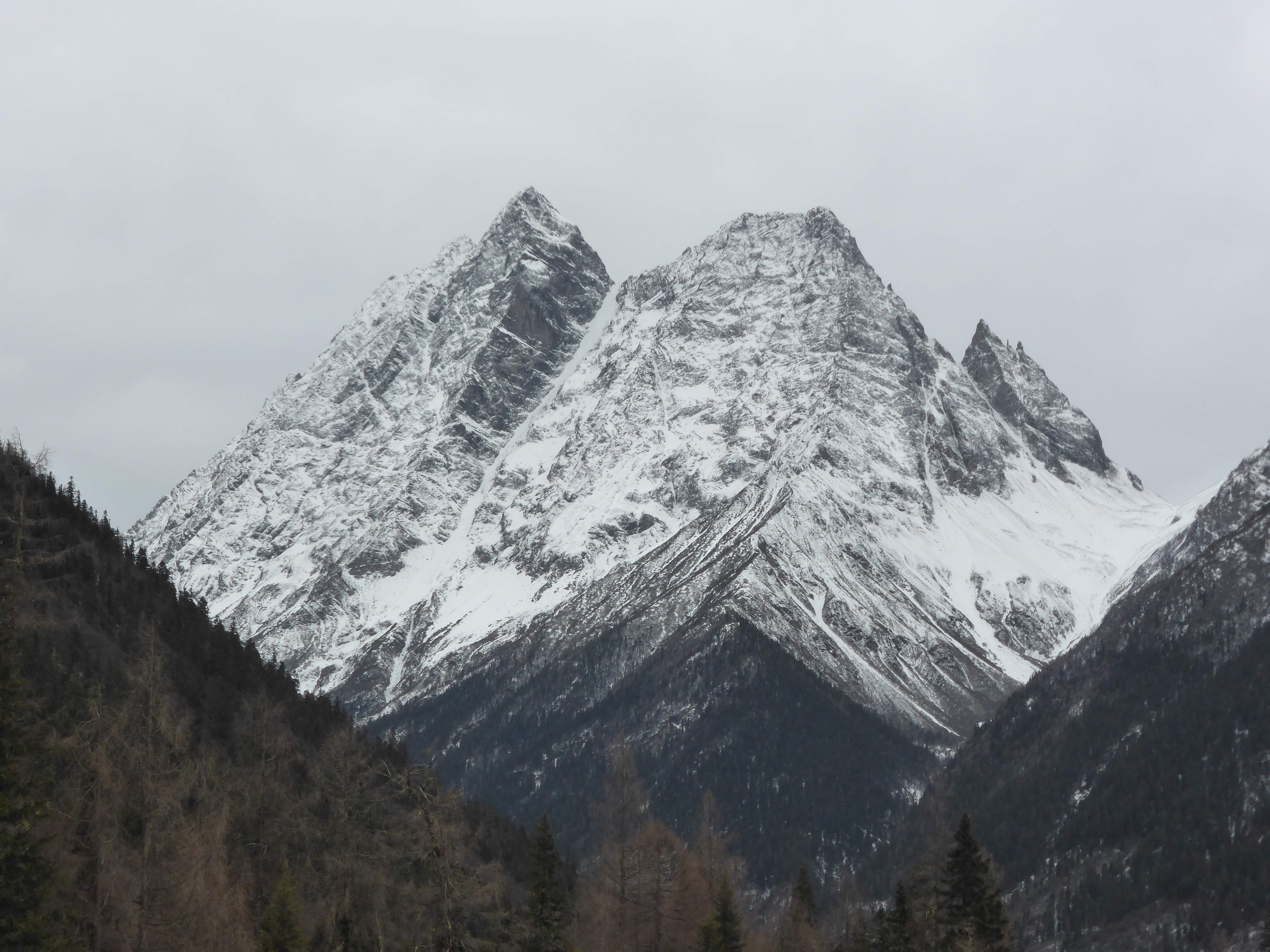
Particularly impressive were the cleft ridges of Hunter Peak, Lieren Feng (猎人峰), also known as Steeple Peak. The name of this mountain appears to be somewhat contentious, but all of the locals whom I spoke with referred to it as Lieren Feng.
Hunter Peak.

Hunter Peak (left) and a cleft peak of unknown name.

The frozen valley river framed distant ridges and peaks.
Shuangqiao Valley.
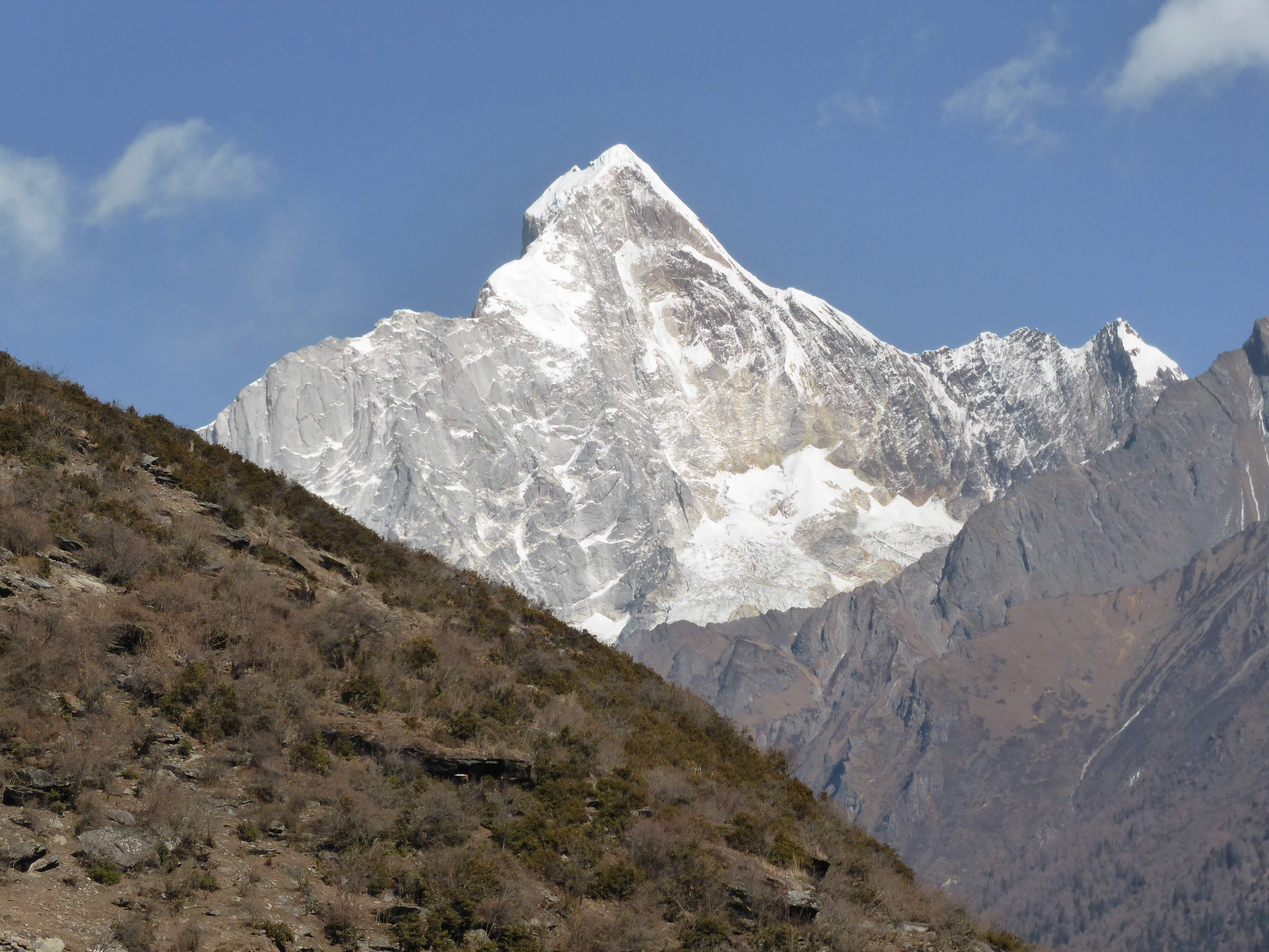
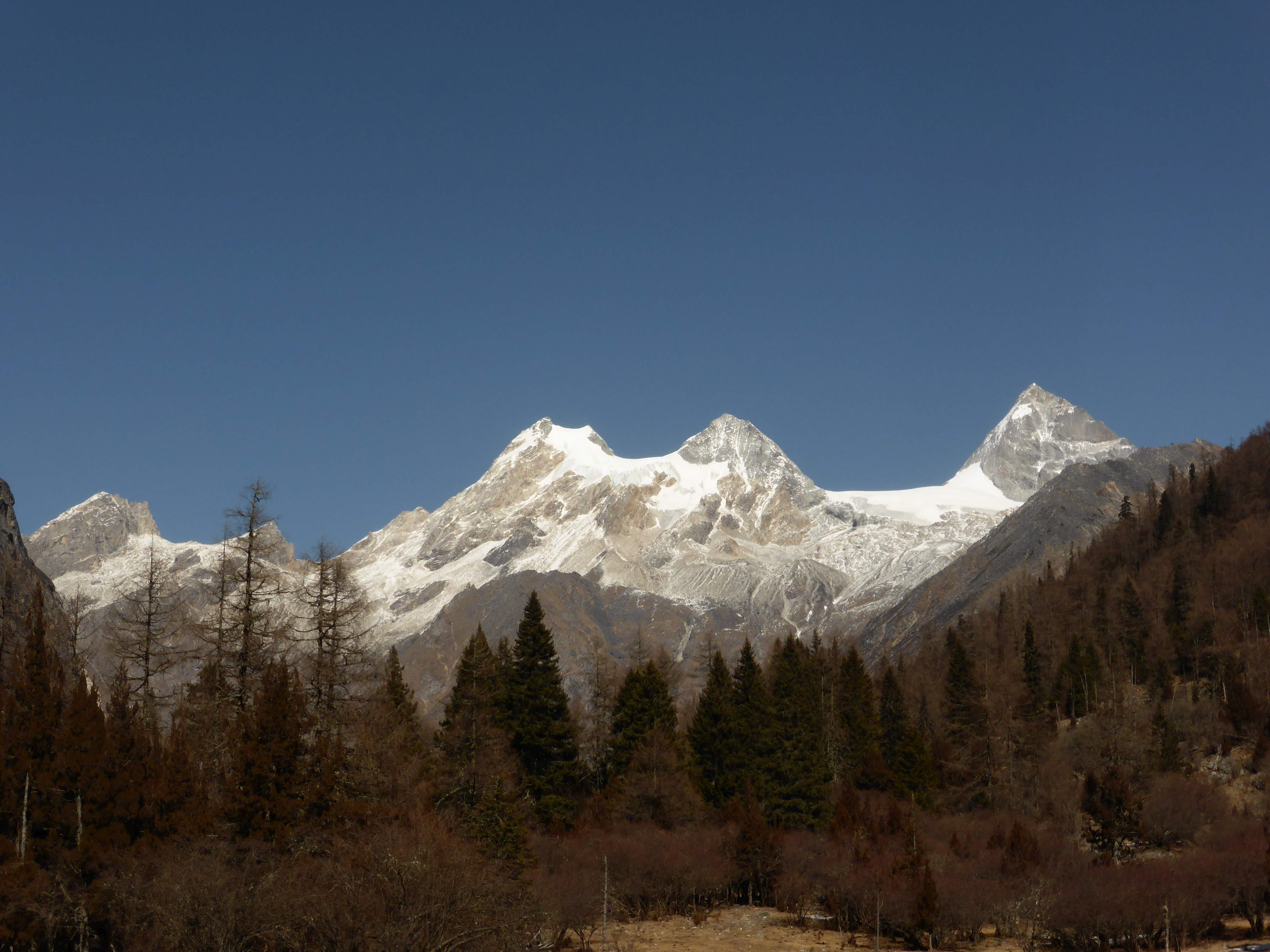
Back in Rilong the mountains still have a strong presence, with Yaomei Feng herself, the highest peak in the area, visible on the skyline beyond the upper edges of town. Yaomei Feng is a gorgeous, aesthetically alluring peak made all the more impressive by being a formidable, seldom attempted, rarely summitted, and very serious climb.
Yaomei Feng (left) and the other three sisters (San Feng, Er Feng, and Da Feng, left to right) above upper Rilong.
Camel Peak West Trip Report
My initial plan was to climb Camel Peak over 6 days, with a full three days for making the 33km approach up the Changping Valley on foot with a heavy pack and another 2 days for descending. At the last minute on the day I was due to begin, standing in the Siguniang Shan National Park office in Aba getting my permit checked, the park official told me that a guide was mandatory – which soon transitioned into “a local horse driver to accompany you to the base of the mountain”.
After some initial phone calls it seemed that nobody wanted to go – wintertime in this area means significant cold at night and an icy valley preventing easy horse access. An hour of anxiety and phone calls later the hotel owner had found someone, Mr. Huang, who came with a sturdy horse and would accompany me for a bit more than the normal daily rate. With no alternative if I wanted to climb legally, I felt O.K. that I didn’t try to ascend the valley unsupported and take a shot at carrying all of my gear up the valley by foot.
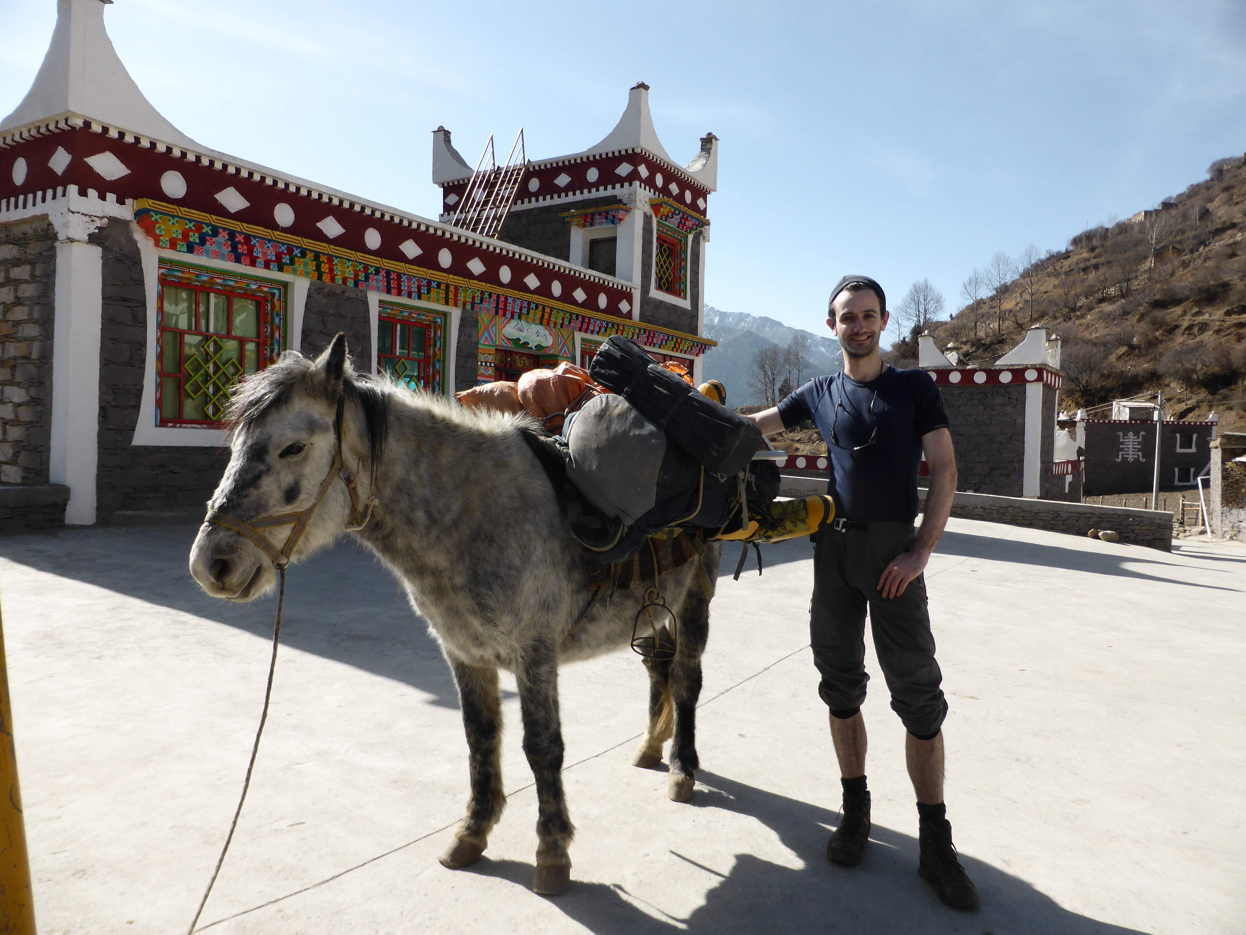
My sturdy packhorse.
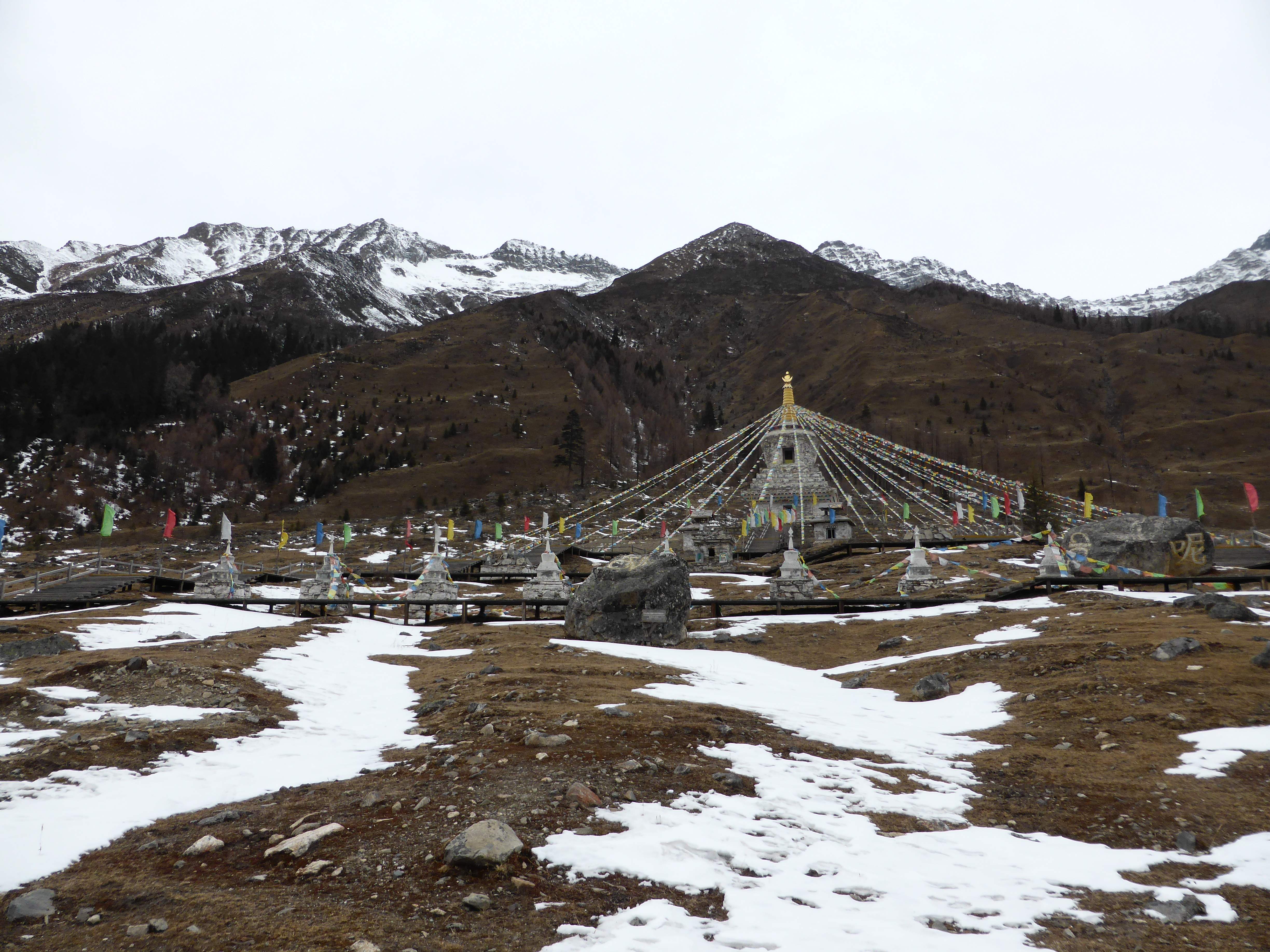
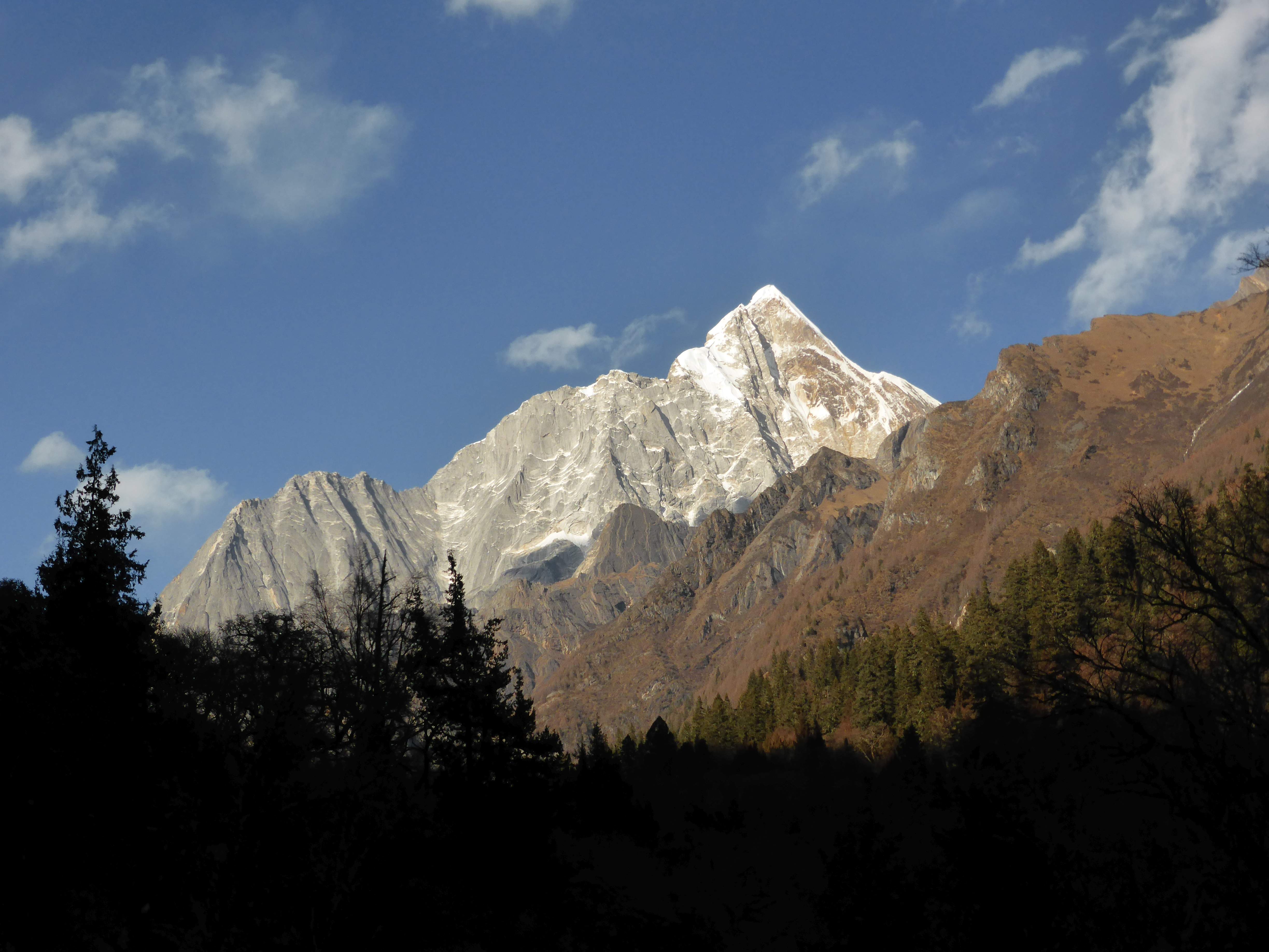
Day 1: A late start due to the unexpected complications in the park office. Beginning at Lama temple, a large and newly constructed Buddhist temple located at the base of Changping Valley around ~3400m, Mr. Huang and I started up the valley at 12:00 p.m. The lower Changing Valley has a board walk in place for around ~4km, and I met a few local herders in this section. Yaomei Feng was prominent in the distance.
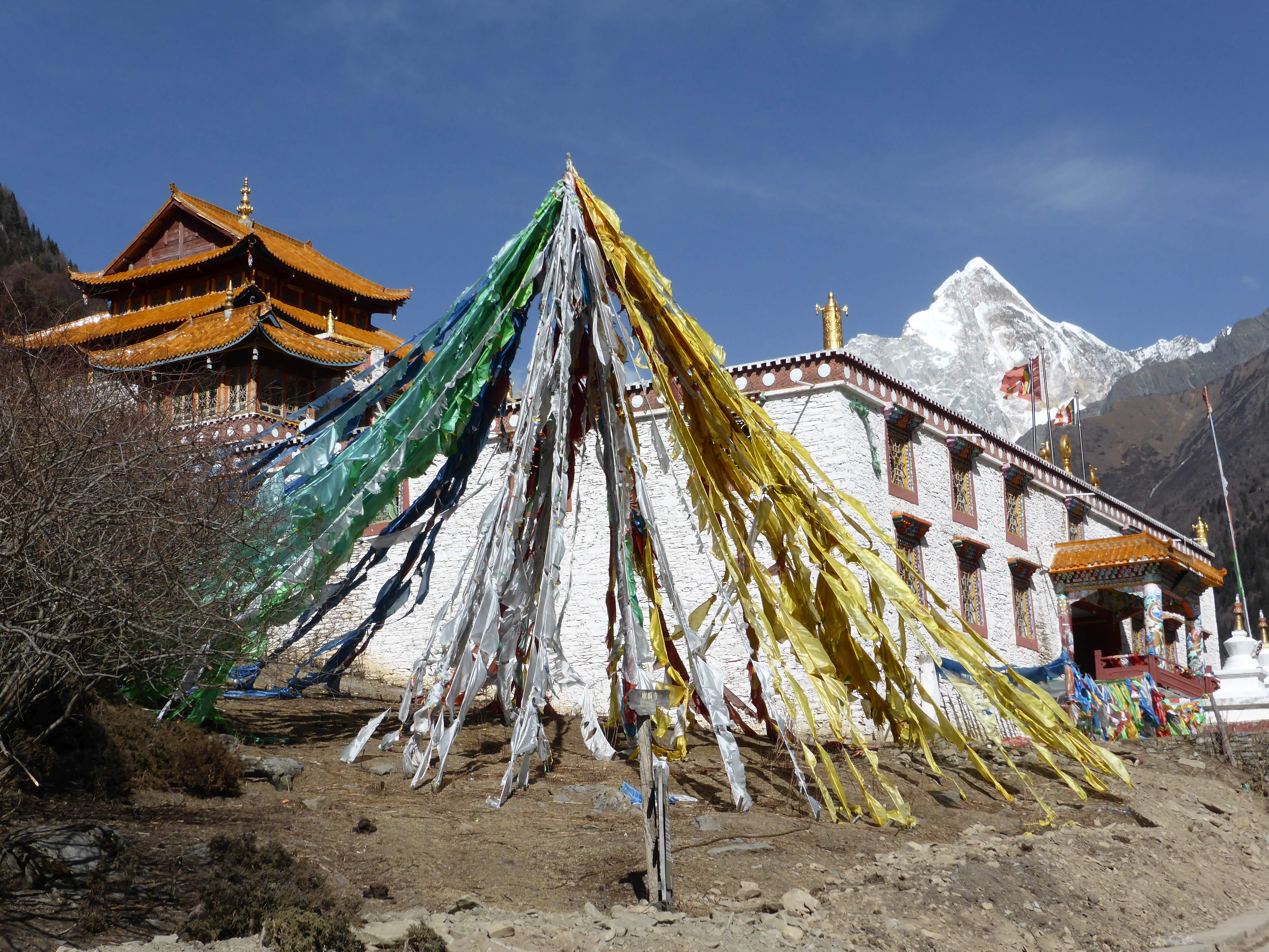
Lama Temple and Yaomei Feng.
Yaomei Feng above Changping Valley.

Yaomei Feng above Changping Valley.
Yaomei Feng.
Once the board walk was finished we soon began to encounter large patches of thick ice. A river runs through the Changping Valley and is fed by run-off streams coming down the valley walls from the surrounding mountains. In winter these streams freeze, flood, and encase sections of riverbank and forest with ice. The horse was unable to safely walk across the slippery ice, which slowed us down considerably as we hacked rough paths with my ice ax or took winding detours through the trees.
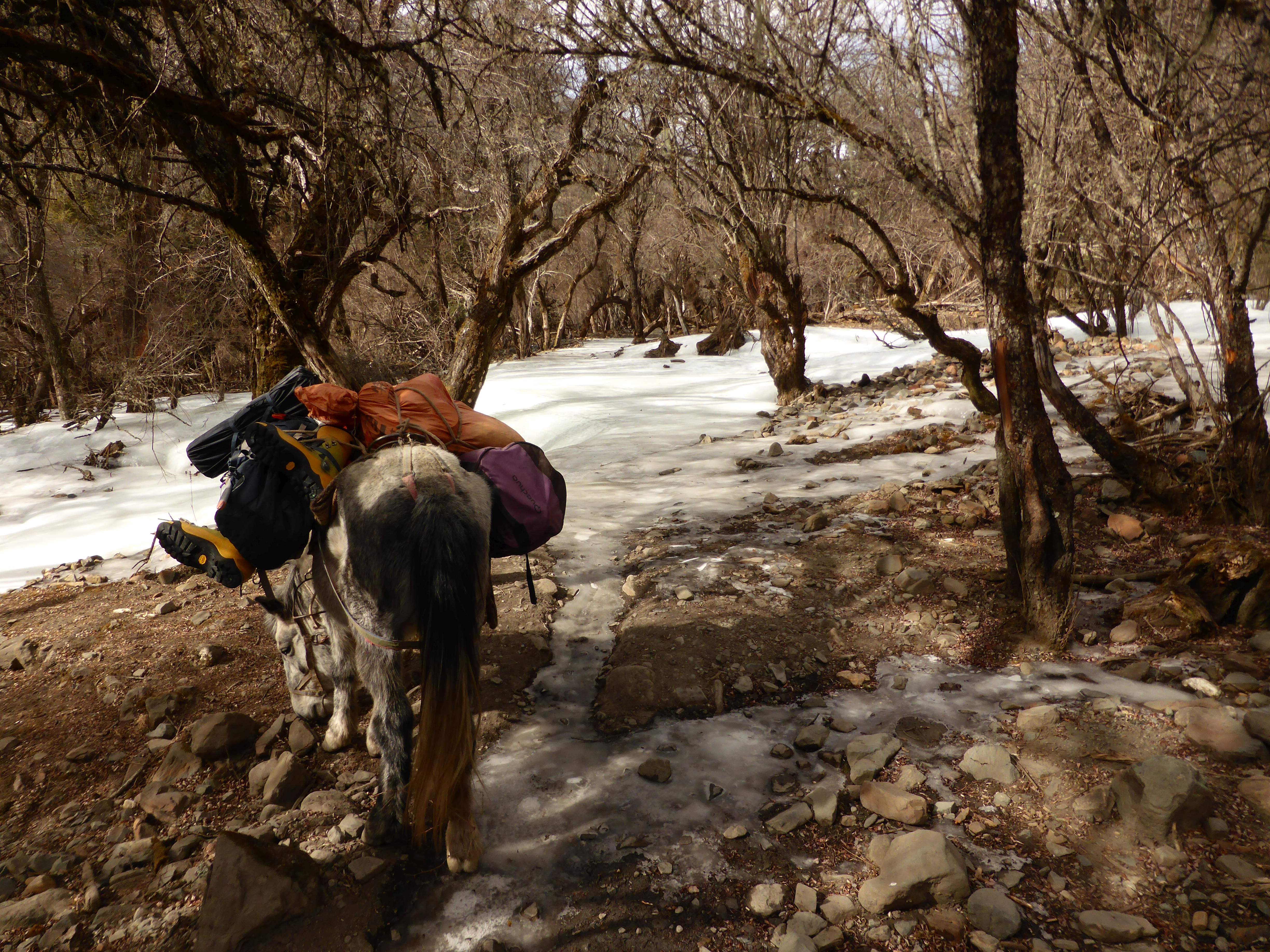
Large swathes of ice covered sections of the valley and were impassable for the horse.
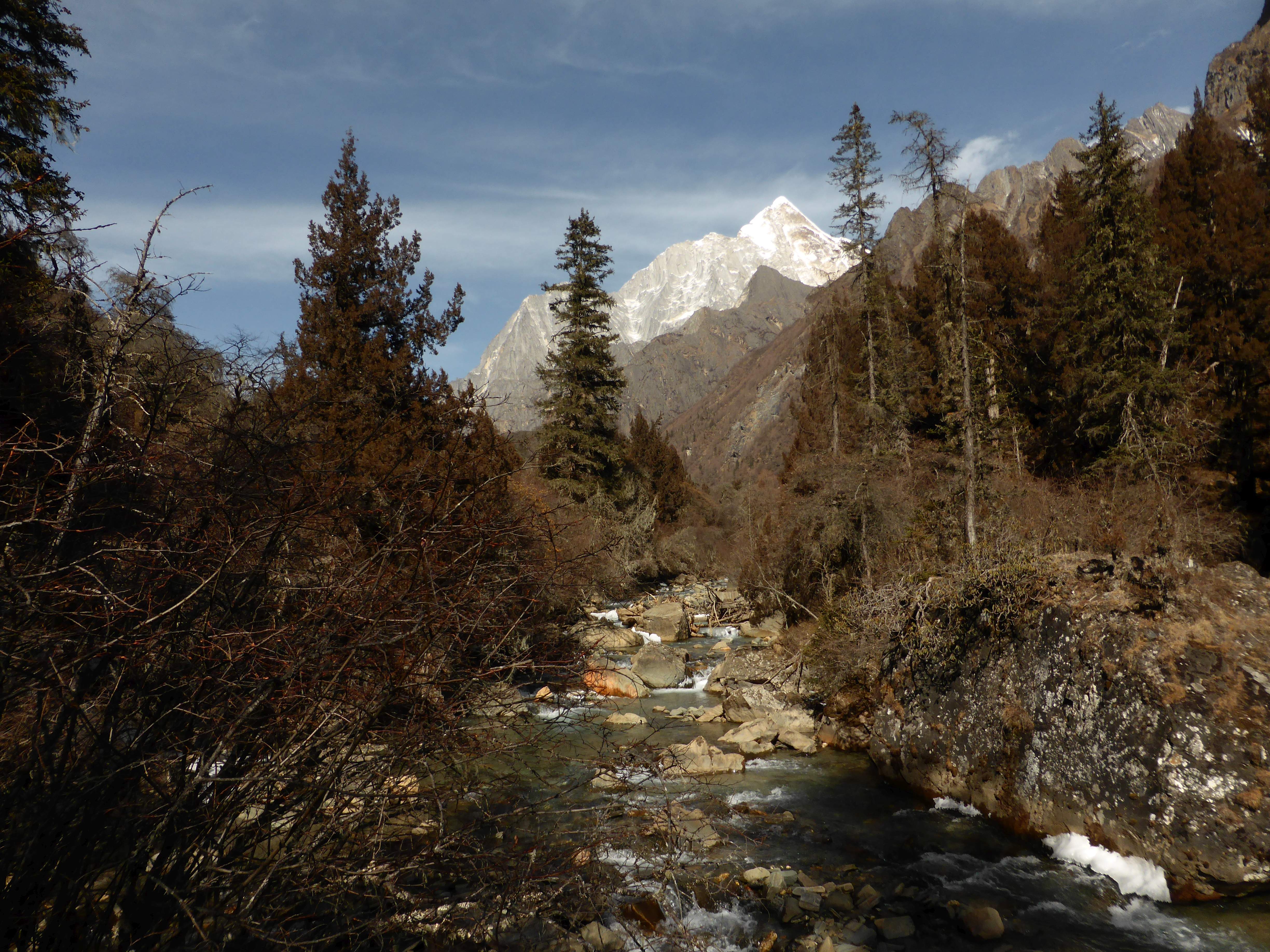
As the valley curved the impressive rock pyramid of Pomiu Feng came into view ahead of us. More and more snow covered the riverbanks as we gained altitude, and sharp tooth-like mountains rose above the valley walls.
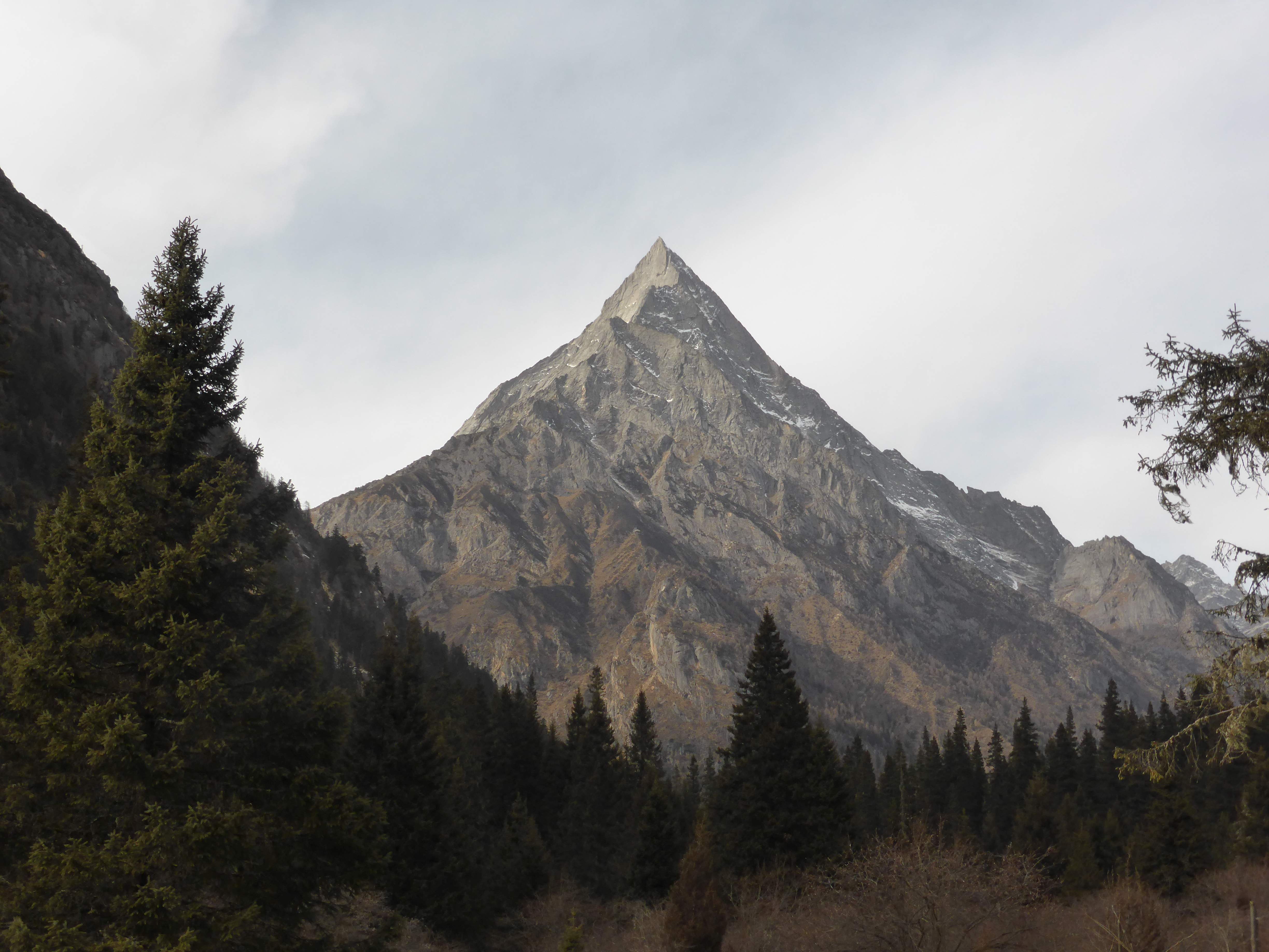
Pomiu Feng.
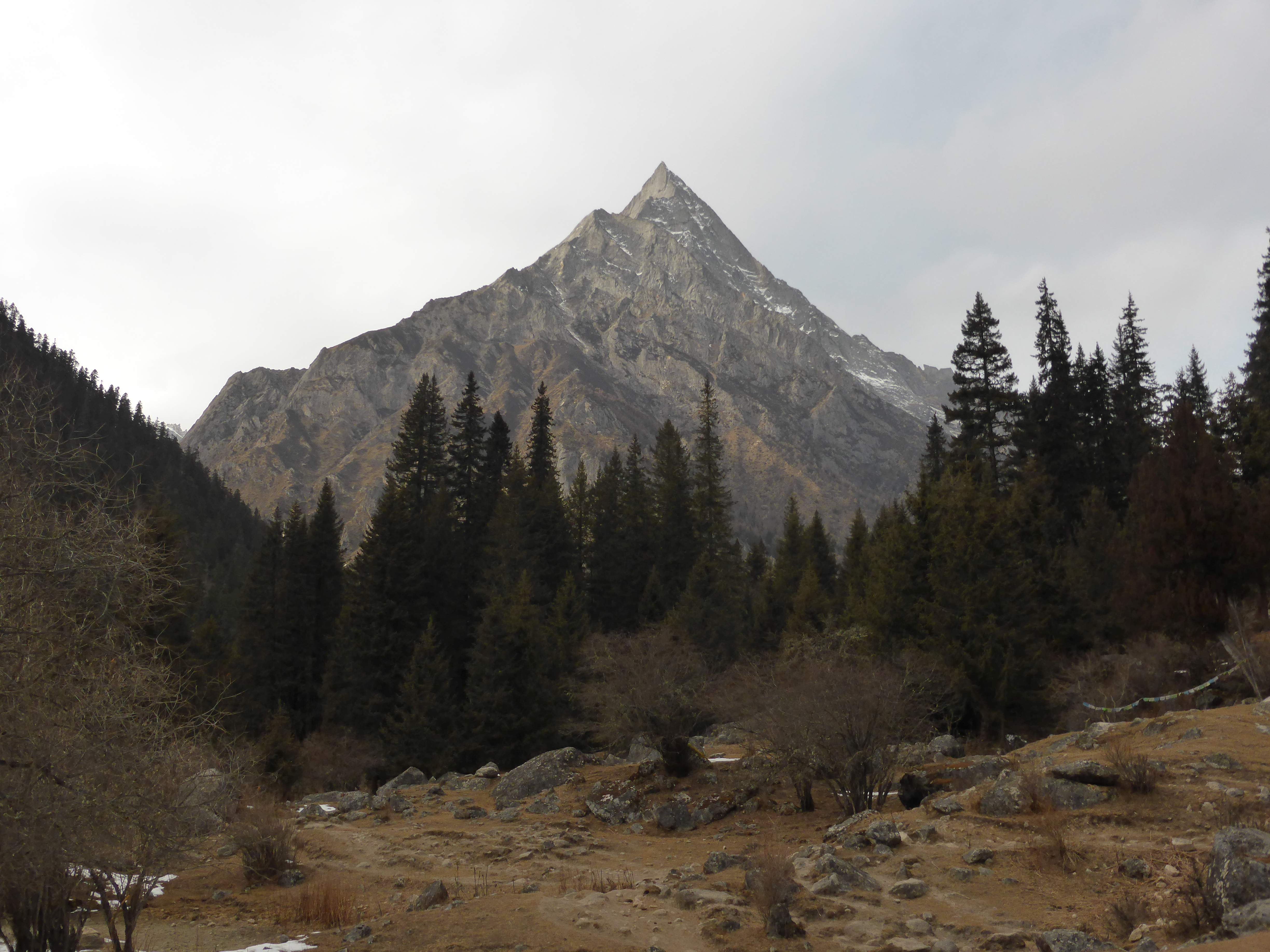
Pomiu Feng.
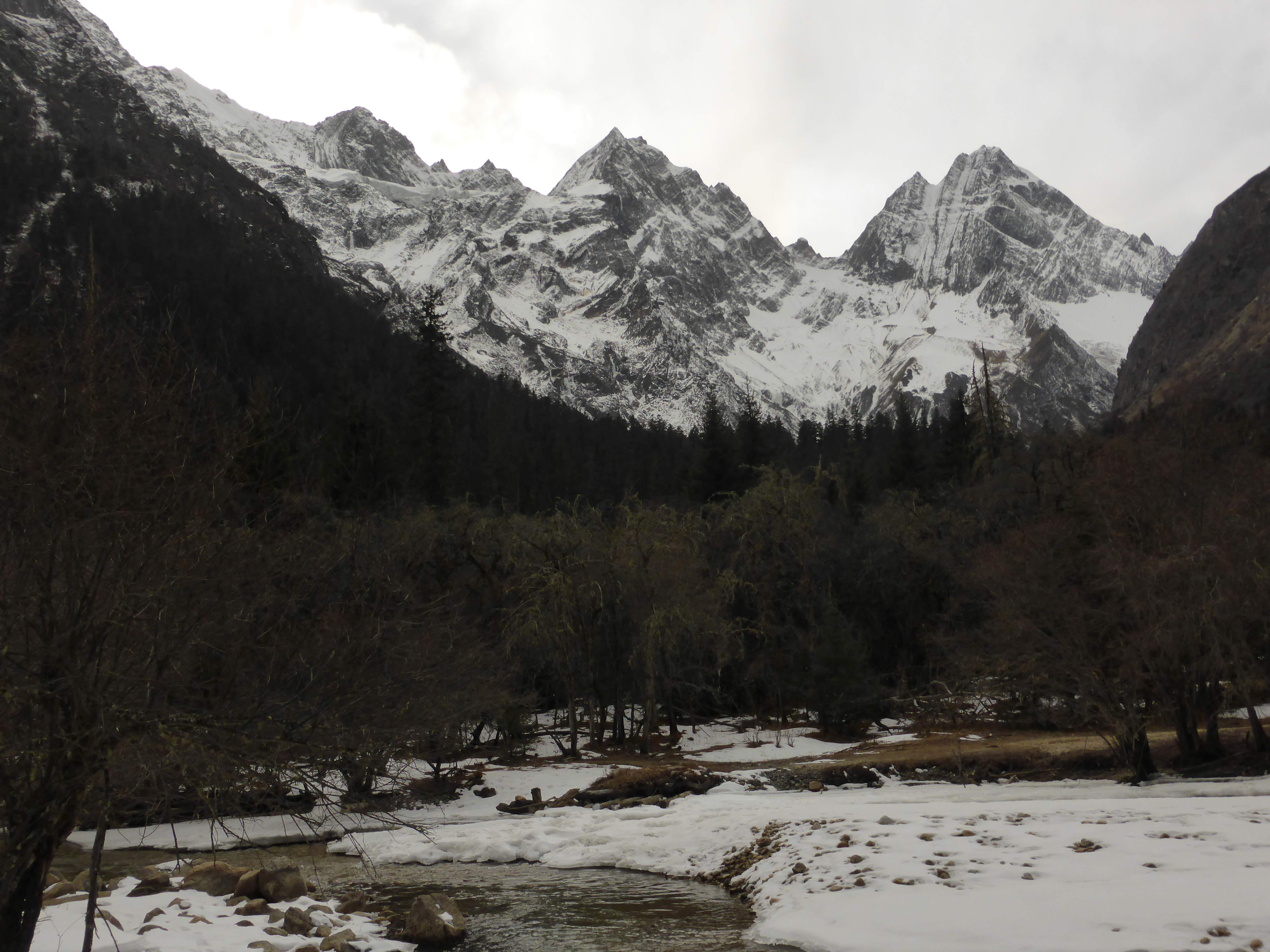
Sharp mountains, names unknown.
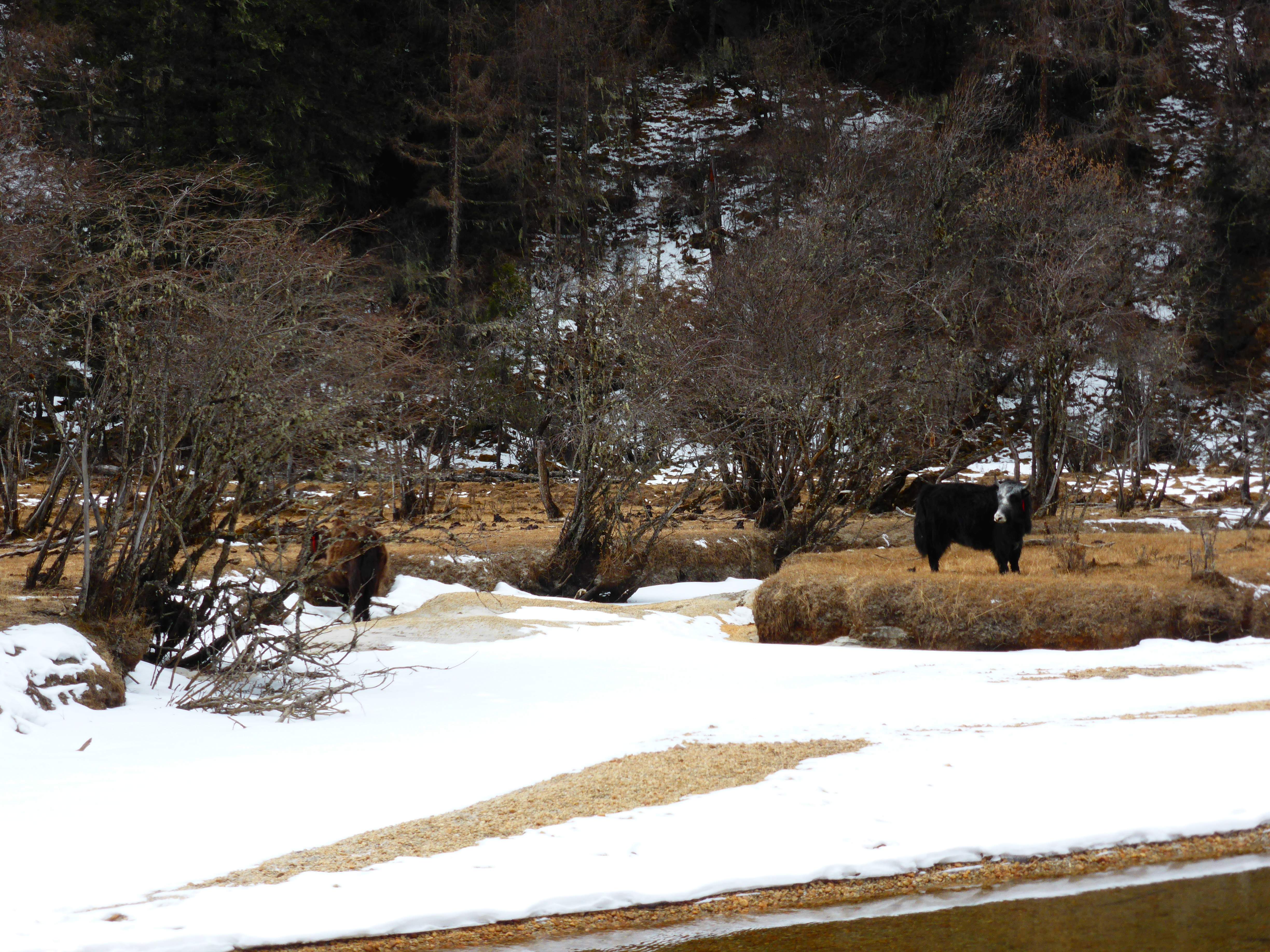
Livestock grazing on the riverbanks.
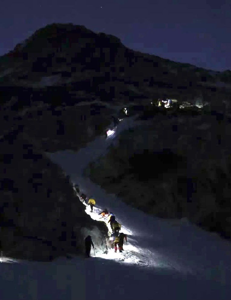
At 5:30 p.m., after 5.5 hours of hiking, we reached the day’s campsite, Muluozi (木骡子) at ~3800m, where a large wooden cabin stands. I was told that this cabin takes overnight visitors during the tourism season, but aside from the caretaker it was empty. Upon reaching camp Camel Peak itself finally came into view, directly ahead at the end of the valley. I pitched my tent by some trees, facing towards the mountain.
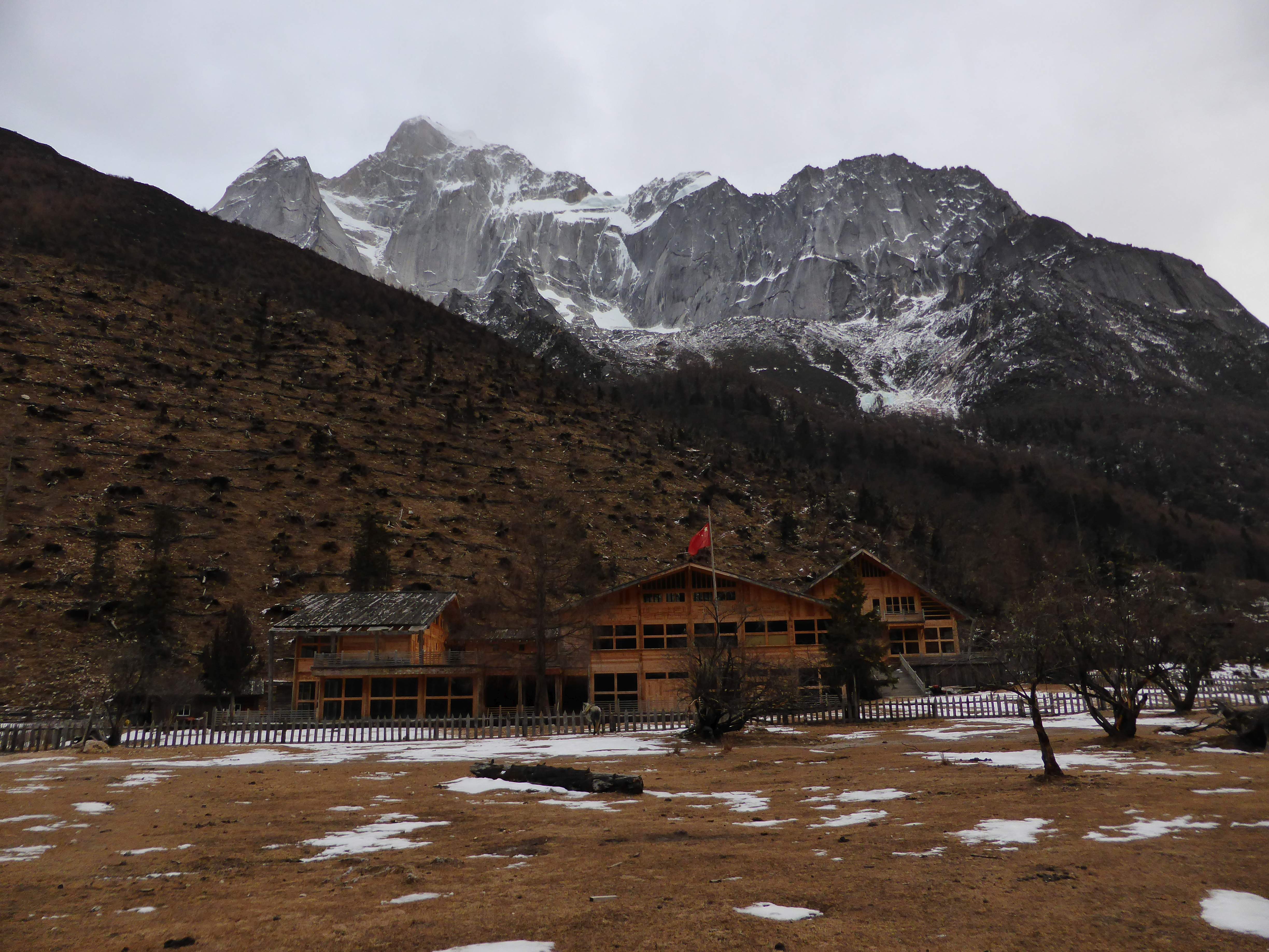
The wooden cabin at Muluozi.
Camel Peak from Muluozi.

My first night’s campsite.
I cooked up a dinner of soup with noodles, sausage and crackers, and prepared water for the next day. When the sun set temperatures plummeted, and I measured -6C inside of my tent.
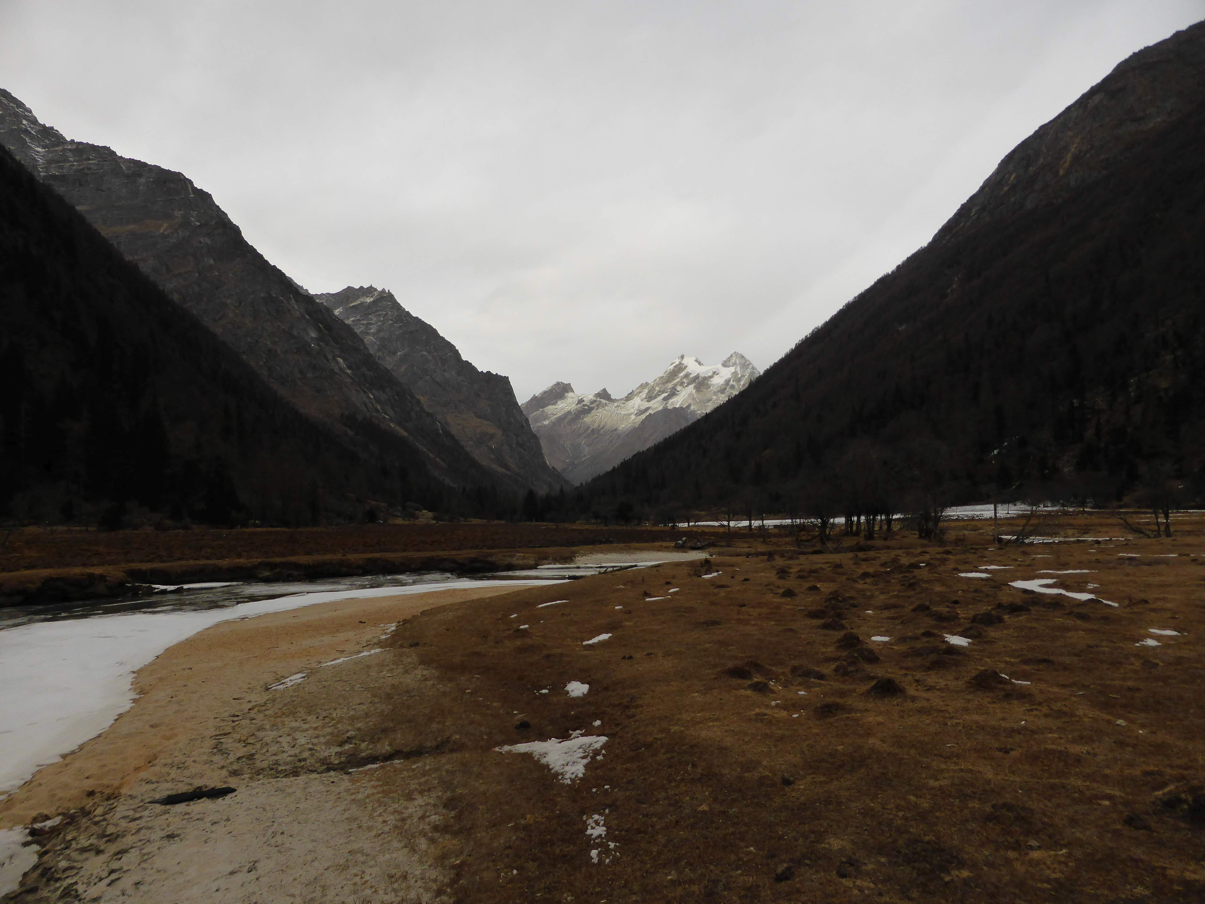
Day 2: After I enjoyed a slow paced breakfast, we packed up the horse and were moving by 11:30 a.m. We encountered a lot more ice above Muluozi, and made slow progress along the riverbanks. Large sections of the river were frozen over.
We reached the end of the valley within a few hours, and navigating the ice worked our way through forest to the cairned livestock trail which leads up the northern valley ridge towards the base of Camel Peak. The weather appeared to be turning, and clouds were building above us and to the north.
Changping Valley from the trail to highcamp. Mr. Huang and horse in bottom right corner.
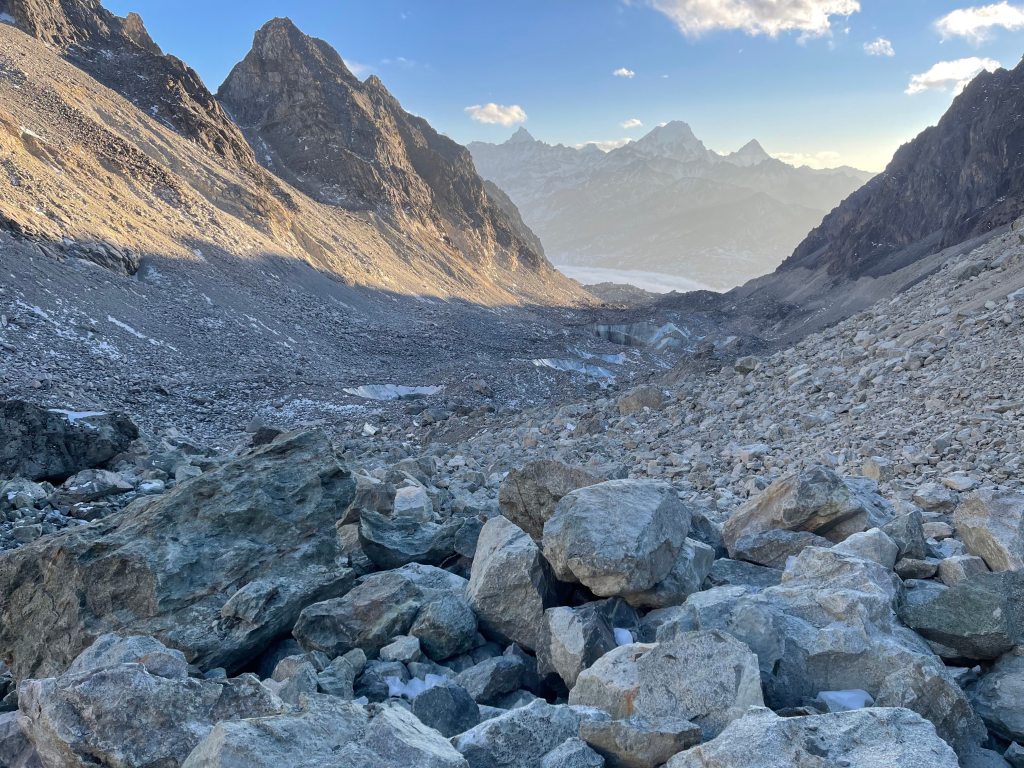
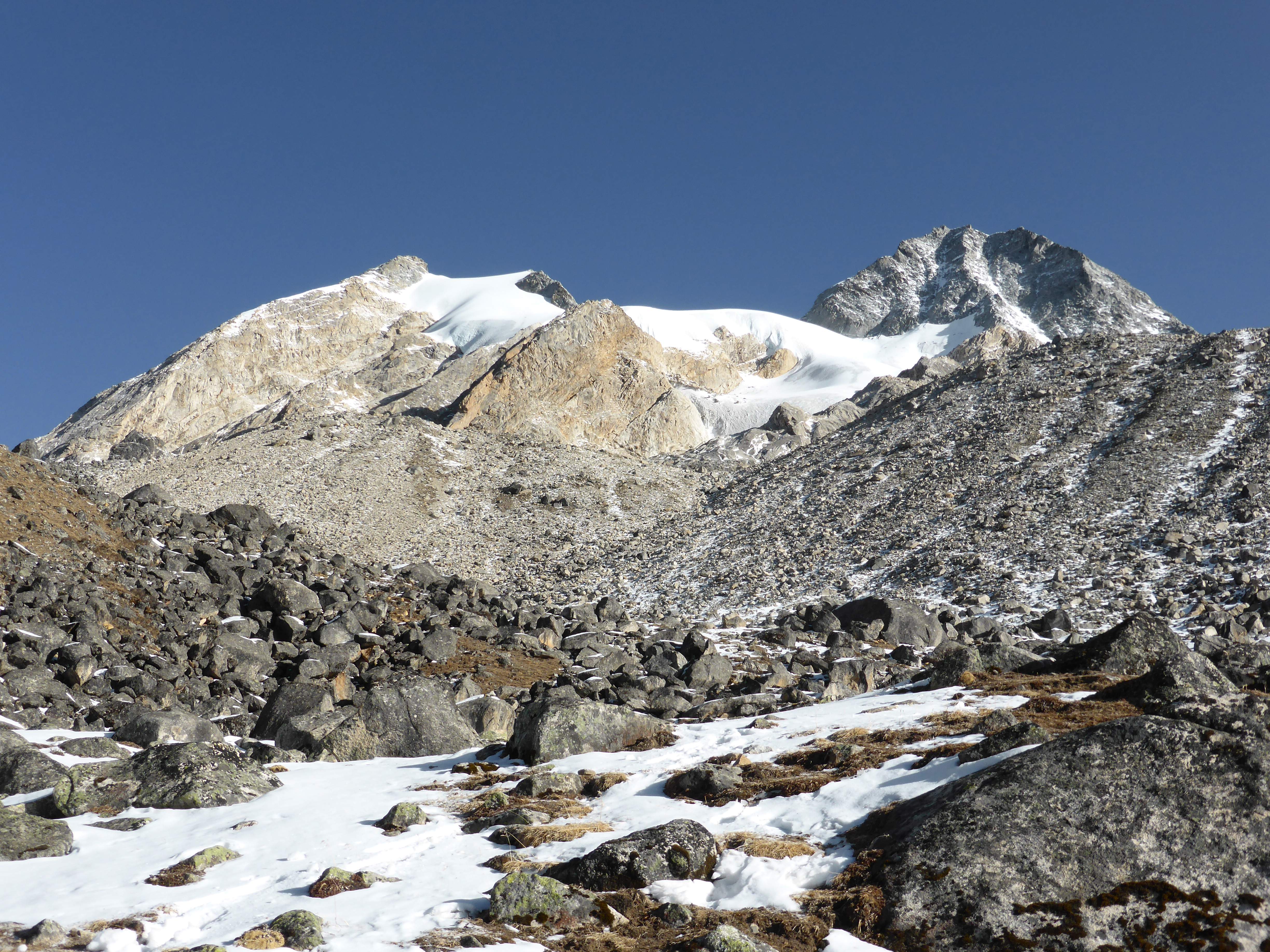
The trail to Camel Peak follows a rough livestock path up the valley, occasionally switchbacking. We soon broke the treeline, and were able to see Camel Peak and Yangmantai (羊满台), the pyramidal mountain beside Camel, above us through breaks in the cloud. The terrain quickly shifted into loose glacial moraine, boulders and scree mixed with snow.
Above the trees we progressed as far as the horse was safely able, finally stopping at 6 p.m., around ~4700m of elevation. The moraine here was snowy, some quite deep within the spaces between boulders. After some searching we found a mostly level patch of ground, where we pitched our tents on the snow. From here I would begin my climbing alone. Changping Valley lay below us with Yaomei Feng towering over it, resplendent in the late afternoon sunlight.
Yaomei Feng from my highcamp.

Yaomei Feng and Changping Valley from my highcamp.
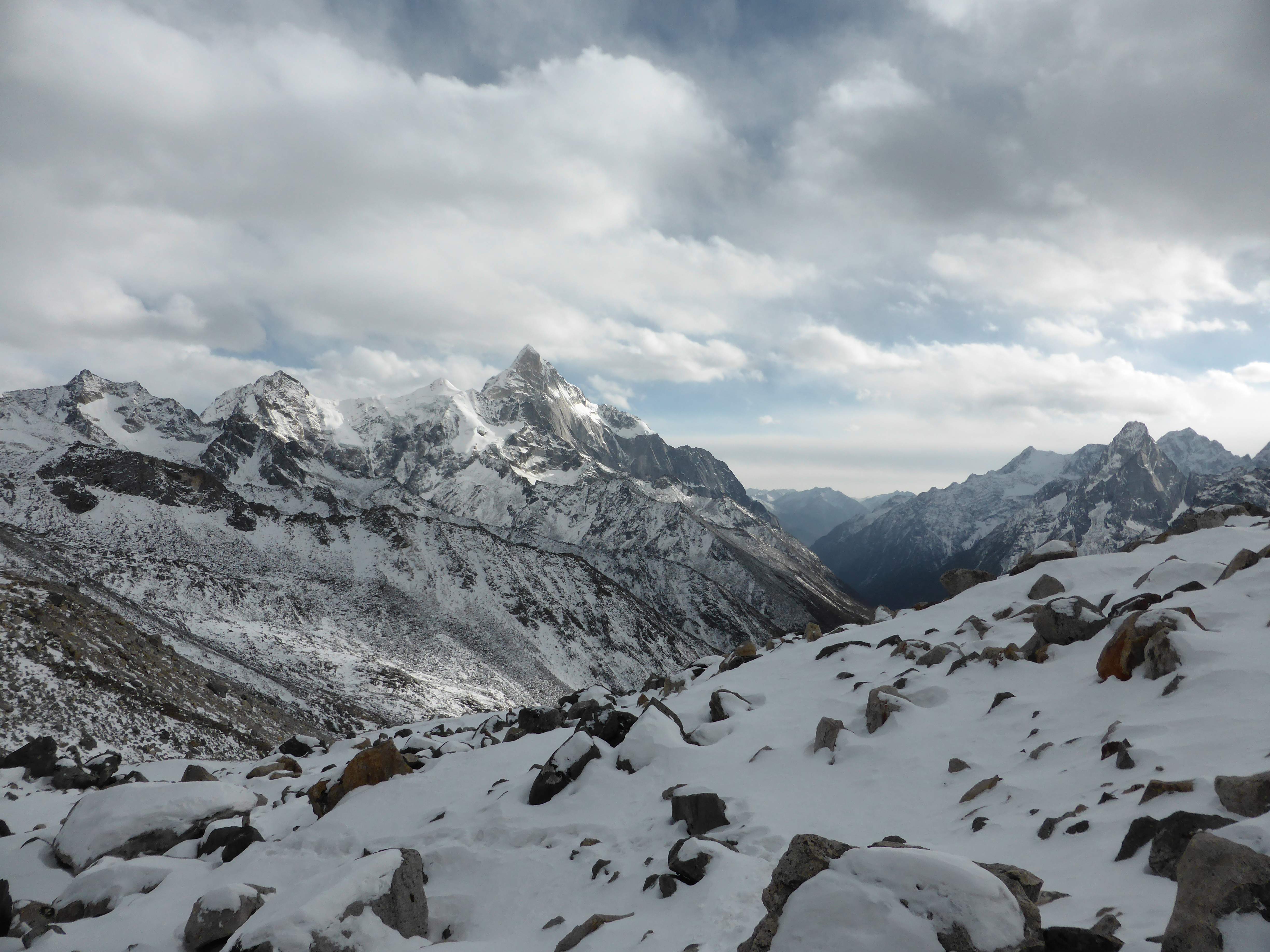
Camel Peak, from near my highcamp. West summit to the left, East summit to the right.
I cooked another dinner of hot noodle soup, complimented by peanut butter on rye bread, sausages and chocolate bars. I felt strong and well acclimated, and managed to eat a decently large dinner. I melted snow to prepare hot water, got my boot liners, batteries, sunscreen, gloves, socks, camera, and clothing into my sleeping bag, and curled up with my hot water bottles. The night was frigid, and I measured -12C inside of my double-walled tent. Intermittent clouds billowed overhead, but bright stars still shone, the dark night sky free from any light pollution.
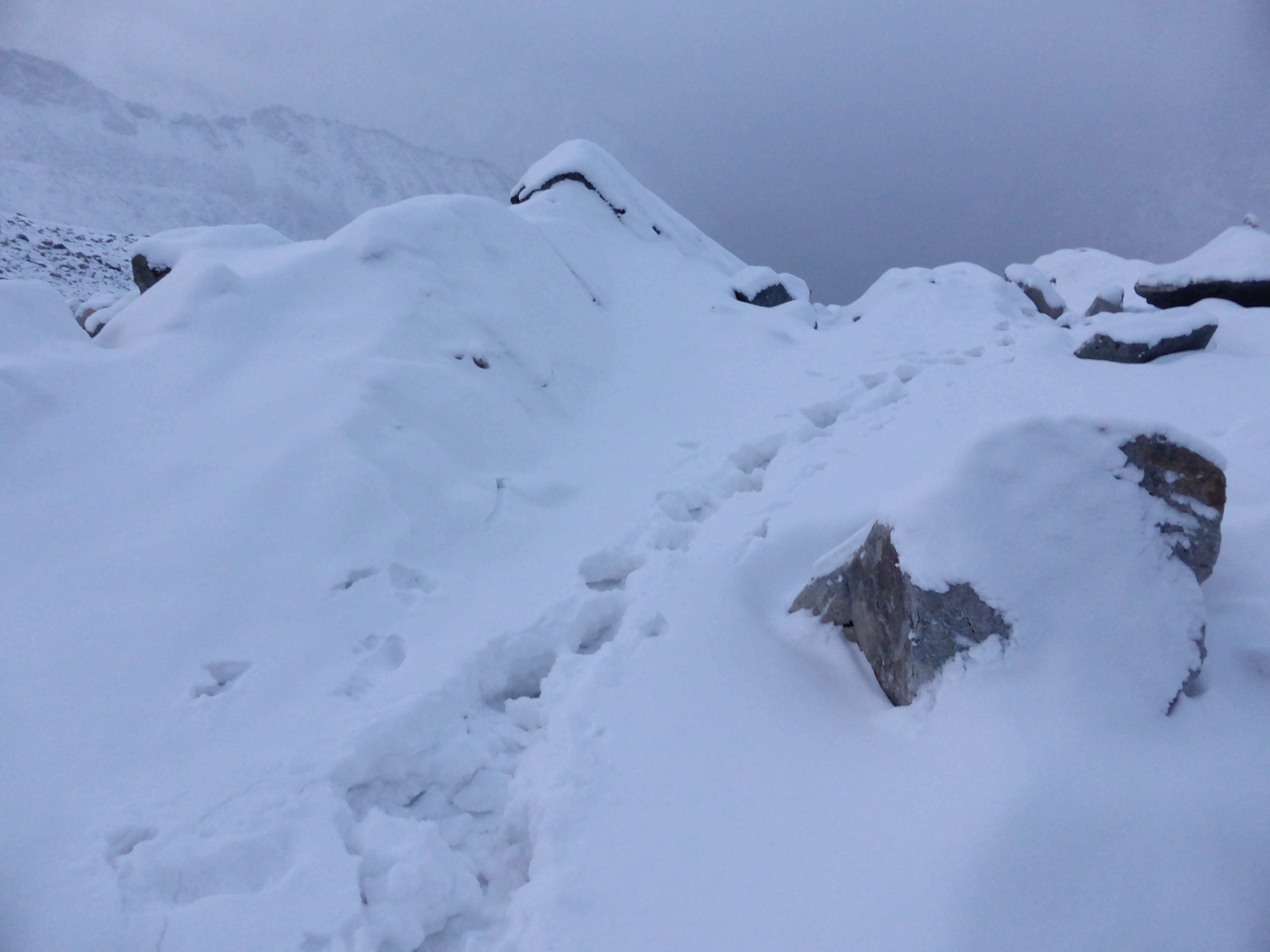
Day 3: I had set my alarm clock for 5:30 a.m., intentionally foregoing an alpine start due to the cold at night. I awoke to discover that roughly 30-40cm of snow had fallen overnight, blanketing everything in soft powder. I prepared my gear, ate a light breakfast, and began moving upwards at 6:30 a.m. The sky had cleared and was cloudless, but gusts of high wind stirred up spindrift.
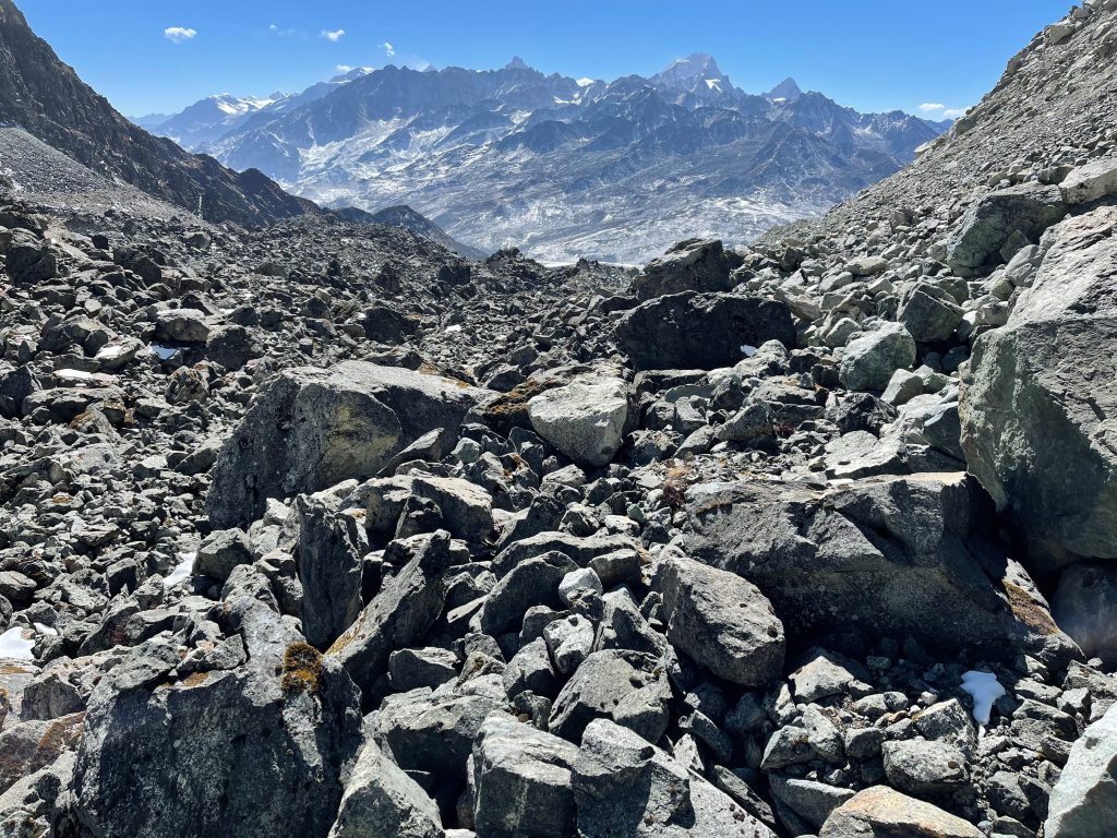
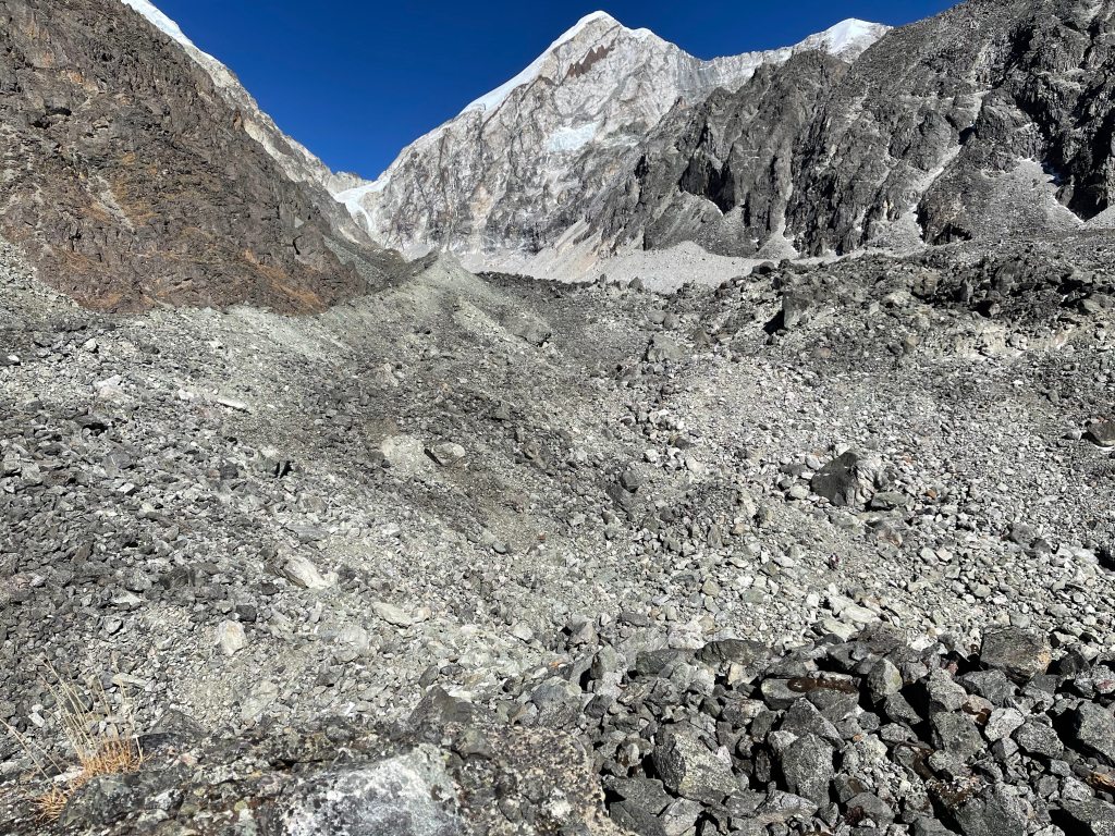
Making progress over the moraine was physically strenuous in deep snow. With the exception of larger protruding rocks the moraine was covered knee deep, and it was difficult to determine what lay underneath. Snow filled gaps between rocks were invisible, and stable footing difficult to come by. I broke trail upwards at a snail’s pace, trying to stay on top of bigger rocks and avoid postholing into the deep snow. Despite my best efforts I found myself frequently sinking into the soft snow between rocks, sometimes up to my waist.

Morning view towards Camel Peak, slightly above my highcamp.
Deep snow over the moraine made progress above highcamp slow.
The varied terrain prevented me from finding a rhythm with which to manage my pace, and the moraine seemed neverending. Reminiscent of Aconcagua’s upper Canaleta, the slog upwards was unpleasant: slippery, unstable, and physically arduous. Tempted to turn back after the first two hours, I forced myself to continue, telling myself again and again that the glacier would offer better and faster climbing. Three hours later, at 9:30 a.m., I finally reached the base of Camel Peak’s glacier.
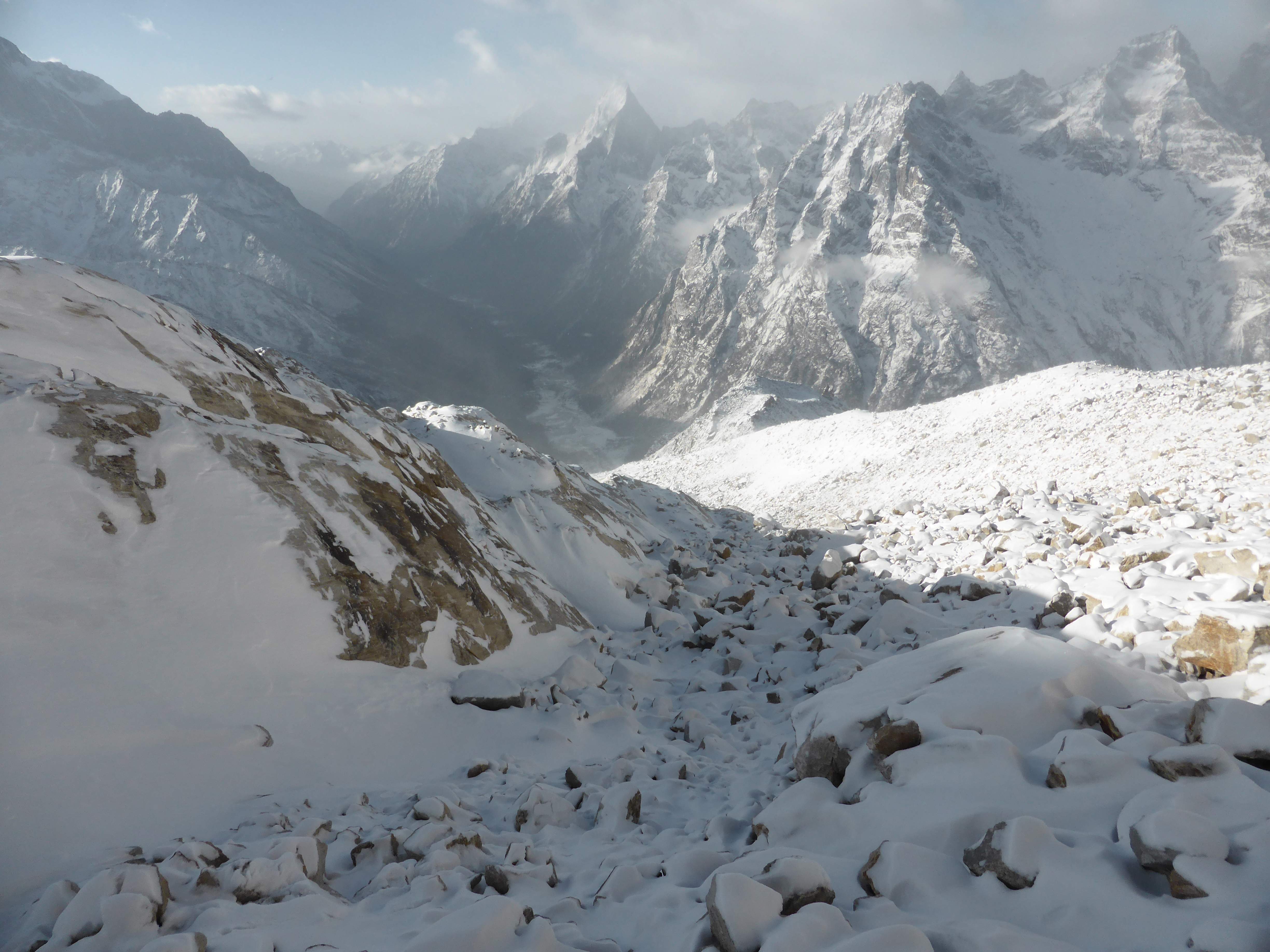
Looking down the snow-covered moraine, from near the base of Camel’s glacier.
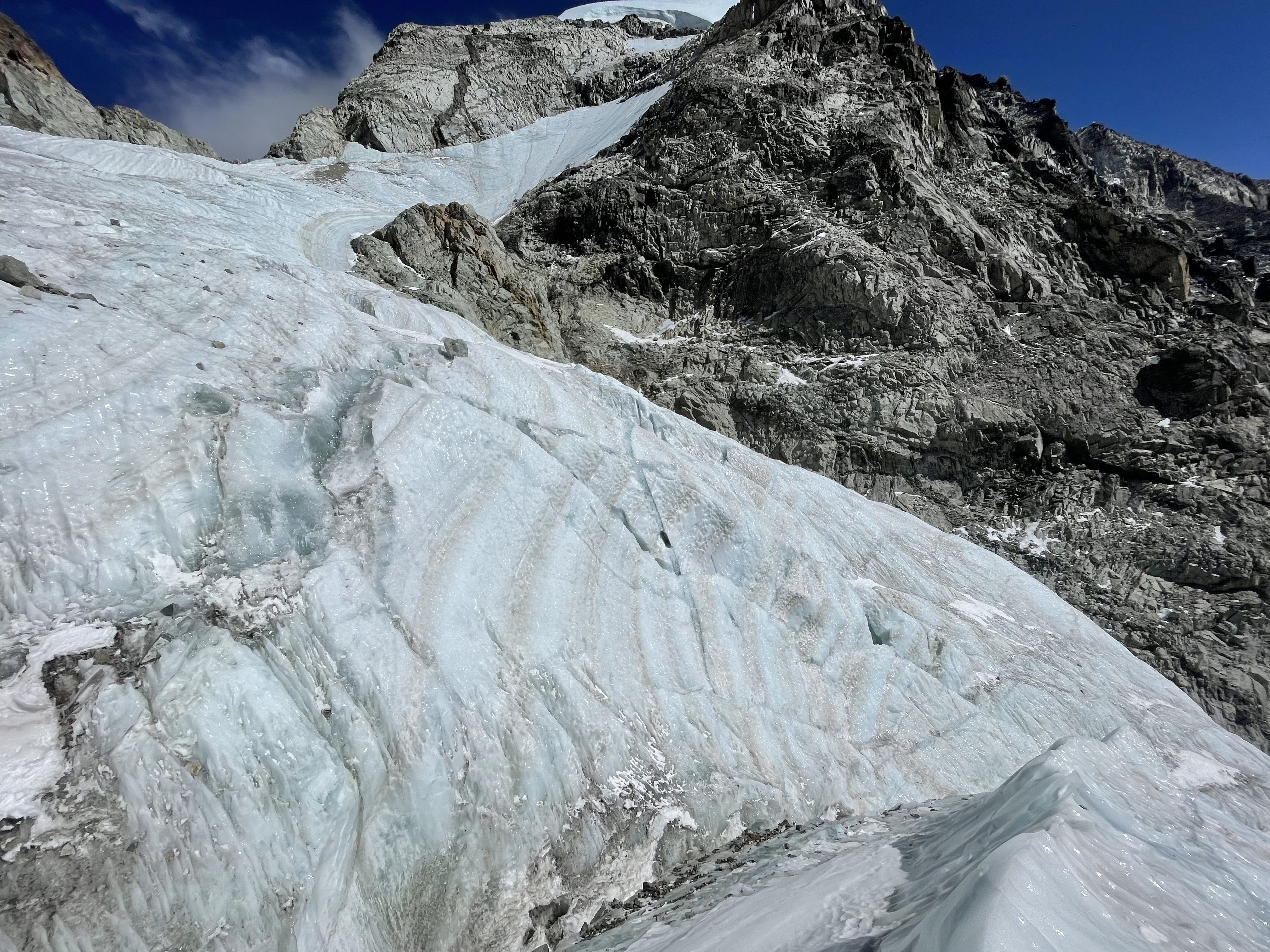
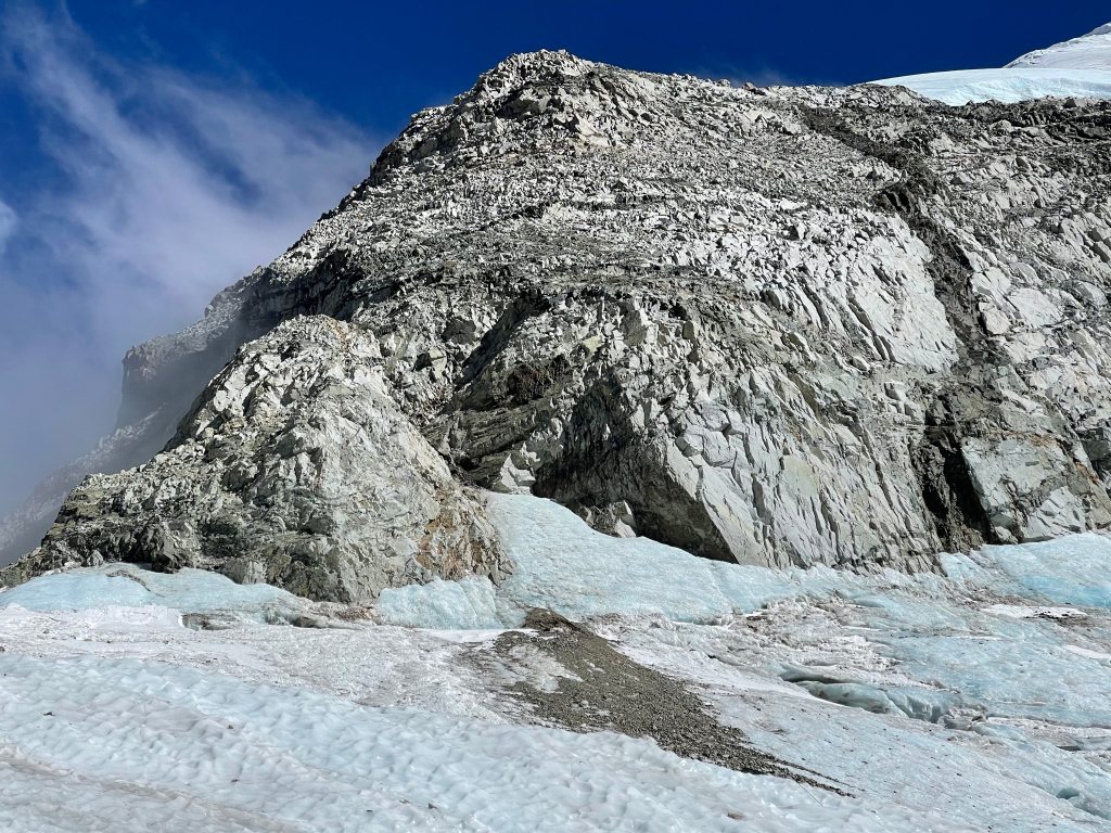
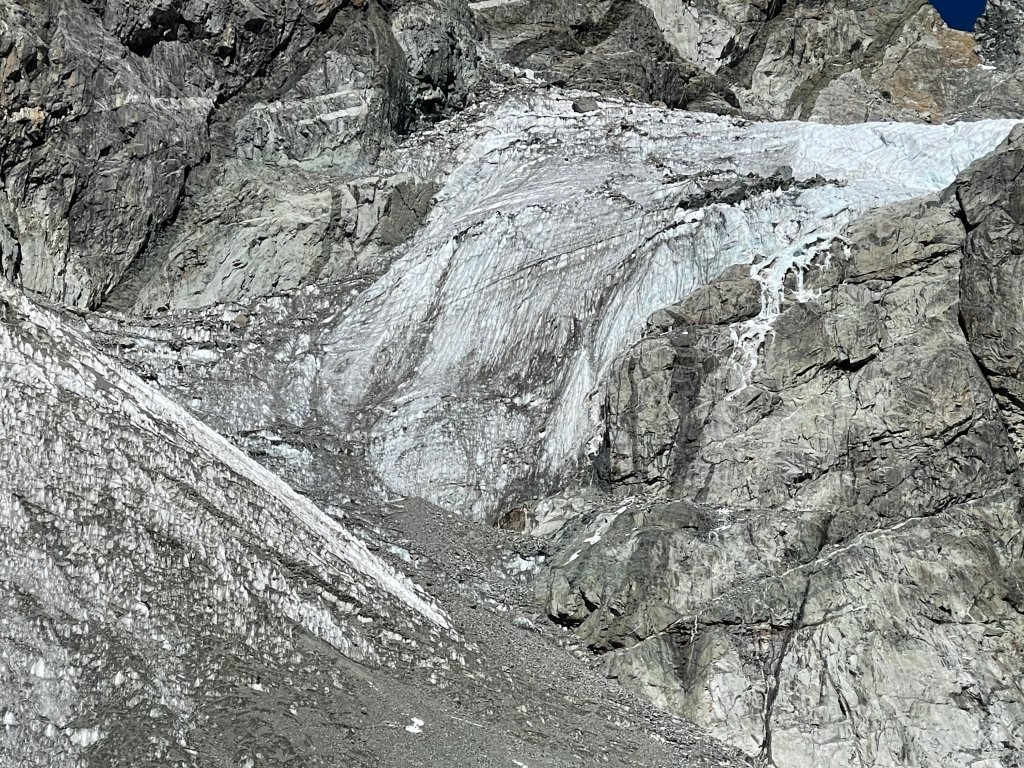
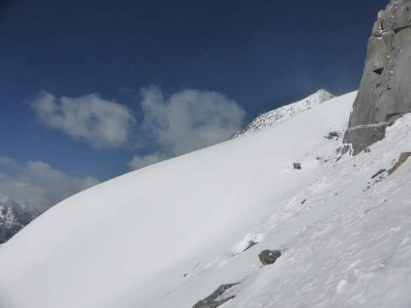
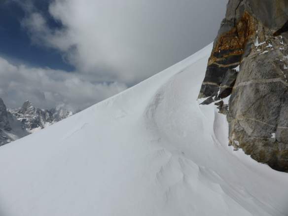
In researching Camel West’s traditional route of ascent I had come across several reports of fatal avalanches on the mountain’s lower slopes. From the base of the glacier it was clear that the terrain above was loaded with fresh, unconsolidated snow. The glacier’s snout showed ice, and I assumed that the night’s snowfall was likely resting upon a hard, solid base. Cautious of the potential for avalanche, I took care to stay off of the main slopes completely, and ascended the entire lower mountain by staying alongside the rocks. See the below image:

My route of ascent, avoiding the main slopes wherever possible. From left to right are the west summit, false west summit, and east summit.
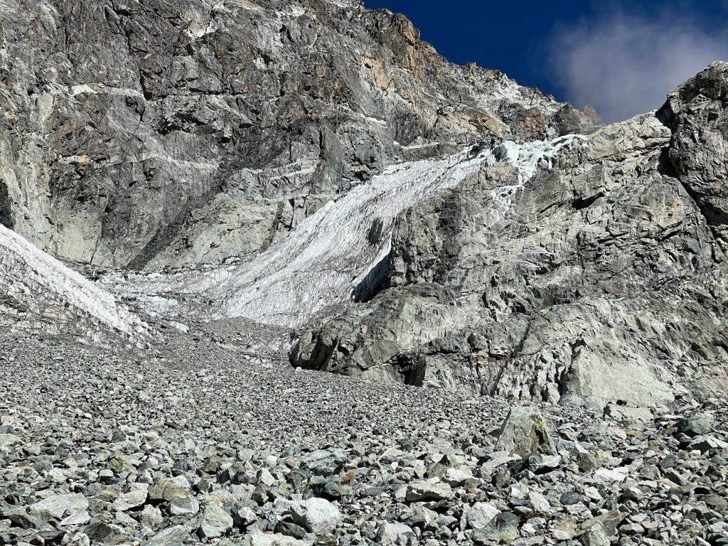
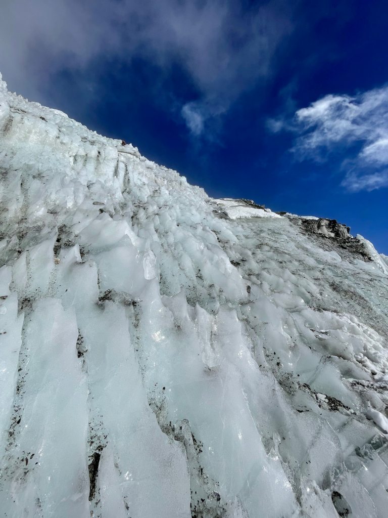
The conditions were less than ideal, with hard ice underneath the deep, powdery snow and gusts of wind blasting me with spindrift. An old fixed line was in place on the lower glacier, but unable to see its anchor I didn’t risk using it. I made better speed ascending the glacier, and fell into a good rest stepping rhythm despite the deep snow.

Looking down the lower glacier towards the moraine.
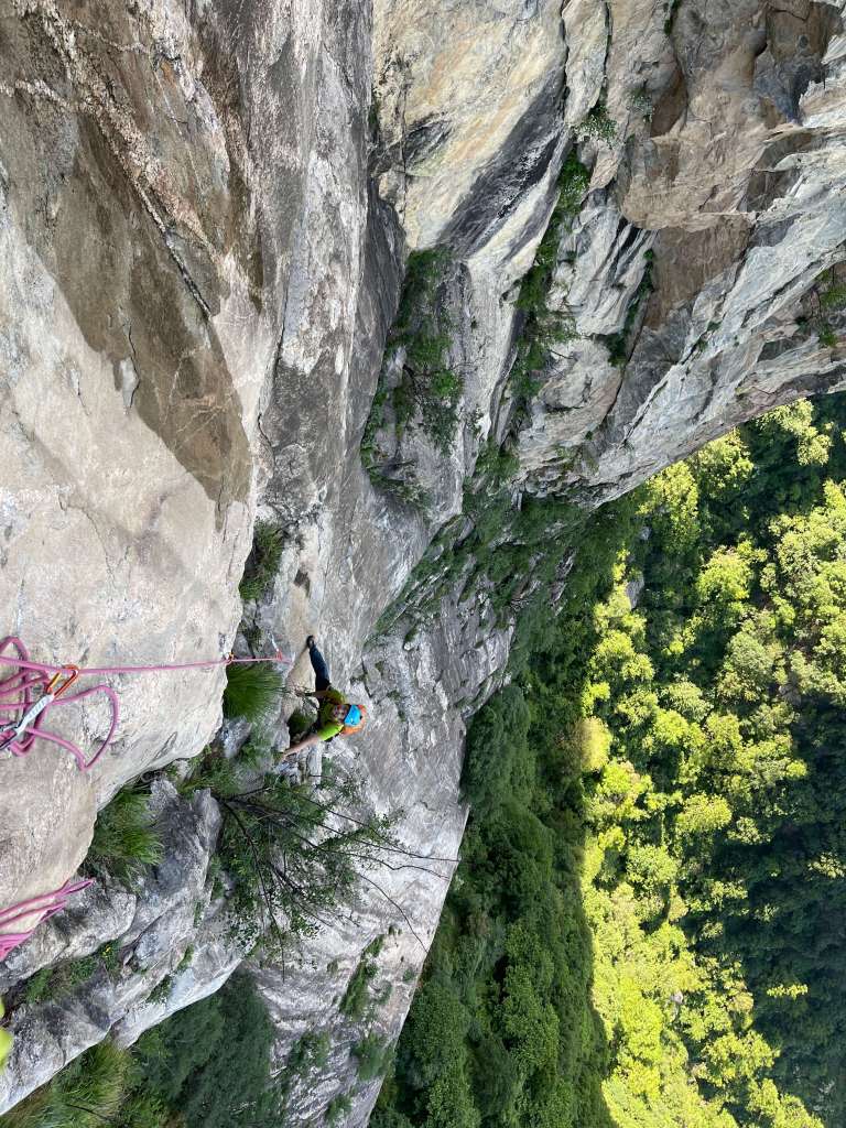
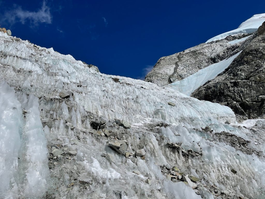
I followed the lower glacier alongside the rocks to the base of the east peak, using my ice ax and one trekking pole to ascend this section. At its steepest the climbing was around 40-45 degrees.
One slope remained, slanting upwards onto the high saddle between the east and west summits. I stayed alongside the south face of the east summit so as to avoid climbing across the deep snow on the main slope. The false west summit came into view across the saddle.
Looking towards the false west summit, from below the east summit.
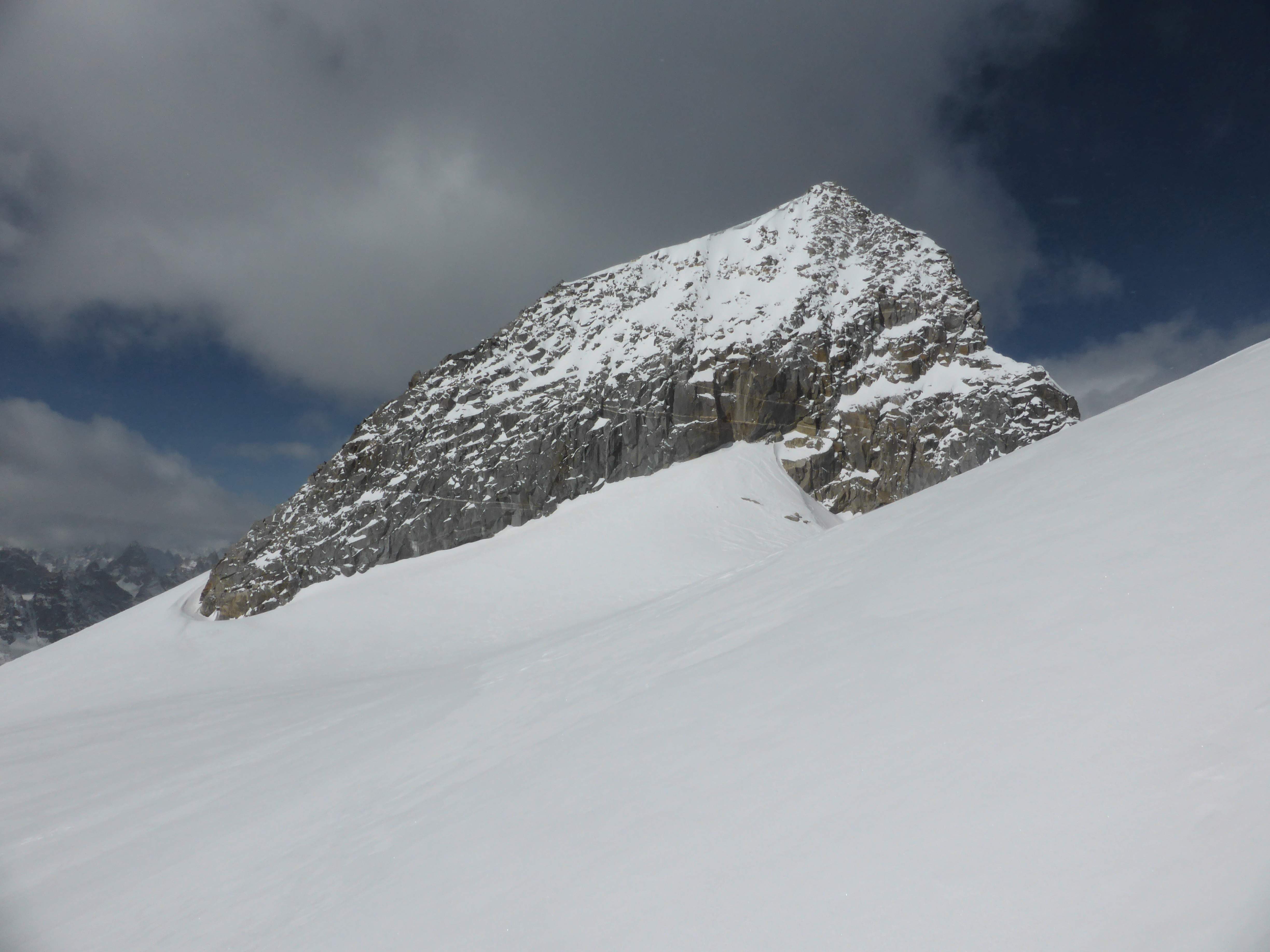
The false west summit, across the saddle.
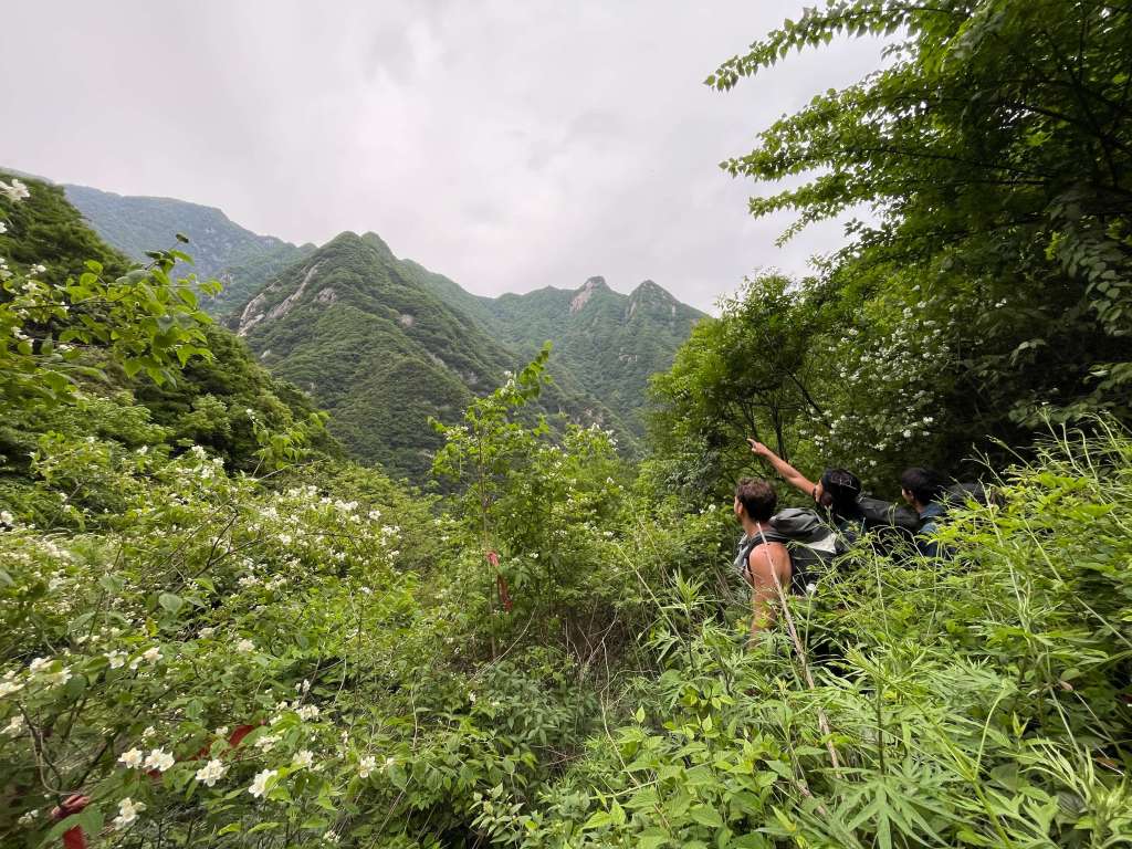
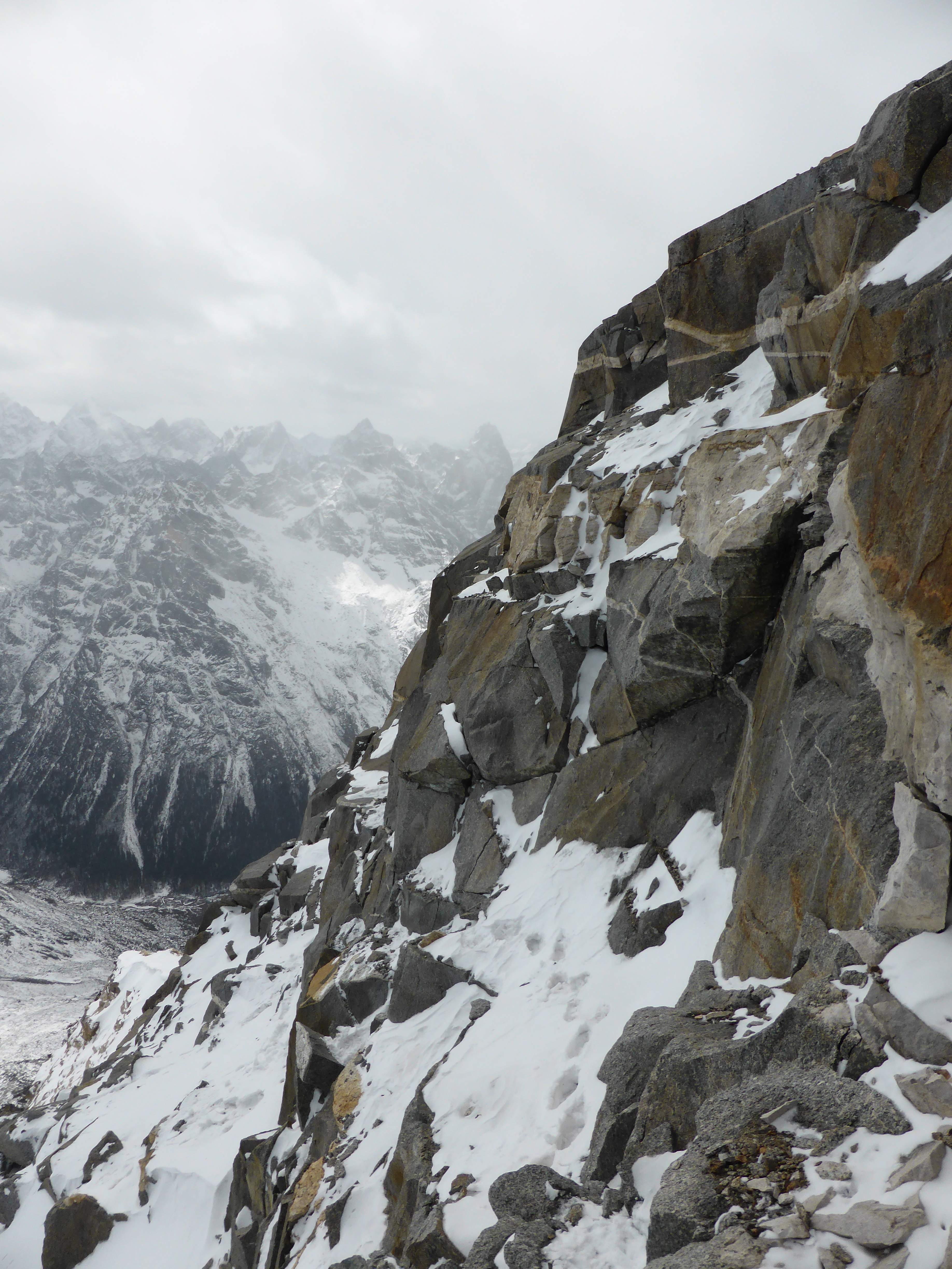
From the saddle I enjoyed good views of the mountains, many unnamed and unclimbed, which line Changping valley to the west. The saddle near the east peak was loaded with deep snow, difficult to break trail and cross, but became shallower as I got closer to the false west summit. The east summit stood jaggedly elegant behind me.
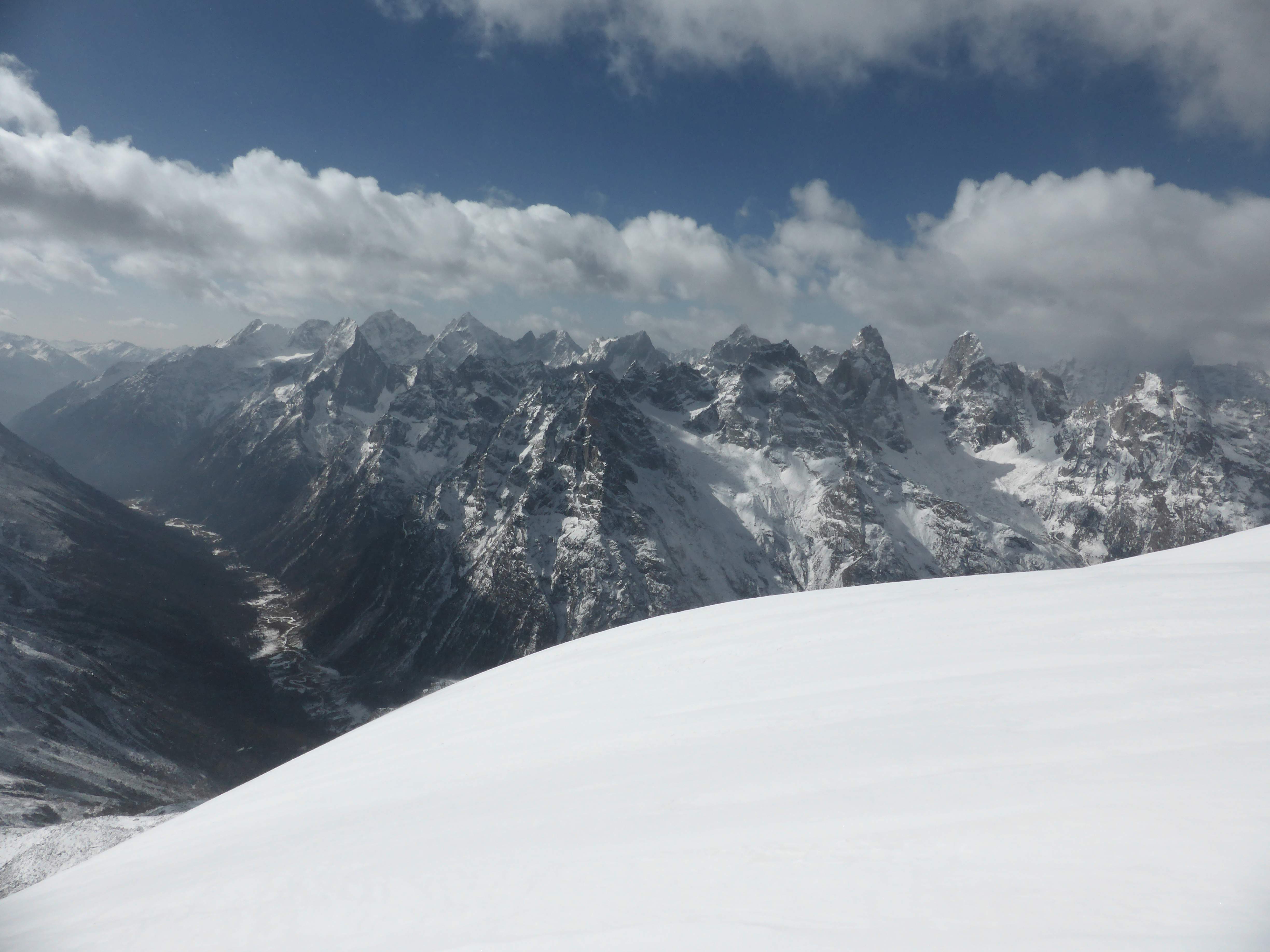
Jagged peaks to the west of Changping Valley.
Looking back across the saddle towards the east summit.
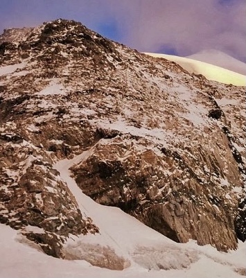
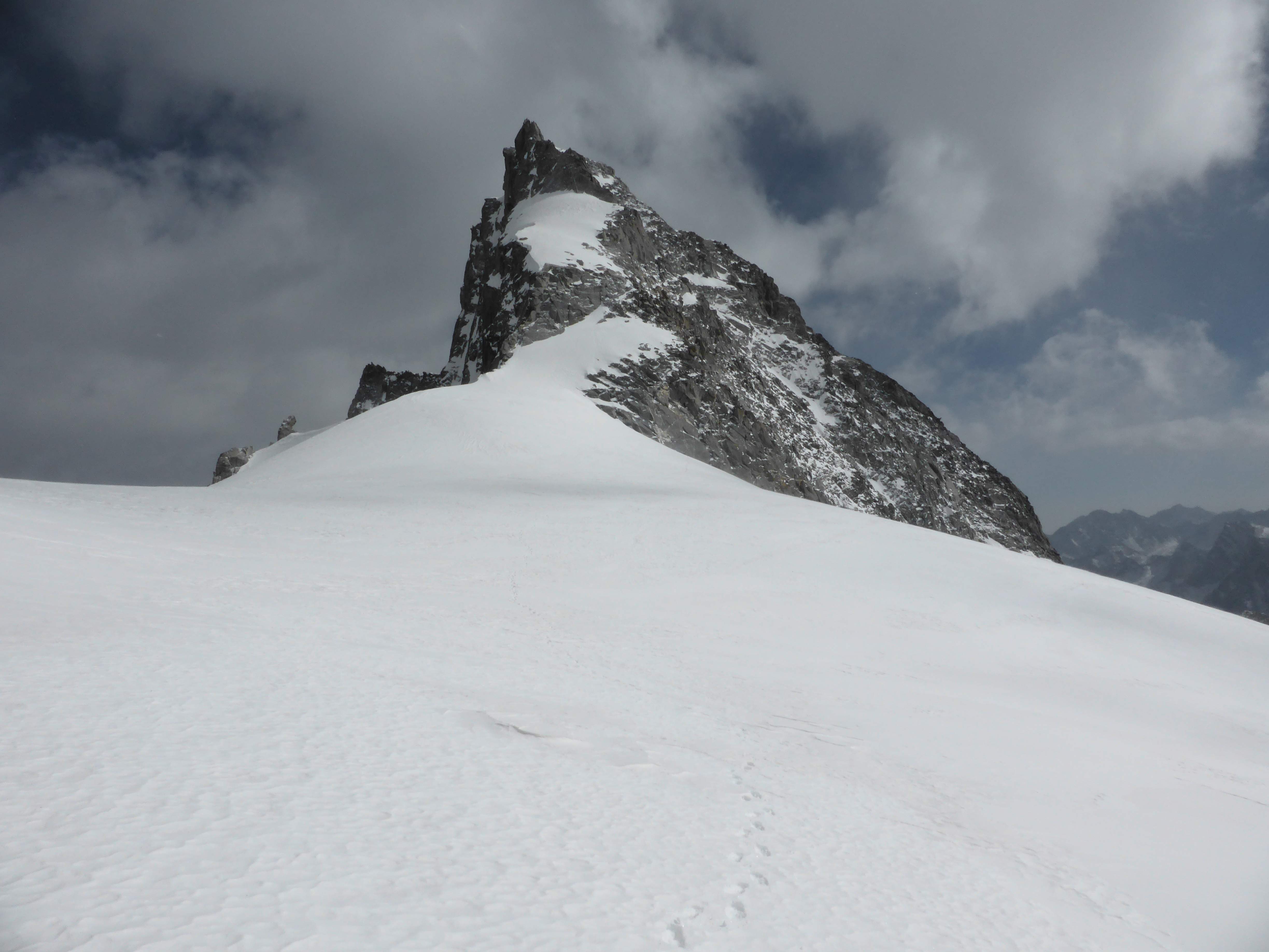
At the lower south base of the false west summit the glacier drops into a steep slope towards the south, and curves around and upwards towards the west. To the north of the saddle is a drop off into a nearly vertical face. Here the climbing became steeper, around 55-60 degrees with knee deep snow in some sections. I put my trekking pole away and used my ice ax together with one ice tool.
The southern base of the false west summit, from the saddle.

Ascending, curving up and around the false west summit through steep, deep snow.
Once around the false west summit a final traverse across a steep ridge leads to the true west summit. I had seen photographs of this section, and knew it to be heavily corniced on the north side. Traversing too low across the ridge would expose me to potential avalanche hazard from above, while traversing too high would expose me to the cornice edge. The snow on the ridge didn’t feel dangerously deep, so I picked a line across the middle and pushed myself to maintain a fast pace across.
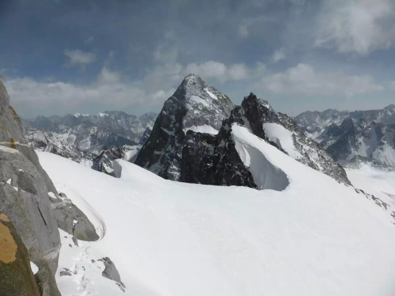
Looking across the final ridge from below the west summit. In the distance from left to right are Yangmantai, the east summit, and the false west summit (the snow covered point below and in front of the east summit).
Once across the ridge the west summit stood above me, a steep rock wall, nearly vertical due west. I began to scout a manageable way up.

Looking across the final ridge towards the west summit.
A quick look confirmed that the north side was a vertical wall with no features suitable for unprotected ascent. The base of the wall to the south seemed promising, until I found the way blocked by featureless, downsloping slabs of rock. Moving back towards the north I climbed a sloping class 3 rock ramp to where it stopped at a snow patch roughly a third of the way up the wall. From here the only way forward was straight up, following a system of cracks. Using my ice tool to jam the cracks and provide additional purchase, I carefully made my way upwards. The climbing wasn’t too difficult, probably low class 5, but the wind and exposure gave me intense focus. Concentrating on my hand, foot, and tool placement, I made steady progress and soon found myself at the top.
Looking down the summit rock wall from roughly halfway up.

Looking down Changping Valley from below the west summit.
Ahead lay prayer flags and a cairn atop a small snow slope.The wind howled past me as I carefully walked the last few steps to the top. At 2:40 p.m. I reached the summit, tired but happy.

The west summit of Camel Peak.

The west summit of Camel Peak, Yangmantai and the east peak behind.
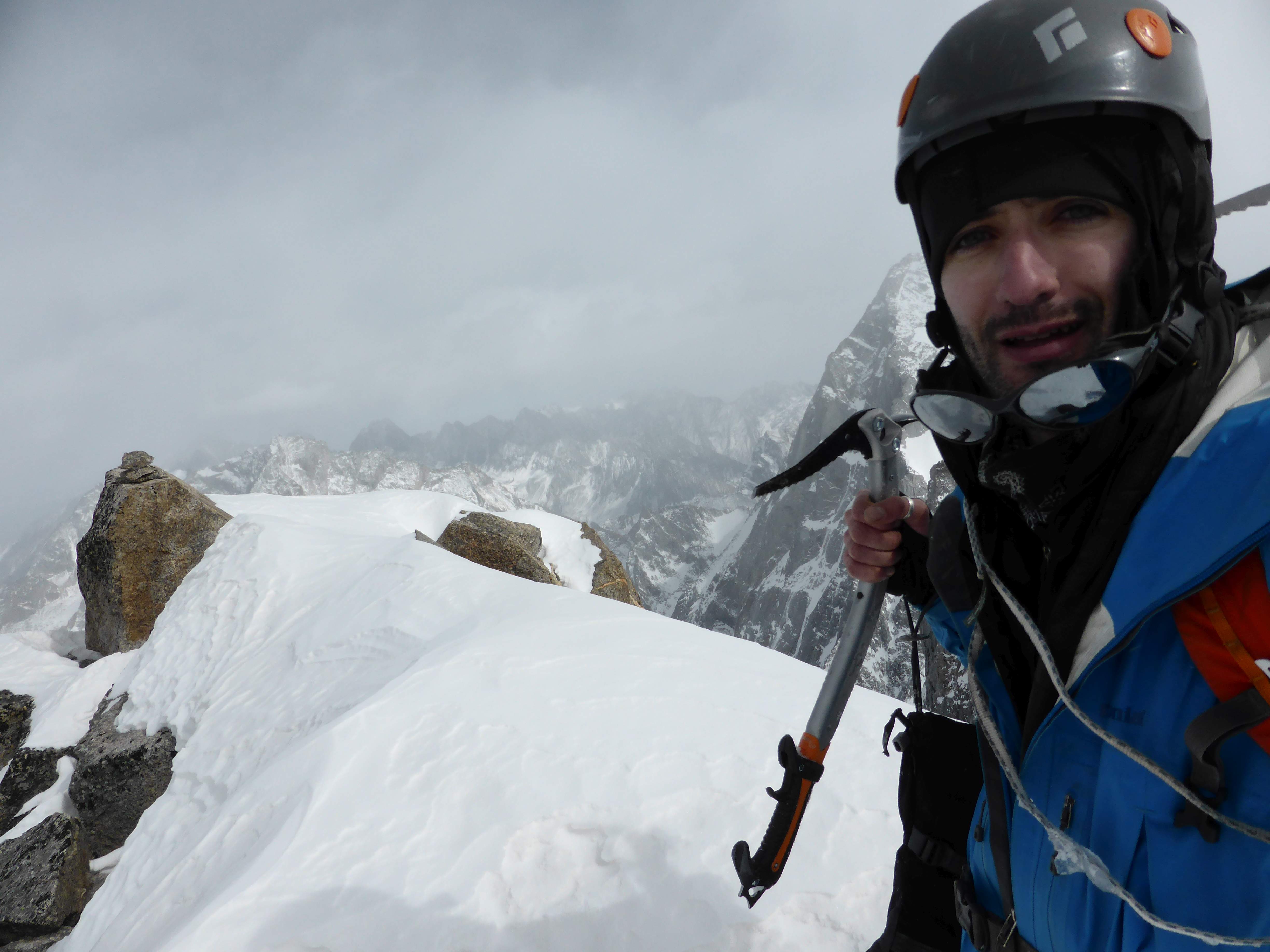
Atop Camel West.
The summit was cold and exposed to the high winds. I quickly took some photographs and began descending after only 4 or 5 minutes. Using my ice tool extensively, I descended the rock as cautiously as possible. At the base of the summit wall I took a short rest and a snack before crossing the ridge.
Retracing my steps on descent was much faster than the ascent had been, with the exception of the saddle separating the east and west summits, where my broken trail through the deep snow near the east summit had been filled in by the wind. At 4:00 p.m. I reached the base of the glacier and found Mr. Huang waiting for me in the rocks.
We walked across the moraine back to the high camp, where we arrived at 5:30 p.m. – a total of 11 hours tent to tent. I ate some bread, drank some water, and organized equipment before immediately falling asleep.
Looking across the moraine, on the way back to highcamp.
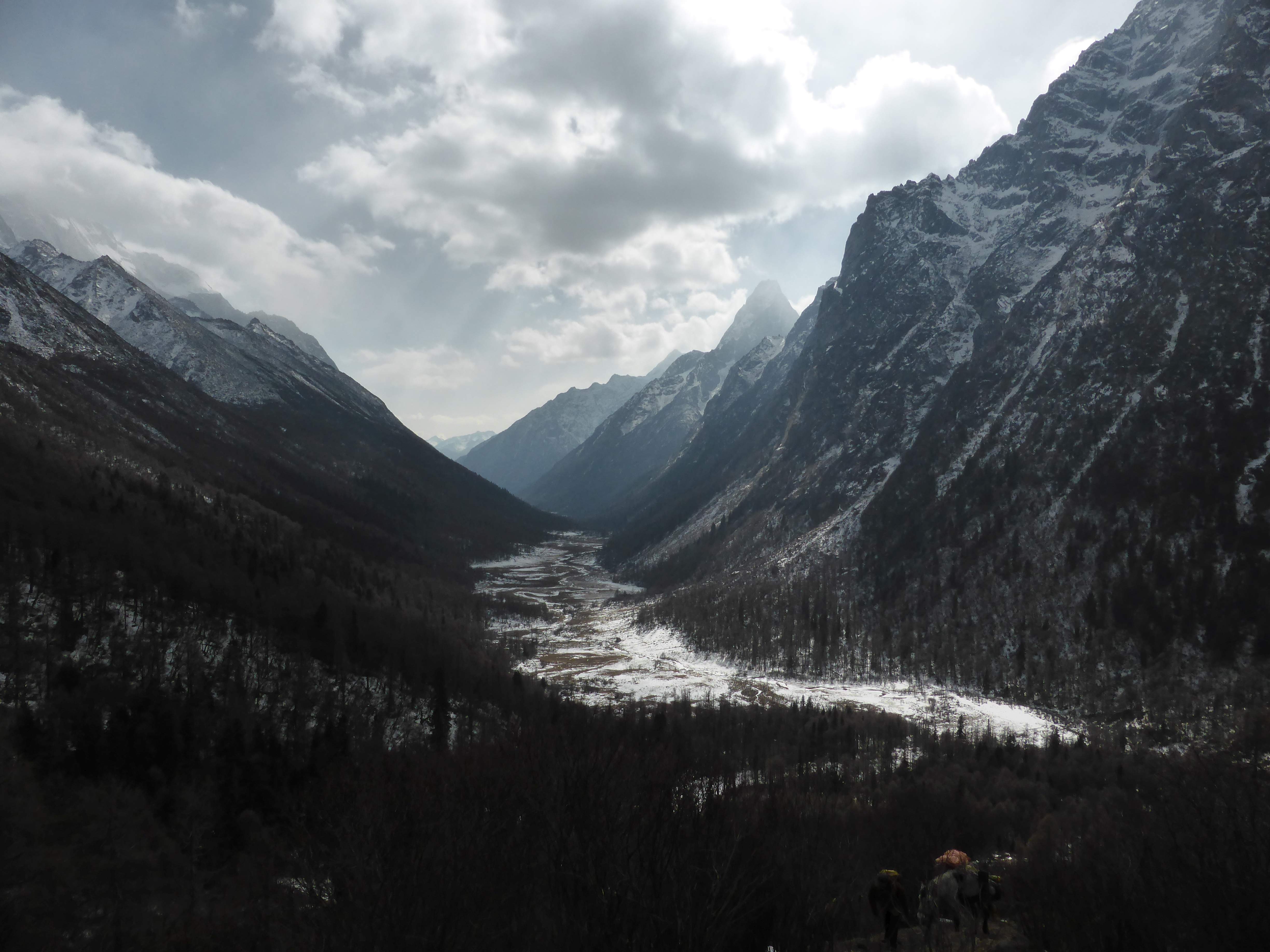
Day 4: Awake at 8:30 a.m. we ate breakfast, packed up the horse and began the long descent down Changping valley. Taking only a few breaks for food and water, we walked all the way from the high camp at ~4700m to Lama temple at ~3200m, covering 33km and 1500m of descent in 7.5 hours. Back in Rilong I showered and went out for a celebratory meal of spicy beef hotpot.

Looking down Changping Valley, descending from high camp.
Thoughts on Camel Peak
Camel Peak tested my mental tenacity, physical training, and prior experience. Climbing solo was rewarding and very engaging. Being alone on the mountain, the only person to climb it in weeks, if not months, was a special feeling. Poor weather and conditions on the mountain made the climb challenging for me, and after the uncertainty surrounding my goal finally attaining the summit felt like a powerful personal achievement. The Siguniang Shan region is filled with wild, steep, vicious mountains, many of which are unnamed and unclimbed. I feel privileged to have visited this area and to have stood atop one of these mountains, even one of the easier among these peaks.
Camel Peak and Yangmantai.
Yaomei Feng.
Accessibility
My SMA contact and Rilong locals advised that, despite the cold temperatures at altitude, winter is a good time to climb in the area due to less inclement weather. I experienced heavy snowfall the night before my climb and high winds on the mountain, but was told that in other seasons precipitation can be very frequent and more severe. October is a high tourism season for the area due to Chinese national holidays, and all of the valleys will likely be crowded with Chinese day hikers. Ascents have been made in this area year round.
I stayed at the Aleeben hotel while in Rilong, and connected with the owner ahead of my climb. He assisted with arranging shared 4×4 transport to/from Rilong and in finding Mr. Huang, the horse-driver, to accompany me at the last minute. It is best to contact the hotel by Wechat or telephone. They may have English speaking staff present during high seasons, but did not during my winter visit. Their website is www.aleeben.com/.
Climbing permits are required for all of the high peaks in the area, and must be obtained through the Sichuan Mountaineering Association. They do not seem to have English speaking staff, and permit applications are completed in Chinese. Permit applications require a detailed itinerary, an acceptable climbing resume, a passport photocopy, proof of a valid Chinese Visa, and an application form. There are fees for climbing – I paid 500 RMB or roughly $100 USD for my permit. The SMA are best contacted by Wechat or telephone, and in particular are very friendly and helpful over Wechat. The SMA website is www.sma.gov.cn/.
Changping Valley has an entrance fee of 150 RMB for overnight visitors. While climbing permits are obtained via the SMA, they are enforced and checked by the Siguniang Shan park administration, located in Rilong. The park did not have any English speaking staff on site. They would not permit me to climb unassisted, and made it mandatory to employ a local horse driver at minimum. The park website is www.sgns.gov.cn/.