Yanapaccha – July 2015

...

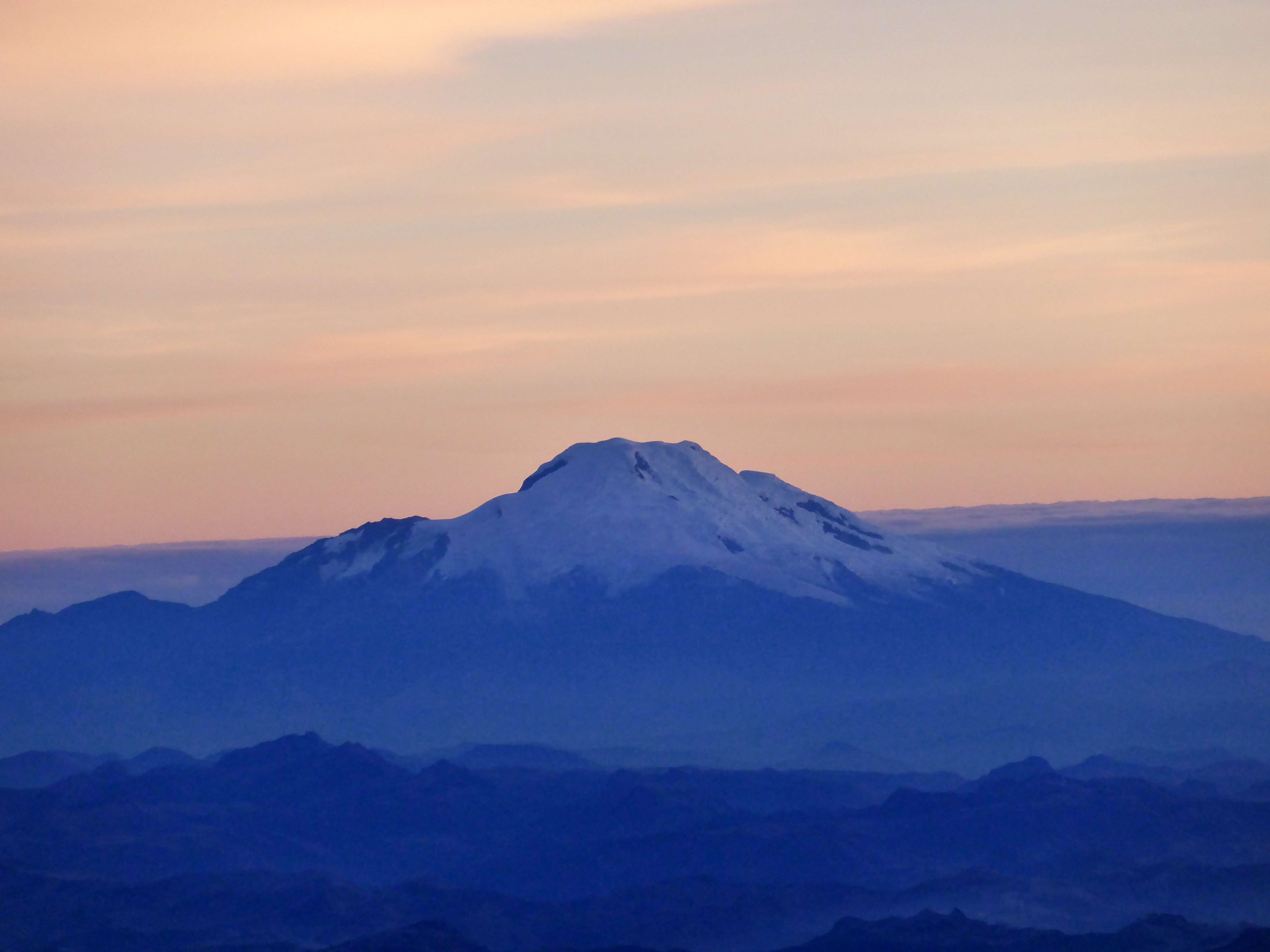
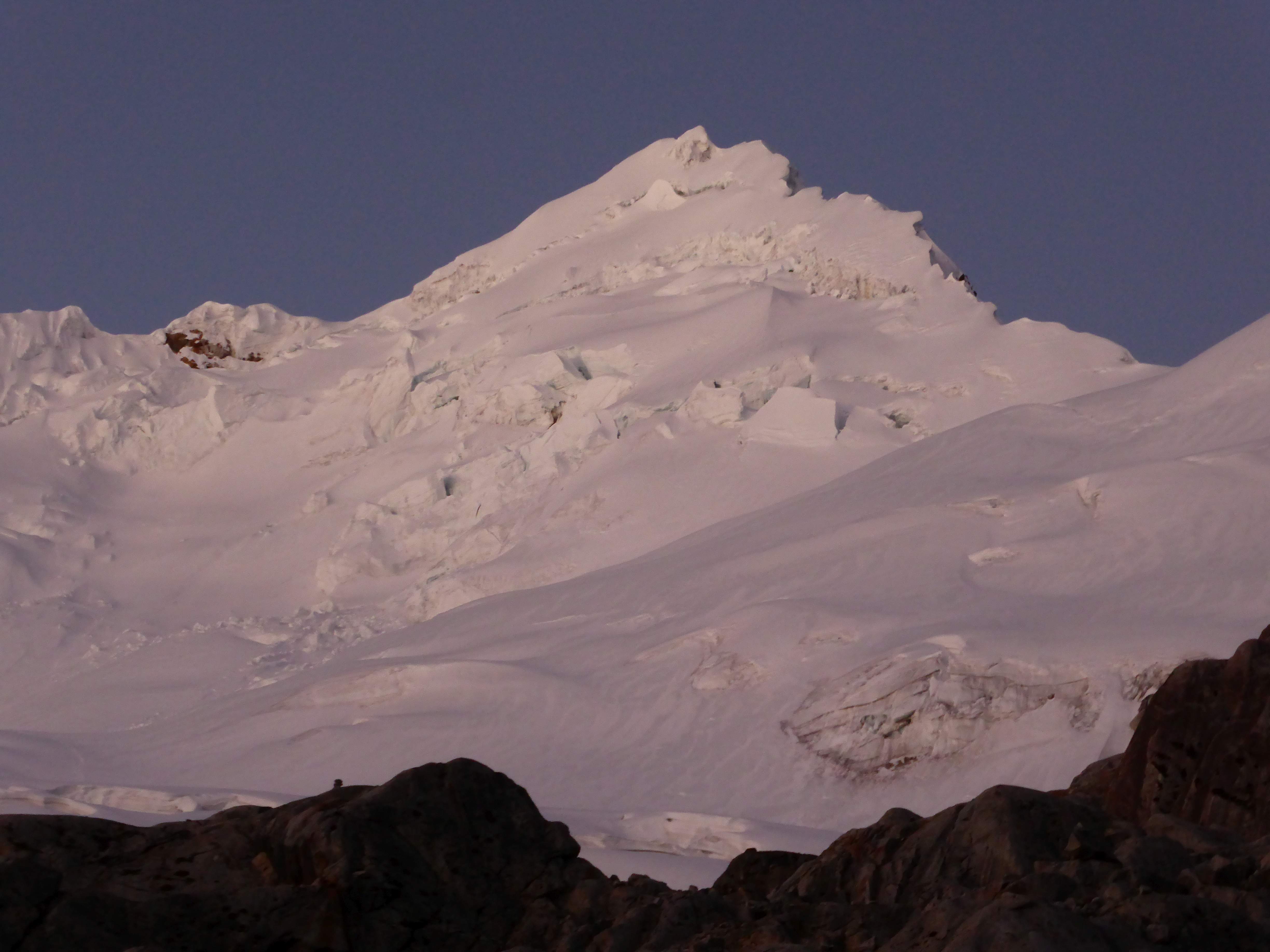
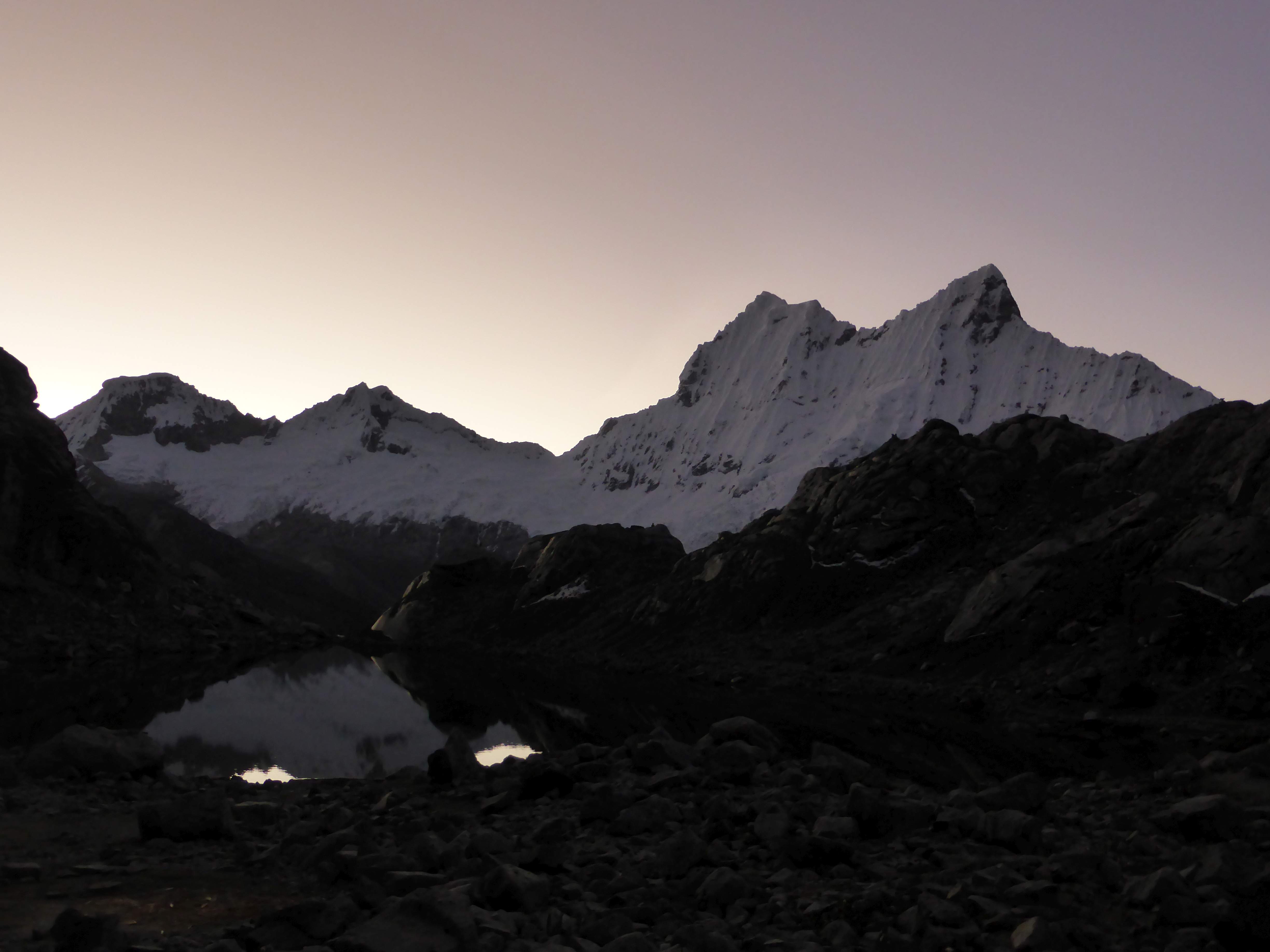
Yanapaccha at dusk from the moraine.

After success on two of Peru’s easy 5000m peaks, Ishinca and Pisco, success on the technical and gorgeous 6000m Tocllaraju, a very disheartening, thwarted attempt on Chopicalqui due to lack of appetite and poor (not eating anything for three days while on the mountain) nutrition, and a 12 hour hotel-to-hotel single day visit to Huascaran’s unexpectedly-closed refuge in inclement weather, we found ourselves with only three climbing days left in Peru.   I had struggled to get enough calories down throughout the trip while at altitude, and while happy with the variety of mountains we’d visited so far, wanted to get onto another technical mountain.

...

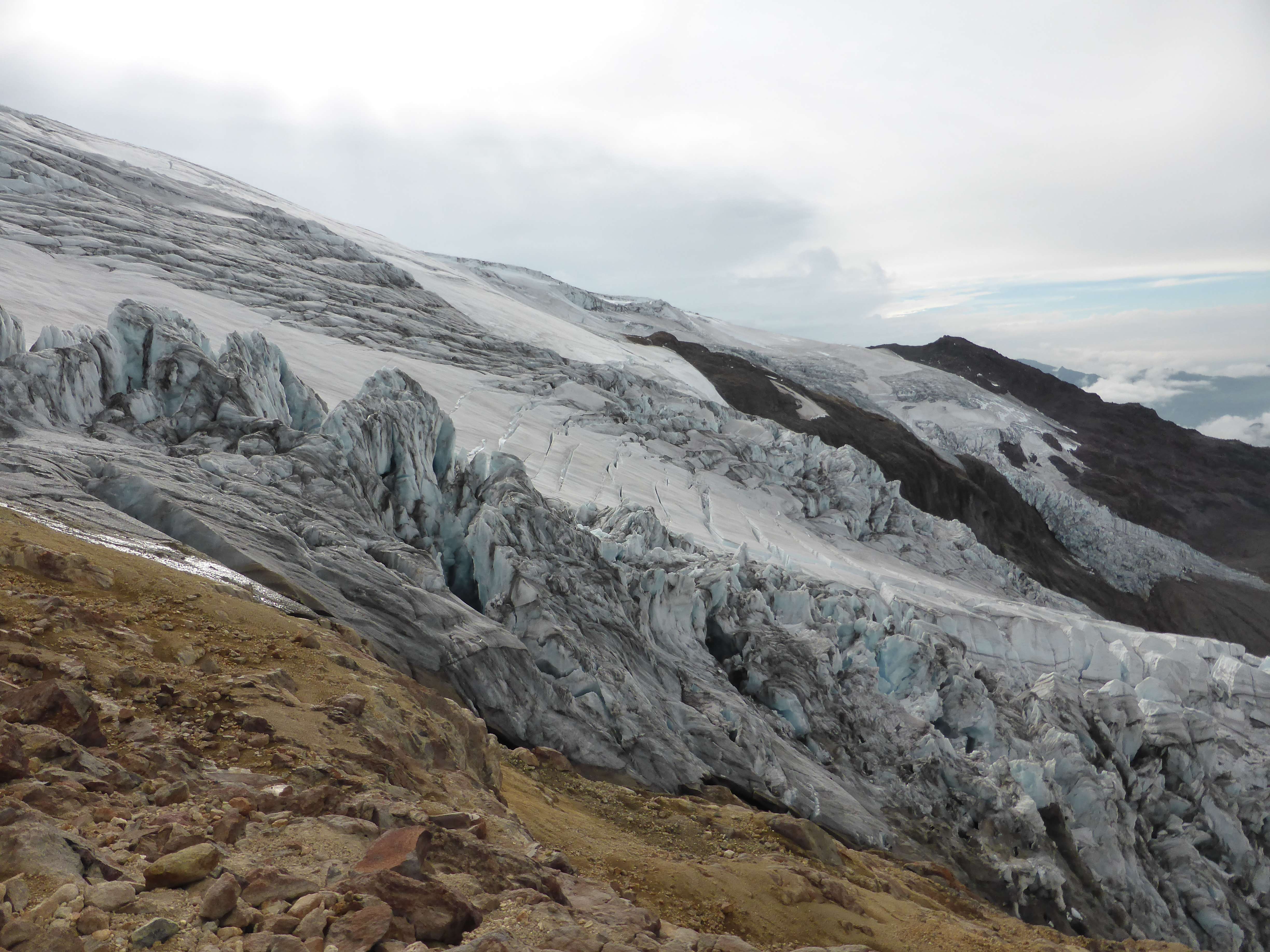
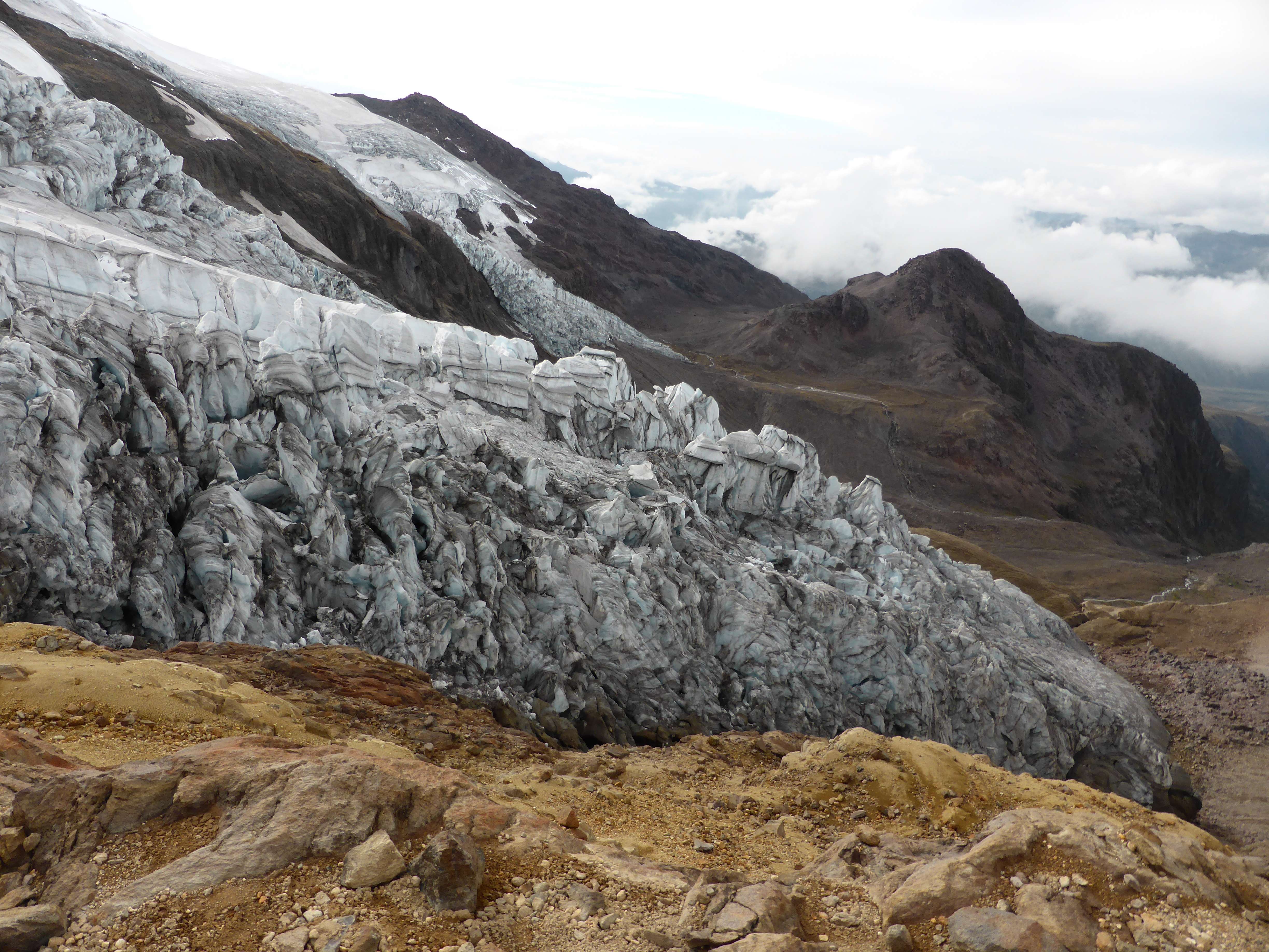
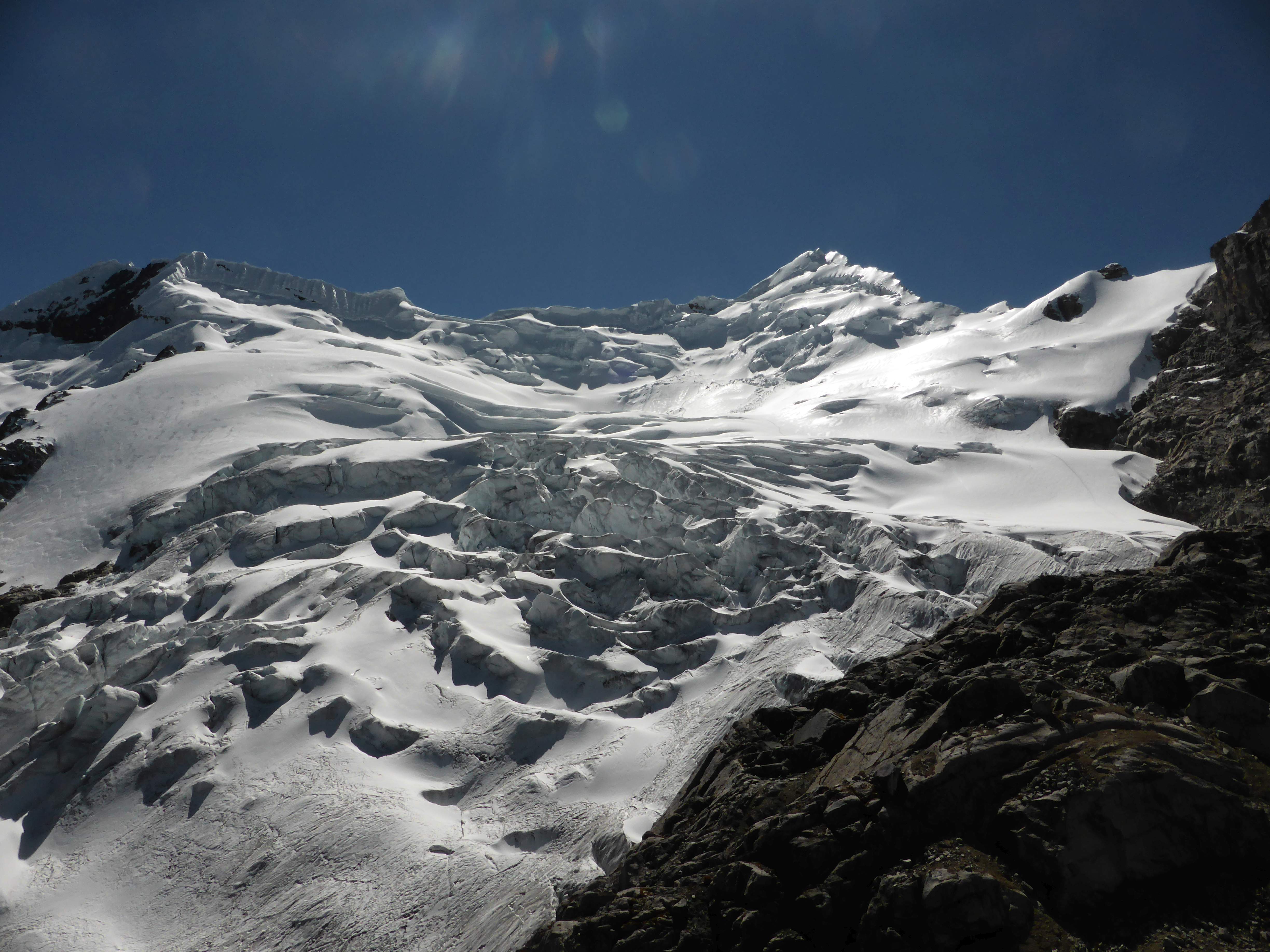
Yanapaccha and it’s enormous glacier, as seen from the approach hike.

With no time to attempt another 6000m peak, and uncertain whether it would even be a good idea given my anaemic appetite, my partner and guide Edgar and I opened the guidebook in search of a technical 5000m peak.  When we discovered that Yanapaccha was a rare exception to Peru’s typically lengthy and brutal approach slogs up, down, and over endless moraine fields, we were immediately sold on the idea of visiting and making an attempt.

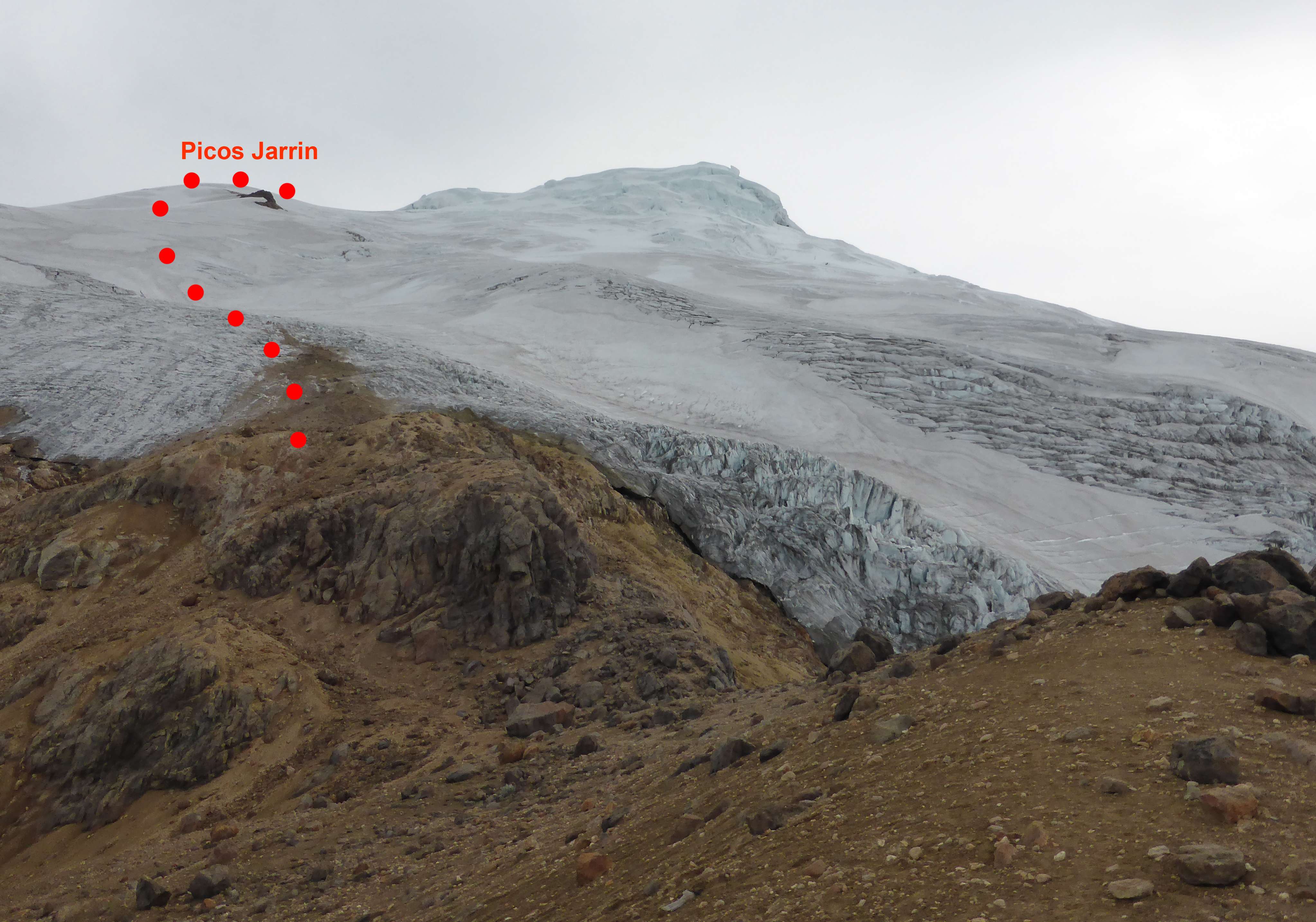
Yanapaccha is not a popular climb, likely due to the fact that it isn’t particularly high yet is technically a good deal more difficult than nearby Pisco.  Regardless, a short and very moderate approach makes Yanapaccha highly accessible, and its large glacier sports some very nice terrain at around an AD difficulty.

Day 1: We left Huaraz in a shared minibus headed for the Quebrada Llanganuco via Yungay, the same area used to access Huascaran, Chopicalqui, and Pisco.  We continued past the access point for the Pisco approach, continued further still past the access point for the Chopicalqui approach, and followed switchbacks upwards to around 4650m where the approach to Yanapaccha begins at the side of the road.  The views here were incredible, with numerous high peaks towering around us.

...

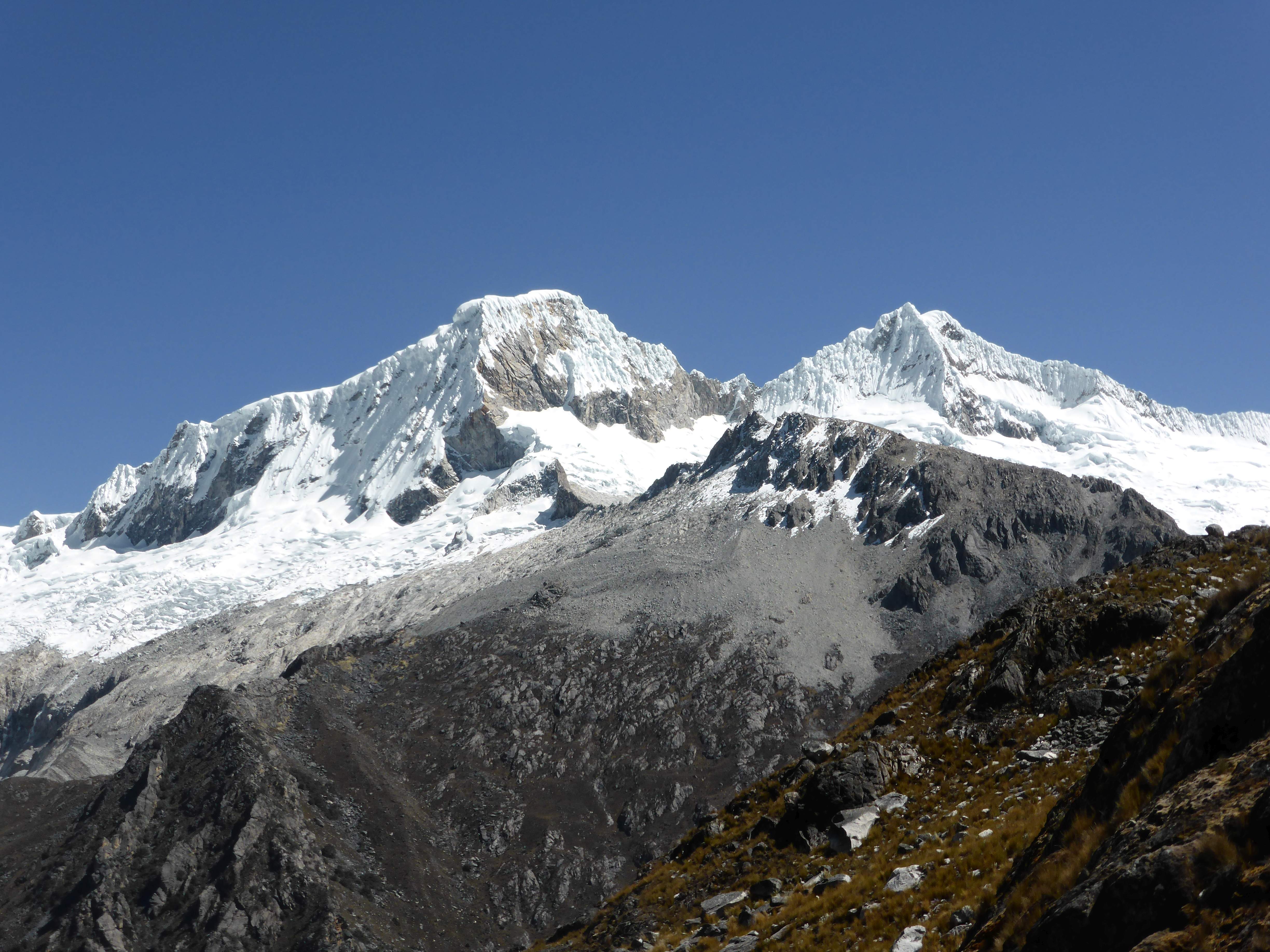
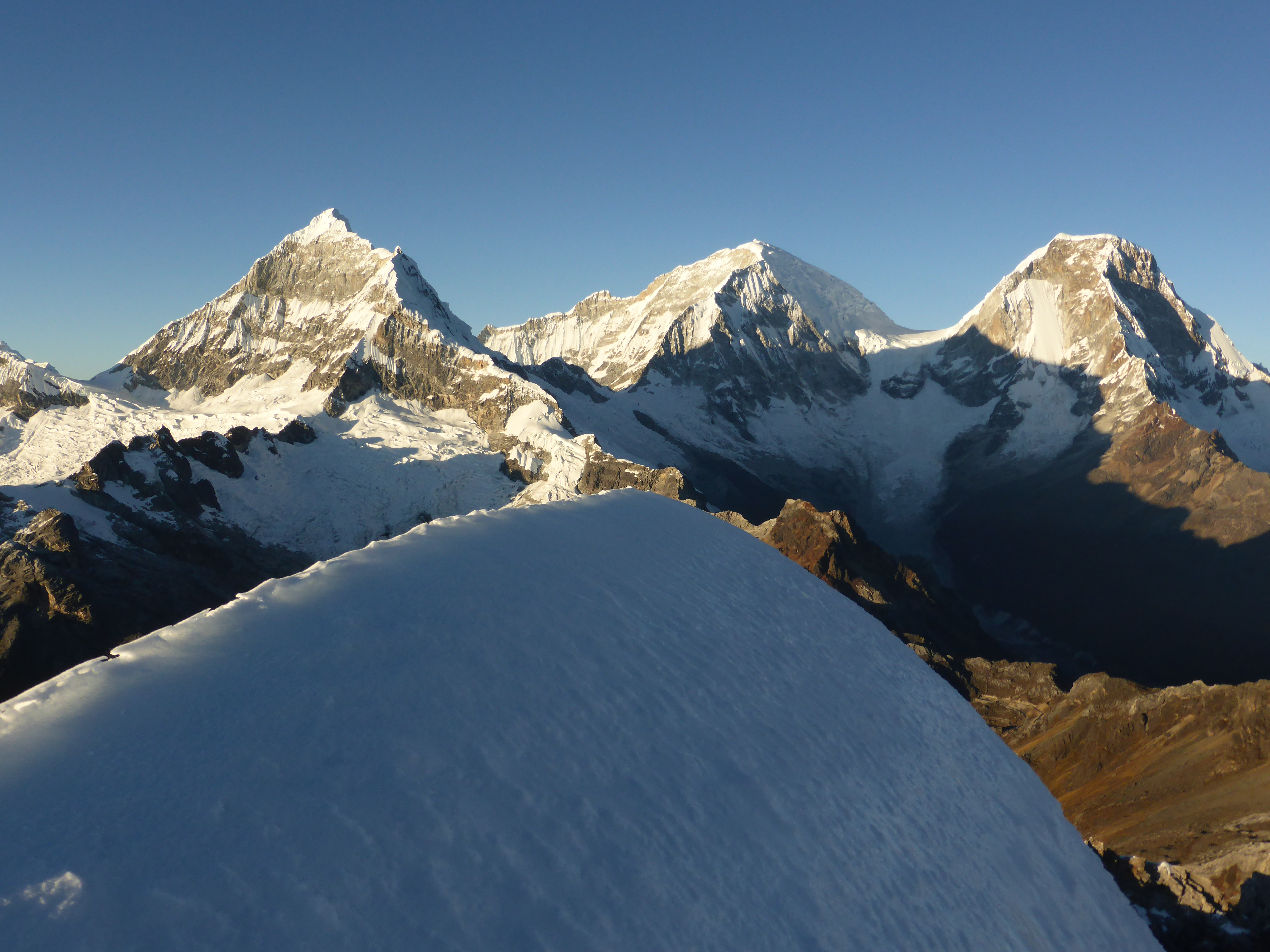
Chopicalqui, Huascaran Sur, and Huascaran Norte high above the Quebrada Llanganuco, as seen from the Yanapaccha approach access point.

...

The Huandoys.

...

Pisco

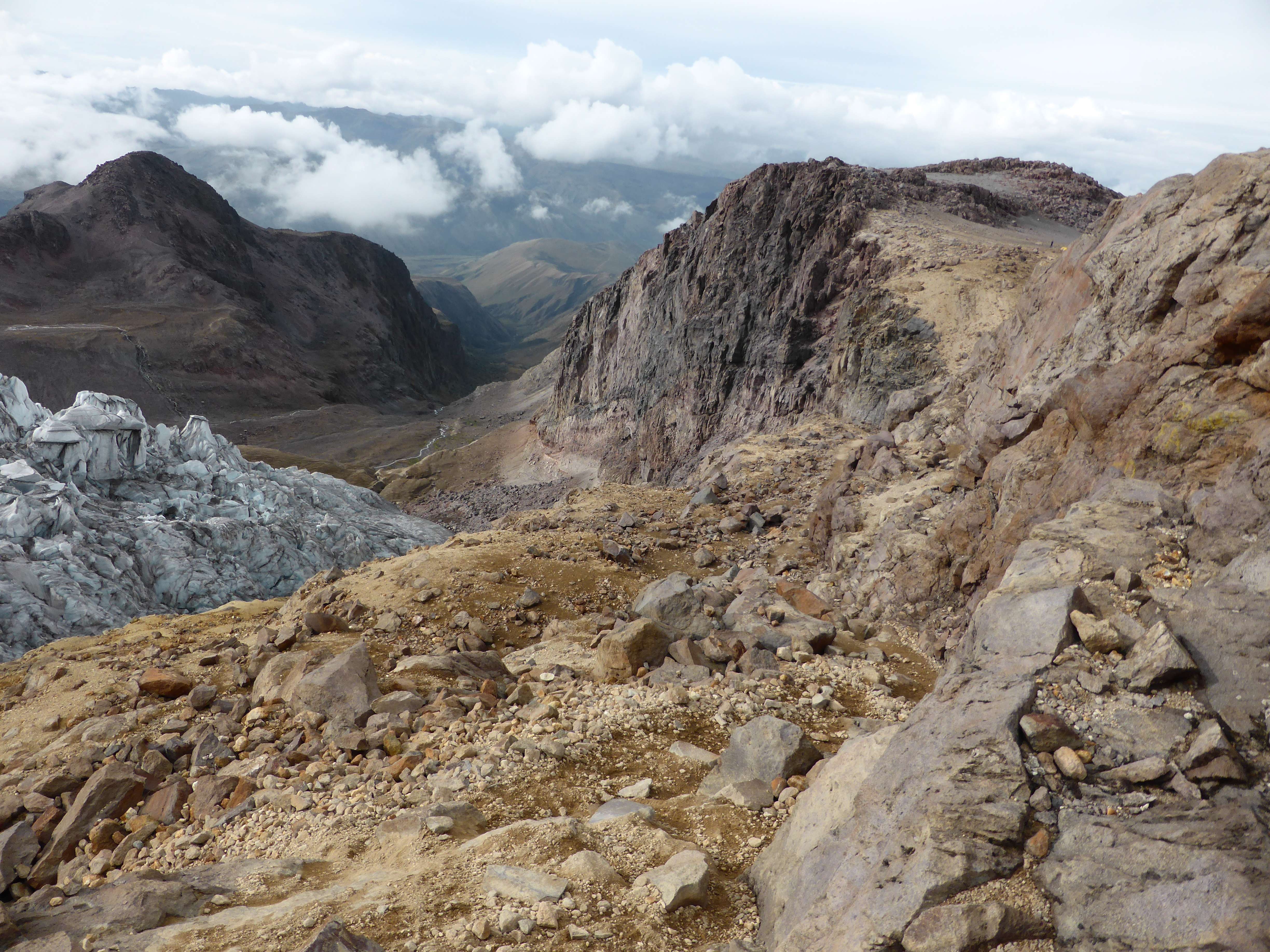
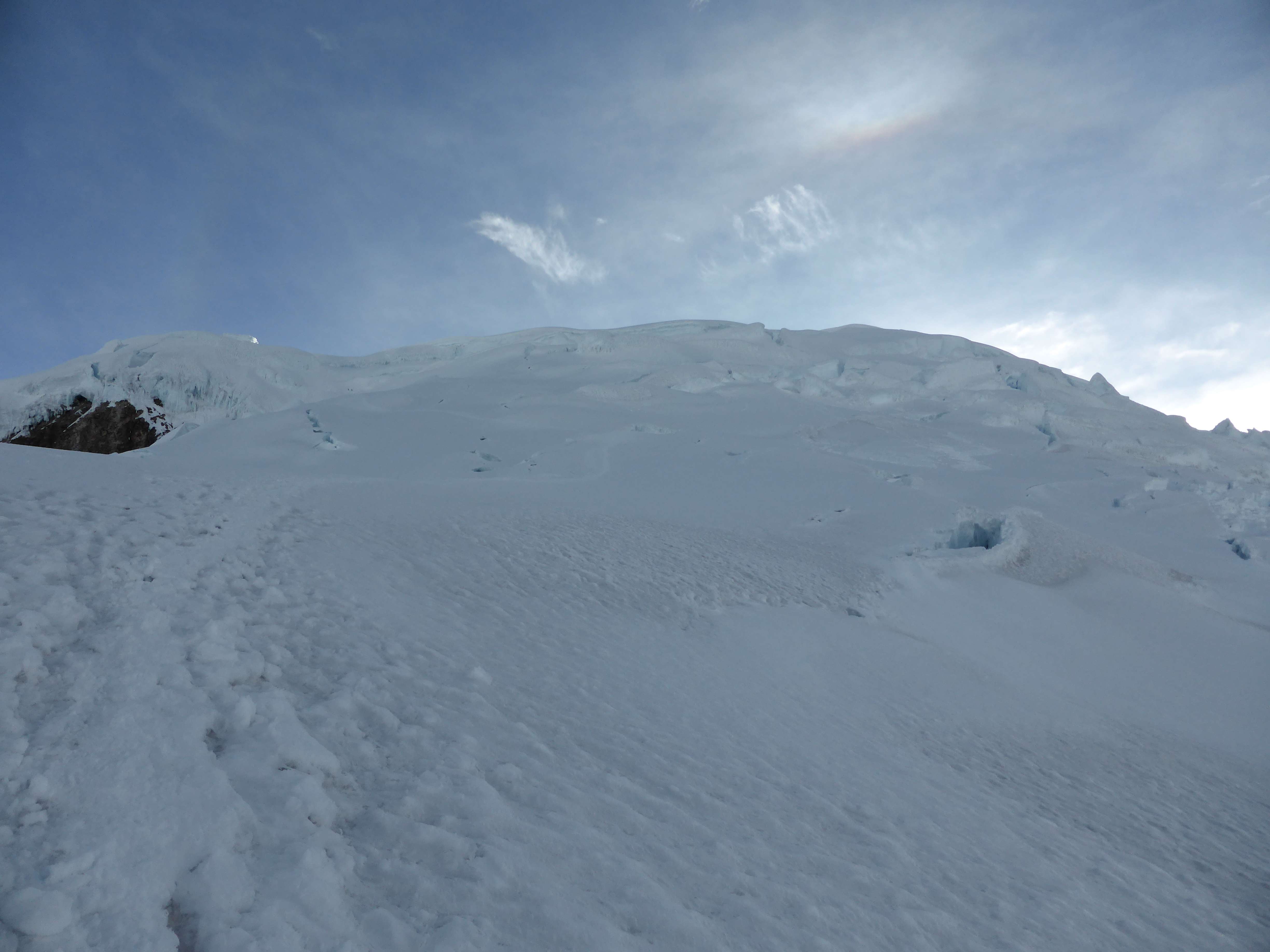
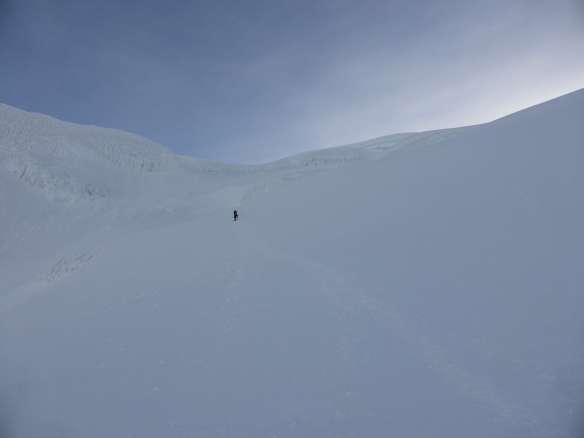
The approach hike was short with minimal altitude gain, and took us only two hours.  The moraine camp below Yanapaccha’s glacier is an incredibly lovely spot, with clear views of Chacraraju above a pristine high-altitude lake.

...

Yanapaccha, from near the moraine camp.

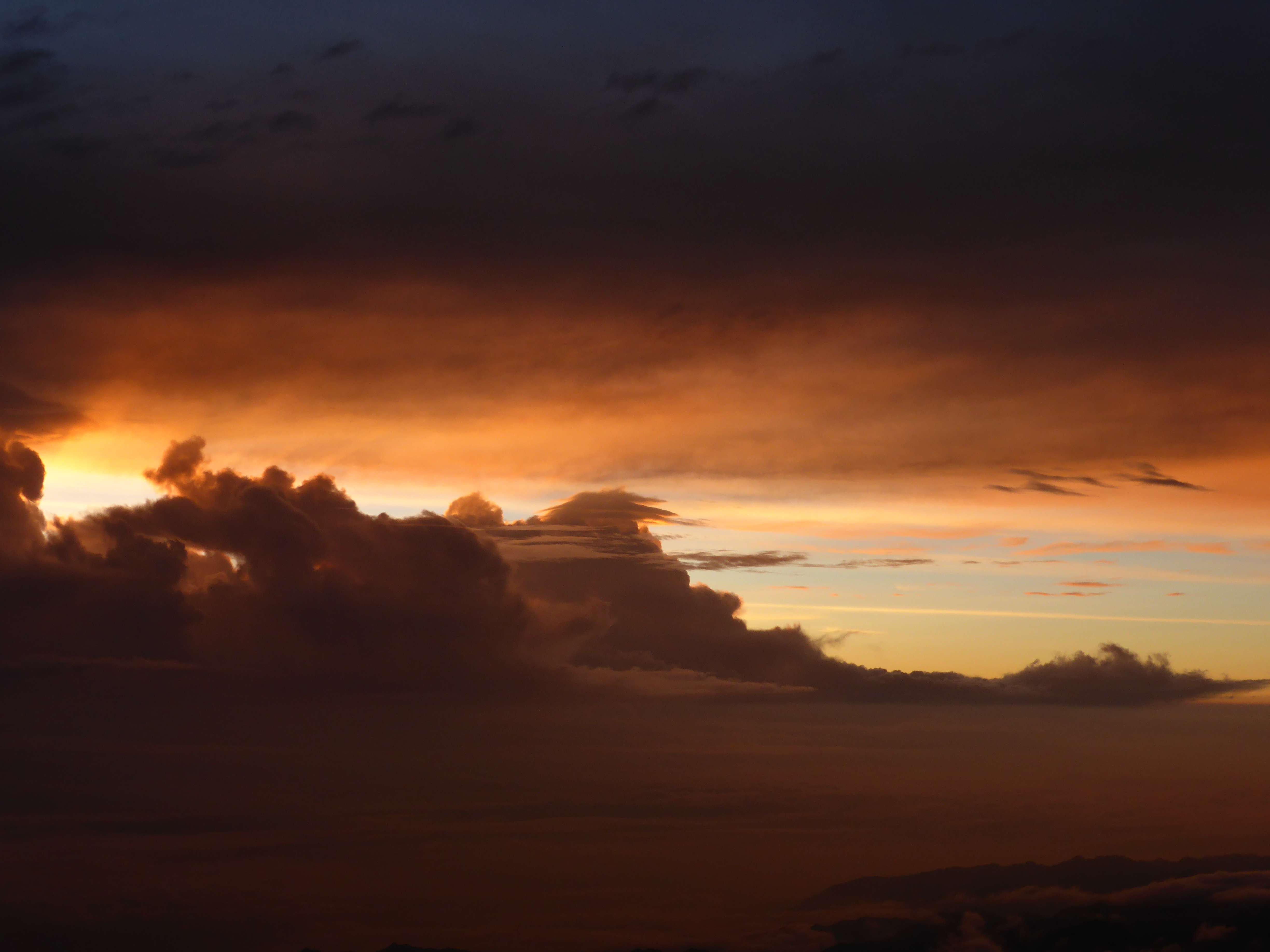
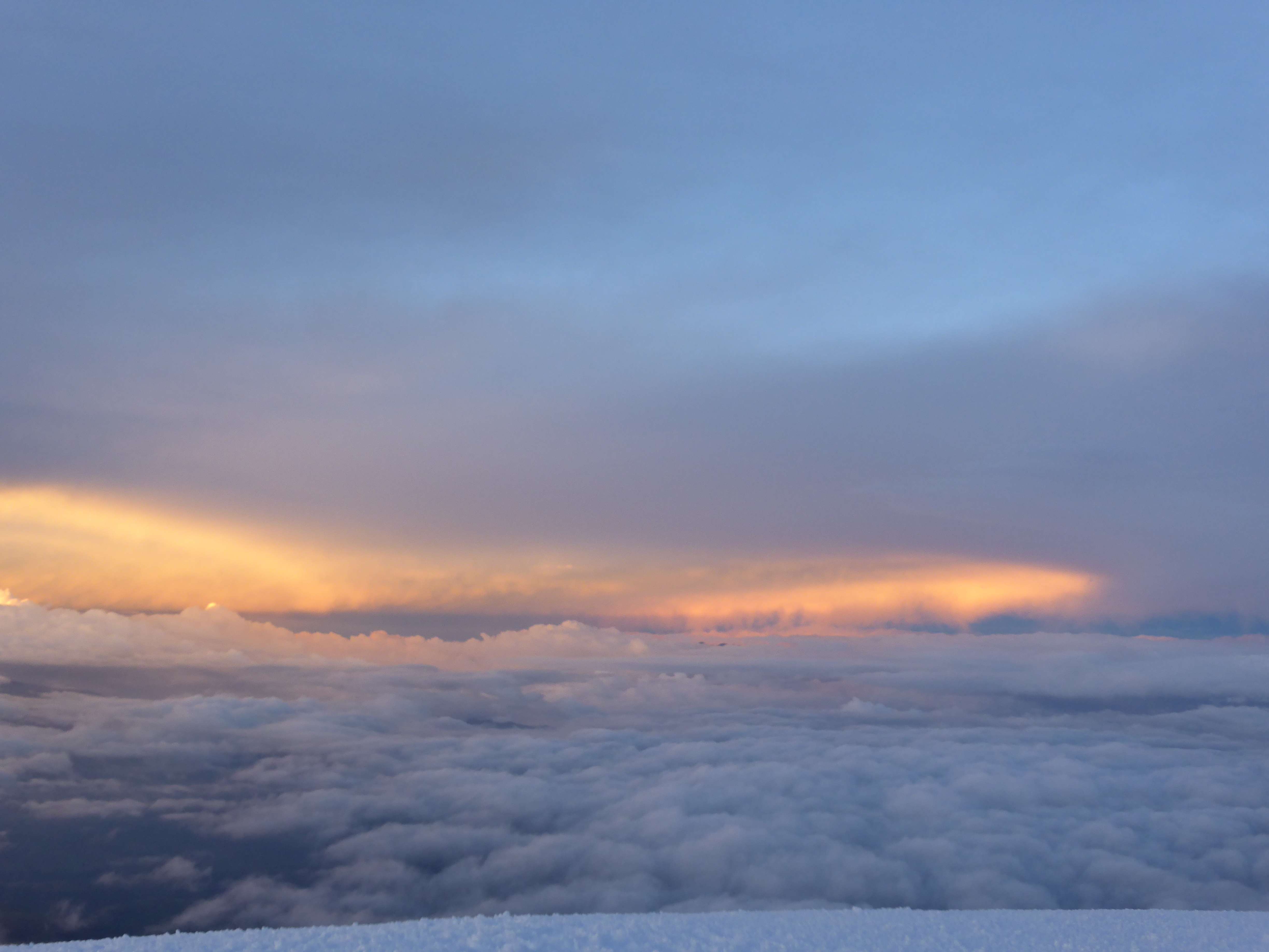
July Sunset happens early in Peru, so we quickly put up our tent and made dinner.  After dinner I spent some time socializing with a 6-person commercial team there to do an ice climbing and glacier skills course before leaving them to take photographs.  The sunset cast lovely light over Yanapaccha, and highlighted Chacraraju and Pisco in the distance.

...

Yanapaccha at sunset.

...

Pisco and Chacraraju at sunset.

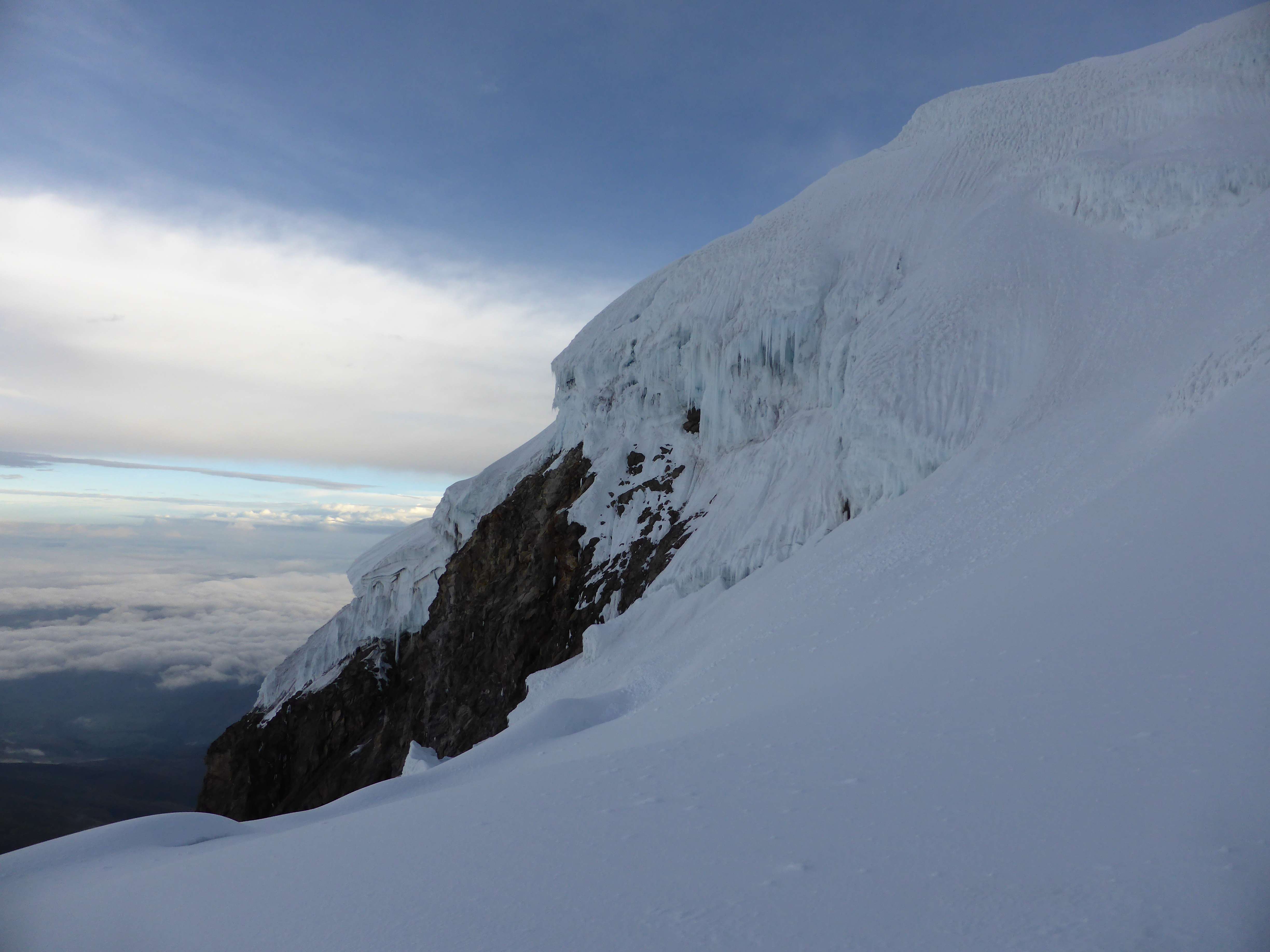
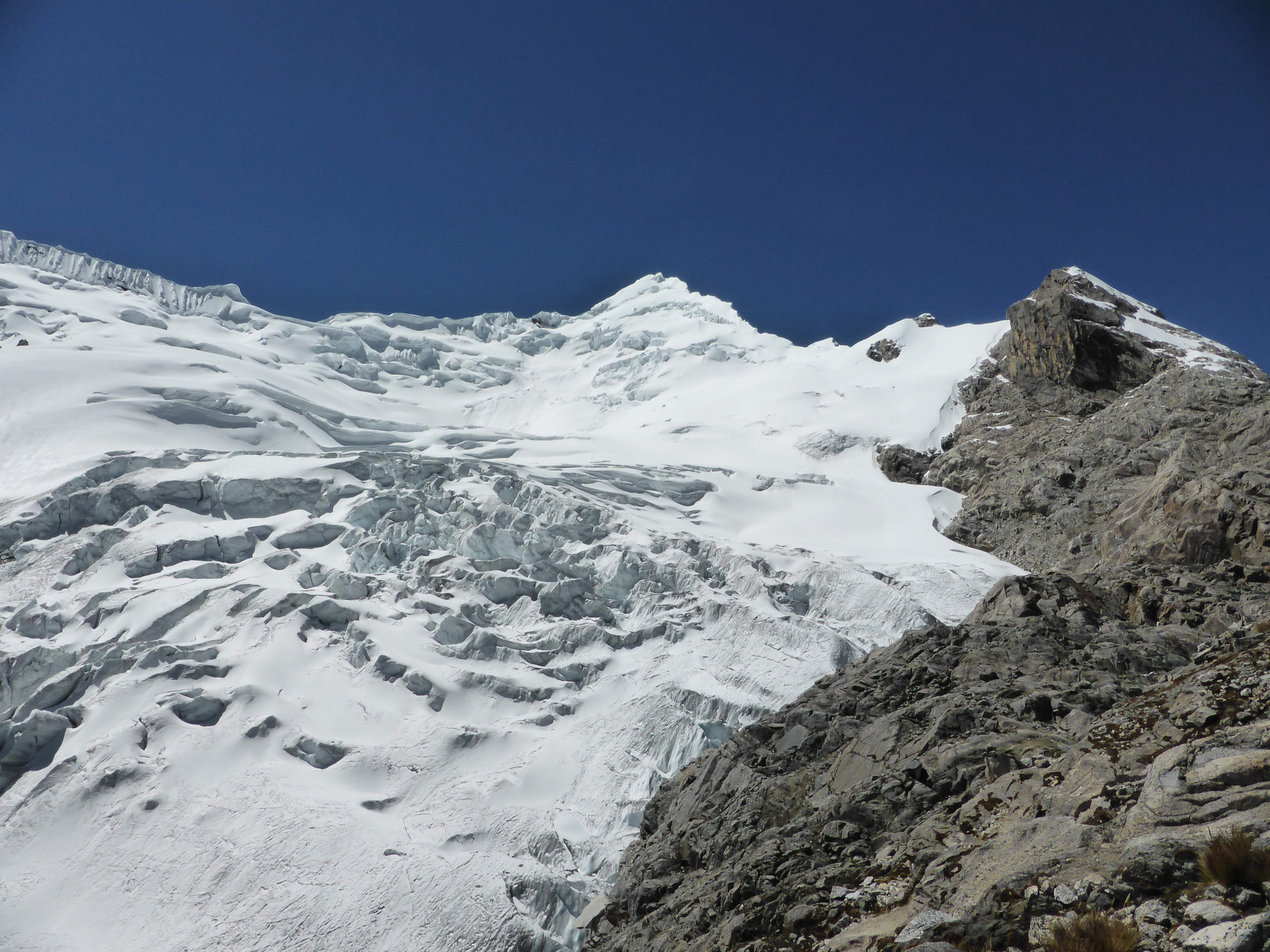
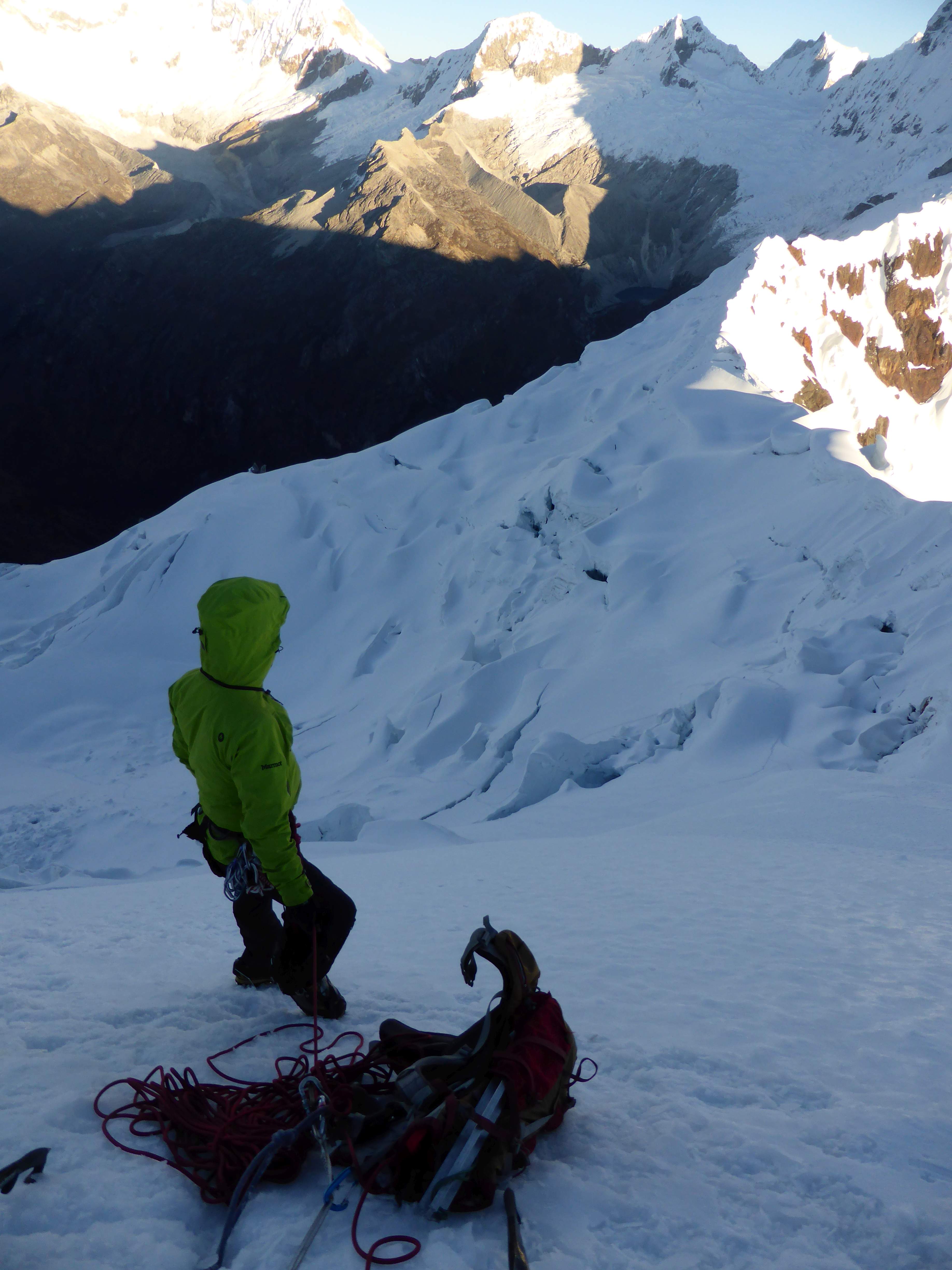
Day 2: We woke up at 1:00, and were moving upwards by 2:00.  From the moraine camp a short 15 minute scramble took us to the base of the glacier, where we put on crampons and roped up.  The entry to the glacier involved a ~5 meter ~60 degree wall of thin water ice – a fine start to the climb!  The lower glacier took us across moderate slopes before becoming more complicated.  The boot track took us across a sketchy snowbridge, which we protected, and along a steep traverse below the summit pyramid before we reached the first of three pitches.  It was very cold, and a light wind gave cause to layer up with my down parka and thick mitts.  We favoured the ridge of the summit pyramid rather than an ascent directly up the face, due to a large crevasse open in the middle of the steep slope.  We climbed steadily and with purpose on belay, using snow pickets as anchors along the ~60-70 degree ridge. The final pitch was interesting, with several medium-sized crevasses splitting the slope and creating short but technical vertical steps.

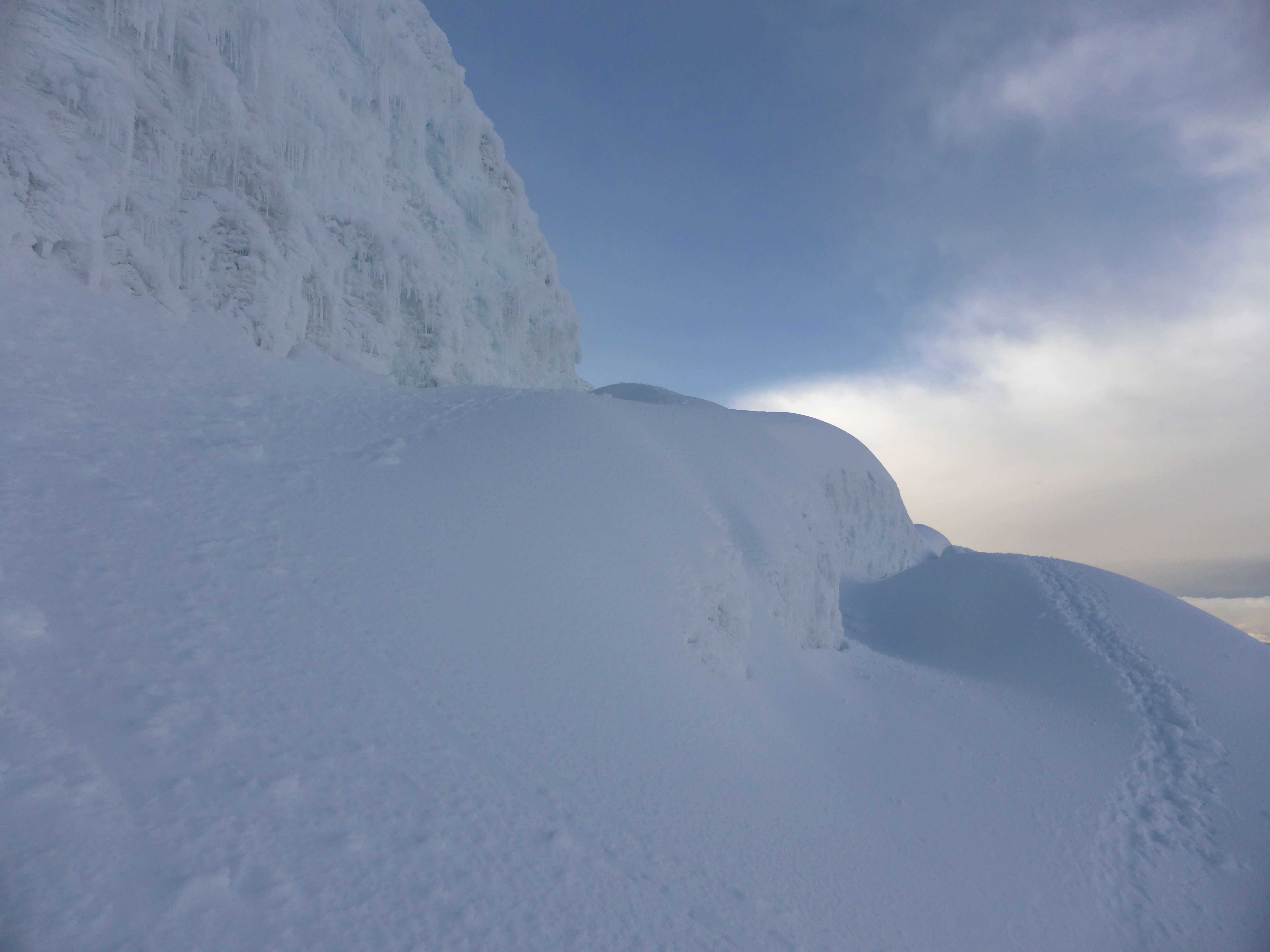
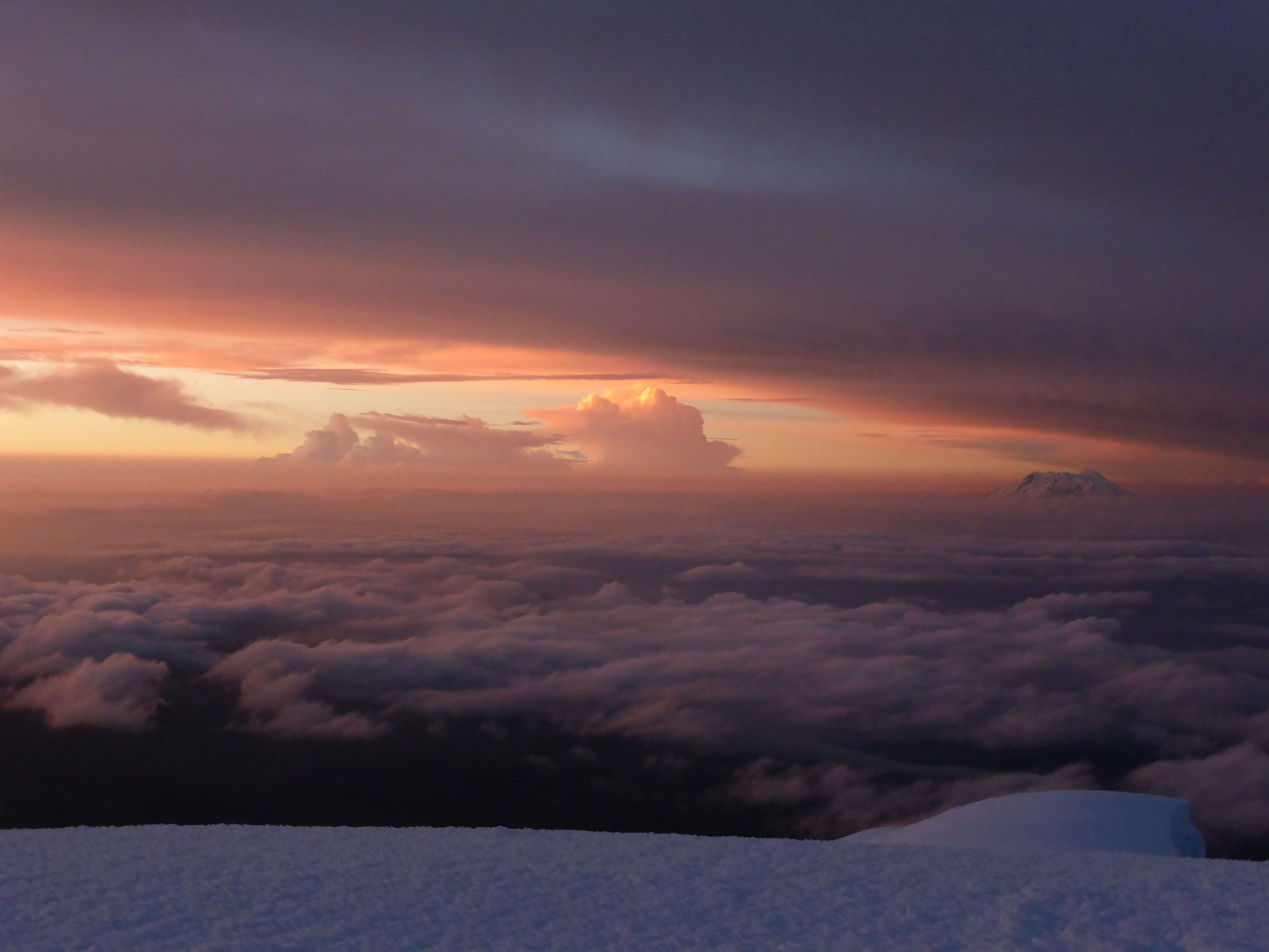
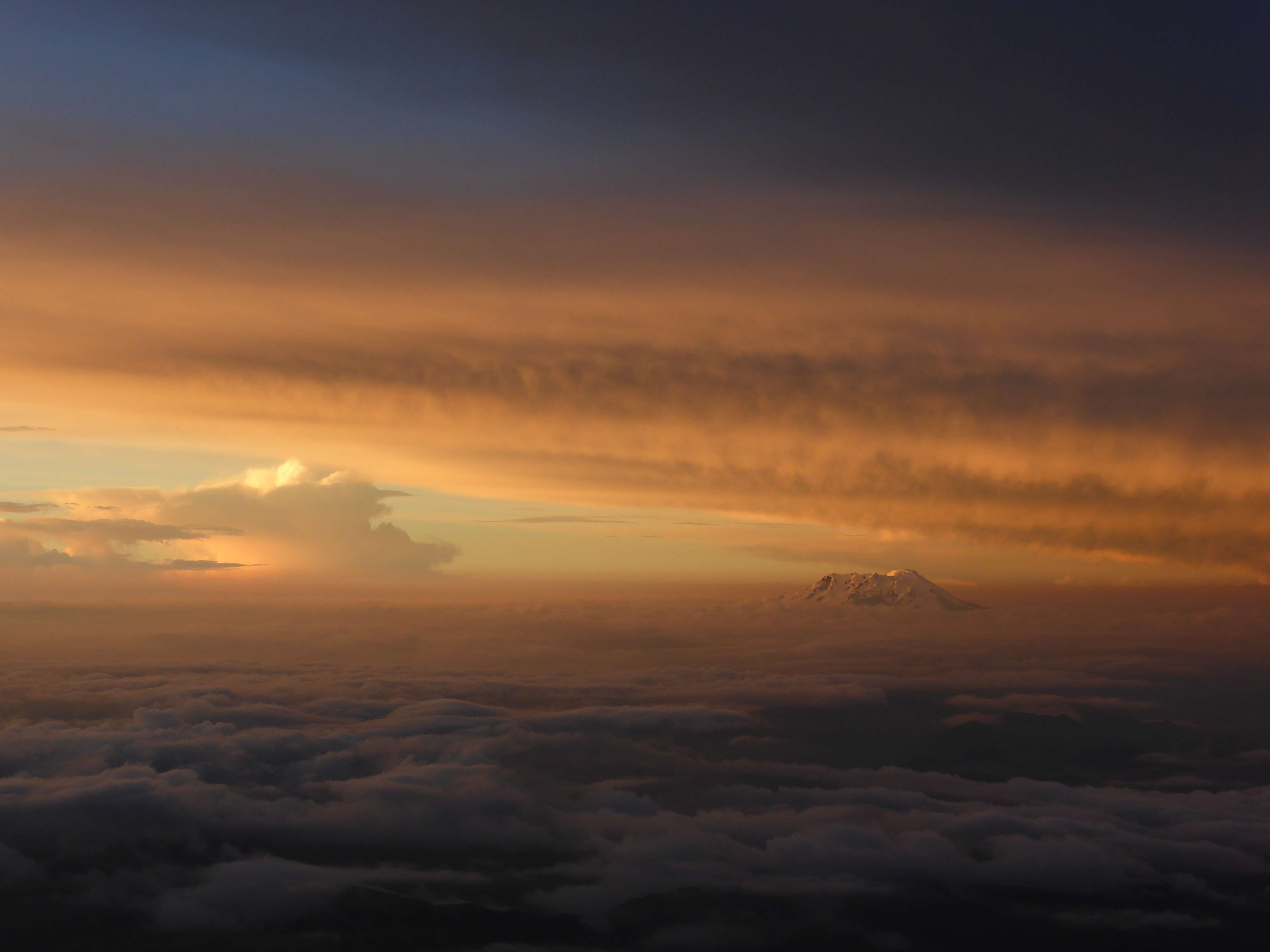
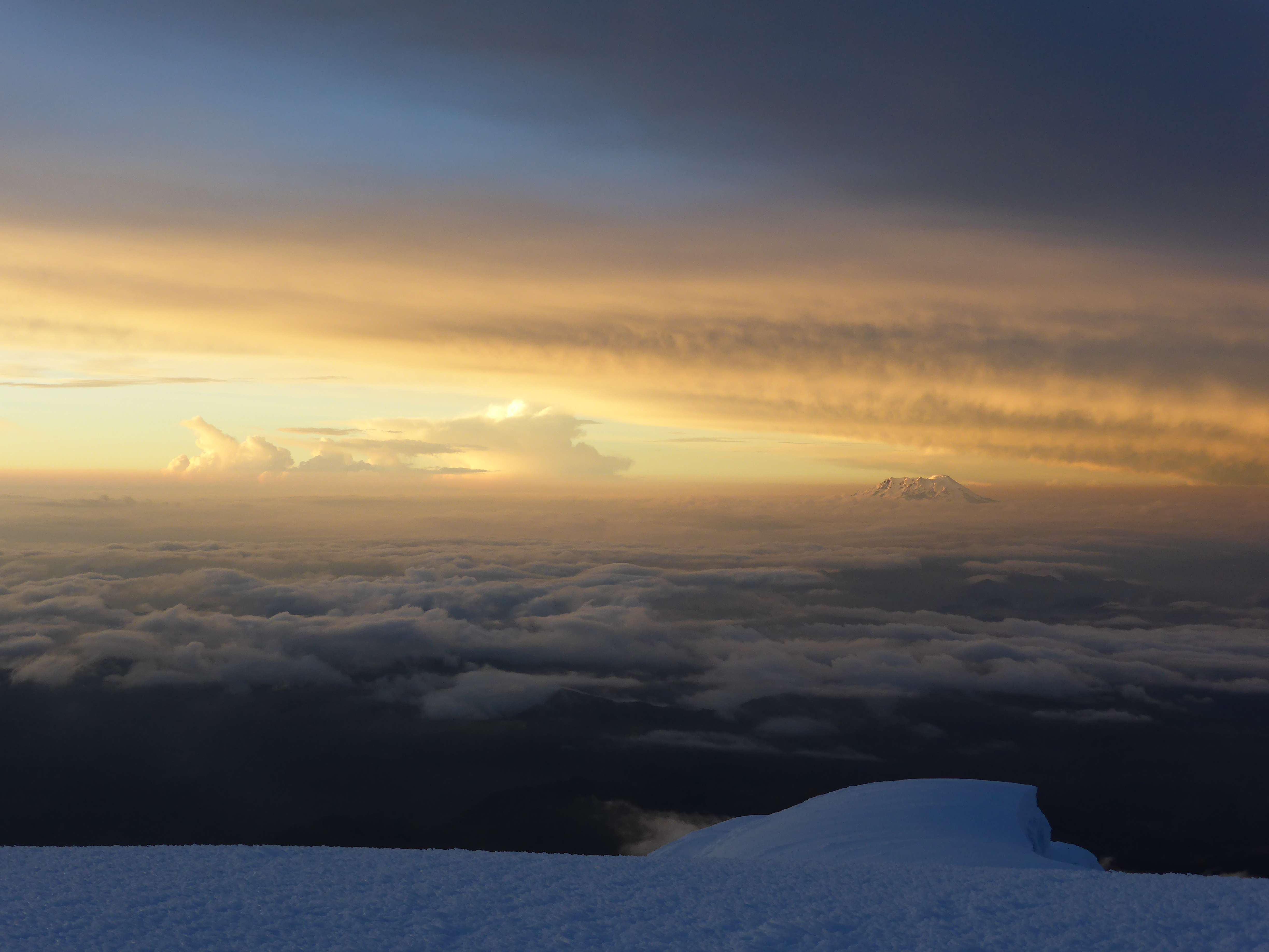
Soon we broke through a small cornice, and after another 10m of climbing reached the summit at 6:30 a.m., four hours after leaving our tent – and what a summit!  The views from the top of Yanapaccha were nothing short of gorgeous.  The Huascarans, Chopicalqui, the Huandoys, Chacraraju, and Pisco rose around us, and we enjoyed excellent angles of view towards all of them.

...

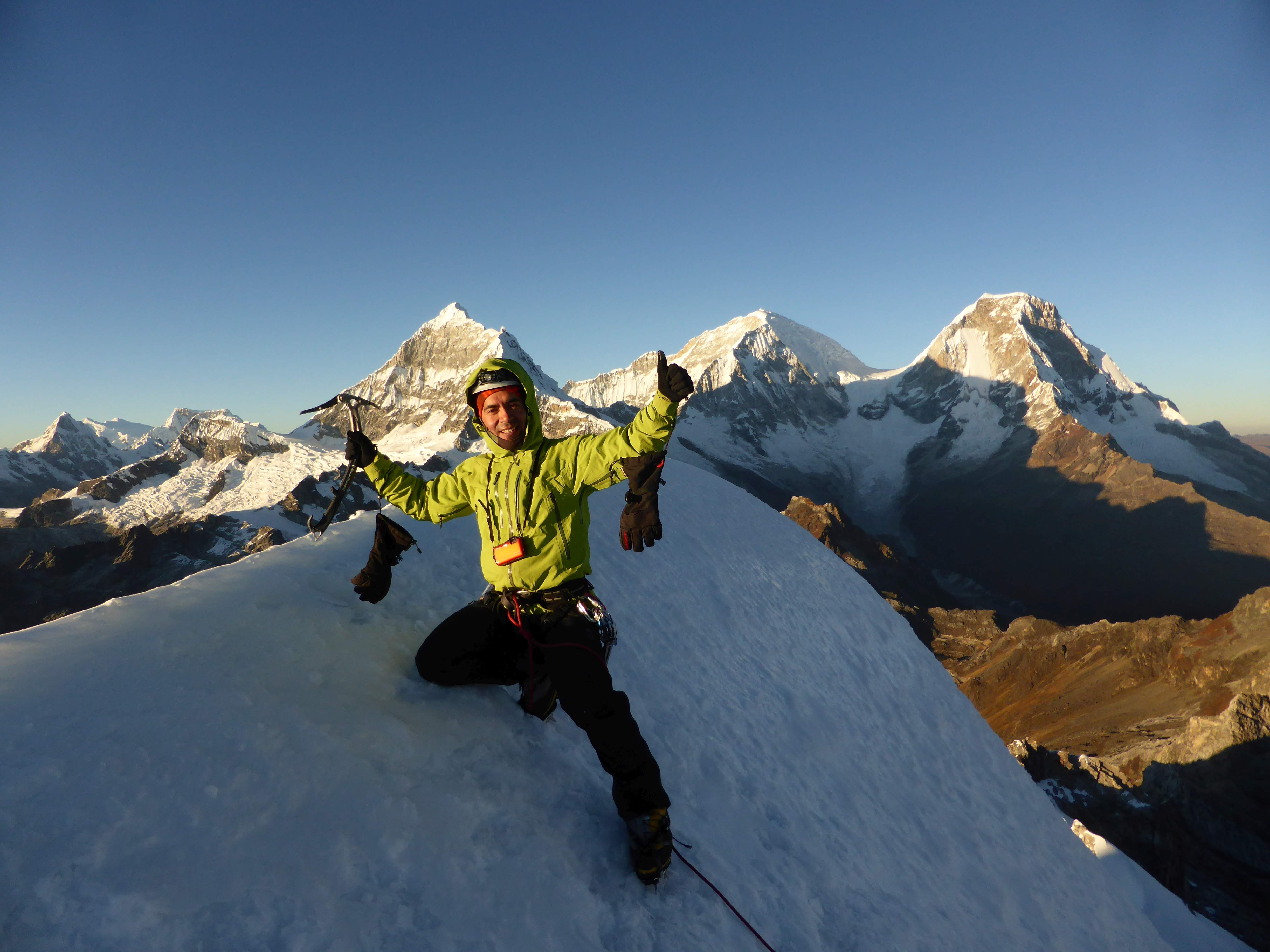
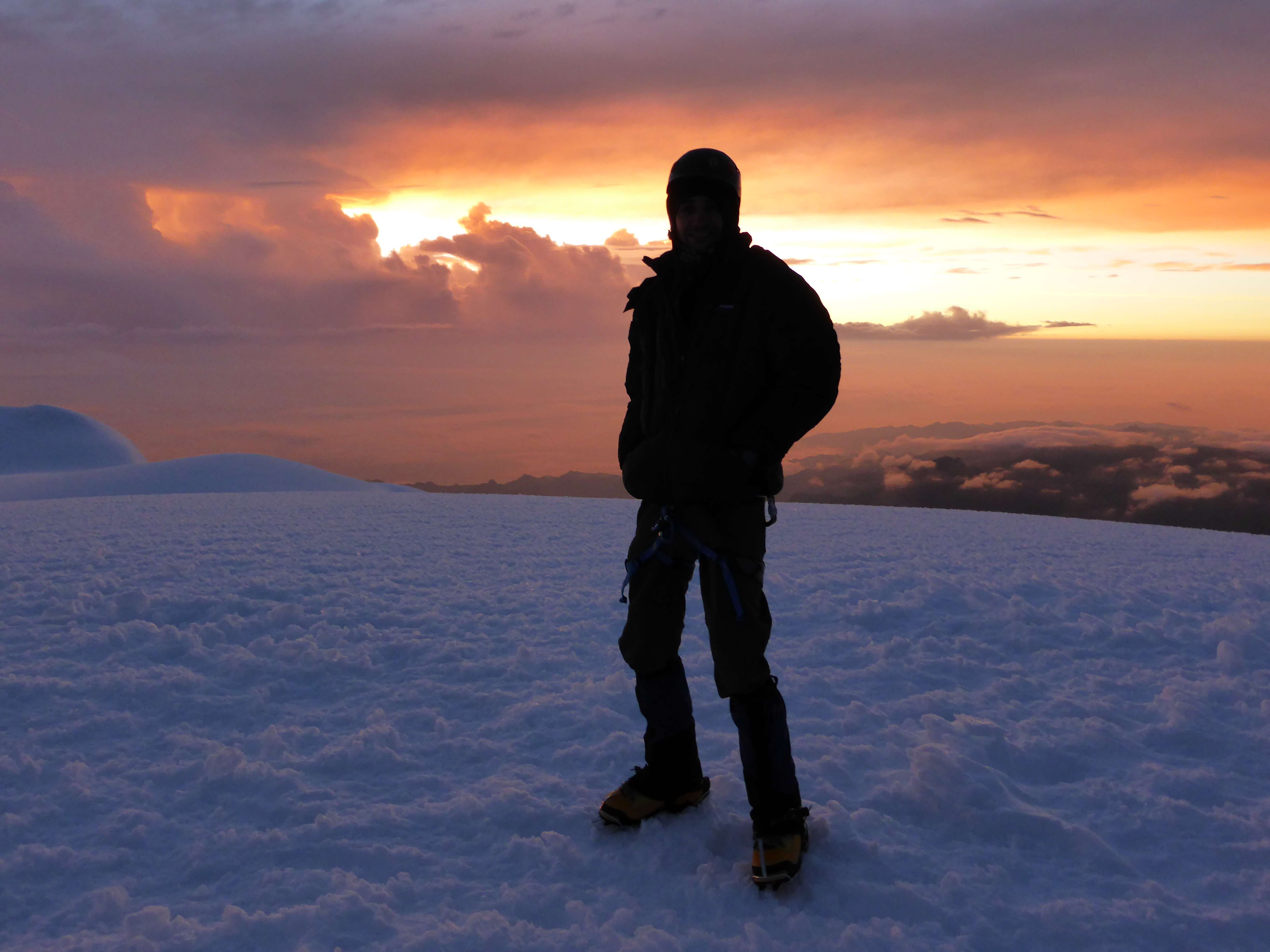
Edgar on the summit of Yanapaccha.

...

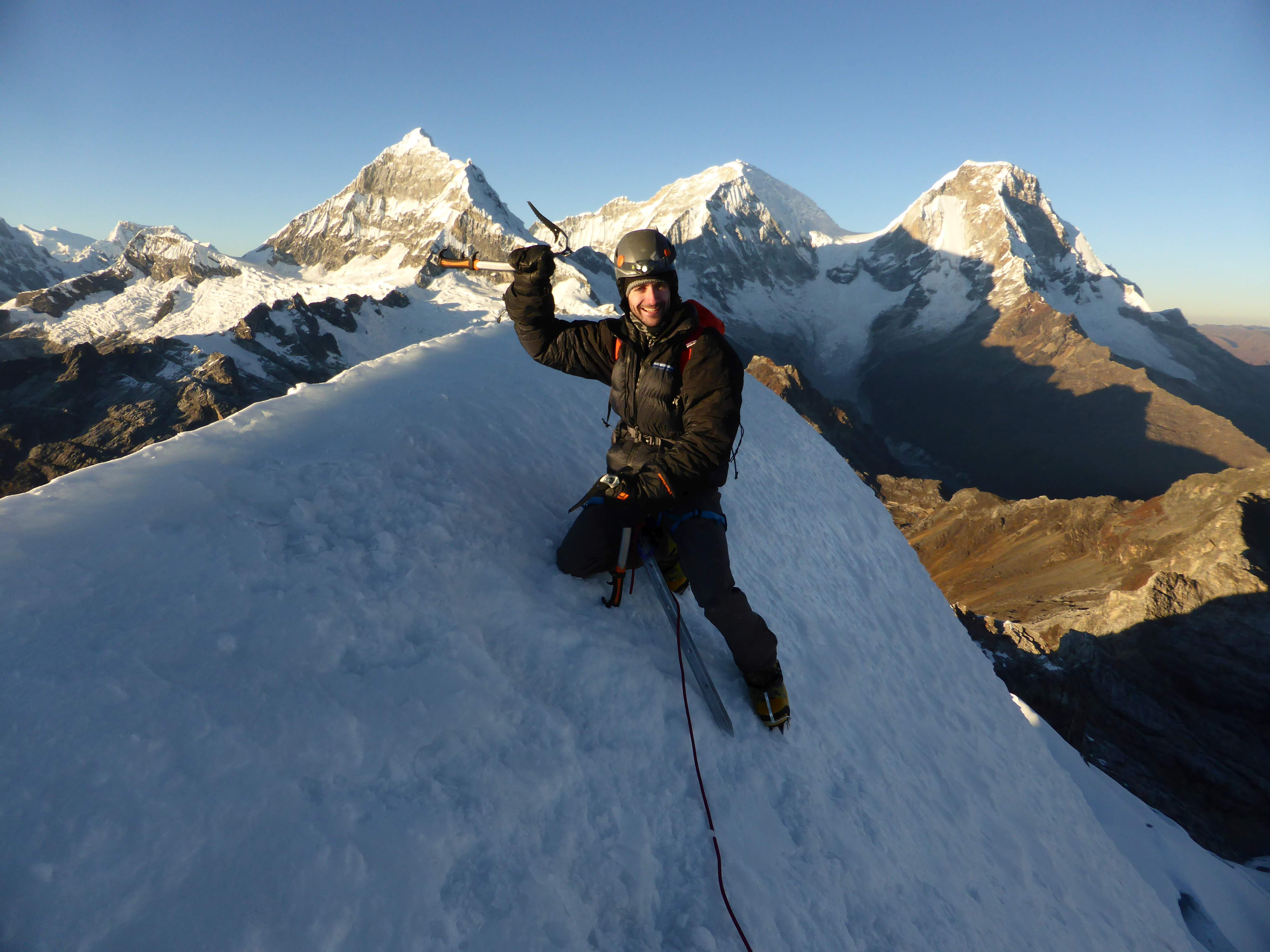
On the summit of Yanapaccha.
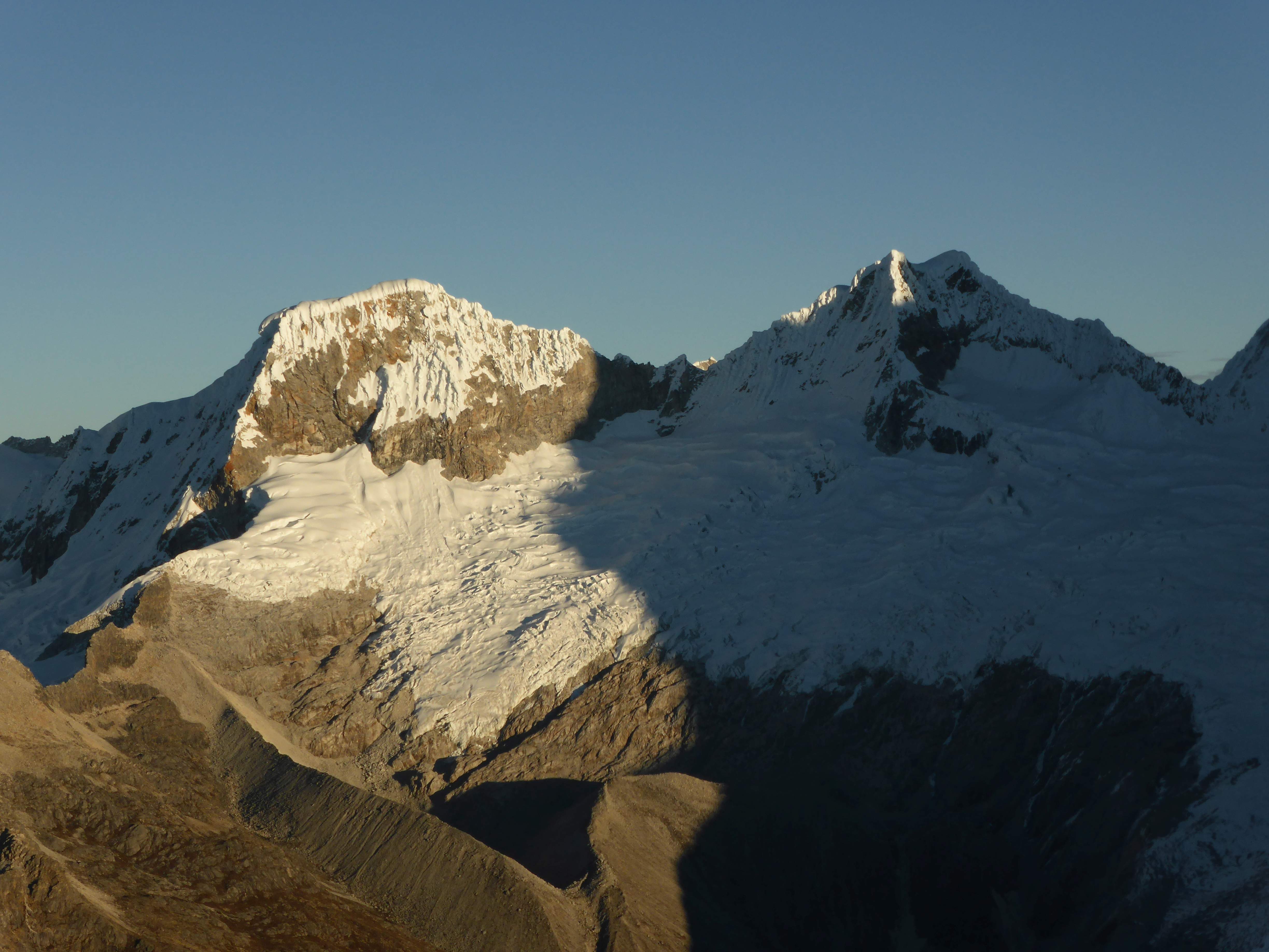
...

Chacraraju

...

The Huandoys.

...

Pisco.

...

Chopicalqui, Huascaran Sur, and Huascaran Norte.

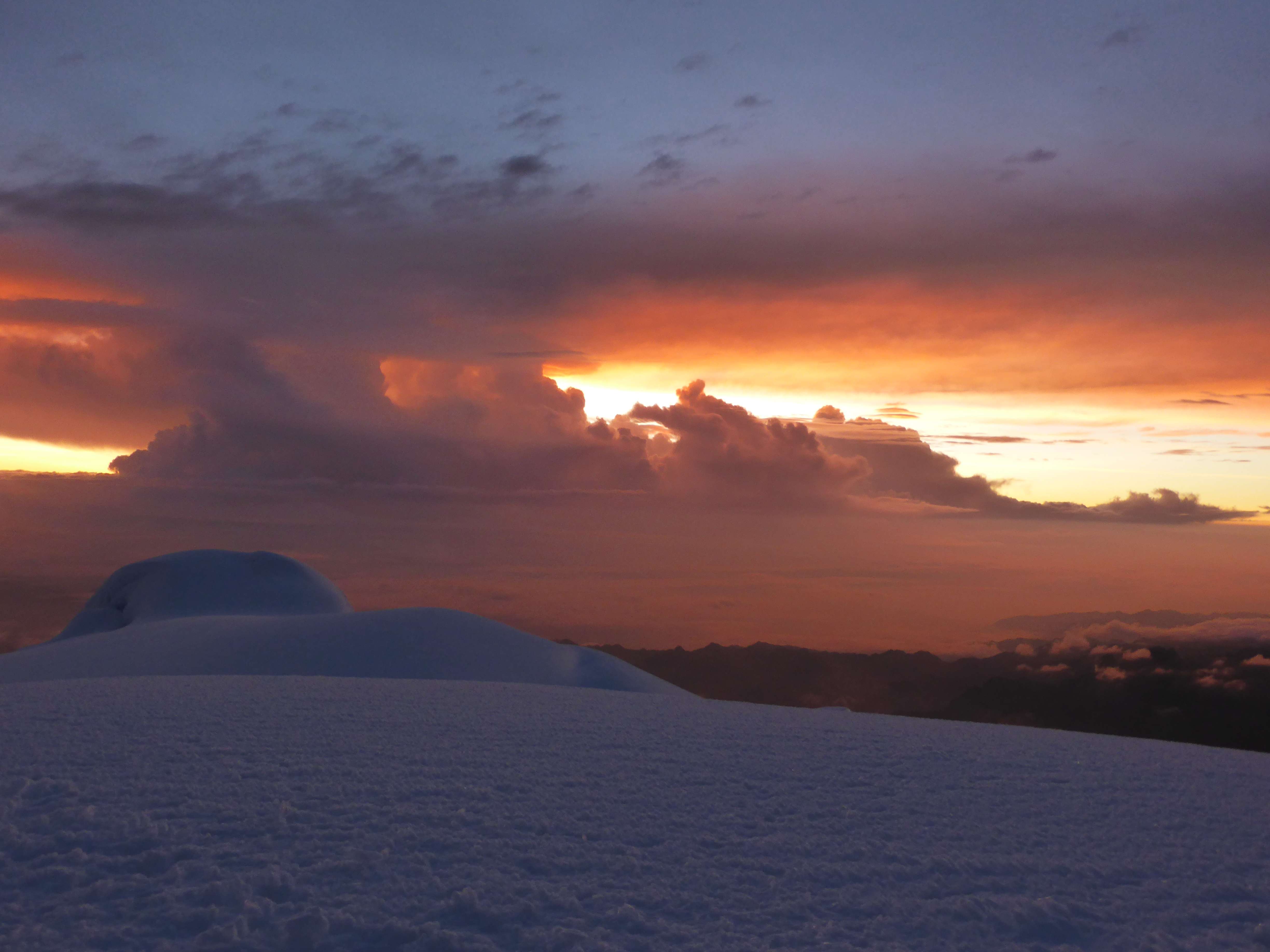
Ahead of us the sun was rising over Yanapaccha’s secondary peaks.  The morning light warmed us up, and put us into good spirits for the descent.

...

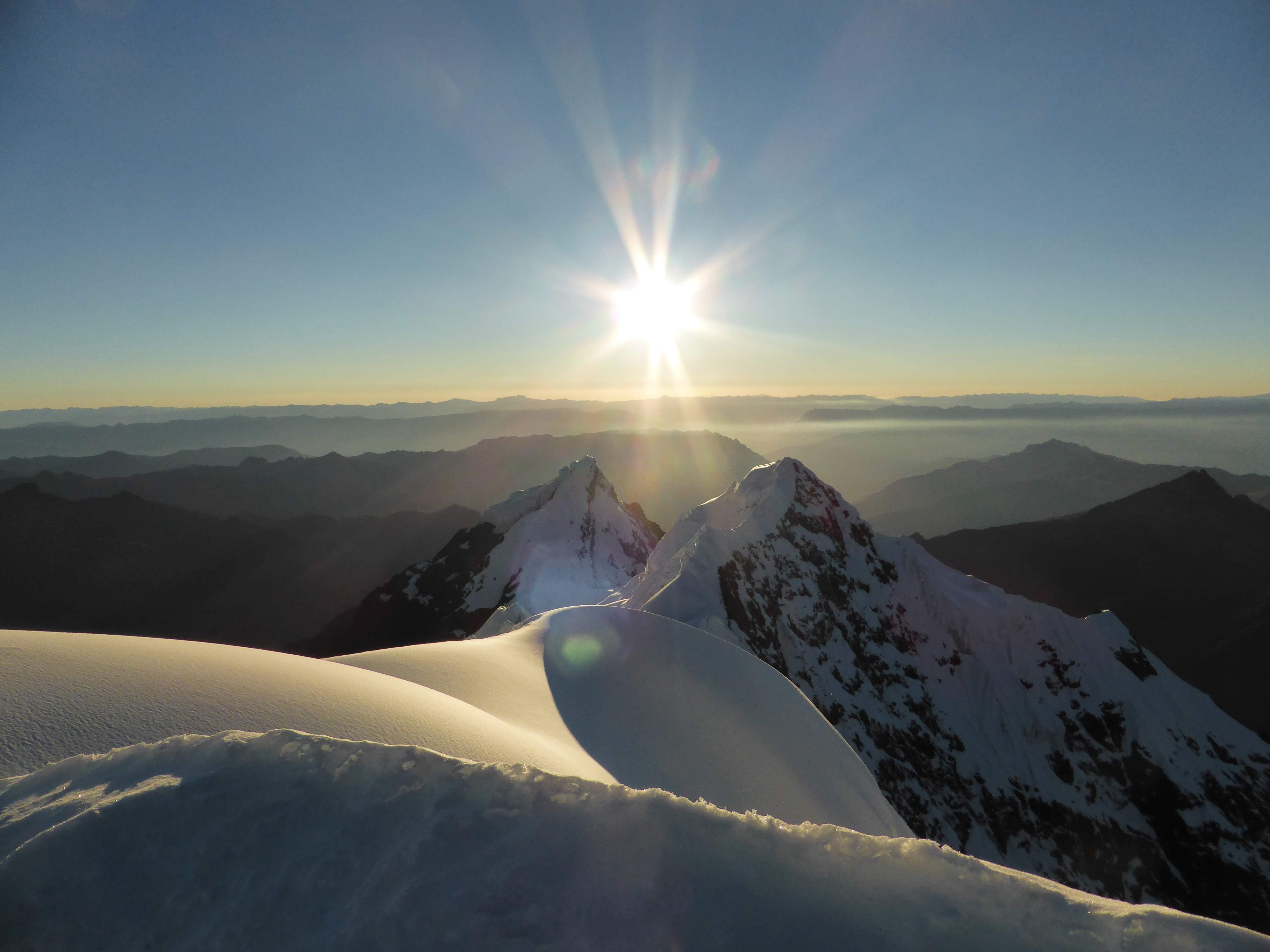
Sunrise from Yanapaccha’s summit.

We decided to leave the summit at 6:30.  We found an anchor placed on the summit, and using it completed a first rappel directly down the face of the summit pyramid.  There was no second anchor to be found on the face, so we sacrificed a picket and some gear to build a second rappel, which took us directly over the large crevasse in the face.  I punched through a snowbridge on this rappel, but didn’t lose the slope or need to slow down.

...

Looking down from Yanapaccha’s summit.

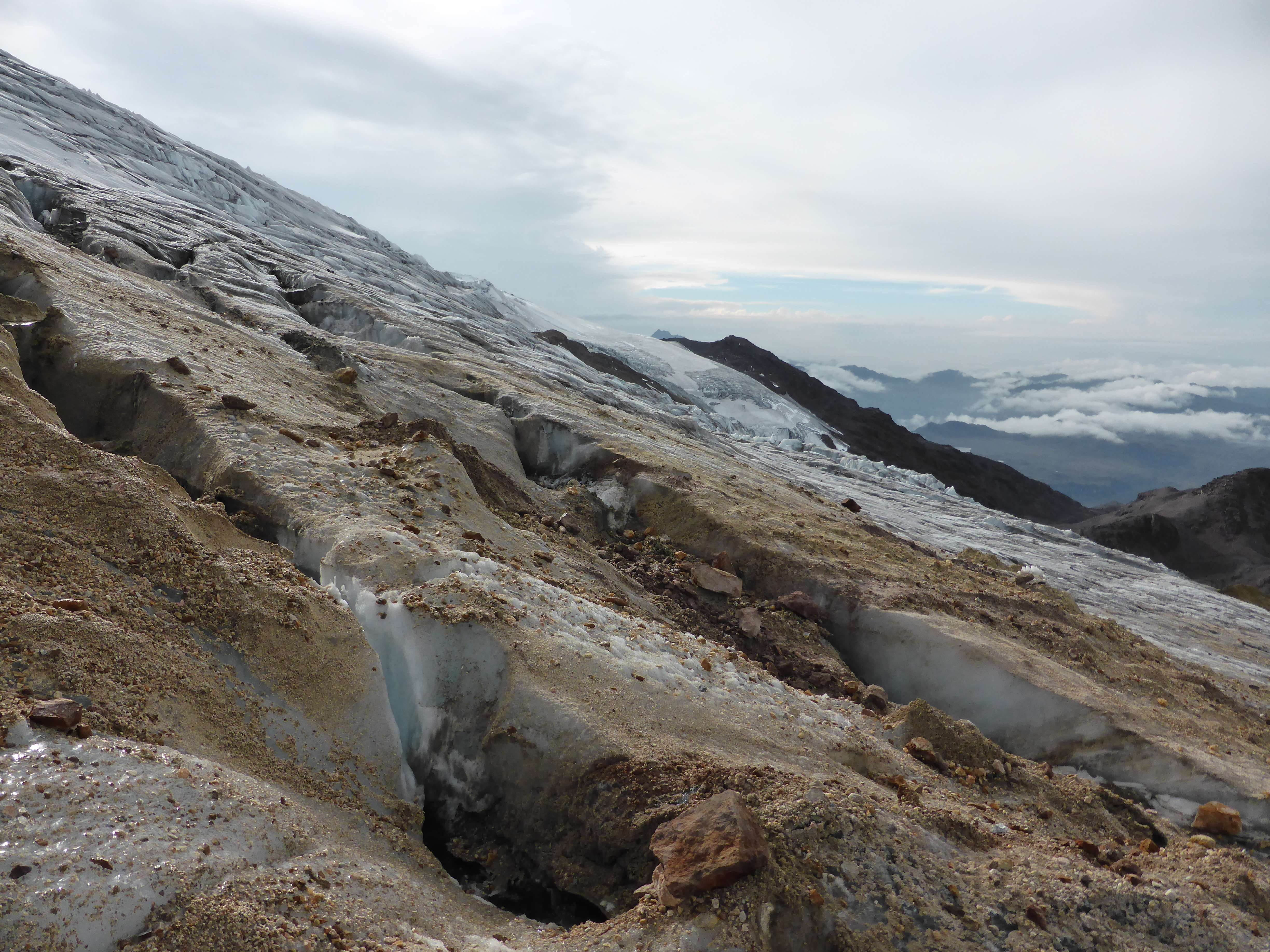
We roped up and down-climbed the final pitch, carefully crossed the thin snowbridge using a picket for protection, and hiked across the long lower glacier back to the moraine.  Very pleased with my performance on the technical pitches of the climb, I nonetheless managed to fall while descending the final ice-wall leading down to the moraine!  Luckily we had decided to protect it with an ice screw, and nothing was damaged aside from pride.

...

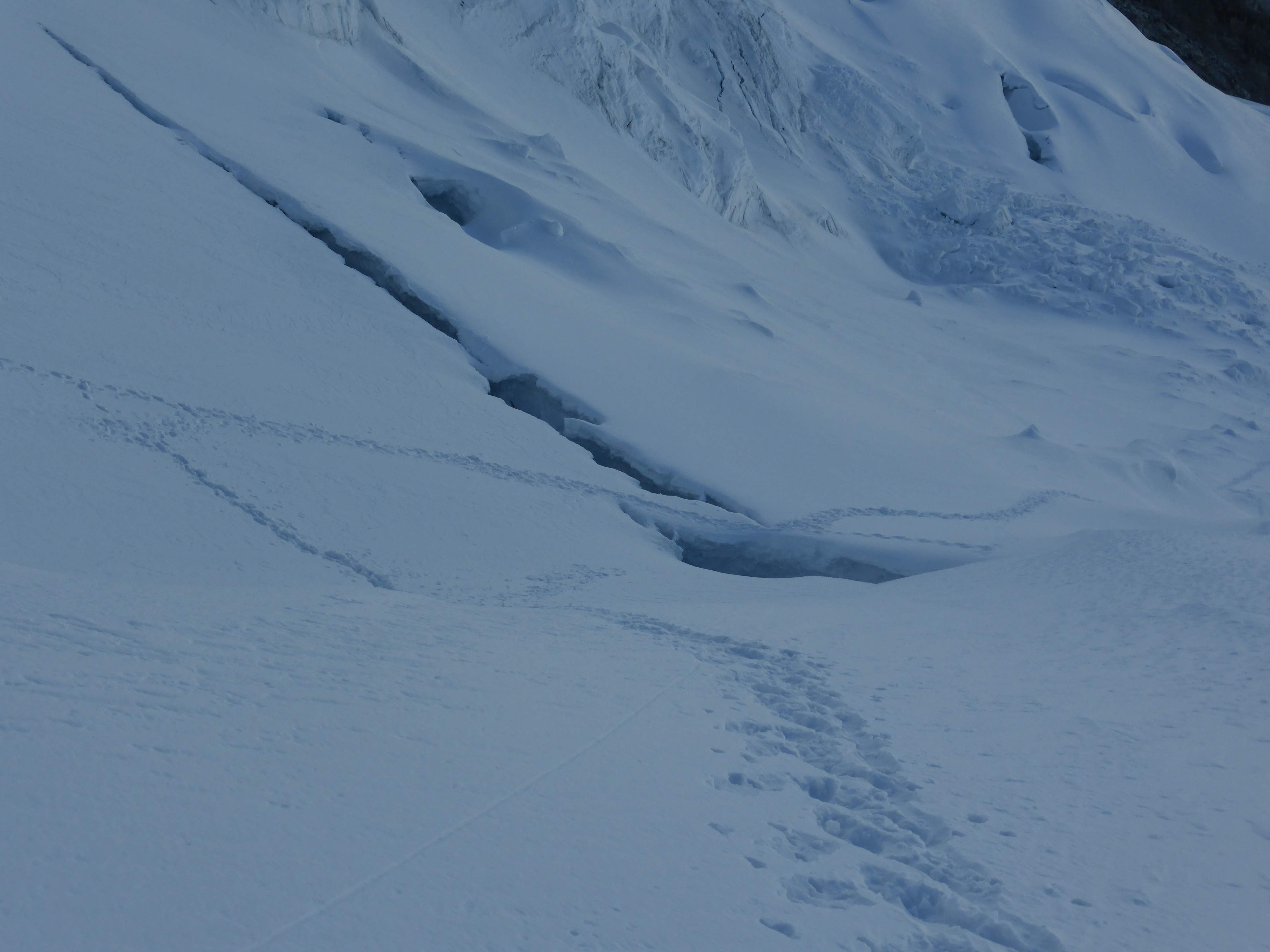
The thin, sketchy snowbridge we crossed on the lower glacier.  We took the time to protect it carefully with a picket.

...

Looking back at Yanapaccha from the top of the moraine.

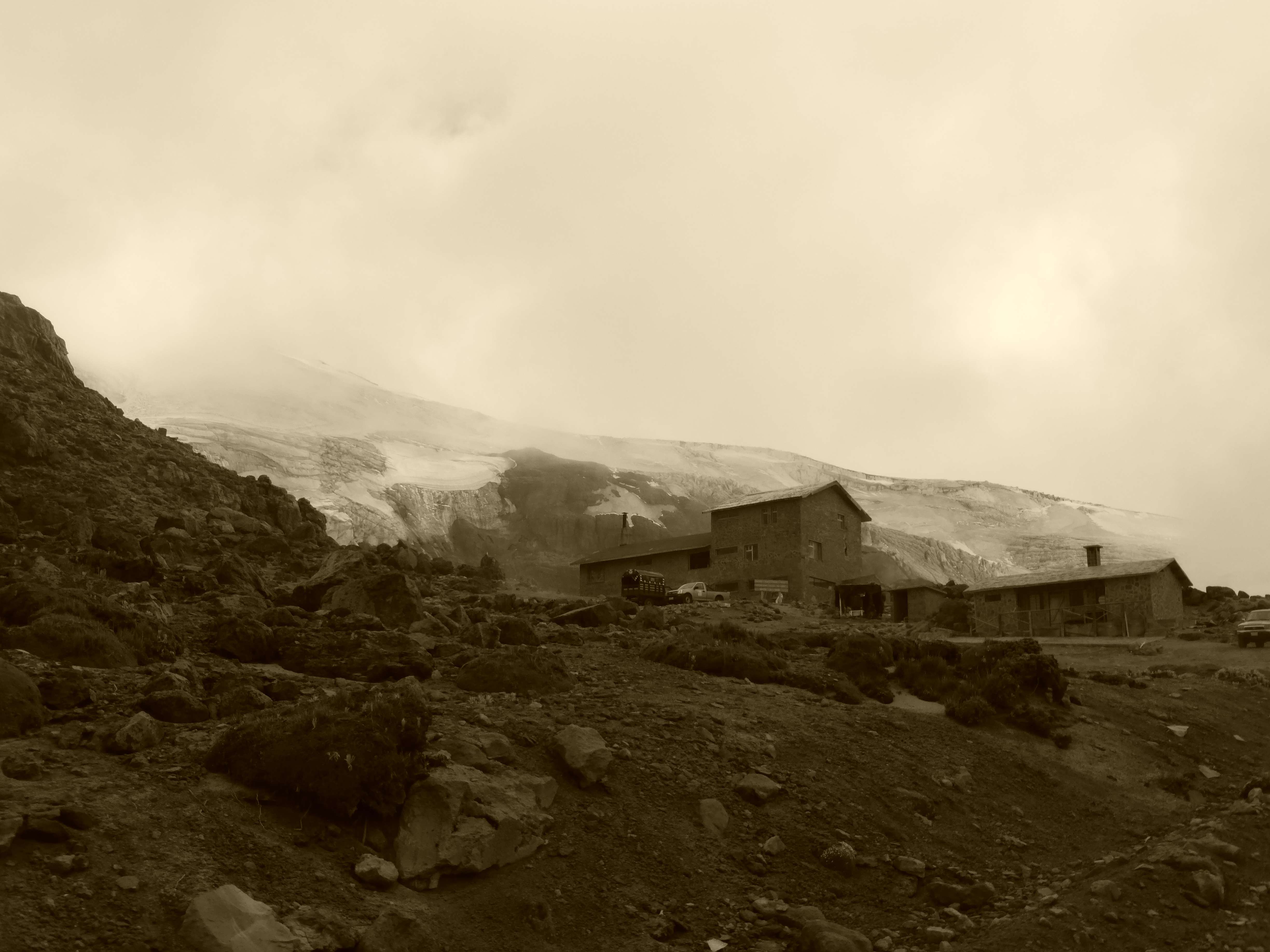
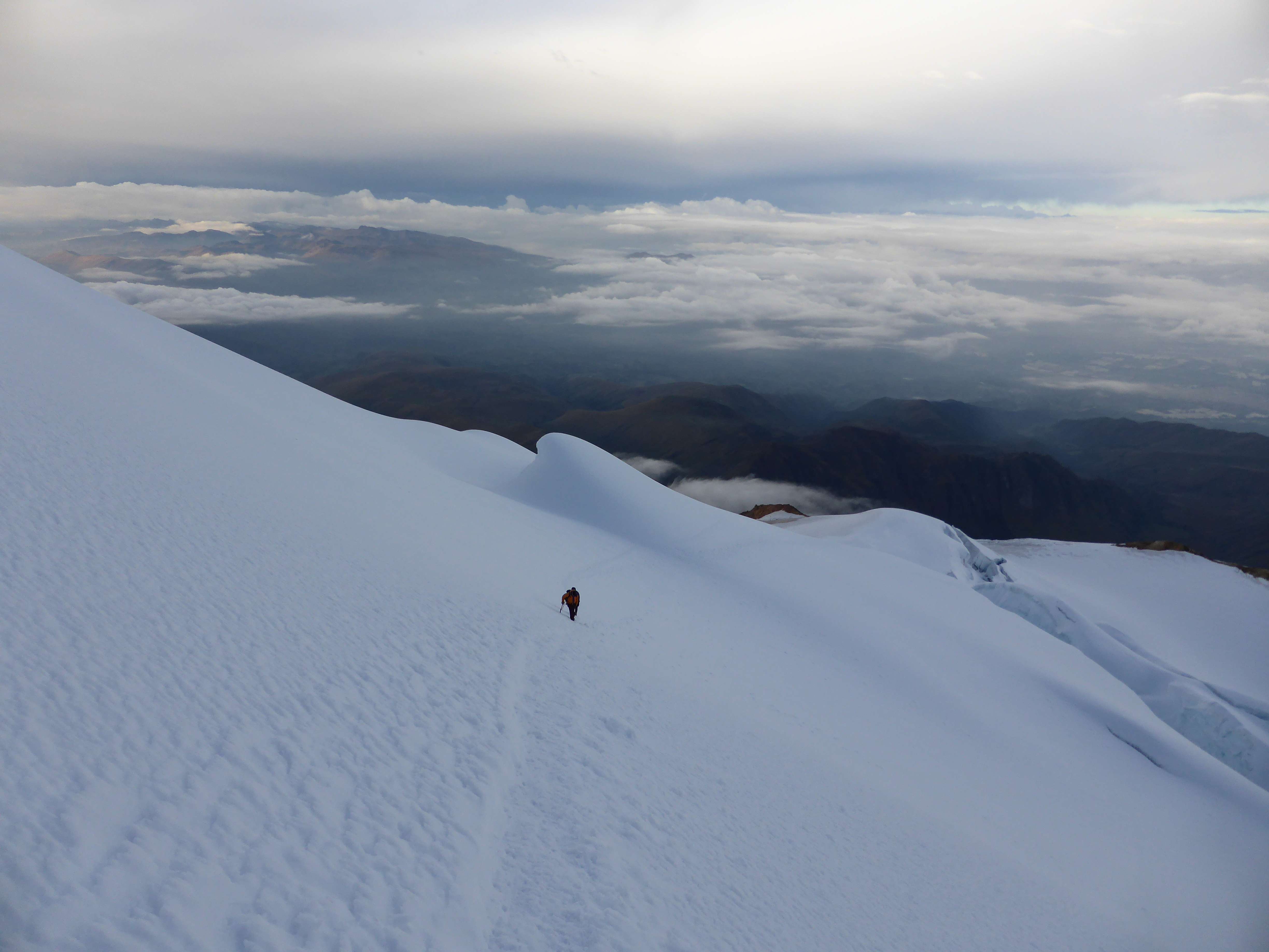
We reached the tent at 9:15, and packed up everything after having a light breakfast.  We hiked out to the road in good time, taking roughly 1:45.  Here we hitched a ride in the back of a truck down to the access point for Pisco, where we waited for an hour for an empty taxi to show up and take us back to Huaraz.

Yanapaccha was an excellent climb.  A short approach, beautiful campsite, relatively short climb, interesting glacier, and stunning summit views made the climb enjoyable and not overly demanding physically, while three technical pitches made it feel exciting, challenging, and worthwhile.  Were Yanapaccha a 6000m peak, I am certain that it would be one of Peru’s most popular climbs – alas, its diminutive (for Peru, anyhow) altitude is likely the reason it is a relatively unknown and seldom visited peak.

Yanapacca’s views of nearby giants like the Haundoys, Huascaran, and Chopicalqui left me with a sense of satisfaction and served to fuel my enthusiasm about revisiting Peru again.  I likely won’t revisit Yanapaccha itself, but will almost certainly find myself in the Quebrada Llanganuco area again.

Accessibility

Peru is an incredible destination for mountaineering, and attracts climbers from all over the world.  The Cordillera Blanca is a climber’s paradise, with seemingly endless possibilities ranging from the accessible and intermediate to extremely difficult and seldom-climbed peaks.  Peru’s peaks for the most part are technical affairs, and almost all of them involve very physical, lengthy approaches.  Because of this, the Cordillera Blanca is generally not considered a good area for inexperienced climbers to begin learning in.  The Cordillera Blanca also hosts numerous high quality multi-day trekking routes which draw a diverse assortment of travellers into Huaraz.

Huaraz is a city with a thriving tourist industry.  Local guides can be hired on the spot or in advance, and logistics services are easy to obtain from any number of local outfitting companies.  Taxis can be used to reach the starting points of approach hikes, but group transportation is also offered by logistics companies, and is less expensive once the cost is split with others.

I climbed with my Ecuadorian friend Edgar Parra while in Peru.  I hired Edgar as a 1:1 climbing partner and guide, having met him while in Ecuador a few years earlier.  Edgar is charismatic, patient, multilingual, safety-conscious, and an impressively strong, experienced climber.  Edgar’s website is http://www.lonelysummits.com/.

I strongly recommend Brad Johnson’s “Classic Climbs of the Cordillera Blanca Peru” as a guidebook for climbing in the Cordillera Blanca. It contains maps, photographs, detailed approach and route descriptions, and many interesting mountain stories.x

Cayambe – January 2014

...

Cayambe, seen from the summit of Cotopaxi at sunrise.

5790m Cayambe is Ecuador’s 3rd highest mountain.  A massive extinct volcano, Cayambe is known for its active glacier and inclement, windy weather.  Interestingly, part of Cayambe is located on the earth’s equator, making it the highest point through which the equator directly passes.  The eruptions of Reventador, a nearby volcano with high activity, and the subsequent ashfall onto Cayambe’s glacier, have given Cayambe a reputation for being icy and out of condition.

...

Cayambe, from near the refuge.

I climbed Cayambe on my eighth day in Ecuador.  Prior to climbing Cayambe I had hiked 4791m Corazon, climbed both of the 5000+m Illiniza volcanoes, and spent several nights sleeping at 4700m.  A week spent hiking at altitude before visiting Cayambe made for great acclimatization, no altitude-related issues, and a far more enjoyable climb.  My acclimatization and climbing itinerary can be seen here.

...

Ash on the lower glacier.

Day 1: The climb began at my hostel in Machachi, where my Ecuadorian climbing partner and mountain guide Pato picked me up in his 4×4 truck.  While Machachi is not particularly close to Cayambe, I was very pleased with the hostel there and had opted to stay rather than move for one night.  Machachi’s proximity to the Illiniza and Cotopaxi national parks makes it a popular base area for visiting climbers, and its location is close enough to all of Ecuador’s major peaks for one to stay there prior to other climbs.  From Machachi we drove for roughly two hours to the town of Cayambe, stopping for food and drinks along the way.  From the town of Cayambe we drove east, towards the Cayambe Coca Ecological Reserve which contains the mountain.  From town the road followed rolling hills alongside deep valleys, brimming with trees and plant life.  The area near the reserve is very rural, and we passed many farms and pastures built along the valley walls.

...

Driving to the base of Cayambe, through the rural area east of the town of Cayambe.

At the end of a rough road we arrived at the base of Cayambe and parked by the mountain cabin, or refuge, where we would spend the night.  At an elevation of 4600m the refuge is a convenient resting place to base a climb out of.  The main refuge building was under construction, but a smaller building to the right of it was open. It cost around $20 for the two of us to stay for the night.

...

The Cayambe refuge.  The larger building to the left was being renovated, but we were able to stay inside the smaller building beside it.

The refuge was small but comfortable, with a kitchen, running water, a little gas stove and padded bunks.  Luxurious compared to camping!  A pair of Austrian climbers and their guides had descended earlier in the day, but had opted to spend another night sleeping here for acclimatization.  They shared good news, and told us that the glacier was in great condition.

...

Inside the Cayambe refuge.

After cooking some food and organizing gear for the next day, we went to sleep early.

....

The refuge’s kitchen.

Day 2: Awake around midnight, we began hiking in the dark at one o’clock a.m.  The sky was clear of clouds, and stars glowed brightly above us.  The standard route on Cayambe begins by following a ridge of dry rock located to the left of the refuge when facing the mountain.  This ridge leads up, around, and onto the glacier, bypassing the complicated icefall of the lower mountain.

....

Descending back along the rock ridge used to reach the glacier.

From the top of the ridge the glacier was level with the rock and easily accessed.  Once we reached the lower glacier we began to navigate upwards, crossing several crevasses and avoiding others, towards a rocky outcrop called Picos Jarrin.  The lowest portion of the glacier was covered in debris, and was riddled with shallow half-meter deep cracks.

Our route past the rocky ridge, climbing to the left of Picos Jarrin to avoid crevasses.

Our route above the ridge, climbing to the left of Picos Jarrin to avoid crevasses.

...

The glacier near the ridge was covered in rock debris and shallow crevasses.

Above Picos Jarrin a series of snow ramps wound past vertical ice cliffs towards the summit, keeping to the climber’s right of a large, prominent rock cliff.

...

Looking up Cayambe during our descent in daylight.  The prominent rock cliff in the top left corner serves as a useful  landmark, as the route ascends just to the climber’s right of it.

...

The rock cliff off route.

The climbing was physical and sustained, but enjoyable under a clear sky and on perfect snow.  Aside from two short traverses the ramps on the upper glacier were roughly 40 degrees at minimum. At its steepest the route sharpened to around 60 degrees for a few stretches of 10-15 meters, requiring front pointing and careful ax placement.  Because of the snow conditions we did not place any pickets for fall protection, although the final ramps to the summit were not without objective hazard due to the enormous ice walls hanging above them.

...

Huge ice walls loomed above the upper route.

...

One of two level traverses below the ice cliffs.

As we approached the top the sun began to rise.  Our timing had been perfect, and we gained the summit at exactly six o’clock a.m., five hours after leaving the refuge.  Cayambe’s summit is a large flat dome and was exposed, windy, and bitterly cold.  In the distant east an enormous thunderstorm flashed with lightning, the sun rising behind it painting the sky to create a surreal, awe-inspiring view.

...

Sunrise on the summit of Cayambe.

...

Thunderclouds to the east.

...

Standing on the summit of Cayambe.

Antisana, Ecuador’s fourth highest, rose above the clouds and glowed purple in the rising sun.

...

Antisana, from the summit of Cayambe at sunrise.

As the sun rose above the thunderclouds the colors shifted from shades of purple, to orange, to a familiar yellow glow.

...

Sunrise on the summit of Cayambe.

...

Sunrise on the summit of Cayambe.

...

Sunrise on the summit of Cayambe.

As the sun finally broke above the clouds, soft pastel colors glowed throughout the cloud ocean stretching below us.

...

Sunrise on the summit of Cayambe.

...

Sunrise on the summit of Cayambe.

...

Sunrise on the summit of Cayambe.

After almost forty minutes on the summit, we began to descend.  We were lucky to enjoy perfect, firm snow, allowing us to move quickly and without difficulty.  On the way down we encountered a team of two other climbers who were still heading up.

...

Looking down Cayambe.  As we descended another team was climbing upwards.

The below image depicts the crux of the route, the top section below the summit, as seen during our descent in daylight. When the photograph is enlarged the other climbing team can be seen ascending, giving a sense of scale to the terrain.

...

Looking back up the route. Several massive ice walls stand above the steep ramps which lead to the summit. The other climbing team is still ascending, giving scale to the terrain when the image is enlarged.

...

Looking down the glacier.

The temperature rapidly warmed up as we descended, and we stopped several times to shed layers.

...

Looking across the lower glacier.

Finally we reached the base of the glacier, where we regained the rock ridge which we had hiked in the dark.  In daylight the lower glacier was particularly impressive, with layers of volcanic ash visible where the glacier had cleaved.

...

The snout of the glacier, layers of ash visible in the ice.

A level area near a small lake on the top of the ridge would have made an excellent location for camping.

...

A small lake on top of the ridge.

After an easy descent we reached the refuge at around nine o’clock, where we had a quick snack before packing up our equipment and driving back to Machachi.  Our plan for the next day involved driving to Cotopaxi National Park where we would begin an attempt on Cotopaxi at around midnight, so we were both eager to get some rest!

CayambeORange

Cayambe under a color changing sky.

Cayambe was an interesting and rewarding climb.  The terrain higher up the glacier felt steeper, physically more rigorous, and much more sustained than that of Cotopaxi a few days later.  The sunrise on the summit was a rare, unforgettably beautiful event.  Cayambe’s glacier is known for its activity and the numerous crevasses on route.  Navigating the lower glacier in the dark with my climbing partner and mountain guide Pato was good practice and a great experience.  If I were to return to Ecuador, I would absolutely make a point of revisiting Cayambe.

Accessibility

Cayambe is fairly accessible, although slightly less so than Ecuador’s more popular mountains. The town of Cayambe is only an hour’s drive from Quito, but the mountain refuge must be accessed via a rough road requiring the use of a 4×4 truck. Climbing Cayambe involves moderate glacier travel, and thus some prior experience with cramponing and ice ax self-arrest.

While in Ecuador I stayed in the city of Machachi between climbs, which provided me convenient access to Corazon, Cotopaxi, and the Illinizas.  Machachi is not really an ideal spot for access to Cayambe, as it is further south and adds an hour to the drive over Quito, but since we planned to climb Cotopaxi after Cayambe, storing extra luggage and food in Machachi made logistical sense. The hostel I used in Machachi, the Puerta al Corazon, was comfortable, well managed, very clean, and had great food – well worth the extra hour’s drive.  They can be contacted by email at info@puertaalcorazon.com

Ecuador’s high mountains can be climbed year round, but weather is often inclement with high winds and heavy precipitation. December, January, and February are considered the most stable months for climbing due to lower winds and relatively lower chances of rain and snow. The Ecuadorian climbers I met told me that June, July, and August are also popular climbing months, drier but very windy. During my trip fog and rain were common in the afternoons, while morning and night weather was typically clear but windy.

Since late 2012 the Ecuadorian government has mandated that all climbers use the services of a local mountain guide.  This policy was put into place in response to a fatal accident on Illiniza Sur.  While in Ecuador I met one unguided group who had snuck onto the mountain, but this is discouraged, and the national parks enforce the policy by refusing entry to unguided climbers.  I hired a 1:1 mountain guide and climbed with him throughout my trip.  We accessed all of the national parks via a 4×4 truck, which my guide drove and owned.  While organizing the logistics and guide for my trip I used the services of Diego Cumbajin Parra, the owner of www.andesclimbing.com, and I would strongly recommend him for his excellent communication, attention to detail, personal presence, and reasonable pricing.  My guide Pato was strong, very familiar with all of Ecuador’s mountains, and completely focused on climbing.