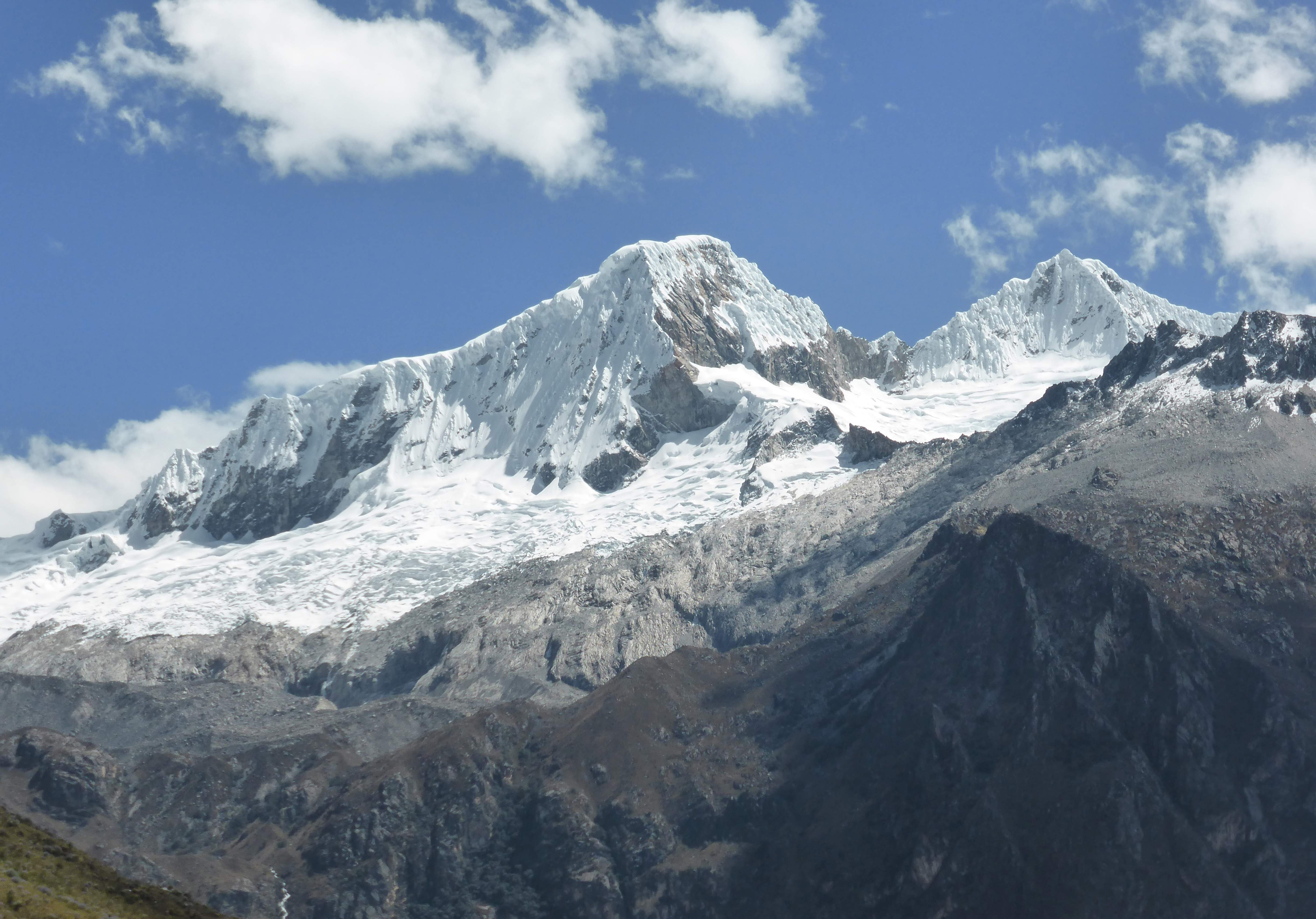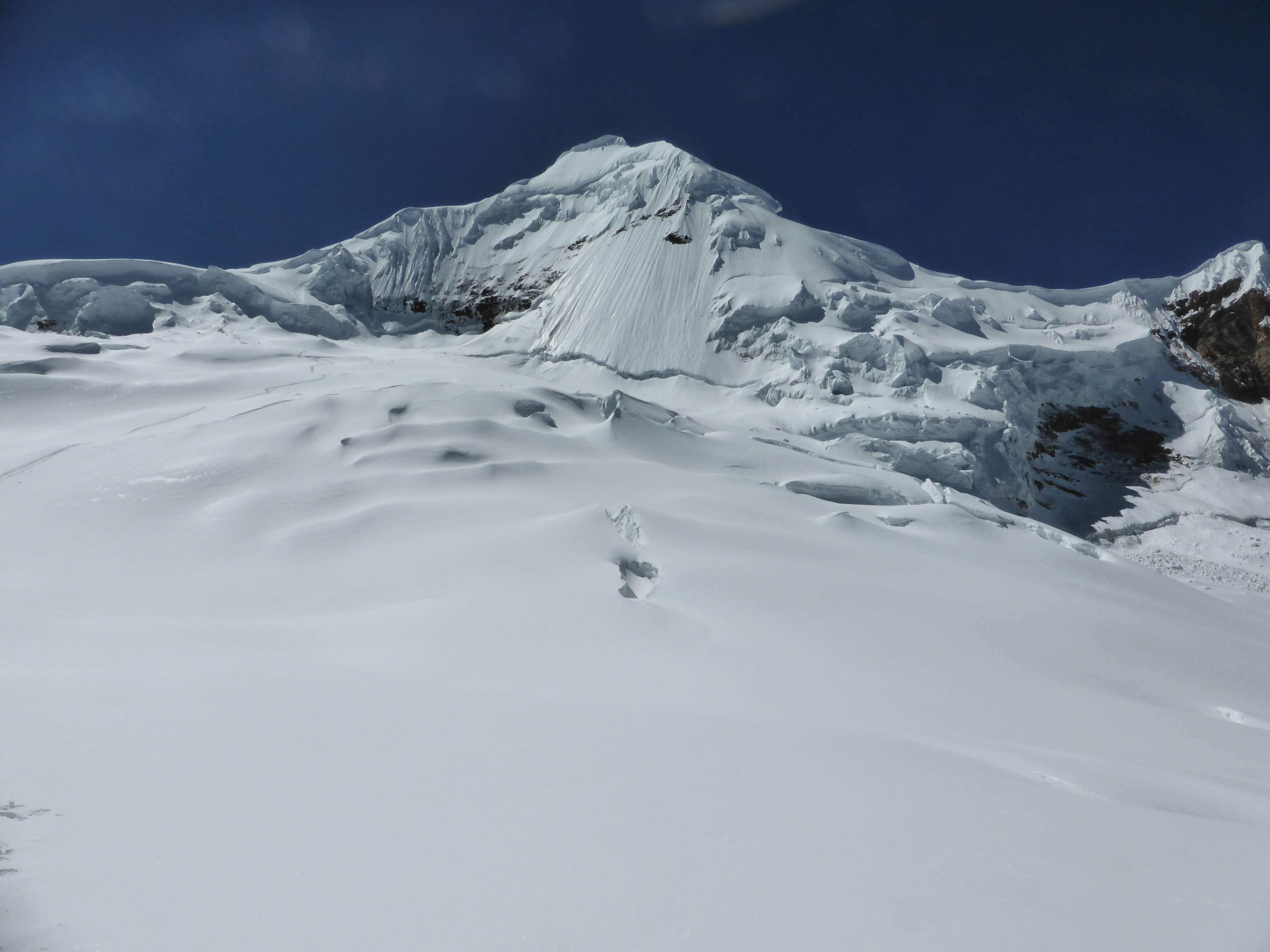
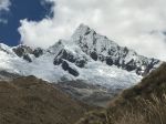
Alpamayo’s southwest face.
Alpamayo
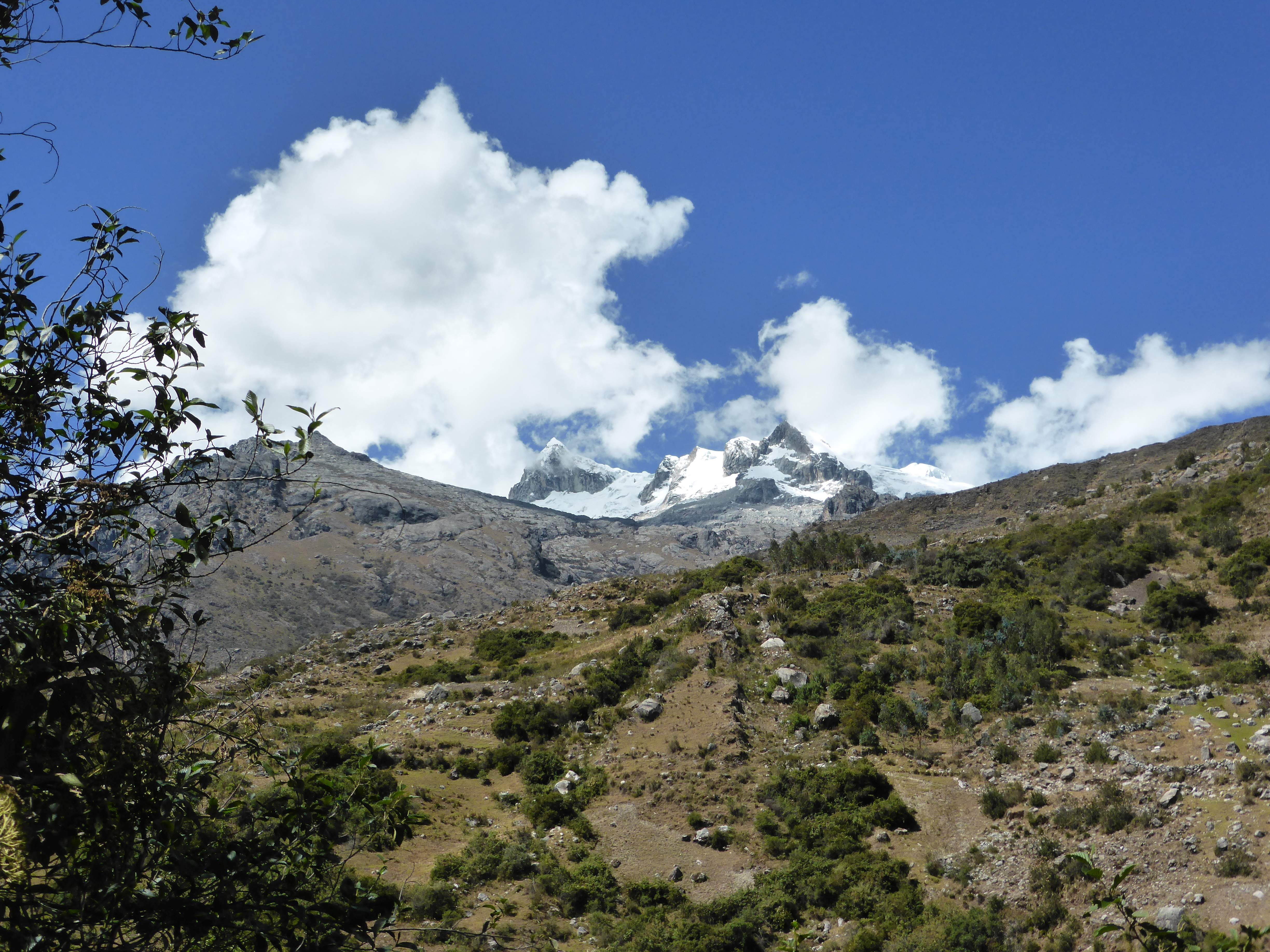
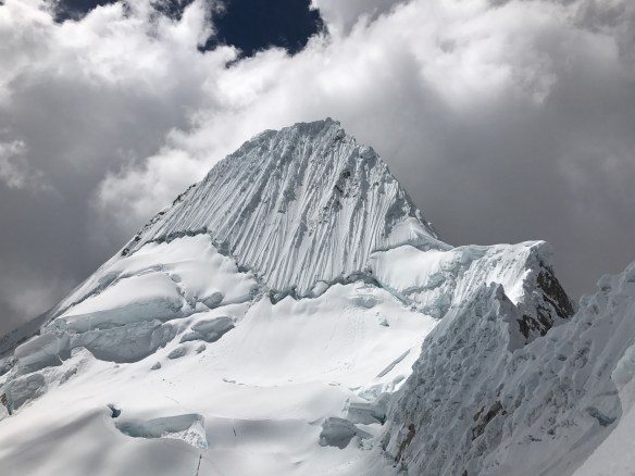
Alpamayo is a stunning pyramid of ice and snow, its steep faces gorgeously fluted with spine-like runnels of ice. Located in the heart of Peru’s beautiful Cordillera Blanca, Alpamayo’s northern aspect is that of a perfectly symmetrical ice pyramid, while it’s southwestern face and standard climbing route rises above the surrounding glacier like an enormous flake of sheer ice, vertical runnels forming a complex texture of natural snow gulleys. At 5947m Alpamayo is not quite high enough to scratch the magic 6000m mark which makes so many climbs in South America popular objectives, yet Alpamayo’s southwest face is nonetheless one of Peru’s most sought-after climbs due to it’s powerful aesthetic appeal and delightfully high quality climbing.
I had been keen on an Alpamayo attempt for several years, but had as yet not been confident enough in my ice ability to take a shot at the steep, relatively technical face. For quite some time Alpamayo was just a dream, an idea, not something which represented a realistic objective for me. I knew that this state of affairs would change if I wanted it to; 6000m and 7000m high altitude climbs had likewise been mere dreams of mine in the not-so-distant past.
In the two years leading into 2017 I had gotten significantly more experience climbing on steeper snow and easy ice, had been doing a lot of multipitch rock climbing throughout the work year, and finally felt comfortable with the systems involved in a climb of Alpamayo’s technical scope. With no local partners for a climb, I contacted my friend Edgar in Ecuador – it so turned out that Edgar was free at the same time as me in August, and we started talking about a plan. Edgar is a strong, experienced guide whom I had climbed with several times previously, and I knew that with him on the rope a summit of Alpamayo would be a realistic objective. After sorting out dates and a rough itinerary for flights, the goal solidified into something real, and I began to put more effort into the upper body endurance elements of my mostly cardiovascular focused training regime. In Huaraz Edgar’s friend Flavio, also an experienced Ecuadorian climber, joined us for a solid team of three.
Acclimatization Strategy
Prior to Peru I spent roughly three weeks in Kyrgyzstan making a solo climb of 7134m Pik Lenin. My intention was to come into Peru pre-acclimated, saving time and expense by enabling a fast and efficient shot at Alpamayo without spending days acclimating ahead of time. I had effectively utilized a similar strategy the year prior in order to make an overnight climb of Mount Elbrus, and was keen to repeat the efficiency and success of that expedition. Finishing on Pik Lenin much earlier than expected, I spent ten days at sea level after getting off of the mountain. I was quite nervous that such a significant rest period would adversely affect my strong acclimation, or compromise it altogether, but these fears were ultimately unfounded. Despite the ten day break from altitude the strategy worked perfectly; throughout the entire climb of Alpamayo I never felt any adverse effects from altitude, and operated very comfortably, extremely well acclimated throughout. Edgar, living above 3000m in Ecuador and constantly climbing Ecuador’s variety of 5000-6000m volcanoes, was likewise well acclimatized from the outset of the trip.
Photographs
-

- Sierra Andina Alpamayo Beer.
-
- Taulliraju, Santa Cruz Trek.
-
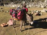
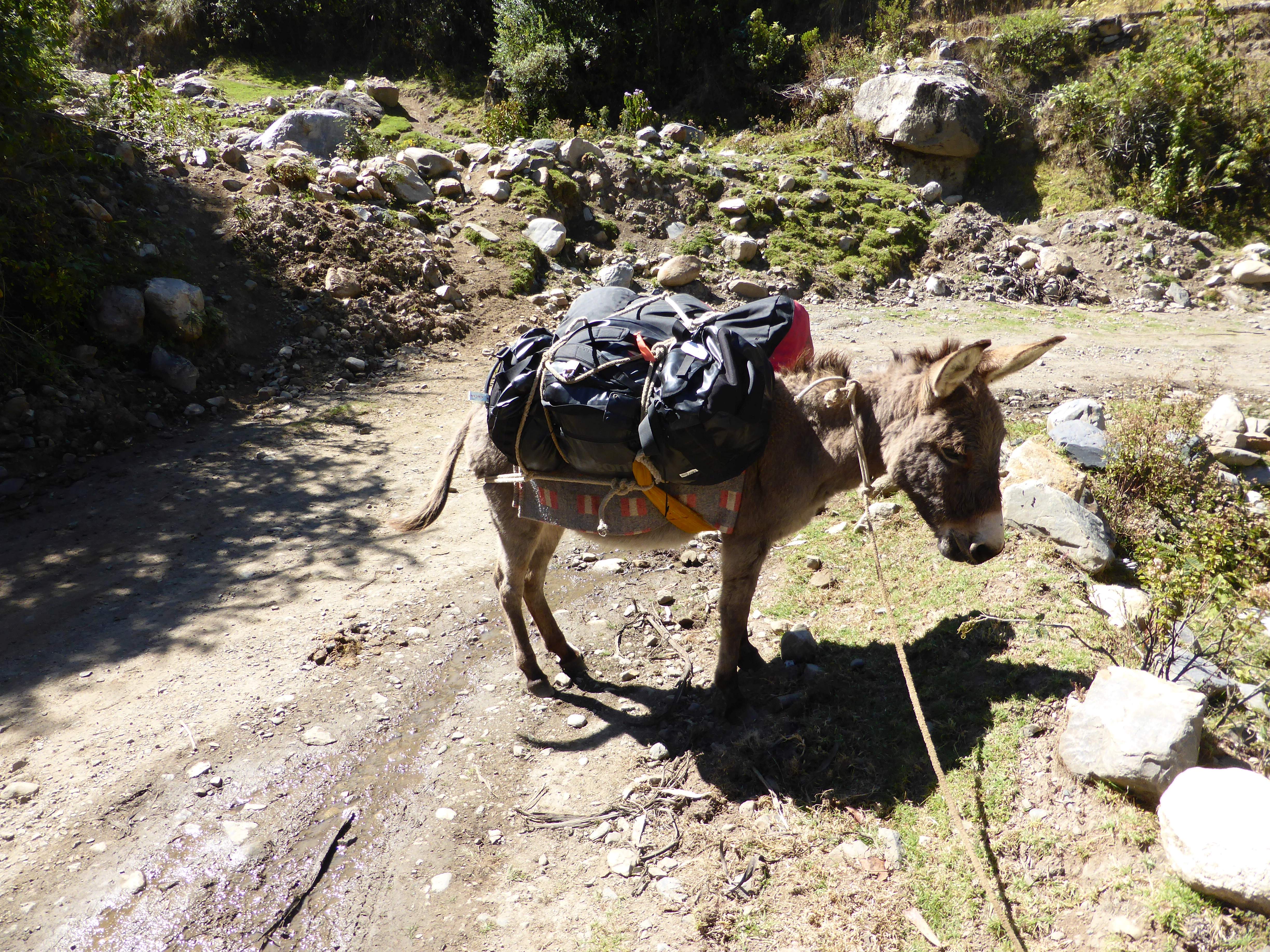
- One of our donkeys, loaded with gear.
-
- Santa Cruz.
-
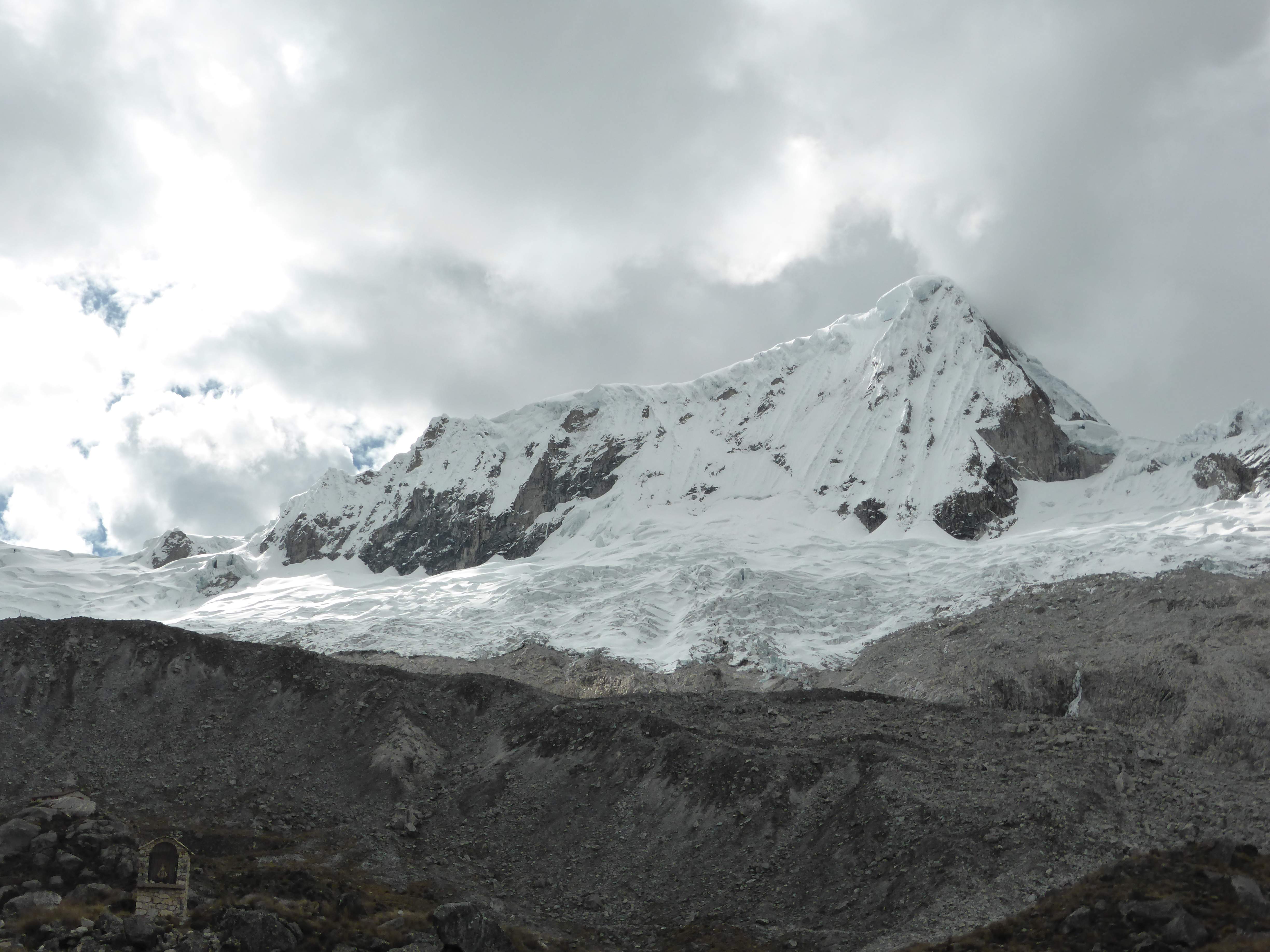
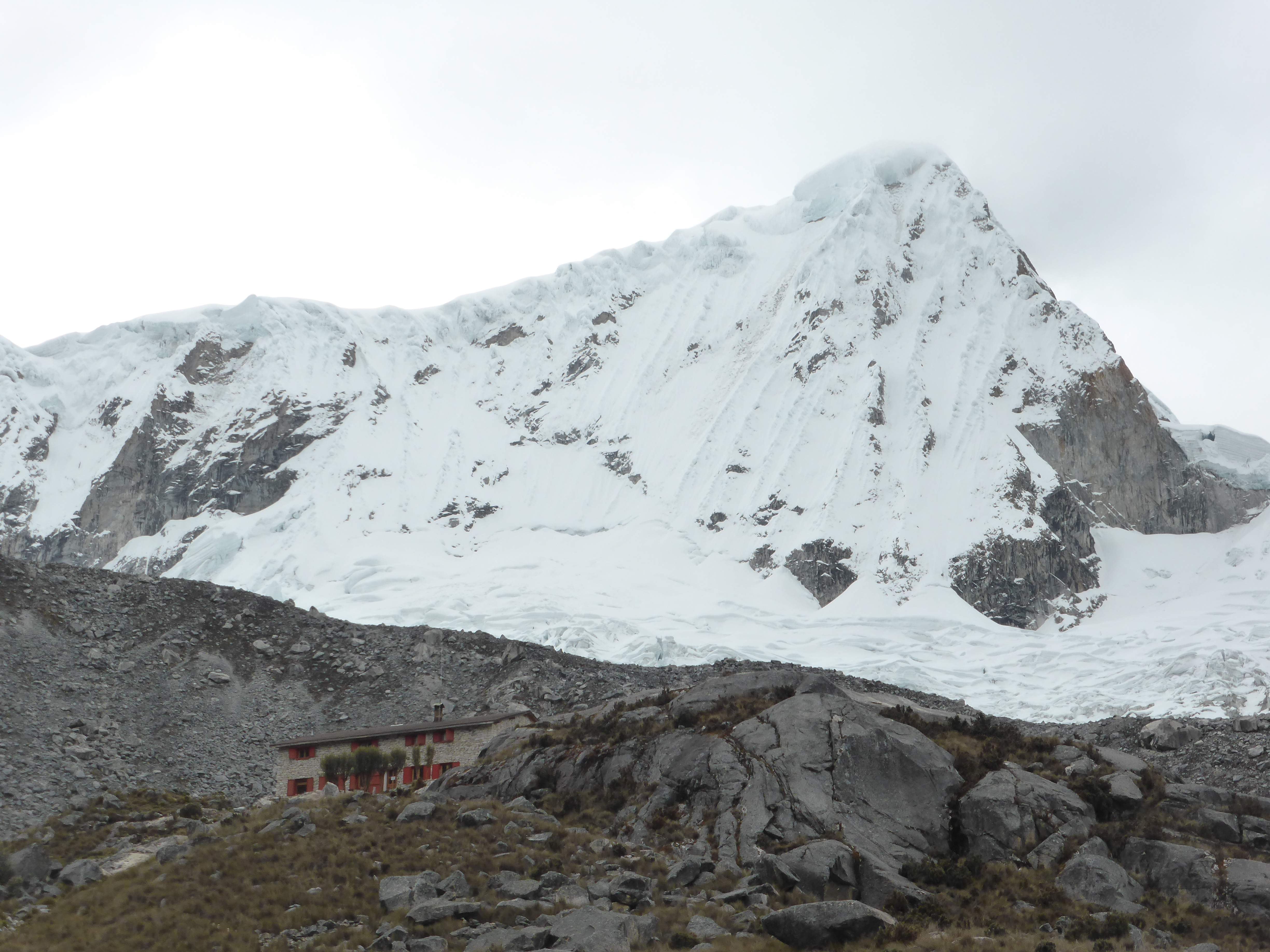
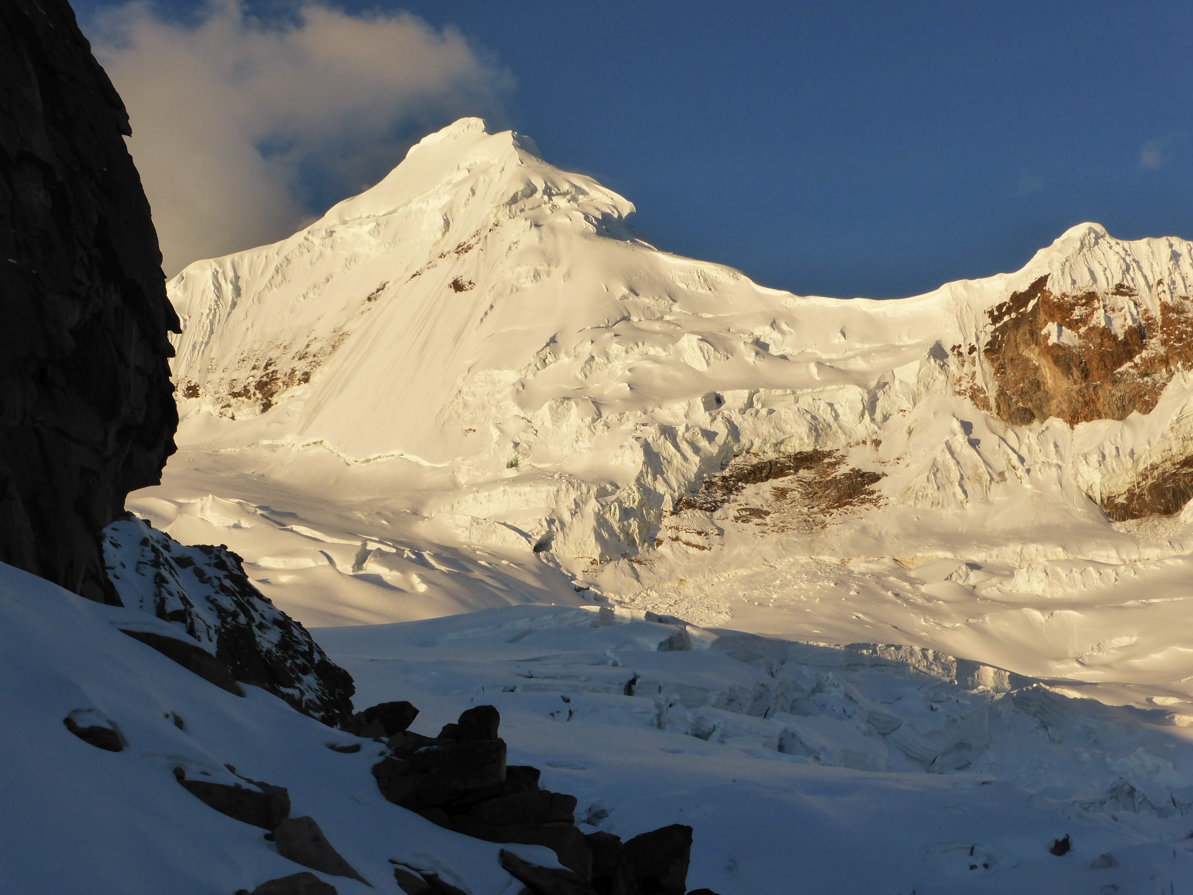
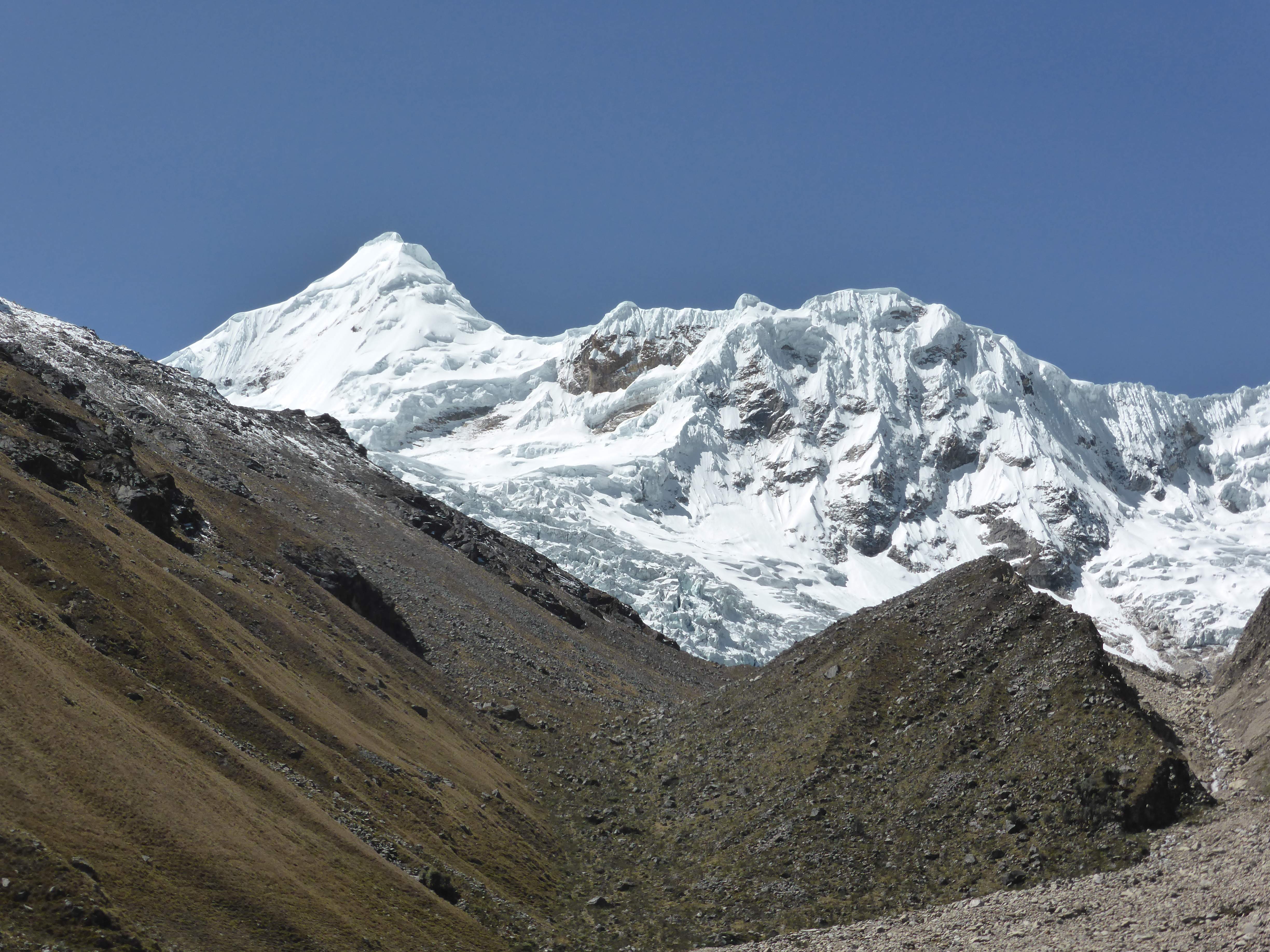
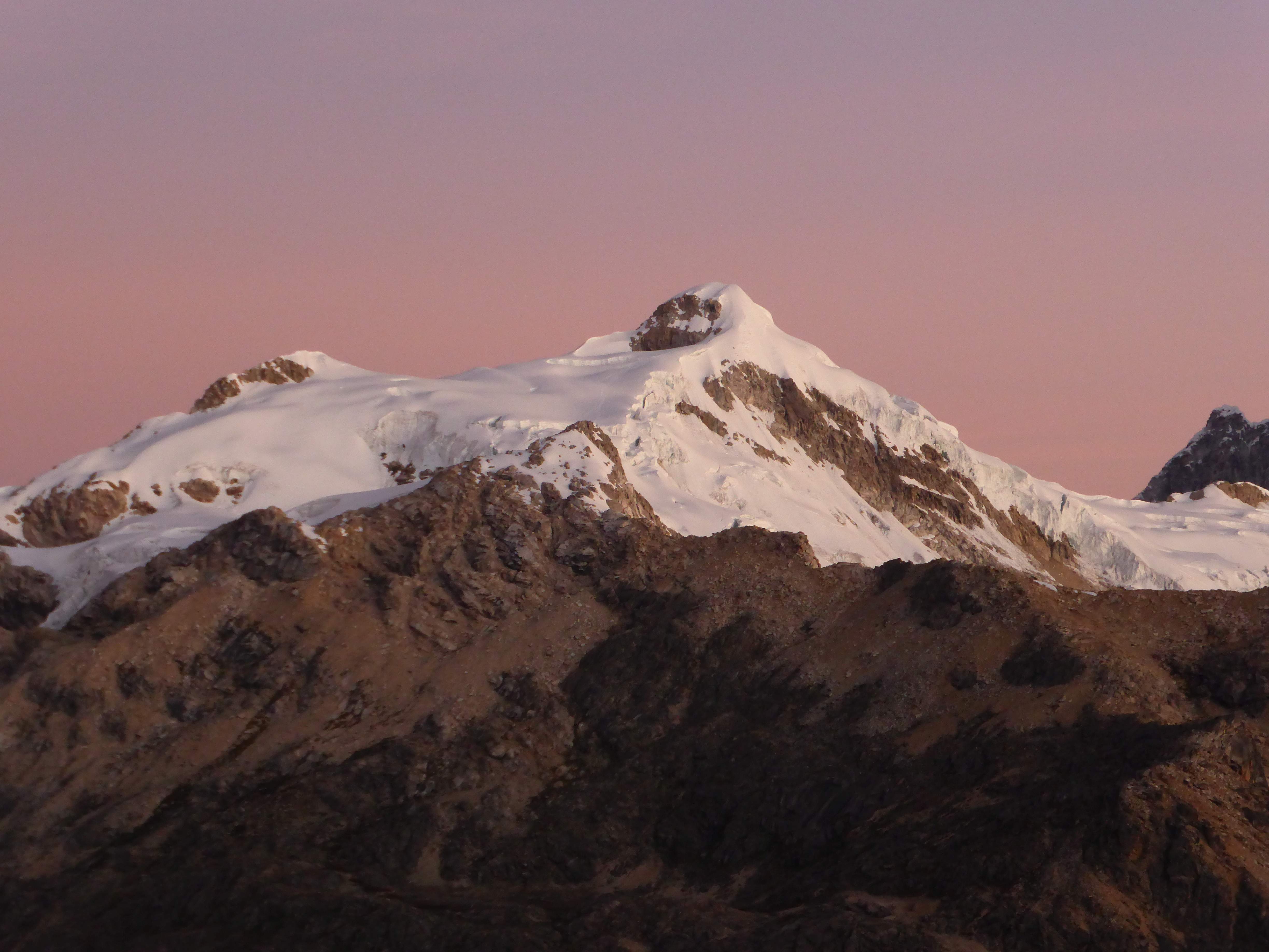
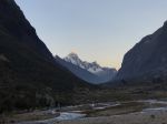
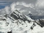
- Alpamayo from near Basecamp.
-
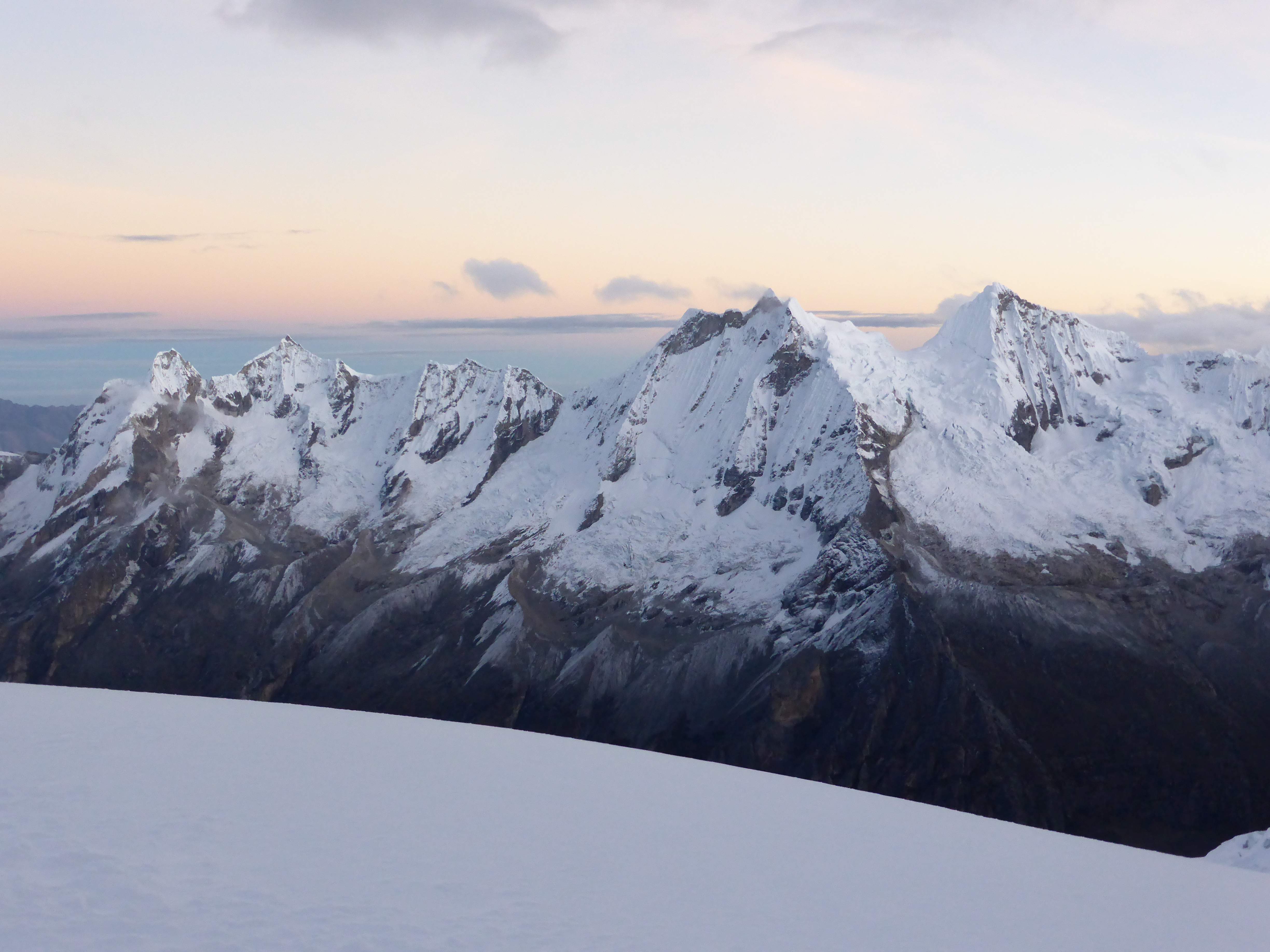
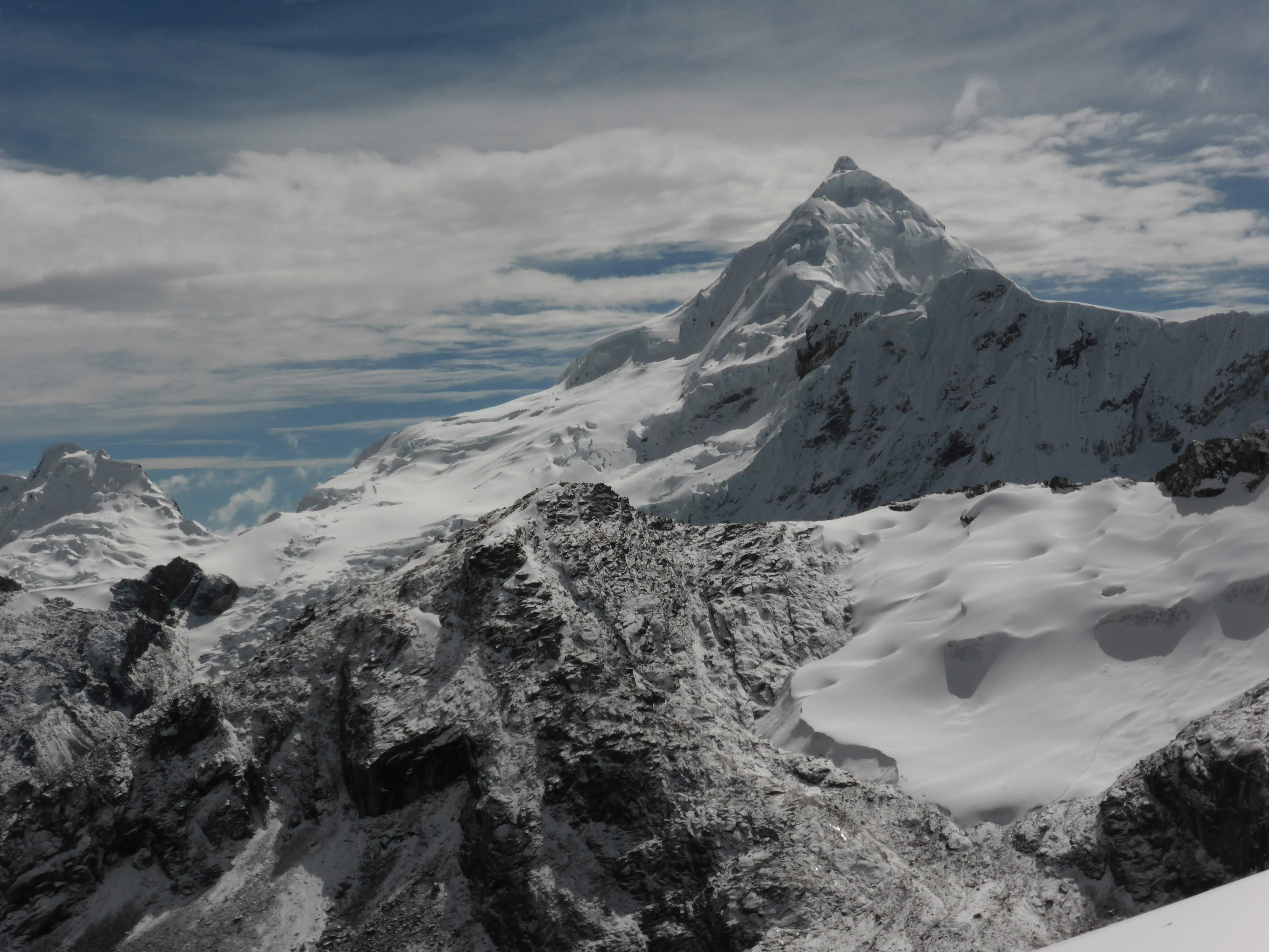
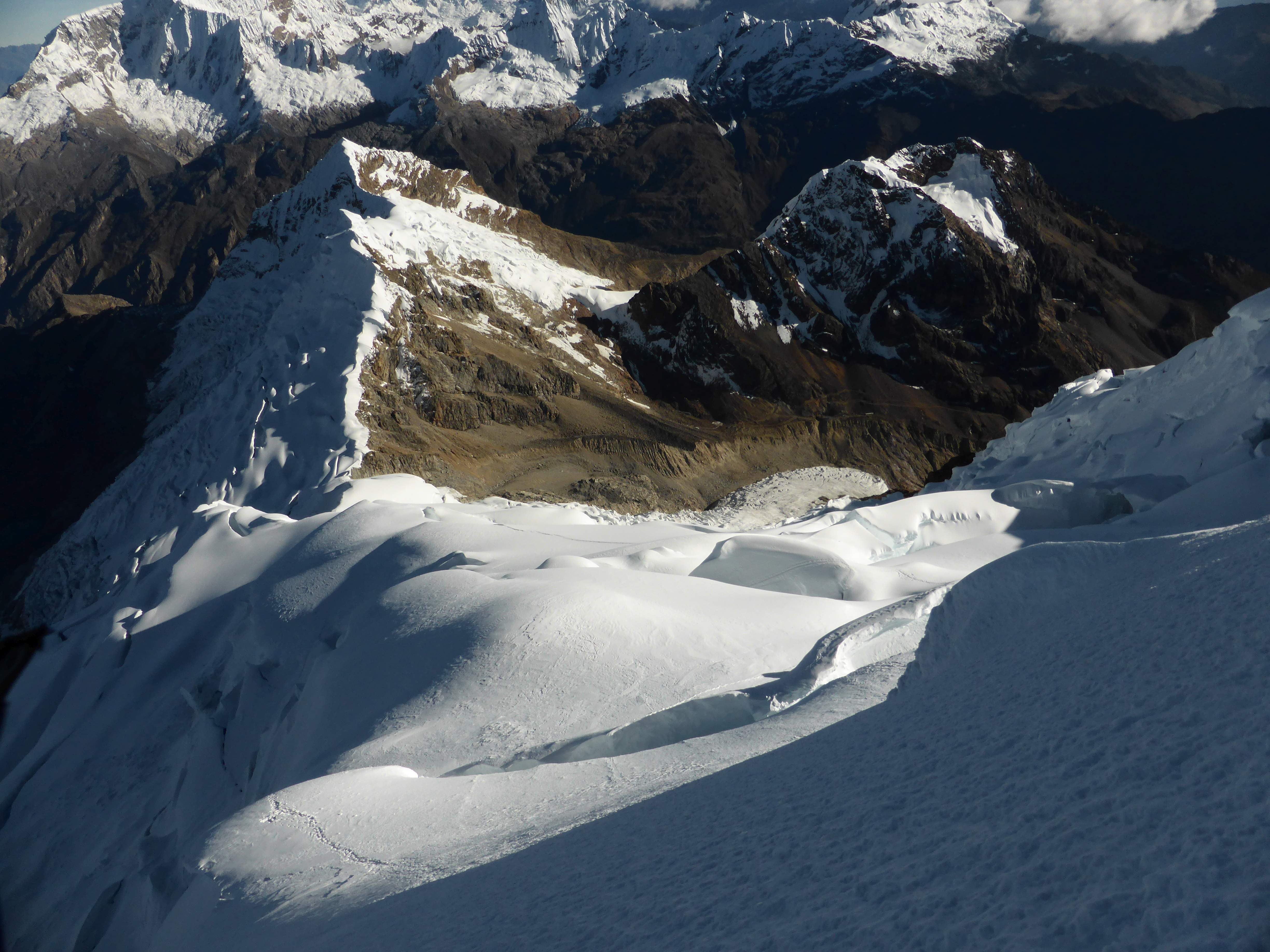
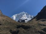
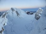
- Nearby mountains.
-
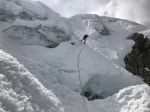
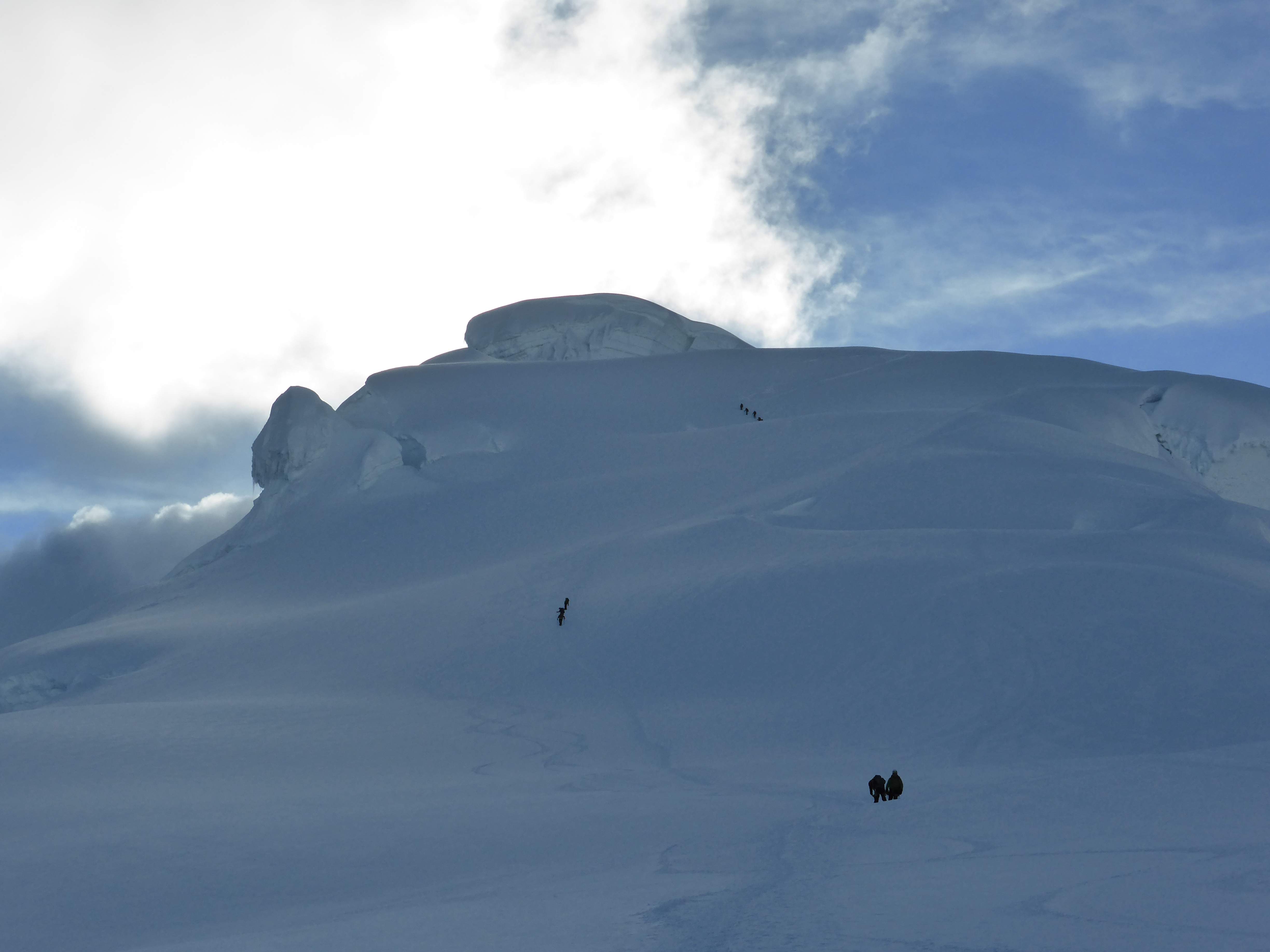
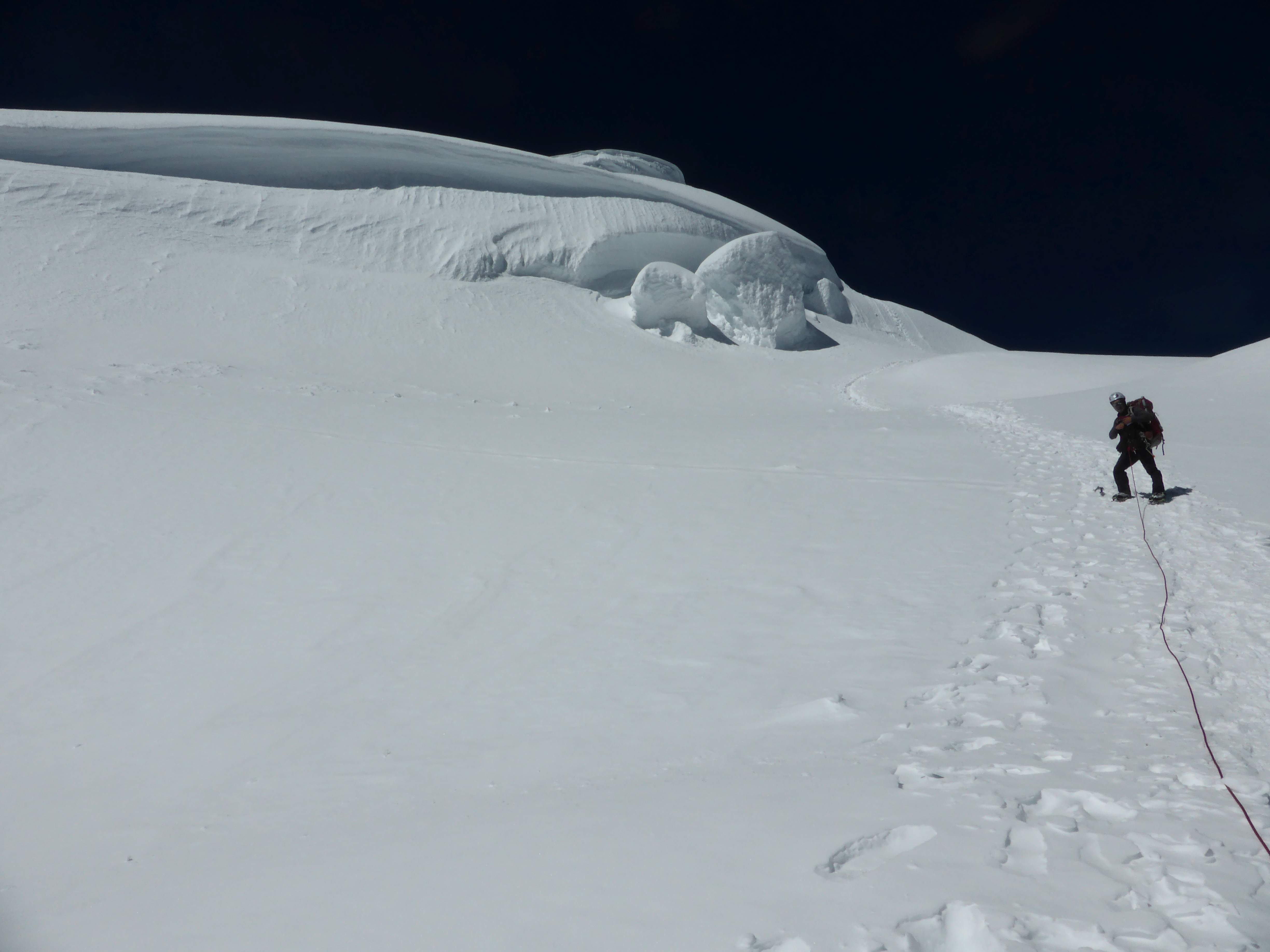
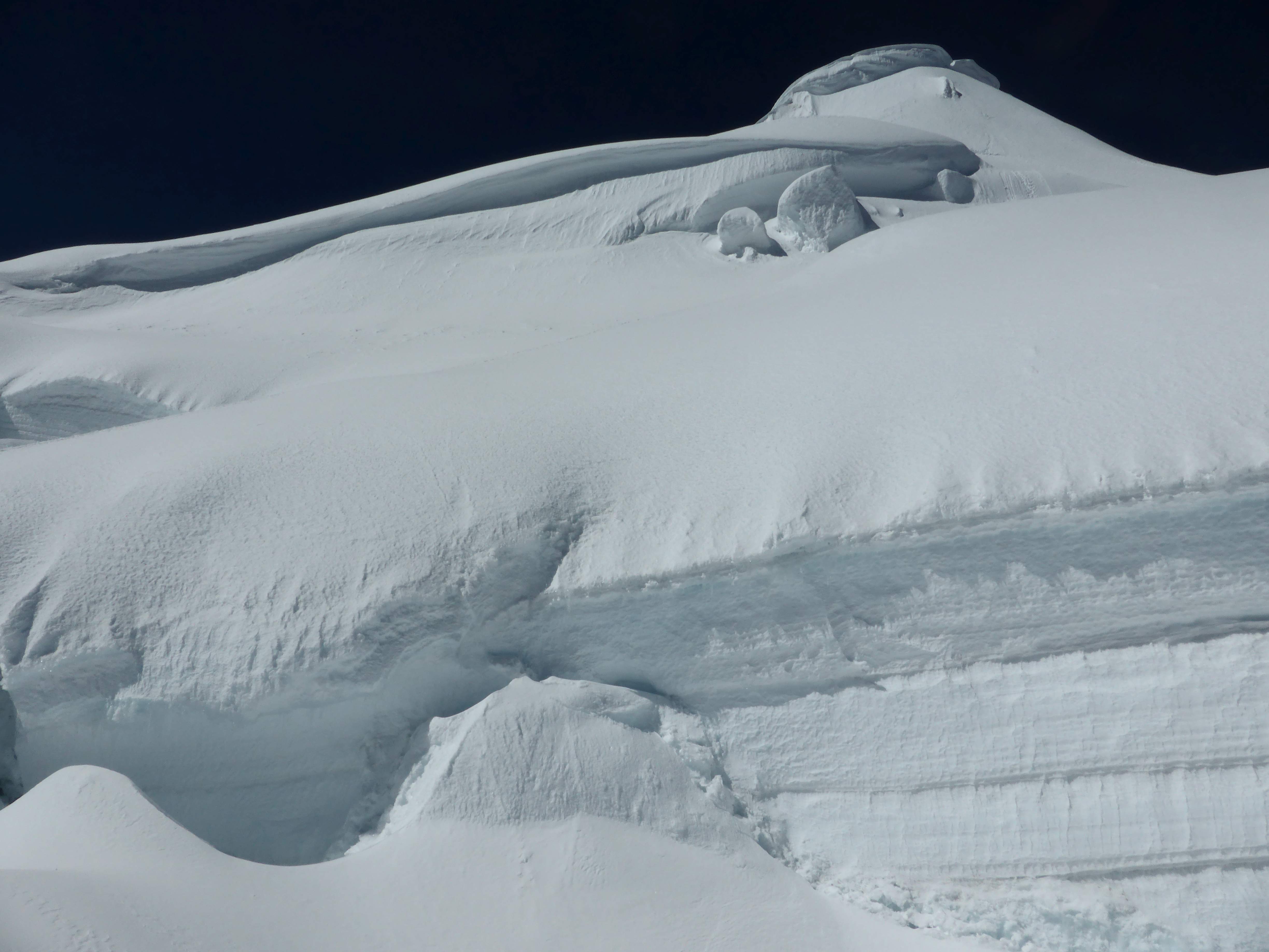
- Rappelling down from the Col.
-

- Rappelling down from the Col.
-

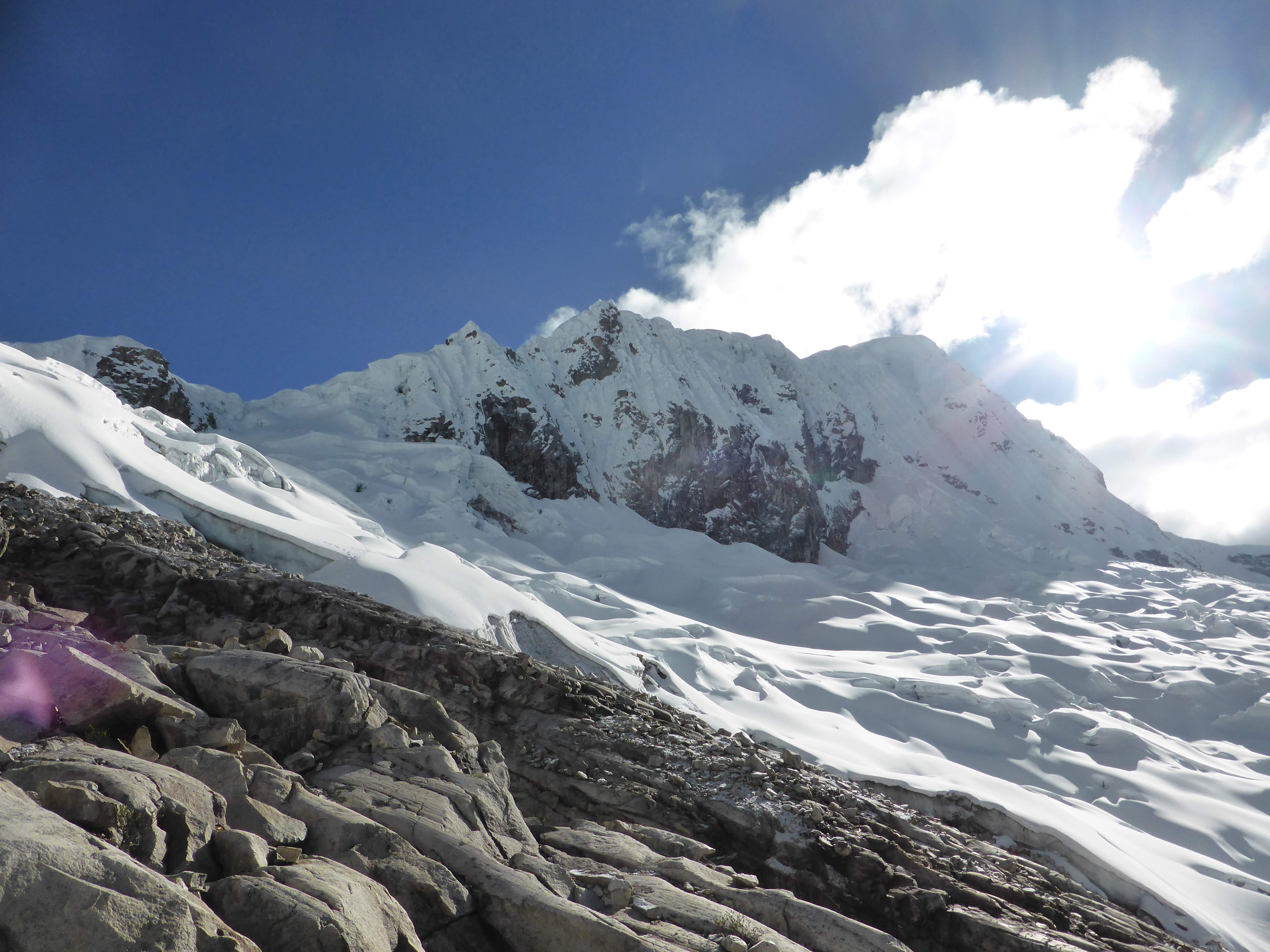
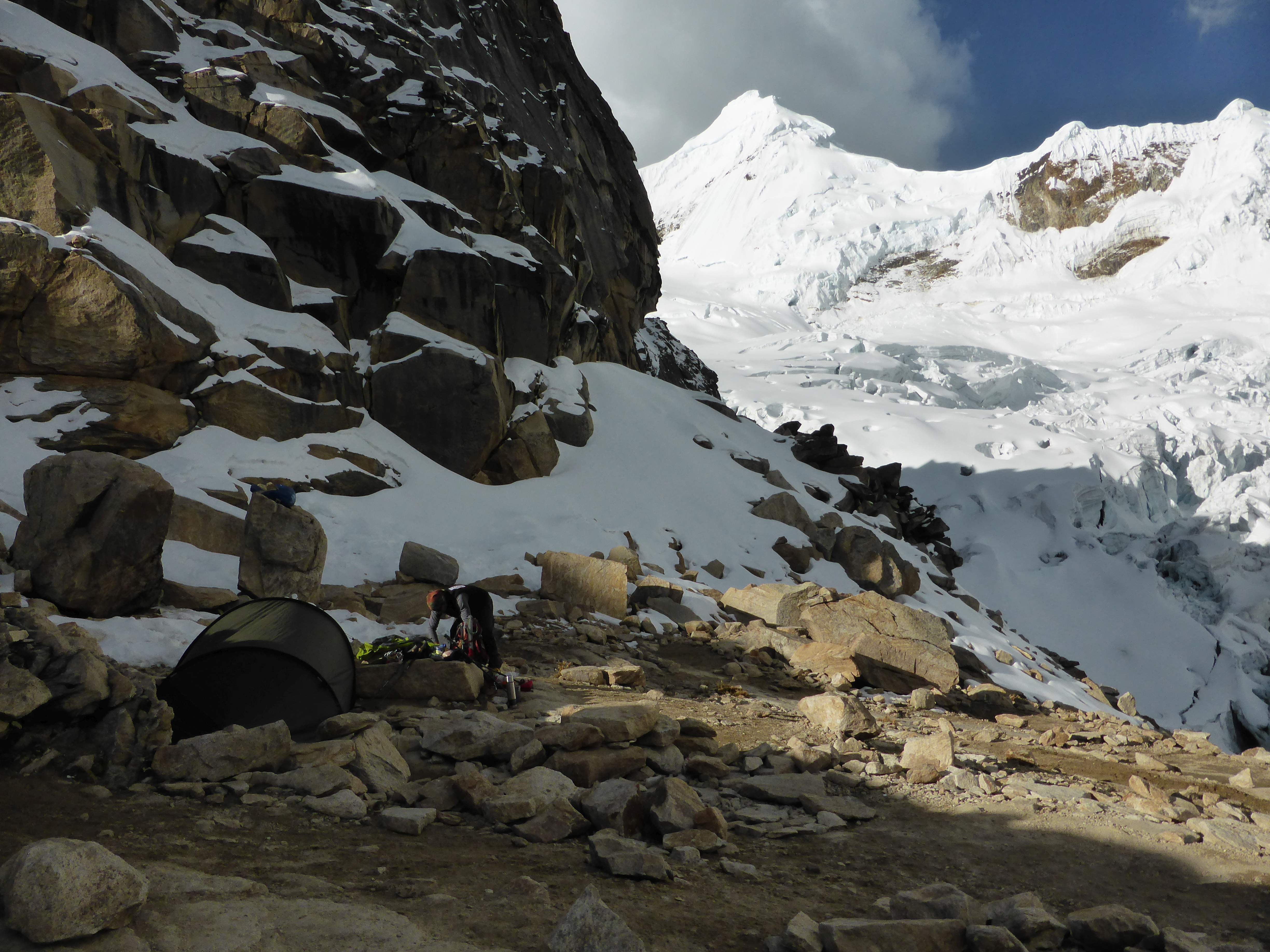
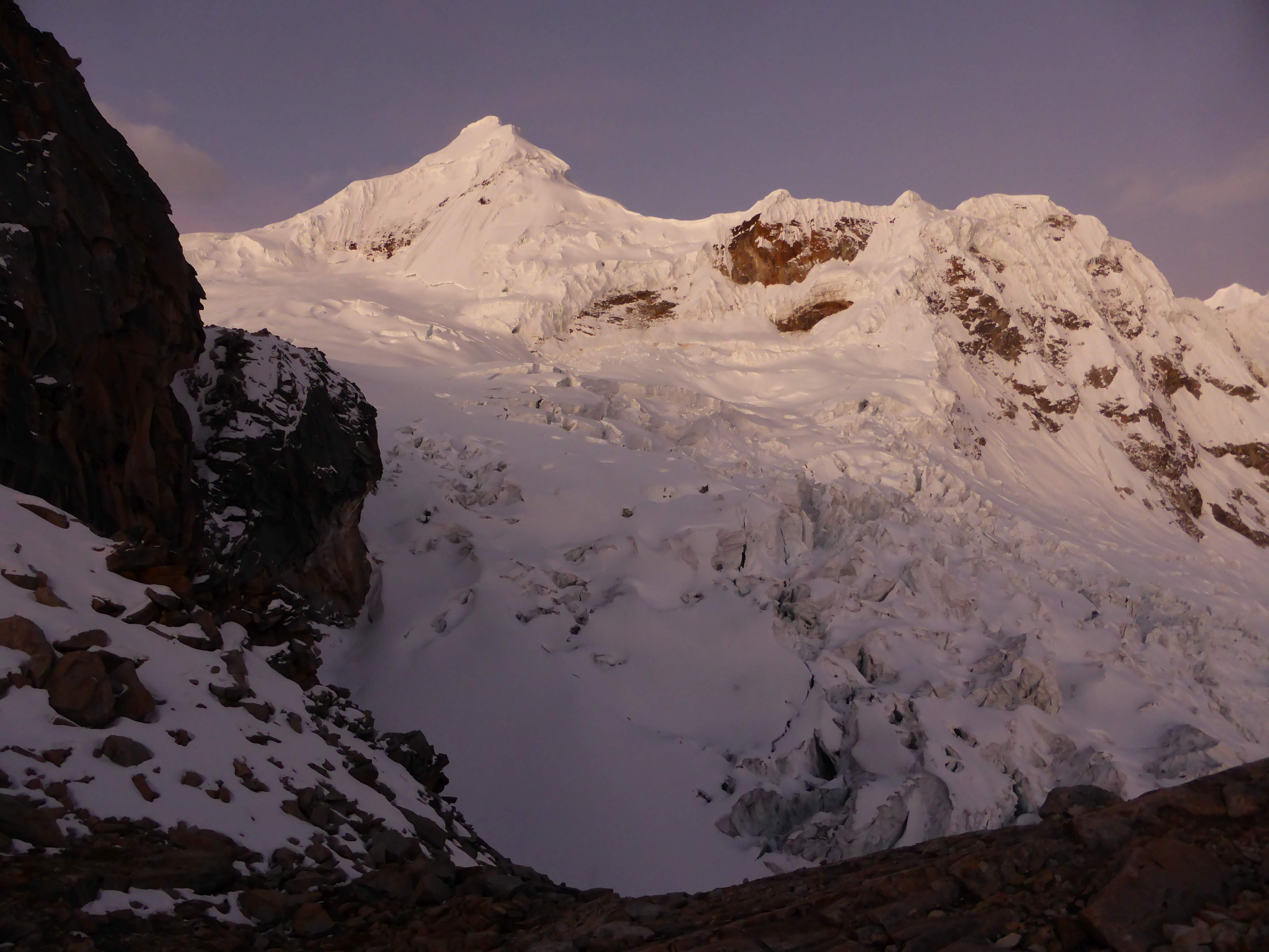
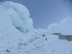
- Looking up towards the Col, from near Moraine Camp.
-
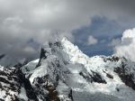
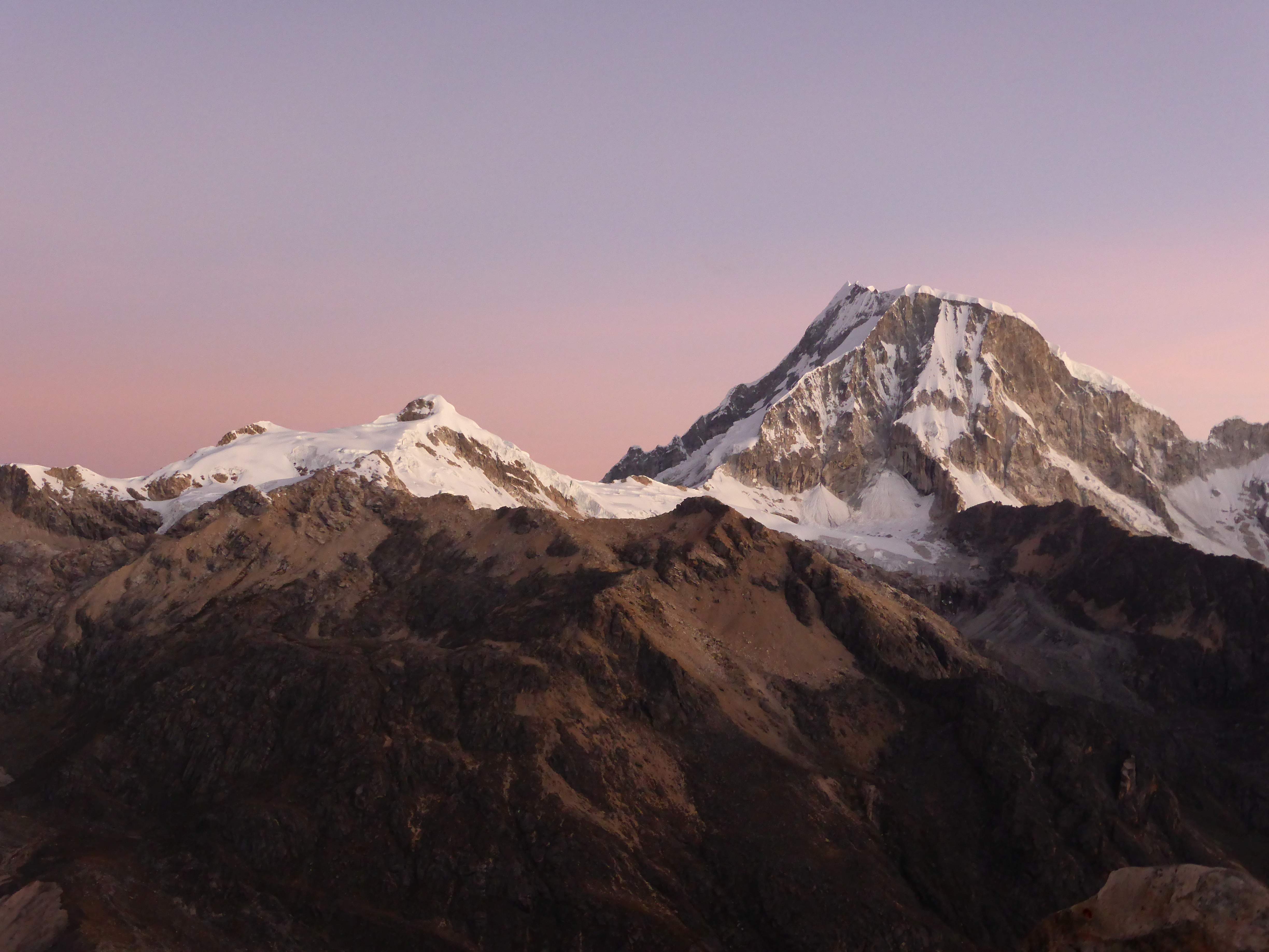
- Nearby Mountains.
-
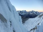
- Looking up the French Direct.
-
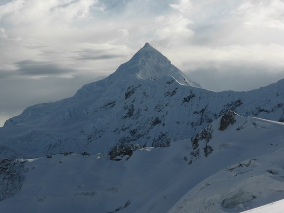
- Quitaraju.
-

- Looking down the French Direct.
-
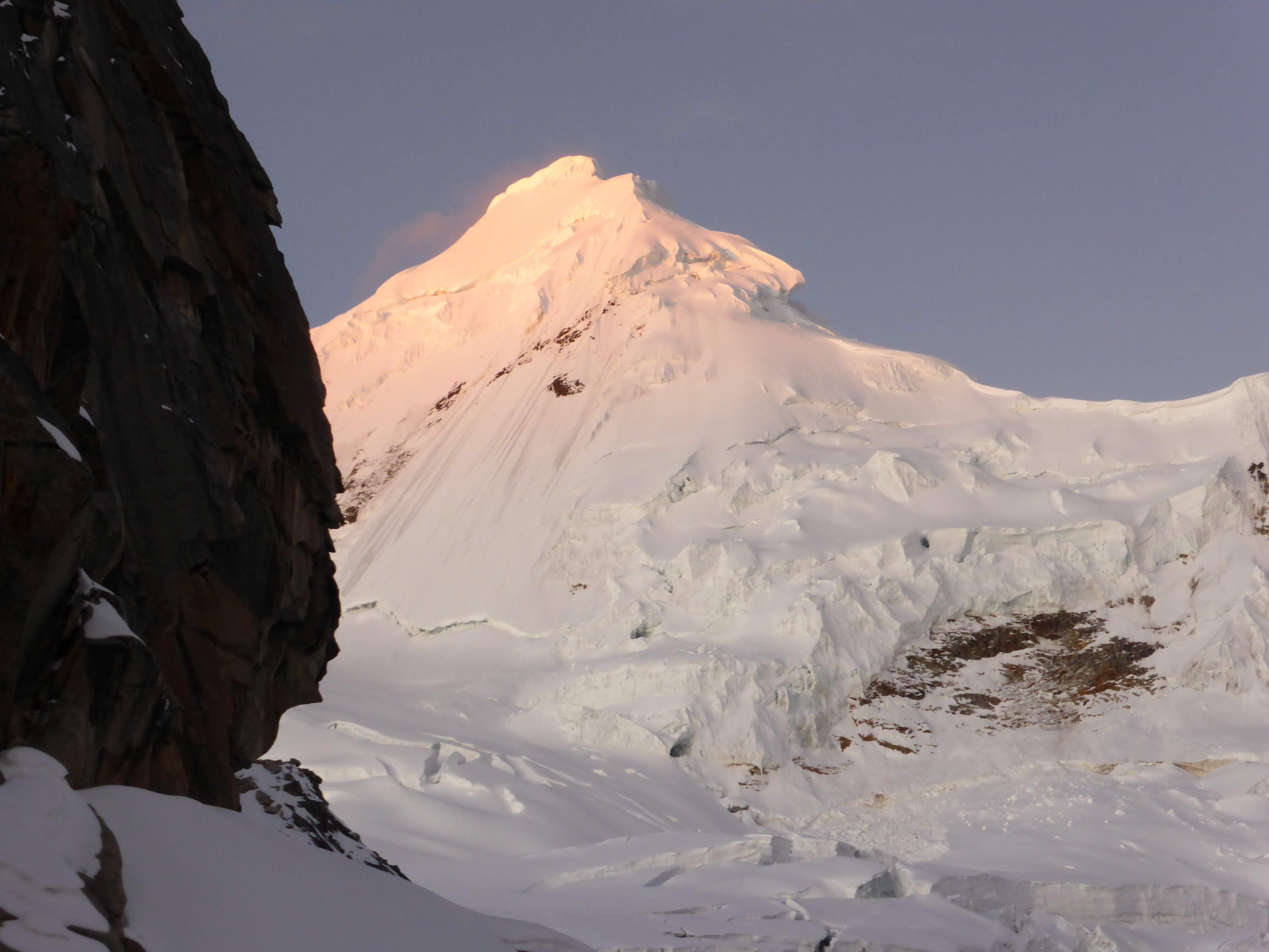
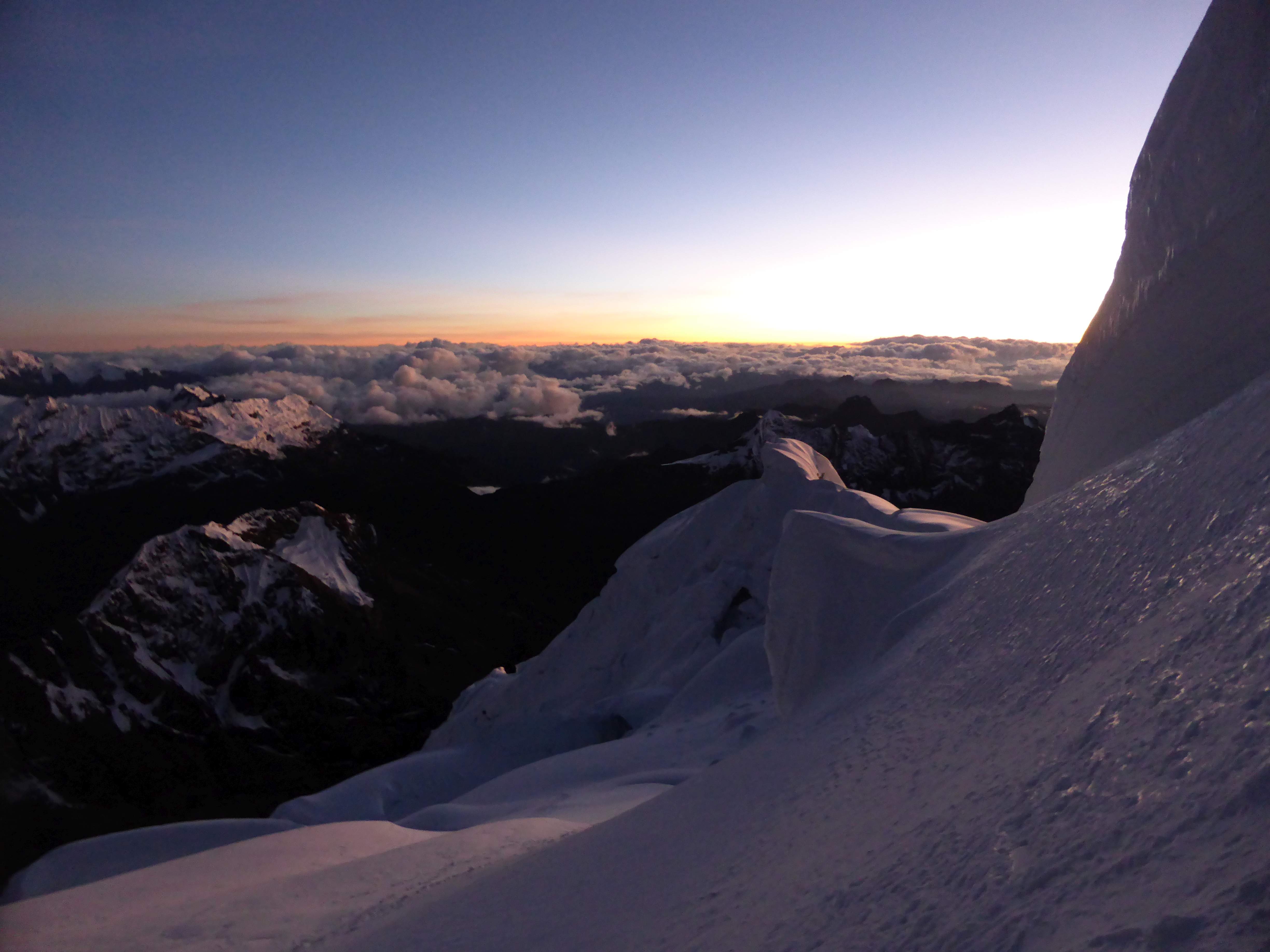
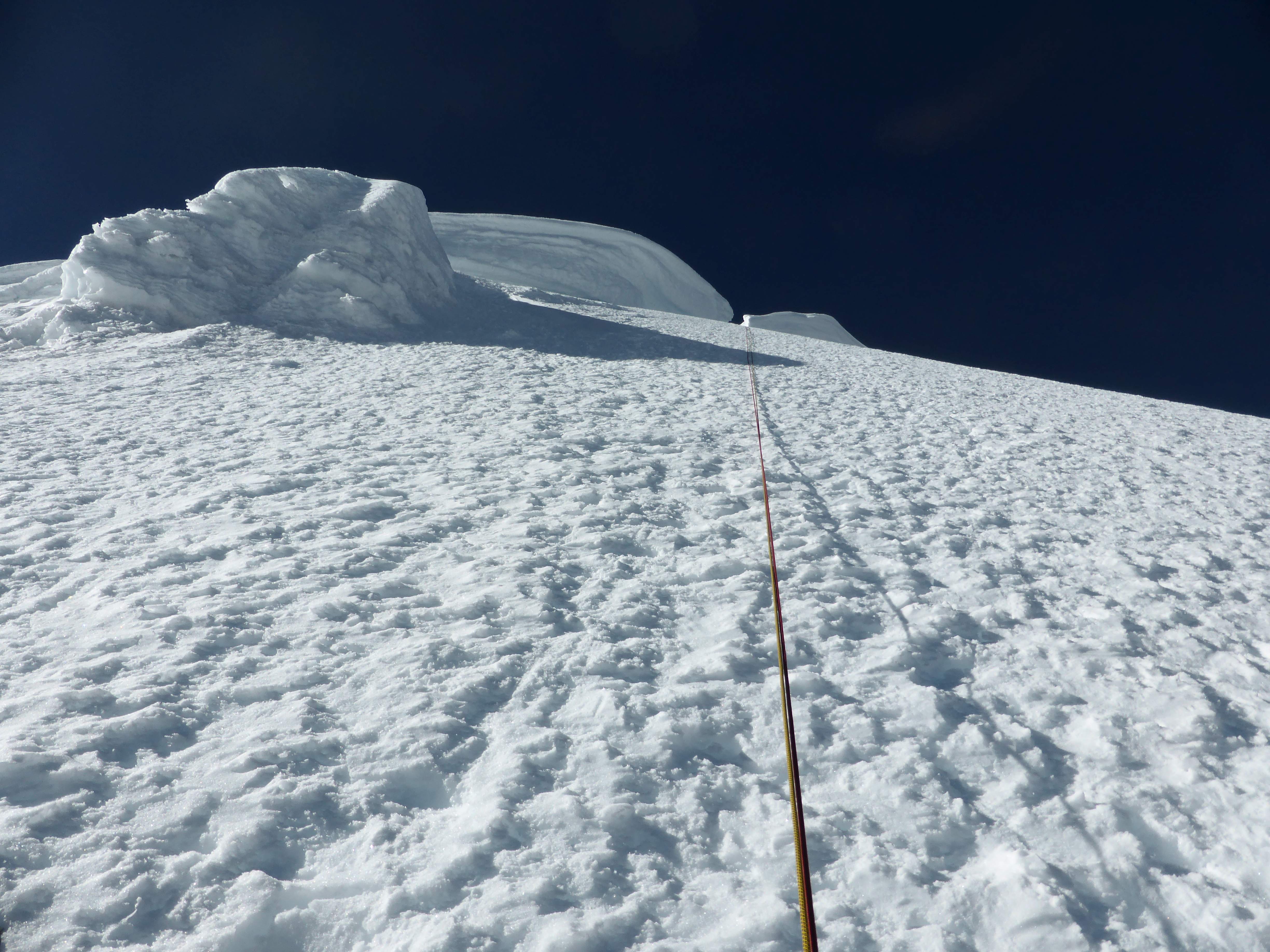
- On the face at sunrise.
-
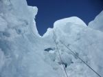
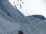
- Water ice on Pitch 8, the steepest pitch.
-
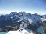
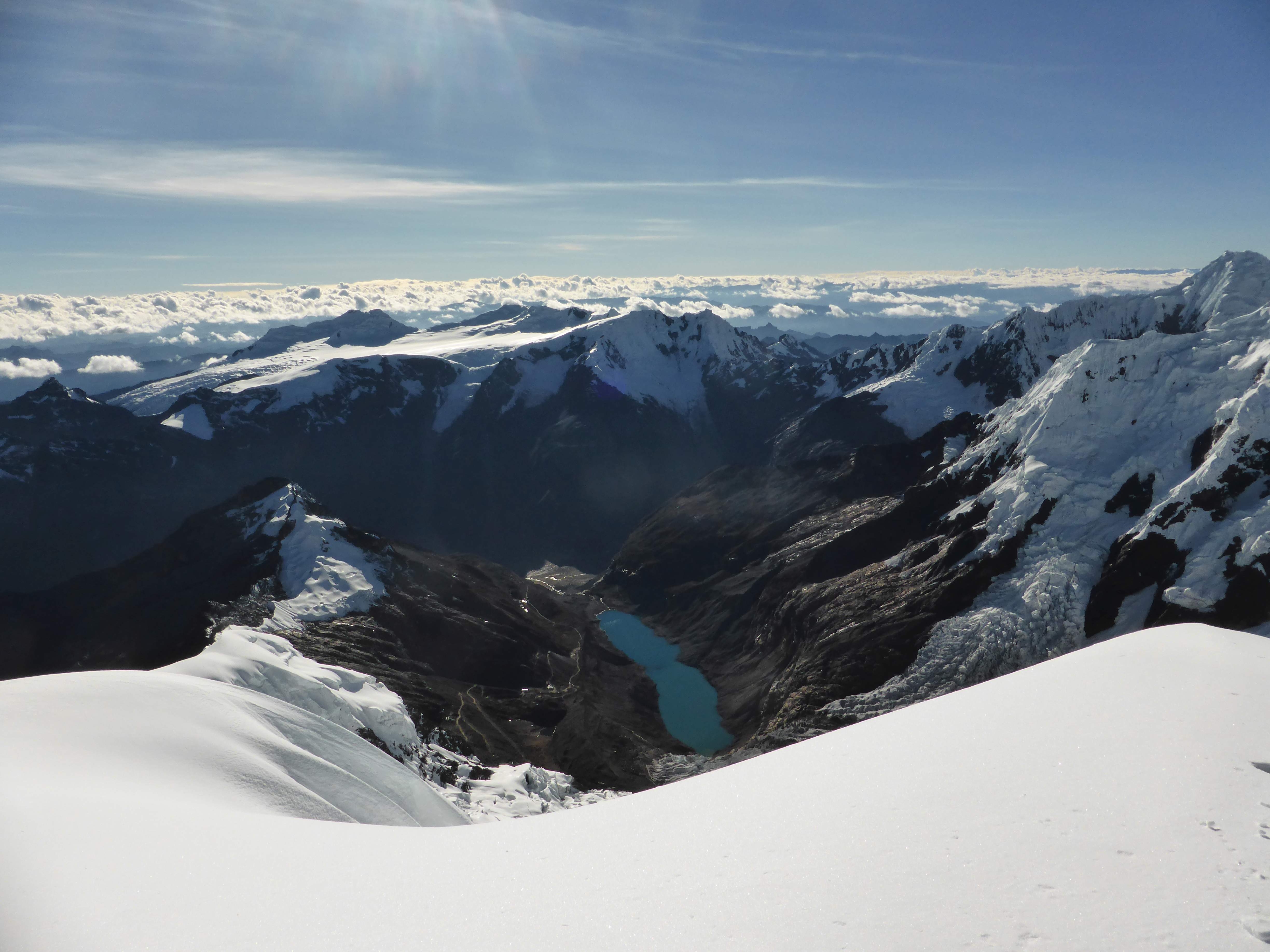
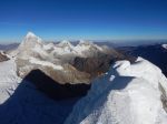
- Summit views.
-

- Summit views.
-
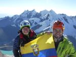
- Edgar and Flavio on the summit.
-

- Summit views.
-

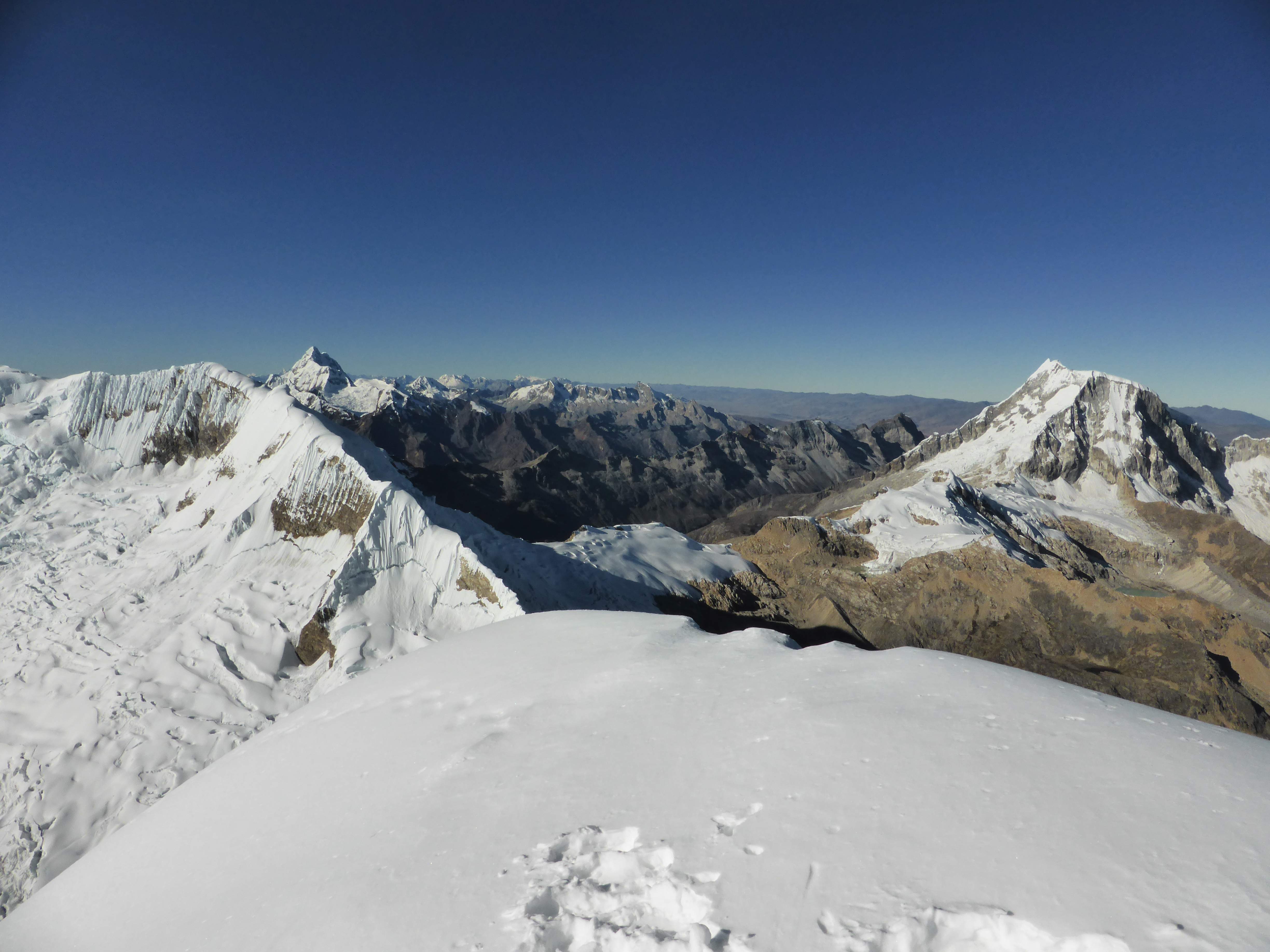
- Quitaraju from the summit.
-
- Looking down the French Direct.
-

- Alpamayo from near the Col.
-

- Artesonraju.
-
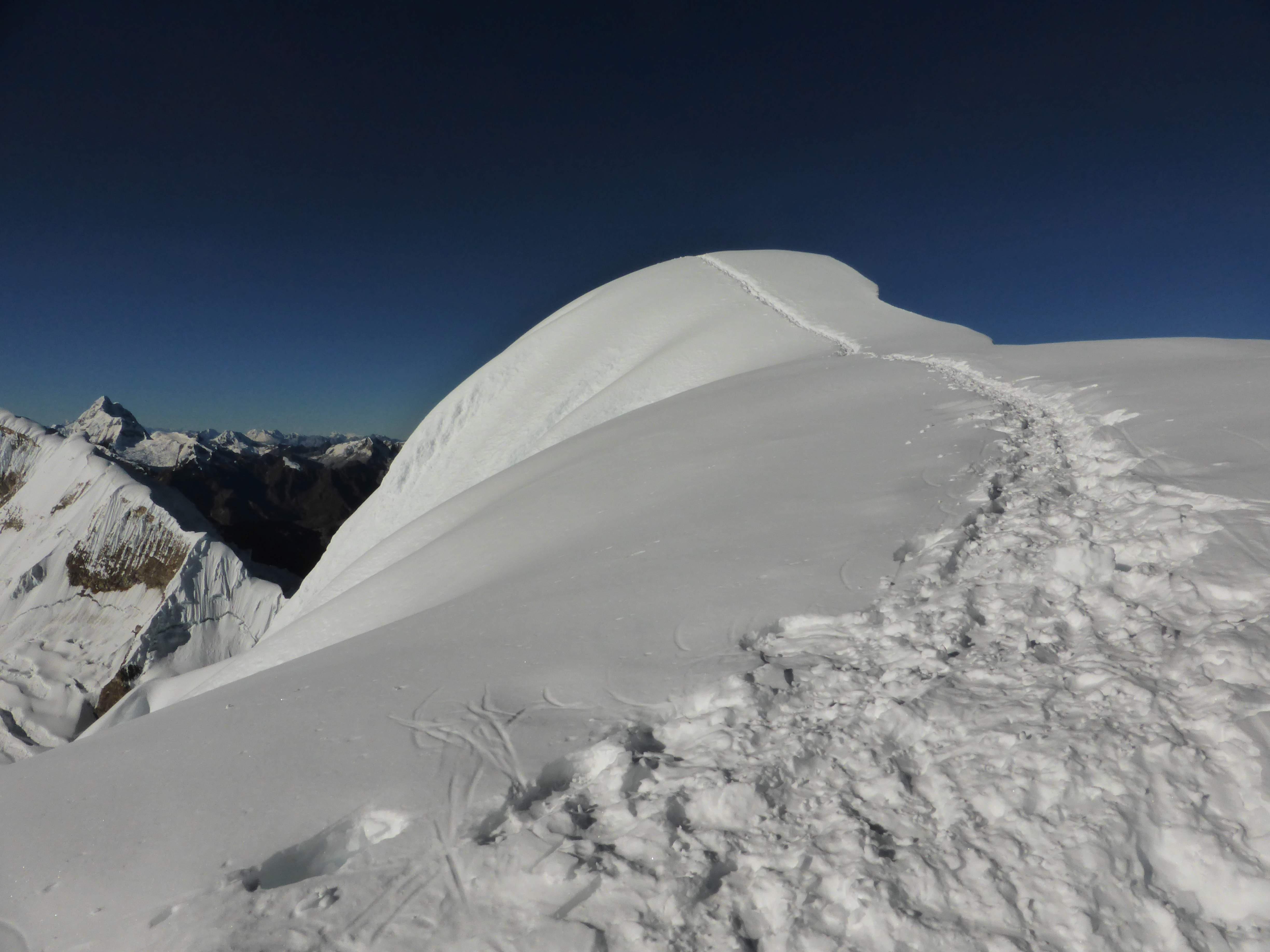
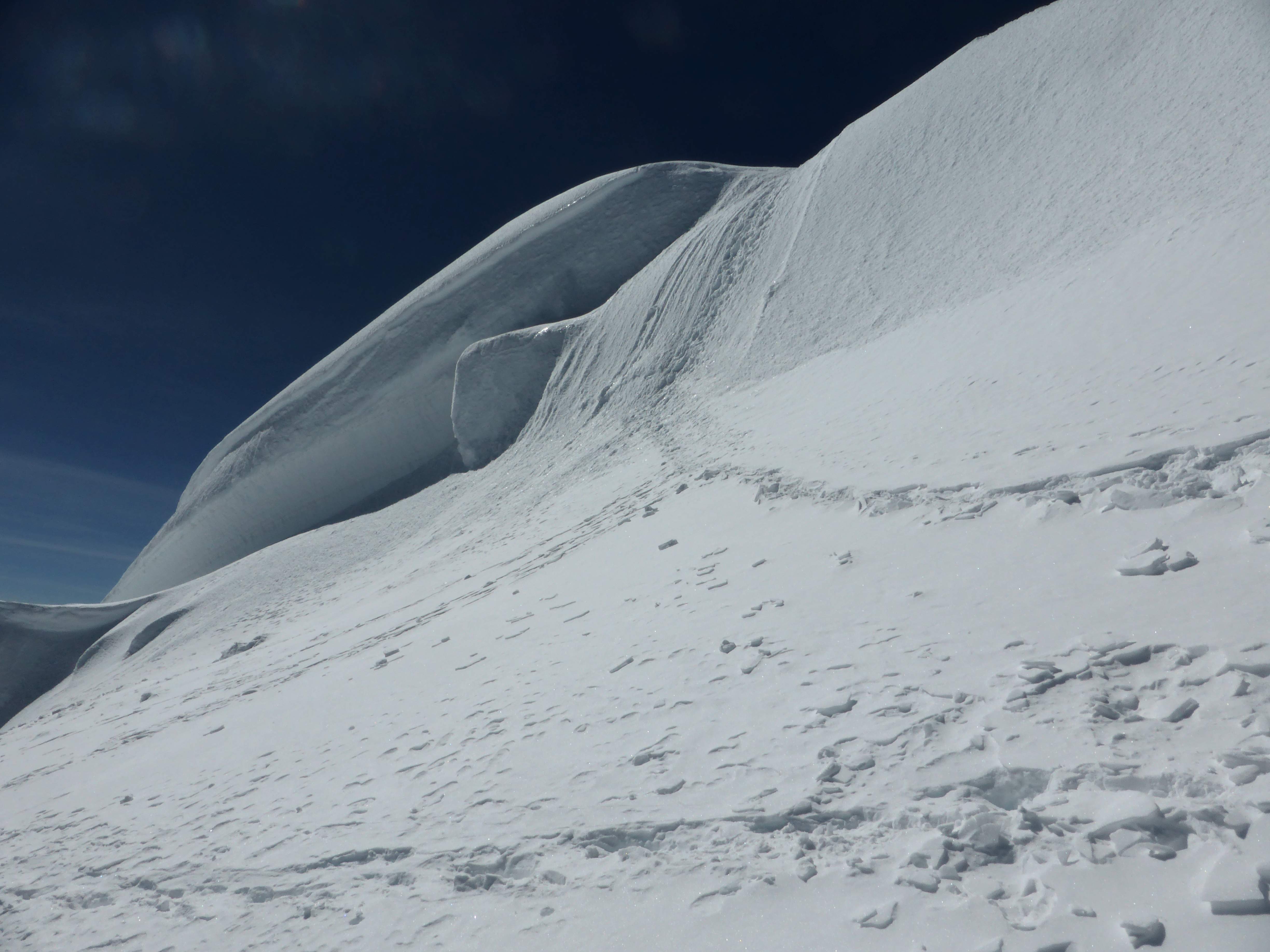
- Alpamayo’s summit ridge.
-
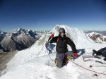
- On the summit of Alpamayo.
Itinerary and Trip Report
Day 1: August 16th
Cashapampa ~2900m to Llama Corral ~3700m. 3:00 hours.
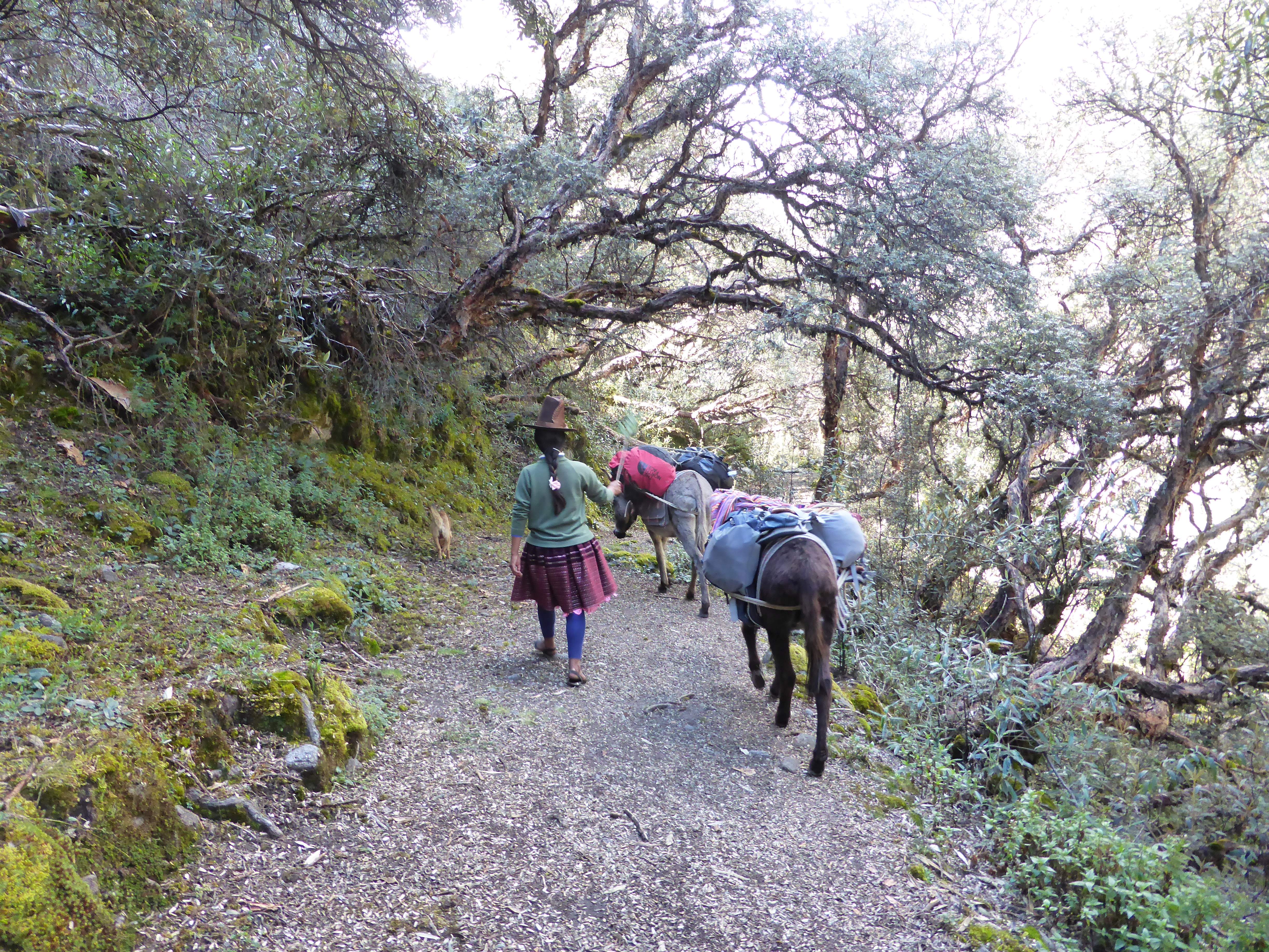
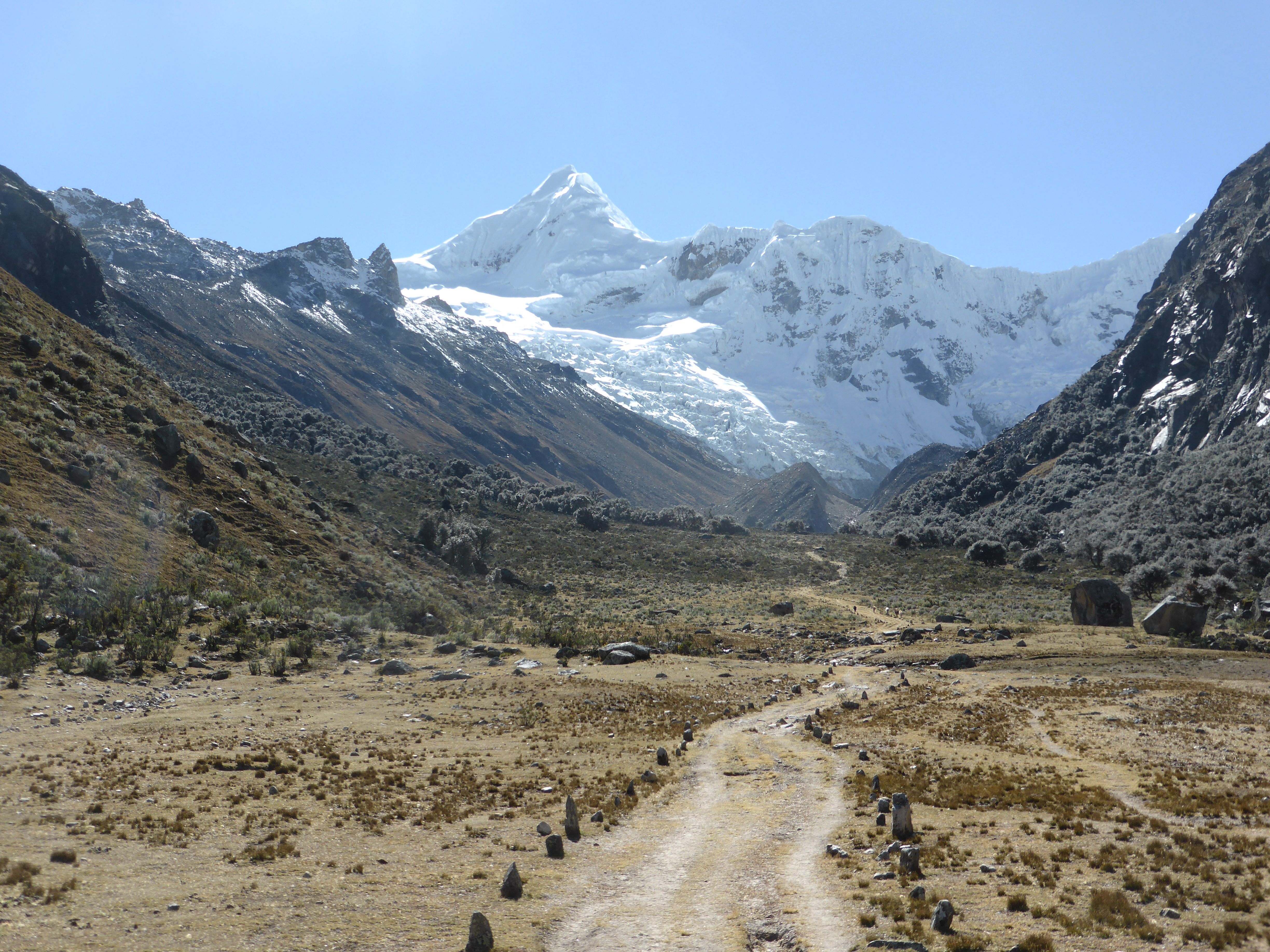
After a long drive disrupted by striking school teachers blocking the road out of Huaraz, we arrived at Cashapampa around lunch time. We ate a quick meal of chicken and potatoes, sorted out Donkeys for carrying our gear, and then headed up the start of the Santa Cruz valley trek which doubles as the approach trail to Alpamayo’s base camp. The hiking was hot, dusty and sweaty, the afternoon sun oppressive. In Llama corral we pitched camp, bought some bottles of cola from a small shop, and slept early.
Day 2: August 17th
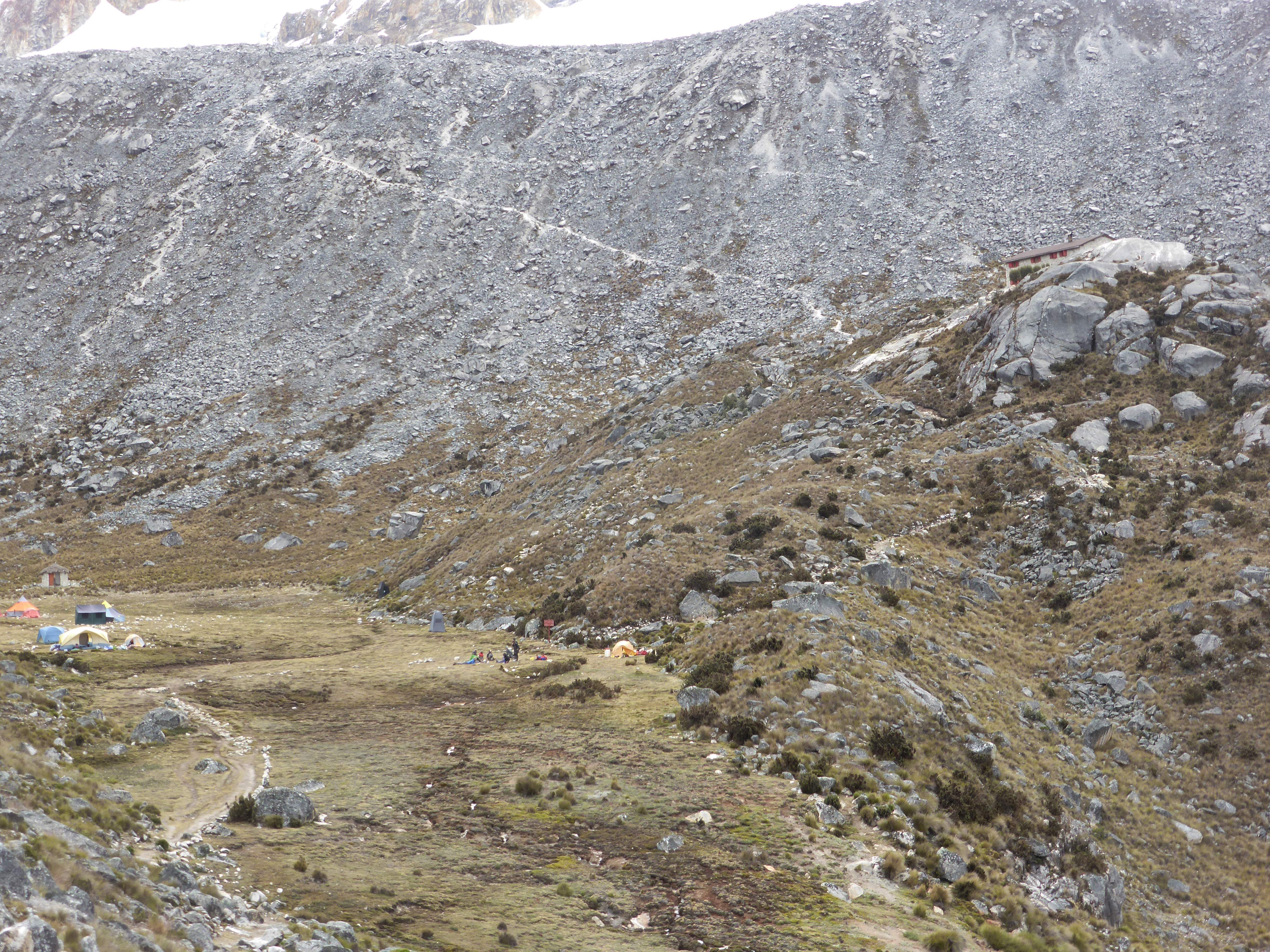
Llama Corral ~3700m to Alpamayo Basecamp ~4300m. 3:30 hours.
Another day of approach hiking across long stretches of dry, level ground. We passed several gorgeous high glacial lakes, and enjoyed fantastic views of surrounding peaks. We turned left off of the Santa Cruz trek and onto a path heading up through steep forest, taking us to Alpamayo Basecamp.
Day 3: August 18th
Alpamayo Basecamp ~4300m to Moraine Camp ~4900m. 2:45 hours.
Due to our strong acclimation, we decided on an aggressive strategy for our summit attempt. We would attempt the summit from Moraine Camp, rather than making the long carry over the Quitaraju-Alpamayo Col to the Col Camp/High Camp. While we knew that this would add some 3-4 hours to the summit bid, we also knew that it would save a lot of energy, avoiding a gear carry over the steep and technical Col. From Basecamp we no longer enjoyed donkey support, and so we left early after breakfast with heavy bags full of equipment. The hike to Moraine Camp follows a trail of switchbacks up through brush and onto bouldery moraine, with clear views of surrounding mountains. The moraine itself has several flat spots for tents – we chose to camp as close as possible to a small stream.
Day 4: August 19th
Moraine Camp ~4900m to Alpamayo Summit 5947m. Descent to Alpamayo Basecamp ~4300m.
4:00 hours, Moraine Camp to the base of the face.
5:00 hours on the face, to the summit of Alpamayo. 1:00 hour on the summit. 7:15 Hours from the summit to Moraine Camp. 1:00 Hour from Moraine Camp to Alpamayo Basecamp.
We departed Moraine Camp at 10:30 p.m., and got down to Basecamp at 5:50 p.m. making for a big day of over 19 hours on the move.
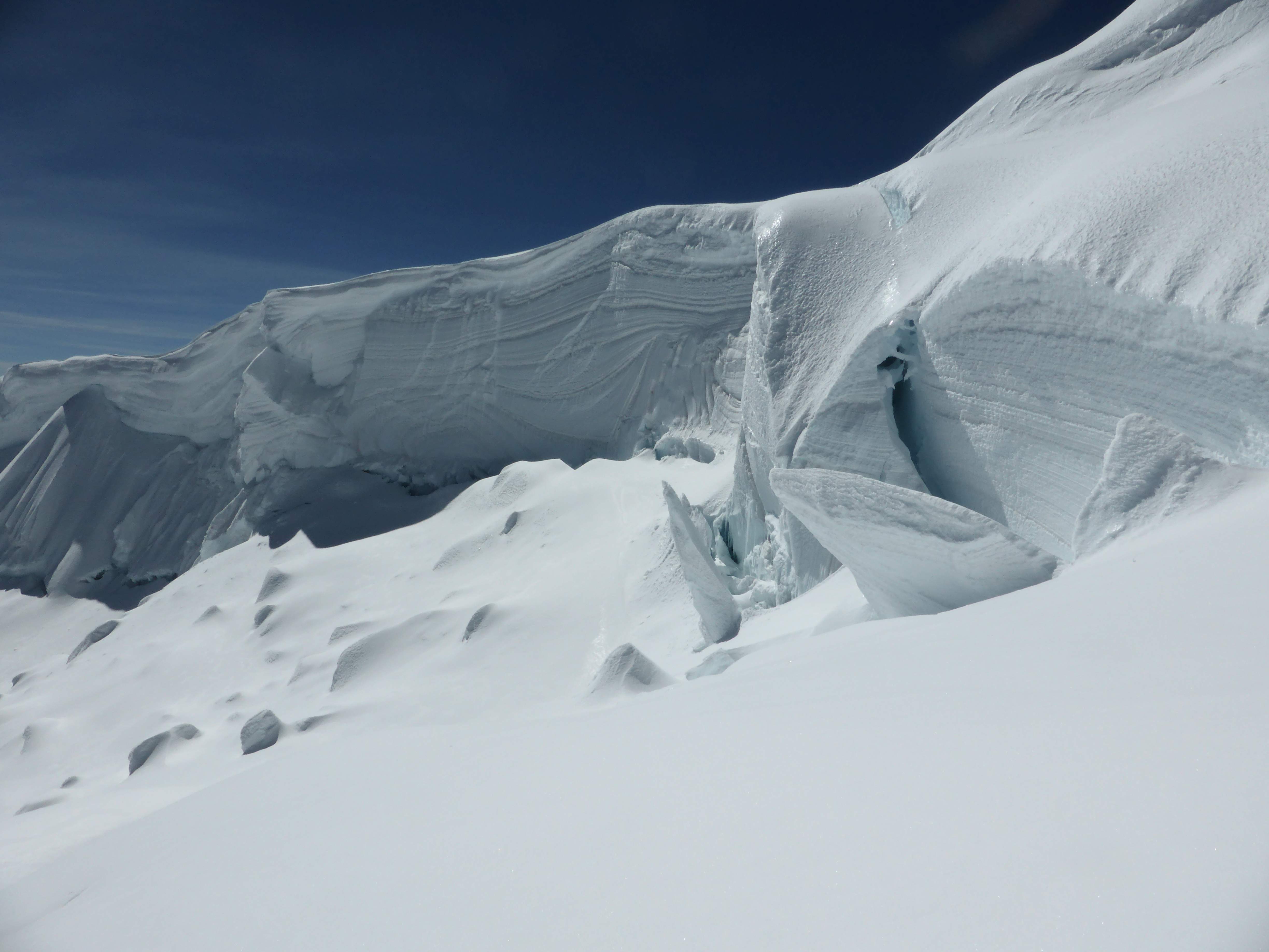
From our tents to the base of the snow we walked for around an hour, crossing large boulders and chossy moraine. From the snowline, the climb to the Quitaraju-Alpamayo Col ascends steep slopes, and although we didn’t feel the need to belay any of it I was very happy with our decision not to haul all of our gear up. It took us a full four hours to reach the base of the wall in the middle of the face, where we arrived at around 2:30 a.m. A team of four Germans was around 30 minutes behind us.
I had heard from an Ecuadorian climber in Kyrgyzstan, and others in Huaraz, that the French Direct route was in great condition this season – and we weren’t disappointed. Gaining the face involved a big move onto overhanging snow above the bergshrund, which Edgar led in style, and seconding it clean felt burly and strong. Pitch 1 above the bergshrund was a moderate snow slope of around 55-60 degrees, with each subsequent pitch getting progressively steeper and icier. The climbing was sustained, but the snow condition was firm and crisp – tooling and frontpointing upwards felt delightfully secure and fun. This being the longest pitched snow route I’d ever undertaken, at eight 50-60m pitches, I focused on my stamina, controlled my breathing, and tried to move carefully and efficiently up the face. Around Pitch 5 I realized that we were roughly halfway up and were going to make it to the top; this sense of impending success fuelled the remaining three pitches. Pitch 8, the last, was rock hard 75-80 degree water ice riddled with pockets, large swathes of it thinly plastered over rock. A final crux above the ice involved a few balance moves onto the summit cornice – and we were on top! The German team followed onto the summit directly behind us, and were very friendly despite having had to climb below us (and all the ice chunks we knocked down) for the entire route, and wait for us to sort out some rope tangles below the final ice pitch.
We were extraordinarily lucky to have direct access to Alpamayo’s true summit – something of a rarity. The true summit is often inaccessible, or very dangerous, guarded by a traverse across the unstable and extremely exposed summit ridge, but this season the French Direct route terminated directly below the highest point on the ridge. We spent roughly an hour on top taking photos of the gorgeous views and enjoying the sense of success. Rappelling the face involved eight raps off of good v-thread anchors, and after a break to shed layers and hydrate at the Col our descent to Moraine Camp took another three raps.
At Moraine Camp we immediately began packing up for a descent to Basecamp, keen to get as low as possible so as to avoid spending an extra night camping. The trudge down to basecamp was heavy and uncomfortable, all three of us tired from the long day. We arrived at basecamp just before sunset, and had enough time to eat a quick meal before heading to sleep, exhausted and satisfied with our accomplishment.
Day 5: August 20th
Alpamayo Basecamp ~4300m to Cashapampa ~2900m. 5:00 hours, with time spent swimming in the high glacial lake between Base Camp and Llama Corral.
Feeling worn out, we took our time descending from Basecamp to Cashapampa. With the donkeys carrying almost all of our gear and leftover food, we enjoyed light packs and good speed down the long, gently sloped trail. Between Bascamp and Llama Corral we stopped to swim in a gorgeous glacial lake; it was freezing cold but refreshing! In Cashapampa we ate a big meal, drank some cold beers, and started the drive back to Huaraz.