Here is a schedule and trip report for my unsuccessful July 2024 attempt on 7134m Pik Lenin.
Atrocious weather – high winds and heavy snowfall throughout my time on the mountain – prevented me from climbing any higher than ~6100m on this attempt. Despite no summit, my main objective in this climb of Pik Lenin was thorough pre-acclimatization for 7010m Khan Tengri, where I was very well prepared and ultimately successful. Although I failed to summit Pik Lenin this time (and didn’t even enjoy myself much!), the time spent was still highly worthwhile; I was so well acclimated afterwards that a rapid ascent of Khan Tengri was possible for me. Take a look at my far more detailed Khan Tengri trip report for a broader discussion of the pre-acclimation strategies which I have now successfully employed multiple times.
Rather than its own goal-oriented expedition, this 2024 attempt on Lenin felt more like an warm up mission, and a very boring one at that. The foul weather kept me camp-bound, and there was loads of downtime with very little to do. Happily, Ak-Sai’s services are top notch, and I was comfortable throughout the endless waiting, waiting for good weather which never came. The following trip report, rather than a more interesting narrative, is essentially just a rough edit of the point-form journal which I kept while in the camps. I hope that it will be useful in some capacity.
Images and details from my successful 2017 Pik Lenin expedition can be found here.
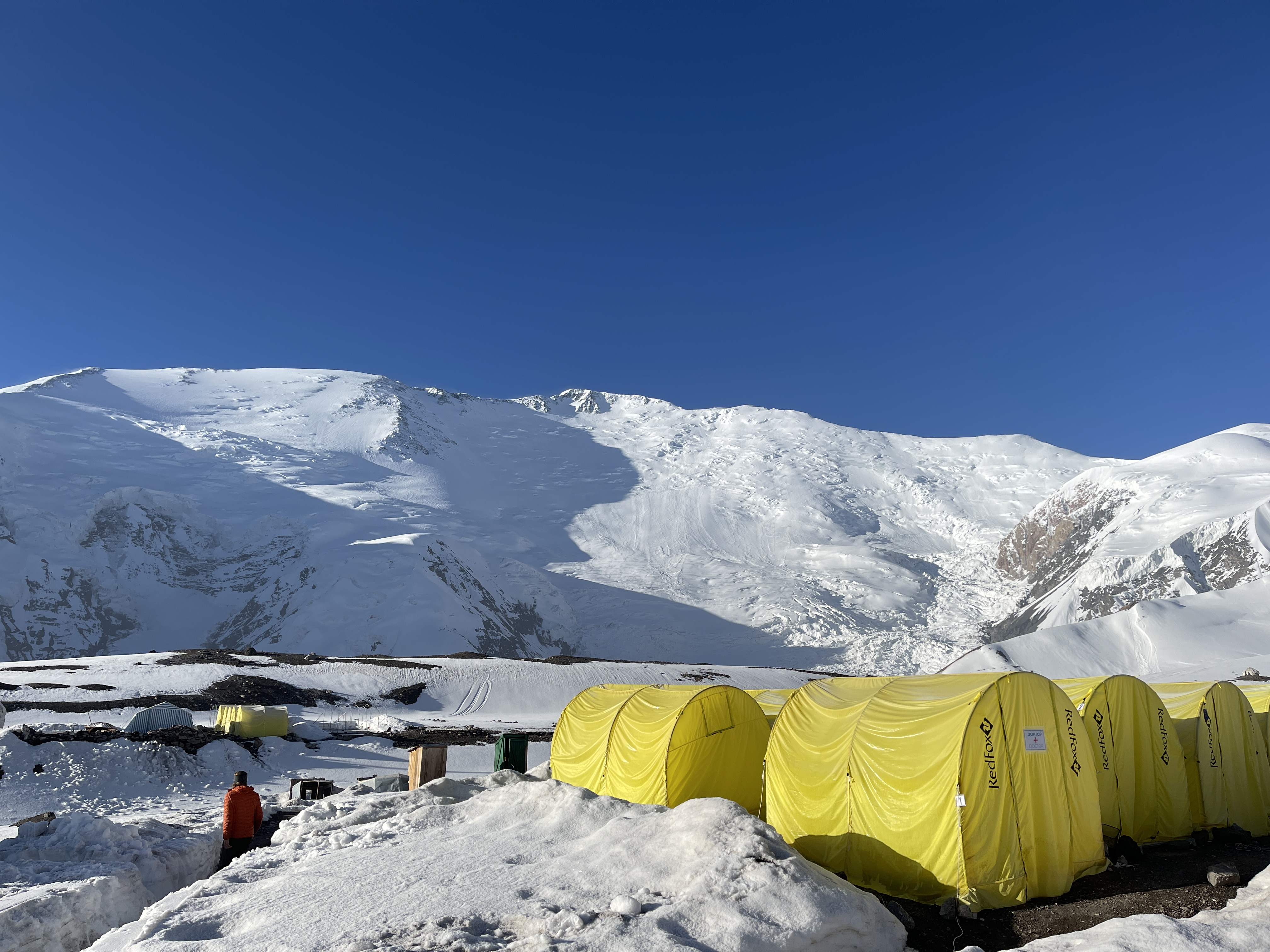
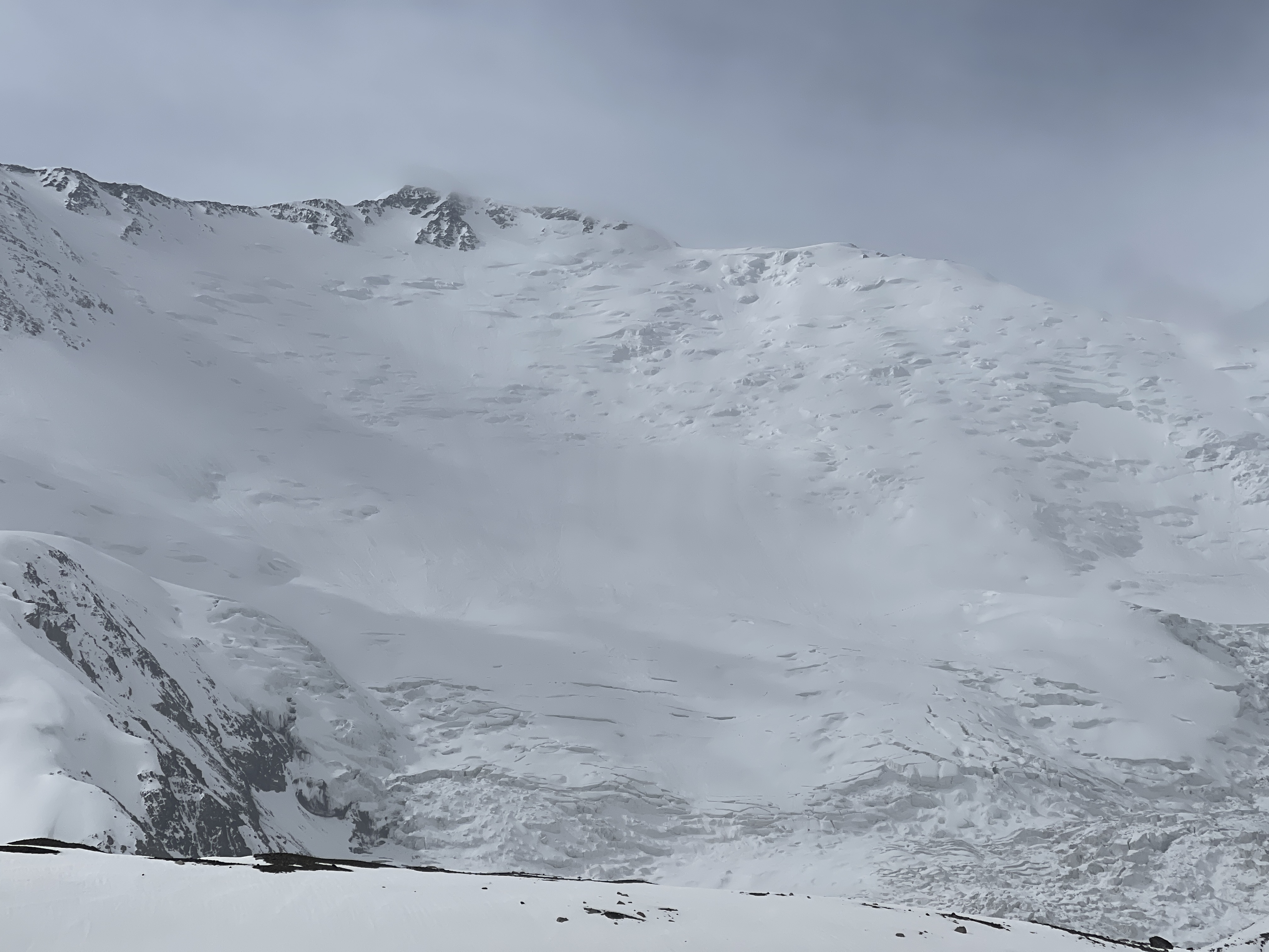
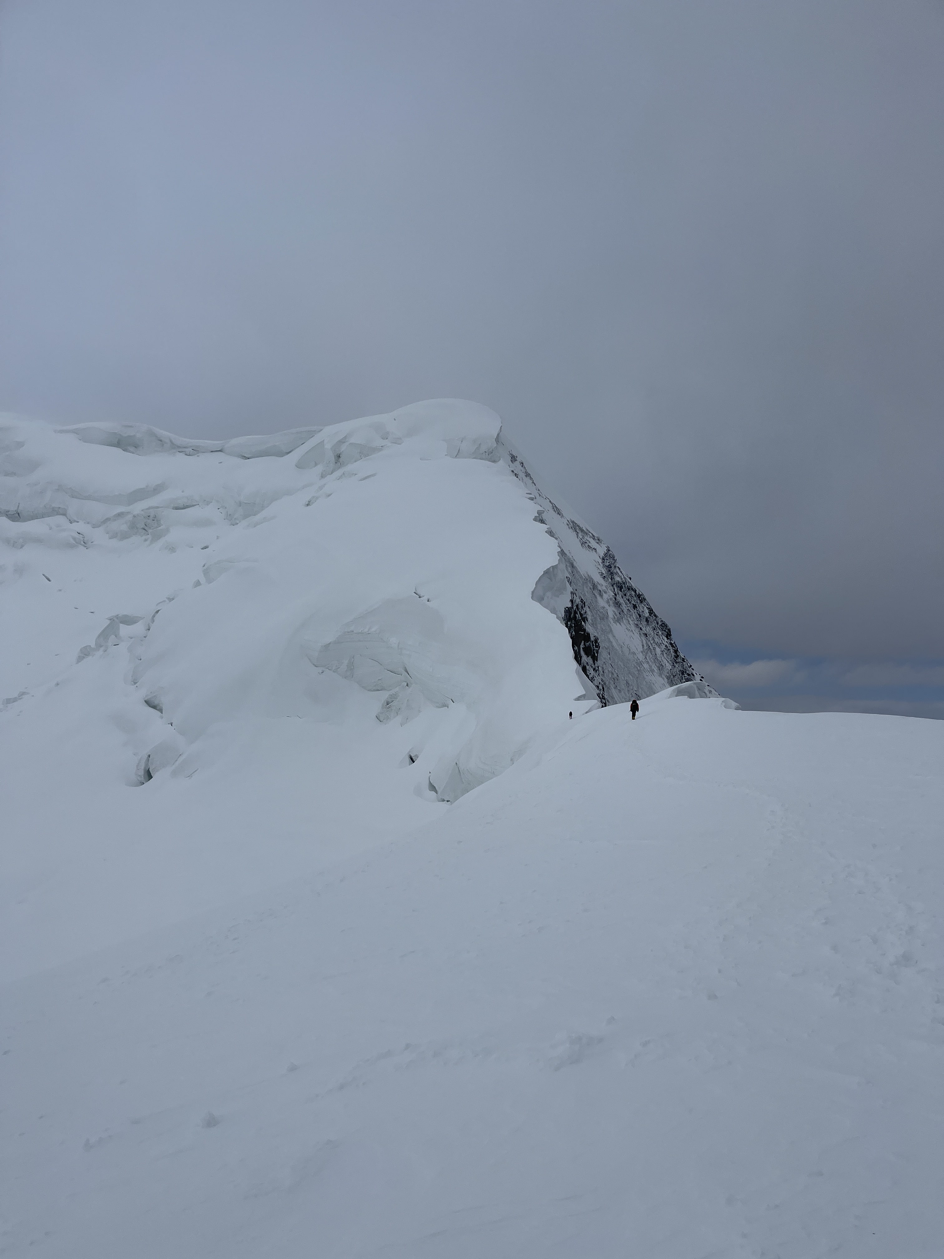
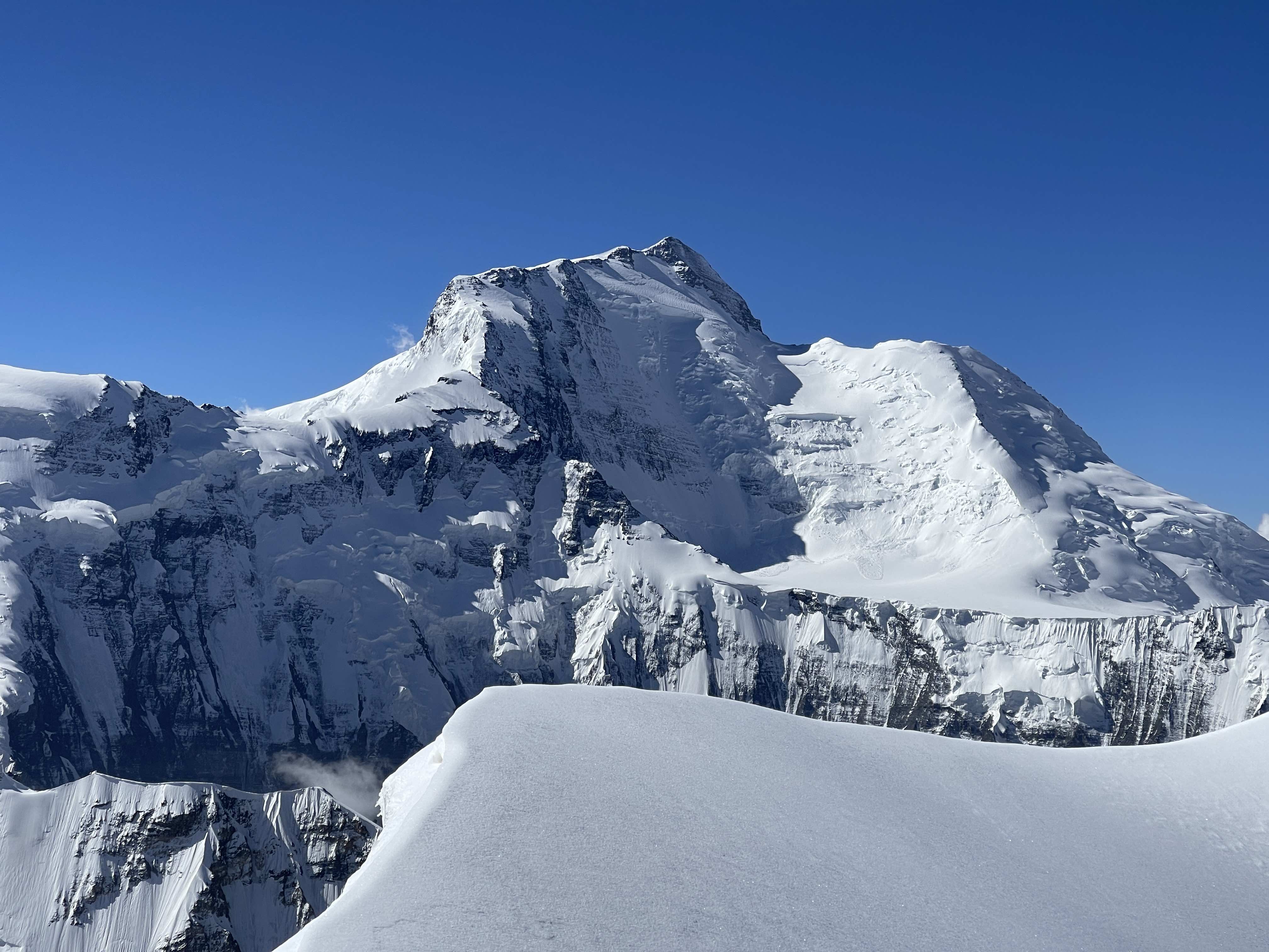
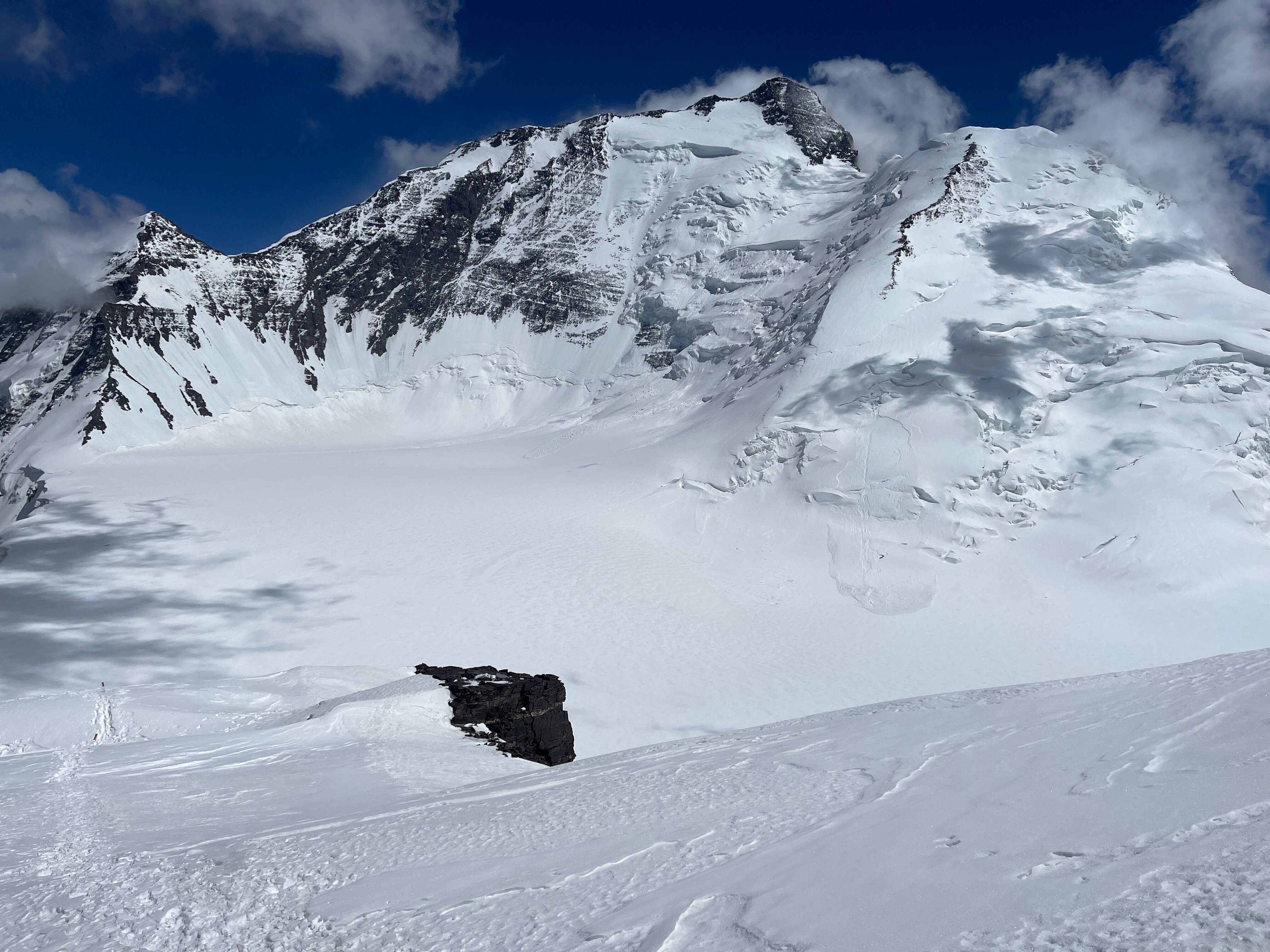
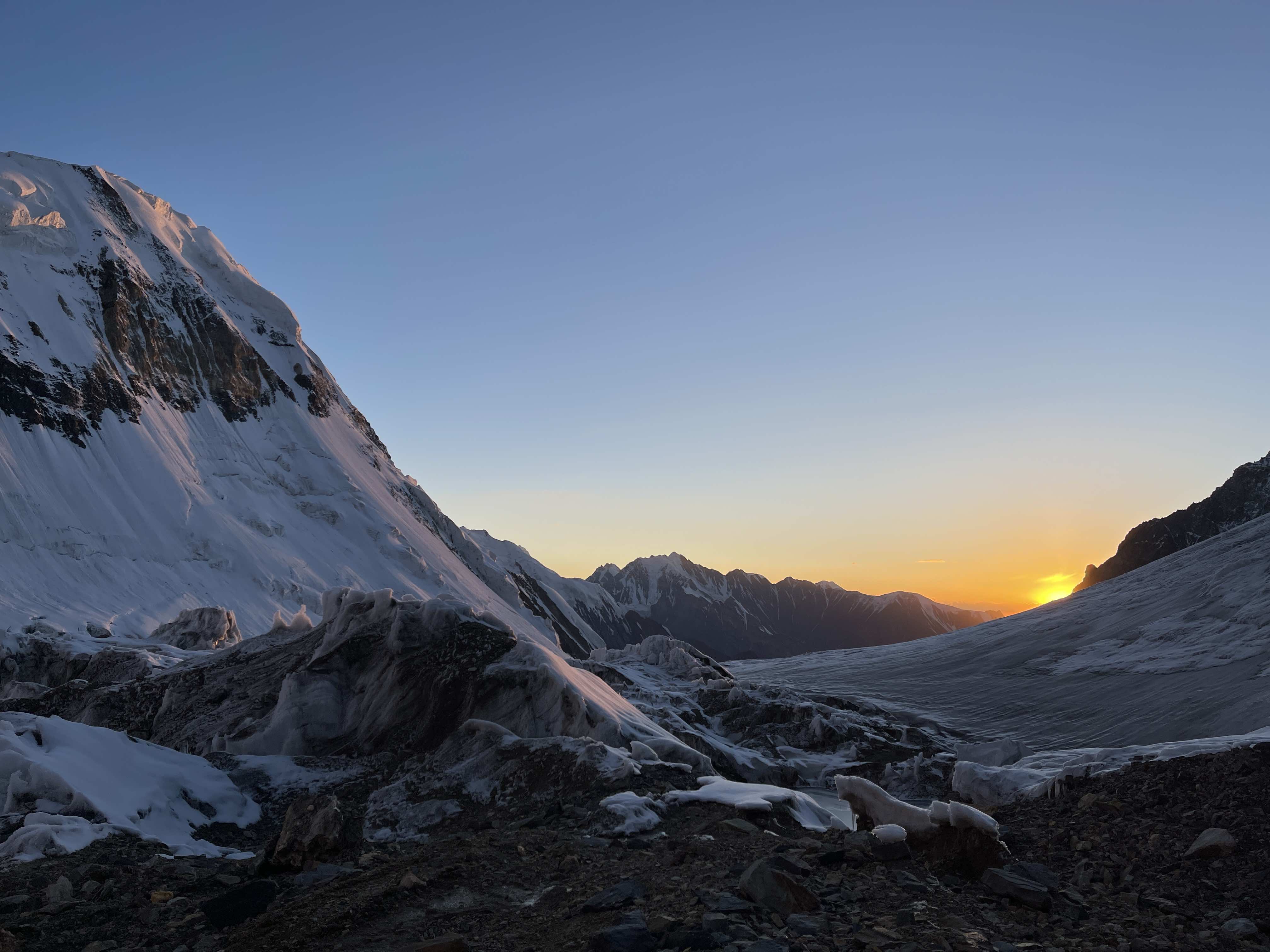
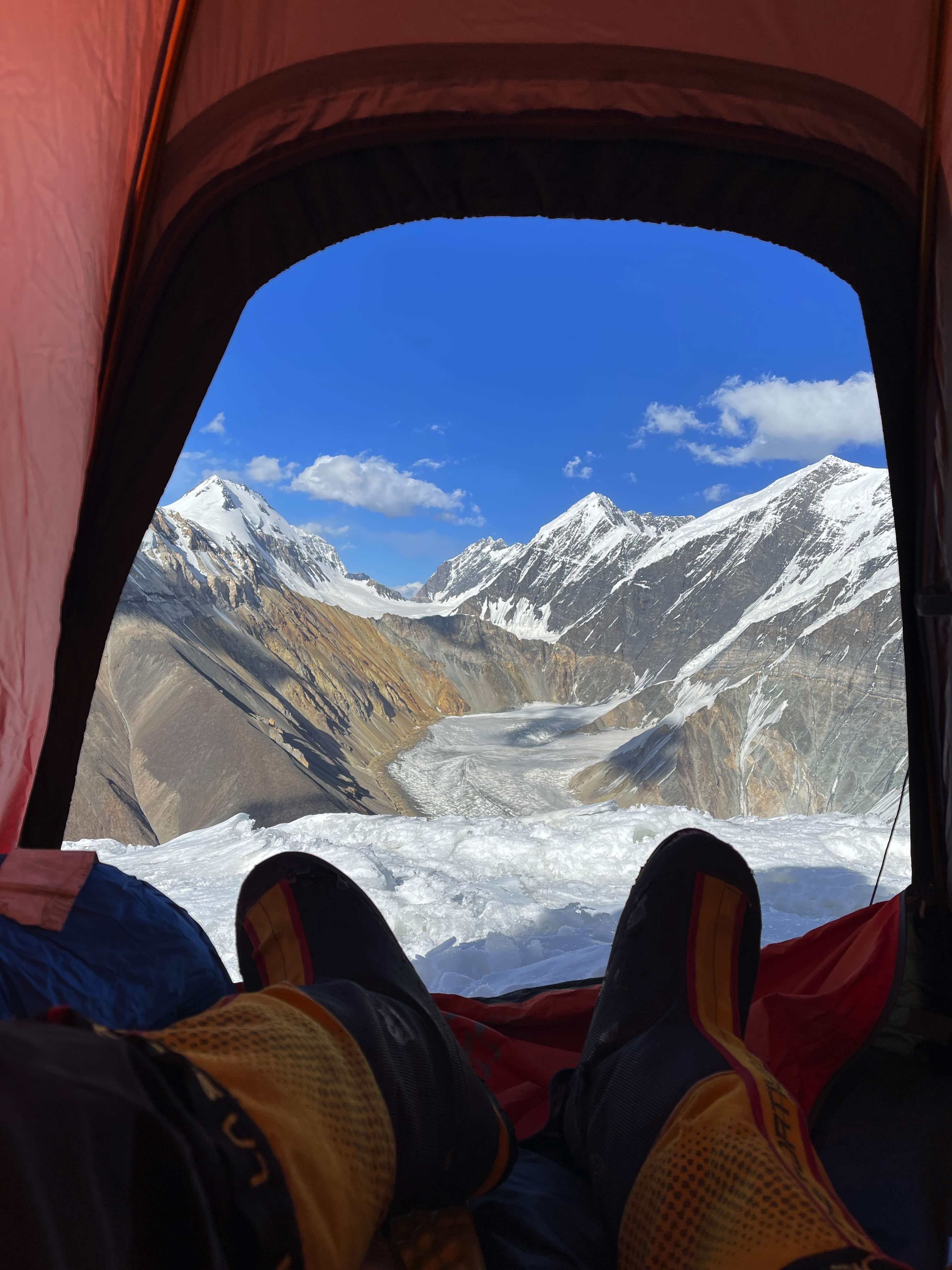
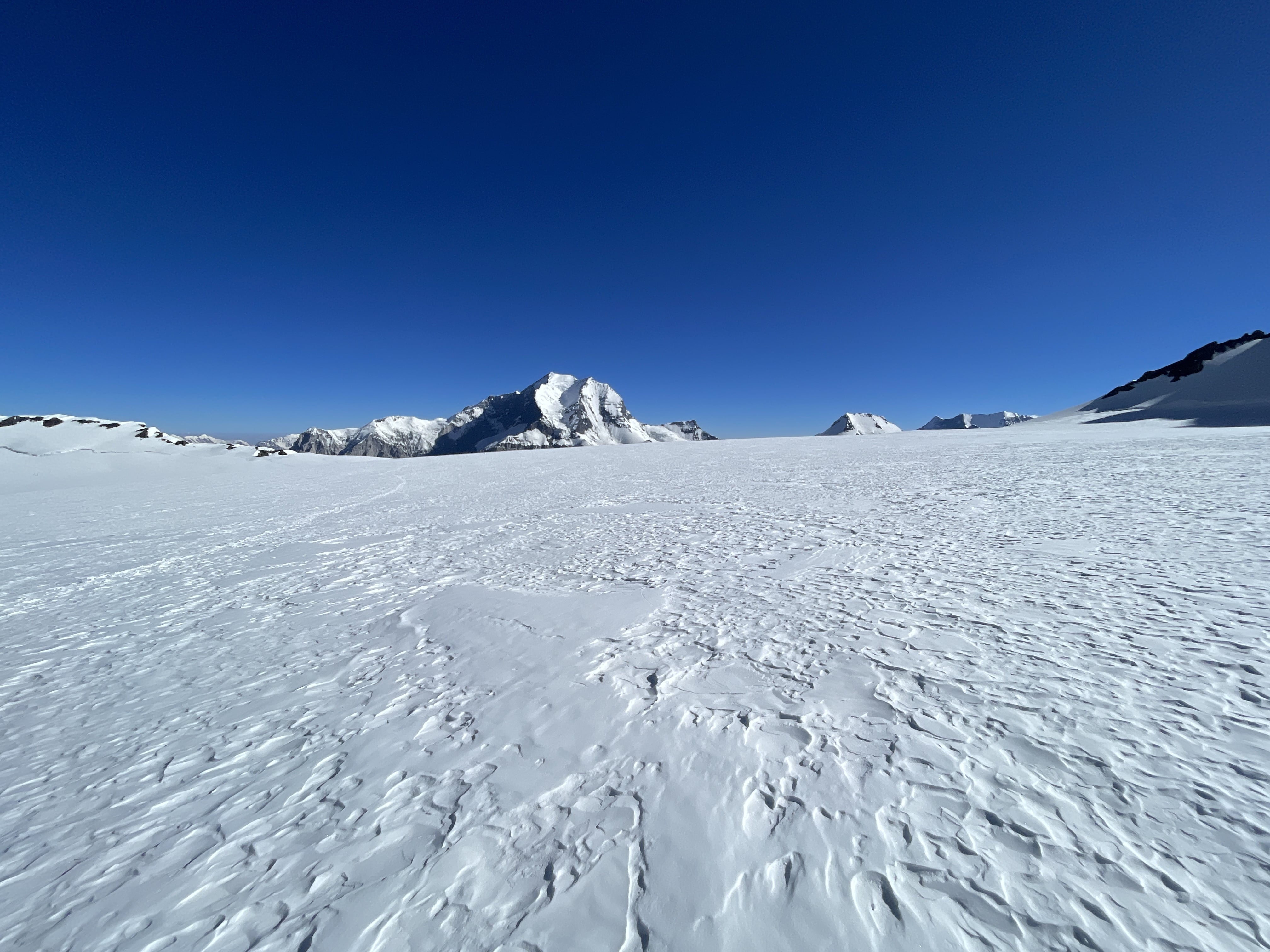
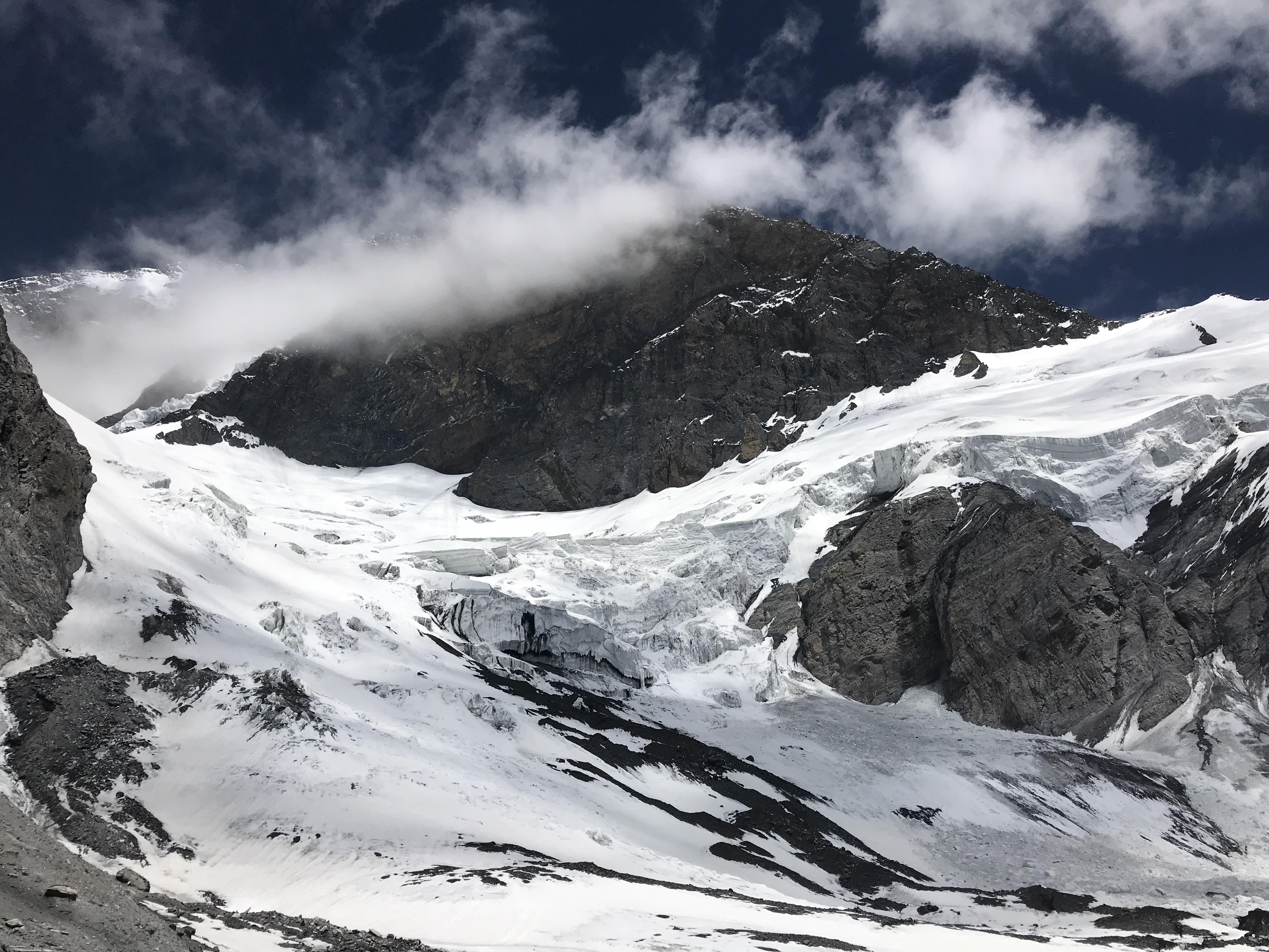
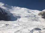
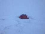
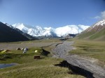
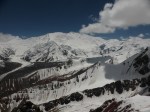
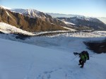
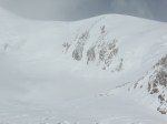
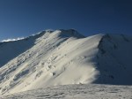
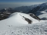
Pik Lenin, from 4400m camp.
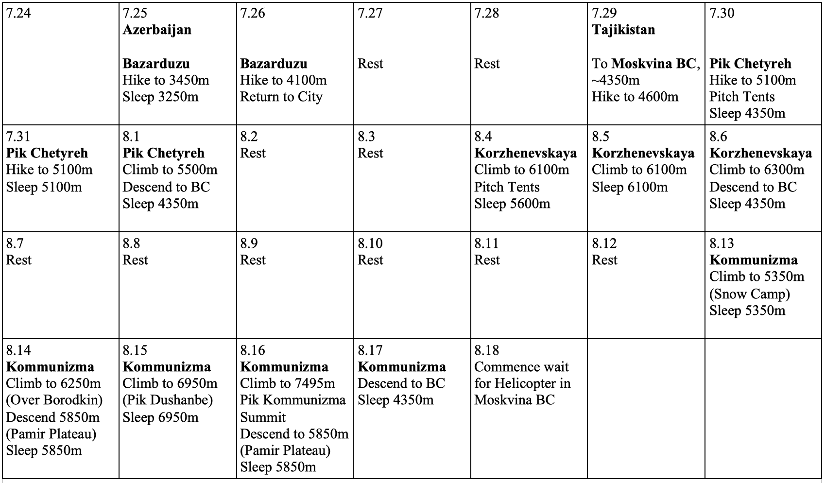
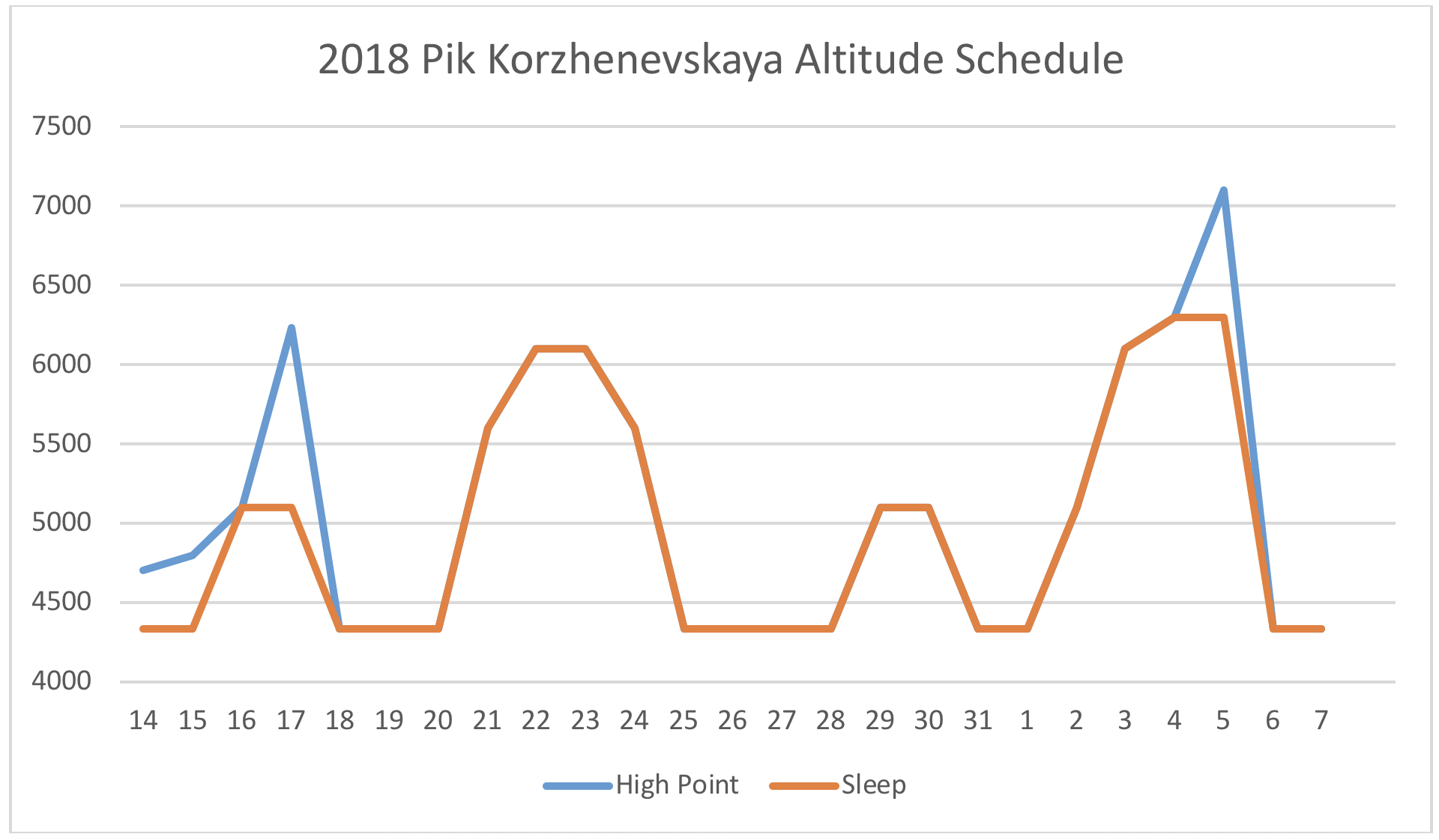
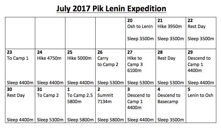
Schedule and Calendar
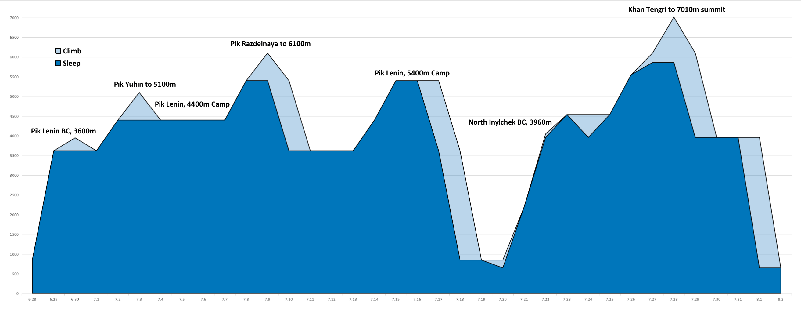
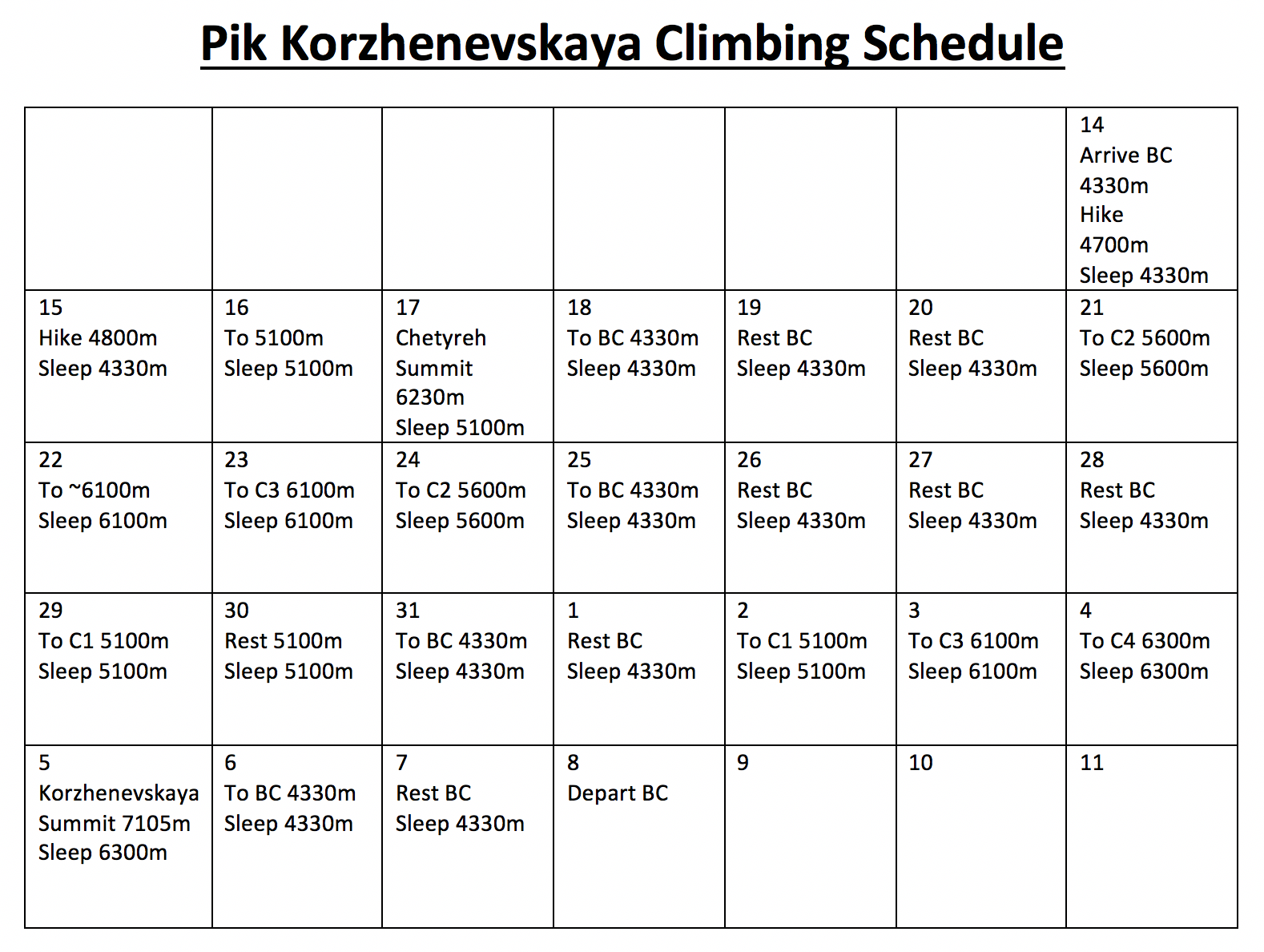
Here is a calendar outlining my acclimation routine and climbing activity throughout my 2024 Pik Lenin climb. I have also charted out the elevations used for my acclimation rotation – with the subsequent Khan Tengri expedtion added on. This attempt on Pik Lenin was predominantly an exercise in acclimation, and despite no rotation above 6100m, the routine I followed was sufficient for a solid acclimatization suitable for ascending into the low 7000m range.
3 am arrive Bishkek, and direct to a Bishkek hotel.
Massively jet lagged! I slept all day long.
6.28
Flight to Osh was delayed. Slept all day and went grocery shopping at night; happily the day prior I had seen that everything stays open until 10 pm, likely due to the summer heat?
6.29
Osh 850m to BC 3620m
Awake at 2am. 8am flight to Osh, 40 minutes.
Drive to Lenin BC, hot in the car!
Much faster than other experiences. About 5 hours from Osh, arrived at 4pm.
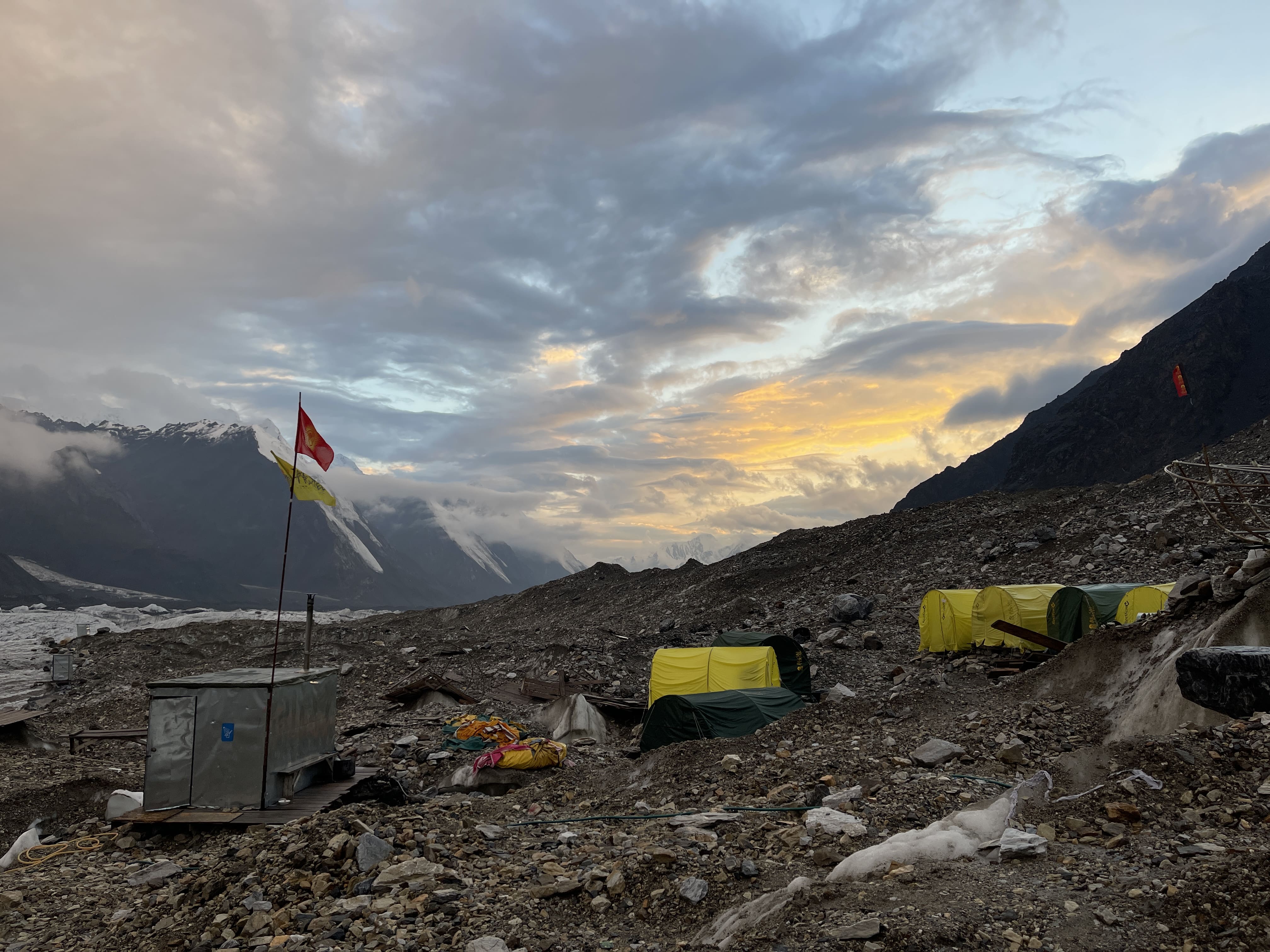
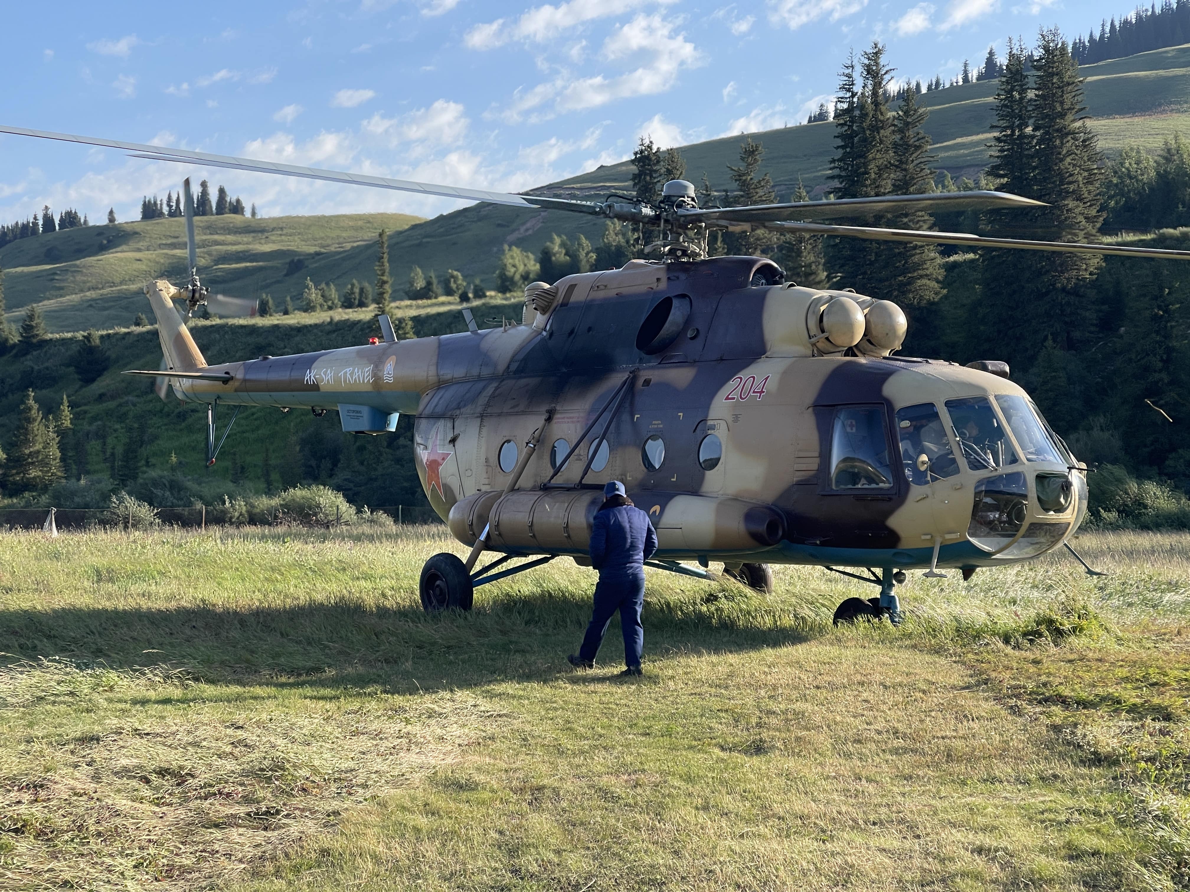
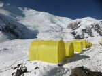
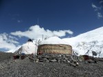
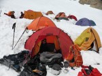
BC is luxurious; awesome food spread, comfortable mess hall, hot showers available 24/7, and now has fast internet with a local SIM card. I used the carrier ‘Mega’ and had full bars, an extremely fast connection in my tent. Unrecognizable to the BC infrastructure of 7 years ago, when I ate in a yurt or in a group tent.
Ak Sai has stepped up their service offering. I was deeply impressed by the quality of the new Ak Sai operated Moskvina Basecamp in Tajikistan during my 2023 Pik Kommunizma expedition, and I was equally impressed by their improved 3600m Basecamp facilities on Pik Lenin.
6.30
Short acclimation hike to 3950m, on the Pik Petrovsky ridge. Going to 4000m is not really worth it for the additional distance involved.
7.1
Rest Day in 3600m Basecamp.
7.2
8:50 am depart 3600m BC.
12:25 pm arrive 4400m camp. Time of 3:35.
Steady rain and wind in the early morning had me nervous about making the hike up, but the weather cleared completely after breakfast. This was a major relief; hiking to 4400m camp in heavy rain would be truly miserable.
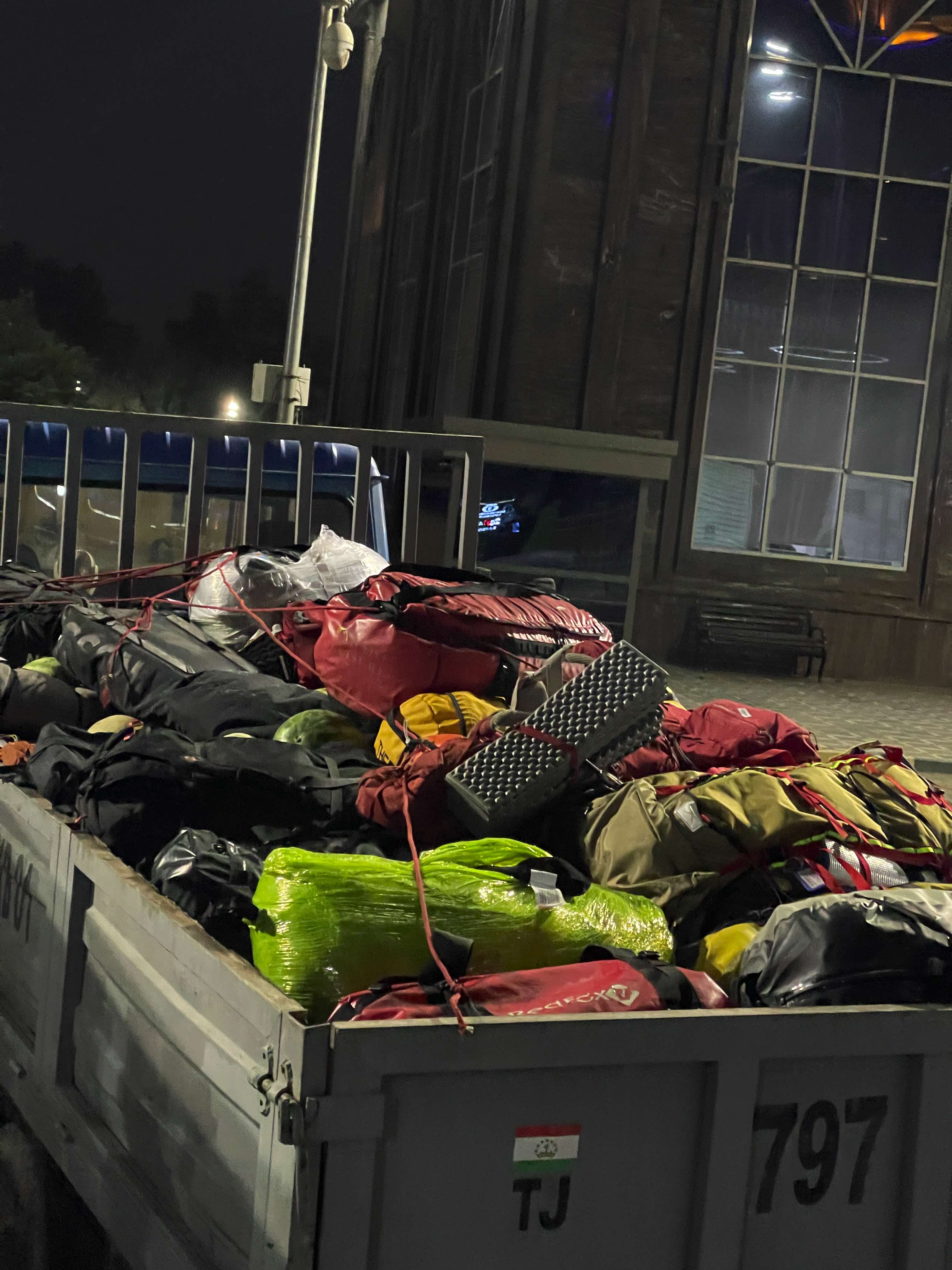
I gave the horses 27kg of equipment and food, and carried about 10kg myself.
I departed 3600m BC at 8:50, and arrived at 4400m Camp at 12:25, a time of 3:35. I was surprised to be an hour faster than my 2017 time, as I didn’t feel that I was rushing. Indeed, I stopped twice to take quite significant tea breaks.
Lunch at 4400m camp was an all-you-can-eat buffet, available right after I arrived. I was astonished and delighted by the quality and variety of fruit on offer! While 4400m camp offers the same infrastructure as I experienced in 2016 and 2017, the food has improved significantly – especially as it is now buffet style.
7.3
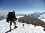
Short acclimation hike. I departed 4400m camp at 9am, arrived 5100m Pik Yuhin at 11am, time of exactly 2 hours.
11:50 start to descend and 12:35 arrive, in time for lunch. 45m descent time. I took a nap in the sun at the top of Pik Yuhin, good for acclimatization.
7.4
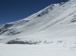
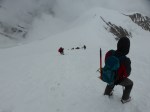
Easy walk to the base of the route up the glacier. Forecast called for heavy snowfall, and as such I felt undecided on next steps. I also felt some urgency in my need to find someone to rope up with for the icefall!
7.5
Rest day.
Heavy snowfall, as forecasted. I had been tempted to ascend today, but upon seeing the weather at 2:30 am I decided to bail, and immediately went back to sleep.
7.6
Rest day.
A departing Swiss and Dutch couple gave me their remaining electrolyte tabs, wet wipes, and hand sanitizer. Their generosity put me into an excellent mood!
Deep snow makes for an unsafe route on the glacier; nobody goes up, nobody comes down. I felt happy to be in 4400m camp, and not trapped higher on the mountain.
7.7
Rest day.
Many groups decided to abandon their expeditions today, due to the poor forecast and the boredom of incessant waiting. I opted to wait patiently; I’d budgeted significant time for my summer mountain goals, and while very bored in 4400m camp, I felt that I could tough it out for a few more days. Ak Sai now has fast WiFi for $5 $USD per hour, and I made a point of using it once every other day to help kill time.
7.8
3:25 am depart 4400m camp.
10:45 am arrive 5400m camp. Time of 7:40.
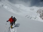
With a favorable weather forecast, I finally committed to moving up to 5400m camp. I teamed up with a pair of fit Belgians so as to have three on the rope for the icefall – a best practice given the number and magnitude of crevasses on route.
I followed my normal strategy for acclimatization rotations, and packed an absolutely enormous load to carry up. I hoped to bring everything I needed to 5400m camp in one shot, thus enabling me to carry only a tiny, light daypack up when it came time for my summit attempt. My backpack was painfully heavy.
We departed Ak Sai’s 4400m camp at 3:25am, and arrived at Central Asia’s 4400m camp at 4:05. We arrived at 5400m camp at 10:45am, a time of 7:20 from Ak Sai’s camp or 6:40 from Central Asia’s. In 2017, with a similarly loaded pack, the climb to 5400m camp took me 7:40 from Central Asia’s camp – not a bad improvement!
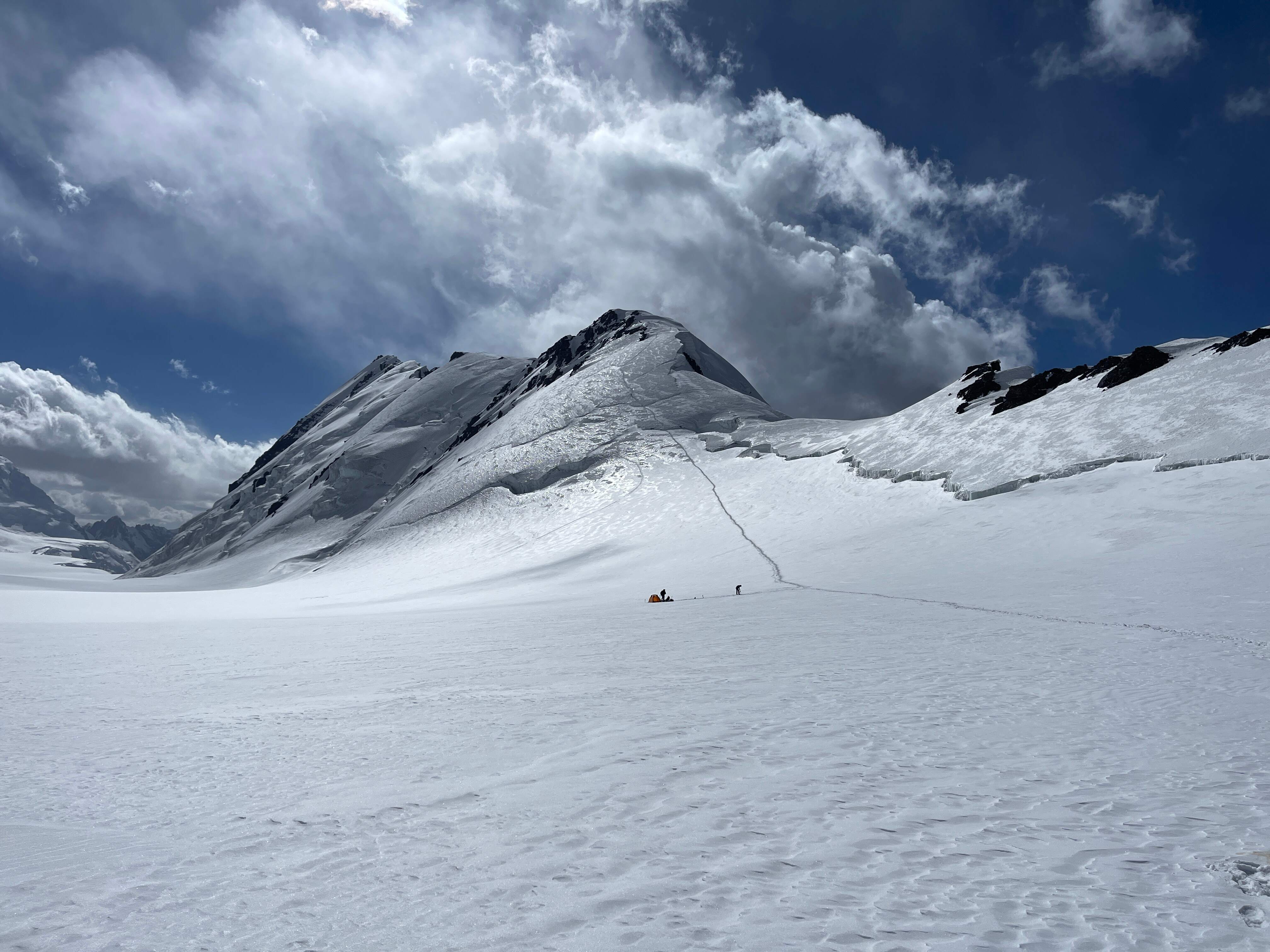
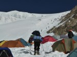
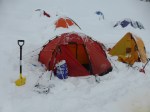
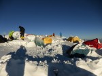
On arrival in 5400m camp I was lucky and grateful to find a perfect tent platform waiting for me. Exhausted, my shoulders, back, and legs thrashed from my heavy backpack, I pitched my tent and immediately took a nap without unpacking anything else. After 90 minutes of sleep in the mid-day heat I spent an hour properly anchoring my tent, unpacking, and brewing a whey protein hot chocolate. I had no headache, nor any other symptoms of AMS; so many days waiting in 4400m camp had definitely provided me with a good base of acclimatization. For dinner I tried a freeze dried meal, but it was so revolting that I was only able to eat half of it. Luckily I had plenty of cheese, sausage, nuts, and chocolate to eat.
7.9
9:35 am depart 5400m camp.
12:55 pm arrive 6110m. Time of 3:20.
Depart 6110m at 1:35 pm.
2:30 pm return to tent at 5400m camp, time of 55m.
I went up on an acclimation rotation, hoping to tag at least 6000m. On my prior Pik Lenin expeditions, this single rotation to 6000m had been sufficient acclimatization preparation for a summit attempt.
High wind and deep snow near the summit of Pik Razdelnaya made for slow going. I opted to stop at 6110m rather than climb into the fierce wind and go all the way to the summit. I felt well enough at 6k, but would have preferred calmer weather. Back at 5400m some green tea, sausage, and cheddar cheese served as my recovery meal. I had a headache in the evening, which was resolved with an ibuprofen.
7.10
8:40 am depart 5400m camp.
11:55 am arrive Ak Sai 4400m camp. Time of 3:15.
2:05 pm depart 4400m camp.
4:45 pm arrive 3600m BC. Time of 2:40.
I woke up feeling quite well, and prepared a breakfast of whey protein hot chocolate, sausage, and mixed nuts. As I’ve undertaken more expeditions, I’ve come to rely less and less upon cooked food while at high camps. Cheese and sausage are reliably easy to eat, although not available in every country. Mixed nuts also offer remarkably high calorie/weight value, and are usually palatable when sick from altitude. Freeze dried food is majorly hit or miss for me, and can feel utterly inedible. It’s also expensive, heavy to deal with if uneaten once prepared, and time consuming to cook.
Our descent from 5400m camp was much slower than I had managed in 2017; three on the rope and one section made more comfortable with a rappel slowed us down. Ak Sai’s camp is also almost an hour past Central Asia’s on the moraine, and the final stretch of chossy rock is quite annoying in late morning heat.
I met the living legend Carlos Soria in 4400m camp; he had apparently just arrived with a Spanish team. I shook his hand and wished him good luck! Lunch in 4400m camp was an otherwise very pleasant reprieve from my high-altitude food.
Hike down to 3600m BC was uneventful, but for a heavy hailstorm which lasted about 30 minutes. BC was luxurious compared to camping higher, and the hot shower was especially welcome.
7.11 – 7.13
Rest days in 3600m BC.
I spent three days resting in 3600m BC, waiting for the deep snow higher up to melt and for the weather forecast to improve.
7.14
8:55 am depart 3600m BC. 12:10 pm arrive 4400m camp. Time of 3:15.
I took my time getting ready after breakfast, until my Belgian friends began urgently calling me, telling me that the Ak Sai truck was waiting for me. I was only partially ready, and still needed to drop my luggage in storage, brush my teeth, prepare water. I tried to hurry, but still took at least ten minutes… When I got to the truck a large crowd was waiting only for me; very unexpected and embarrassing!
The truck departed at 8:55 am, and drove us to the cliffs where the hike begins to steepen. I hadn’t taken the truck the last hike from 3600m to 4400m – indeed I had departed at 8:50 am and arrived at the cliffs *before* the truck! I paced only 15m faster with the ride. Despite a similar timing to my first hike up, I felt incredibly fresh and energized this second time. Three days of rest in BC had supported great recovery and robust acclimation.
7.15
3:25 am depart 4400m camp. 9:25 am arrive 5400m camp. Time of 6:00.
Awake early, we were treated to a cloudless sky bright with stars and a visible Milky Way. We made it to 5400m camp in approximately 6 hours from Ak Sai’s camp, or roughly 5:15 from Central Asia’s.
High wind as we entered the ‘frying pan’ was extremely cold, and balance was tricky at times. Likely sustained at around 40km/h. This tapered off as we reached camp, tired.
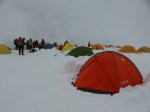
I found my tent in superb shape, undisturbed, perfectly anchored, and nicely set into about 10 cm of snow. It was warm and cozy inside, very well insulated from the wind.
My hard Kyrgyz cheese from Bishkek was amazing, totally fresh and unspoiled. I carried 1.5 kg of it up, and was able to eat large quantities right away. Major thanks to the Ak Sai Basecamp manager who helped me refrigerate it while I was rotating and resting in BC.
I felt myself developing symptoms of a cold: a very sore throat and runny nose. I was hopeful that it would resolve overnight, or at least not get worse.
7.16
I spent the entire day in tent, eating, reading, and resting. Wind was so severe that there was absolutely no way to move higher, and the prospect of descending also seemed risky. My cold symptoms were more or less the same; I decided to see how I felt the next day, and hopefully ascend.
7.17
10:20 a.m. depart 5400m camp. 1:40 p.m. arrive 4400m camp. Time of 3:20.
My sore throat had developed into a full-on head cold. I decided to descend, rather than risk the throat infection getting into my lungs. I’d been similarly sick several times prior at altitude, and knew that a lung infection could set me back multiple days.
Weather was also absolutely awful, with high wind and yet more heavy snowfall scheduled.
We departed 5400m camp at a late 10:20 am, slow getting ready and digging up the tent while not feeling well. Arrived at 4400m camp at 1:40pm, a time of 3:20.
Depart 4400m at 3:20, arrive 3600m 6:40. Many, many breaks on the way down, moving at a leisurely and relaxed pace.
7.18
5:20 pm depart 3600m BC and return to Osh.
7.19
Day spent in 850m Osh.
7.20
Flight to 650m Bishkek.
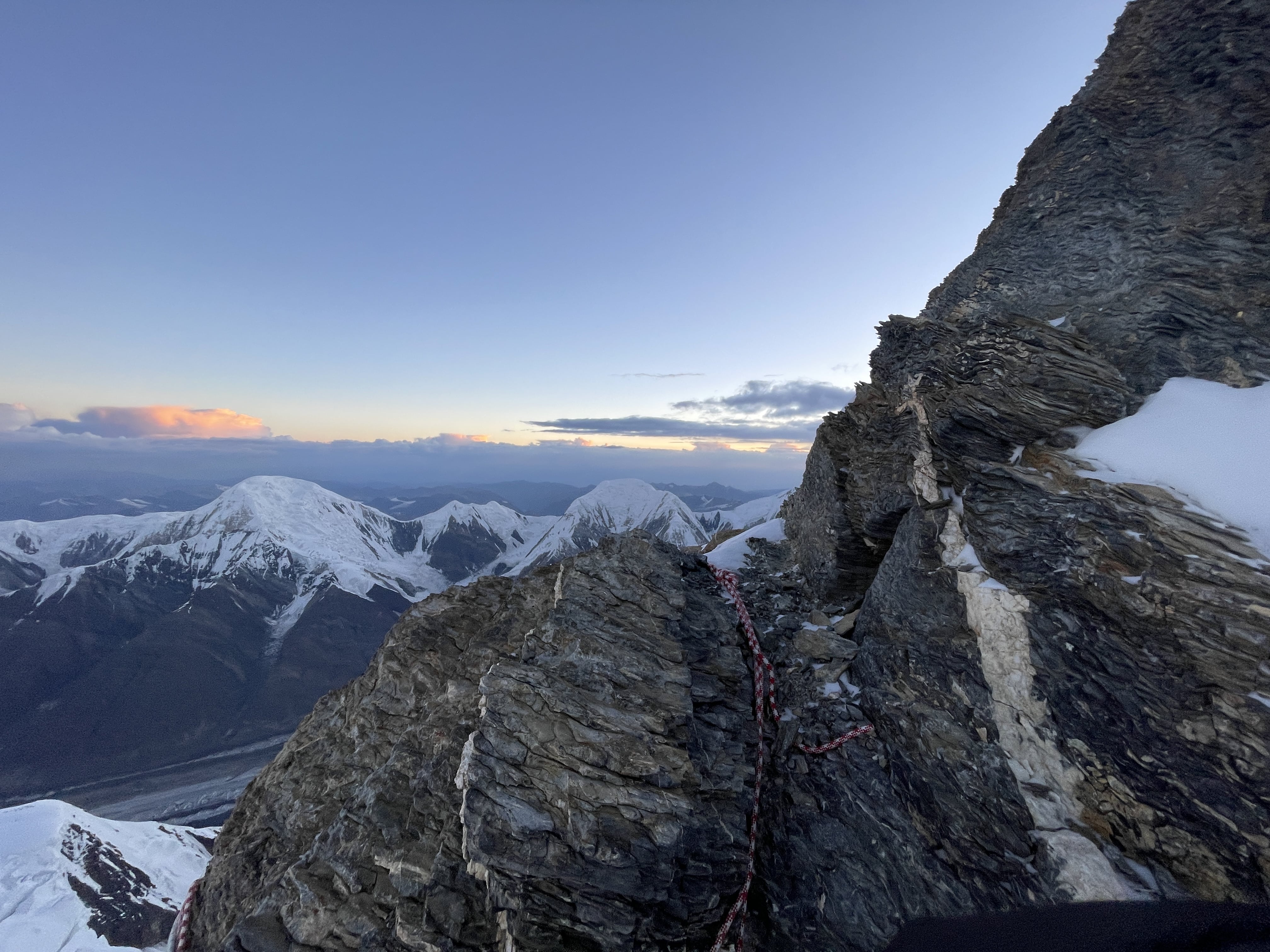
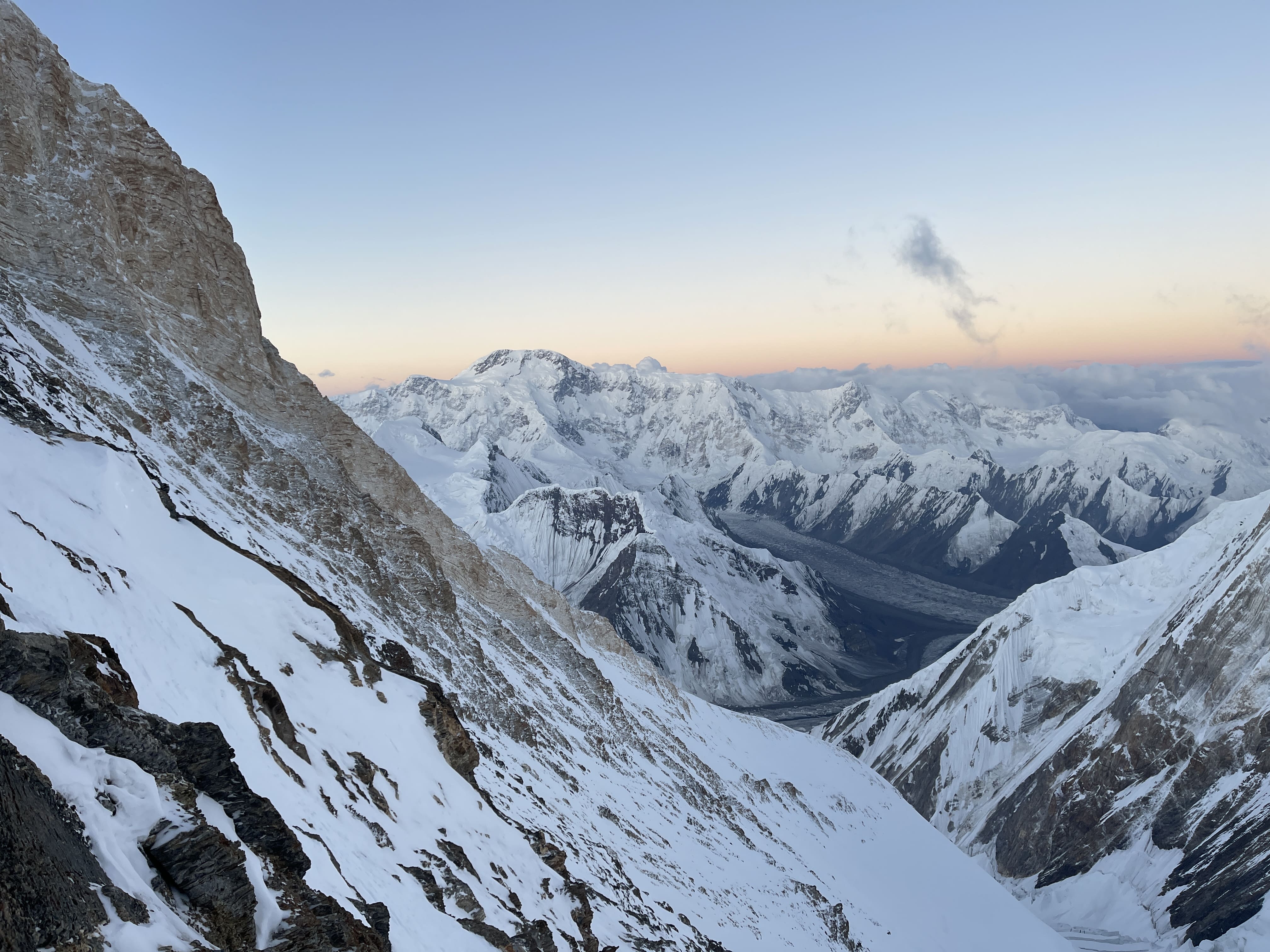
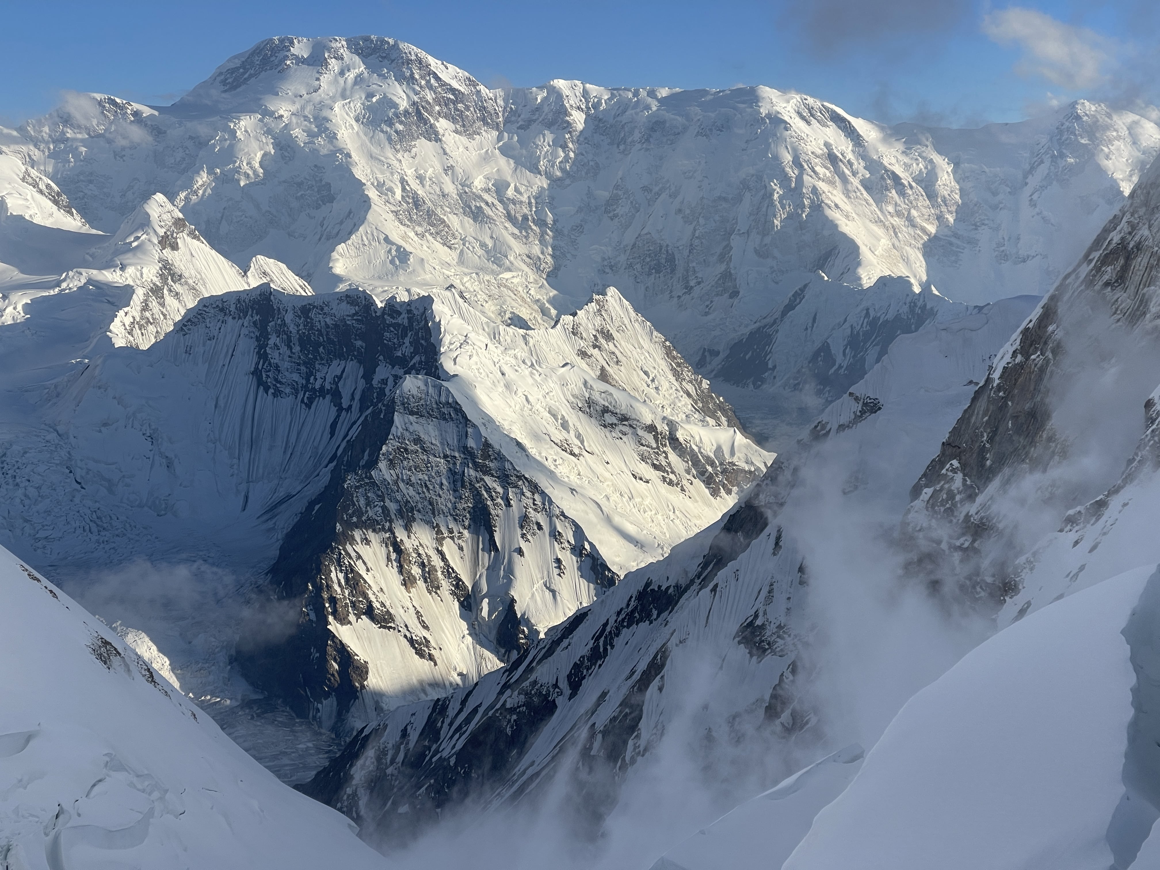
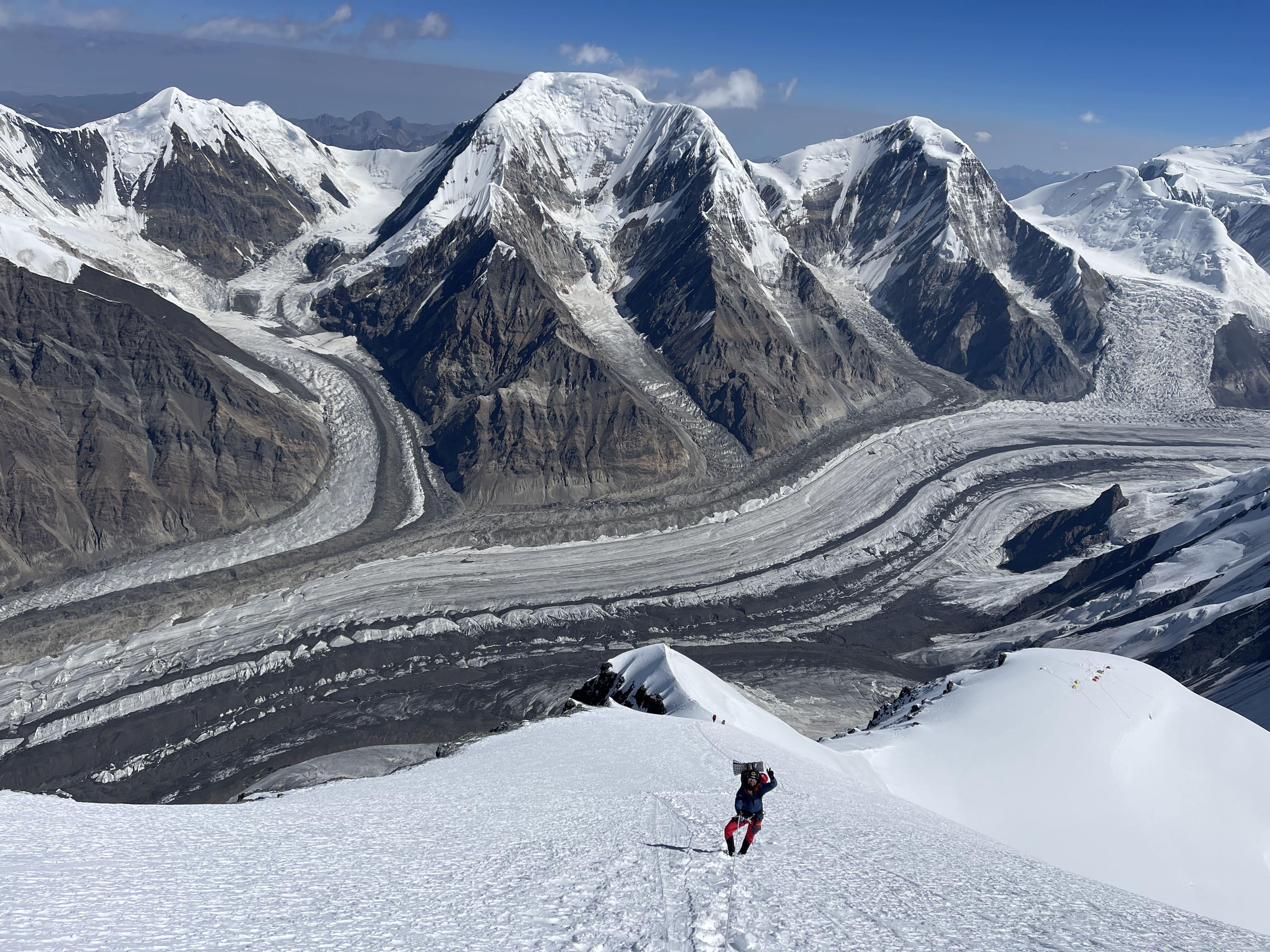
Images
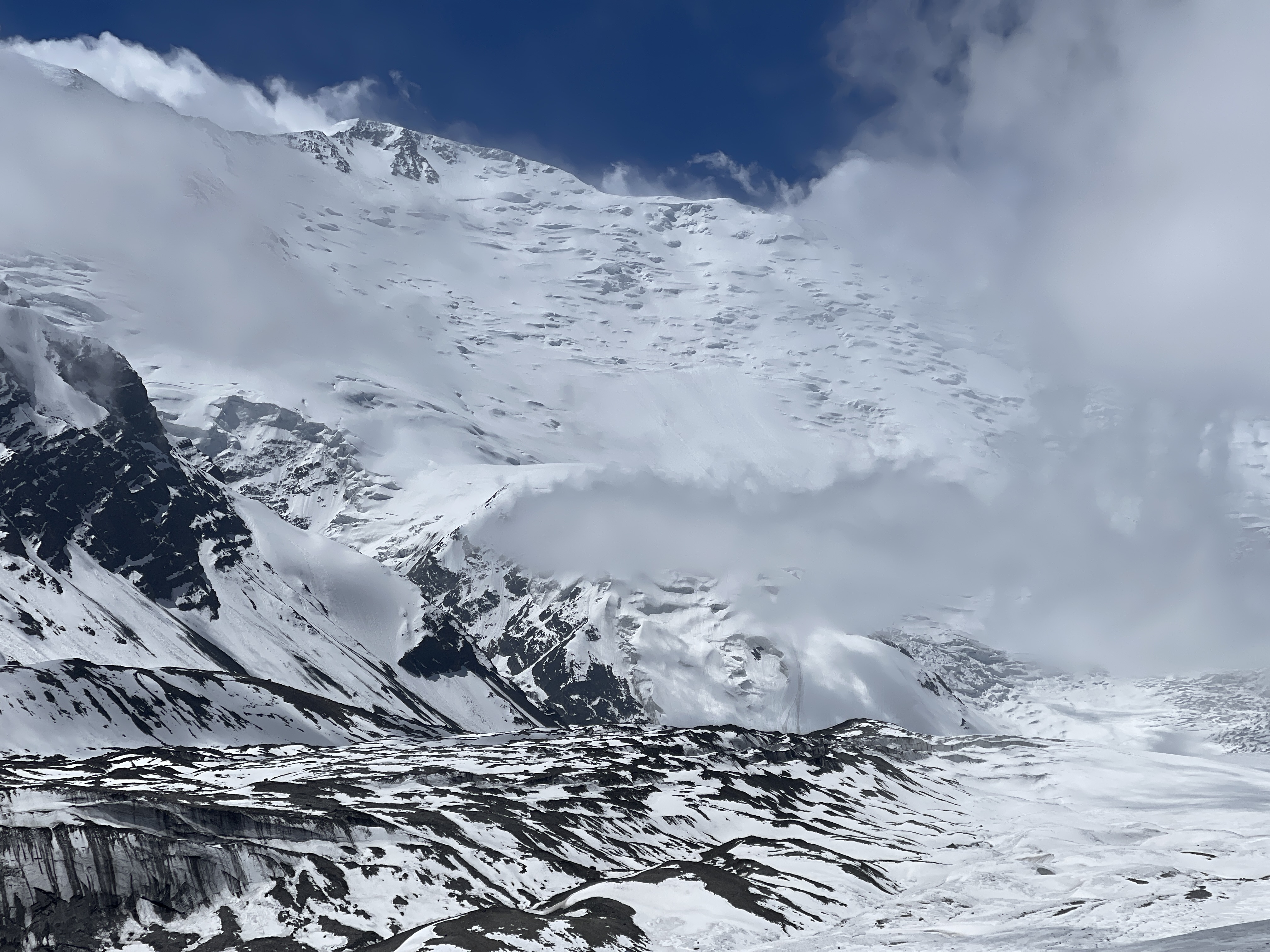
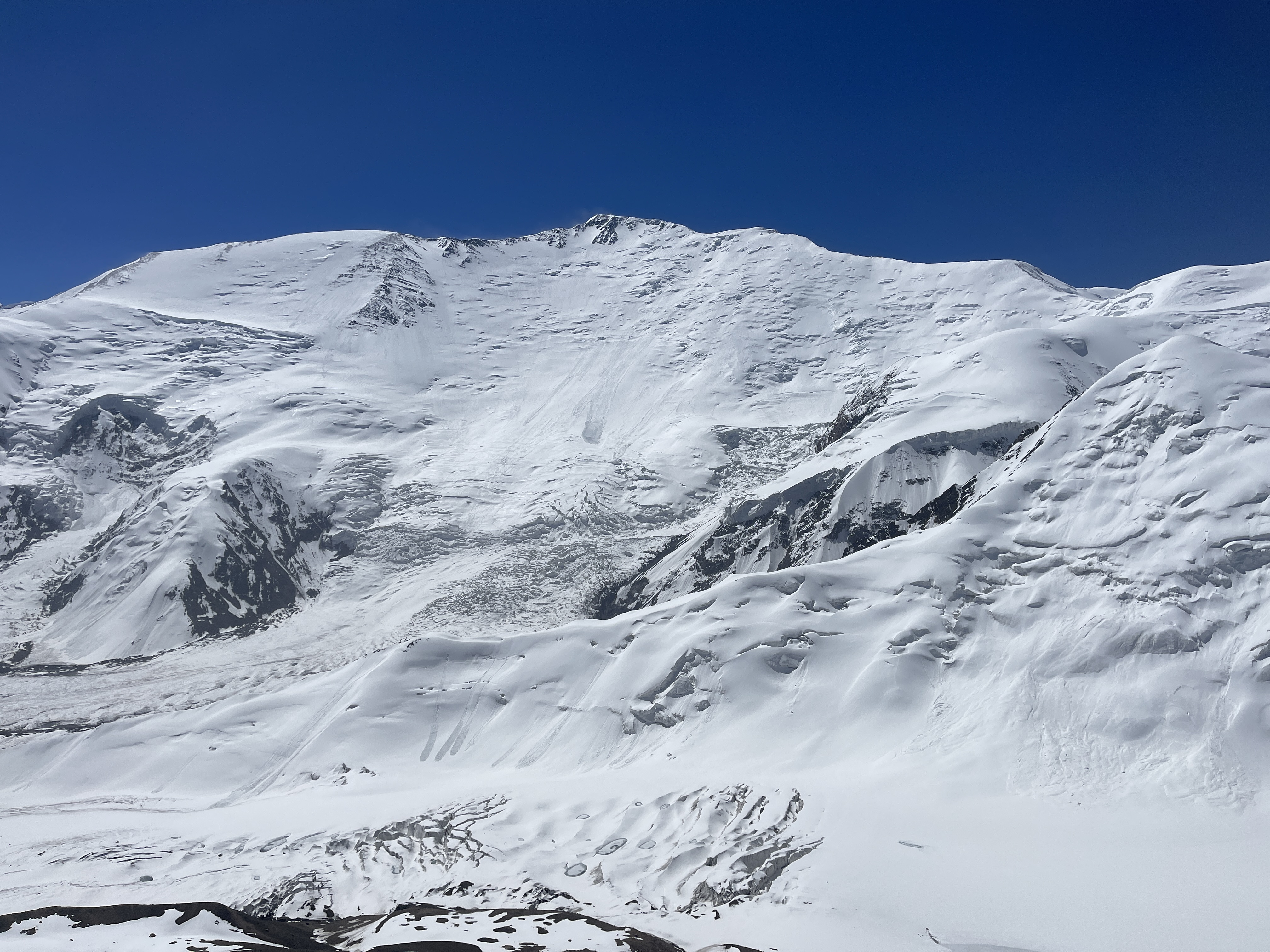
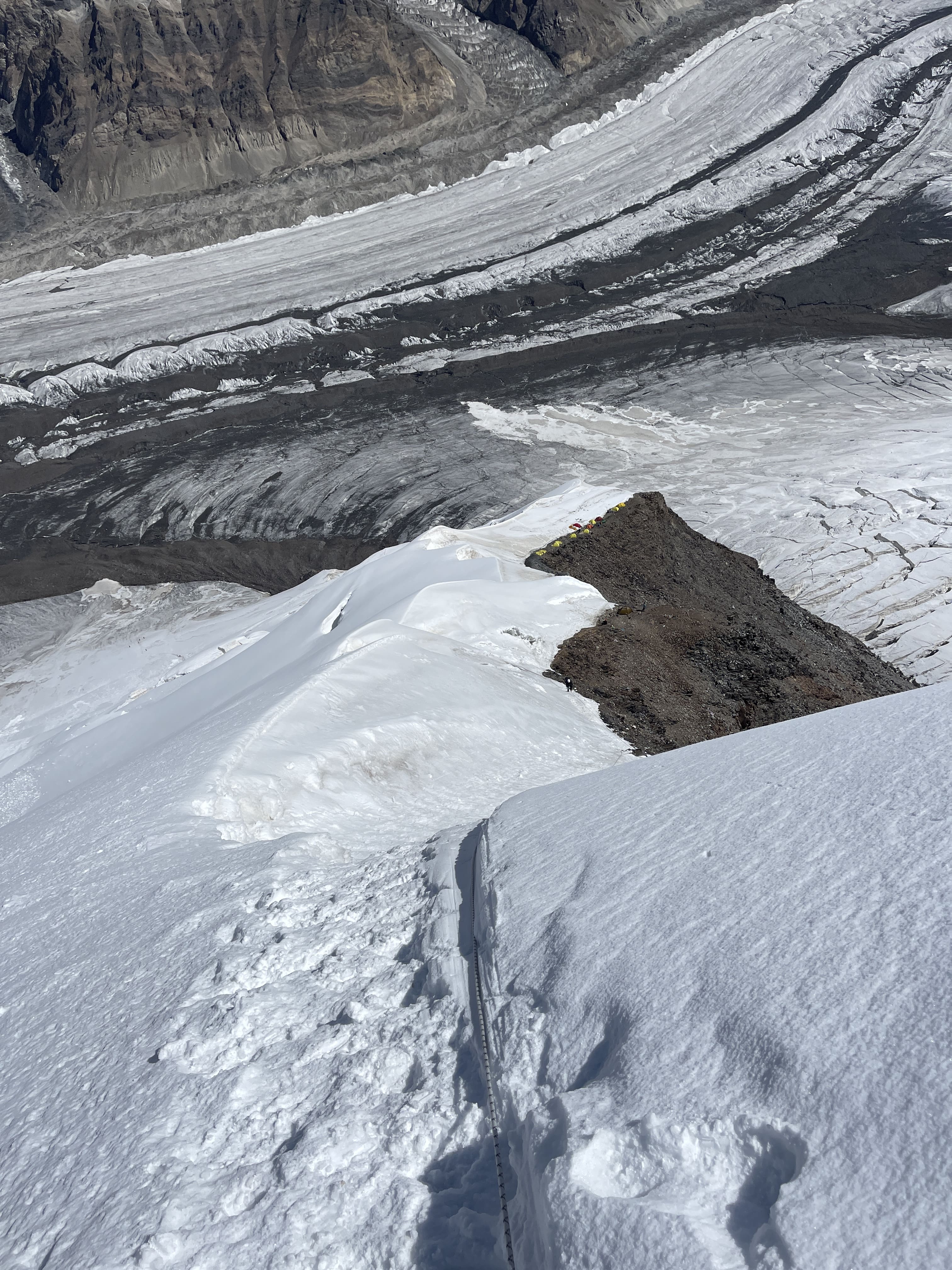
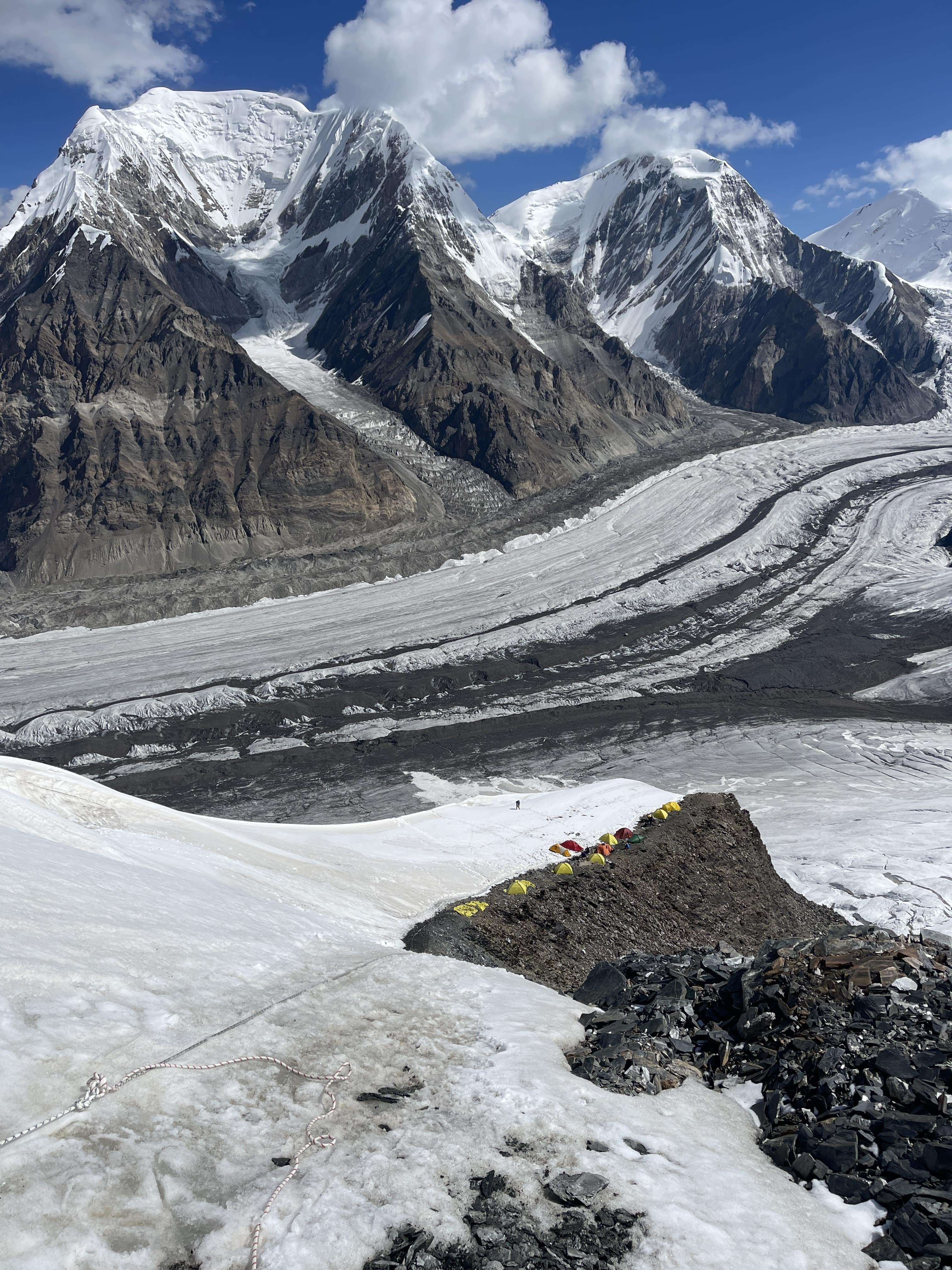
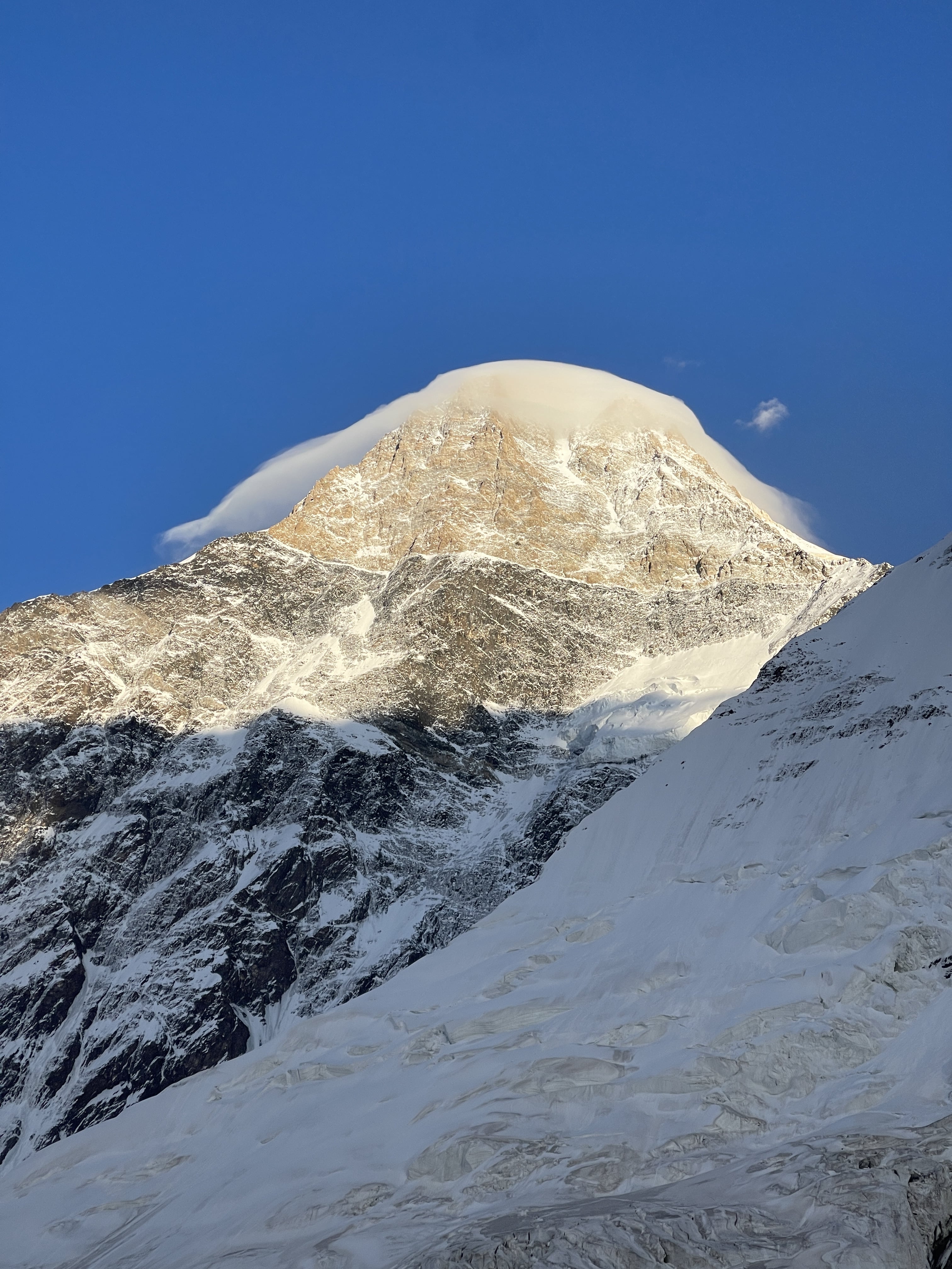
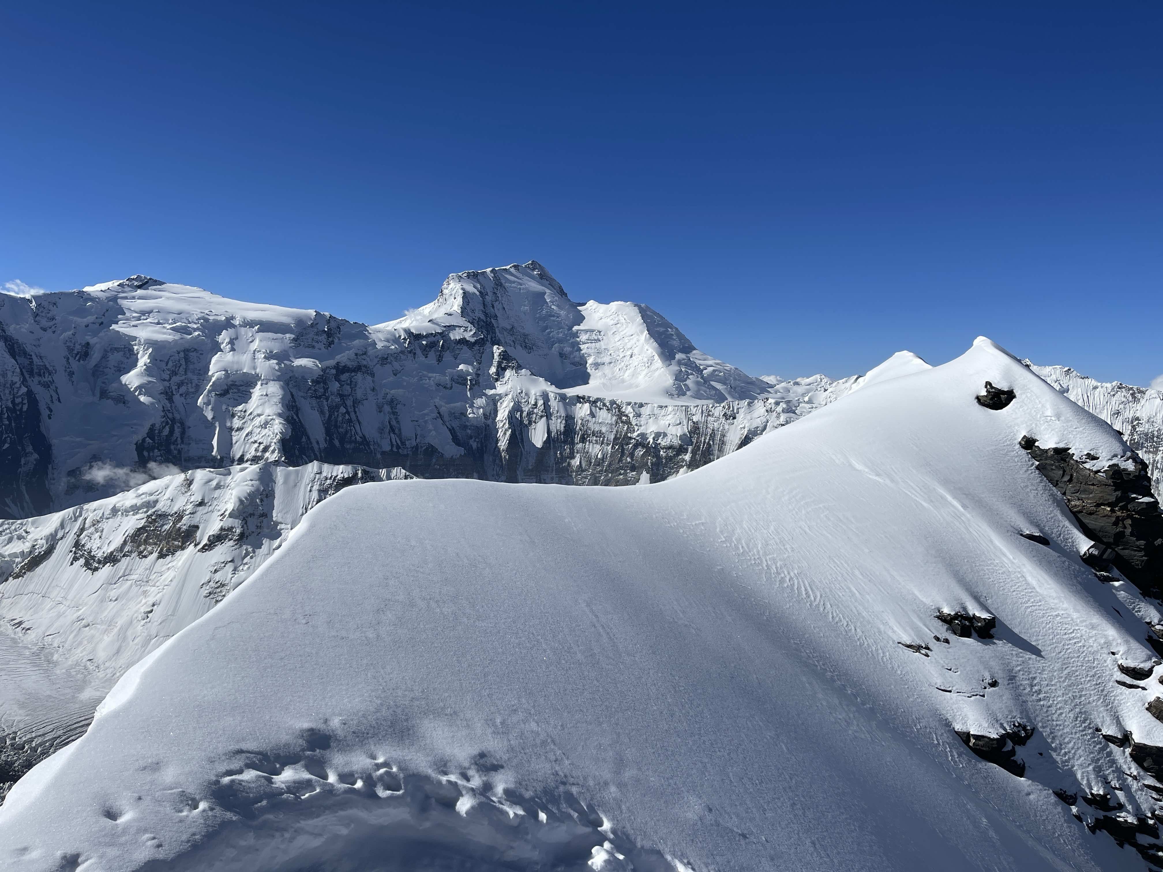
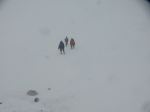
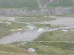
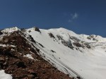
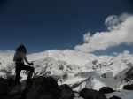
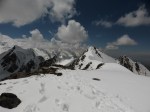
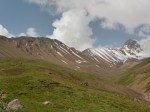
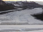
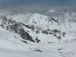
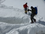
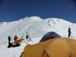
Pik Lenin from 3600m BCPik LeninPik Lenin from 4400m campPik Lenin4400m campPik LeninThe base of the route at dawn5400m camp5400m camp
Thoughts on Pik Lenin
This was my third time climbing on Pik Lenin, and the earliest in the season I’d ever been on the mountain. My main goal for the 2024 summer season was 7010m Khan Tengri, and my time on Pik Lenin was predominantly intended as acclimatization. That said, I did want to summit Pik Lenin a second time, tried my best to do so, and was shut down completely by weather conditions.
As acclimatization, my time on Pik Lenin served me very well, and I was able to make a rapid ascent of Khan Tengri – standing on the summit just over a week after departing the Pik Lenin basecamp. I feel that extensive rest intervals at 4400m camp, plus a three day stint in 3600m camp, produced a thorough ‘foundation’ of very good acclimatization. The quality of the facilities also likely helped, especially the hot showers in 3600m camp, and the abundant all-you-can-eat food provided in both 3600m and 4400m camps.
I would definitely return to Pik Lenin for another acclimation round in the future. If seriously keen to summit I’d definitely avoid starting any earlier than the last week of July. Weather was truly awful throughout my time on the mountain in 2024, characterized by high winds and enormous snow dumps. If I hadn’t summited Lenin previously, I would have been enormously disappointed and discouraged by the experience; conditions were simply not conducive to summiting.
No 7000m mountain is ‘easy’, and in poor conditions even the most moderate 7000er can become all but impossible.
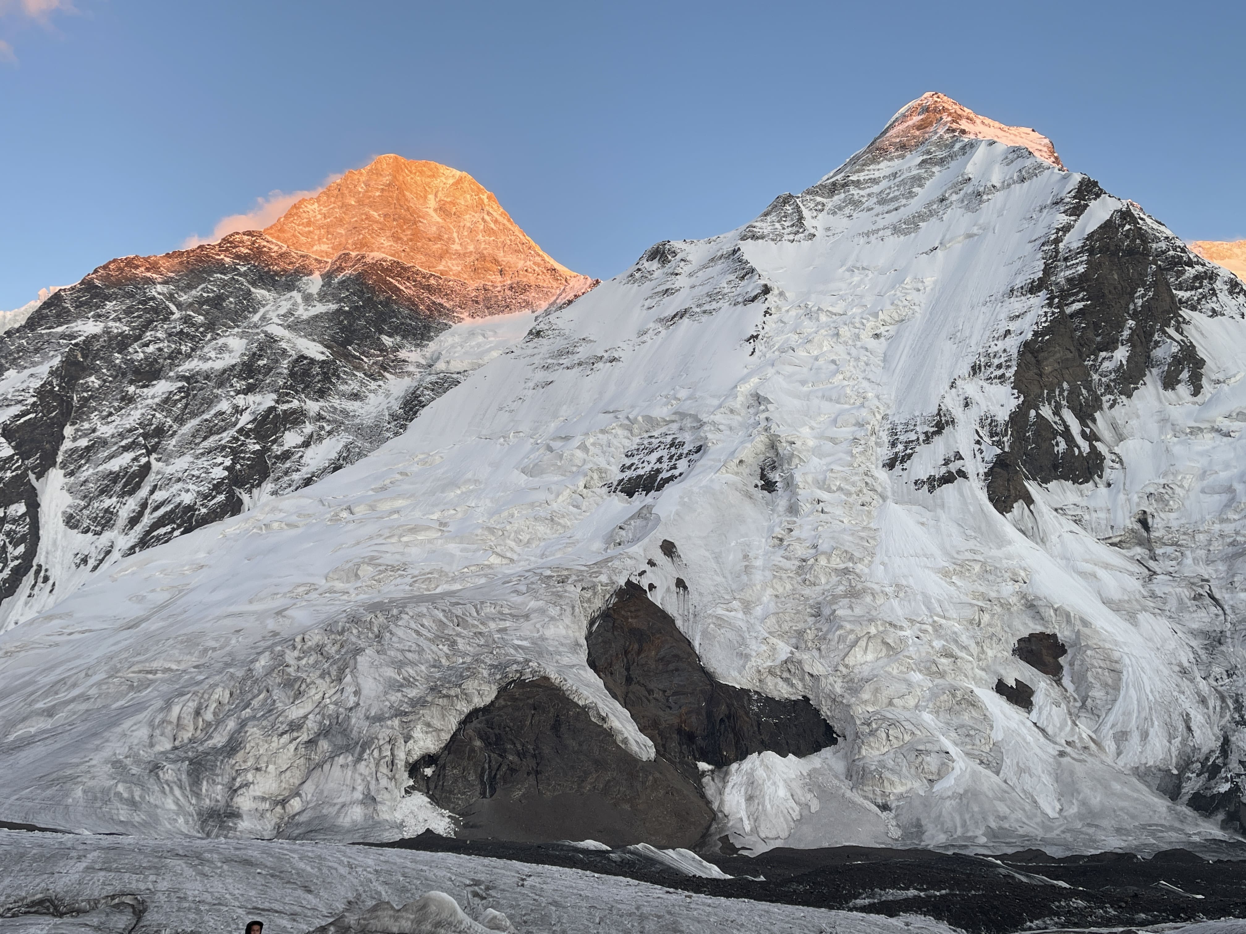
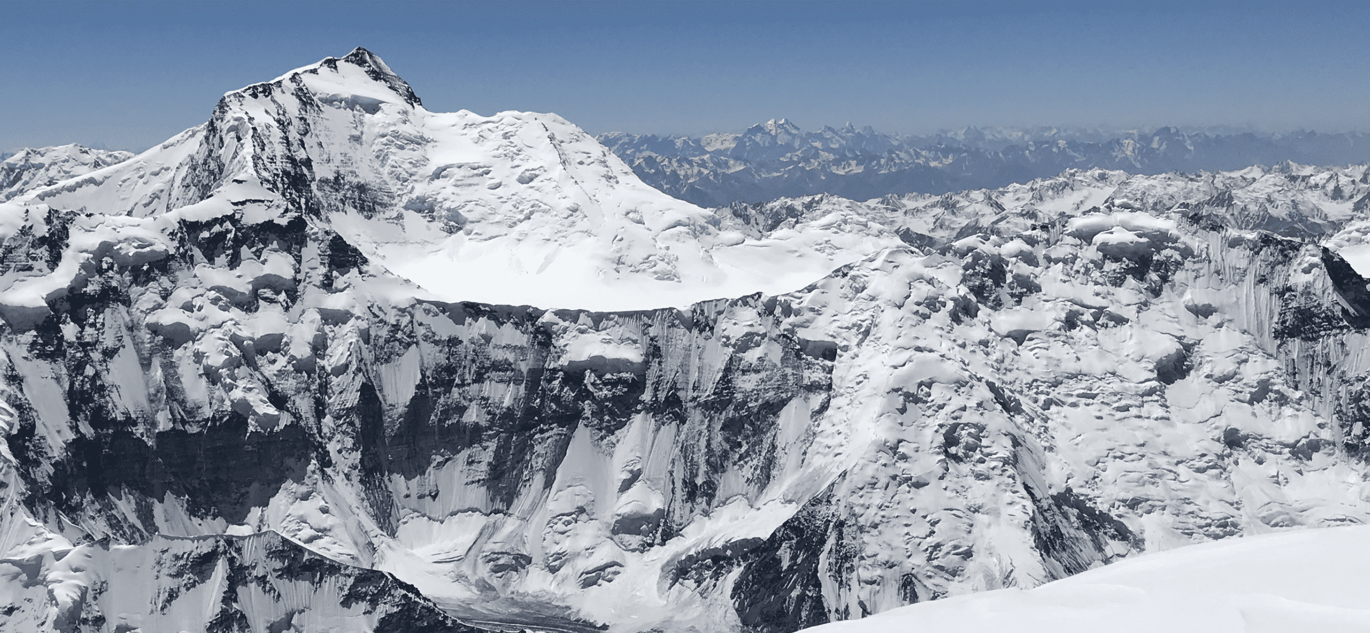
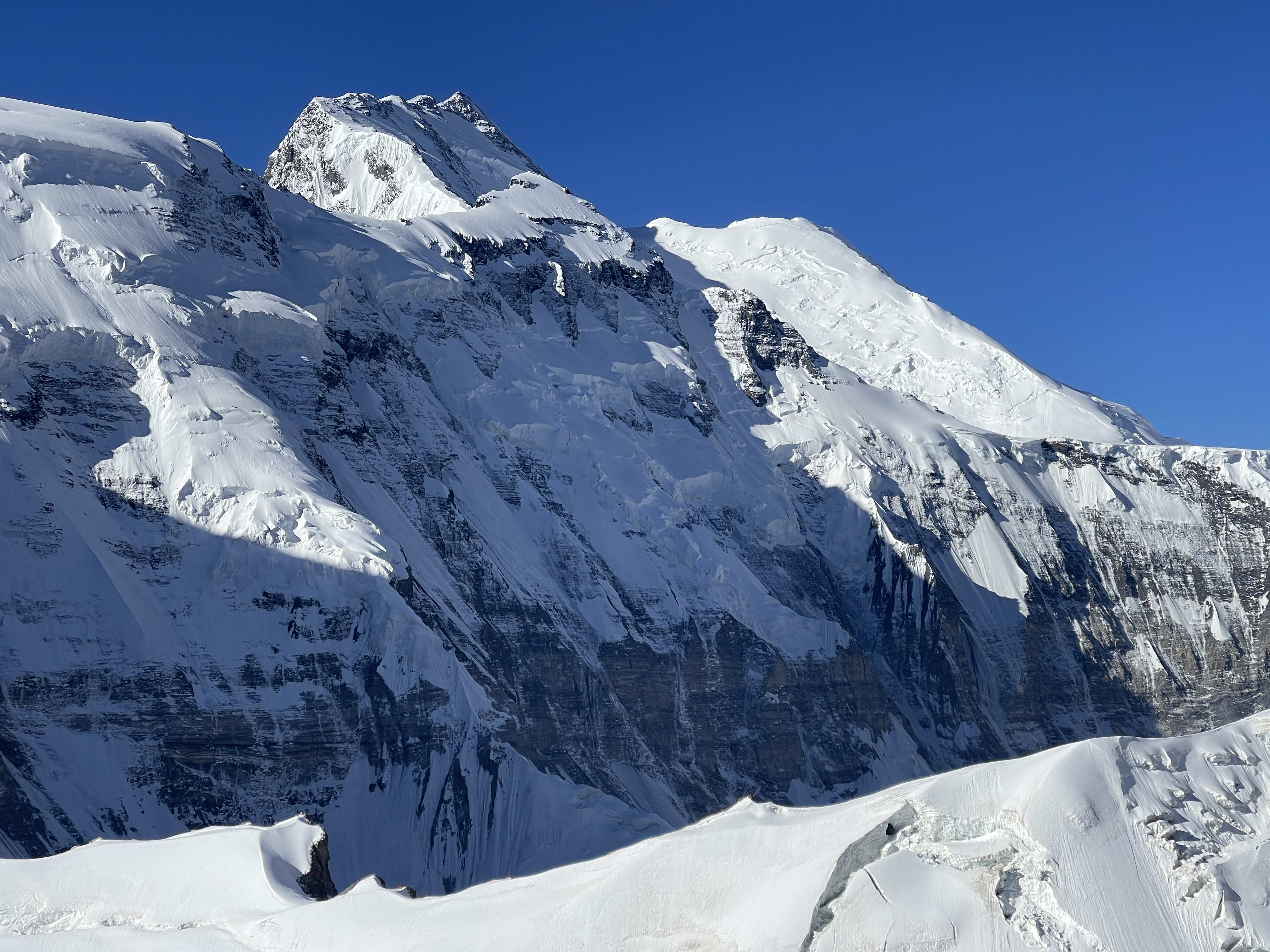
Khan Tengri from North Inylchek GlacierKhan Tengri at sunsetKhan Tengri from North Inylchek BasecampKhan Tengri from Chapaev Shoulder
Khan Tengri is the high point of Kazakhstan, the second highest peak of the Tian Shan range, and one of the five 7000m snow leopard peaks. At 7010m Khan Tengri is also the world’s northernmost 7000m peak, although there is some contention as to whether its altitude should be considered 6995m on account of a significant ice cap adding to the peak’s geological elevation. Its northern latitude means that weather on Khan Tengri is unstable and often severe, and that climbers encounter a thinner atmosphere than is found at comparable elevations further south.
Khan Tengri is an exceptionally beautiful mountain on account of its prominence, its pyramidal shape, and its remarkable geological composition – the upper peak from ~6000m is a marble pyramid steep enough on its north face to remain mostly free of snow. Viewed from the north on a clear day, at sunset this pale yellow-gold marble catches the light of the setting sun and glows in a fiery, blood red hue. When viewed from the south Khan Tengri presents a perfect snow pyramid reminiscent of K2 in Pakistan or Alpamayo in Peru. The first time I experienced Khan Tengri’s sunset alpenglow I could only gape in awe – it is one of the most glorious, impressive peaks I have ever laid eyes upon.
The Goal: An Independent 7000m Snow Leopard Summit
I had been keen to make an attempt on Khan Tengri for many years prior to my 2024 expedition. Khan Tengri is a mountain which, early on in my mountaineering progression, seemed utterly out of reach for me. I first laid eyes on images of the route in 2015 when Edgar Parra, a friend and mountain guide from Ecuador, had shown me photos from his ascent. For many years, Khan Tengri stood in my mind as a mountain which I thought I’d never be skilled or strong enough to climb, let alone independently (which I define here simply as ‘unguided’). With time and experience it began to seem more realistic, and possible for me to safely take a shot at. A variety of climbers I’d met over the years, including several friends, had recommended the northern route to me, emphasizing its viability for an independent or ‘solo’ (if such can be considered possible, given the fixed ropes) climb, its relatively good protection via seasonally maintained fixed lines, and its challenging, rewarding character. I had similarly been warned that the south route was unacceptably risky, due to significant serac and avalanche exposure.
After successful and highly rewarding experiences on Pik Kommunizma and Manaslu in the summer through autumn of 2023, I knew that I would be keen for another big mountain goal in 2024. While I shifted my focus entirely to rock climbing after Manaslu, and kept it there for the following six months, beginning in the early spring of 2024 I also committed time and energy to a training regime for mountaineering.
With no partners available on an aligned timeframe the expense, extreme physical toll, and guide support of a second 8000m expedition undertaken without friends did not seem particularly viable to me. At the same time, Pik Kommunizma had renewed my enthusiasm for the 7000m snow leopard peaks, and based on the advice of friends I felt confident that Khan Tengri could be doable if going alone. At this point I had summited three of the 7000m snow leopards, had climbed on those three peaks five times in total, and had done so independently – whether with friends or all alone – each time. I committed to an early start at the very beginning of the season, paid my deposit to Ak-Sai Travel, who now operate both the north and south basecamps on the Inylchek glacier, and prepared to return to Central Asia. I would warm up and pre-acclimatize on Pik Lenin, before shifting to Khan Tengri via the North Inylchek basecamp.
I pre-acclimated for Khan Tengri by making an attempt on 7134m Pik Lenin, the basecamp of which is also accessed from within Kyrgyzstan. I had previously summited Lenin in the summer of 2017, and in 2016 had also made an unsuccessful attempt; this was my third time on the mountain. I had a very rough time of things on Lenin on account of sustained inclement weather – enormous snow dumps and high winds – and never made it higher than ~6100m. Nonetheless, my time spent moving up and down Lenin, and resting at elevation, served as adequate acclimation for a rapid ascent of Khan Tengri. I summited Khan Tengri on my 7th day in North Inylchek. I did not feel as thoroughly acclimated as I wanted to be, largely due to my ‘low’ highpoint on Lenin, but my acclimation was definitely sufficient and served my goal wonderfully. Had I made it to the summit of Lenin during pre-acclimation, I believe that my subsequent time on Khan Tengri would have felt much easier than it did.
Pre-acclimation via expedition enchainment is a majorly effective strategy for tackling big mountains. It requires a significant time investment, which is a deterrent for many, but significantly improves odds of success and quality of experience (minimizing AMS and discomfort) at altitude. Climbing a ~7000m peak before a lower but technically demanding peak in the ~6000m range effectively mitigates altitude as a factor for the second climb. Climbing a 7500m peak and spending weeks in basecamp before an 8000m peak prepares the body with a thorough acclimation ‘foundation’, making a no-o2 ascent more realistic. At the time of writing I have successfully enchained four major expeditions above 7000m:
7134m Pik Lenin as preparation for an ‘overnight’ solo ascent of 5642m Mt. Elbrus, with no acclimation rotation on Elbrus.
7134m Pik Lenin leading into a rapid 5-day ascent of 5947m Alpamayo, where we skipped high camp and gained the summit on day 4.
7495m Pik Kommunizma as pre-acclimation for an ascent of 8163m Manaslu, where a single rotation to ~6650m was sufficient for my summiting without the use of supplementary oxygen.
7134m Pik Lenin prior to 7010m Khan Tengri, where I was able to summit on my 7th day without any rotations above ~4500m.
Pik Lenin is uniquely ideal for this purpose. It is inexpensive, quite high, highly accessible, very comfortable due to a developed basecamp, geographically close to me (I live in China), and relatively straightforward to rotate up and down on. When climbing Lenin it is notably easy to gain 5000m on nearby Pik Yuhin; this may be one of the most efficient and comfortable places to tag 5000m anywhere in the world. Lenin is a slog most of the way, but in spite of that I’d totally go back and spend time on Lenin (yet again!) in preparation for other peaks.
Schedule and Calendar
Here I have put together a calendar outlining my acclimation routine and climbing activity throughout my 2024 Pik Lenin and Khan Tengri climbs. I have likewise charted out the elevations used for acclimation rotations, culminating in an ascent.
Long, full-day drive to Karkara at 2200m. Many stops made the ride far lengthier than expected.
7.22
Helicopter ride for ~40 minutes through the valleys and into the mountains, to North Inylchek basecamp at 3960m, with first views of the Tian Shan range.
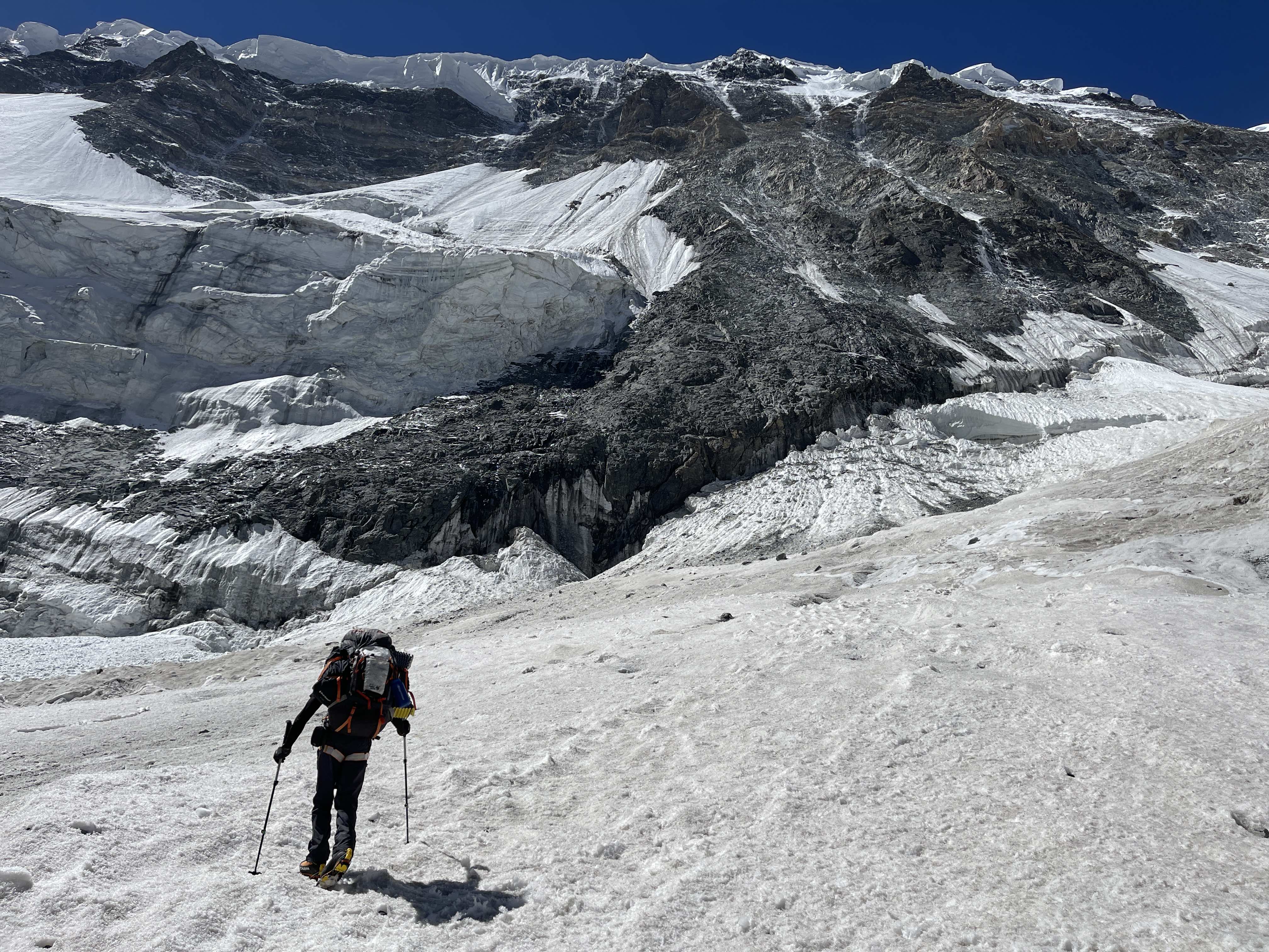
After lunch I went for a hike to crampon point at 4050m. Time of 45 minutes to get there, crossing moraine and dry glacier. A large river crossing was bridged with a wooden platform, which must be found via a specific ice valley. The river is fierce and powerful, quite dangerous, and must be crossed with caution.
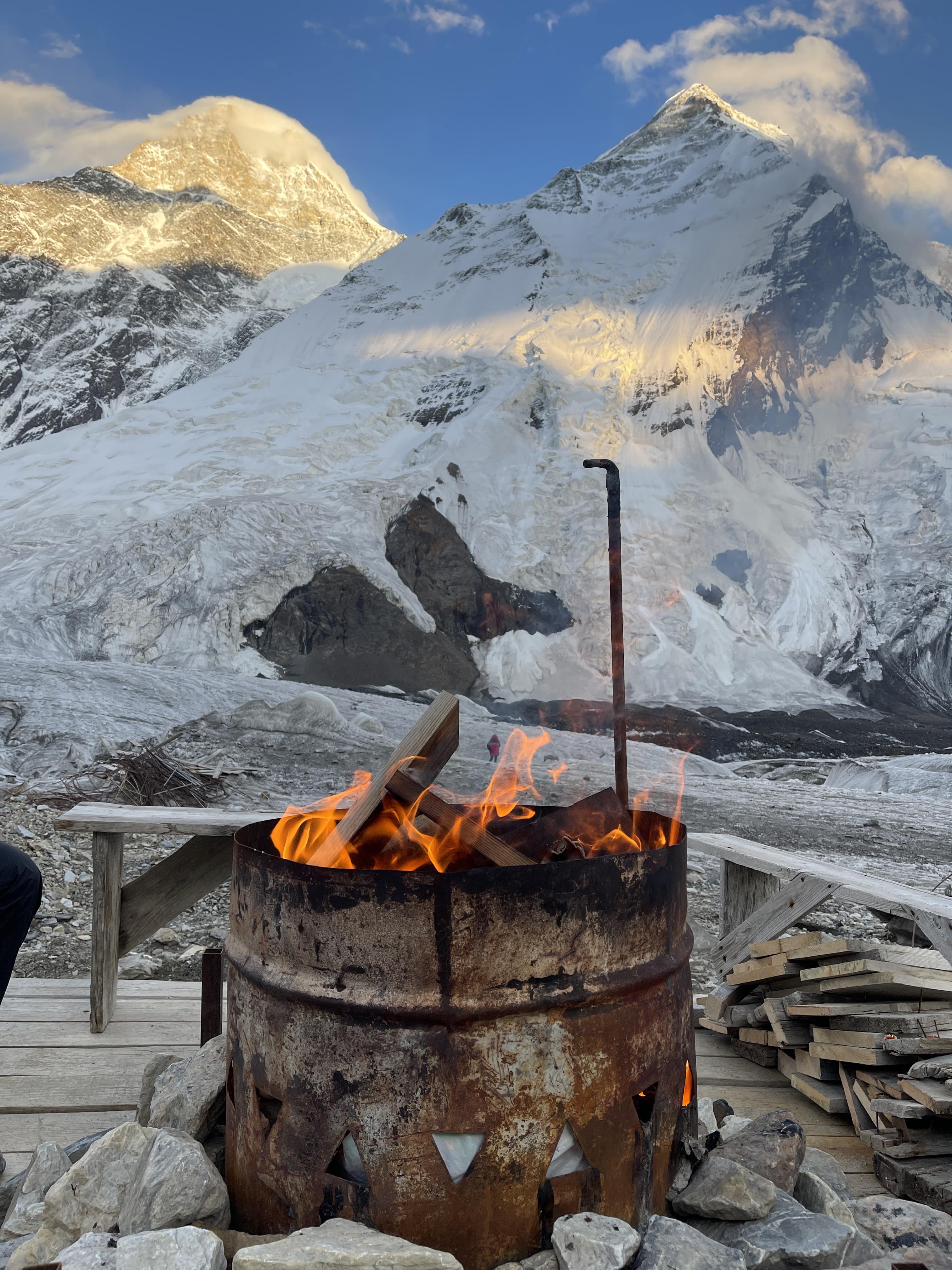
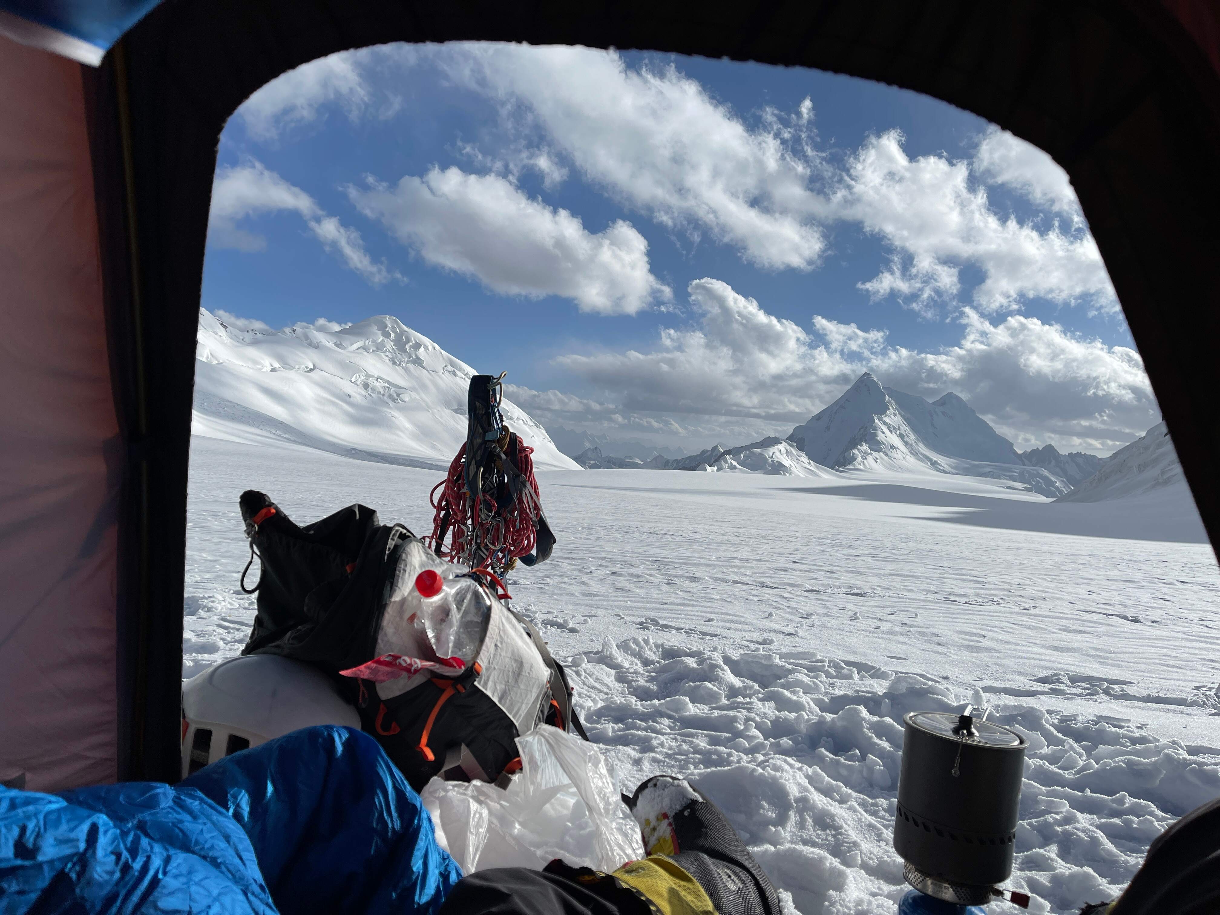
North Inylchek Basecamp is small, rugged, spartan. Situated upon moving glacier, there are no permanent structures – indeed, the tents shift and slowly flow over time. My sleeping tent developed a distinctive slant and a troubling instability throughout my short stay in it. Food was consistently excellent, and Basecamp staff were friendly and professional. Yet, the camp feels cold and desolate when compared to Moskvina or to Lenin’s BC and ABC. There is no greenery, little life, much shadow and ice.
Khan Tengri presides above camp, majestic in its geometry. On clear evenings it glows orange and red at sunset, magnificent and ominous. Surrounding peaks are sharp and severe, numerous 5000m teeth rising alongside Khan Tengri, steep and pronounced. The Tian Shan are serious business, and very few of the visible mountains would be easily ascended. The proximity of the Inylchek glacier is startling; it is always underfoot, and its exposed ice lies a few short meters from camp. Climbers in camp visit it frequently for the washroom facility. Puddles of meltwater form, freeze, and drain throughout the day. Rivers of pure glacial water materialize at noon. The glacier is the highway which leads to the base of the route upward, and the foundation upon which camp is temporarily constructed.
7.23
2:20 pm depart BC. 3:35 pm arrive crampon point. Time of 75 minutes. 6:30 pm arrive Camp 1, 4540m. Time of 4:10 from BC.
I packed 6 days worth of supplies and all of my equipment for higher up. I had decided to go heavy and get the carrying over with in one shot – a strategy which has worked well for me in the past. I hoped to potentially even make my way into position for a summit attempt off of this heavy carry.
Soft snow made the heavy pack quite grueling to manage throughout steeper sections of the easy climb to Camp 1. I wished that I’d left earlier in the day; soft snow bridges were more than a bit dodgy. I used my jumar twice on fixed lines, making the slush easier to manage.
Camp 1 is small, but I had no problem finding a rock platform for my low-profile one-person tent. One benefit of a small tent is the ease of pitching in tight spaces!
7.24
9:20 am depart 4540m Camp 1 10:05 arrive Crampon Point. 11:05 arrive BC. Time of 1:45.
I woke up to steady, wet snowfall, and very poor visibility. I decided to bail rather than waste gas and food waiting around in Camp 1. Conditions were very damp. Ascending in such conditions would be miserable, and it would be hard to dry off properly once back in my tent.
I descended fairly quickly, although fresh snow slowed me down as I pulled ropes out and looked for the optimal path down. The moraine was lovely in the snow, and the flags which mark the way to the wooden bridge across the glacial river were much easier to see.
It was quite hot; I sweated inside of my water resistant layers and was thoroughly soaked once I got back to BC.
I was pleased to make a heavy carry to Camp 1, as I would never have to make that section of the route with a huge pack again. At the same time, I was disappointed not to get my equipment and supplies up to Camp 2, as doing so would have set me up nicely for a fast-paced summit attempt later.
7.25
Depart BC at 10:10 am. Arrive Camp 1 at 13:10 pm. Time of 3:00.
After spending all of 7.24 in Basecamp, during sustained wet snowfall and poor conditions, the forecast shifted for the better. I agreed to move up on a similar time schedule as two other independent climbers, Lucas from Germany and James from the UK, and meet them in camp 2 on the 26th. We would then share a tent and stove in Camp 3 on the 27th.
I ascended in a light breeze and full sun, making a good pace whilst subjectively ‘taking it easy’. Conditions were much better than my first climb to Camp 1, as I left much earlier in the day. Having a lighter backpack was also quite enjoyable!
I observed two enormous serac collapses off of Khan Tengri’s shoulder, to the climber’s left of the north face. These did not threaten the route or its approach. It was very pleasant to arrive at Camp 1 with my tent pitched and food ready to eat. Conditions were flawless in camp, sunny and warm with a light breeze. I was easily able to dry my boots in the sun, and take a comfortable nap.
I ate well all afternoon and evening, and slept for over 9 hours. Light snow fell overnight, exactly as forecasted.
7.26
9:30 am depart Camp 1 4540m. 16:05 pm arrive Camp 2 5550m. Time of 6:35.
The route from Camp 1 to Camp 2 covers steep terrain, with several ice and rock steps. The rock steps and an exposed rock traverse were fun, and not strenuous for me, but the steep ice was brutal to front point while hauling my heavy backpack. I felt great with breathing and altitude, just absolutely slammed by the weight of my enormous pack. There were almost no places suitable for stopping to rest, due to the sustained steepness of the terrain. I had trained well for this expedition, but mostly via running rather than load hauling. This definitely contributed to my intense discomfort in managing my heavy pack while on steep terrain. Unfortunately, the remainder of the climb was like this; steep, and difficult with a big bag.
The weather was sunny and warm for most of the way, shifting into cloud and wind as I approached Camp 2. The entire route is fixed each season, and I kept my ascender on the lines for the majority of the climbing. With the ascender on, the route felt secure and reasonably well protected, but remains relentlessly steep. Without fixed ropes, the route between Camp 1 and Camp 2 would be an order of magnitude more strenuous, and I would not have felt at all comfortable soloing the vast majority of it. This would be a theme for the remainder of the route from Camp 2 to Camp 3 and then to the summit; if not already fixed this would be a very challenging and involved mixed route with what appeared to me to be fairly mediocre protection. Make no mistake, the majority of climbers – myself included – are only ascending Khan Tengri from the north due to the presence of the fixed lines.
Lucas and James met me at Camp 2 as planned. They arrived well before me, coming directly from Basecamp with light packs given that they had already deposited their tents, equipment, and supplies in Camp 2. I pitched my tent between theirs, and would leave my tent and some spare supplies here when the three of us moved up to Camp 3 together with a shared tent.
7.27
8:30 am depart Camp 2. Arrive 6100m Chapaev Shoulder at 12:45. 13:25 pm arrive Camp 3 5860m. Time of 4:55.
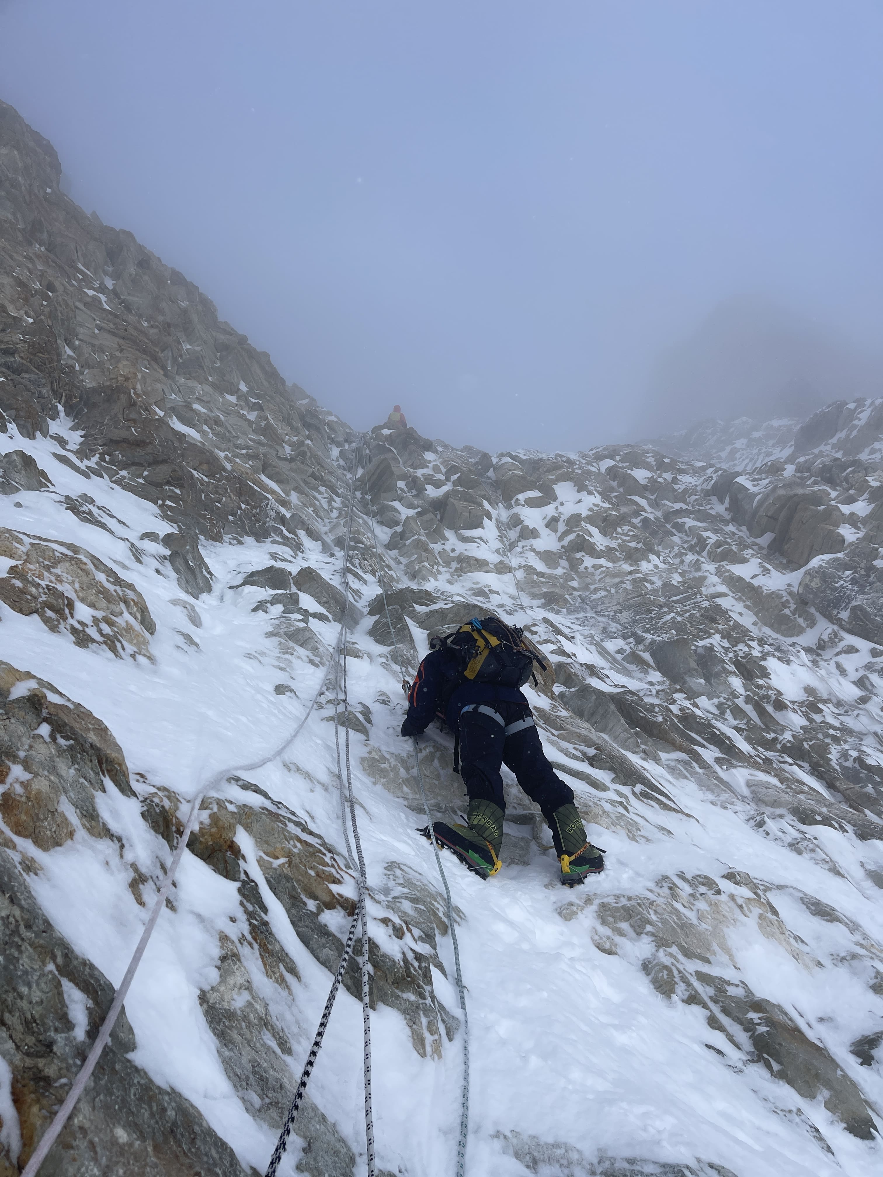
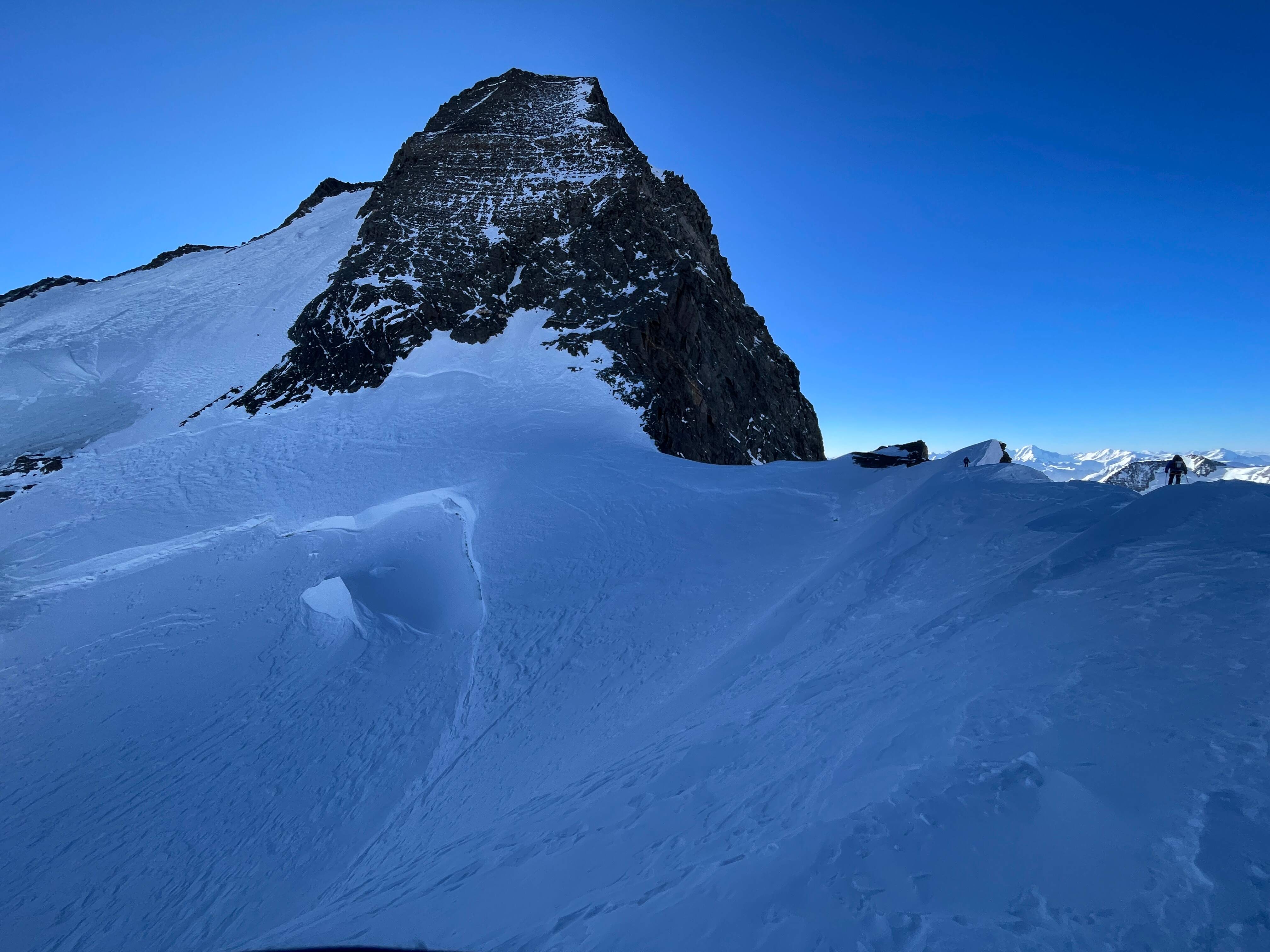
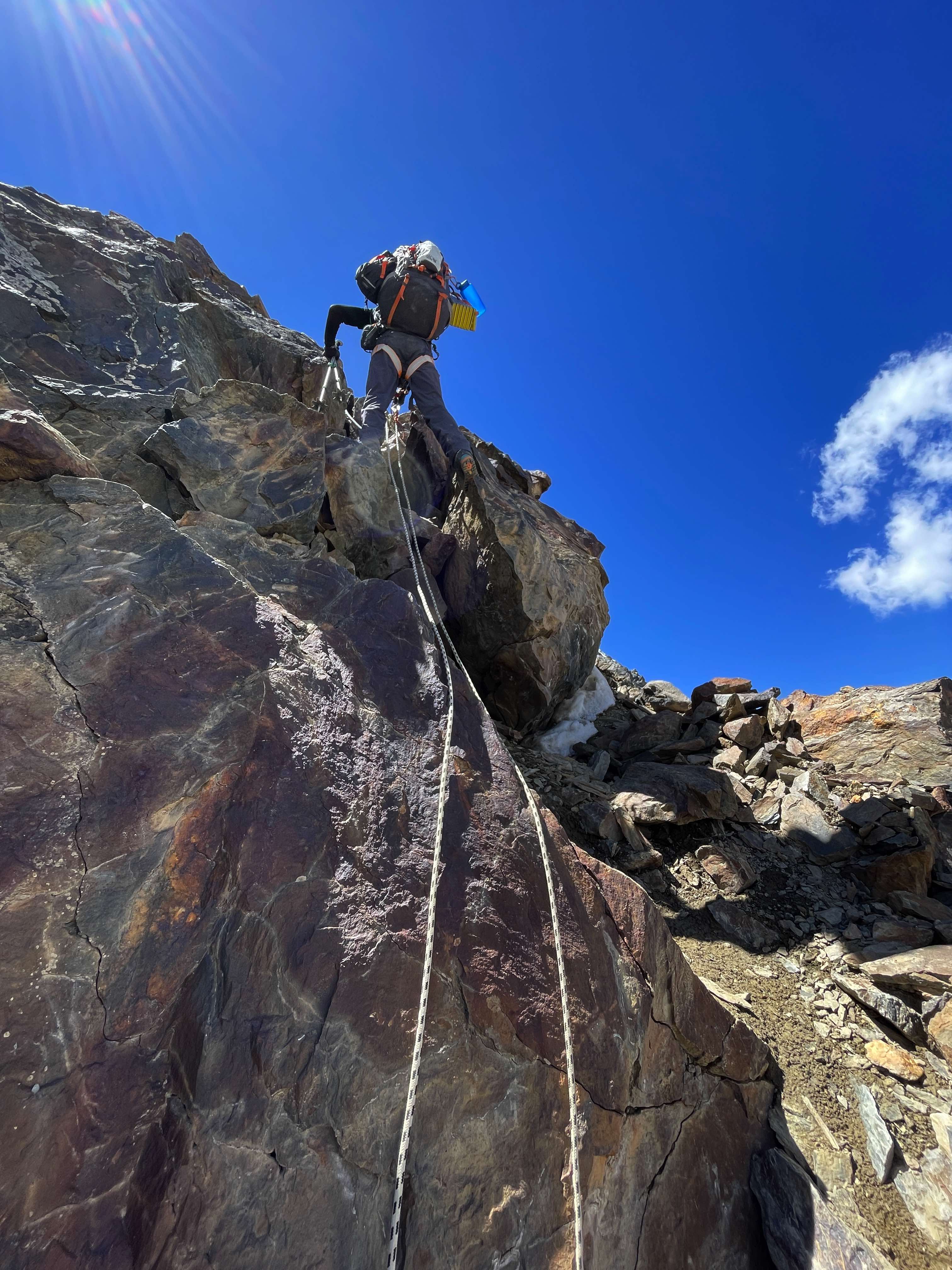
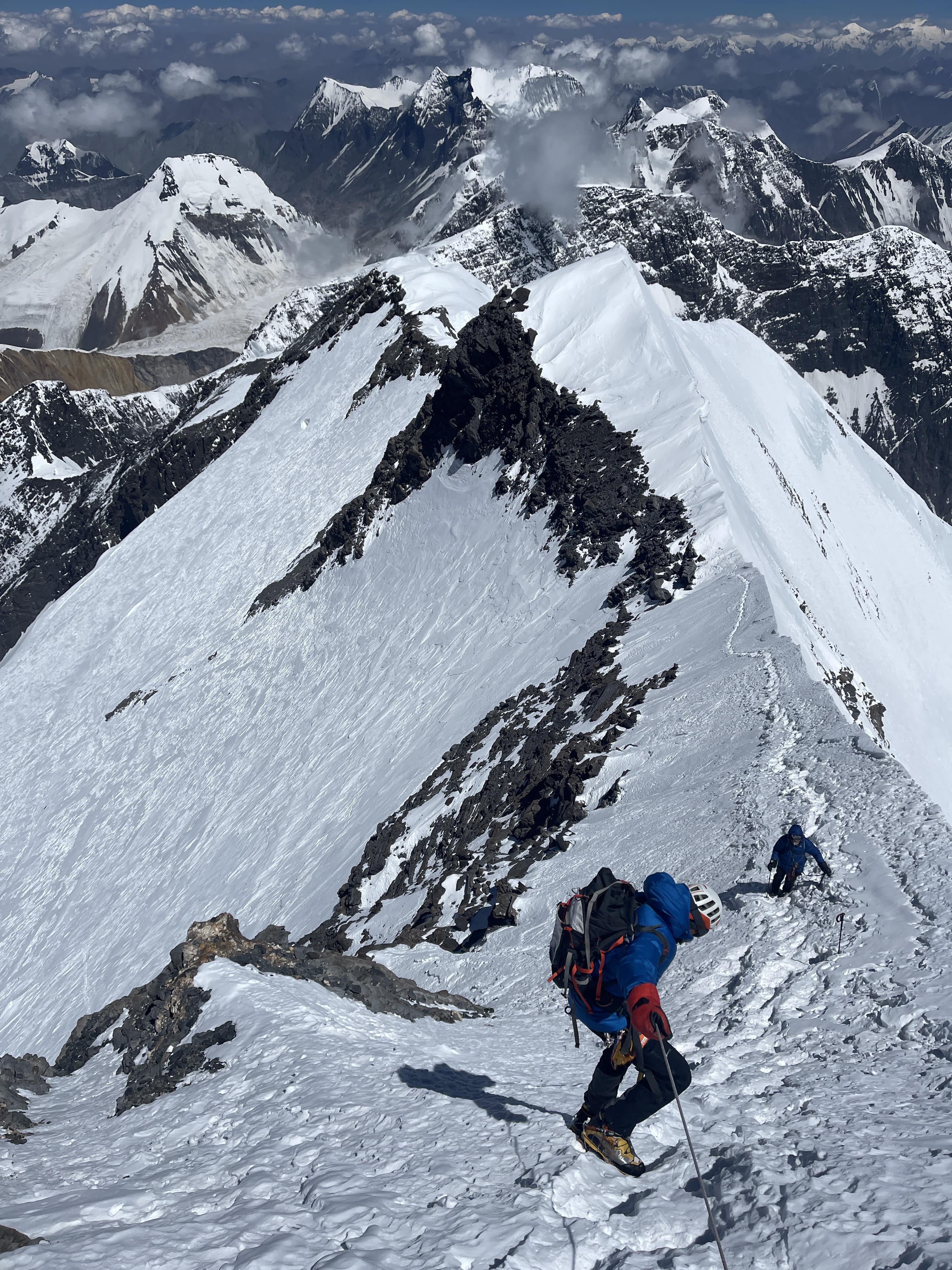
More steep, sustained climbing from Camp 2 to Camp 3. Many rock and ice steps, but the fixed ropes made for secure climbing with the jumar on as a backup. The route up and over Chapaev shoulder is quite demoralizing, as it seems to go on forever – climbing still higher even while Camp 3 is clearly visible below! This aspect of the north route, paired with relentlessly sustained steepness, contributes to its (deserved) reputation for being difficult. Chapaev’s shoulder represents an additional ~250m of ascent and descent which must be covered – both on the way up and on the way down.
Views from the top of Chapaev shoulder were superb, and we spent fifteen minutes taking photos and looking at Khan Tengri’s west ridge under clear skies. The descent down to Camp 3 was very quick on firm snow. Camp 3 is a tiny snow ridge dropping off into large cornices to the north, and a steep face to the south, but we quickly found a flat space for our shared tent.
The forecast for 7.28 was promising, calling for 35 km/h wind with light snowfall in the morning and heavier snowfall in the evening. Lucas, James, and I decided to commit to a summit attempt.
7.28
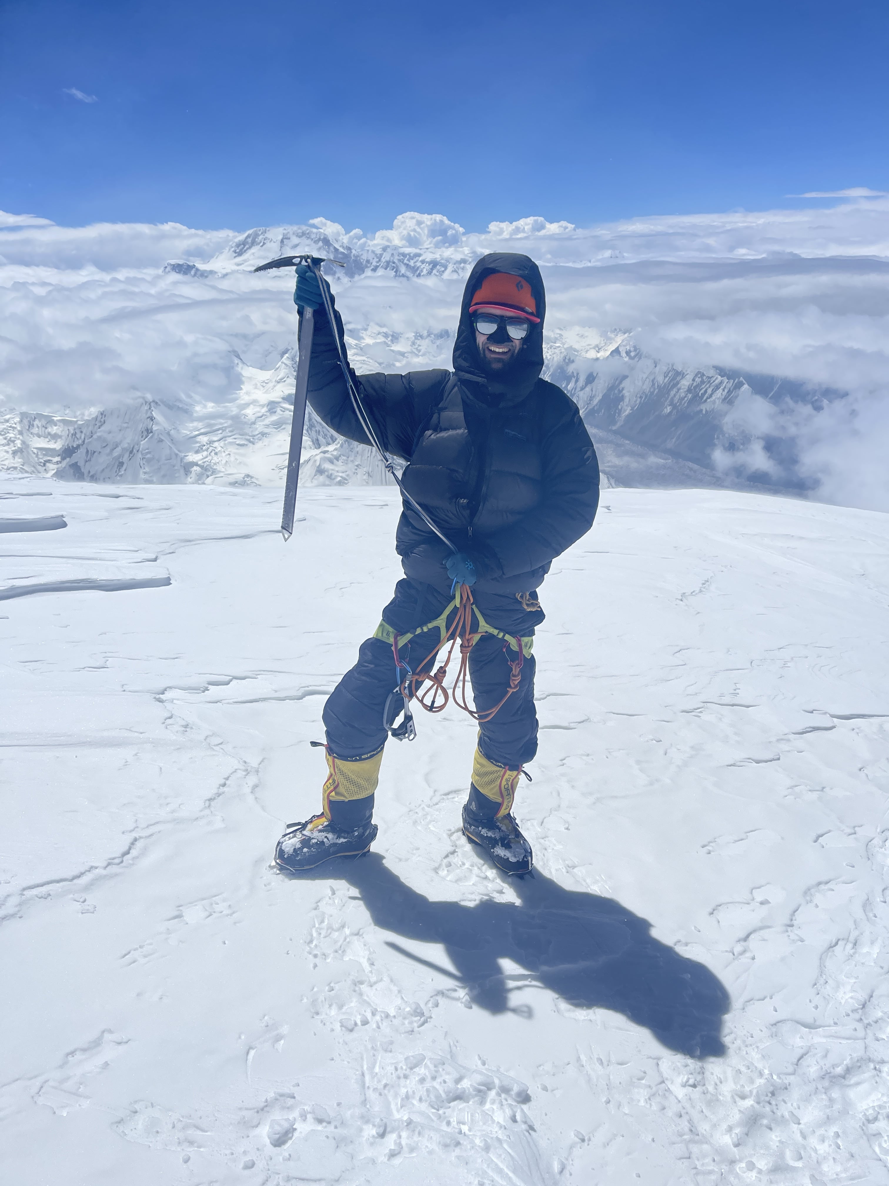
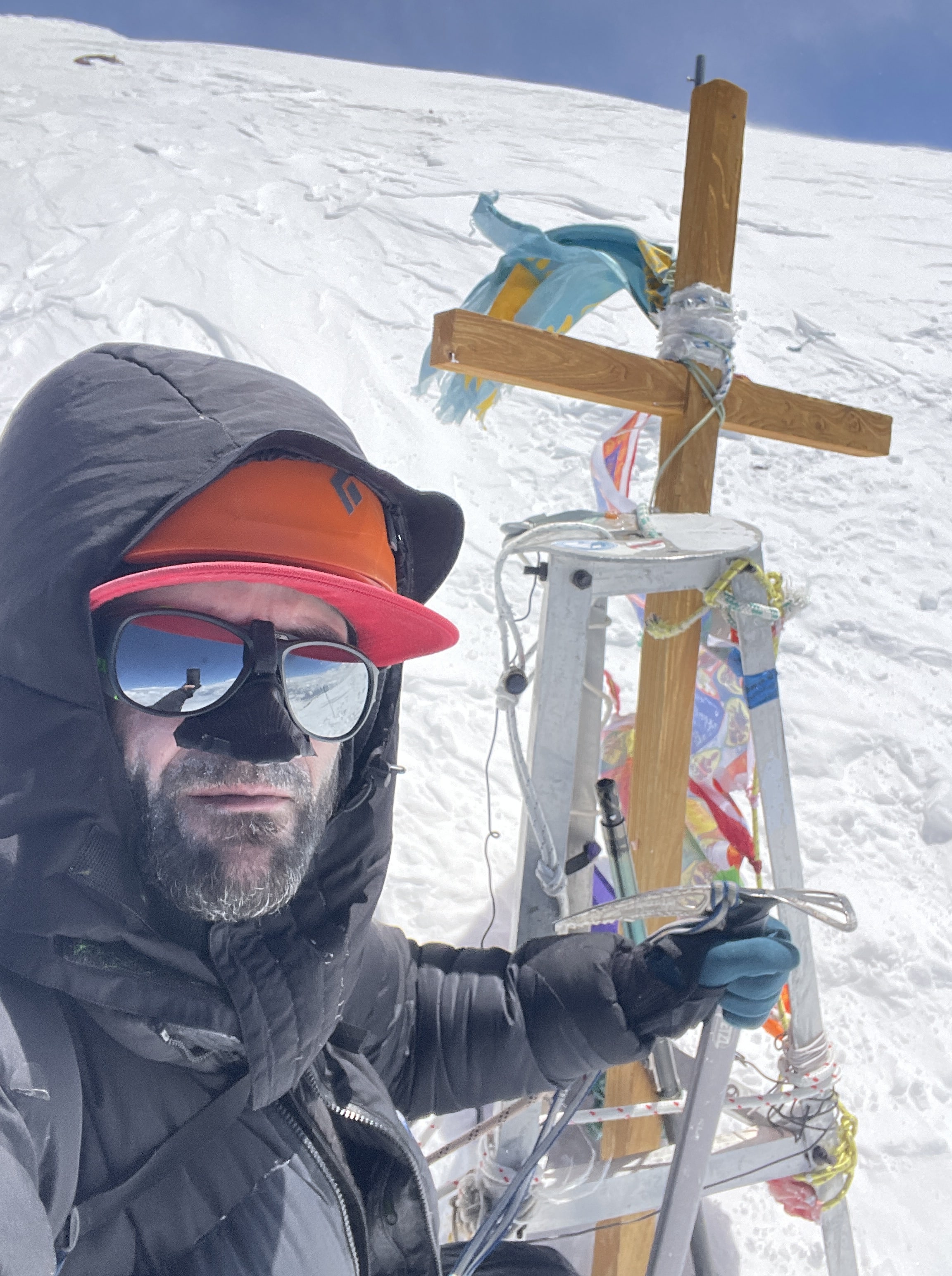
Awake at 12:30 am. 2:45 am start. 12:20 pm Summit. Time of 9:35. 3:50 pm return to camp. Time of 13:05 round trip.
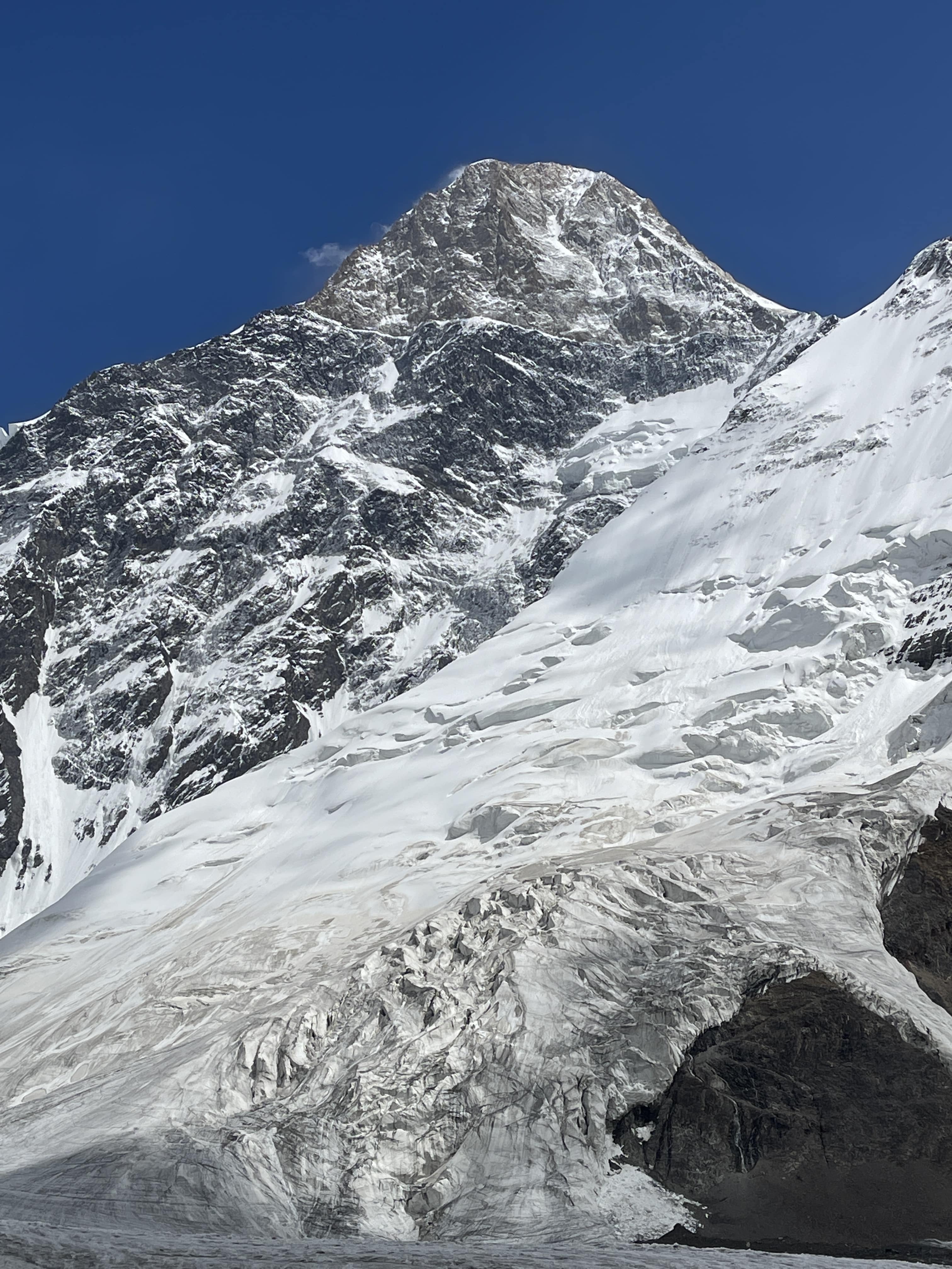
Khan Tengri’s summit, and summit cross.
The route to the summit begins with a low-angled snow climb, but rapidly steepens. The majority of the route to the summit is relentlessly steep. There is almost nowhere to stop without anchoring off, and only a handful of small, level ledges. Two of these are sometimes used as high camps, and both were occupied by very tightly-pitched 2-person tents. James left our tent first, and Lucas struck out ahead of me. Lucas climbed impressively fast, and I wouldn’t see him again until ~100m below the summit. I caught up to James where the route steepened, and climbed more or less on pace with him until the couloir, where I moved on ahead of him.
The weather for our summit day was very much sub-optimal, with intermittent high winds and sustained snowfall throughout the ascent. Around 4 am I began to fear that the forecast was entirely incorrect, and that the projected evening snowfall had shifted forward to early morning. Beginning at around 8am there were two hours of vicious wind and driving snow wherein I seriously thought about bailing. I pushed through in the hopes of the weather shifting, and although high wind continued, the snow eased off.
I climbed in my down pants, down storm parka, and all of my base and mid layers. My base and mid layer system for the upper body was: 150g merino t-shirt, 150g merino long sleeve, 200g merino long sleeve, Patagonia R1, Patagonia Nanopuff. For my legs, my system was: 200g merino underwear, 150g merino leggings, 200g merino leggings (yes, two pairs of merino leggings, layered), Patagonia softshell guide pants. I use a Feathered Friends Volant storm parka, and Feathered Friends Volant down pants for 7000m peaks. I wear a single heavyweight merino sock. Gloves were an issue for me on summit day; due to constant manipulation of my jumar and personal anchor I was not able to wear my 8000m storm mitts during the climb. I wore a Polartec liner glove inside of the storm mitt mid-glove, a ‘crab claw’ with bifurcated index finger. If I were to return to Khan Tengri I’d purchase the warmest, heaviest five-finger glove I could find and leave my mittens behind.
Without my storm parka’s hood closure, a thick Polartec buff face mask and my goggles, my face would have become too cold to continue – I had to minimize any skin exposure to the air. I quite frankly would have majorly benefited from wearing my full down suit in the frigid, windy conditions we experienced – but carrying it up to Camp 3 in the nice weather lower down would have been miserable! Khan Tengri was a bloody cold climb; I had more gear than I thought I’d need, used all of it, was still cold, and am glad that I was especially cognizant of protecting my hands and feet while moving. The ‘wiggle step’ is an important technique to master; wiggling the toes and fingers in line with every single rhythmic rest-step higher.
Dawn eventually cracked the frozen night sky open, revealing Pik Pobeda in the distance. Pobeda’s summit glowed warmly, while its enormous massif spanned across the horizon below. A fearsome mountain, Pik Pobeda is the hardest and most dangerous of the snow leopards, the ‘gatekeeper’ to finishing the five. Sunrise did not, unfortunately, bring warmth. Khan Tengri’s normal summit route follows the west ridge, which does not catch morning sun, and the wind was too intense for daylight to make much of a difference.
At around ~6800m, I roughly approximate the elevation here, I reached the couloir where the ridge traverses north onto the mountain’s upper slopes. There was a significant bottleneck here, as the handful of climbers ahead of me worked their way past the sketchy pair of core-shot fixed ropes. Unanchored in the middle, the ropes protected the traverse from a deadly fall, but did not serve to keep a climber comfortably on route. They were very loose, difficult to jumar in a controlled manner, and majorly slowed down the people ahead of me. I reckon that I waited for almost 45 minutes for my shot at this short ~15m of the route; when it was my finally turn to climb I used my axe for balance and delicately cramponed across the traverse with the ropes held as taut as possible. On the way down, rappelling this section was also annoying, and one of the slowest sections to navigate.
Above the couloir I finally gained Khan Tengri’s upper slopes, and was greeted by the glory and life-bringing warmth of the sun. The sunshine revitalized me, filling me with hope and renewed motivation. Immediately overheated, I anchored myself to slather sunscreen onto my face and remove my down pants. Taking the pants off would prove to be a mistake, as I needed to put them on again when intense wind resumed less than an hour later. Above the couloir is a fun rock step on beautiful marble. Fresh fixed lines made for perfect protection here, and I racked my axe so that I could free climb. I made use of a hand jam, stemmed, and pulled some easy rock moves with my jumar as backup. This section of rock was by far the highlight of the route for me – class 5 climbing and a hand jam above 6800m!
The final slopes to the summit are moderately angled, but were arduous in their own way due to intense wind and cold. Snow quality was acceptably firm and the route up was easy, but weather made for significant discomfort. I met Lucas here, on his way down from the summit, and we exchanged words of encouragement. Near the summit are several large boulders, and enough small, flat areas for a few tents. Some ambitious teams do apparently camp up there, although the prospect of hauling gear up makes me shudder.
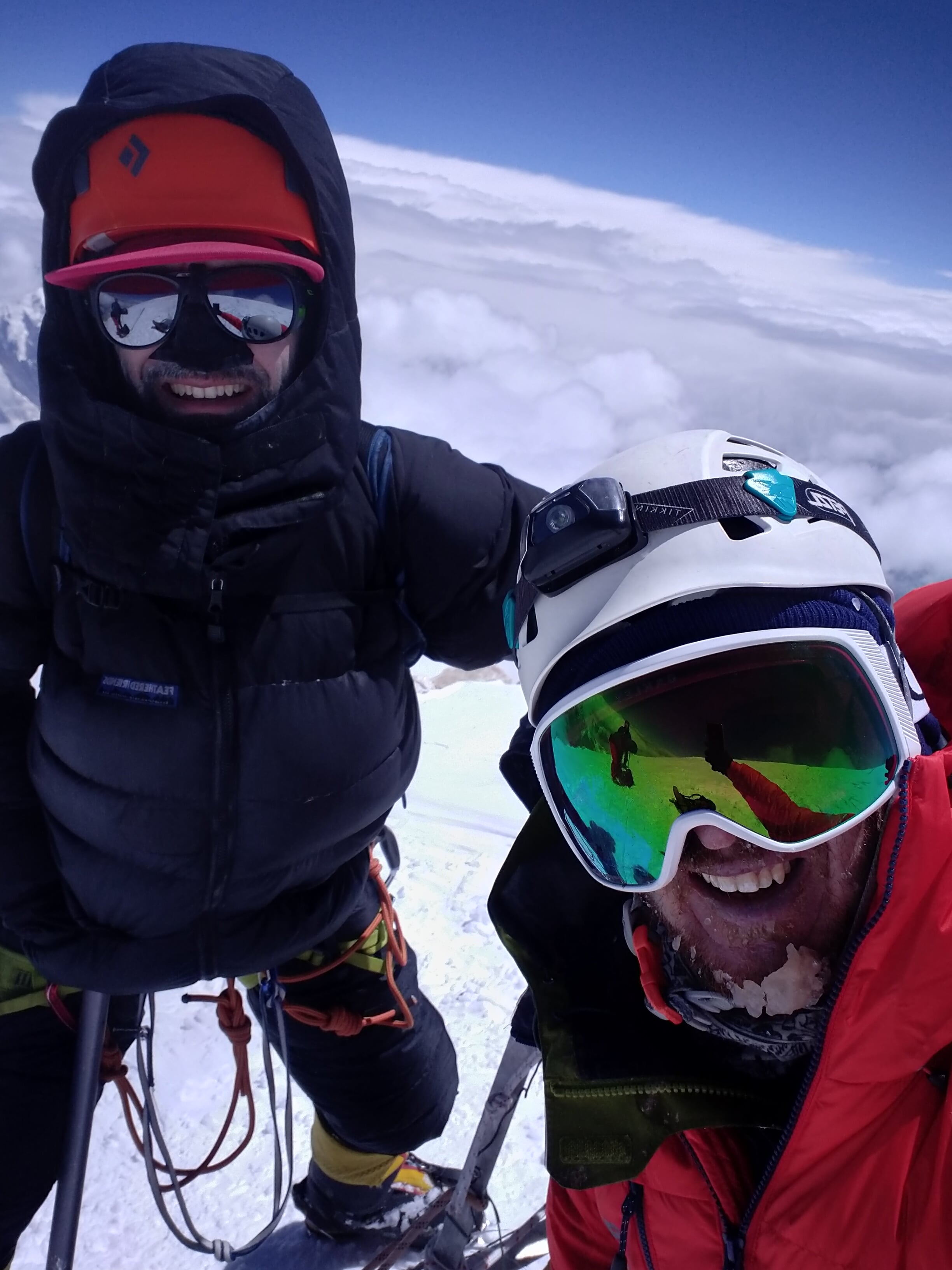
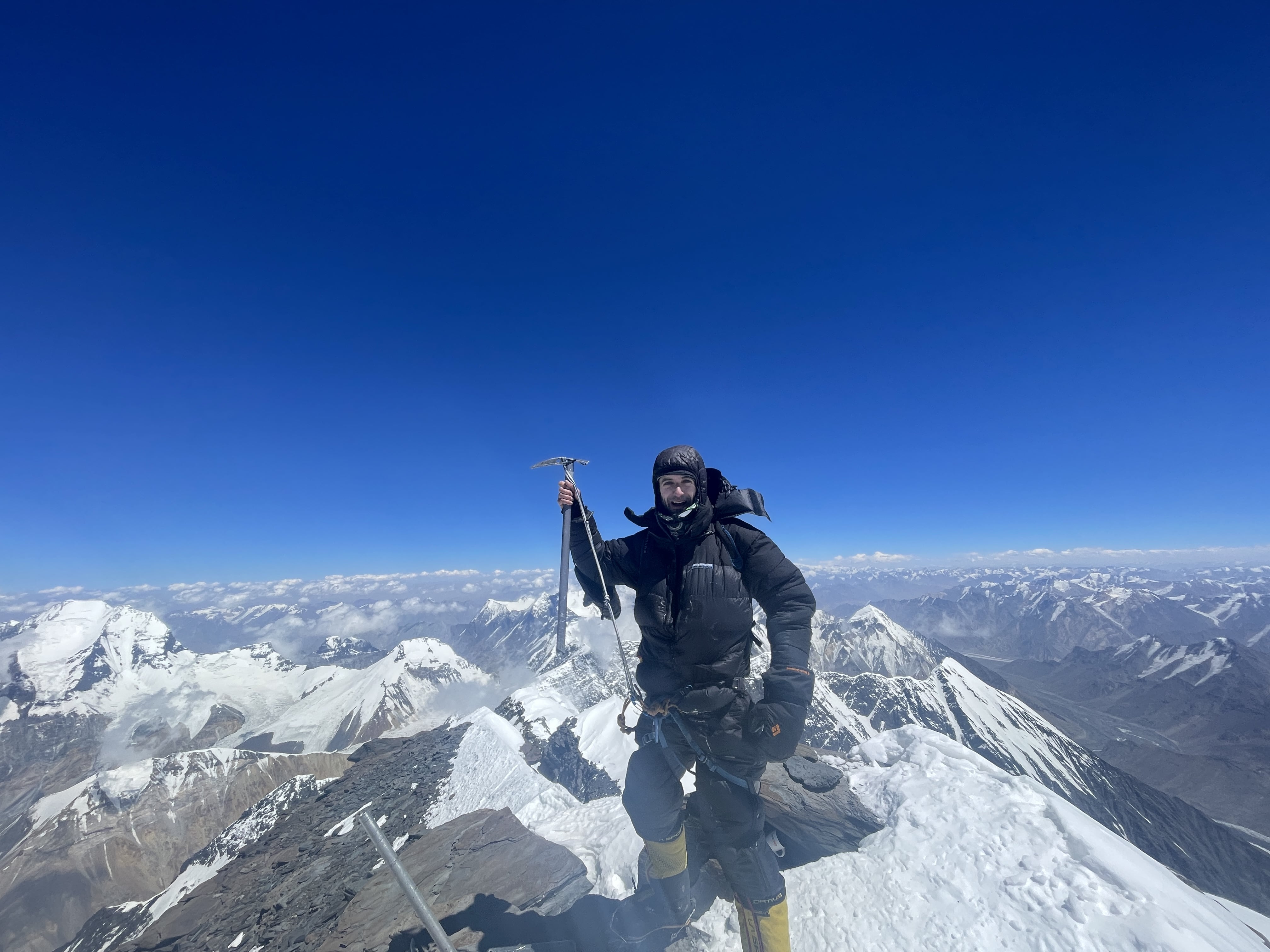
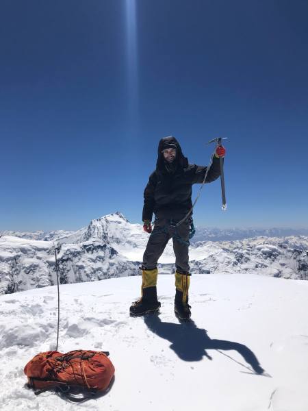
When I reached the top, I let out a shout of triumph. It had been a long push, in poor conditions, and I was delighted and relieved to have made it. Each meter was fought for and hard earned. The summit day was physically and mentally difficult. A lot of this can be attributed to the impact of weather conditions, especially wind. The summit plateau was excruciatingly cold, due to intense and sustained winds. I was only able to stay for a few minutes and hastily take photographs of Pik Pobeda, Khan Tengri’s summit cross, and the surrounding terrain. A friendly Ukrainian climber who was already on the summit when I arrived generously removed his gloves in order to take my photo for me. I climbed the final ~10m up the ice cap, to the true high point of the mountain, the controversial final meters which designate Khan Tengri as a 7000m peak. James arrived as I was headed down, and we quickly took a selfie together.
The descent to our high camp tent felt endless; rappel after rappel after rappel, mostly on iced and knotted fixed lines. I made a concerted effort to remain focused and intentional in my actions, double check my systems, lock my carabiners, and generally be as careful as possible. I was fatigued, mentally and physically, and knew that mistakes would come easily should I allow them.
Back at the tent, I clocked my round-trip time at 13:05, not very fast at all. I believe that inclement weather slowed me down significantly. I also lost between 30-60 minutes due to the small bottleneck at the couloir traverse fixed lines. I also could definitely have trained with better specificity; my calves persistently felt like an athletic bottleneck on Khan Tengri. I was not fully prepared for the amount of front-pointing and sustained steep terrain, and had been especially worn down by the struggle of managing my enormous backpack during the steep load carries.
7.29
10:55 am depart Camp 3. 1.5 hour rest in Camp 1. 18:00 pm arrive Crampon Point. ~3 hour rest at Crampon Point. 21:50 pm arrive BC.
James, Lucas and I slept in, and took our time eating breakfast, drinking coffee, and packing up. A massive avalanche woke Lucas and I in the early morning – it swept the southern route below Camp 3. A serac collapse off of Pik Chapaev had triggered the slide, a common occurrence given Chapaev’s topography above the southern route’s approach gulley. Lucas and I turned our radio on to listen for any distress calls from the south: nothing. On return to basecamp we would learn that one man had died in this avalanche, and that two others had been seriously injured.
The climb from Camp 3 back up Chapaev’s shoulder was slow and annoying – yet more jugging on the jumar. Happily this ~250m climb would be the final use of my ascender on the route.
Endless rappelling on the way down. Chapaev’s shoulder is around 6100m high, and the base of the route sits at roughly 4000m. Accounting for some sections of smoother terrain and short sections of walking, I figure that I easily rappelled 1800m in total. Many fixed ropes were icy, pulled too tight by snowfall or glacial shift, or were knotted in awkward places mid-rap. Diagonal rappels and raps on loose scree or deep snow began to add their toll both physically and mentally.
In Camp 1 we stopped to pack our tents and spare supplies, and take a much needed break from rappelling. We stopped again for several hours to regroup as a trio at Crampon Point, drying our boots and socks in the sun and gazing at Khan Tengri’s splendor.
We were all exhausted, and the final easy dry glacier crossing to basecamp felt like a bit of a death march. On return to basecamp – manna from heaven! A hot meal, a cold Coca Cola, and the Sauna facility were all ready and waiting for us! Never before have I slept so well after drinking a full liter of cola.
7.30
Rest day in Basecamp. I felt quite alright this day, not particularly worn down, albeit with a very healthy appetite. The weather began to deteriorate, and we were grateful that we had summited when we did.
7.31
Helicopter scheduled for today, but cancelled due to foul weather. High wind and steady rain all day long.
8.1
Helicopter at 11 am back to Karkara camp. Long drive back to Bishkek, total time of ~6.5 hours with minimal gas station stops.
Images
James and I on the summitDeparture helicopterNorth Inylchek basecampIce bath in basecampApproach to crampon pointAscending Chapaev Shoulder, from C3The summit ridgeJames, reaching the summitPik Pobeda, from Khan Tengri summitKhan Tengri’s summit crossSummit daySummit dayPik PobedaSummit daySummit dayPik PobedaPik PobedaPik PobedaCamp 3, Coca Cola in handSummit ridge from Chapaev ShoulderSummit ridge from Chapaev ShoulderApproaching Camp 3Approaching Camp 3Khan Tengri at sunsetAbove Camp 1Above Camp 1Above Camp 1Khan Tengri at sunsetClouds over Khan TengriThe Tian ShanThe Tian ShanThe Helicopter
Thoughts on Khan Tengri
Khan Tengri via North Inylchek was a difficult climb. The terrain and demands of the ascent, even with fixed lines in place, represent a totally different scope of ascent than Pik Lenin or Pik Korzhenevskaya, the other two ‘lower’ 7000m snow leopard peaks. Weather was challenging, and extremely cold on summit day. Load carries on relentlessly steep terrain posed a real challenge, and are something which I will endeavor to train for with better specificity in the future. I was delighted to summit Khan Tengri in an independent style, and in good time due to pre-acclimation. Pik Lenin had been a total wash, a boring grind of a climb with days upon days spent waiting out foul weather, and having that ascent pay off with success on Khan Tengri was a joy. North Inylchek is a spartan base camp, but food was both sufficient and good, the sauna was delightful, and the staff were highly capable. Ak Sai runs a solid operation, and I have been very impressed by their basecamps on Moskvina, Pik Lenin, and the Inylchek glacier. Ak Sai’s pricing is of quite good value, in my opinion, if just paying for basecamp.
Khan Tengri is one of the most beautiful mountains I have ever climbed, or even seen! This is a special peak, one of the world’s most remarkable, unique in its character. The marble cap of the upper mountain is unlike anything I have ever seen elsewhere – I’d love to hear a geologist go into greater depth as to its formation and nature. Witnessing the blood red glow of Khan Tengri at sunset is indelible, a powerful mountain experience which will never leave me.
Editing this journal as I am, in late September of 2024, it is interesting to compare my physical state after Khan Tengri, with that of my condition after Manaslu – Khan Tengri was subjectively a ‘harder’ climb than Manaslu, yet Manaslu was much ‘harder’ on my body and mind. After Khan Tengri I felt pretty good, had an appetite and energy, had lost about 4kg of body mass, was able to rapidly begin regaining lost weight. After Manaslu I was physically ruined, suffered from short term cognitive fatigue or impairment, had no appetite for about a full day, and had lost about 7kg of body mass. My rock climbing performance took roughly three months, around 12 weeks, to fully recover from Manaslu. As I write, I subjectively feel that my rock climbing performance has taken only about 6-7 weeks to recover from Khan Tengri.
I am of the firm belief that the southern route to Khan Tengri’s west ridge (the northern and southern routes share the same summit ridge) is unacceptably hazardous, exposed to severe and unavoidable objective risk in the form of serac-induced avalanche off of Pik Chapaev. We saw or heard numerous slides on the southern side of the route, and multiple fatalities and grievous injuries occurred in 2024. I am compelled to put this to writing, phrased in strong language: If planning to climb Khan Tengri, you should prepare for and train for the northern route. Do not play dice with your life on the southern side of the mountain.
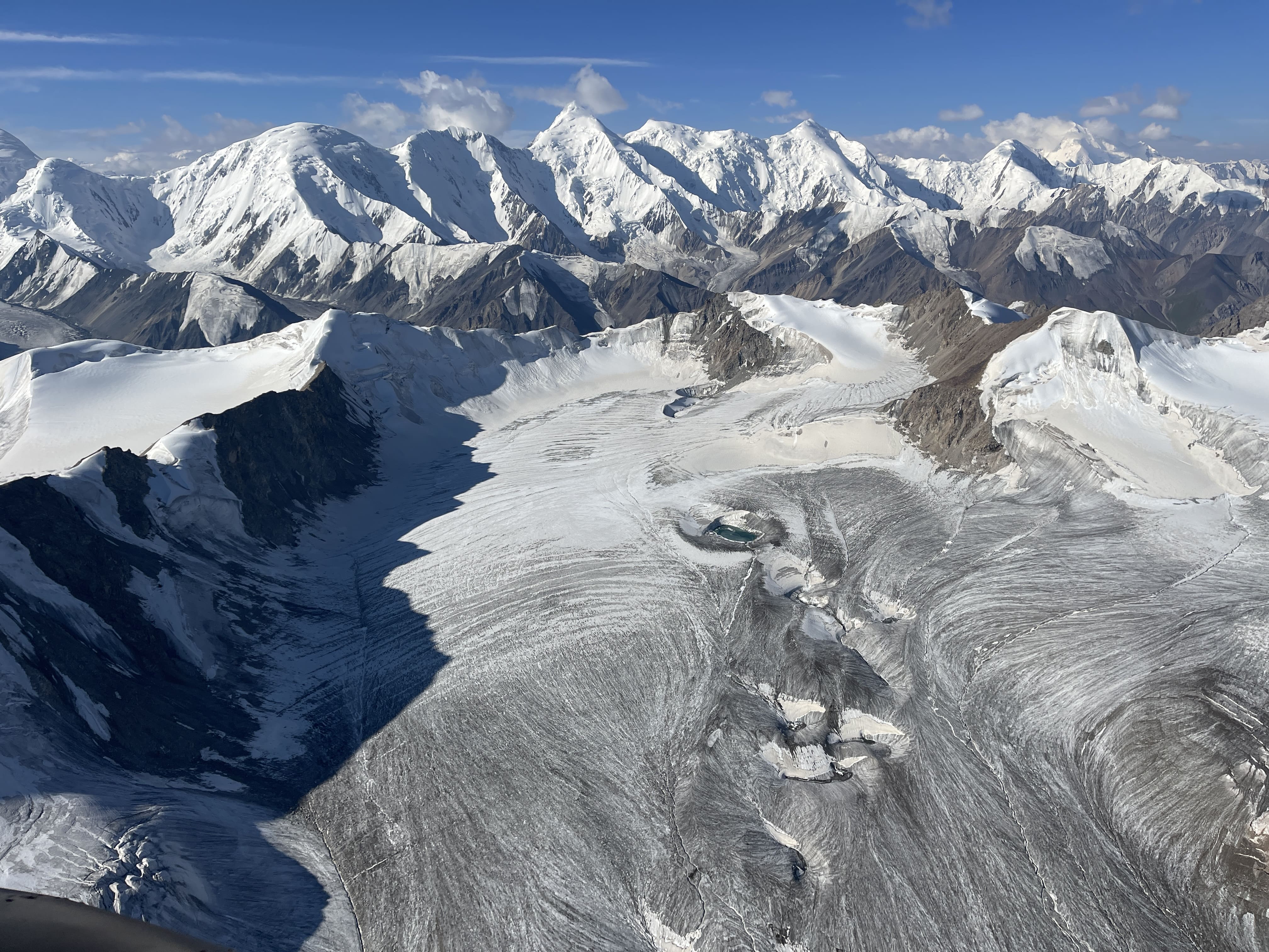
Pik Kommunizma, the Pamir Plateau, and the Borodkin Spur as seen from the summit of 7105m Pik Korzhenevskaya.Pik Kommunizma as seen from 6100m camp on Pik Korzhenevskaya.Pik Kommunizma as seen from near the summit of 6230m Pik Chetyreh.
The highest mountain of the Pamir range, the highest mountain of the former Soviet Union, the highpoint of modern day Tajikistan, the world’s 50th highest mountain, one of the five 7000m Snow Leopard peaks. 7495m Pik Kommunizma, renamed as Pik Ismoil Somoni by the Tajik state in 1998, is an absolutely enormous mountain which utterly dominates its surroundings. A primordial axe-head ridge of black rock, Kommunizma rises above the high Pamir Plateau, which is itself guarded on all sides by severe walls and high ridges of shining snow. Climbing Kommunizma by the normal route is akin to climbing three mountains; the ~6250m Borodkin Spur from ~4300m basecamp, 7007m Pik Dushanbe from the ~5850m Pamir Plateau, and finally Kommunizma itself. The normal route is long and circuitous, ‘uphill both ways’, exposed to inclement weather and to some degree of objective hazard.
I first set eyes on Pik Kommunizma in 2018 during an ascent of Pik Korzhenevskaya, a nearby 7105m mountain which shares basecamp. My timing and strategy were insufficient to make an attempt in 2018, but Kommunizma’s presence was nonetheless a constant. The distinctive summit ridge was always there, looming on the horizon, clearly visible from each of the lower peaks which I climbed on that expedition. In 2023 I found an opportunity to return for a proper attempt, and was ultimately successful in summiting.
Basecamp and Access
The vast majority of the time Pik Kommunizma is climbed from Moskvina Glades Basecamp, as the normal route and all of the mountain’s most well-known variations begin here. Moskvina is a decades-old location which has seen use, in various incarnations, since Soviet times – although I did learn during this particular visit that the original basecamp which was employed in the earliest years of the area’s climbing is located significantly lower down the valley than present day. Moskvina is a rare oasis of greenery in a high altitude desert; there is a small lake (albeit polluted with rusted oil drums, amongst other ancient detritus), enough grass grows to attract herds of mountain goats, and several streams flow in from various glaciers.
Moskvina has been dramatically upgraded and improved since my 2018 expedition to Pik Korzhenevskaya. It is now one of the better basecamps that I have had the pleasure of staying in. The ‘old Moskvina’ of 2018 was an absolute dump, rife with food insecurity, stomach issues likely stemming from bad water, poor sanitation, leaky tents, and generally miserable facilities. The ‘Moskvina of today’ offers 24/7 hot water, a free hot shower at any time of day one pleases, an indoors hand-washing station with abundant hand soap, clean cooking and eating facilities, an excellent revamped Russian sauna, water sourced from glacial runoff well above living quarters, and solid operations management facilitated by Ak-Sai – an operator of good reputation and considerable renown on the Snow Leopard peaks. The staff at Moskvina this year were competent, friendly, and accommodating throughout my one month stay – especially the kitchen staff and the head basecamp manager. The situation at Moskvina has been massively improved and modernized, and I would be very surprised if there isn’t eventually an attendant rise in climber interest with the area as a result.
The basecamp package cost me $3,300 $USD, inclusive of a shared tent, three meals per day for 30 days (I ended up staying in basecamp between 7.29 and 8.25), all permits, use of facilities, a hotel stay on either end of the trip, airport transfers, and helicopter rides both in and out. The only area for improvement which I could really pin down as significant, would be the rather limited stock of for-purchase goods such as beer and soft drinks; everything was sold out within a week of helicopter restocking. The pay-per-use satellite internet connection was somewhat dodgy, but good enough for basic usage and always fairly refunded when non-functional – certainly much better than nothing.
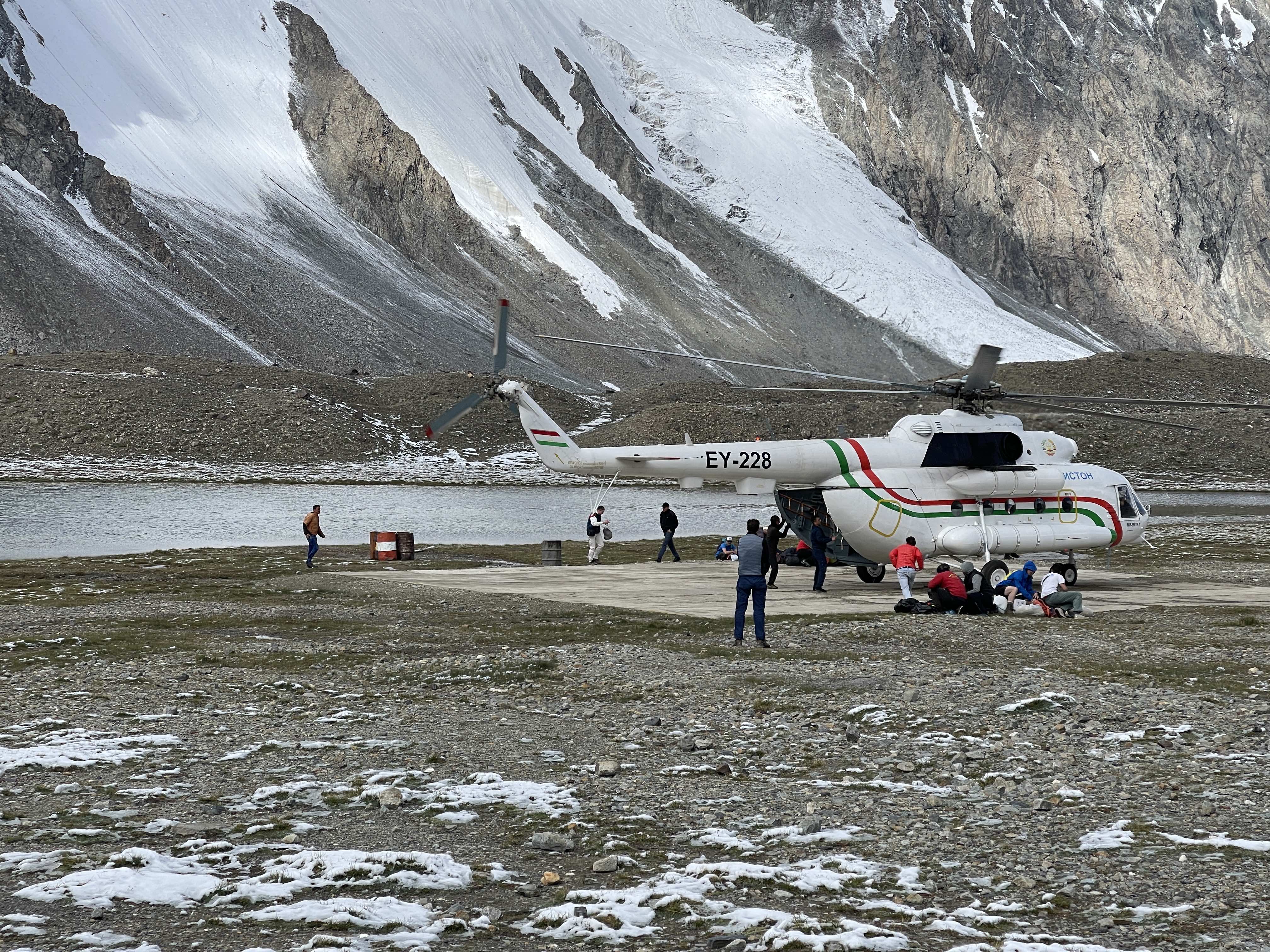
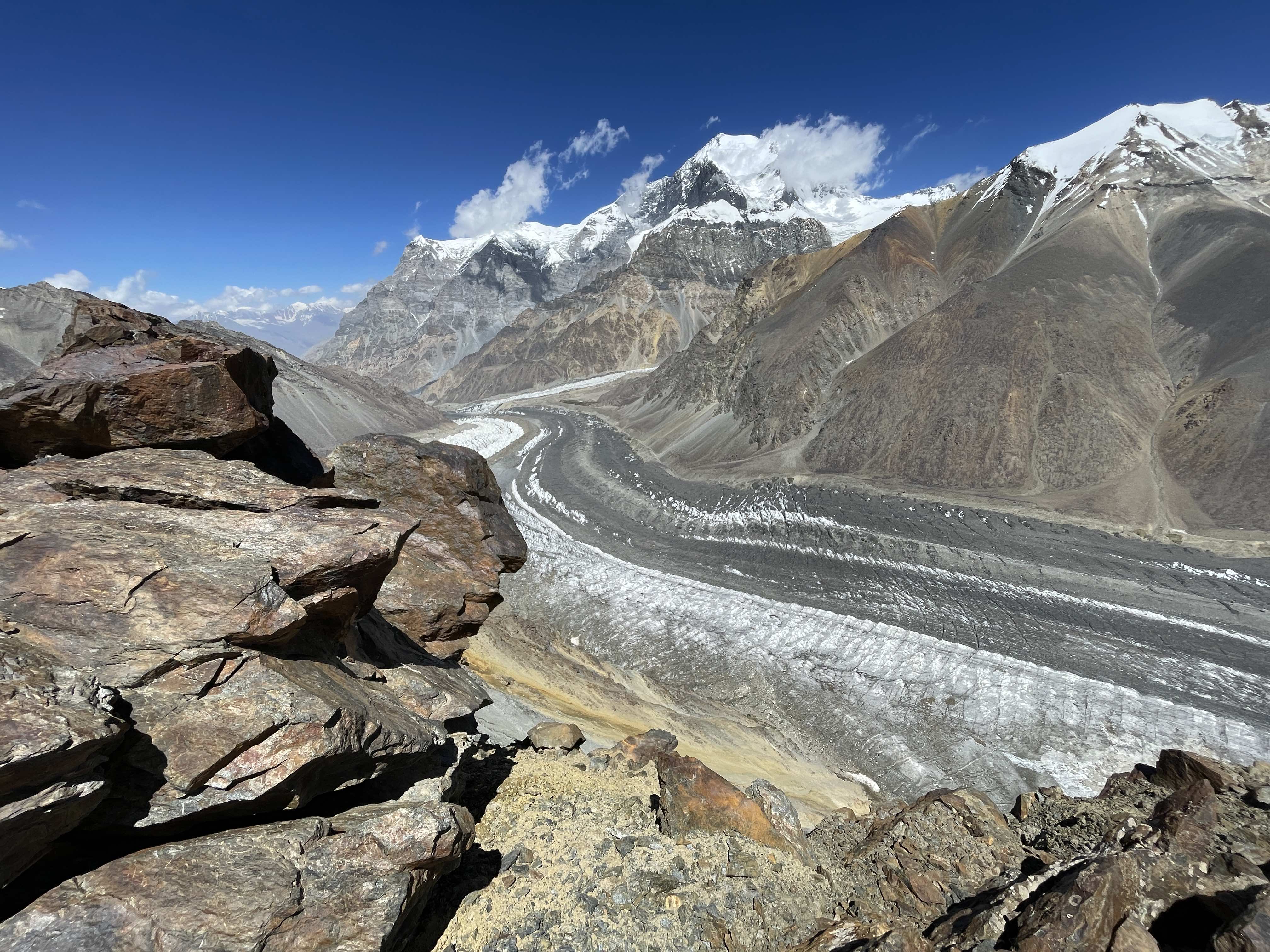
Moskvina is traditionally accessed by helicopter, although the lengthy approach trek is definitely possible and seems to attract interest from a few brave souls every season. In 2023 most helicopters flew from Djirgital, a small town an 8 hour drive from Dushanbe on very rough mountain roads. A few flights did run directly from Dushanbe, specifically the first flight in and the last flight out; the helicopter was provided by a Tajik airline this year, and we infer that it is parked and maintained at the Dushanbe airport. The helicoper flight takes about 40 minutes from Djirgital, and is incredibly scenic, offering magnificent views of the Pamirs and tantalizing first glimpses of Pik Korzhenevskaya and Pik Kommunizma. Helicopter flights were managed externally, but booked alongside the basecamp package; there’s no independent booking, and the helicopter is specifically offered as a part of the logistics operation for climbers.
Russian saunaThe new MoskvinaHelicopter landing
Route Description
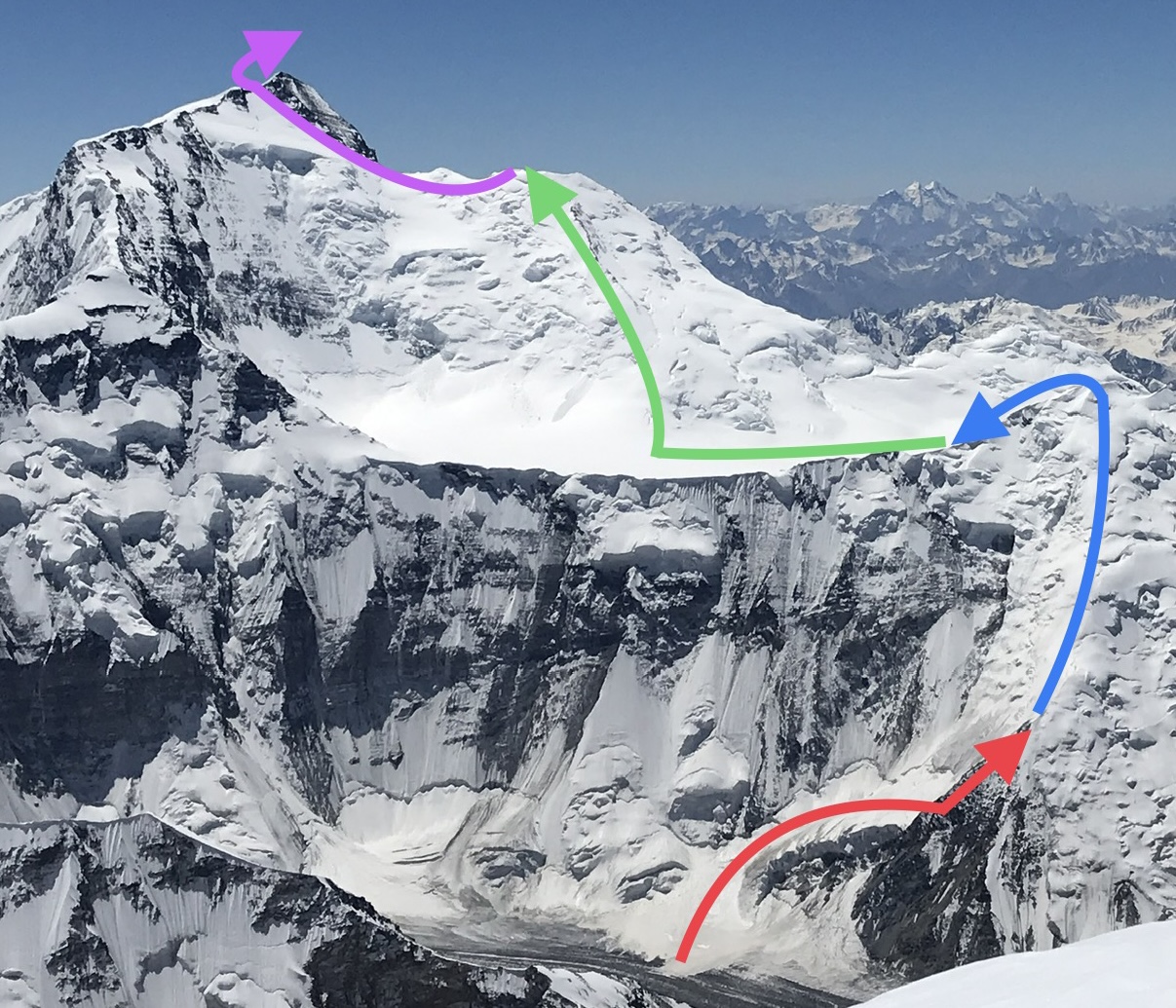
Ramp to ~5200m Rock Camp: Red ~5200m Rock Camp to ~5850m Pamir Plateau: Blue ~5850m Pamir Plateau to ~6950m Pik Dushanbe: Green ~6950m Pik Dushanbe to Summit: Purple
~4300m Moskvina Basecamp to Ramp
A moderate moraine hike with several variations through the rocks and lower glacier, with one small river crossing. Quite well cairned throughout, straightforward directly up the valley. A wide, open space below the ramp presents a good cache spot, and has a simple helicopter pad marked out with white rocks.
Ramp to ~5200m Rock Camp on the Borodkin Spur
Ascending the RampViews of Korzhenevskaya from the rock ridgeThe notchAscending the rock ridge
The infamous ramp remains objectively dangerous, exposed to avalanche from serac collapse, but is definitely less risky than in years prior. Conditions were very dry throughout my time in Moskvina this season, and the ramp area was no exception. Most of the giant, hanging seracs seemed to be stable, and only one upper corner was responsible for the majority of releases. Several large slides did hit the route, but never when climbers were present. The largest slides seemed to be in evenings, perhaps due to freeze / thaw cycles. Moving briskly, exposure to the most dangerous sections of the ramp was limited to around 15 minutes on descent. The rockfall and collapsing lower glacier of Korzhenevskaya, found at around 5000m, felt significantly riskier than Kommunizma’s ramp did.
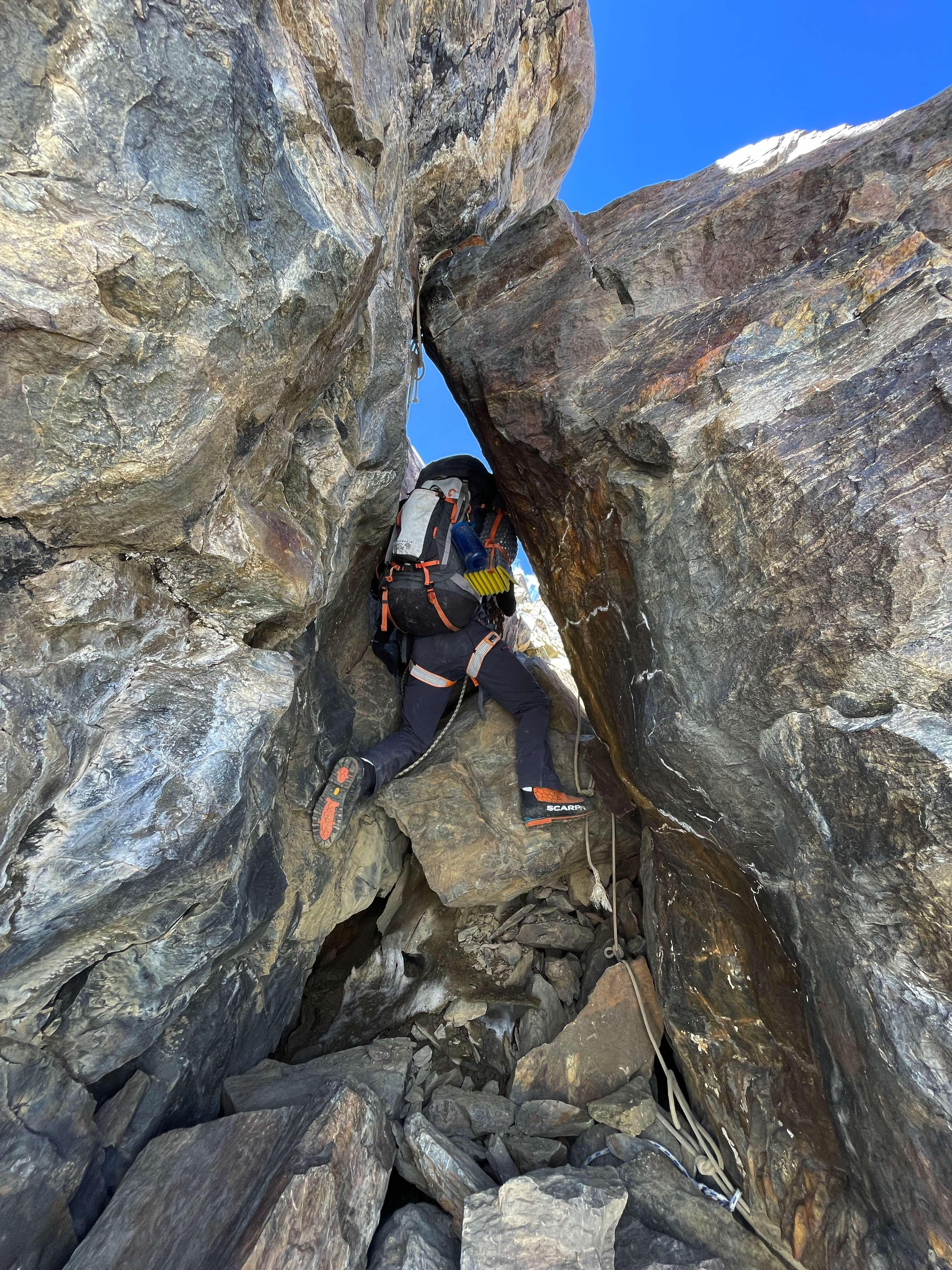
After gaining a few hundred meters up the gently sloped snow ramp, an obvious rock ridge littered with old fixed lines starts up the Borodkin Spur. The rock is pitted and scratched from many decades worth of cramponing; I took my crampons off and was able to actually enjoy the terrain. This was the most interesting part of the entire route, and there is even a cool notch / tunnel which one must climb through. Despite a fair bit of choss the rock ridge mostly offered great scrambling, with exposure and excellent views over the lower glacier. The Rock Camp is found at the top of the ridge between 5100m and 5200m, and has about a dozen good pre-built tent platforms, solid relics from expeditions past.
~5200m Rock Camp to ~5850 Pamir Plateau
The Pamir Plateau, from the Borodkin Spur.Looking back at the Borodkin Spur.Camping on the PlateauCamping on the Plateau
The Borodkin Spur continues on snow past the Rock Camp, up to around ~6250m. Numerous small campsites can be found along the way, mostly underneath cornice formations, but nothing is particularly large and it would be difficult to place more than a few tents. During my ascent I camped the first night at ~5350m, on a level snow shoulder speckled with hairline crevasses. There are several significantly steep sections of climbing, all of which had been fixed by guided parties earlier in the season. Two cornice steps offered difficulty, even fixed, due to slight overhang and exposed ice. On descent several of the fixed ropes had melted out v-thread anchors, and on the way up one section of fixed line was no longer anchored safely. Caution with anchors placed by others, and a spare screw or two, is essential.
The Borodkin Spur is long and really drags on; cresting the top and getting a first view of the Pamir Plateau below is truly wonderful. The descent from ~6250m down to the Pamir Plateau at ~5850m is mostly quite moderate but did exhibit one significant section of steep and exposed water ice, which we fixed one of our ropes on. Ascending from the plateau some 400m back up the Borodkin Spur after summiting was arduous, and seemingly endless when fatigued.
It is worth nothing that the Moskvina side of the Borodkin was crevassed, with most frozen over or filled but nonetheless present. In the dry conditions which we enjoyed everything was nicely visible, and hazards were very easy to avoid. In deeper snow, or with no boot track, it would be well-advised to consider roping up.
~5850m Pamir Plateau to ~6950m Pik Dushanbe Camp
Ascending Pik DushanbeSummit Pyramid from Pik Dushanbe
The Pamir Plateau is enormous and mostly flat; one can camp essentially anywhere. Crossing the plateau isn’t hard at all, and snow conditions were excellent for us. There were no significant crevasses along our line of crossing, nor any nearby it. I can envision significant difficulty if met with deep snow on the plateau, but this would also implicate the entire route, especially the Borodkin Spur.
The ascent of Pik Dushanbe is long and repetitive, a moderate snow slope the entire way. There were no particularly steep sections, and limited terrain variation. A few crevasses lurk along the line of ascent, but were mostly straightforward to see and avoid. A highly visible rocky ridge characterizes the upper half of the slope, and provides a good landmark for navigation. On descent, in whiteout, this rock band easily kept us on route and making good progress. The campsite at ~6950m is located in a nicely sheltered col near the top of Pik Dushanbe, with flat space for quite a few tents. Several much smaller tent platforms exist in the rocks along the ridgeline, with space for one or two tents every two hundred meters or so. Views of Kommunizma’s summit pyramid are grand and imposing from the 6950m camp; the rock wall hangs ominously over Pik Dushanbe and appears much larger close up than from afar.
~6950m Pik Dushanbe Camp to 7495m Summit
Crossing to Summit PyramidAscending the snow slopeUpper summit ridge
A short descent of some ~100m from camp leads to a rolling ridgeline towards the base of Kommunizma’s summit pyramid. There is a fair bit of ascent / descent throughout this section, more than one would expect when viewing the mountain from a distance, which becomes quite demoralizing when on the way back into camp after summiting. In particular, the final slope back up to 6950m camp is heartbreaking to climb after the summit. The ridge soon reaches the base of the summit pyramid, where a massive snow slope accesses the upper summit ridge. There was a decently switchbacked boot track on our summit day, but no ropes had been fixed by earlier teams. Sections of the face are quite steep, and there were patches of icy terrain where fixed lines or running protection would have been very welcome. A bad fall anywhere on the face would be difficult to arrest, and the subsequent runout is enormous.
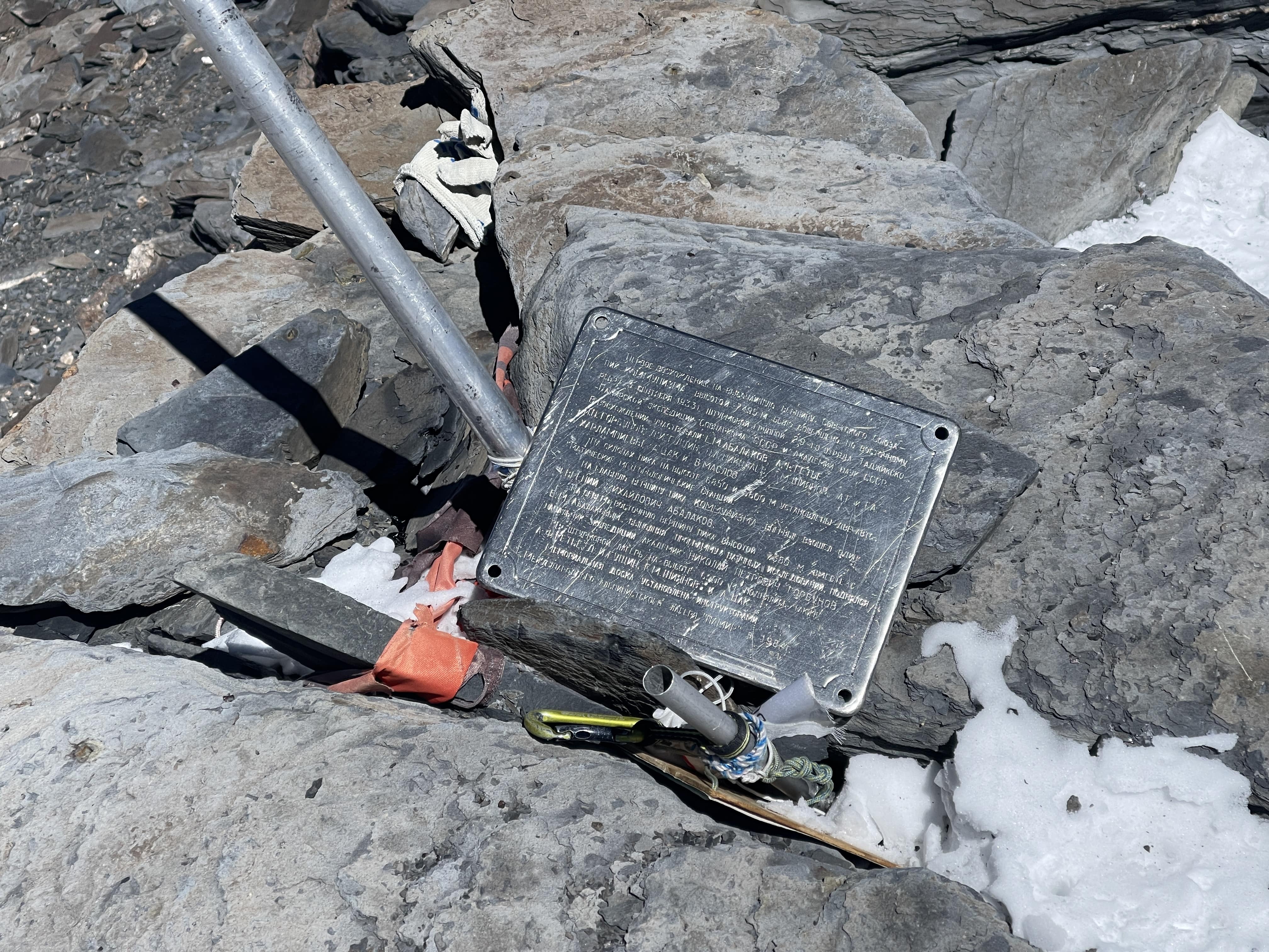
On reaching the upper ridge of the summit pyramid the gradient steepens significantly, and the ridge drops off in a severe cliff. The degree of exposure is startling, as the mountain’s upper aspect provides no clue towards the summit ridge’s sharp edge when viewed from a distance. The sharp ridgeline ascends abruptly, with a slight rolling traverse as one reaches Kommunizma’s summit. A single fixed line was a welcome discovery here, protecting the steepest pitch of the exposed ridge. The summit is small, but flat and unambiguously the peak’s high point. A plaque and some broken poles marked the top, with Pik Korzhenevskaya prominently visible across the valley and the entirety of the Pamirs stretched out far below.
Trip Report and Schedule
I flew into Moskvina with friends Eric and Andreas, whom I had climbed with in 2019 on Noshaq in Afghanistan. Prior to Moskvina Glades, Eric, Andreas, and I pre-acclimated by hiking Bazarduzu in Azerbaijan, where I tagged 4100m. Torrential rain on the only day scheduled for the hike soaked me to the skin, and I turned around well short of the summit. Once in Moskvina I engaged in two subsequent acclimation intervals on Pik Chetyreh, to 5500m, and on Pik Korzhenevskaya, to 6300m. Icy conditions prevented our group from attempting a Chetyreh summit, and personally feeling bad on Korzhenevskaya I opted to stop at 6300m and spend a night at 6100m instead of pushing for the summit. I previously summited both Chetyreh and Korzhenevskaya in 2018.
On this trip Eric, Andreas, and I split the cost for the services of a private meteorologist, Chris Tomer, whose forecasting proved to be remarkably accurate and useful for strategizing. With a night at 6100m and a high point of 6300m under my belt, I rested for six consecutive days in 4300m Moskvina, waiting for a forecasted weather window with low wind. This acclimation schedule proved to be more than adequate acclimation for 7495m Pik Kommunizma, likely due to a significant base acclimation period and high quality rest spent at 4300m.
Following my six day ‘Russian rest’, I started up Kommunizma alongside Paul Schweizer, an experienced friend whom I knew previously from Pik Lenin in 2016, and from Pik Korzhenevskaya in 2018. On day two I convened with Reuben Kouidri, who alongside Eric and Andreas had opted to make a single lengthy push straight from basecamp, combining what I had split into my own day one and day two schedules. Reuben and I subsequently shared a tent and stove, and climbed as partners throughout the remainder of my Kommunizma ascent. We summited together on day four from Pik Dushanbe camp, and descended to the plateau in the same day.
Calendar
Acclimation Graph
Dark blue depicts sleeping elevation, light blue depicts climbing elevation.
Day-by-Day
Day One: August 13th ~4300m Moskvina Glades to ~5350m Snow Camp 8 Hours, +1050m
Having marinated in Basecamp for about a week, our small band of five unguided climbers – Andreas from Denmark, Eric from the USA, Reuben from the UK, Paul from Scotland, and myself from China/Canada – were all feeling antsy and eager to move. I had been resting very well since coming down from 6300m on Korzhenevskaya, supplementing my Basecamp diet with high-protein food from Dushanbe, maintaining finger strength with simple hangboarding (on my small, one-handed fingerboard) every other day, and doing some light bouldering on (surprisingly decent) nearby blocks when it was warm enough. Our professional weather forecast pointed to low winds and warmer air temperatures on August 16th, and it became increasingly apparent that this would be the best summit day over the coming weeks.
Andreas, Eric, and Reuben planned to wait as late as possible for a firm weather confirmation, and then pull a long first day climbing overnight from Basecamp all the way to the 5850m Pamir Plateau. I had done poorly with the subsequent recovery at altitude following a similarly lengthy 11.5 hour day while acclimating on Korzhenevskaya, and wasn’t keen on straining myself during an ‘approach day’. The long Korzhenevskaya push served as a reminder – after almost four years away from high altitudes – making me cognizant of the ethos which had always worked very well for me on previous climbs; slow and laid back days leading up to a strong summit attempt.
As luck would have it, my fourth friend Paul was both keen to aim for our August 16th summit day and similarly aligned with my aversion to a long first day’s climb. I had initially met Paul on Pik Lenin in 2016, where we climbed together through the lower icefall and to 6000m, and had run into him again at Moskvina in 2018, when I summited Pik Korzhenevskaya. Paul is something of a ‘quiet legend’, enormously experienced and accomplished in the mountains, yet humble and very reserved in downplaying his significant achievements. Paul and I didn’t plan to meet in Moskvina this year, but were happy to run into each other once again. We had always gotten on well, shared a similar enthusiasm, and had a mutual sense of trust in safety standards and competence. Paul had also been up part of the route already, had gas cached on the mountain, and knew conditions well – extremely fortuitous for me! The two of us agreed to climb together, up 1000m from basecamp, to camp at ~5350m on a snow shoulder near the middle of the Borodkin Rib where Paul’s cache was located.
Reuben and I collaborated to pair up after the first day, sharing a tent, stove, and gas supplies. I’d carry the tent up on day one, and Reuben would climb overnight with Eric and Andreas to ‘catch up’ with me, bringing stove and gas, on day two. Reuben and Eric would each carry a radio, for check-in with base camp. Paul graciously offered to share his stove and previously cached gas on day one, saving me significant weight. Paul and I made an early start, taking advantage of the excellent (eggs, and more food than normal!) ‘early alpine breakfast’ offered by the basecamp cook. We set off at a leisurely pace along a well-marked trail, through the moraine up the valley towards Kommunizma. Paul already knew the moraine well, which saved us some trouble in avoiding repeated descents and ascents.
The approach was uneventful, and happily the glacial ramp at the base of the Borodkin was likewise very straightforward and smooth. Two small avalanches did release above us, but were so far off that they didn’t hit, nor even spray, the route of ascent. The ramp is heavily crevassed, but everything was so dry and clearly visible that we didn’t see a need to rope up. The rock ridge past the ramp offered engaging climbing, and I enjoyed the scrambling far above massive glaciers, with awesome views and big exposure on both sides.
Past the rock ridge the snow slopes of Borodkin’s Rib begin at around 5200m, and a dodgy looking fixed rope greeted us, protecting an icy initial section of climbing. Under test strain most of the rope pulled free, some 50m of line. We gingerly ascended up the first section without weighting the remaining lines, rightly nervous of any anchor’s integrity. I finally got high enough to inspect the remaining intermediate anchor, a good v-thread, and confirm that it was safe for us to jumar the line. This process of testing, ripping out, and then inspecting the ropes wasted a fair bit of our time, but it was still only early afternoon and we had a comfortable buffer. We soon found ourselves at Paul’s cache on a flat, but exposed, snow shoulder at around 5350m.
Here we dug a little bit to flatten out tent platforms and then pitched our twin single-walled tents, hairline crevasses conveniently located right at the doorways. I gratefully accepted Paul’s gracious offer to melt snow on his stove and with his cached gas, and managed to eat a huge meal of freeze dried food, cheese, mixed nuts, and snack foods. We settled in for an early rest, and I slept remarkably well throughout the entire evening. The decision to take a slow first day had worked out for me, resulting in a very minor fatigue load, a healthy degree of food consumption, and an excellent night’s sleep at a relatively low elevation.
Day Two: August 14th ~5350m Snow Camp to ~6250m Borodkin Spur 8:30 a.m. – 14:00 p.m.: 5:30 Hours, +900m ~6250m Borodkin Spur to ~5850m Pamir Plateau 14:00 p.m. – 15:00 p.m.: 1 Hour, -400m
Paul and I took our time in the morning, given the relatively short ascent which awaited us. After a good breakfast, again with Paul generously sharing his stove and gas, we packed and were moving by 8:30 a.m. About an hour later we heard voices and saw figures below us; Andreas, Eric, and Reuben had caught up, climbing since around 2 a.m. All three seemed to be in good spirits, and indeed there was plenty to be happy about: a decent boot track continued the rest of the way up the Borodkin, with only a thin dusting of snow over top of it. As we ascended, a large group of Russian climbers descended past us. They were ‘tourists’, on an epic ‘mountain tour’ traverse expedition, and had hiked into Moskvina before summiting both Korzhenevskaya and Kommunizma. Their plan had been to complete a traverse of Kommunizma, descending to some distant village on the side opposite to Moskvina. They had summited Kommunizma some days prior, but one of their members had fallen on descent and been seriously injured; they were headed back to Moskvina for an evacuation. We wished them good luck.
Making steady progress upwards, I reached the top of the Borodkin, around 6250m, at 14:00. The upper Borodkin was viciously cold due to high winds, some of the worst we experienced throughout the five day climb, and it was a relief to find shelter on the far side where the descent begins. The first views of the Pamir Plateau from the top were breathtaking; the plateau is much larger and more impressive than the mountain’s profile would suggest from a distance. The plateau not only stretches out between Borodkin’s Rib and the base of Pik Dushanbe but is also remarkably wide, and falls off starkly to the Moskvina side where it is guarded by severe walls of rock and ice. Pik Dushanbe and Kommunizma preside grandly above the plateau; cresting the Borodkin is akin to having summited a 6000m peak and discovering the lofty base of yet higher mountains behind it.
Descending 400m down the plateau-side of the Borodkin was mostly quite moderately sloped and took one hour, slowed somewhat due to a large patch of exposed water ice which we opted to fix one of our ropes on. Eric proficiently placed two screws, and a treacherous traverse with bad runout became an easy diagonal rappel. On the plateau ahead of us we met Russian guide Pavel and his client Olga, who gave us good advice on the flattest section to set camp. We got our tents up, collected excellent slabs of compact snow for cooking, and settled in for the night.
Day Three: August 15th ~5850m Pamir Plateau to ~6950m Pik Dushanbe 9:50 a.m. – 17:20 p.m.: 7:30 Hours, +1100m
Our group opted for a late start, anticipating a rapid ascent up Pik Dushanbe. We broke camp and were moving by 9:50 a.m. Eric and I opted to rope up and go first on the first section off of the plateau, as visually there seemed to be potential for hidden crevasses. After some 300m of elevation gain it became clear that snow conditions were excellently crisp, everything dry enough for good visibility of any hazards, so we unroped and continued separately.
Ascending Pik Dushanbe was a real slog. The terrain drags on and on with minimal variance in slope or character, an enormous moderate snow slope the entire way, 1100m up. Around halfway up there is a prominent rock band which serves as a clear landmark, with a few small camping platforms dotting the rocks every few hundred meters.
At 16:30 p.m. and around 6700m, Andreas, Reuben and I stopped for a short rest at one such site and briefly discussed the possibility of pitching camp below the 6950m high camp. Eric was already well ahead of us by the time we had stopped, and was out of shouting distance; we couldn’t make out if there were larger sites higher up or not. Andreas committed to high camp, while Reuben and I briefly ran through the pros and cons of stopping where we were. We quickly decided that given we had already somewhat underestimated the timing of our ascent up Pik Dushanbe, we would do poorly to similarly underestimate the summit day by starting too low.
Less than an hour later, at 17:20, Reuben and I reached the 6950m camp. It had been a long day, and a few hours slower than anticipated. In hindsight we probably could have climbed faster or started earlier in the day, but despite it being late the weather was very cooperative; almost no wind. Andreas and Eric had their tent up and were preparing for the night, so Reuben and I likewise focused on getting everything unpacked and organized. Three Russians we had met a week earlier in basecamp – Constantine, Dima, and their guide – were also in their tent, having summited that morning. They had spent several days waiting out bad winds in high camp, but gave us encouraging information on the good condition of the route.
Reuben wasn’t feeling well at all, and complained of blurry vision and stomach issues – he had significant trouble eating, and vomited up most of his food. To make matters worse, when helping him dump a bag of chocolate mousse I accidentally managed to spill most of it onto his outer boot shells!
In the tent, small tasks at this high elevation felt slow and difficult, and I was generally uncoordinated – as evidenced by the chocolate spill. Yet in spite of this I generally felt pretty decent, and was able to eat a fair amount of my cheese, sausage, and snack foods for dinner. I boiled water nonstop, right until sunset, and contentedly drank over a liter of tea, plus a big bowl of sugary hot chocolate mixed with whey protein. Paul arrived late, right at sunset, and I greeted him with a half litre of hot water. We went to sleep early, planning for a 5 a.m. start, and I slept quite well given the elevation.
I woke up at 4 a.m. and began preparing for a 5 a.m. start to our summit attempt. In lieu of cooked food I ate a bowl of dry muesli, some energy gels, and a large hunk of Tajik cheddar cheese. The stove fired up, but the first of what would soon become many problems reared its head when it became apparent that our gas canister had frozen overnight, despite our storing it inside of the tent. With the gas flowing at a pathetic dribble, just barely hissing into the burner, melting snow was taking an inordinate amount of time. A second problem; Reuben’s only Nalgene water bottle cracked when we filled it, spilling water and rending it useless for a summit bid. The third issue; Reuben’s boot lace snapped, likely due to the mousse that I had spilled on the boots the day prior freezing solid overnight. Fourth; I managed to capsize a full litre of melted water, wasting it, after waiting over an hour to prep it. Fateful bad luck and the consequences of minor carelessness were conspiring against us.
Andreas and Eric managed to depart on time, at 5 a.m., and Paul shared some water before heading out shortly after them. While the various mistakes and setbacks which Reuben and I experienced read as trivial in writing, they posed rather significant challenges at 7000m. We moved slowly, with diminished cognitive alacrity. We swapped an empty soda bottle for the busted Nalgene, carefully tied the boot lace back together, slowly warmed our gas can, and borrowed Andreas’ stove from his tent (we had cached about 1 kg of spare gas on the plateau, and an abundant supply at Pik Dushanbe Camp) so as to run two burners simultaneously. Reuben and I, in reflection well after the fact and in a nice restaurant at sea level, both agreed that we handled these setbacks well; we cooperated, communicated, stayed as focused as we could, and eventually sorted everything out.
Nonetheless, we departed almost two hours later than intended, at 6:45 a.m. This could have been catastrophic for us, but we managed to maintain a healthy pace and make up for lost time. We descended from Pik Dushanbe quickly, following Eric, Andreas, and Paul’s boot tracks across the ridge line. This initial ridge section involved more descent than I had expected, but eventually terminated at a small rock band, the base of Kommunizma’s upper face and summit pyramid.
The upper face presented an endless slog, but happily, mostly on visible boot track. Constantine’s tracks from the morning prior were still in place, and Eric, Andreas, and Paul had further beaten them in. Time dripped and crawled during the climb up the face, my complete focus dialed into each step’s crampon and axe placement. The terrain was fairly steep, with some small sections of water ice, and a fall would have been difficult to arrest well. Ahead, I saw Andreas and Eric traverse left off of the switchbacks that Reuben, Paul, and I were ascending; a voice came over Reuben’s radio, Zaravko the basecamp manager, watching through a telescope and telling us to continue climbing directly. I passed Paul, we wished each other luck, and I continued after Reuben up the switchbacks. Andreas and Eric came into visibility on the ridge above us, moving fast towards the summit. Carefully passing a final 5m section of sketchy water ice, I eventually reached the summit ridge at the rightmost snow notch.
The exposure was incredible, with the face dropping off abruptly and a sharp ridge line extending up to the right. The Pamirs spread out below under a deep blue sky, dozens of 5000m and 6000m peaks, stark contrast between black rock and white snow. Behind us Korzhenevskaya presided with particular prominence, standing alone over the lower glaciers, its long summit ridge and route of ascent perfectly framed against the sky. Reuben was just slightly ahead of me, as the two of us began up the ridge towards the highpoint.
Andreas and Eric met us halfway up the ridge and offered encouragement, telling us that we were almost there. I congratulated them; they had both completed the five Snow Leopard peaks with their ascent of Kommunizma, and just had to descend safely. Fifteen minutes later Reuben and I were both at the summit, a small, flat, unambiguous high point marked with a plaque and some debris. We hugged, shook hands, and started quickly taking photographs. It had taken us almost exactly five hours to summit from Pik Dushanbe, a superb outcome in light of our haphazard start in the morning. The wind was sharp and biting at the top, so we quickly began to descend. We met Paul at the notch, exchanged greetings, and started down the face.
The descent required total concentration. The face is fairly steep, and sections of ice were tricky to navigate with only a trekking pole and a long axe. The ridge back to the base of Pik Dushanbe was miserable, each uphill section taxing my resolve. Pik Dushanbe itself was a hideous slog, and felt like significantly more elevation than it had on the way down. When I finally reached camp Eric and Andreas greeted me with a half litre of hot water. I told them I’d wait for Reuben, and we agreed to meet down in the plateau camp, using our satphones to coordinate if anything happened. Camp was sunny and sheltered from the wind, so as Andreas and Eric finished packing and departed I lay down in the tent to take a nap. Reuben arrived about an hour later, feeling exhausted; we agreed to sleep for one hour and then descend.
My alarm clock woke us up on time, and we began packing up. The weather shifted, and thick cloud socked us in with low visibility. Without wands marking the top of the route up Pik Dushanbe, we wouldn’t even have been able to make out the correct direction of descent. Paul arrived right as we finished packing, and told us that he intended to spend the night at Pik Dushanbe camp and descend in the morning. I asked Paul “Would you go down in this weather?”, to which he replied “No. But, you’ll make it”. Filled with renewed confidence and resolve, Reuben and I hoisted our packs and headed into the swirling mist.
The hike down took forever, the two of us fatigued and struggling somewhat through a few inches of freshly fallen snow. Between whiteout and snowfall, our old boot tracks were almost impossible to make out, but the rocky ridge served as a landmark and compass, keeping us on track along the ridge proper. After a few hours we broke below the clouds and could see the plateau laid out below us, under the glow of a glorious sunset. Andreas and Eric’s tent was clearly visible in the distance, below the Borodkin, but we both felt too worn down to cross the plateau and join them. Reuben glissaded the final few hundred meters of descent, and we pitched our little single-walled tent on the first flat stretch of snow we came across. We felt much better having descended some 1100m, and despite the whiteout hiking down had been the correct decision. We boiled water, ate some light food, and fell asleep.
Day Five: August 17th ~5850m Pamir Plateau to ~4300m Moskvina Glades 10:50 a.m. – 18:30 p.m.: 7:40 Hours, +400m / -1950m
Reuben and I slept in late, and awoke to hot sun and high wind on the plateau. We really dragged our feet, and took our time getting ready. We met Tomas and Martin, two strong Czech brothers who had skied Pik Chetyreh and Pik Korzhenevskaya in the weeks prior, as they crossed the plateau towards Pik Dushanbe. They would go on to summit Kommunizma and ski most of the descent. Reascending the plateau-side of Borodkin’s Spur was awful, our pace miserably slow. Our fixed rope was still in place on the iced-over section, and we stopped to recover my two ice screws, re-anchoring the top of the rope on a v-thread. This would later prove to be a mistake, as a day later Paul would find the rope unusable, the lower section inaccessible.
Cresting the Borodkin, our pace rapidly accelerated once on downhill terrain. We quickly found ourselves at the top of the ramp, fresh with avalanche debris, and we hustled across so as to minimize exposure. At the helipad we changed into approach shoes, an enormous relief for feet accustomed to stiff mountaineering boots. The trek back to basecamp was sloppy, our wobbly legs uncooperative on loose scree, and we both lost our footing more than once. Basecamp eventually came into view, and before we knew it we were crossing grass. Eric and Andreas greeted us, offering congratulations and sharing handshakes. After dropping my bag I immediately cracked the celebratory 1.25L bottle of Coca Cola I’d purchased ahead of time, and headed inside the kitchen hall to try and scrounge up some fresh food.
The climb was truly over, we’d made it safely back. Paul would join us in Moskvina two days later; all five of us succeeded. Eric and Andreas departed a few days later, hitching a ride on the Russian ‘tourist’ evacuation helicopter. They subsequently ascended the Uzbekistan and Turkmenistan highpoints, surveying and establishing a new Uzbek highpoint in the process, and also completing the highpoints of every one of the ‘stan countries. Reuben and I would wait 9 days for the scheduled helicopter to take us back to Djirgital, and then spend an entire day driving back to Dushanbe. The wait, while boring, served the purpose of solidifying and preserving my acclimation for subsequent mountain goals in September.
Images
Loading the truck in DjirgitalLoading the truck in DjirgitalHelicopter in DjirgitalHelicopter in MoskvinaSunrise, 5100mKommunizma from KorzhenevskayaKommunizma from KorzhenevskayaMountain goats, MoskvinaCrossing the RampRock Ridge, BorodkinKorzhenevskaya from BorodkinRock Ridge, BorodkinRock Ridge, BorodkinRock Ridge, BorodkinCamping at ~5350mCamping at ~5350mCloud ocean from the BorodkinThe Pamir PlateauThe Pamir PlateauKorzhenevskaya, across the Pamir PlateauThe Pamirs, from Kommunizma summitKorzhenevskaya, from Kommunizma summitKommunizma summitKommunizma summitThe summit plaqueDescending the summit ridgeSunset over the Pamir PlateauThe Pamir PlateauGlissading down Pik DushanbeKorzhenevskaya, across the Pamir PlateauCzech brothers ascending the upper facePik KommunizmaPik Kommunizma
Thoughts on Pik Kommunizma
Pik Kommunizma presents an enormously long route, about 3600m of altitude gain, and quite a lot of slogging up moderate glacier. After summiting, I strongly felt that I’d never climb the route again. It is too long, has far too much uphill climbing after the summit, is too repetitive, and doesn’t offer much in the way of interesting terrain. Views throughout the route were exceptionally good, especially when contextualized by prior climbs of Korzhenevskaya and Chetyreh. After Kommunizma, I felt a strong desire to climb something ‘more interesting’ (a direct route!) next time. Moskvina now offers enormous value for independent climbers, presenting great access to two 7000m mountains at a very reasonable price. The two independent Czech brothers summited Chetyreh, Korzhenevskaya, and Kommunizma in a single season. Eric, Andreas, and Reuben all managed both Korzhenevskaya and Kommunizma. The basecamp is remarkably comfortable, helicopters actually ran on time this year, and the mountains are very beautiful.
Pik Kommunizma was my first significant mountaineering goal since Covid ‘ended’ in China, reopening the border for two-way travel. I had been away from altitude, and serious mountaineering, for well over three years. Throughout Covid-related travel restrictions in China I had intensely shifted my focus and goal-setting into rock climbing, while trying to maintain basic cardio fitness through lesser mountain goals, hiking, and a little bit of cardio training. I trained quite well leading into Kommunizma, while still maintaining sport climbing activities, through a structured and committed six month endurance-oriented training regime. My good athletic performance on the mountain, and a successful summit, left me with a great sense of confidence and accomplishment; I hadn’t let go of mountaineering throughout Covid travel restrictions, and had proven to myself that I remained capable of good preparation and execution. The entire expedition was long enough for me to get back into the rhythm of my old equipment and food systems, and initial rotations up Pik Chetyreh and Pik Korzhenevskaya gave me both robust acclimation and a chance to make mistakes at lower stakes.
Good luck with conditions played a significant role in our experience on Kommunizma. Fixed ropes placed by a Russian guide two weeks prior to our ascent, and maintained by Ak-Sai, aided many of the steep sections. An incredibly dry season made for a visible glacier, and our ascent involved almost no trail breaking; the descent from Pik Dushanbe under steady snowfall was the worst of it. The climb would have been significantly harder through deep snow or up an unbroken route. The climb would have been harder, or impossible, without the camaraderie and teamwork of Reuben, Paul, Andreas, and Eric. The upgraded basecamp allowed for an excellent recovery environment, and besides a throat infection after summiting I didn’t experience any stomach issues or serious illness. Our weather forecast was invaluable, and secured a low-wind summit day for us.
We organized our climb through ClimberCA, a proxy for Ak-Sai and Tajik Peaks, although one should ostensibly be able to organize directly with either of these two companies. As of late 2023, their websites are:
Pik Korzhenevskaya, viewed from the approach to Pik Chetyreh.
Pik Korzhenevskaya from the east, viewed from the summit of Pik Chetyreh.
Pik Korzhenevska and Moskvina Glades Basecamp
Tajikistan’s 7105m Pik Korzhenevskaya isn’t the most famous 7000m mountain, but is undeniably a peak of extraordinary beauty. Korzhenevskaya is named for the wife of the Russian geographer who discovered the peak, and the compliment in this gesture is clear to understand as soon as one sets eyes upon the mountain’s profile; the mountain’s eastern aspect is a gorgeous pyramid of snow and rock rising high above the surrounding valleys, both gargantuan and elegant in its lines. The standard climbing route is as inspiring as the mountain’s figure, and after navigating the lower mountain follows the exposed southern ridge line for over 1,000 vertical meters directly to the summit. Pik Korzhenevskaya is one of five 7000m peaks of the old Soviet Union, and thus is a required objective for any mountaineer who aspires to earn the Snow Leopard climbing award granted to those who attain their summits.
The Moskvina Glades basecamp used for ascents of Korzhenevskaya doubles as the basecamp for the highest peak in the area, 7495m Pik Kommunizma / Pik Somoni. This makes for a largish international population of varying ability and experience. The basecamp itself is operated by the Pamir Peaks company, who are the only game in town for logistics. The basecamp is decidedly rough and ready, and essentially only accessible by helicopter. The helicopter departs from the small town of Djirgital, a full day’s drive from Dushanbe, and operates on an unreliable, delay-prone schedule. Approach via foot is possible but very difficult, and in 2018 only two individuals made the trek into basecamp, both later opting to fly on the way out. The helicopter crashed several days after my departure from basecamp, killing five.
Moskvina Glades Basecamp.
Moskvina Glades Basecamp.
Moskvina Glades Basecamp.
Pik Chetyreh from Basecamp.
Helicopter.
Helicopter.
Pik Chetyreh.
There is no sensible alternative to using the Moskvina Glades basecamp, and it is far better than nothing – I would be doing a grave disservice not to compliment the wonderful sauna facility built from a repurposed shipping container, and would be wasting my energy were I to complain about any perceived inadequacies. One would do well to bring spare food, stomach medicine, water purification tabs, and all personal equipment – especially ropes. I kept a detailed diary throughout my time in basecamp and on the mountain, which I have summarized into this page.
Pik Somoni, viewed from the summit of Pik Korzhenevskaya.
Route Description
The normal route is somewhat convoluted, at least until ~6100m where it gains the south ridge. The below images are of a map drawn by my Polish friend Konrad, who graciously gave me permission to share it. His descriptions are written in Polish, but it nonetheless should serve as a visual aid for understanding the route. I have color coded the camps and route sections in the image adjacent to the original drawing. Below, I have written my own detailed descriptions for each section of the route.
Map of route.
Map of route.
4200m Basecamp to 5100m Camp 1
Besides summit day this is the longest section of the route. Immediately outside of basecamp the route crosses a section of glacier. This area melts rapidly in the daytime, and the cleanest route through will change day by day. While crampons aren’t needed, it is well advised to mark one’s path with cairns or wands. There will be a variety of easy ways through to the other side, and it is best to route find rather than waste time climbing vertical ice walls.
Crossing the glacier.
Crossing the glacier.
Crossing the glacier.
On the other side a well worn footpath switchbacks up grassy hills. The route continues to be well marked as it crosses a section of river. The boot track soon transitions onto rock, and while the direction should be mostly obvious one should keep an eye open for cairns. There are several class 3 moves in this rocky section, as the route gains altitude. After crossing a significant river below a large waterfall the route becomes harder to visualize, but large cairns should still be in sight. Ascending several hundred meters of hideous scree takes one onto a rocky plateau adjacent to an icefall; 5100m Camp 1.
5100m Camp 1 to 5300m Camp 1.5, to 5600m Camp 2
The route out of Camp 1 starts on a visibly worn boot track and is fairly obvious. It ascends an icefall adjacent to a meltwater waterfall, involving several steep sections of glacial ice. Without fixed ropes in place the competent use of crampons and axe are essential for ascending, and this area becomes congested when large groups are on the mountain. Fixed lines were placed along this part of the route in 2018, but the ‘rope’ used was merely unrated ~6mm nylon twine with no sheath. Beware; ropes of this quality, along with their suspect anchors, are not to be fully trusted for hauling body weight on an ascender. This is a steep, slightly technical section.
Above the icefall is a muddy river, and on its bank is 5300m Camp 1.5, a popular alternative to Camp 1. The water here will need to be filtered for debris.
Continuing across the muddy river, the route gains the glacier proper. This section of lower glacier is rapidly melting out and was a hazardous crevasse field in 2018. The cracks are numerous and large, and the snowbridges were changing day by day. Crossing after early morning is ill advised, and crossing at any time of day unroped represents a terribly risky exposure to a bad fall. I watched this section of glacier visibly transform during my time on the mountain, with enormous crevasses opening and forcing rerouting. The old Camp 2 at ~5800m no longer exists, as the glacier has completely receded several hundred meters away from the rock face which the camp used to to sit alongside. 5600m Camp 3 now sits on a flat area of snow, above the worst of the crevasses.
Looking up the lower glacier towards 5600m Camp 2, from 5300m Camp 1.5. Camp 2 is out of sight, but would be located in the middle-left of this image. 6100m Camp 3 is visible in this image, where the rock meets the snow along the skyline in the upper right of the picture.
5600m Camp 2 to 6100m Camp 3
Above 5600m Camp 2 the glacier improves significantly and involves far fewer crevasse hazards. The route continues to ascend the hanging glacier visible in the above image (ascending to the right, in the image above), crossing several slopes of moderate steepness. A bergshrund must be crossed at around ~5900m. This section was fixed with nylon twine in 2018. 6100m Camp 3 sits at the top of the glacier, at the very base of the south ridge, and is visible to climbers as a notch in the rock. It is a small space, and suitable for only 4-5 tent platforms.
The bergshrund. 6100m Camp 3 is visible in this image as a notch of snow against the sky, in the top right corner of the picture.
My tent at 6100m Camp 3.
The three photos below are not mine, but are of my partner Pat and I. Credit to Dave from Lithuania for taking such excellent shots of us arriving at Camp 3, and for being so kind in sharing them with me.
Reaching 6100m Camp 3.
6100m Camp 3.
Ascending to 6100m Camp 3.
6100m Camp 3 to 6300m Camp 4
Past 6100m Camp 3 the route ascends roughly ten meters of rotten, low class 5 rock in order to gain the south ridge. Old fixed lines were in place on this section, with good anchors tied off on large boulders. This short rock step is the most technical section of the entire climb, but is made trivial by fixed ropes. Above the rocks one must ascend a section of narrow, exposed ridgeline before gaining the nicely sized plateau of 6300m Camp 4.
6300m Camp 4, Pik Somoni in the distance.
Ridge between Camp 3 and Camp 4.
Rock section above Camp 3.
6300m Camp 4 to 7105m Summit
The route to the summit is delightfully direct, and follows the ridge line straight to the base of the summit pyramid. The ridge is very exposed in places, and involves several short slopes up to ~65 degrees. One of these slopes was iced over on my ascent, and I fixed my 30m rope on it. The route steepens at the base of the summit pyramid, but there were sturdy old fixed lines in place. The flat, broad summit was marked with only a single tent pole.
Looking down the south ridge after fixing my line, en route to the summit.
The summit pyramid.
Summit view.
Looking down the south ridge.
Looking down the south ridge.
Looking up the south ridge.
The south ridge.
Schedule and Trip Report
Acclimation near Dushanbe
Prior to flying into the Moskvina Glades basecamp and beginning Pik Korzhenevskaya, I spent five days hiking in mountains nearby Dushanbe with Estonian friends. The hike was very pretty, and served as a great warmup. I do not know the name of the range which we hiked in, but do know that it wasn’t the Fan Mountains! We reached a high point of around ~3,500m and spent a night above 3,000m for acclimation. A few days spent between 2,000m-3,000m made a significant difference in providing some pre-acclimation to make for a smoother transition higher.
Mountains near Dushanbe.
Mountains near Dushanbe.
Mountains near Dushanbe.
Estonian friends and I.
Mountains near Dushanbe.
July 14th Arrive 4330m Moskvina Glades basecamp. Acclimation hike to 4700m.
Helicopter into basecamp with Estonian friends. Acclimation hike to 4700m along the approach to Pik Chetyreh.
July 15th Acclimation hike to 4800m.
Carried 10kg of equipment to ~4800m in preparation for an attempt on Pik Chetyreh. Lots of scree and loose rock on this section of the approach.
July 16th Move to 5100m.
Left Moskvina at 9:30 a.m., arrived at 5100m Pik Chetyreh basecamp at 4:30 p.m., 7 hours. See my Pik Chetyreh trip report for more details of this climb.
July 17th Ascend 6230m Pik Chetyreh, sleep 5100m.
5:30 a.m. start, 2:30 p.m. at 6230m Pik Chetyreh summit (likely main summit, possibly a sightly lower sub-summit; see trip report), 7:00 p.m. back in tent. 13.5 hour day.
July 18th Descend to 4330m basecamp.
7:30 a.m. depart Pik Chetyreh basecamp, 10:00 a.m. arrive Moskvina. Descent on scree was unpleasant with a heavy bag.
July 19th-20th Rest days at 4330m basecamp.
Two full rest days.
July 21st Move to 5600m Camp 2.
My friend Pat and I departed Moskvina Glades basecamp at 6:20 a.m., making the long approach hike to 5100m Camp 1 in just over 4 hours and arriving at 10:40 a.m. At Camp 1 we spent some time arranging equipment and changing boots for the next leg of the climb on snow and ice. We ascended the icefall/waterfall past Camp 1 and reached 5300m Camp 1.5 at around 1:00 p.m. After a short rest and some conversation with other climbers staying at the camp we continued onto the hideous lower glacier. The snow was melting out in the early afternoon sun, and conditions were miserable. Knowing what we were getting into when planning to climb from basecamp to Camp 2 in one push, we had agreed that we’d turn around if afternoon conditions were too unsafe. With care and a steady pace we made good progress across the sketchy terrain, and arrived at 5600m Camp 2 at 3:00 p.m.
July 22nd Move to 6000m.
We departed Camp 2 at 11:00 a.m. – in hindsight far too late in the day and a costly mistake. Snow conditions were predictably terrible in the afternoon heat and slowed our progress significantly. No climbers had been further then just above the bergshrund, or roughly ~5900 on the route, and below the bergshrund we found ourselves slogging through mostly unbroken mush. Crossing the bergshrund itself was tricky due to the soft snow, and above we realized that a significant traverse across a steep slope made unstable by melt separated us from the proper location for Camp 3. Late in the day, and tired from breaking trail through slush, we opted to ascend the rock ridge directly above the bergshrund. We pitched it into two 20m pitches of rotten ice and loose rock, with a single screw and a picket for protection. Atop the ridge at ~6,000m we dug a tent platform and hunkered down for the night. Had we departed Camp 2 earlier, or had I been willing to take on the full traverse in the slushy conditions, we likely could have moved to the proper 6100m Camp 3.
July 23rd Move to 6100m Camp 3.
Starting early, we packed up and completed the traverse to the normal 6100m Camp 3. The traverse only took about an hour and made me question whether or not my call to camp atop the ridge the day before had been wise – we likely could have completed the traverse the day prior in roughly the same amount of time, albeit with terrible, soft snow conditions. At 6100m Camp 3 we met six other climbers who had ascended from 5600m Camp 2 that day. We dug a good platform for our tent, and spent the remainder of the day resting.
July 24th Descend to 5600m Camp 2.
Moderate wind, snowfall, and cloud cover made for a thoroughly uninviting looking summit ridge. All eight of us agreed that a summit push would be ill advised in the conditions, especially given that we would be breaking trail and opening the route for the season. Two of the other climbers decided that they would head higher in the afternoon to check, and if necessary replace, the fixed lines on the rock step above camp. After breakfast Pat climbed up to the base of the ridge, breaking trail to scope out the rock. When he returned, we discovered that we were almost out of propane – we had packed for four days, and had used most of our supplies. Facing more inclement weather for the next few days, we opted to pack up and descend immediately rather than try to wait a day or two for a summit shot. The six other climbers stayed and all summited the next day, the first of the season, albeit in very poor, difficult conditions.
Pat and I departed at 12 p.m., and reached 5600m Camp 2 in just an hour. Unfortunately, once again arriving in the afternoon, we realized that the glacier below Camp 2 was out of condition for a descent lower; crevasses were open, snow bridges were marginal, and the snow was even softer than our first crossing on ascent. We opted to stay in Camp 2 with what we had, scrounging some spare propane which Pat had stashed earlier. We sat throughout the afternoon with nothing to do but look down over the glacier, and were surprised when, at 3:30 p.m., we saw figures ascending solo and unroped. The first climber, an extraordinarily strong and very experienced Bulgarian named Ivan, made it without incident. Regardless, it was agonizing watching him gingerly ascend the melting death trap of cracks. The second, a Chinese climber whom I’d met earlier in basecamp, wasn’t as fortunate. When his first snowbridge blew, dropping him waist-deep into the monster crevasse below, Pat and I quickly scrambled to rope up and get rescue gear racked; we were certain that we’d need to venture out into the crevasse field to try and recover him from a fall. Luckily, as he went in he was able to struggle, flail, and pull himself out – only to fall through, waist-deep again, on the next bridge. Somehow escaping unscathed after his second punch-through, he greeted us below Camp 2. It turned out that he had ascended with no down parka, no sleeping bag, and no gas or stove. By sharing equipment we devised a rough and ready sleeping situation good enough to keep three people warm, and we spent a cold night huddled together, squatting an empty 3-person guide tent out of necessity.
July 25th Descend to 4330m basecamp.
Departed 5600m Camp 2 at 6:15 a.m., early so as to ensure stability when crossing the crevasse field below camp. Arrived at 5100m Camp 1 around 8:00 a.m., to find a lot of congestion on the narrow route up the frozen waterfall. Had a very limited supply of water coming from 5600m Camp 2, but was able to fill my bottle with clean, fresh glacial melt at 5100m Camp 1. Thirst quenched, and leaving a large cache at Camp 1, I was able to maintain a brisk pace for the remainder of the hike down. Arrived back in basecamp at 10:30 a.m.
July 26th-28th Rest days at 4330m basecamp.
Three full rest days.
July 29th Move to 5100m Camp 1.
Facing a dodgy weather forecast, Pat and I nonetheless decided to ascend to 5100m Camp 1, if only to recover the gear which we had cached there. We left basecamp at 11:00 a.m., and arrived at 5100m Camp 1 at 3:20 p.m.
From around ~4700m onwards deep snow covered the route, and with snow still falling steadily it was clear that the route was out of condition. Descending climbers, many unsuccessful in their summit bids the day prior, reported waist deep snow above 5600m Camp 2. We figured that we would carry on and see conditions for ourselves, and accepted that we might merely be on a gear recovery mission. As we met more people descending, among them climbers we knew, we continued to hear the same description of waist-deep snow conditions on the upper mountain.
At 5100m Camp 1 we pitched our tents and hunkered down, the snow steadily continuing to blanket everything.
July 30th Rest day at 5100m Camp 1.
It continued to snow. We opted to wait rather than to descend, in the hopes that the weather would shift. The weather didn’t shift.
July 31st Descend to 4330m basecamp.
As it continued snowing, we gave in to the fact that the weather was not going to cooperate with our plans, and packed our cached equipment for the descent to basecamp. The descent was slow with heavy bags, and the snow covered path made navigating the rock scrambling trickier. We departed at 10:20 a.m. and reached basecamp at 1:20 p.m.
August 1st Rest day at 4330m basecamp.
Weather remained inclement, and having cleared all of our equipment off of Korzhenevskaya we began to prepare ourselves for an attempt on Pik Somoni.
August 2nd Move to 5100m Camp 1.
The weather began to improve overnight. Rather than wait another 2-3 days to begin a Pik Somoni attempt alongside Estonian friends, we opted to return to Korzhenevskaya and take another shot. Another Estonian friend, Marie, joined Pat and I. We repacked all the equipment we had brought down two days prior – a psychologically arduous task, knowing that we could have simply left it all at 5100m Camp 1! We took our time, in no rush given our intent to overnight on the rocks at Camp 1, and departed basecamp at 2:20 p.m., reaching 5100m Camp 1 at 6:20 p.m.
August 3rd Move to 6100m Camp 3.
We departed 5100m Camp 1 early so as to ensure a safe crossing of the crevasse fields below 5600m Camp 2. Left 5100m Camp 1 at 6:20 a.m., arrived at 5600m Camp 2 at 9:10 a.m. The route had changed significantly since my first crossing of this section, and crevasses were fully opened up, snowbridges collapsed. Circumnavigating the cracks made the route longer, and generally not much better than it had been a week earlier.
We took a short rest, and began from 5600m Camp 2 at 10:10 a.m., reaching 6100m Camp 3 at 2:40 p.m. The route above Camp 2 was straightforward enough, and in much better condition that my earlier ascent of it – the recent heavy snowfall had consolidated very nicely. The bergshrund was nicely frozen up, and a smooth climb this time around.
At Camp 3 we dug tent platforms, and began to prepare for a summit bid the following morning.
August 4th Move to 6300m Camp 4.
We awoke early to discover relatively high winds. We quickly made the decision to go back to sleep and use the day for a move to 6300m Camp 4, from where we would have a shorter shot at the summit. We departed after lunch at 11:50 a.m., and arrived at Camp 3 at 1:30 p.m. The move up wasn’t difficult, gaining the summit ridge via a moderate rock step. Later in the afternoon saw the arrival of two Polish friends, Piotr and Konrad, who would later join us on the climb to the summit.
Camp 3 is a generously sized plateau a few hundred meters up the ridge, with enough space for several tents. We spent the afternoon eating, hydrating, and resting. In my notes I remarked that I “hydrated more than 2L, ate a full meal, lots of snacks, hot cocoa, nuts, gels, granola bars, some oats. Stomach is full, feel very warm and comfortable.” I had a healthy appetite at high camp, and with plenty of time to take the day slowly was able to thoroughly fuel up for the next day’s climb.
August 5th Ascend 7105m Pik Korzhenevskaya, sleep 6300m.
We planned to start early, but given our good pace in the days prior opted not to push an alpine start so as to avoid the cold of night. I woke up at 3:30 and took my time eating a light breakfast – instant noodles with half a liter of soup broth – drinking coffee, and preparing equipment for the summit push. I brought 1L of hot tea and 1L of hot electrolyte mix in my down parka, along with Honey Stingers gels and crunchy granola bars for snacks. As usual, I carried my storm mitts and down pants in my summit bag.
I left my tent at 5:00 a.m., feeling strong. I made a steady pace up the ridge; snow conditions were perfect, there was almost no wind, and overhead the sky was blue and free of clouds. At around 6800m I briefly stopped to fix my rope to an iced over slope which I figured I’d want to rap on descent, but otherwise took only a few hydration breaks. I reached the summit without incident at 11:30 a.m., and spent almost an hour completely alone at the top. Konrad was the first to arrive, and after he helped me to take some photographs I began to descend. I departed the summit at around 12:20 p.m., and was back in my tent at 6300m Camp 4 at around 2:35 p.m. The descent was relatively smooth, although it is notable that several sections of ridge are distinctly ‘no fall zones’ due to the narrow terrain and severe drop-offs.
On the summit of Pik Korzhenevskaya.
August 6th Descend to 4330m basecamp.
Cleaned camp, packed all equipment into a massive descent bag, and headed down the mountain. I departed 6300m Camp 4 at 9:00 a.m. with Pat and Marie, and reached 5100m Camp 1 at 1:00 p.m., where I stopped to take a rest. I left 5100m Camp 1 at 2:30 p.m. and reached basecamp at 5:30 p.m., in time for a delightful sauna and a dinner of borscht in the mess hall.
August 7th Rest day at 4330m basecamp.
August 8th
Depart basecamp via helicopter.
I lucked out, and got onto an emergency evacuation helicopter back to Djirgital – there was room for several passengers in addition to the evacuee. This was enormously fortunate, as the helicopter’s normal schedule is infrequent and prone to unexpected delays – Pat remained in basecamp, and would later wait over a week for an exit helicopter after he summited Pik Somoni. A few days after my departure the helicopter crashed, killing five. I spent the remaining 6 days of my trip getting food poisoning and resting in the sweltering heat of summer Dushanbe. I stayed in the City Hostel, an excellent place, and rented the basement out with other climbers who were also waiting for flights home. I was happy to meet my Estonian friends in town when they returned from Moskvina Glades just a day before my departure.
I was delighted to have summited Korzhenevskaya after two false starts, and pleased to have made it up Pik Chetyreh despite our team being woefully underequipped. I felt some sense of personal regret for not having made any attempt whatsoever on Pik Somoni, especially since the loss of time stemming from our decision to halt the first attempt on Korzhenevskaya was largely responsible. I feel strongly that I will return to Moskvina Glades again in a few years time, likely after fully pre-acclimating on another 7000m mountain.
I summited 7134m Pik Lenin on August 2nd, 2017. I climbed solo above 5300m Camp 2, using a basecamp support package for 3500m Basecamp and 4400m Advanced Basecamp (“Camp 1”) from Central Asian Travel. I roped with other independent climbers while crossing the heavily crevassed lower glacier between 4400m Advanced Base Camp and 5300m Camp 2. Images and details from my unsuccessful 2016 Pik Lenin expedition can be found here.
Pik Lenin, from 3500m Basecamp.
In July of 2016 I made an unsuccessful attempt on Pik Lenin. Afterwards, the mountain and my non-summit had persistently lingered on my mind. I thought about the climb almost daily, dwelling upon my feelings of disappointment and considering what had gone wrong.
In February of 2017 I made a rather unpleasant, and ultimately unsuccessful attempt on a solo of 6893m Ojos del Salado from the Argentine side, via an approach across the vast and barren high altitude Atacama Desert. While unsuccessful, reaching only ~6350m due to thigh deep snow, extreme winds, and an incoming storm, I was surprised afterwards by my feelings of acceptance. The solo approach from an unacclimated start had been so gruelling that I was glad just to have made it to the base of Ojos, and the snow/weather conditions so poor that progress beyond my high point would indeed have been impossible for me; the non-summit had been entirely out of my control.
I didn’t feel the same way about Pik Lenin. I felt that I had made a mistake, that I should have continued and forged on instead of turning around, that I had given up too easily and let myself down. I decided to return and try again.
Pik Lenin.
Below are images from the expedition, a calendar/schedule of my 2017 climb, and a day-by-day trip report.
Pik Lenin 2017 Photographs
Pack Horses at Basecamp.
Pik Lenin and Advanced Basecamp.
Pik Lenin and Advanced Basecamp.
Advanced Basecamp.
The Meal Yurt, Advanced Basecamp.
Pik Lenin from the base of the route.
Climbers ascending to Camp 2.
The Summit.
The Summit.
The Summit.
The Russian whom I met at the Summit.
Descent conditions, above the knife.
Descent conditions, the three Ukrainians at the Lenin/Razdelnaya saddle.
Descending below ‘The Knife’.
My highcamp at 5800m.
Breaking camp at 5800m.
Pik Lenin 2017 Trip Report
My 2017 Expedition Schedule.
July 20th
A 7.5 hour drive from Osh to Pik Lenin basecamp, arriving at 6:00 p.m. I ate dinner and immediately went to sleep, still jetlagged due to the transition from North America.
July 21st
A relaxed hike took me to 3950m on nearby Pik Petrovski. Having climbed to the summit the year prior, I opted to stop after an hour of hiking and relax instead of pushing myself to move higher. A rapid descent down a scree slope took me back to basecamp.
July 22nd
One of my bags had not made it to Bishkek, missing the London/Moscow transfer. Within were all of my climbing clothes. I opted to take a full rest day in basecamp, and as luck would have it, the bag arrived just after midnight on a truck from Osh. Central Asian Travel’s Osh manager had sorted the delayed luggage’s transit from Bishkek to Osh, and delivered it on the next basecamp supply truck. Very impressive.
July 23rd
Loaded horses with 32kg of equipment and food, taking a ~12kg bag for myself. Hiked to Advanced Basecamp 4400m, 9:45 a.m. to 2:45 p.m. or 5 hours at a leisurely pace. I hiked accompanied by a Ukrainian soloist whom I had happened to meet several years prior on Aconcagua. It rained steadily throughout the day, transitioning into wet snow as we reached Advanced Basecamp.
July 24th
After lunch I took a leisurely hike to 4760m up a nearby scree ridge. Stopped hiking after an hour, rested in the sun for about an hour, and then made a quick descent back to Advanced Basecamp.
July 25th
I roped up with the Ukrainian soloist who had hiked to Advanced Basecamp with me, and we made an acclimation climb up to 5000m on the route to Camp 2. We began at 4:15 a.m. and reached 5000m at 9:00 a.m., a time of 4:45. At 5000m we took a break for about half an hour and then headed back down. We began early in order to avoid poor snow conditions and ensure that snowbridges would be in good shape.
The route was in decent condition, albeit with many more crevasses than I had encountered the year prior. A large avalanche had hit the route to Camp 2 about a week earlier, along the flat traverse below a heavily corniced section of the North Face immediately prior to Camp 2, and an early start in cold, stable conditions would also help to mitigate our exposure to another event.
July 26th
I roped up with my Ukrainian friend once again for a carry to 5300m Camp 2 – fairly essential practice given the volume and state of the crevasses on route. I opted to take up all the supplies I would need for 8 days on the mountain in one foul shot on this carry, and thus make it the only truly heavy load of the entire climb. Rather than bring a second heavy load with me during my summit bid, which would burn energy and time when I would need it most, I had decided ahead of time that getting the carrying over with all at once was both manageable and reasonable given the technically easy nature of the route to Camp 2.
We departed 4400m Advanced Basecamp at 4:20 a.m., and arrived at 5300m Camp 2 at 11:40 a.m., a very slow time of 7:20. We took a slow, easy pace with our heavy bags, slowing further when the morning sun turned the route into a horrible furnace of soft snow and glare. On arrival I immediately pitched and anchored out my tent, cooked lunch, and took a nap.
July 27th
After breakfast I packed a light bag and climbed to 6100m Camp 3, 9:15 a.m. to 12:15 p.m., or three hours. The route out of Camp 2 follows a ~35-40 degree slope before traversing across gentle terrain to the base of Pik Razdelnaya. A final slope of increasing steepness, to around 40-45 degrees, leads to Camp 3 at 6100m-6150m on the summit of Pik Razdelnaya. I rested for half an hour at 6100m and then descended to 5300m Camp 2, taking one hour. I had a headache on return to Camp 2, and to my dismay discovered that I had packed an empty Ibuprofen blisterpack. I took a nap, spent the afternoon reading, and struggled to eat a full dinner.
July 28th
I had initially planned to make a second acclimation hike to 6100m today, but woke up feeling lethargic and uncomfortable. I had a minor headache and no appetite; mild AMS. I began my acclimation hike, but stopped at around 5500m and decided that I should take a full rest day instead. While I didn’t feel terrible enough to warrant descending, I had a fairly unpleasant rest day roasting in the heat of my tent.
July 29th
I packed a light bag and descended from 5300m Camp 2 to 4400m Advanced Basecamp, leaving my tent and supplies well anchored. I departed at 7:00 a.m., and reached ABC at 8:50 a.m. I descended alone, unable to find another independent climber to rope with, gingerly making my way across the crevasses. In ABC I spent the remainder of the day resting, checking the weather forecast for a possible summit window.
July 30th
The forecast showed a few days of favourable weather, followed by an abrupt spike in wind speeds. I took a full rest day, and prepared to begin my summit bid on the 31st.
July 31st
With an extremely lightweight bag, I departed for 5300m Camp 2 roped up with an independent Czech climber. We began climbing at 4:15 a.m. and arrived in Camp 2 at 9:00 a.m., taking 4:45. The weather was perfect, clear and windless, and the climb much easier than my load carry several days before.
August 1st
I packed all of my equipment and supplies and climbed from 5300m Camp 2 to 5800m, near the base of the final slope below 6100m Camp 3. I departed Camp 2 at 10:30 a.m., and arrived at my 5800m “Camp 2.5” at 1:00 p.m., taking 2:30 while moving at a leisurely pace. Here I stopped and pitched my tent.
I had decided in advance that I would forego sleeping at 6100m Camp 3, and instead use this spot at 5800m as the high camp from which I would launch my summit bid. I had made this decision for several reasons. First, Camp 3 is filthy. Human waste and dirty snow is everywhere, making it very difficult to prepare clean water. This had likely contributed to the stomach issues I had experienced in 2016. Second, Camp 3 is fairly high, making it difficult to eat and sleep well. I knew from prior experience that camping 300m lower would have a significant positive influence on my appetite and sleep. Third, Camp 3 is very exposed, and I knew from my three nights there in 2016 that in high wind or storm it would be a particularly unpleasant place to be based.
While I was nervous that the additional 300m of altitude gain on summit day would be quite significant when undertaken prior to the already very long summit ridge (almost 6km above 6000m), I also felt strong, and confident in my endurance. Given that the ridge to the summit descends ~100m immediately past Camp 3, I was setting myself up for a 1400m summit day. I had decided that the tradeoffs of using a lower high camp were worth it, and indeed I enjoyed a quiet, pleasant afternoon of rest and abundant eating. I checked the weather forecast on my satellite phone before going to sleep; it called for 25km/h winds and light snowfall.
August 2nd
Awake around 3 a.m., I managed to eat a light meal and drink some water. I packed two litres of water with electrolyte mix (one heavily caffeinated), some snacks, my down pants, and my storm gloves into a summit pack. I left my tent at 4:20 a.m., intentionally late compared to the standard departure times used by most who climb Lenin. I left late because I knew the route to be of very moderate difficulty, and because I wanted to minimize the time spent climbing in darkness and the cold of night.
I crossed the ridge towards the slope to Razdelnaya and Camp 3 and began to ascend, reaching Camp 3 at 5:40 a.m. as the sun began to rise, taking 1:20 from my tent. Without stopping in Camp 3 I descended ~100m to the saddle between Razdelnaya and Lenin’s summit ridge, where I continued upwards on moderate snow slopes. The sun began to cast a glow over the mountain, warming things up and providing superb views of the surrounding mountains and the massive glacier far below.
I began to pass other climbers, a few having turned around. I soon reached the base of ‘The Knife’, a short ~50-55 degree snow slope sporting a fixed rope of dubious anchorage, and front pointed up it with my 70cm straight shaft ice ax and trekking pole. From the top of the knife the route continued along gentle slopes for what felt like an eternity. The entire summit ridge from Camp 3 to the high point is well above 6000m and is almost 6km long.
At around 11:45 I met a friendly French Canadian climber whom I had spoken with in Camp 2 days earlier; he was descending from the summit, was encouraging, and told me that I was getting close to the top. I enjoyed the bright sunshine and blue skies, and made steady pace with a focused, controlled rest stepping rhythm. Around half an hour later the weather abruptly and somewhat violently worsened. A strong wind picked up, clouds rolled over the mountain, and snow began to fall. I double checked my phone battery, confirmed that my GPS was tracking correctly, and continued on.
I soon found myself ascending across the upper summit ridge in deteriorating visibility. At around 12:30 p.m. I reached the upper plateau of rolling hills and false summits, where I encountered a group of climbers debating their course of action. Another climber descending from the summit was telling them that the summit was still about an hour away, and further that he felt the worsening conditions made the upper slopes too dangerous to proceed. Confident in my GPS navigation, holding a litre of water, still feeling strong, well prepared with abundant backup layers in the form of my down pants and storm mittens, and still feeling quite comfortably warm in my extremities, I continued past them. Ten minutes later the summit came into view, one climber descending from it and a third figure standing atop.
I reached the summit at 12:45 p.m., 8:25 from my tent at 5800m and 7:05 from Camp 3 at 6100m. I spent about 3 minutes quickly taking a few dozen photographs of the summit and of myself. The climber who was on top when I arrived was Russian, alone and preparing to descend. While he did not speak English, nor I Russian, I introduced myself and offered to accompany him down with my GPS, to which he happily agreed. We began down through an absolute whiteout.
The descent was long and psychologically arduous. Moving in atrocious visibility and high winds, which felt as if gusts were reaching into the ~70km/h range, my GPS track was the only thing keeping me headed in the right direction and off of the slopes leading down to Lenin’s north face. Below the slope of ‘The Knife’ visibility improved somewhat, but progress remained slow. As we reached the saddle between Razdelnaya and Lenin’s summit ridge we met three friendly Ukrainians whom I had run into twice previously on the mountain.
Only about 100m of distance and 80m of vertical away from Camp 3, the GPS nonetheless remained absolutely essential for navigation in the poor visibility. As we broke trail through now-knee-deep snow, electric shocks buzzed our hair; thunder boomed in the distance. Rather than risk being struck by lightning, we removed all of our metal equipment, tossed it in a heap several meters away from us, and grounded ourselves for roughly half an hour until the thunder ceased. I reached Camp 3 at 7:20 p.m., and continued down to my 5800m high camp, getting back into my tent at 8:00 p.m., making for a fifteen and a half hour day.
August 3rd
The storm continued all night, dumping a good 20-30 cm of fresh snow. High winds continued in the early morning, and I resigned myself to the fact that I might have to wait a day before descending. Around 9:00 a.m. the wind began to calm somewhat, and I quickly began packing my equipment for descent. I departed my camp at 10:20 a.m., and started the slog back down to Camp 2.
Along the way I met a pair of friendly and experienced Czech climbers who agreed to rope up for the final descent from 5300m Camp 2 to Advanced Basecamp. I was delighted to have a group of three on my rope for the lower glacier, as while conditions were wet enough for crevasses to be easily visible, the route was made somewhat riskier for now being snow covered. We reached Advanced Basecamp at 3:00 p.m., an unpleasant and slow descent on loose, wet snow while hauling heavy bags.
August 4th – 5th
I descended from Advanced Basecamp to Basecamp, using horses to haul some ~30kg of equipment down. The day after arriving in Basecamp I drove back to Osh.
7134m Pik Lenin is well known for predominantly two reasons; as one of the “easiest” 7000m climbs in the world, and as the site of the worst mountaineering accident, by fatality count, to ever occur. The mountain’s designation as “easy” strikes me as an inside joke of sorts. The climb is very much a non-technical glacier slog, and Lenin is frequently summited by relatively inexperienced climbers. However, the high altitude, long distances, expedition nature of climbing from an unacclimated start, and the fierce weather of the area make Lenin a considerably more involving climb than its mild technical grade may initially suggest. Images and a detailed trip report from my successful 2017 Pik Lenin expedition can be found here.
View of Pik Lenin from near the summit of Pik Petrovski.
In deciding to attempt Pik Lenin I felt that I would be following a very logical approach to making my first 7000m summit. A non-technical 7000m mountain seemed a good progression from walk-up and moderately technical 6000m climbs. The nature of the climb also seemed conducive to undertaking the expedition independently above basecamp, and perhaps even entirely solo – as much as one can ‘solo’ a mountain as popular as Lenin. After a fairly moderate five month training cycle I sorted out service for access and basecamp logistics, hiring Kyrgyz operator Ak-Sai Travel for this, planned out a balanced supply of food for my high camps, put together an acclimation plan, and booked airfare for Bishkek, Kyrgyzstan.
Ultimately, my attempt on Pik Lenin was unsuccessful. My acclimation routine, rotations up the mountain, and high camp move all went very, very well. However, during my summit bid I experienced an upset stomach and unstable bowels, and this paired with 40-50km/h morning winds caused my decision to turn myself around and descend from only ~6400m. Flight timeframes and energy were not conducive to a second summit attempt, and so I left Kyrgyzstan without a summit, a profound sense of disappointment weighing upon me.
Below is a calendar/schedule of my acclimation and climb, as well as a collection of images from my 2016 Pik Lenin expedition.
My 2016 Expedition Schedule.
Expedition food.
Expedition Gear.
Lunch on the way to basecamp.
Distant mountains.
Marmots.
Comfortable basecamp tents.
First view of Pik Lenin from basecamp.
First view of Pik Lenin from basecamp.
Ak-Sai’s basecamp.
Pik Petrovski.
Pik Petrovski.
Ascending Pik Petrovski.
Aesthetic mountains nearby basecamp.
Ascending Pik Petrovski.
Ascending Pik Petrovski.
View of Pik Lenin from near the summit of Pik Petrovski.
View of Pik Lenin from the summit of Pik Petrovski.
View of Pik Lenin from the summit of Pik Petrovski.
Pik Petrovski summit ridge. Summit in distance may or may not be the true highpoint.
Waterfall en route to Camp 1.
The pass, en route to Camp 1.
The pass, en route to Camp 1.
Camp 1.
Pik Lenin from nearby 5100m summit.
Pik Lenin Panorama.
5100m summit above Camp 1.
Climbers ascending Lenin, first carry to Camp 2.
The lower glacier.
Climbers ascending Lenin, first carry to Camp 2.
Climbers crossing a crevasse, first carry to Camp 2.
5100m summit nearby Camp 1.
Climbers ascending Lenin, first carry to Camp 2.
Climbers ascending Lenin, first carry to Camp 2.
The ‘frying pan’ below Camp 2.
Camp 2.
Camp 3.
Descending from Camp 3.
Camp 2 from the route to Camp 3.
Descending in poor conditions.
Climbers debating whether to descend or wait, Camp 2.
Poor weather at Camp 2.
My tent at Camp 2.
Descending from Camp 2 with two other independent climbers.
Looking back at Camp 2.
5100m mountain near Camp 1, after the storm.
Crossing a snowbridge.
Crossing a snowbridge.
Crossing a snowbridge.
Crossing moraine and glacier to reach ‘The WiFi Yurt’